- Joined
- Oct 30, 2016
- Messages
- 991
Back in July a thunderstorm-ruined overnight turned in to a day hike up Mt Bierstadt. At the summit I watched a lady doing yoga poses and somehow (I don't remember exactly) we ended up making the descent together, filling a couple hours with pleasant conversation. Marla's lived in Colorado for a long time and spends most of her free time hiking and backpacking (and bagging 14ers), and so we had enough in common that I suggested we link up on Facebook in order to increase our potential pool of outdoor partners by 1.
With winter conditions already making an appearance in the high country, I wanted to get out and try to summit a few more mountains before things get too wild up there. I reached out to Marla, we kicked around a few ideas, and settled on tackling the Decalibron. Decalibron is a clever name for a route that passes over four 14er summits: Mt Democrat, Cameron, Lincoln and Bross.
We headed out very early and arrived at Kite Lake basin just as the sun rose. The trailhead sits at 12,000 feet and it was a balmy 19 degrees out but thankfully not much wind.
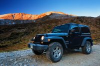
Here's Marla's Jeep doing its damnedest to convince me to buy my own:
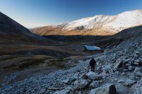
You are above treeline from the start here, and the first few miles are primarily a slog through scree and old mine tailings.
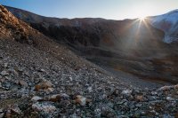
Pikas everywhere. I've never seen so many pika. Strangely we didn't see a single marmot until hiking back out, and then it was more marmots than I'd ever seen and no pika at all.
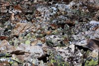
One of many pieces of mine ruins, this one sitting near the junction where you head one way up Mt Democrat or the other to Mt Cameron. The trailhead sign said Mt Bross access is currently closed due to some sort of private property squabble which I won't detail here. We didn't realize that no one actually pays attention to this and so we basically shorted ourselves a summit by following the 'rules'. Bross will have to get checked off some other time.
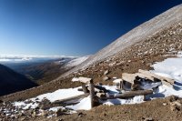
Snow was in the forecast for around noon (never happened), so we decided to go for Cameron and Lincoln which are very close to each other and then if the weather permitted come back and grab Democrat.
Our route shown here. Democrat to the west, Cameron and then Lincoln to the east. An unclaimed Bross sitting smugly in the southeast corner.
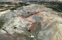
It's about a thousand feet of elevation from the junction to whichever summit you're heading for. A decent amount of snow and ice was already on the slopes. I brought spikes but didn't put them on until the descent from Democrat where the situation changed from 'spikes might be nice' to 'spikes will see me making it home tonight'.
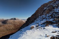
Looking back towards Democrat from part way up Cameron.
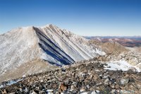
The summit of Cameron is actually the lower of the two humps seen below. This was really weird. When you're on the summit, the hump in the foreground looks to be higher than you. When you walk over to the foreground hump, the summit is clearly higher than you.
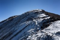
Made it! Mt Cameron, 14,238 ft.
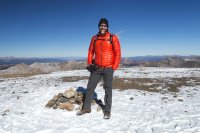
Marla as I first saw her, lol:
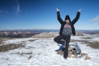
From Cameron it's an easy saddle traverse to reach Mt Lincoln.
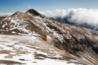
A little bit of exposure towards the tip of Lincoln but not too bad. Very sketchy near the actual summit due to ice.
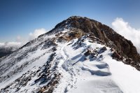
Made it again! Mt Lincoln, 14,286 ft.
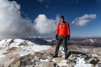
Looking at Bross from the summit of Lincoln. Dark wintery clouds kept pushing over the basin, but it seemed like they were staying just south of our line so we decided to head back down to the Democrat/Cameron junction and decide if weather would grant us one more summit.
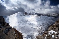
A really stunningly beautiful view back out over Kite Lake basin from somewhere on the descent from Cameron. Still a little nervous about those clouds, and the wind was roaring like a freight train when I took this pic.
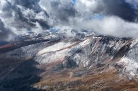
Long story short, we decided that we could make it up Democrat and we did just that.
Mt Democrat, 14,148 ft.
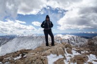
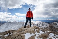
I shot a 12 image pano from the top. Click here for huge full size version (50MB).

Spikes went on for the descent (there were sections ascending Democrat that were barely passable they were so slick), but other than taking far longer than it seemed it should have everything went just fine. As I said, the talus fields were chock full of super plump marmots getting ready to brave the winter.
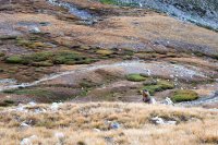
A good day with a chance acquaintance who's become a friend. We stopped for food and beer in Bailey on the way out (great Elk stew at Rustic Station - highly recommend).

My wife and I just got new phones for the first time in forever, and the new one shoots 4K video. I filmed with that instead of my SLR and I have to admit it looks pretty sweet, though I think the auto-stabilization gives it a weird floaty effect (or maybe it's just me). Anyway, here it is for those who care to check it out:
With winter conditions already making an appearance in the high country, I wanted to get out and try to summit a few more mountains before things get too wild up there. I reached out to Marla, we kicked around a few ideas, and settled on tackling the Decalibron. Decalibron is a clever name for a route that passes over four 14er summits: Mt Democrat, Cameron, Lincoln and Bross.
We headed out very early and arrived at Kite Lake basin just as the sun rose. The trailhead sits at 12,000 feet and it was a balmy 19 degrees out but thankfully not much wind.
Here's Marla's Jeep doing its damnedest to convince me to buy my own:

You are above treeline from the start here, and the first few miles are primarily a slog through scree and old mine tailings.


Pikas everywhere. I've never seen so many pika. Strangely we didn't see a single marmot until hiking back out, and then it was more marmots than I'd ever seen and no pika at all.

One of many pieces of mine ruins, this one sitting near the junction where you head one way up Mt Democrat or the other to Mt Cameron. The trailhead sign said Mt Bross access is currently closed due to some sort of private property squabble which I won't detail here. We didn't realize that no one actually pays attention to this and so we basically shorted ourselves a summit by following the 'rules'. Bross will have to get checked off some other time.

Snow was in the forecast for around noon (never happened), so we decided to go for Cameron and Lincoln which are very close to each other and then if the weather permitted come back and grab Democrat.
Our route shown here. Democrat to the west, Cameron and then Lincoln to the east. An unclaimed Bross sitting smugly in the southeast corner.

It's about a thousand feet of elevation from the junction to whichever summit you're heading for. A decent amount of snow and ice was already on the slopes. I brought spikes but didn't put them on until the descent from Democrat where the situation changed from 'spikes might be nice' to 'spikes will see me making it home tonight'.

Looking back towards Democrat from part way up Cameron.

The summit of Cameron is actually the lower of the two humps seen below. This was really weird. When you're on the summit, the hump in the foreground looks to be higher than you. When you walk over to the foreground hump, the summit is clearly higher than you.

Made it! Mt Cameron, 14,238 ft.

Marla as I first saw her, lol:

From Cameron it's an easy saddle traverse to reach Mt Lincoln.

A little bit of exposure towards the tip of Lincoln but not too bad. Very sketchy near the actual summit due to ice.

Made it again! Mt Lincoln, 14,286 ft.

Looking at Bross from the summit of Lincoln. Dark wintery clouds kept pushing over the basin, but it seemed like they were staying just south of our line so we decided to head back down to the Democrat/Cameron junction and decide if weather would grant us one more summit.

A really stunningly beautiful view back out over Kite Lake basin from somewhere on the descent from Cameron. Still a little nervous about those clouds, and the wind was roaring like a freight train when I took this pic.

Long story short, we decided that we could make it up Democrat and we did just that.
Mt Democrat, 14,148 ft.


I shot a 12 image pano from the top. Click here for huge full size version (50MB).

Spikes went on for the descent (there were sections ascending Democrat that were barely passable they were so slick), but other than taking far longer than it seemed it should have everything went just fine. As I said, the talus fields were chock full of super plump marmots getting ready to brave the winter.

A good day with a chance acquaintance who's become a friend. We stopped for food and beer in Bailey on the way out (great Elk stew at Rustic Station - highly recommend).
My wife and I just got new phones for the first time in forever, and the new one shoots 4K video. I filmed with that instead of my SLR and I have to admit it looks pretty sweet, though I think the auto-stabilization gives it a weird floaty effect (or maybe it's just me). Anyway, here it is for those who care to check it out:
Last edited:

