LarryBoy

Hiker Trash
.
Joined
Jan 4, 2015
Messages
2,746
20200721_082812.jpg


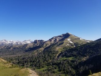
I know most of us don't really want to relive the debacle that was 2020, but this was actually a highlight of an otherwise terrible year. As spring turned to summer and it became that my planned PCT hike wasn't happening, I made other plans. Those plans involved long-distance hiking, but in a socially distant way. My plan was to drive to the beginning of the route, hike in an 800-mile circle, and resupply at remote road crossings with supplies I'd cache beforehand. The goal was to avoid public transit, hitchhiking, and towns, thus completely eliminating the possibility of spreading the virus. And what better way is there to explore the vast beauty of the Greater Yellowstone Ecosystem than to spend two months in unbroken wilderness?

After spending several days driving to road crossings and burying IGBC-compliant caches, I began my hike on July 1st at Targhee Pass, just west of West Yellowstone, MT.

Section 1: The Tetons

The first section of the route was probably the biggest filler section, and by far the least pleasant. I slogged thru incredibly buggy lowlands, including logging areas just west of the park boundary, and the Bechler River area, which was completely flooded and a veritable hatchery for mosquitoes. They're by far the worst I've ever seen - approaching Arctic levels, I imagine. At one point, I killed seventeen of them with a single random handclap in front of my face. I was suited up from head to toe, wearing my rain mitts in 85-degree weather, sweltering and miserable.

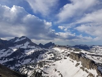
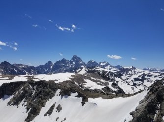
Fortunately, after a few days, I climbed into the Tetons, where the script flipped entirely. I made my way along the crest (or trails near the crest), trudging over much snow, but reveling in the early-season beauty of one of the most spectacular ranges anywhere. Aside from the day where I overlapped with the Park's Teton Crest Trail, I saw nobody. Perhaps it was just a burst of initial picture-taking enthusiasm, but about a third of my photos from the entire 800 miles were taken in the Tetons. It was that spectacular.

The section ended at Teton Pass, where I dug up my first cache and prepped for my next section thru some little-known ranges.
20200707_084019.jpg


20200706_125733.jpg


Section 2: Snake River & Wyoming Ranges

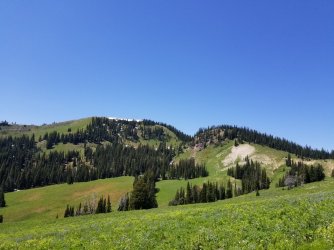
I definitely didn't do the Snakes justice. I was in large part (75%) following my buddy Pepperflake's route from a couple years earlier, and reading between the lines, I could tell that his route thru the Snakes involved quite a bit of suffering, owing to bad/non-existent trail conditions. So I went a different way, which involved far less bleeding, but also less spectacular scenery. There were some nice wildflowers, but the Snakes were otherwise pretty ho-hum by the outrageously high standards of this hike.

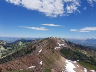
The Wyomings, on the other hand, were incredible. In the first half, I followed a mapped trail that didn't exist. In the second half, I followed an unmapped trail that did exist. Both halves were spectacular. The Wyomings are smeared in a two-toned orange and gray paint scheme, and despite its lack of wilderness designation, I felt this was one of the most "out there" sections of the hike. I must return at some point to visit the southern part of the range, which I unfortunately couldn't justify the detour to, as I was next headed north into the Gros Ventres. To get there though, I had to do the most arduous bushwhack of the entire hike - 4000 feet straight down to the Hoback River, all without a scrap of trail. By time I got to the Hoback, my pant legs were held together by more duct tape than fabric.
20200712_134704.jpg


20200709_120519.jpg


Section 3: The Gros Ventres

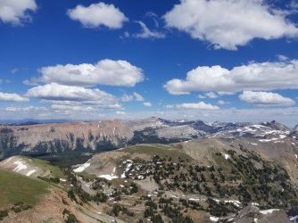
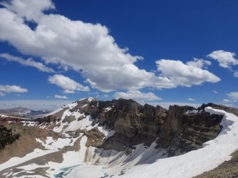
I began the section with one of the few roadwalks on the route - about 10 miles on dirt. Then I made my way thru a beautiful valley before making the long climb to the crest of the range. I alternated walking on the crest itself, with glacially-carved "shelves" on either side of it. I saw one of the bluest lakes of my life up here, and had picture-perfect weather. I summited a few peaks, and generally reveled in life. A few resupplies in by now, I was brimming with confidence that I could really pull off this "two months without a town stop" grand adventure. The Gros Ventres also really surprised me. I knew they were pretty, but I didn't know that they were every bit as beautiful as the Tetons, but with none of the people or red tape. I loved this section.

The section ended with a boring walk, largely along the CDT, as I transitioned from the Gros Ventres to the Absarokas. I've long held that the CDT takes the worst of all possible routes through the Greater Yellowstone. It's not the CDT's fault of course; it's just that all the most interesting stuff in the GYE is far away from the Divide itself.
20200714_154442.jpg


20200714_151648.jpg


Section 4: Absarokas South

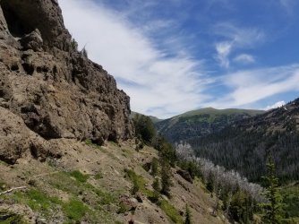
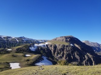
I traced almost entirely familiar ground in this section, having done a similar Absarokas trek a few years ago. After a long and circuitous meander up on the lovely Buffalo Plateau, I dropped into a series of passes and valleys in the Thorofare area. This was one area where I "dumbed down" Pepperflake's route significantly. The section was just too long to get bogged down in some truly brutal ridgeline traverses. But I still had my fair share of fun planned for the second half of the section - a series of off-trail passes and traverses.

While following an elk trail that wound its way thru some cliffs in the Deer Creek Pass area, I turned a corner and met a grizzly at close range (7-8 feet), already charging. Trapped between me and the cliffs, he made contact, giving me a good swipe, and charged again. On the second charge, I caught him in the eye with my trekking pole. The force of the collision sent me flying, whereupon i rolled under a tree, covered my neck with one hand, and played dead. I aimed my bear spray behind me with the other hand, but by that point, he was already fleeing the scene.

After laying there for about 10 mins to make sure he was good and gone, I got up, hiked to the nearest main trail (about 1 mi away), did a little first aid, and bailed down that side trail to get medical attention. I caught a ride to the hospital with a good Samaritan, where I was treated for some deep lacerations to my arm and chest. They stitched me up and sent me on my merry way, very grateful to be alive. It took about 2 weeks before I was healed up enough to continue my journey.

Humans and bear stories are like moths and flames, so you can read more about the bear incident here if you so choose.
20200720_131609.jpg


20200719_184508.jpg


Section 5: Absarokas North

I ended up skipping about 40 miles between Deer Creek Pass and where I resumed my journey at the North Fork Highway. Someday I'd like to go back and fill those miles in, just to see what I'm missing, but for the time being it made more logistical sense to restart my route from the North Fork Highway. Plus, I had no desire to return to the scene of the crime quite yet. Some day, but not immediately. Side note - if anyone finds a pair of microspikes with grizzly claw marks in them near Deer Creek Pass, I'd appreciate those back!

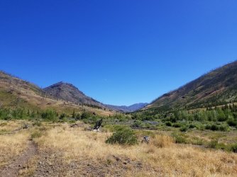
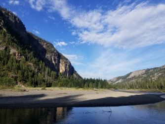
At any rate, the Absarokas North section was a bit of a stinker. The beginning was pretty nice, traveling thru the wonderful Hoodoo Peak area. But then I dove east down toward the Clark Fork Canyon, which turned out to be a very long detour thru low terrain, with pretty underwhelming scenery. I'm sure the Clark Fork is an amazing paddle, but as a hike, it's really not worth it. There's a lot of filler miles to get there and back, and while the inner gorge is beautiful, it was short enough to not make it worth all the miles to get there. Plus the evil vampire mosquitoes from Section 1 returned with a vengeance.

If I had to do it again, I'd continue along the Absaroka Crest toward Cooke City. That route is beautiful, extremely remote, and truly adventurous. I've been skunked on that section once before, and would be keen to try it again.

On the second or third night of this section, a fox tried to sneak up on me as I was eating supper. Still a mite jumpy after the close ursine encounter, I was not amused, and pelted him with rocks until he yowled and slunk away. I saw neither hide nor hair of him the rest of the night.
20200810_110702.jpg


20200813_083727.jpg


Section 6: The Beartooths

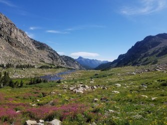
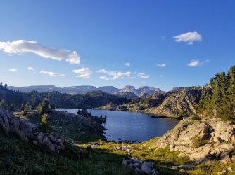
This is where the character of my route really changed. The first half, up until I got hurt, had involved a lot of off-trail, crazy bushwhacking, scrambling, and high adventure. I had more of the same planned for the Beartooths. But still very much in recovery mode (and unable to lift my arm above the shoulder yet), I had to take a mellower path through the Beartooths. I still did plenty of off-trail (and some scrambling, because I just couldn't help myself!), but I stayed on the Beartooth Plateau rather than venturing into the land of huge climbs and sketchy scrambles on the north side of the crest. Still though, the BT's are beautiful, and I was blessed with great weather and the opportunity to swim constantly - all the better to keep the wound clean!

The section concluded with new terrain for me - the Lake Fork Plateau. It was beautiful, and completely unexpected. I'd spent many hours agonizing over the best route in that area, and yet somehow completely lost sight of how beautiful it was slated to be until I got there and saw it first-hand.
20200816_160907.jpg


20200814_192426.jpg


Section 7: Beartooths West

This is really the northernmost extension of the Absarokas, but we've already got 2 Absaroka-named sections. Sorry.

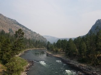
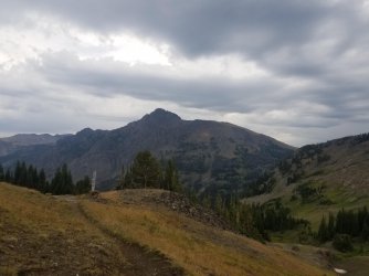
This section was entirely on-trail, owing to some huge and nasty burn areas in the higher, prime terrain. So I followed main corridor trails over just one major pass, Boulder Pass, and down into Yellowstone itself. I'd previously been in Yellowstone for less than a day twice, in sections 1 and 5, but this was the only time I'd need an actual backcountry permit. Smoke moved in as i made my way down the Black Canyon of the Yellowstone, and by time I made it to Mammoth Hot Springs (my only town stop of the GYL, because you're legally prohibited from caching supplies in the park), the sky was a eerie shade of yellow. Guess they'd been smoking too many Marlboros in Oregon and Washington.
20200820_160512.jpg


20200819_095030.jpg


Section 8: The Gallatins

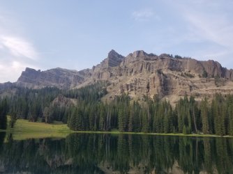
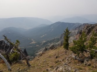
This was probably the easiest section of the route, as it was entirely on-trail. It could have been very beautiful too, except for the thick smoke that now overhung the region. I kind of felt like I was hiking on Venus. I spent a couple more nights in the park, having secured a backcountry permit in just in the nick of time before crossing the border in section 7. There was definitely a sense of freedom in leaving the park though, as I could once more camp where I liked, and move at my own pace. One of those nights was spent at Ramshorn Lake, a beautiful alpine lake beneath the watchful gaze of its eponymous craggy peak.

The section concluded with a wonderful walk thru the uppermost part of Hyalite Basin. As i walked down to the highway that separates the Gallatins from the Madisons, the weather, having been so stable all summer, finally started to turn.
20200823_180347.jpg


20200823_120027.jpg


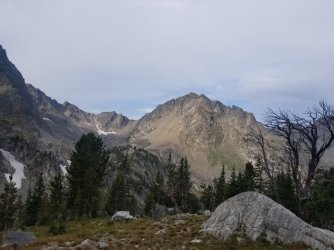
Section 9: The Madisons

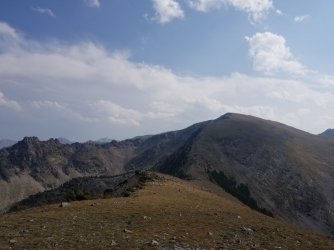
Weather really forced me onto a lower route here, away from the pass-and-alpine basin roller coaster I'd planned very near the crest of the range. On one such alternate, I looked up and saw a bolt of lightning hit Lone Mountain, where I would have been had it not been for a prudent re-route. Still though, I cruised thru the Spanish Peaks and past the Sphinx. I took several low routes when necessary, but still managed to see some nice stuff. On my last morning, as the rain changed to snow, I dropped down to US 89 and walked (not without irony) a paved highway into West Yellowstone to close the loop - an unfitting end to such a marvelous journey. But this route was never about the purity. I skipped forty miles after the bear attack. I took a more conservative route after that injury. And yet, the route felt complete. The route began just as the snow was melting. It ended juts as it began falling again. It was a full season spent in the greatest, wildest, and most complete ecosystem of the mid-latitudes.

And I'm alive. Praise God for that.
20200827_084342.jpg


20200826_162635.jpg
 
Last edited:
Joined
Jan 18, 2014
Messages
350
Breathtaking’…thanks for bringing some cool mountain weather into my livin room this morning in steamy Austin Texas.
 

scatman

Member
.
Joined
Dec 23, 2013
Messages
3,155
This made my day! Great report! Thanks for taking the time to share your story and the beautiful scenery with us. So how many resupply caches did you have? One every hundred miles or so? Besides the bear and fox, what other wildlife did you see along the way? Any challenging river crossings, or were they pretty straightforward, particularly early on on your trek? The next time you go, shrink me down to miniature size and let me ride along on your shoulder. Please, please, please. :) Very inspirational for this old guy. Thanks again. Just amazing.
 
Last edited:

LarryBoy

Hiker Trash
.
Joined
Jan 4, 2015
Messages
2,746
This made my day! Great report! Thanks for taking the time to share your story and the beautiful scenery with us. So how many resupply caches did you have? One every hundred miles or so? Besides the bear and fox, what other wildlife did you see along the way? Any challenging river crossings, or were they pretty straightforward, particularly early on on your trek? The next time you go, shrink me down to miniature size and let me ride along on your shoulder. Please, please, please. :) Very inspirational for this old guy. Thanks again. Just amazing.
I had 8 resupply stops I believe. 4 were caches buried underground. The other 4 were boxes mailed to dude ranches where I could mask up, grab my box, and get out of there in 3 seconds. In retrospect, I wish I'd just gone with all caches, because it turns out that caches are wonderful and maildrops are terrible.

In terms of wildlife, I think had ~10 bear sightings, about an even mix of black, griz, and mystery bears I was too far away to tell. The most special was a momma griz and bounding cub on the Lake Fork Plateau - fortunately, at a safe distance where they had an easy way of escape. It was pretty rare not to see an eagle/hawk circling overhead, and the population of elk in the Wyoming Range is kind of out of control. I did not see a bison on this trip (though I was up too high in mountainous terrain for their prime habitat), and I heard many wolves but saw none.

No tough water on this one. I crossed all major rivers (Snake, Hoback, Shoshone, Clark Fork, Yellowstone, Gallatin, Madison) on bridges. Like you said, there were a couple of deeper crossings in the first few days in the Bechler area (Mountain Ash Creek stands out), but although they were waist-deep, they were pretty languid and not a problem
 

Diane Greer

Member
Joined
Nov 28, 2013
Messages
28
Wow, impressive trek. Glad your ok after the bear attack. Would love to learn more about your route through the Wyoming Range and the Gallatin Range!
 

Vegan.Hiker

Member
Joined
Jul 5, 2014
Messages
2,099
Glad you are ok and back at it. Great write-up and photos. Great write-up in the link you provided as well.
 

Kmatjhwy

Wilderness Wanderer
Joined
Sep 23, 2016
Messages
724
Great Trip Report! Awesome! Good for you and glad that you survived that bear attack. Wow! What a story! Yes how much good wild country is all over in this Greater Yellowstone Ecosystem. Wishing You the Best!
 

Rockskipper

No ETA
.
Joined
Jun 11, 2017
Messages
4,044
What a fantastic adventure! In the book, “Canyons and Ice: The Wilderness Travels of Dick Griffith,” he talks about his many trips through the Arctic and how rabid fox were such a problem. They would come into his camp fearless and he was even injured by one once. He says it’s a common problem in the Arctic. Hopefully the fox that approached you was just bold and not ill.
 

LarryBoy

Hiker Trash
.
Joined
Jan 4, 2015
Messages
2,746
What a fantastic adventure! In the book, “Canyons and Ice: The Wilderness Travels of Dick Griffith,” he talks about his many trips through the Arctic and how rabid fox were such a problem. They would come into his camp fearless and he was even injured by one once. He says it’s a common problem in the Arctic. Hopefully the fox that approached you was just bold and not ill.
Crazy! In this case, I think he just wanted some of that delicious Dorrito dust or something like that. He scrammed in a hurry once he was the object of bombardment.
 

LarryBoy

Hiker Trash
.
Joined
Jan 4, 2015
Messages
2,746
Great Trip Report! Awesome! Good for you and glad that you survived that bear attack. Wow! What a story! Yes how much good wild country is all over in this Greater Yellowstone Ecosystem. Wishing You the Best!
One of the coolest things about this trip was the sense of continuity within the GYE. I'd spent a decent amount of time in the area previously - and even hiked thru on the CDT - but those different places - Beartooths, Tetons, Absarokas just existed in my mind as pockets of familiarity in a vast sea of unknowns. Linking them together and seeing the underlying unity of that wild country was truly something special!
 

LarryBoy

Hiker Trash
.
Joined
Jan 4, 2015
Messages
2,746
Wow, impressive trek. Glad your ok after the bear attack. Would love to learn more about your route through the Wyoming Range and the Gallatin Range!
The Gallatins were entirely on trail, largely along the Gallatin Crest Trail. I thought this section was pretty nice, but would have been infinitely better had it not been for all the smoke! I really only got a taste of the Wyomings - a day south from 189 and then a day back north. I traveled some basically non-existent trails, and did a pretty gnarly bushwhack, so I can't really recommend my route! The Wyoming NRT looks super nice though - definitely want to go back there some day and walk the length of the range.
 

Kmatjhwy

Wilderness Wanderer
Joined
Sep 23, 2016
Messages
724
Yes how much good country all over here in the Greater Yellowstone Ecosystem and only separated by a few roads. Have hiked most of it thru the summers. Good Good for you in doing this. And again that was some bear encounter. Wow! Thanks Again for posting! And whatever happens, you will have the memories of this experience to relive for the rest of your days. There is still soooooo much to see and experience in this life and in this world.

Wishing You the Best!
 

norwegianxplorer

Norwegian Xplorer
Joined
Apr 1, 2018
Messages
111
View attachment 99512

I know most of us don't really want to relive the debacle that was 2020, but this was actually a highlight of an otherwise terrible year. As spring turned to summer and it became that my planned PCT hike wasn't happening, I made other plans. Those plans involved long-distance hiking, but in a socially distant way. My plan was to drive to the beginning of the route, hike in an 800-mile circle, and resupply at remote road crossings with supplies I'd cache beforehand. The goal was to avoid public transit, hitchhiking, and towns, thus completely eliminating the possibility of spreading the virus. And what better way is there to explore the vast beauty of the Greater Yellowstone Ecosystem than to spend two months in unbroken wilderness?

After spending several days driving to road crossings and burying IGBC-compliant caches, I began my hike on July 1st at Targhee Pass, just west of West Yellowstone, MT.

Section 1: The Tetons

The first section of the route was probably the biggest filler section, and by far the least pleasant. I slogged thru incredibly buggy lowlands, including logging areas just west of the park boundary, and the Bechler River area, which was completely flooded and a veritable hatchery for mosquitoes. They're by far the worst I've ever seen - approaching Arctic levels, I imagine. At one point, I killed seventeen of them with a single random handclap in front of my face. I was suited up from head to toe, wearing my rain mitts in 85-degree weather, sweltering and miserable.

Fortunately, after a few days, I climbed into the Tetons, where the script flipped entirely. I made my way along the crest (or trails near the crest), trudging over much snow, but reveling in the early-season beauty of one of the most spectacular ranges anywhere. Aside from the day where I overlapped with the Park's Teton Crest Trail, I saw nobody. Perhaps it was just a burst of initial picture-taking enthusiasm, but about a third of my photos from the entire 800 miles were taken in the Tetons. It was that spectacular.

The section ended at Teton Pass, where I dug up my first cache and prepped for my next section thru some little-known ranges.

View attachment 99494

View attachment 99495

Section 2: Snake River & Wyoming Ranges

I definitely didn't do the Snakes justice. I was in large part (75%) following my buddy Pepperflake's route from a couple years earlier, and reading between the lines, I could tell that his route thru the Snakes involved quite a bit of suffering, owing to bad/non-existent trail conditions. So I went a different way, which involved far less bleeding, but also less spectacular scenery. There were some nice wildflowers, but the Snakes were otherwise pretty ho-hum by the outrageously high standards of this hike.

The Wyomings, on the other hand, were incredible. In the first half, I followed a mapped trail that didn't exist. In the second half, I followed an unmapped trail that did exist. Both halves were spectacular. The Wyomings are smeared in a two-toned orange and gray paint scheme, and despite its lack of wilderness designation, I felt this was one of the most "out there" sections of the hike. I must return at some point to visit the southern part of the range, which I unfortunately couldn't justify the detour to, as I was next headed north into the Gros Ventres. To get there though, I had to do the most arduous bushwhack of the entire hike - 4000 feet straight down to the Hoback River, all without a scrap of trail. By time I got to the Hoback, my pant legs were held together by more duct tape than fabric.

View attachment 99496

View attachment 99497

Section 3: The Gros Ventres

I began the section with one of the few roadwalks on the route - about 10 miles on dirt. Then I made my way thru a beautiful valley before making the long climb to the crest of the range. I alternated walking on the crest itself, with glacially-carved "shelves" on either side of it. I saw one of the bluest lakes of my life up here, and had picture-perfect weather. I summited a few peaks, and generally reveled in life. A few resupplies in by now, I was brimming with confidence that I could really pull off this "two months without a town stop" grand adventure. The Gros Ventres also really surprised me. I knew they were pretty, but I didn't know that they were every bit as beautiful as the Tetons, but with none of the people or red tape. I loved this section.

The section ended with a boring walk, largely along the CDT, as I transitioned from the Gros Ventres to the Absarokas. I've long held that the CDT takes the worst of all possible routes through the Greater Yellowstone. It's not the CDT's fault of course; it's just that all the most interesting stuff in the GYE is far away from the Divide itself.

View attachment 99498

View attachment 99499

Section 4: Absarokas South

I traced almost entirely familiar ground in this section, having done a similar Absarokas trek a few years ago. After a long and circuitous meander up on the lovely Buffalo Plateau, I dropped into a series of passes and valleys in the Thorofare area. This was one area where I "dumbed down" Pepperflake's route significantly. The section was just too long to get bogged down in some truly brutal ridgeline traverses. But I still had my fair share of fun planned for the second half of the section - a series of off-trail passes and traverses.

While following an elk trail that wound its way thru some cliffs in the Deer Creek Pass area, I turned a corner and met a grizzly at close range (7-8 feet), already charging. Trapped between me and the cliffs, he made contact, giving me a good swipe, and charged again. On the second charge, I caught him in the eye with my trekking pole. The force of the collision sent me flying, whereupon i rolled under a tree, covered my neck with one hand, and played dead. I aimed my bear spray behind me with the other hand, but by that point, he was already fleeing the scene.

After laying there for about 10 mins to make sure he was good and gone, I got up, hiked to the nearest main trail (about 1 mi away), did a little first aid, and bailed down that side trail to get medical attention. I caught a ride to the hospital with a good Samaritan, where I was treated for some deep lacerations to my arm and chest. They stitched me up and sent me on my merry way, very grateful to be alive. It took about 2 weeks before I was healed up enough to continue my journey.

Humans and bear stories are like moths and flames, so you can read more about the bear incident here if you so choose.

View attachment 99500

View attachment 99501

Section 5: Absarokas North

I ended up skipping about 40 miles between Deer Creek Pass and where I resumed my journey at the North Fork Highway. Someday I'd like to go back and fill those miles in, just to see what I'm missing, but for the time being it made more logistical sense to restart my route from the North Fork Highway. Plus, I had no desire to return to the scene of the crime quite yet. Some day, but not immediately. Side note - if anyone finds a pair of microspikes with grizzly claw marks in them near Deer Creek Pass, I'd appreciate those back!

At any rate, the Absarokas North section was a bit of a stinker. The beginning was pretty nice, traveling thru the wonderful Hoodoo Peak area. But then I dove east down toward the Clark Fork Canyon, which turned out to be a very long detour thru low terrain, with pretty underwhelming scenery. I'm sure the Clark Fork is an amazing paddle, but as a hike, it's really not worth it. There's a lot of filler miles to get there and back, and while the inner gorge is beautiful, it was short enough to not make it worth all the miles to get there. Plus the evil vampire mosquitoes from Section 1 returned with a vengeance.

If I had to do it again, I'd continue along the Absaroka Crest toward Cooke City. That route is beautiful, extremely remote, and truly adventurous. I've been skunked on that section once before, and would be keen to try it again.

On the second or third night of this section, a fox tried to sneak up on me as I was eating supper. Still a mite jumpy after the close ursine encounter, I was not amused, and pelted him with rocks until he yowled and slunk away. I saw neither hide nor hair of him the rest of the night.

View attachment 99503

View attachment 99502

Section 6: The Beartooths

This is where the character of my route really changed. The first half, up until I got hurt, had involved a lot of off-trail, crazy bushwhacking, scrambling, and high adventure. I had more of the same planned for the Beartooths. But still very much in recovery mode (and unable to lift my arm above the shoulder yet), I had to take a mellower path through the Beartooths. I still did plenty of off-trail (and some scrambling, because I just couldn't help myself!), but I stayed on the Beartooth Plateau rather than venturing into the land of huge climbs and sketchy scrambles on the north side of the crest. Still though, the BT's are beautiful, and I was blessed with great weather and the opportunity to swim constantly - all the better to keep the wound clean!

The section concluded with new terrain for me - the Lake Fork Plateau. It was beautiful, and completely unexpected. I'd spent many hours agonizing over the best route in that area, and yet somehow completely lost sight of how beautiful it was slated to be until I got there and saw it first-hand.

View attachment 99504

View attachment 99505

Section 7: Beartooths West

This is really the northernmost extension of the Absarokas, but we've already got 2 Absaroka-named sections. Sorry.

This section was entirely on-trail, owing to some huge and nasty burn areas in the higher, prime terrain. So I followed main corridor trails over just one major pass, Boulder Pass, and down into Yellowstone itself. I'd previously been in Yellowstone for less than a day twice, in sections 1 and 5, but this was the only time I'd need an actual backcountry permit. Smoke moved in as i made my way down the Black Canyon of the Yellowstone, and by time I made it to Mammoth Hot Springs (my only town stop of the GYL, because you're legally prohibited from caching supplies in the park), the sky was a eerie shade of yellow. Guess they'd been smoking too many Marlboros in Oregon and Washington.

View attachment 99506

View attachment 99507

Section 8: The Gallatins

This was probably the easiest section of the route, as it was entirely on-trail. It could have been very beautiful too, except for the thick smoke that now overhung the region. I kind of felt like I was hiking on Venus. I spent a couple more nights in the park, having secured a backcountry permit in just in the nick of time before crossing the border in section 7. There was definitely a sense of freedom in leaving the park though, as I could once more camp where I liked, and move at my own pace. One of those nights was spent at Ramshorn Lake, a beautiful alpine lake beneath the watchful gaze of its eponymous craggy peak.

The section concluded with a wonderful walk thru the uppermost part of Hyalite Basin. As i walked down to the highway that separates the Gallatins from the Madisons, the weather, having been so stable all summer, finally started to turn.

View attachment 99508

View attachment 99509

Section 9: The Madisons

Weather really forced me onto a lower route here, away from the pass-and-alpine basin roller coaster I'd planned very near the crest of the range. On one such alternate, I looked up and saw a bolt of lightning hit Lone Mountain, where I would have been had it not been for a prudent re-route. Still though, I cruised thru the Spanish Peaks and past the Sphinx. I took several low routes when necessary, but still managed to see some nice stuff. On my last morning, as the rain changed to snow, I dropped down to US 89 and walked (not without irony) a paved highway into West Yellowstone to close the loop - an unfitting end to such a marvelous journey. But this route was never about the purity. I skipped forty miles after the bear attack. I took a more conservative route after that injury. And yet, the route felt complete. The route began just as the snow was melting. It ended juts as it began falling again. It was a full season spent in the greatest, wildest, and most complete ecosystem of the mid-latitudes.

And I'm alive. Praise God for that.
View attachment 99510

View attachment 99511
Incredible!
 

Tim Valentine

Member
.
Joined
May 24, 2015
Messages
157
Wow, what an experience. The PCT will seem tame compared to what you had to deal with every day and night in the GYE. Thanks for posting this and so glad you were able to go right back out there, physically and mentally. Good luck on your attempt at the PCT! If you need a ride from the San Diego airport to the start of the PCT in Tecate contact me.
 

LarryBoy

Hiker Trash
.
Joined
Jan 4, 2015
Messages
2,746
Wow, what an experience. The PCT will seem tame compared to what you had to deal with every day and night in the GYE. Thanks for posting this and so glad you were able to go right back out there, physically and mentally. Good luck on your attempt at the PCT! If you need a ride from the San Diego airport to the start of the PCT in Tecate contact me.
Thanks Tim, I'll keep that in mind! The PCT kind of seems like "dessert" to me - nice and easy, sweet, and pleasant. Hopefully I get the chance to test that hypothesis some day!
 

Artemus

I walk
.
Joined
Jun 25, 2012
Messages
4,427
Wonderful account, mister! The writing and the pictures help bring it to mind but the magnitude of the adventure is not done justice. Having a serious encounter with a grizzly by yourself way back in just emphasizes the low key nature of your account. Kudos lad, you are one of my backcountry heroes! Unfortunately “epic” is overused but that is how this mere mortal views your walk.
 
Similar threads
Thread starter Title Forum Replies Date
OldBill Snow Conditions - Greater Yellowstone Trip Planning 1
TheMountainRabbit Invite Greater Yellowstone Area, July 9th-11th Meet Up (Members Only) 0
norwegianxplorer Greater Yellowstone part 2, from the Headwaters of Yellowstone River, through the Thorofare, Overlook Mountain, Rampart Creek Backpacking 9
norwegianxplorer Greater Yellowstone, to the headwaters of the Yellowstone River with My Own Frontier. Backpacking 11
Bob Fires in greater yellowstone Trip Planning 0
Absarokanaut Hello From Greater Yellowstone Noobs: Introduce yourself! 5
J Short time in Greater Bears Ears. Couple Dayhikes April 5 and 6, 2021 Hiking & Camping 5
Dave Greater Canyonlands National Monument General Discussion 5
I Slough Creek - Yellowstone June 5 & 6 Meet Up (Members Only) 19
Bob Yellowstone 5/8/23 - UPDATE General Discussion 9
Parashakti Late July in Yellowstone Trip Planning 9
scatman Rescue Creek - Yellowstone National Park Meet Up (Members Only) 11
E Weeklong+ backpacking recs in Yellowstone NP? Trip Planning 11
Jackson Yellowstone Backcountry Lottery Results General Discussion 45
BobFink Yellowstone South Entrance to Fox Creek via Basin Creek Cutoff - Labor Day 2022 Trip Reports 4
Bob Snakes in Yellowstone General Discussion 11
shredhiker Yellowstone Heart Lake September 2022 Backpacking 9
Janice Yellowstone Yurt Camp - Feb. 19-23, 2023 Trip Reports 15
TheMountainRabbit Northern Yellowstone NP - January 2023 Winter Sports 6
Ymyr Suggestions in a Yellowstone and a Beartooth trip Trip Planning 25
scatman A Yellowstone Love Story (Bog Creek Euphoria) - September 12, 2022 Backpacking 28
TractorDoc Yellowstone's Wrangler Lake, Bog Creek, Joseph's Coat Springs, Broad Creek, Wapiti Lake, Hot Springs Basin, and Pelican Valley. The Second Half. Backpacking 15
Georgia Yankee Where to see/hear wolves Yellowstone NP backcountry in September? Trip Planning 16
TractorDoc Yellowstone's Wrangler Lake, Bog Creek, Joseph's Coat Springs, Broad Creek, Wapiti Lake, Hot Springs Basin, and Pelican Valley. Part One of Two. Backpacking 61
TractorDoc Yellowstone's Hayden Valley, Trout Creek, Beach Lake, and Arnica Creek Meadows. September 11, 2022. Hiking & Camping 7
TheMountainRabbit Pitchstone/Bechler Loop (Yellowstone NP) - September 2022 Backpacking 17
P Summer night in Yellowstone Backpacking 4
P Yellowstone, one night by a lake Backpacking 19
wsp_scott Yellowstone September 2021 Backpacking 6
P Shoshone Geyser Basin, Yellowstone, 2022 Backpacking 6
P Yellowstone--Heart Lake to South Entrance Backpacking 13
travel2walk Yellowstone: Bechler Canyon, Aug 12-15 2022 Backpacking 21
kwc Lightning Strike near Yellowstone General Discussion 8
scatman Shoshone Lake Lollipop Loop - Yellowstone National Park - July 24, 2022 Backpacking 63
Absarokanaut Flooding in Yellowstone National Park and Adjacent Areas of Montana Today June 13, 2022 General Discussion 82
Rockskipper Yellowstone visitation down 34% over Memorial Day - maybe price of gas? Any predictions for the summer? General Discussion 17
McKee80 yellowstone wildlife in september Trip Planning 8
Outdoor_Fool Yellowstone - Through the Heart of the Park Backpacking 12
marquis20 Day 1: Grand Teton Wilderness and Black Canyon of the Yellowstone - June 2021 Backpacking 0
Outdoor_Fool Week-long Ramble Through Southern Yellowstone Backpacking 22
TractorDoc Yellowstone's Hayden Valley in a Day -- September 17 2021 Hiking & Camping 27
Rockskipper Yellowstone Backcountry Permits Available Online In 2022 General Discussion 72
Janice Yellowstone - Winter Yurt Trip? Winter Sports 22
Rockskipper Yellowstone Approached 5 Million Visitors In 2021, A Record General Discussion 1
TheMountainRabbit Invite North Yellowstone, January 23rd-25th Meet Up (Members Only) 0
wsp_scott Family trip to Grand Teton and Yellowstone Hiking & Camping 15
scatman Grizzly Lake - Yellowstone National Park - September - 2022 Meet Up (Members Only) 149
P Overnight at Ice Lake, Yellowstone Backpacking 4
P Yellowstone Snake River weekend Backpacking 7
TractorDoc Yellowstone's Shoshone Lake, Ouzel Creek, and Three Rivers Junction -- September 13-16 2021 Backpacking 62

Similar threads

Don't like ads? Become a BCP Supporting Member and kiss them all goodbye. Click here for more info.

Top