Navigation
Install the app
How to install the app on iOS
Follow along with the video below to see how to install our site as a web app on your home screen.
Note: This feature may not be available in some browsers.
More options
Style variation
You are using an out of date browser. It may not display this or other websites correctly.
You should upgrade or use an alternative browser.
You should upgrade or use an alternative browser.
100 miles of Highline trail in Uintas
- Thread starter natylka
- Start date
Parma
@parma26
- Joined
- Feb 12, 2014
- Messages
- 762
The Highline is typically done between Leidy Peak and Highline Trailhead and it's about 80 mi. Most seem to do it between 5-8 days.
I'm tentatively planning on doing it summer 2016.
Search Highline trail here and you'll get a bunch of fun to sort thru.
I'm tentatively planning on doing it summer 2016.
Search Highline trail here and you'll get a bunch of fun to sort thru.
- Joined
- Aug 9, 2007
- Messages
- 12,965
It's not close to 100 miles unless you walk a bunch of dirt roads that a car could drive on. From the Leidy Peak Trailhead to Highway 150, it's closer to 80-ish if you do the full thing. Some people start at Chepeta and drop off the first bit, but I think that's cheating (and closer to 60-ish).
Anyway, there are a handful of folks here who have done it. I know @langutah for sure. I attempted it but got sick and was with faster hikers (for me) and had to bail at Chepeta.
Some possibly useful links:
My failed attempt:
http://backcountrypost.com/threads/the-highline-leidy-to-chepeta.1122/
http://backcountrypost.com/threads/live-from-the-highline-trail.1077/
This thread has some info as well as a LONG story on how NOT to do it.
http://backcountrypost.com/threads/uintas-highline-trail-2012.806/
@Dstring's report:
http://backcountrypost.com/threads/the-highline-trail-8-31-9-7.1318/
slc_dan
Desert Rat-Weekend Warrior
- Joined
- Jun 7, 2012
- Messages
- 1,687
I am thiking of doing this during 4th of July long weekend so that I dont have take additional vacation days.
This is something I'm curious of, but you'll need to watch the weather/snow pack this spring. Some of the passes may still be covered that early.
- Joined
- Aug 9, 2007
- Messages
- 12,965
4th of July is too early unless it was an unusually dry winter and/or an usually hot spring. The problem would be getting over nearly-vertical snow-covered passes like Dead Horse. It's different from year to year, but this is why most of the end to end traffic really gets going later in July/early August.
- Joined
- Jul 23, 2013
- Messages
- 1,665
As others have said, the most popular starting point and have it still "count" is Leidy while starting at Chapeta will give you a slightly abbreviated way. To do the full thing I think you're alluding to, if you're going by USGS maps, then yes, you could start at the junction of FR-47 with Highway 191 north of Vernal. Allegedly, that is where the official trailhead is for the eastern end and then weaves through all the roads as you go westward, but from what I've read elsewhere in the past, because it isn't traveled and maintained as much, it becomes hard to distinguish through some of the "parks" and many of the few people who start with that leg end up going cross country and it can become easy to go off course in a big way if you're not careful. This is where a good GPS or map and compass navigation would be good to have. Then again, perhaps the USFS has done more trail work through the area more recently to improve the route. I don't know. I've also read that it's a lot less scenic and water sources through that stretch between 191 and Leidy may or may not be a little bit more scarce, depending how dry the water year has been. That said, if you're feeling that ambitious, it would be awesome to see a trip report of someone who successfully went that full distance from 191 to 150 or visa versa. The only report I could find online of someone who started from 191 ended up having to pull out at Painter Basin and had to be picked up at Henry Fork due to a bothersome knee or something. I would not attempt a trip like this without some kind of SPOT or InReach device, even if I was with a group.
I think most people will plan for about 6 days if starting from Leidy. Shave a day if starting from Chapeta and add at least a day to make it 7 if you're going to start from 191. It wouldn't hurt to add an extra contingency day in case of bad weather and you get shut down up for the better part of a day. Of course, you could also train up like some of these ultra runners out there and do it in about 24 hours as has been done by others, but then you miss much of the scenery.
Also, as has been said, unless willing to pack an ice axe and some crampons and know how to use them properly, I wouldn't plan to attempt it until late July unless it has been an exceptionally dry & warm winter/spring. If it was an exceptionally wet and heavy winter/spring, then probably best to wait until mid august.
I'd really love to give this trail a go as well in the next few years, probably starting at Leidy. Here's a decent video of someone else's trek along the trail when you have a good hour to watch it.
Mullet
Searching for a paradise....
- Joined
- Dec 28, 2014
- Messages
- 74
I'm planning on doing it this July with some buds of mine, although I'm starting at chepeta it will be test physically and mentally. I'm so stoked! It's really got me excited to get in great shape and really evaluate my gear weight.
JoshuaDyal
Member
- Joined
- Mar 16, 2015
- Messages
- 186
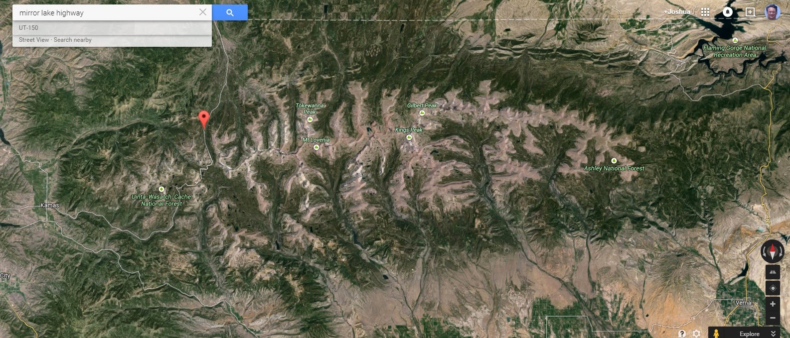
I've always thought that the start at 191 and the end at Mirror Lake Hwy was kind of arbitrary. If you look at satellite imagery of the Uintas (as on Google Earth) you'll easily see that from Leidy Peak to somewhere quite a bit west of Mirror Lake has a uniform appearance and character while the portion to the east of Leidy does not.
In a couple of years, I'm thinking of doing a Highline Trail hike, but I'd start at Leidy and continue into the Western Uintas, stitching together a route using mostly maintained trails (but a very small bit of road-walking and maybe just a bit of bushwhacking to connect to easier trails without going way out of my way). I'd end at Yellow Pines trail head, nearly in Kamas.
It's just far enough that I might need a food drop somewhere too, just so I don't have to carry a ridiculously large pack.
- Joined
- Aug 9, 2007
- Messages
- 12,965
I agree, hiking east of Leidy is pointless. It's just a forest with a bunch of dirt roads.
Ending at 150 I think makes a bit more sense though. After hiking 80+ miles through real wilderness, it would be a total buzzkill to cross or follow the highway and head west into the land of a bazillion boy scouts and day hikers. Cars whizzing by, tons of people, gun shots in the distance and then the whine of ATVs as you get over in the far western parts. That would definitely be more true to the concept, but a sad way to finish a hike like that, IMO.
Ending at 150 I think makes a bit more sense though. After hiking 80+ miles through real wilderness, it would be a total buzzkill to cross or follow the highway and head west into the land of a bazillion boy scouts and day hikers. Cars whizzing by, tons of people, gun shots in the distance and then the whine of ATVs as you get over in the far western parts. That would definitely be more true to the concept, but a sad way to finish a hike like that, IMO.
JoshuaDyal
Member
- Joined
- Mar 16, 2015
- Messages
- 186
I haven't stitched together an eastern extension yet to map out a full Uintas Range Traverse, crossing all of Dinosaur National Monument and everything, but theoretically it sounds fun.The 'Real" Unita Highline Route would start in Colorado, where the ridge of peaks drops off and would end west of the Mirror Lake highway........ just sayin'
andyjaggy
Member
- Joined
- Dec 2, 2013
- Messages
- 944
I think I will eventually do the highline, but until then I feel like the reward/work ratio is much better doing individual trips into the different basins. I've never been much of a through hiker, I like to set up shop somewhere and really get to know an area before moving on.
Parma
@parma26
- Joined
- Feb 12, 2014
- Messages
- 762
I saw this posted on another website (not nearly as cool as this one of course!) as a comment to a Highline trail TR:
by StunnedWolf Feb. 27, 2015
Highline trail update. I am a member of Uintah Basin Chapter of Back Country Horsemen of Utah. Two years ago we adopted the Highline trail from Leidy Peak trail head east to the trailhead just off from Hwy 191. We finished last fall we cleared all the wind the falls and marked the trail with cairns and carsonite posts. We plan on going back next spring to make sure there sure there isn't any log jams. Hope you all enjoy
Don't like ads? Become a BCP Supporting Member and kiss them all goodbye. Click here for more info.