Blake Merrell
Life Elevated - Rising Higher
- Joined
- Feb 25, 2013
- Messages
- 600
We should get together and have a rehab bash.
I'm game!!
Follow along with the video below to see how to install our site as a web app on your home screen.
Note: This feature may not be available in some browsers.
We should get together and have a rehab bash.
Sweet. I'm stoked! I've been reading your posts for a while and I've thought to myself 'I wonder if he'd be game for an adventure?' And based on your Imlay in a day story...I'd say yes.I'm game!!
Are there pics to this?
awesome. I'll be looking shortlyIf you do a forum search for Peru you'll find both our trip logs and the links to our Picasa photo pages for the trip.
On Picasa you can also find our photos from the Machu Picchu trek...as well as about fifty other backpacking adventures


The ~13 miles from Franconia Notch to Galehead Hut took me 13 hours. Raining and blowing sideways. I jumped sideways into a tree on one occasion to keep from falling off a rock.devil's path is indeed a ball buster,although i did it a long time ago in the 80s, but not the most difficult trail ive hiked.the AT thru the whites is tougher. there are also a number of smaller trails in the whites that are insane, more like rock climbs, including the kings ravine trail, the castle ravine trail, madison gulf trail, great gully trail,huntington ravine trail, to name a few. i would rank western maine on the AT to be tougher than devils path.
One of my top five was certainly the North Rim to South Rim in-a-day and then rest up for a day and South Rim to North Rim back again, in-a-day.North Rim to South rim in Grand Canyon via Kaibab Trail ........ many moons ago when younger.
A third of my top 5 hardest was when I did Kings's peak in a day and a half from the north as well - in my Birkenstocks. I got to the trailhead and found I had forgotten my hiking shoes. I drove out of the mountains to Lyman et al for half a day looking for tennis shoes or anything but all the shoe retailers had folded up to concede to Wally World in Evanston. I was pissed off so I went back and hiked it with a tarp bivy anyway. Just a few shin spints and my already worn out birkies were even more worn out but we summitted (me and my birkies).Another top five was training for the above RRR.
A couple of weeks before my buddy and I hiked King's in a day from the north. We actually encountered people we knew doing the climb in two days in the upper meadows. The last 5 miles of forest slog were brutal but that was the first time I figured out putting the earbuds out and popping music gave me dancing feet when I was tired and bored. Such a good pick me up now.
I think that is 26 miles and about 11K' (I choose to count the up AND the down, like for my ski trips, because all those feet are hard.)
Dave, you overnighted unprepared two nights ??? Any advice for us that are afraid-of-the-dark?Got my truck stuck in the mud once on a "day trip". Short story made shorter - two days and two nights, 34 miles, open desert, late winter, no shelter, no food, eating dirty snow for water (made me puke....). Never felt in any danger or anything, aside from hunger, thirst and cold, didn't even suffer much, just a garden variety shit sandwich, but of above average proportion, simply had to eat it one bite at a time.
- DAA
Dave, you overnighted unprepared two nights ??? Any advice for us that are afraid-of-the-dark?
My kinda day! Tough and awesome.My most difficult hike was a 42 mile "Death March" that I did with a nephew last July 9. We both just wanted to see how far we could go in a day.
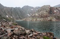
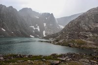
We started at 4:10 in the morning at the Big Sandy Trail Head in the Wind River Range of Wyoming. We hiked past Big Sandy Lake then up and over the Climber's Pass (just west of Jackass Pass). Then down to Lonesome lake, leaving the outlet of Lonesome Lake at just a few minutes before 8 am and headed down the North Fork Trail to where it intersected the Lizard Head Trail. From that intersection, up the Lizard Head Trail and over to the Bear's Ears Trail. Down the Bear's Ears Trail past Valentine Lake and continued on down to and across the Little Wind River. We continued north then west to Grave Lake, around Grave Lake and then on to Hailey Pass. After crossing Hailey Pass, we continued on down the Hailey Pass Trail which connects to the Pyramid Lake Trail passing Skull Lake on the way to the crossing of Washakie Creek and then taking the Fremont Trail past Marm's Lake, Dad's Lake and Mirror Lake back to the Big Sandy Trail Head, arriving there at 10:20 that evening. Total elevation gain (and loss) was in the neighborhood of 5500 feet for the day. My nephew's GPS indicated 41.9 miles and 15 hrs and 14 minutes of moving time. The rest of the time was spent in donning and removing raingear (twice), taking pictures, potty breaks (about 6-my nephew was having some stomach problems and had to stop every couple of hours), falling on my face (only once!! thank heavens), filtering water and a few minutes at the crossing of Little Wind River to try to decide if we wanted to cut the trip short and hike over Washakie Pass instead of going around Grave Lake (we decided to stick with our original route around Grave Lake).
After getting back to the Big Sandy Trailhead that evening, it took me 10 minutes (no kidding!) to get my shoes off and fall over into bed. I slept in the back of my vehicle on a double-wide air mattress that I had inflated in the back. In the meantime, my nephew, tough dude that he is, decided to drive back to his home in Lander.
I drove home the next day and didn't do any hiking or anything strenuous for 2 full weeks before I felt recovered enough to do any hiking.
However, by the 3rd of August I was back up to the Winds with some friends that I go with each year for another 5 day trip to Titcomb Basin/Indian Basin area.
Just can't get enough of the Winds!!!!!!!!!!!!!!
Unforeseen conditions sometimes make the trip in many ways. That day sounds steller.The hardest hike for me, was a trip into lower Grand Gulch down to the confluence with the San Juan, at least that was our intention. We accessed Grand Gulch at Deer Canyon, which in itself is not an easy backpack. It had been raining, and we expected some water, but not as much as we encountered. Each crossing was a crap shoot, as the water tended to be deeper on the edges of the stream, and was moving pretty fast. We had to make a lot of crossings, and it got old pretty quick. Constantly wet. The stream never stopped flowing. We made it to Grand Arch, about 18 miles from our camp at the head of Deer Canyon. We were about 6 miles from the confluence, but Grand Arch is incredibly beautiful. With a great campspot. So we decided to stay.
Don't like ads? Become a BCP Supporting Member and kiss them all goodbye. Click here for more info.
