Toughest Hike or Backpacking Day

I'm totally game for an adventure! It would be great to meet ya! Now to get my butt back in shape so I can keep up haha

Sent from my SM-G900V using Tapatalk
 
Are there pics to this?

If you do a forum search for Peru you'll find both our trip logs and the links to our Picasa photo pages for the trip.

On Picasa you can also find our photos from the Machu Picchu trek...as well as about fifty other backpacking adventures
 
If you do a forum search for Peru you'll find both our trip logs and the links to our Picasa photo pages for the trip.

On Picasa you can also find our photos from the Machu Picchu trek...as well as about fifty other backpacking adventures
awesome. I'll be looking shortly
 
Well, I just posted this in the "Longest day" thread, and then came upon this topic. Probably fits in here, too :)
---
Ok, long story coming.

Backpacking - 36 miles. Back in 2005 or so a friend and were hiking the Washington portion of the Pacific Crest Trail from north to south. Thing is, it was only supposed to be a 26 mile day to our resupply and a warm, dry bed in White Pass. The day started great - despite the 3rd day of rain in a row we were motivated by the ecstatic vision of a warm, dry hotel room and cold beer. Unfortunately, my friend was a little too motivated.

On that trip we rarely walked side by side, usually having a few hundred yards (at least) in between us. I stopped to take some photos of some enchanting Doug Firs towering above in the eerie fog, when my friend "J" passed by me. He was in the zone, and didn't say anything. And I didn't think anything of it. I put the camera away and continued my jaunt. After about a half mile of walking solo I approached an oddly designed trail junction with an oddly placed trail sign. A feeling of doom suddenly hit my chest. I had a bad feeling about this. I knew the PCT continued to the left, but the design made the correct path "feel" like it went to the right - a trail that traveled due west a few dozen miles to Mt. Rainier National Park. Not the direction we wanted to be heading in, in other words. I hunted for foot prints in the muddy trail. Strangely, I didn't see prints in either direction. I gave him the benefit of the doubt and trusted that he took the correct trail. We had an absolute rule that the hiker in the lead always stop a trail junction, no matter how obvious. J was known to get into meditative zones while he walked - did he completely miss the junction? I could only surmise. With a hurried, panicked energy, I hustled ahead on the PCT, desperately searching for a sign of him. There were none.

I ended up switchbacking down a 1000 feet or so through the fog and rain. I'd spot a footprint every now and then that had to belong to J. I could even make out the little Salomon symbol. I began yelling his name, only to hear it get swallowed by the fog. My instincts were telling me that he wasn't down here, that I should turn around. But I kept going, convinced that those prints were his. But they weren't. An older man appeared out of the dark forest, hiking northbound. Surely he'd give me the relief that my friend actually was still somehow ahead of me? Unfortunately, no. His first words to me, in a deep grizzled voice were "Wellll hellllo - didn't think I'd bump into anyone out here on a day like this". That was all I needed to hear. He obviously hadn't seen anyone else that morning. I stared blankly at him. Could've been minutes for all I know. So many feelings coursing through me - anger, fear, disbelief, confusion, panic. I never said a word to the man. When I finally snapped to it and realized the gravity of the situation, I simply spun around and began marching back up those switchbacks. I needed to get back to that junction.

My brain was hit by a flashflood of negative emotion on that climb back up, only temporary soothed by the thought that he had to have realized his mistake by this point and I'd see him trundling down those switchbacks anytime now. It didn't happen. Exhausted and back at the trail junction, I caught my breath and inhaled my second to last item of food for the day. After a few shouts of his name, I shot down the side trail. And sure enough, within 200 yards or so, I came upon some very fresh foot prints. They were undoubtedly his.

I began to jog down the trail, shouting his name in heavy breathing intervals. Despite the temporary relief that finding his prints provided me, I had new, larger, scarier items to contemplate. Because here's the kicker: J had the tent. I was wet, I was cold, my friend and hiking partner was who-knows-where, and with this detour I probably had 20+ miles left and it was getting close to 2pm. A distance that was growing with every step I took down this spur trail in the opposite direction. If I don't find him, how will I make it through this night?

I had a decision to make. I was tortured by the thought of abandoning the search for J, but it was one that I was forced to entertain. He didn't have much backpacking experience, and zero navigational know-how. Hell, he didn't even have a paper map - I did. But at least he had a shelter. Meanwhile, I was getting chilled (despite all the walking) and my sleeping bag was already a damp mop. It'd be foolish to try to make it though a night in these conditions with saturated gear. So I set a cut off point. I'd hike down one more mile, or twenty minutes. And at that point I'd force myself to end the hunt and turn around and make like a bee to White Pass where I'd be able to call for help. It was a terrifying proposition, but in my panicked brain I felt it was the wisest one for my own safety.

The following stretch was nauseating. I think I even slowed my pace down, fooling myself into thinking that I could somehow out-wit time and delay the inevitable. I was shouting even more now, voice crackling under the stress, knowing that my screams weren't getting anywhere in this oppressively drenched forest. That scared me even more. I waddled along silently for a stretch, looking at my watch and wondering just how far I could stretch this out. When, truly, I was about to give up any hope of finding him, a yell from down the trail gave me an electrifying jolt. I looked up from the hypnotizing rhythm of my muddy shoe shuffling to see him about 25 yards away, stopped and as white as a ghost. We just stared at each other for a few moments, he giving me a horrified and apologetic look and me giving him every emotion my face could possibly wear - mostly negative I am sure. I thought I'd feel more relief and joy. Maybe I did, but that door slammed shut violently with the reality of what still laid before us.

After that point, not much was said. Just a dreary death march parade of gloppy footsteps and the icy swooshing of our nylon ponchos. I think we may have walked 10 miles or so before I could finally ask him what had happened - of how in the hell he got 4 miles down an overgrown spur trail before he realized something was amiss and turned around? Well, turned out he never saw the trail junction. In fact, even before that, he hadn't even seen me take one step off of the trail to take photos of those trees. That whole time, he genuinely thought he was following me.

We made it out in the dark, but we made it. Checked in to a small motel in White Pass and slept one of the better sleeps of my life. For the rest of our abbreviated trip I didn't leave him out of my sight while we were on the trail. Oddly, approximately 3 days after that marathon, we both developed severe pain in our achilles, which completely debilitated us. Did all of the walking through mud force us to alter our gaits enough that it brought this on? Either way, we at least made it through the legendary Goat Rocks Wilderness and Mt Adams Wilderness areas before the onset, so we had seen the best of what Washington had to offer. We were also still dealing with some post traumatic fallout from an experience that could've ended very badly. It was a good time to be done. So it wasn't with too heavy of hearts that we hitched out to the charming town of Trout Lake, WA and ate Huckleberry shakes in silence. While we remained friends for a bit, J and I never backpacked again together.
 
Last edited:
Early August, 2014

Cloud Peak Wilderness Area, Bighorn Mountains, Wyoming

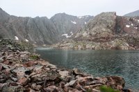
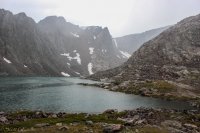
The day started out like any other day and ended with me questioning darn near everything. I hiked up Florence Canyon to document the washing out of the trail under gorgeous bluebird skies. Not having the desire to hike all the way up the canyon, which I had done a few times already that summer, I decided to venture off trail to what is called the Powell Cirque. I had heard great things about the glacially carved hanging valley and the lakes held within. It as one of the places at the top of my list to visit that summer. By the time I had made it up the thousand+ foot slope to the cirque, in was raining. More than raining, it was a deluge. Lightning and thunder reared their ugly heads. I huddled under a rock for an hour. While huddled under said rock I discovered the importance of finding a good, sheltering, rock to hide when hiding from storms as the amount of water falling was only slightly lessened in my hiding place. Water seeped through, Water soaked through rain gear. Water drained down my jacket and into my pants. I became soaked. And very displeased.

After an hour or so I decided I was wet enough that adventuring in the cirque wouldn't make me any more wet. I proceeded to spend a couple hours blundering around a drenched granite boulderfield hoping to not slip and bust my head open or drown in the lake. My little dream adventure had turned into a dangerous mini nightmare. Eventually I left to go slip and slide down the wet slope back to the canyon floor...

Where the horror continued. The trail was either flooded or a sloppy mess most of the way back to camp. I was so wet and miserable I didn't take my boots off for the three creek crossings. What was more wetness after all?

More wetness was more wetness that wouldn't dry out when I got back to camp. The rain had stopped but the day was still overcast and humid. While I could legally have a fire at my camp, all wood nearby was soaked. With all my clothes soaked and hanging, I resorted to using my camp stove to get even a semblance of dryness into my underwear. Standing butt naked, waving my camp stove back and forth trying to not light my underwear on fire made a lot of questions go through my mind. I was pretty happy when I crawled into the sleeping bag that night and for the first time in hours felt warm.

Lots of lessons learned that day. Bring extra clothes when you camp, clothes that do not get warn unless they must and will stay dry no matter what. Wet clothes are fine in the day but being dry in camp is a must. Take the time to find shelter rocks that actually shelter you. Take your boots off for creek crossings even when you are soaked. Boulderfields are dangerous when wet. When the weather starts turning and you can abort, ABORT. Sometimes, especially in high alpine areas, the risk is just not worth the reward.

So yeah, that day was pretty bad.
Tour 5 East Side-50.jpg Tour 5 East Side-51.jpg Tour 5 East Side-52.jpg
 
devil's path is indeed a ball buster,although i did it a long time ago in the 80s, but not the most difficult trail ive hiked.the AT thru the whites is tougher. there are also a number of smaller trails in the whites that are insane, more like rock climbs, including the kings ravine trail, the castle ravine trail, madison gulf trail, great gully trail,huntington ravine trail, to name a few. i would rank western maine on the AT to be tougher than devils path.
The ~13 miles from Franconia Notch to Galehead Hut took me 13 hours. Raining and blowing sideways. I jumped sideways into a tree on one occasion to keep from falling off a rock.

Toughest days for me were

1) 22 miles in the pouring rain from somewhere in southern Vermont to Glastonbury Mountain. 40 degrees, rain and wind. I was slightly hypothermic by time I got to camp, and my clothes froze solid overnight. On June 15ish.
2) Blaurock Pass in the Winds on a floppy ankle. Was in the middle of nowhere and came down with Achilles tendonitis. Had to cross a fairly burly pass on one ankle, with shooting pain. After I got down the other side, I did about a mile per hour for a couple days as I could hardly walk. Next time I do a big off-trail trip, I'm going to do some stretching for months beforehand so my tendons can tolerate steep climbs, over and over.
 
North Rim to South rim in Grand Canyon via Kaibab Trail ........ many moons ago when younger.
One of my top five was certainly the North Rim to South Rim in-a-day and then rest up for a day and South Rim to North Rim back again, in-a-day.

23 miles each way and 11'000 feet of vert. each way and it was Upside Down. You climbed down to the river and upon getting tired had to hike all the way back out of the gravity well uphill.

This is a HIGHLY recommended route for one time. There is water the whole way - even drinking fountains. Near-gourmet food and a soft bed in the middle. And, of course, the hike up and down the entire strata of one of the most beautiful geological features in the universe. Too much development and people for doing it twice though.
 
Last edited:
Another top five hardest was training for the above RRR.

A couple of weeks before my buddy and I hiked King's in a day from the north. We actually encountered people we knew doing the climb in two days in the upper meadows. The last 5 miles of forest slog were brutal but that was the first time I figured out pulling the earbuds out and popping music gave me dancing feet when I was tired and bored. Such a good pick-me-up now.

I think that is 26 miles and about 11K' (I choose to count the up AND the down, like for my ski trips, because all those feet are hard.) At least it is right side up.
 
Last edited:
Another top five was training for the above RRR.

A couple of weeks before my buddy and I hiked King's in a day from the north. We actually encountered people we knew doing the climb in two days in the upper meadows. The last 5 miles of forest slog were brutal but that was the first time I figured out putting the earbuds out and popping music gave me dancing feet when I was tired and bored. Such a good pick me up now.

I think that is 26 miles and about 11K' (I choose to count the up AND the down, like for my ski trips, because all those feet are hard.)
A third of my top 5 hardest was when I did Kings's peak in a day and a half from the north as well - in my Birkenstocks. I got to the trailhead and found I had forgotten my hiking shoes. I drove out of the mountains to Lyman et al for half a day looking for tennis shoes or anything but all the shoe retailers had folded up to concede to Wally World in Evanston. I was pissed off so I went back and hiked it with a tarp bivy anyway. Just a few shin spints and my already worn out birkies were even more worn out but we summitted (me and my birkies).
 
Last edited:
Got my truck stuck in the mud once on a "day trip". Short story made shorter - two days and two nights, 34 miles, open desert, late winter, no shelter, no food, eating dirty snow for water (made me puke....). Never felt in any danger or anything, aside from hunger, thirst and cold, didn't even suffer much, just a garden variety shit sandwich, but of above average proportion, simply had to eat it one bite at a time.

- DAA
Dave, you overnighted unprepared two nights ??? Any advice for us that are afraid-of-the-dark? :)
 
Dave, you overnighted unprepared two nights ??? Any advice for us that are afraid-of-the-dark? :)

Keep a positive mental attitude. The whole thing was about that. In my cold analytical heart, I KNEW I was going to be fine. I knew exactly where I was. Knew exactly where I was going. Knew almost exactly how long it was going to take me (I was only off by an hour). But I also KNEW it was really, really going to suck. Knew I was going to be cold, hungry, thirsty and tired. So, the whole thing, for me, was about not letting despair set in - which, was a struggle at times. Just keep putting one foot in front of the other, embrace hunger (had myself fairly convinced the weight loss was all bonus and hungry was good!), stop early to get as comfortable as you can for the night (I just found a deer bed in the PJ's and got a fire going, didn't sleep worth a damn but otherwise didn't suffer too badly either, I've had worse nights in a sleeping bag).

- DAA
 
I have had several hard trips and love them all for the challenge they have given me. For a single day I would pick an early season day hike to kings peak. I had a small day pack and ran most of the way in. I started up the chute and could not make it past the cornice that always lingers at the top. So, I had to reroute around to gunsite and up through the cliffs. I made the peak no problem but when on my way off sprained my ankle. 4 hours to make the peak and 12 to get out. The runoff was incredible this year so I had to route through the Henry's lake side instead of the going up by dollar lake (the bridge was down at elk horn). I had several high water river crossings. This was also a solo hike so I was on my own. You truly discover what you have inside when you are by yourself and face this kind of adversity.
Hardest multi-day trip: a buddy and I under full pack did the high line trail trail in 3 days. Had to dig pretty deep on some of those high passes. I recently did it solo in 4 days and that was a dream comparatively speaking.
Have to mention the solo snowshoe kings peak trip in January. Had to break trail the entire way. Don't think I have ever been that tired in my life ha ha


Sent from my iPad using Tapatalk
 
My most difficult hike was a 42 mile "Death March" that I did with a nephew last July 9. We both just wanted to see how far we could go in a day.

We started at 4:10 in the morning at the Big Sandy Trail Head in the Wind River Range of Wyoming. We hiked past Big Sandy Lake then up and over the Climber's Pass (just west of Jackass Pass). Then down to Lonesome lake, leaving the outlet of Lonesome Lake at just a few minutes before 8 am and headed down the North Fork Trail to where it intersected the Lizard Head Trail. From that intersection, up the Lizard Head Trail and over to the Bear's Ears Trail. Down the Bear's Ears Trail past Valentine Lake and continued on down to and across the Little Wind River. We continued north then west to Grave Lake, around Grave Lake and then on to Hailey Pass. After crossing Hailey Pass, we continued on down the Hailey Pass Trail which connects to the Pyramid Lake Trail passing Skull Lake on the way to the crossing of Washakie Creek and then taking the Fremont Trail past Marm's Lake, Dad's Lake and Mirror Lake back to the Big Sandy Trail Head, arriving there at 10:20 that evening. Total elevation gain (and loss) was in the neighborhood of 5500 feet for the day. My nephew's GPS indicated 41.9 miles and 15 hrs and 14 minutes of moving time. The rest of the time was spent in donning and removing raingear (twice), taking pictures, potty breaks (about 6-my nephew was having some stomach problems and had to stop every couple of hours), falling on my face (only once!! thank heavens), filtering water and a few minutes at the crossing of Little Wind River to try to decide if we wanted to cut the trip short and hike over Washakie Pass instead of going around Grave Lake (we decided to stick with our original route around Grave Lake).

After getting back to the Big Sandy Trailhead that evening, it took me 10 minutes (no kidding!) to get my shoes off and fall over into bed. I slept in the back of my vehicle on a double-wide air mattress that I had inflated in the back. In the meantime, my nephew, tough dude that he is, decided to drive back to his home in Lander.

I drove home the next day and didn't do any hiking or anything strenuous for 2 full weeks before I felt recovered enough to do any hiking.

However, by the 3rd of August I was back up to the Winds with some friends that I go with each year for another 5 day trip to Titcomb Basin/Indian Basin area.

Just can't get enough of the Winds!!!!!!!!!!!!!!
 
The hardest hike for me, was a trip into lower Grand Gulch down to the confluence with the San Juan, at least that was our intention. We accessed Grand Gulch at Deer Canyon, which in itself is not an easy backpack. It had been raining, and we expected some water, but not as much as we encountered. Each crossing was a crap shoot, as the water tended to be deeper on the edges of the stream, and was moving pretty fast. We had to make a lot of crossings, and it got old pretty quick. Constantly wet. The stream never stopped flowing. We made it to Grand Arch, about 18 miles from our camp at the head of Deer Canyon. We were about 6 miles from the confluence, but Grand Arch is incredibly beautiful. With a great campspot. So we decided to stay.
 
My most difficult hike was a 42 mile "Death March" that I did with a nephew last July 9. We both just wanted to see how far we could go in a day.

We started at 4:10 in the morning at the Big Sandy Trail Head in the Wind River Range of Wyoming. We hiked past Big Sandy Lake then up and over the Climber's Pass (just west of Jackass Pass). Then down to Lonesome lake, leaving the outlet of Lonesome Lake at just a few minutes before 8 am and headed down the North Fork Trail to where it intersected the Lizard Head Trail. From that intersection, up the Lizard Head Trail and over to the Bear's Ears Trail. Down the Bear's Ears Trail past Valentine Lake and continued on down to and across the Little Wind River. We continued north then west to Grave Lake, around Grave Lake and then on to Hailey Pass. After crossing Hailey Pass, we continued on down the Hailey Pass Trail which connects to the Pyramid Lake Trail passing Skull Lake on the way to the crossing of Washakie Creek and then taking the Fremont Trail past Marm's Lake, Dad's Lake and Mirror Lake back to the Big Sandy Trail Head, arriving there at 10:20 that evening. Total elevation gain (and loss) was in the neighborhood of 5500 feet for the day. My nephew's GPS indicated 41.9 miles and 15 hrs and 14 minutes of moving time. The rest of the time was spent in donning and removing raingear (twice), taking pictures, potty breaks (about 6-my nephew was having some stomach problems and had to stop every couple of hours), falling on my face (only once!! thank heavens), filtering water and a few minutes at the crossing of Little Wind River to try to decide if we wanted to cut the trip short and hike over Washakie Pass instead of going around Grave Lake (we decided to stick with our original route around Grave Lake).

After getting back to the Big Sandy Trailhead that evening, it took me 10 minutes (no kidding!) to get my shoes off and fall over into bed. I slept in the back of my vehicle on a double-wide air mattress that I had inflated in the back. In the meantime, my nephew, tough dude that he is, decided to drive back to his home in Lander.

I drove home the next day and didn't do any hiking or anything strenuous for 2 full weeks before I felt recovered enough to do any hiking.

However, by the 3rd of August I was back up to the Winds with some friends that I go with each year for another 5 day trip to Titcomb Basin/Indian Basin area.

Just can't get enough of the Winds!!!!!!!!!!!!!!
My kinda day! Tough and awesome.
Salud!

sent from an undisclosed location
 
The hardest hike for me, was a trip into lower Grand Gulch down to the confluence with the San Juan, at least that was our intention. We accessed Grand Gulch at Deer Canyon, which in itself is not an easy backpack. It had been raining, and we expected some water, but not as much as we encountered. Each crossing was a crap shoot, as the water tended to be deeper on the edges of the stream, and was moving pretty fast. We had to make a lot of crossings, and it got old pretty quick. Constantly wet. The stream never stopped flowing. We made it to Grand Arch, about 18 miles from our camp at the head of Deer Canyon. We were about 6 miles from the confluence, but Grand Arch is incredibly beautiful. With a great campspot. So we decided to stay.
Unforeseen conditions sometimes make the trip in many ways. That day sounds steller.
Salud!

sent from an undisclosed location
 
Not sure on the millage but one day on the highline last year we camped below kings and in one day went up Anderson pass, went to the top of kings, went over tungsten and over porcupine and down 5 or 6 miles to camp. So three passes and kings in one day. It was awesome.
 
Similar threads
Thread starter Title Forum Replies Date
M Lost a drone in the San Rafael River area/below the wedge. No time to hike in to retrieve. General Discussion 0
TrailScot Day hike in the Upper East Side of Zion - October 2023 Hiking & Camping 5
TrailScot Upper Paria Loop Hike - September 2023 Backpacking 4
OldBill Short hike at the Grand Canyon of Pennsylvania Hiking & Camping 1
kwc Fall hike to Chase Lake, Southern Adirondacks Hiking & Camping 1
O YNP Union Falls easy hike Aug 4-8 2023? Meet Up (Members Only) 9
kwc Another Adirondack Hike Hiking & Camping 3
kwc Hadley Mountain hike Hiking & Camping 1
T America's Wildest Through-hike General Discussion 0
kwc Short Snowshoe Hike today, Southern Adirondacks Hiking & Camping 2
kwc Another Southern Adirondacks hike - Clockmill Pond and Rock Lake Hiking & Camping 0
Ellen What are your favorite spots to hike and camp in December? Trip Planning 10
F The El Camino Real, A failed hike. Backpacking 16
P Scatman's Grizzly Lake hike, 2022 Backpacking 28
Jackson Quick day hike in the Montana Absarokas Hiking & Camping 13
kwc Adirondack Hike to Middle Lake Hiking & Camping 0
TrailScot "I'll take the High Road ..." - A Loop Hike around the Canyons of Needles - May 2022 Trip Reports 14
norwegianxplorer Hiking Sierra de las Nieves, Spain. Sunrise hike from Yunquera, Andalusia, Wild boar and Spanish Ibex Hiking & Camping 0
Rockskipper Afraid to hike alone? Go with this guy - or maybe not. General Discussion 2
Titans Birthday hike Nov 2021 Hiking & Camping 13
P A short hike on the AT in Shenandoah National Park Hiking & Camping 0
kwc Hadley Mountain Fire Tower hike, Southern Adirondacks Hiking & Camping 1
seekinglost 1000 Mile Nevada Thru Hike on the Basin and Range Trail Trip Reports 14
kwc Short hike to a fire tower Hiking & Camping 3
MikeP Canmore Thru-Hike Trip Planning 1
JuddOutdoors Hike To Grass Lake //Desolation Wilderness //Lake Tahoe Basin Hiking & Camping 0
kwc Blue Mountain hike, Central Adirondacks Hiking & Camping 0
kwc Goodnow Mountain fire tower hike Hiking & Camping 2
norwegianxplorer Mt Whitney Virtual Hike via Horseshoe Meadows & Mt Langley, Sequoia Kings Canyon National Park Backpacking 1
kwc Winter Hike into Broomstick Lake 1/13/21 Hiking & Camping 2
Outdoor_Fool October Denali Hike Hiking & Camping 21
Tomaswmitchell Cuberant Lake hike, Bigfoot tracks? Video Hiking & Camping 2
kwc Stony Pond hike, Central Adirondacks Hiking & Camping 1
Arizona Jones Willow Valley Loop Hike, Arizona Canyoneering 8
kwc Hurricane Mtn hike in the Adirondacks Hiking & Camping 2
regehr quick Medicine Bow / Laramie-area hike? Trip Planning 0
ramblinman Boulder Creek Day Hike, Escalante National Monument Hiking & Camping 5
J Family hike in the Maze in June? (Canyonlands / Moab) Am I crazy? Trip Planning 5
U Just picked up a permit for Shelf Lake 2 nights in Mid/Late July. Any ideas for a day hike/summit from there? Trip Planning 0
kwc Adirondack Spring Hike #? Hiking & Camping 1
kwc Another Hike in the Adirondacks 5/13/20 Hiking & Camping 3
kwc Yet Another Adirondack Hike 5/5/20 Hiking & Camping 1
kwc Another Adirondack Hike 4/23/20 Hiking & Camping 2
Perry Afternoon Hike in Redrock Canyon Trip Reports 2
Perry Day Hike Exploring the Wasatch Ridge Line Hiking & Camping 5
Yvonne Snow Hike up the West Rim, December 15, 2019 Hiking & Camping 7
Benjamin Hayden Looking for good hike away from people in Sedona in mid-February Trip Planning 3
Yvonne Sepulcher Mountain Hike, Yellowstone NP, September 2018 Hiking & Camping 2
Yvonne Yellowstone 2020 backcountry hike questions Trip Planning 21
Yvonne Day Hike to Cache Lake, Yellowstone NP, August 2019 Hiking & Camping 6

Similar threads

Back
Top