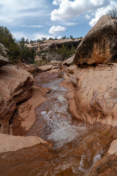
Guess the spot: Utah Edition
- Thread starter Ben
- Start date
")


Similar threads
Similar threads
-
-
 The value of the various Guess the Spot threads
- Started by Outdoor_Fool
- Replies: 6
-
 NYTimes article: Guess the spot saves someone's life
- Started by wsp_scott
- Replies: 1
-

-

-

-

-
-

-
-

-
Identify the spot Utah: I don't know where it is
- Started by James and Amy
- Replies: 2
-

-
-

-

-
-
-

-

-

-
-

-

-

-

-
-

-

-
Invite Looking for shuttle partner -- two trips in Southern Utah
- Started by Normie
- Replies: 5
-
 Oh look yet another Utah conditions thread: mid May 2023
- Started by BeardoMcGrath
- Replies: 9
-

-

-
-
-

-
Grand Gulch Cedar Mesa Utah 11 Day Backpack October 2022
- Started by canyonman342
- Replies: 10
-
-
four day backpacking trip in southern Utah starting this weekend
- Started by vrak
- Replies: 4
-

-
 "I Would Walk 500 Miles ..." - A Utah Adventure - April 2022 - Final Part
- Started by TrailScot
- Replies: 11
-
"I Would Walk 500 Miles ..." - A Utah Adventure - April 2022 - Part 5
- Started by TrailScot
- Replies: 3
-
"I Would Walk 500 Miles ..." - A Utah Adventure - April 2022 - Part 4
- Started by TrailScot
- Replies: 10
-
"I Would Walk 500 Miles ..." - A Utah Adventure - April 2022 - Part 3
- Started by TrailScot
- Replies: 4
-
"I Would Walk 500 Miles ..." - A Utah Adventure - April 2022 - Part 2
- Started by TrailScot
- Replies: 5
-
"I Would Walk 500 Miles ..." - A Utah Adventure - April 2022 - Part 1
- Started by TrailScot
- Replies: 6
-

-
-
Dripping Canyon to Grand Gulch, Cedar Mesa, Utah - March 2022
- Started by TrailScot
- Replies: 7