Navigation
Install the app
How to install the app on iOS
Follow along with the video below to see how to install our site as a web app on your home screen.
Note: This feature may not be available in some browsers.
More options
You are using an out of date browser. It may not display this or other websites correctly.
You should upgrade or use an alternative browser.
You should upgrade or use an alternative browser.
Uintas Conditions 2019
- Thread starter Johnpaulj
- Start date
- Joined
- Jan 4, 2015
- Messages
- 2,836
- Joined
- Aug 9, 2007
- Messages
- 12,951
- Joined
- Jun 25, 2012
- Messages
- 4,429
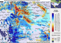
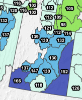
Well, this is interesting too but different interesting as compared to the Windies. Contrast this "Departure from Normal" map of the region to the conditions from last year. Admittedly they are from much different dates but each compares the current conditions to the average or normal conditions for that date. For this tracking thread note the Uinta River Mountains. Even though a few ranges in the region are well below normal, like the Wind Rivers and Bighorn mountains the Uintas had above normal snowfall and snowfall stored on the ground this year. Cool blue colors indicate above average snow depth using the scale to the right. Warm and hot yellows and reds indicated below average snow depth on the ground.
This indicates to me that maybe we can get into the high country of the Windies (and Yellowstone and the Bighorns) a little early again this year but in the Uintas we are going to be postholing in snow in the high country through June and July depending on aspect and elevation.

This indicates to me that maybe we can get into the high country of the Windies (and Yellowstone and the Bighorns) a little early again this year but in the Uintas we are going to be postholing in snow in the high country through June and July depending on aspect and elevation.

Last edited:
Historical data indicates that even a big year should see dirt in the valleys ~10,000' by July. But the high passes...
https://wcc.sc.egov.usda.gov/nwcc/site?sitenum=396&state=UT


https://wcc.sc.egov.usda.gov/nwcc/site?sitenum=396&state=UT


Parma
@parma26
- Joined
- Feb 12, 2014
- Messages
- 754
Saw this posted on Friends of Kings Peak Facebook page:
- Joined
- Aug 8, 2016
- Messages
- 2,072
Saw this posted on Friends of Kings Peak Facebook page:
For those of us that don’t do Facebook what’s it about?
Sent from my iPhone using Tapatalk
Parma
@parma26
- Joined
- Feb 12, 2014
- Messages
- 754
It says,
“Okay just checked. Currently 47 inches at snotel site below Elkhorn Crossing (bridge). About a foot a week melt out so at least a month until trail is clear to the bridge. It’s going to be a long while until you can do the peak without snow.”
https://wcc.sc.egov.usda.gov/nwcc/site?sitenum=1193&state=ut
- Joined
- Aug 8, 2016
- Messages
- 2,072
It says,
“Okay just checked. Currently 47 inches at snotel site below Elkhorn Crossing (bridge). About a foot a week melt out so at least a month until trail is clear to the bridge. It’s going to be a long while until you can do the peak without snow.”
https://wcc.sc.egov.usda.gov/nwcc/site?sitenum=1193&state=ut
Thanks for that! But.... sigh.
Parma
@parma26
- Joined
- Feb 12, 2014
- Messages
- 754
From the US Forest Service:
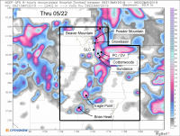
Heber-Kamas Ranger District gate across Mirror Lake Highway (Highway 150) is open, (so the snowmobilers and skiers can access the area), but there is still a Road Closed/No Winter Maintenance sign on the road. Snow levels higher up Hwy 150 make it impassable to vehicles. Depth at Bald Mountain is 83 inches. Depth at Trial Lake is 68 inches. No campgrounds are open yet. Trails are either still under snow or are mud/snow/ice/water mixes. The road to Strawberry Marina is clear, mostly, but the marina is not open yet. Access to Chicken East is also open. Wolf Creek Pass road open to junction with Mill Hollow road.
Heber-Kamas Ranger District gate across Mirror Lake Highway (Highway 150) is open, (so the snowmobilers and skiers can access the area), but there is still a Road Closed/No Winter Maintenance sign on the road. Snow levels higher up Hwy 150 make it impassable to vehicles. Depth at Bald Mountain is 83 inches. Depth at Trial Lake is 68 inches. No campgrounds are open yet. Trails are either still under snow or are mud/snow/ice/water mixes. The road to Strawberry Marina is clear, mostly, but the marina is not open yet. Access to Chicken East is also open. Wolf Creek Pass road open to junction with Mill Hollow road.
- Joined
- Aug 8, 2016
- Messages
- 2,072
From the US Forest Service:
Heber-Kamas Ranger District gate across Mirror Lake Highway (Highway 150) is open, (so the snowmobilers and skiers can access the area), but there is still a Road Closed/No Winter Maintenance sign on the road. Snow levels higher up Hwy 150 make it impassable to vehicles. Depth at Bald Mountain is 83 inches. Depth at Trial Lake is 68 inches. No campgrounds are open yet. Trails are either still under snow or are mud/snow/ice/water mixes. The road to Strawberry Marina is clear, mostly, but the marina is not open yet. Access to Chicken East is also open. Wolf Creek Pass road open to junction with Mill Hollow road.
Ooh, ooh! It’s a start!
Sent from my iPhone using Tapatalk
- Joined
- Jul 23, 2013
- Messages
- 1,657
- Joined
- Aug 8, 2016
- Messages
- 2,072
Holy guacamole!
- Joined
- Jan 4, 2015
- Messages
- 2,836
A ready-made igloo!
- Joined
- Jun 25, 2012
- Messages
- 4,429
Correction, @WasatchWill. Just read the post at the USFS FB page and this is actually the outhouse at Bald Mountain Pass - a thousand feet or more higher. Just wanted all to know.


