chandlerwest
Member
- Joined
- Feb 7, 2015
- Messages
- 550
2020 has been a transitional year for me. A year where I contemplated the questions, "Am I done physically?", and worse, "Am I done mentally?" Did I quarantine for six months because it was the right thing to do, or was it just an excuse to not drag myself over unforgiving terrain? Was 62 years old my stopping point? Because at heart I am a couch potato! My "quarantine find" was Professional Disc Golf. Who would have thought that watching people throw hi-tech Frisbees through tick and poison ivy infested woods would be so enjoyable!! Then the Timeshare Resort near Glacier National Park was closed for both of our weeks so for the first time in 15 years we didn't go to Glacier.
Jeff headed back to college in August so I was left alone contemplating "am I done?" Temperatures finally dropped below 100 degrees and I started getting the frustrating realization that "if I don't get out there, then..........I am done." So I bucked up and bought my National Park SENIOR Pass and spent three treks into the backcountry of Zion National Park.
Initially I did what I thought would be a easy adventure. Over a route that I was familiar with. Up Separation Canyon I went.
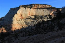
I will be going up yonder bowl
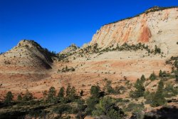
The route takes me through a nice rock garden
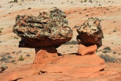
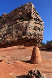
After reaching the top of the bowl I get this view out over the only remaining area of the Parunuweap that I have to explore. Maybe next spring? When the cactus are blooming?
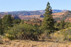
Worked my way to a saddle that @Jeffrey Chandler and I discovered a couple years ago. By this time I physically was feeling the affects of not doing much of anything for a year. And worse yet I didn't have the mental enthusiasm to joyfully push through the fatigue. But I Did push........so I guess I Did have what I needed. But then again.....what choice did I have!
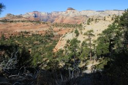
I was finally at my goal for this trip I was going to explore the ridge that juts out to the north. I got a bit of a bounce to my step being in new territory and it was pleasant terrain.
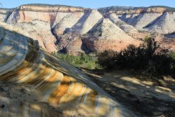
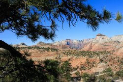
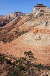
I couldn't get any farther!!! It Never gets old being in the 4th busiest National Park and....being absolutely alone!!
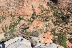
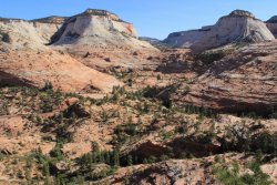
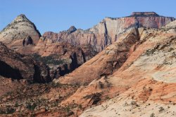
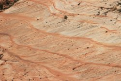
This shot looks across towards where I will go in a week. I essentially circle Aires Butte. The tall pyramid, on the right
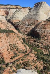
My plans were to retrace my steps back to the car. My route had been similar to a horseshoe. I was exhausted and that just seemed to scream "isn't there a better option!?!" I didn't have a map with me (jeesh) so I delved into past memories of adventures out here in the East Canyons. The dust started falling from the mental gears in my brain. That old, rusty, adventure enthusiasm said "what if...... I can find a way to drop into the Crawford Access Drainage?" So I charged into the mental/physical challenge of making that work out. Of course it turned out to be twice as tasking as retracing my step but I survived.
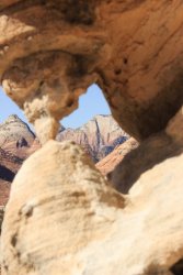
It looked oppressive to get back to that saddle so I Had to make this work.
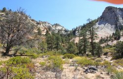
Long story short. I was so engaged in route finding, and surviving that I didn't get many pictures. Also.....90 degrees is still friggin' HOT. I was able to make my way down into the that drainage to the west and back to Clear Creek and the road. I could have hiked the road back to my car but I made the naive decision to stay in Clear Creek because I knew that there were nice photos to get. But my body was wasted. Walking on that sand, boulders, and gravel was way beyond reasonable. But again.......I survived it. Not sure I could go 10 steps without finding a "sitting rock."
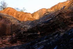
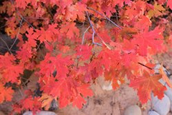
It was disheartening to find names scratched into the walls of the narrow slots of Clear Creek. Being close to the road it is too easy for the jerk tourists to access.
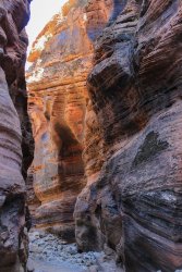
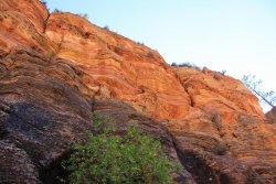
A week later I found myself exploring the upper reaches Keyhole Canyon. Again an area I had been to twice before but I wanted to get beyond Jughandle Arch, explore the side drainages, plus check out the area to the west. Having done okay(?) last week I was a better mentally prepared starting out. I suppose........yeah..
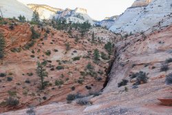
This shot is over to the saddle between South Ariel Peak and Aerial Butte. It comes into play later in the day.
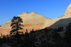
It was a pleasant walk. Nothing crazy.
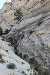
I reached my turnaround point. Looking back down canyon with Jug Handle Arch high above on the right.
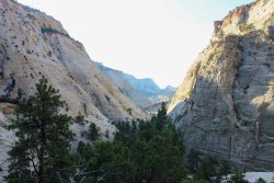
I couldn't get any farther going north.
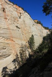
Jug Handle Arch
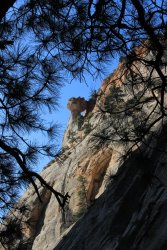
Let's see how far I can get up this side canyon. I just go until.....I can't. These trips were also while that woman was lost in Zion. So I was doing some heavy contemplation how responsible I was for my personal safety out here. NO ONE is just going to walk by me if I get into trouble. It added a bit a gravitas to proceedings.
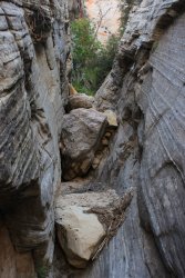
I could not make getting up this work
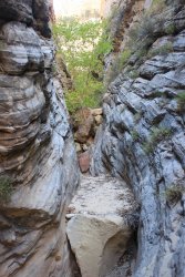
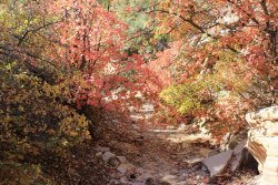
Let's see what is up the next side drainage. It has a nice headwall!!!
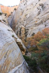
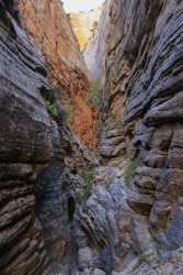
I don't know how many times I slid down this before I declared myself "good" and made my way out.
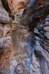
Hey look.....Jug Handle Arch.
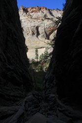
Now, to make way around to the west side of Keyhole drainage. I could go on and on about "pitch" but I know that most of you are familiar with that obstacle. I just want to acknowledge that pitch is less of an issue when you have shoes with great traction........but I DON'T so finding that route across pitch becomes a mathematical problem.
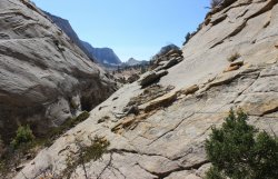
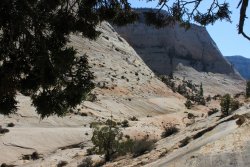
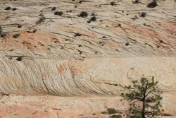
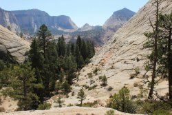
I finally made it to the small drainage that goes off to the west. I knew from previous adventures in the lands to the west that this took me to a precipitous drop off which is a waterfall a couple weeks during the year.
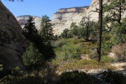
I reached the drop off and get a couple shots up and down that drainage. I had been on yonder ridge line a week ago.
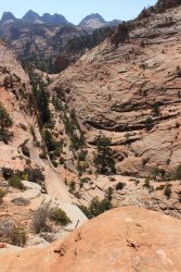
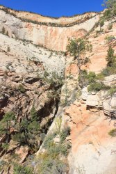
I was a happy camper. I got to where I wanted to go. At this moment I was 100% committed to retracing my steps (maybe exploring a bit more nearer to the Keyhole slot canyon).
I looked at this wall and went......."ahhhhhh dammit". I could "see" a "path" head across that slope. Leading to a "flat" spot. I didn't know what terrain was beyond that "flat" spot but I knew that if it was navigatable it would lead to an area that had thwarted me twice before.
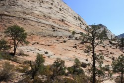
Let me insert some retroactive beta for this route. (Never in my wildest fantasy had I considered doing this!!) This is a photo that I took from the rim in 2017. I will be traveling from left to right. "Ants on hill". That is all that it is. But it is ALL across an ever changing pitch!!!!!!!!! You can easily find the above shot in this photo, towards the bottom left.
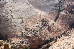
I head out. Needless to say I am fully mentally engaged at this point. I trusted that I could find "safe enough" pitch to make this work.
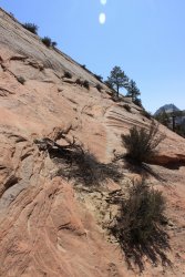
I had one move where the "trail" blew out. But it was only a two step move. And the only thing that gave me pause were me boots and the amount of "air" that was off to the right. Got through that little problem just fine. "Don't want to do that again!" I came upon a similar situation but this one was probably 4-5 steps to "solid ground". The pitch was even more enticingly reasonable, but again, could I trust my boots, and my brain to ignore the seemingly infinite slide to the right. I started my first step and instantly, mentally, hesitated. I spent the next seconds experiencing "fear". It was all instinct, trying to get any body part to grasp onto something. Foot, butt, hand, please. I sat on the heals of my boots for awhile letting my heart slow down. Stood up. Realized that I needed to just "commit". I would hold on the pitch. I was across!!!!!! "This has to lead me where I want to go because I can't do that again". This is a shot looking back so it must be documenting that particular area. Of course I had already done it so it looks just fine......I suppose.
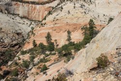
It wasn't easy but there was no drama going forward. Just route finding.
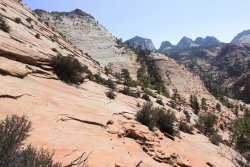
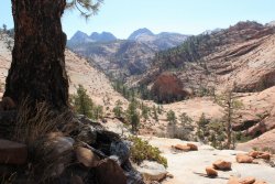
My immediate goal comes into sight. I suppose it could be called a "bowl"? It leads to that saddle that I referred to awhile back. I felt confident that I came out above the area that had thwarted me twice as I tried to gain access from the drainage to the west.
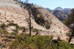
Here is some retro-beta from 2017 of what has been call the "Center of the Universe". If only I had studied this photo prior to this trip maybe I would have been back to my car by now. I should note that this shot doesn't even contain where I had failed previously, as it is below camera.
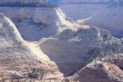
When I reached the bowl I was so disheartened because the way up look positively ugly. There wasn't a route that screamed "take me". Did I go through all this just to slide down the slope to the west and not get to the saddle?! I sat and sat and sat until I noticed that I was sitting on a "ramp" that rose to the south. "Maybe if I go up this ramp I will get high enough that I can find a "route" "over" to the summit." Which is what happened. Accept by then, I could see that it was a false summit. "I'll worry about that when I get there."
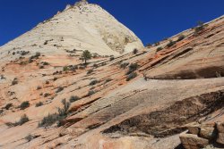
This was the false summit/lip I had to get over. I KNEW if I could trust my boots and my legs it was 2-3 three easy steps but I had trust in neither. But I could see a couple sharp edges for footing so I headed across. Funny thing was those edges slowly started getting farther apart so I was getting a bit bowlegged. It gave me a good laugh at the time....so that was nice! I saw a spot in the blue/white wall that was lower. I put my butt against it.....got a good grip with my right hand....got my heal to stick on something and backwards spider crawled up. I could have just laid there it bliss!!!!!
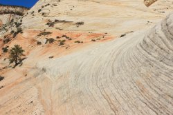
Of course there were 2 or 3 other false summits but I was in the hump of the saddle so I was home free!!!!
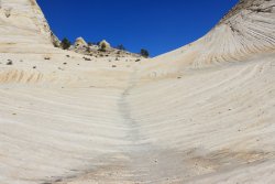
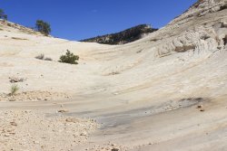
I MADE IT !!! Looking down into Keyhole Drainage. I have beaten the Center of The Universe
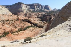
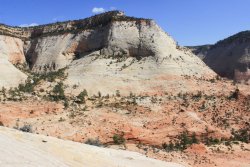
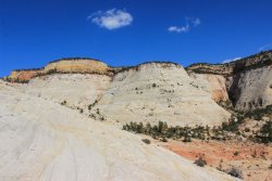
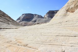
The beta says that you can access this saddle from Keyhole. I was praying that it would present itself to me once I was there. All I saw was........a slide, catch air, splat!!!!
I saw this "path". I took it around one blind corner and went "I don't want anything to do with this!!!!!!"
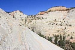
So I headed back down to the west. I knew that it was a much longer way, but I told myself it was a series of ledges not "air, splat". I just had to figure out how to "get down...............there" a few times. This is a photo of the "path" I took from the earlier ramp to the blue/white wall. It is a thoroughfare!!!
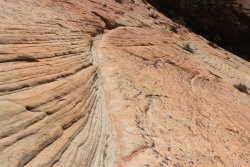
One last look upwards. Now I just have to get down through the area that broke me twice before.
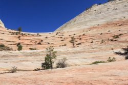
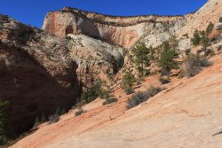
By this time I was getting exhausted from playing this mental game of finding the best and safest route through this puzzle. My mental was catching up with my physical exhaustion. Knowing that this is when accidents happens (typing that now sure sounds funny.) I was open to "cheating". Once I could see the bottom I would hunt for corrugated slope. Sit down and inch my way down the slope. It wasn't graceful but it was effective.
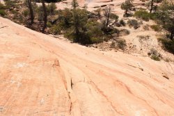
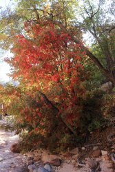
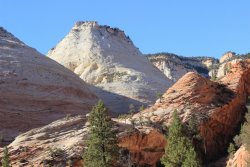
One final fall foliage shot then road walk back to my car. I learned my lesson last week. No stinkin' Clear Creek for me!!!! Then a view from my car to the Center of the Freakin' Universe!
This trip report is taking a lot longer than I expected. I envisioned it as one story so, forgive me, I am going to plow through. Thank you for sticking with me.
A month ago I found beta for this adventure out of the Right Fork of North Creek. It takes you to a ridge line that overlooks the Southwest Desert and the backside of West Temple, etc. In other words it would be the definition of Epic. I asked the boys if I should even consider doing it. Keep in mind this was before I had done these previous two documented trips. So I was in full bore "am I done?" mode. Neither of them encouraged me to try the route. But I made it to Center of the Universe so I supposed I was as embolden as I could possibly get. So off into the Right Fork I go.
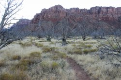
Looking back up to the lava cliff that you have to make your way down. There is a social trail......so there is That.
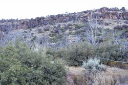
A story: I am making my way up North Creek towards the confluence of the Left Fork (Subway) and Right Fork. I'm not lost but I'm not exactly going a clean route. I hear something in the Thick brush to the right. I see a dark mass. My brain instantly goes "bear?" (I'm a Glacier NP guy), then I go "elk?" then I see "cow". "What are you doing here, this is a "Wilderness Area?" It appears excited to see me. As if it has been wandering by itself....forever. It comes towards me. I walk away. It follows me. I lose it as I go deeper into thicker brush towards rushing water. So my question is.......what do you do when a cow is approaching you? Petting it seems like something to do, but somehow wrong. It out weighs you by hundreds of pounds.
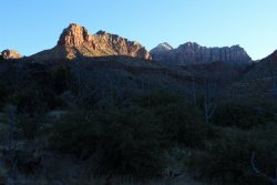
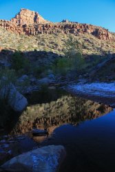
In 2015 I went up Right Fork as far as physically possible. It took me awhile to remember that it involves walking in water. Route finding became easier once I remembered to splash on through.
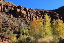
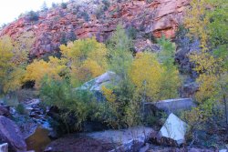
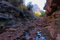
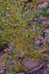
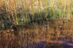
This is were I leave the Right Fork and head up Trail Canyon. On paper it is only a couple miles but it is a "dirty" drainage. The beta said to stick to the creek but it was so cluttered with brush, debris, and boulders that I tried to stay above it as much as I could. I was also expecting it to be dry. But it had running water in it. That threw me off my game. The beta mentioned water and mud.....but they had gone in April. We have had one day of rain in six months so I felt it would be dry.
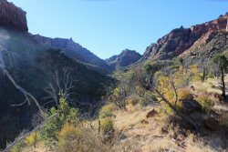
Looking up Right Fork
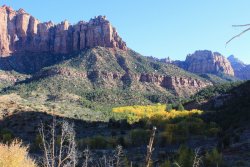
Let's make our way south!! Somewhere I busted my tail bone on something. I don't remember the initial "pow" but I sure noticed the subsequent tenderness every time I sat down or slid 20 feet down a slope. (I didn't take a picture of that slope because I am sure it would look lame in the shot and my memory wants to be that I slid "over 20 feet into a creek!")
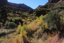
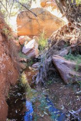
I eventually found the source of the water. It was a spring that was dripping thru brush and grass at a small side canyon. I couldn't get a photo of it because Trail Canyon is so narrow, deep and cluttered. When I was trying to get to sleep this night it came to me........."it's a ditch!!" Above the spring the drainage was essentially dry. Trial Canyon is such a cluttered drainage because its main water source is a trickling spring and it doesn't get enough cleansing flash floods.....I assume. When I finally reached this pour off it confirmed that I was in the right place. Up until then I "figured" I was in the right place.
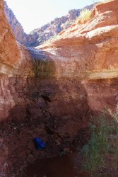
I successfully got around this using the slopes back canyon on the right. This photo is back towards Right Fork.
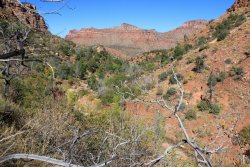
From up there I could see the crux of the trip. There is a 100 foot dry fall that you get around by trudging up the slope to the right. By this time I knew that time was not on my side. I also knew that once I got up that slope I still was a long way from the view that I wanted. All I saw on that slope was Gamble Oak (razor trees), thick brush, and misery.
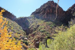
I was told that there is an Elk Trail that gets you up that. Okay??!! Supposedly it is reached near the Spring. Okay??!!!
I should have turned around but no, I Had to get down there and get closer to the dryfall and slope. I had to prove that it looked impenetrable from close up. It did!
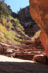
I tried to document Trail Drainage better on my way out. I had picked up a nice walking stick first thing in the morning. It turned out to be a godsend. It was like I had three legs in this terrain.
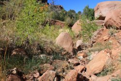
Slice and dice environment
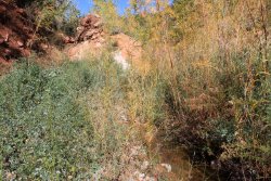
But if you kept you eyes open there was beauty!!
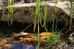
I think that is North Guardian peaking out. A rare view out of the drainage. Could be South Guardian though.
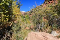
As I crawled over a tree......"that sure is nice!"
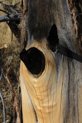
Glory be, the Right Fork is in sight!
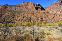
A look back up Trail Drainage. The slope is in the shade way back there. This shows that it is a long way to the ridge line once up that slope. What was I thinking?!!
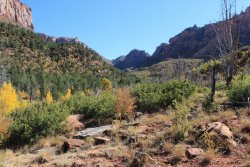
A final look up the Right Fork
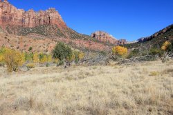
Let's get out of here!
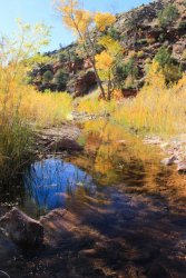
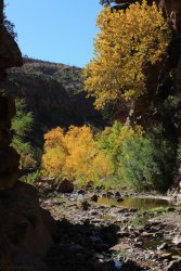
I see something like this and I will fall all over myself not to disturb it.
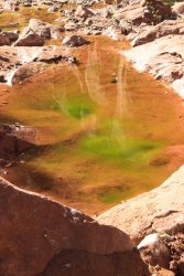
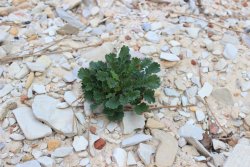
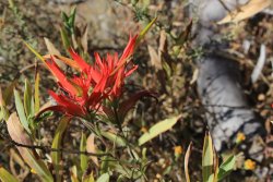
Still had a wildflower to capture and a balanced rock.
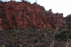
All that is left is the lava cliff. I had been out of water for quite awhile. I was spent in every measurable way. But I knew I had the available light so I took my sweet time getting up that cliff.
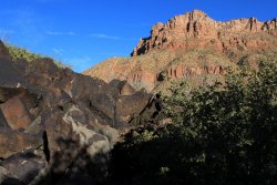
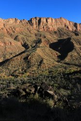
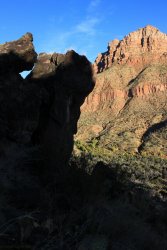
Made it to the top.........there was much rejoicing!
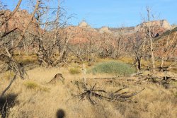
So the question is: Am I done? Is October 2020 my dying exploratory spurt? Is this my final trip report?
At this typing I am hoping that in the spring I will force myself to look back to this October and use it to motivate me to get to that final ridge in the Parunuweap. Which will get me to our summer trips to Glacier. I will then reassess where I stand.
Thanks again for sticking with me with this report.
Jeff headed back to college in August so I was left alone contemplating "am I done?" Temperatures finally dropped below 100 degrees and I started getting the frustrating realization that "if I don't get out there, then..........I am done." So I bucked up and bought my National Park SENIOR Pass and spent three treks into the backcountry of Zion National Park.
Initially I did what I thought would be a easy adventure. Over a route that I was familiar with. Up Separation Canyon I went.

I will be going up yonder bowl

The route takes me through a nice rock garden


After reaching the top of the bowl I get this view out over the only remaining area of the Parunuweap that I have to explore. Maybe next spring? When the cactus are blooming?

Worked my way to a saddle that @Jeffrey Chandler and I discovered a couple years ago. By this time I physically was feeling the affects of not doing much of anything for a year. And worse yet I didn't have the mental enthusiasm to joyfully push through the fatigue. But I Did push........so I guess I Did have what I needed. But then again.....what choice did I have!

I was finally at my goal for this trip I was going to explore the ridge that juts out to the north. I got a bit of a bounce to my step being in new territory and it was pleasant terrain.


I couldn't get any farther!!! It Never gets old being in the 4th busiest National Park and....being absolutely alone!!


This shot looks across towards where I will go in a week. I essentially circle Aires Butte. The tall pyramid, on the right

My plans were to retrace my steps back to the car. My route had been similar to a horseshoe. I was exhausted and that just seemed to scream "isn't there a better option!?!" I didn't have a map with me (jeesh) so I delved into past memories of adventures out here in the East Canyons. The dust started falling from the mental gears in my brain. That old, rusty, adventure enthusiasm said "what if...... I can find a way to drop into the Crawford Access Drainage?" So I charged into the mental/physical challenge of making that work out. Of course it turned out to be twice as tasking as retracing my step but I survived.

It looked oppressive to get back to that saddle so I Had to make this work.

Long story short. I was so engaged in route finding, and surviving that I didn't get many pictures. Also.....90 degrees is still friggin' HOT. I was able to make my way down into the that drainage to the west and back to Clear Creek and the road. I could have hiked the road back to my car but I made the naive decision to stay in Clear Creek because I knew that there were nice photos to get. But my body was wasted. Walking on that sand, boulders, and gravel was way beyond reasonable. But again.......I survived it. Not sure I could go 10 steps without finding a "sitting rock."


It was disheartening to find names scratched into the walls of the narrow slots of Clear Creek. Being close to the road it is too easy for the jerk tourists to access.


A week later I found myself exploring the upper reaches Keyhole Canyon. Again an area I had been to twice before but I wanted to get beyond Jughandle Arch, explore the side drainages, plus check out the area to the west. Having done okay(?) last week I was a better mentally prepared starting out. I suppose........yeah..

This shot is over to the saddle between South Ariel Peak and Aerial Butte. It comes into play later in the day.

It was a pleasant walk. Nothing crazy.


I reached my turnaround point. Looking back down canyon with Jug Handle Arch high above on the right.

I couldn't get any farther going north.

Jug Handle Arch

Let's see how far I can get up this side canyon. I just go until.....I can't. These trips were also while that woman was lost in Zion. So I was doing some heavy contemplation how responsible I was for my personal safety out here. NO ONE is just going to walk by me if I get into trouble. It added a bit a gravitas to proceedings.

I could not make getting up this work


Let's see what is up the next side drainage. It has a nice headwall!!!


I don't know how many times I slid down this before I declared myself "good" and made my way out.

Hey look.....Jug Handle Arch.

Now, to make way around to the west side of Keyhole drainage. I could go on and on about "pitch" but I know that most of you are familiar with that obstacle. I just want to acknowledge that pitch is less of an issue when you have shoes with great traction........but I DON'T so finding that route across pitch becomes a mathematical problem.


I finally made it to the small drainage that goes off to the west. I knew from previous adventures in the lands to the west that this took me to a precipitous drop off which is a waterfall a couple weeks during the year.

I reached the drop off and get a couple shots up and down that drainage. I had been on yonder ridge line a week ago.


I was a happy camper. I got to where I wanted to go. At this moment I was 100% committed to retracing my steps (maybe exploring a bit more nearer to the Keyhole slot canyon).
I looked at this wall and went......."ahhhhhh dammit". I could "see" a "path" head across that slope. Leading to a "flat" spot. I didn't know what terrain was beyond that "flat" spot but I knew that if it was navigatable it would lead to an area that had thwarted me twice before.

Let me insert some retroactive beta for this route. (Never in my wildest fantasy had I considered doing this!!) This is a photo that I took from the rim in 2017. I will be traveling from left to right. "Ants on hill". That is all that it is. But it is ALL across an ever changing pitch!!!!!!!!! You can easily find the above shot in this photo, towards the bottom left.

I head out. Needless to say I am fully mentally engaged at this point. I trusted that I could find "safe enough" pitch to make this work.

I had one move where the "trail" blew out. But it was only a two step move. And the only thing that gave me pause were me boots and the amount of "air" that was off to the right. Got through that little problem just fine. "Don't want to do that again!" I came upon a similar situation but this one was probably 4-5 steps to "solid ground". The pitch was even more enticingly reasonable, but again, could I trust my boots, and my brain to ignore the seemingly infinite slide to the right. I started my first step and instantly, mentally, hesitated. I spent the next seconds experiencing "fear". It was all instinct, trying to get any body part to grasp onto something. Foot, butt, hand, please. I sat on the heals of my boots for awhile letting my heart slow down. Stood up. Realized that I needed to just "commit". I would hold on the pitch. I was across!!!!!! "This has to lead me where I want to go because I can't do that again". This is a shot looking back so it must be documenting that particular area. Of course I had already done it so it looks just fine......I suppose.

It wasn't easy but there was no drama going forward. Just route finding.


My immediate goal comes into sight. I suppose it could be called a "bowl"? It leads to that saddle that I referred to awhile back. I felt confident that I came out above the area that had thwarted me twice as I tried to gain access from the drainage to the west.

Here is some retro-beta from 2017 of what has been call the "Center of the Universe". If only I had studied this photo prior to this trip maybe I would have been back to my car by now. I should note that this shot doesn't even contain where I had failed previously, as it is below camera.

When I reached the bowl I was so disheartened because the way up look positively ugly. There wasn't a route that screamed "take me". Did I go through all this just to slide down the slope to the west and not get to the saddle?! I sat and sat and sat until I noticed that I was sitting on a "ramp" that rose to the south. "Maybe if I go up this ramp I will get high enough that I can find a "route" "over" to the summit." Which is what happened. Accept by then, I could see that it was a false summit. "I'll worry about that when I get there."

This was the false summit/lip I had to get over. I KNEW if I could trust my boots and my legs it was 2-3 three easy steps but I had trust in neither. But I could see a couple sharp edges for footing so I headed across. Funny thing was those edges slowly started getting farther apart so I was getting a bit bowlegged. It gave me a good laugh at the time....so that was nice! I saw a spot in the blue/white wall that was lower. I put my butt against it.....got a good grip with my right hand....got my heal to stick on something and backwards spider crawled up. I could have just laid there it bliss!!!!!

Of course there were 2 or 3 other false summits but I was in the hump of the saddle so I was home free!!!!


I MADE IT !!! Looking down into Keyhole Drainage. I have beaten the Center of The Universe


The beta says that you can access this saddle from Keyhole. I was praying that it would present itself to me once I was there. All I saw was........a slide, catch air, splat!!!!
I saw this "path". I took it around one blind corner and went "I don't want anything to do with this!!!!!!"

So I headed back down to the west. I knew that it was a much longer way, but I told myself it was a series of ledges not "air, splat". I just had to figure out how to "get down...............there" a few times. This is a photo of the "path" I took from the earlier ramp to the blue/white wall. It is a thoroughfare!!!

One last look upwards. Now I just have to get down through the area that broke me twice before.


By this time I was getting exhausted from playing this mental game of finding the best and safest route through this puzzle. My mental was catching up with my physical exhaustion. Knowing that this is when accidents happens (typing that now sure sounds funny.) I was open to "cheating". Once I could see the bottom I would hunt for corrugated slope. Sit down and inch my way down the slope. It wasn't graceful but it was effective.

One final fall foliage shot then road walk back to my car. I learned my lesson last week. No stinkin' Clear Creek for me!!!! Then a view from my car to the Center of the Freakin' Universe!


This trip report is taking a lot longer than I expected. I envisioned it as one story so, forgive me, I am going to plow through. Thank you for sticking with me.
A month ago I found beta for this adventure out of the Right Fork of North Creek. It takes you to a ridge line that overlooks the Southwest Desert and the backside of West Temple, etc. In other words it would be the definition of Epic. I asked the boys if I should even consider doing it. Keep in mind this was before I had done these previous two documented trips. So I was in full bore "am I done?" mode. Neither of them encouraged me to try the route. But I made it to Center of the Universe so I supposed I was as embolden as I could possibly get. So off into the Right Fork I go.

Looking back up to the lava cliff that you have to make your way down. There is a social trail......so there is That.

A story: I am making my way up North Creek towards the confluence of the Left Fork (Subway) and Right Fork. I'm not lost but I'm not exactly going a clean route. I hear something in the Thick brush to the right. I see a dark mass. My brain instantly goes "bear?" (I'm a Glacier NP guy), then I go "elk?" then I see "cow". "What are you doing here, this is a "Wilderness Area?" It appears excited to see me. As if it has been wandering by itself....forever. It comes towards me. I walk away. It follows me. I lose it as I go deeper into thicker brush towards rushing water. So my question is.......what do you do when a cow is approaching you? Petting it seems like something to do, but somehow wrong. It out weighs you by hundreds of pounds.


In 2015 I went up Right Fork as far as physically possible. It took me awhile to remember that it involves walking in water. Route finding became easier once I remembered to splash on through.


This is were I leave the Right Fork and head up Trail Canyon. On paper it is only a couple miles but it is a "dirty" drainage. The beta said to stick to the creek but it was so cluttered with brush, debris, and boulders that I tried to stay above it as much as I could. I was also expecting it to be dry. But it had running water in it. That threw me off my game. The beta mentioned water and mud.....but they had gone in April. We have had one day of rain in six months so I felt it would be dry.

Looking up Right Fork

Let's make our way south!! Somewhere I busted my tail bone on something. I don't remember the initial "pow" but I sure noticed the subsequent tenderness every time I sat down or slid 20 feet down a slope. (I didn't take a picture of that slope because I am sure it would look lame in the shot and my memory wants to be that I slid "over 20 feet into a creek!")


I eventually found the source of the water. It was a spring that was dripping thru brush and grass at a small side canyon. I couldn't get a photo of it because Trail Canyon is so narrow, deep and cluttered. When I was trying to get to sleep this night it came to me........."it's a ditch!!" Above the spring the drainage was essentially dry. Trial Canyon is such a cluttered drainage because its main water source is a trickling spring and it doesn't get enough cleansing flash floods.....I assume. When I finally reached this pour off it confirmed that I was in the right place. Up until then I "figured" I was in the right place.

I successfully got around this using the slopes back canyon on the right. This photo is back towards Right Fork.

From up there I could see the crux of the trip. There is a 100 foot dry fall that you get around by trudging up the slope to the right. By this time I knew that time was not on my side. I also knew that once I got up that slope I still was a long way from the view that I wanted. All I saw on that slope was Gamble Oak (razor trees), thick brush, and misery.

I was told that there is an Elk Trail that gets you up that. Okay??!! Supposedly it is reached near the Spring. Okay??!!!
I should have turned around but no, I Had to get down there and get closer to the dryfall and slope. I had to prove that it looked impenetrable from close up. It did!

I tried to document Trail Drainage better on my way out. I had picked up a nice walking stick first thing in the morning. It turned out to be a godsend. It was like I had three legs in this terrain.

Slice and dice environment

But if you kept you eyes open there was beauty!!

I think that is North Guardian peaking out. A rare view out of the drainage. Could be South Guardian though.

As I crawled over a tree......"that sure is nice!"

Glory be, the Right Fork is in sight!

A look back up Trail Drainage. The slope is in the shade way back there. This shows that it is a long way to the ridge line once up that slope. What was I thinking?!!

A final look up the Right Fork

Let's get out of here!


I see something like this and I will fall all over myself not to disturb it.

Still had a wildflower to capture and a balanced rock.


All that is left is the lava cliff. I had been out of water for quite awhile. I was spent in every measurable way. But I knew I had the available light so I took my sweet time getting up that cliff.


Made it to the top.........there was much rejoicing!

So the question is: Am I done? Is October 2020 my dying exploratory spurt? Is this my final trip report?
At this typing I am hoping that in the spring I will force myself to look back to this October and use it to motivate me to get to that final ridge in the Parunuweap. Which will get me to our summer trips to Glacier. I will then reassess where I stand.
Thanks again for sticking with me with this report.
Last edited:
