- Joined
- Aug 21, 2018
- Messages
- 737
Apparently a book deal has been reached and there are rumors of a movie in the works, so I thought it wise to submit the second half of our story so that the editors have more material to work with. Perhaps they will get to the end and say meh, it's not worth their time and they will drop the project. 
Day Three: Wednesday, September 14, 2022.
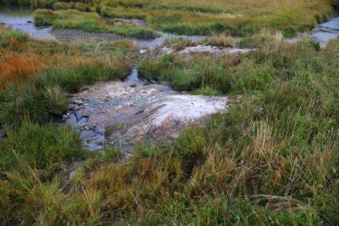
We left off at Joseph's Coat Hot Springs and campsite 4B1 at Broad Creek. Here is a picture to refresh your memories.
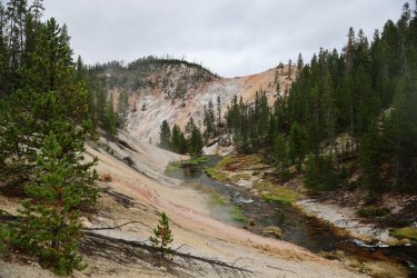
I woke up to the sound of something I had been fortunate not to hear on my past September Yellowstone trips. . . rain.
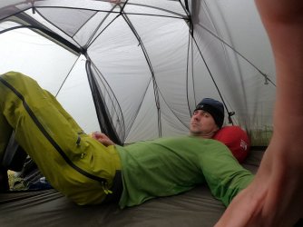
I tend to wake up early on most mornings. I watched the rain drops roll off the tent for a while even though I was eager to get out and explore the Joseph's Coat area. I passed the time by packing up as much of my gear as I could. Here is what the scene looked like while I waited for a break in the rain.
My impatience finally took over and I put on my rain gear. No one else was up and about yet so I started walking North from the campsite. The big camera stayed in the dry for most of the day, so the pictures that follow are either cell phone or GoPro images.
There is some distance between the campsite and the colorful stuff at Joseph's Coat. I walked passed Hugh's tent to make sure the bear did not come to visit him after gnawing some hide from the nearby carcass. No punctures in his tent so I took that as a positive.
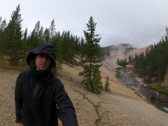
Breaking thru the trees brings a familiar scene. Just more steamy and more selfie than before.
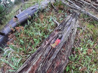
I found a small paintbrush still in bloom. Yay flowers!
The slope is steeper than it looks.
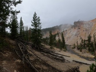
A nice waterfall on Broad Creek. Normally I take pictures of everyone else. Because they were still sheltered in their tents you get me.
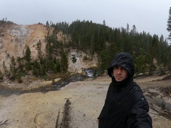
A similar view to our opening image. I wonder if that bank erosion on the lower left is from this year's heavy rains.
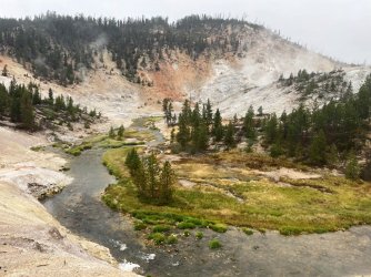
I walked my way down to the level of Broad Creek. Once there I took a 360 video.
Several still shots from my morning walk.
Another cool waterfall.
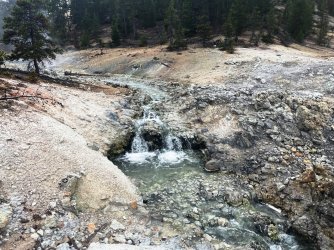
These rocks look suspiciously hand placed, but the silt built up behind them makes me think it had to been done long ago.
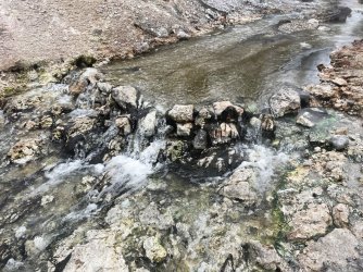
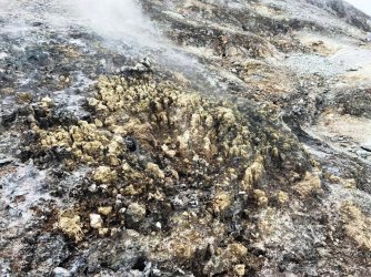
Areas of the ground were covered in these tiny pillar-like structures. I will call them Sulfur Castles.
A view looking West after I had walked down Broad Creek.
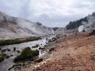
All sorts of interesting things covering the ground here.
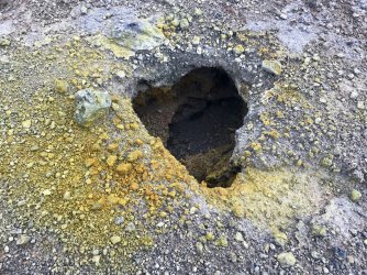
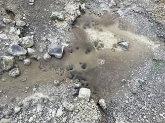
Somehow I missed getting a still shot of the most active feature at Joseph's Coat: Spring Number 2. Fortunately, you get to see it in this next video.
I could have wandered around Joseph's Coat all day. In fact, I had wanted to walk a mile downstream to see the large waterfall on Broad Creek as it worked its way North. I knew I should get back to camp though to see what the others were up to, so that is what I did.
The rain let up just enough for us to have a dry breakfast and pack up our gear.
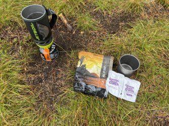
Breakfast of Participants. I'm not sure I qualify as Champion.
Just as we packed up the rain began to fall steadily. It would continue to do so for the majority of the day. A picture of our group as we were ready to head off.
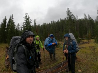
You'll notice Patrick looking a bit plump in that previous photo. I put "pack cover" on the gear list I gave him during our trip preparations. Patrick, in typical Patrick fashion, thought outside the box and opted to utilize a poncho for this purpose. His choice of attire did function to keep him dry. It also had the unexpected benefit of keeping Hugh, Cody, and I entertained. How can one not smile while watching a round, blue man scramble thru the backcountry? From here on out Patrick would be known as "Poncho." It was either that or blueberry.
Patrick, as well as the rest of us, would need every bit of protection that our rain gear could give today. Our goal was to travel from our campsite at Joseph's Coat to our next campsite, 4W2, at Wapiti Lake. In planning, Hugh decided our route should follow Broad Creek. That sounded simple enough. . . almost as if it would be an easy day. What we could not know was how many times we'd have to cross Broad Creek. . . as well as what the terrain would be like along the way. Only one way to find out!
The map below does not necessarily show our exact route, but it was the best I could do in my simple paint program.
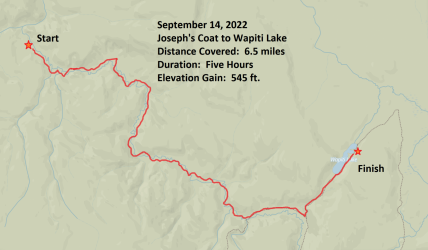
Shortly after leaving Campsite 4B1. Morale is high as Hugh might say, even if Cody and Patrick's body language says otherwise.
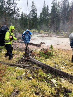
A look down on Broad Creek. Broad Creek has a tendency to meander from hillside to hillside as we worked up the little valley it lives in.
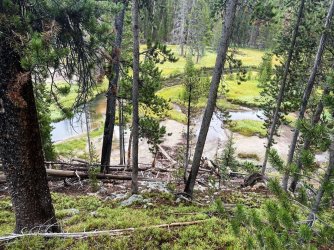
The view just a short distance South of Campsite 4B1.
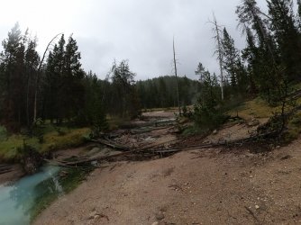
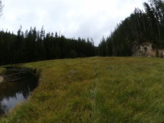
Some areas were flat enough to allow walking in a straight line. Even when the rain would let up the wet grass would still try to soak our feet.
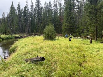
Hugh ended up taking the lead for most of the day. Can you see his trail in this picture?
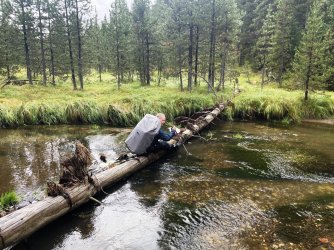
This picture reveals one of the reason's Hugh was so quick. Crossing Broad Creek would happen so frequently that we did not bother to change shoes. Instead, we would try to find a stable log to use as a bridge. Early on Hugh had a bit of a misstep and plunged his feet into the water. From here forward he would just splash across the creek crossings while Cody, Patrick, and I would take our time with the log crossings.
Hugh riding a log across Broad Creek. Yee-Haw!
Cody showing Hugh how it is done. He only has one pole because he let me use the other one.
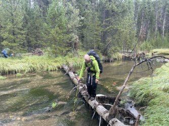
Poncho's Turn.
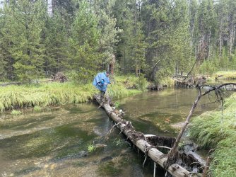
I would try to follow Hugh's trail as best I could, then wait for Cody and Patrick. It is either raining here or my lens is smudged. Or both.
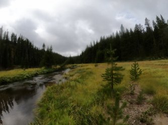
Many times Broad Creek cut right into a hillside and we had to walk the line between wet and dry. The line would be razor thin in some spots.
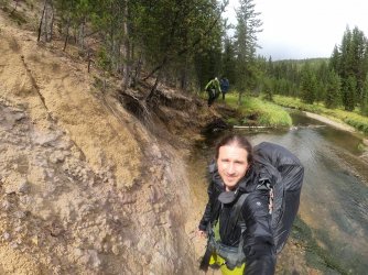
I think Poncho's feet were rather wet by this time.
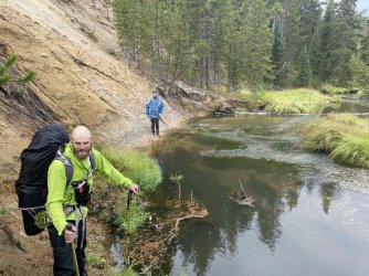
More wet grasses to walk through. This may have been in the vicinity of old campsite 4B2. I do not believe the park service offers it as an option anymore.
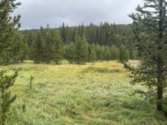
More log bridges to cross.
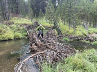
More of Broad Creek cutting right into a steep hillside.
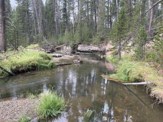
Patrick's feet were wet enough that he began taking Hugh's approach to crossing Broad Creek. I know it is raining in this one.
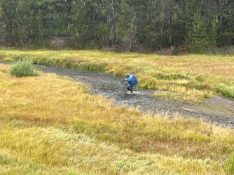
One of my favorite parts of the hike up Broad Creek was crossing this steep, orange hillside. It was a long way down to the bottom should you trip up.
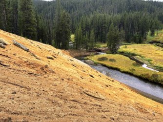
Hugh took the low road.
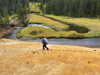
Cody and Patrick went high. I was somewhere in the middle. Wish I had taken some video here!
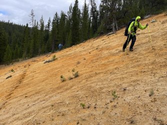
There were actually several orange hillsides, but none were as special as the first.
Following Hugh down the Banks of Broad Creek. The word that kept coming to mind as I watched his pack sway back and forth while he walked was "lumbering." That is what happens when one has to carry a heavy spoon.
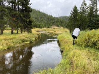
This was the spot where I gave in to Hugh and Patrick's creek crossing technique. No logs were available and I was too tired to continue looking upstream, so I did what any already saturated hiker would do and sloshed across. I did not realize how not wet my feet were before until I started walking after the crossing.
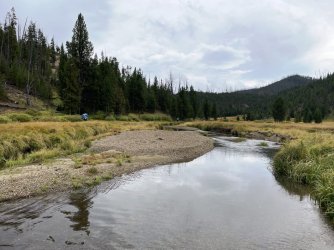
As the valley began to open up Patrick and Cody were glad that the worst was behind us. Or was it?
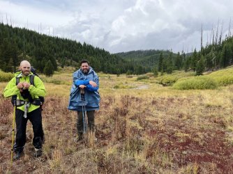
I took a quick side trip to check out campsite 4B3. You can still reserve this one, but I'd recommend approaching from the South.
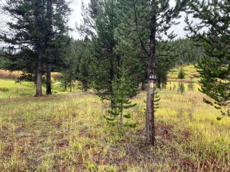
We caught up with Hugh and took this group photo. I believe it does a good job of displaying the day's saturation factor.
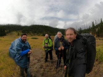
The sun actually gave us a small window for a well-deserved snack break. Cody was still trying to hand out his energy bars, so I ate another one. Patrick avoided anything that resembled a burrito.
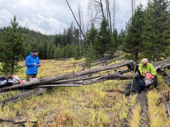
Hugh took a moment to be one with his surroundings and enjoy the view surrounding Broad Creek. It was here that he told us to move on ahead to the campsite at Wapiti Lake and that he would catch up. He said he did not want to hold us back (even though he led the way the entire day). I was not sure if Hugh's words were a command or a suggestion, but Cody, Patrick, and I were not taking any chances. I think he just wanted us to have the campfire going by the time he arrived at camp.
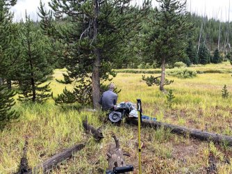
Looking back down the Broad Creek Valley. Those ominous clouds would get into a shoving match with the sun. . . and the clouds would win.
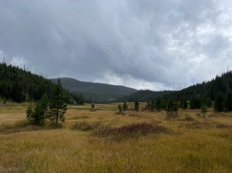
After leaving Broad Creek we started walking on official NPS trail. The first time in over a day!
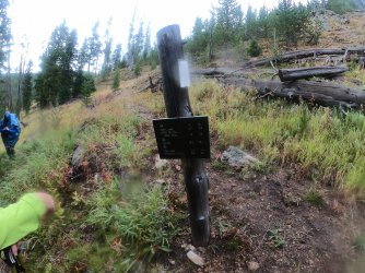
The hike to Wapiti Lake climbs a hillside and provided a nice view down to the Broad Creek Valley.
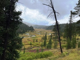
Somewhere down there was a lonely Scatman, lumbering his way towards us.
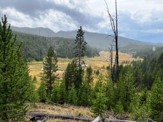
The hike up the hillside felt like a lot more work than it probably was. Wet, squishy boots did not help.
Our first views of fishless Wapiti Lake.
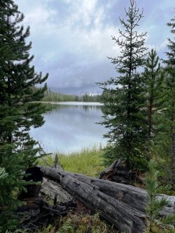
Our campsite was up ahead on a little peninsula emerging from the right. Cody, Patrick, and I picked up our pace because the clouds looked like trouble.
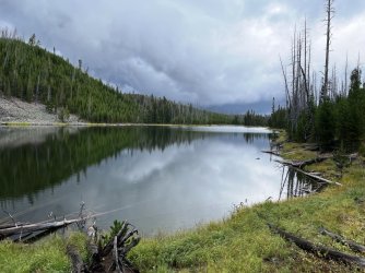
We arrived in camp just in time to get caught in a heavy rain shower. All we could do was stand under a dryish tree and wait.
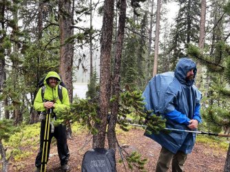
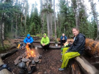
As we waited Hugh arrived in camp. It was not long after that a break in the rain took place and we scurried to set up our tents. The rain held off long enough to allow the starting of a fire. This was my first Yellowstone backcountry fire -- normally Septembers have been too dry to risk burning down the park. A fire was definitely in order after today's events and we thoroughly enjoyed it. Except maybe Hugh. I can see he is struggling with his nemesis in this picture. . . every mouthful of his Chad Mendes Bison Mashers burned more calories lifting it from the bag than Hugh gained from eating it.
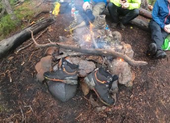
No @Bob , we are not cooking our boots in this picture, we are simply trying to dry out some of the wetness. The fire helped dry us out some, but it was going to take more than a little flame to bring back that warm and cozy feeling.
We watched the fire until darkness was upon us. After putting out the flames we headed back to our tents with our semi-dry boots. Tomorrow would be a good day because camp was staying put so no rush to break things down in the morning. I fell asleep just as I had woken up -- to the sound of raindrops on my tent, but now I was tired enough not to care and slept thru the racket.
Day Four: Thursday September 15, 2022.
Thankfully the rain stopped sometime in the night. Just as day was breaking, I could hear something splashing around in the lake water. I was too comfortable in my tent to investigate. It could have been a water bird, a grizzly along the shore, or Hugh taking a morning swim. Some mysteries will never have an answer.
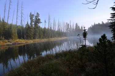
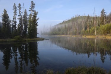
When I did roll out to greet the day I walked down to the lake shore. Early morning Wapiti Lake water provided some nice reflections for photographs.
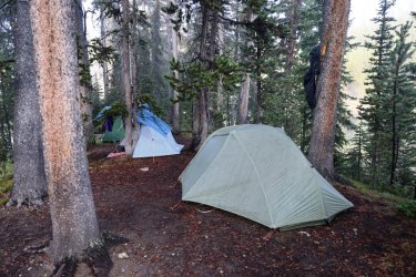
Wet tents at campsite 4W2.
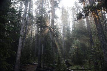
During breakfast a pleasant display of sun rays warmed our faces, but not our footwear.
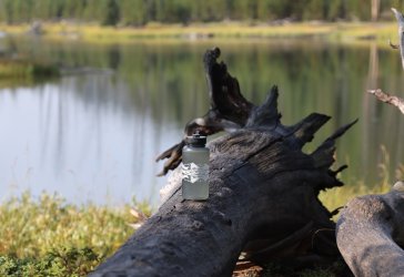
While filtering water I took a minute to represent Backcountry Post at Wapiti Lake.
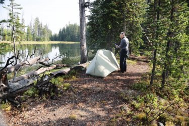
A quick tour of camp. Hugh chose the spot furthest from the lake shore on the peninsula. I have to assume that it was the flattest spot.
Cody and Patrick, probably arguing about who's boots where the wettest.
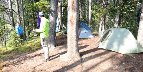
Patrick taking a moment to admire his "Pownching." Some sort of Awning/Poncho hybridization.
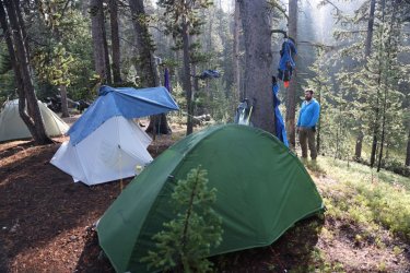
We could have easily enjoyed a leisurely morning relaxing at our campsite by the shores of Wapiti Lake. . . but that is not how Hugh and I roll. We planned a lolli-pop loop day hike to the Hot Springs Basin. We had originally intended to make the trip all the way up to Rainbow Springs but decided to save that destination for another day. Hot Springs Basin would be enough.
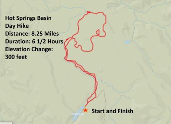
Once again, this map shows a rough outline of our route. Simple paint program and all.
Our route started by following the Wapiti Lake Trail North a short distance. Hugh told us to take a left thru the trees after a short distance, which he did.
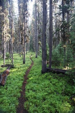
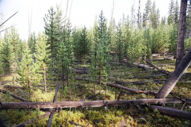
Cody, Patrick and I must have taken the trail a little too far and we had to navigate thru some of this before finding Hugh and the meadow on the other side.
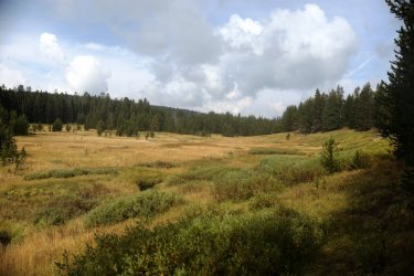
Once out of the trees we walked the meadows lining Shallow Creek.
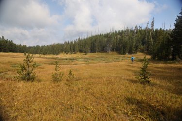
Looking back towards where Shallow Creek meets Wapiti Lake.
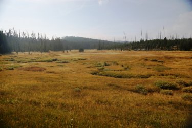
Hugh patiently waiting on us up ahead. He is standing just to the right of center. I wondered if he had brought the spoon along for the day hike, but I did not dare ask.
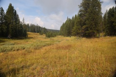
Our path forward.
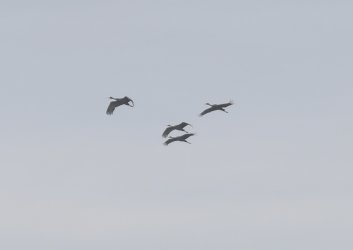
We stirred up a group of Sandhill Cranes as we walked and they provided us with a noisy flyover.
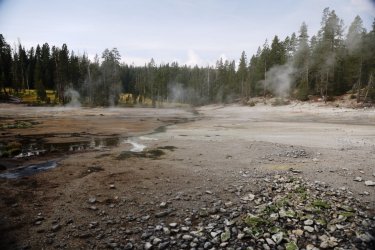
Thermal features began to line the banks of Shallow Creek rather quickly.
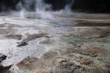
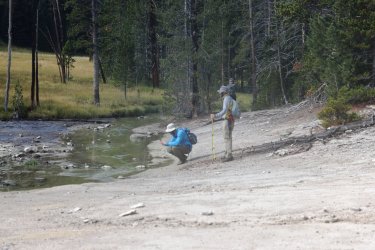
Patrick, getting the shot.
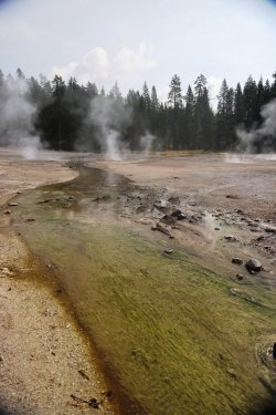
Heading downstream.
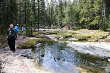
Looking downstream.
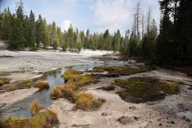
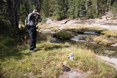
Hugh kept reminiscing about a bison skull he saw in the area years ago. I was able to capture the reunion.
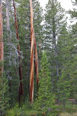
I found these barber pole trees fascinating.
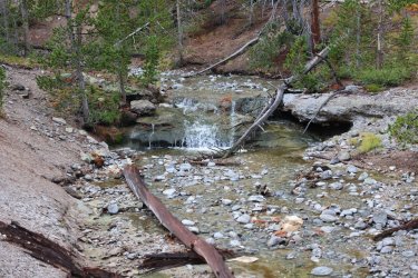
Nice waterfall on Shallow Creek.
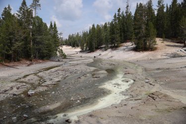
North of the waterfall the ground begins to get more thermally.
Look at Hugh go! He must have left the spoon back at camp.
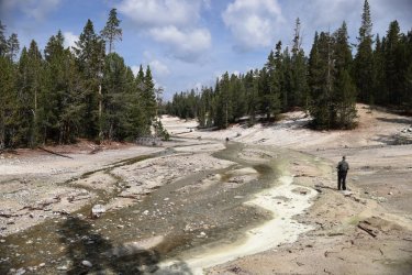
We would walk up the little hill in front of Hugh in the last picture and cut thru a small cluster of trees to this view.
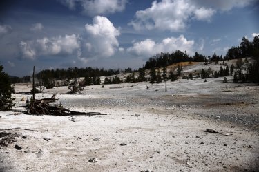
And this.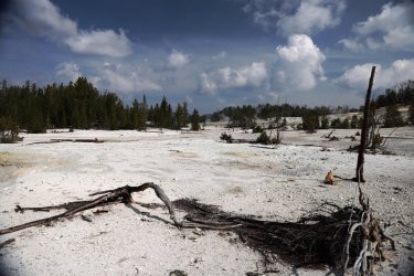
And this.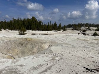
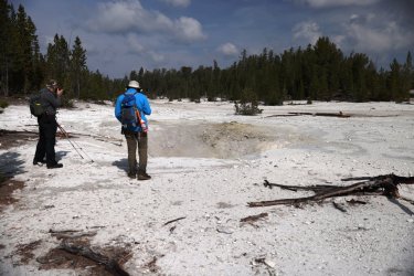
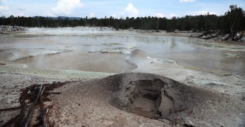
A ginormous hole in the earth was one of the first things that greeted us.
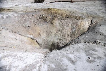
A look down inside.
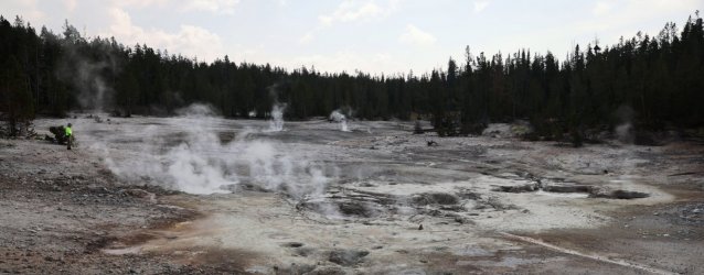
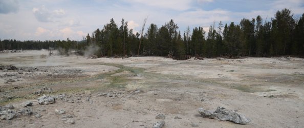
Hot Springs Basin covers a very large area. I would go so far as to say that it might cover an area as large as the Upper Geyser Basin. It may not contain the spritzy geysers for which Upper Geyser Basin deservedly gets attention, but it does contain a significant number of hot springs and mud pots I've not seen in similar numbers anywhere else in Yellowstone. At least not as of yet.
What will follow will be a lot of pictures from Hot Springs Basin. I'll keep the comments to a minimum. . . unless I cannot help myself. We only covered a portion of the basin during our day's exploration. . . I would not mind making a return trip to see what we missed.
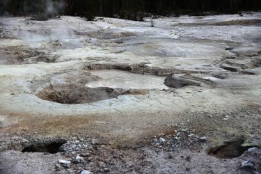
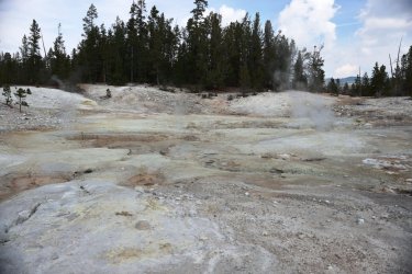
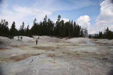
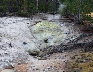
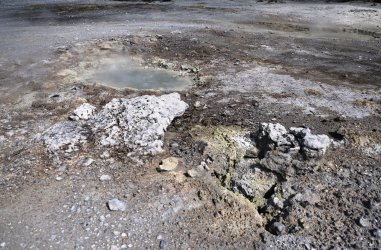
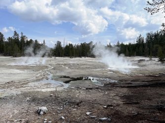
No lie, Patrick was actually communicating with people back home in this area. We actually had cell service in most locations -- I was able to call home at least once a day. The carrier is AT+T for the curious.
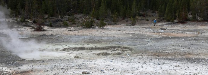
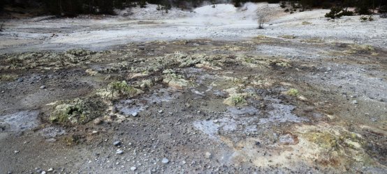
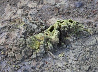
These little sulfur stacks covered the ground in many areas.
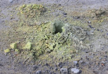
Interesting Mud Pot with a milky surface but dark gray bubbles.
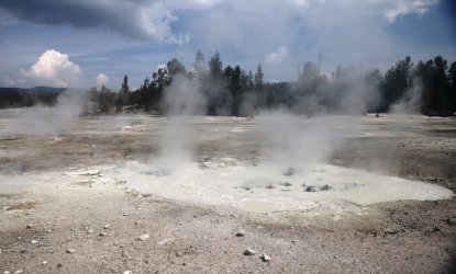
Water marks on the ground/down wood suggest this area would look very different in June or July.
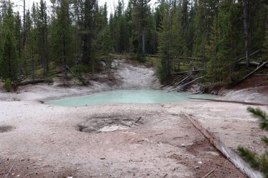
Reminds me of a cracked egg.
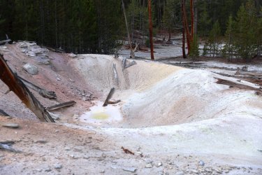
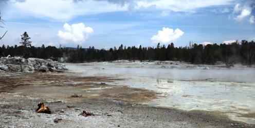
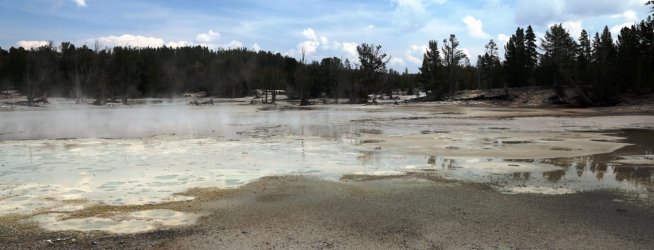
Hurdling trees while touring the basin.
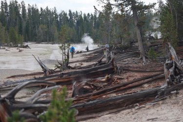
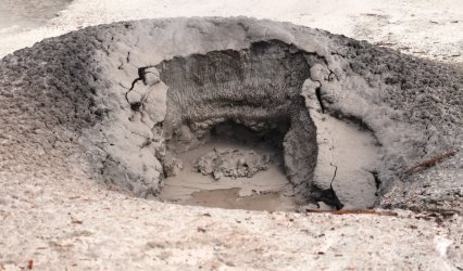
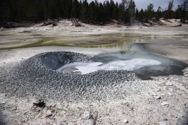
I love a good mud pot. Hot Springs Basin is full of them.
So many colors. . .
And Textures. . .
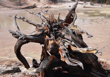
Even the down wood has character here.
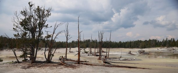
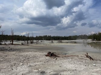
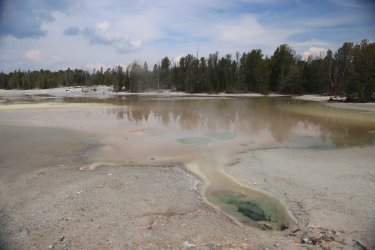
Cody for scale.
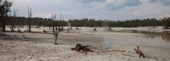
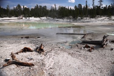
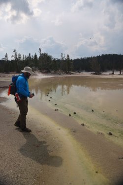
Patrick is wondering who lined up all those rocks.
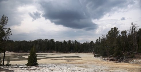
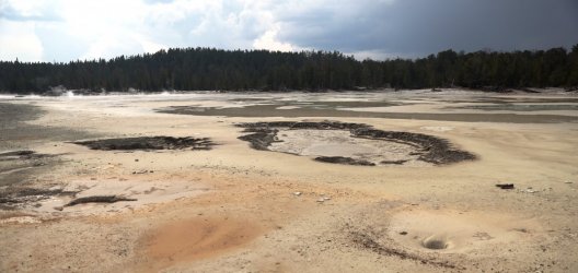
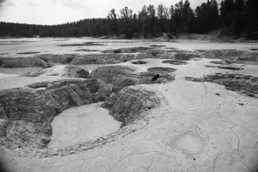
We turned a corner and for a moment I thought I was in canyon country.

Canyon Country in miniature, that is. Hands down this was my favorite feature/visual of the entire day.
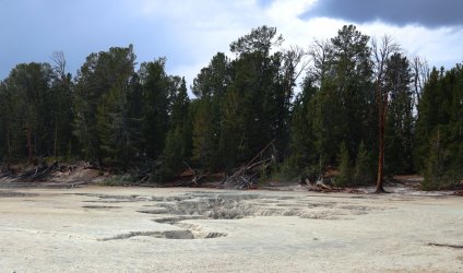
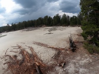
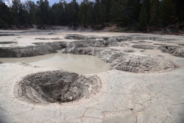
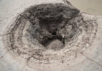
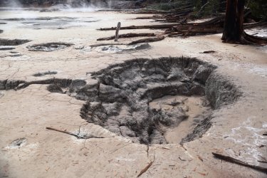
In case you were counting, I brought three picture taking devices with me on this trip.
1. Big Camera:
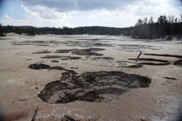
#2. Cell Phone.
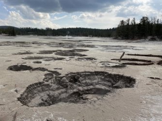
#3. GoPro.
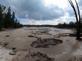
I'll understand if you skip ahead past all the thermal pictures. Just a couple more. . .
Another lively mud pot.
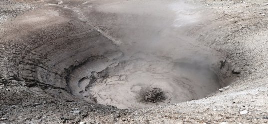
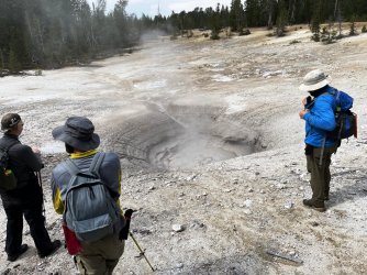
Hugh was starting to get a little hungry and I failed to pack him some extra snacks, so he had to resort to what nature could provide.
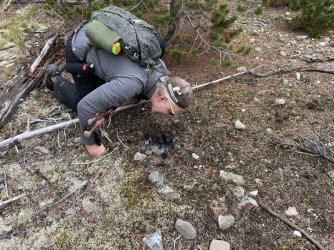
Eventually we wandered our way to one of the main stretches of Hot Springs Basin.
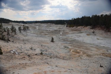
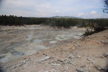
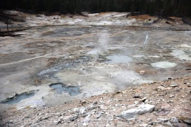
I wandered off while Hugh, Cody, and Patrick took a rest. Can you find them?
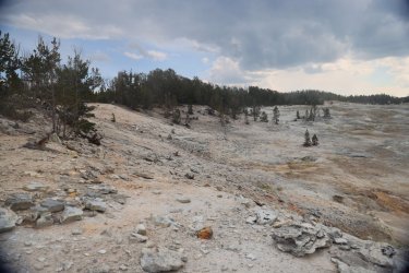
How about now?
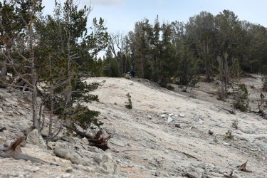
I walked a hillside ridge to view the thermal awesomeness below.
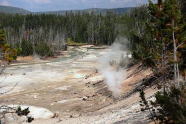
Looking downstream on Shallow Creek. We have almost closed our loop. Fumaroles are fun.
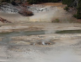
I spied with my little eye what I thought was a small geyser erupting. Could have easily been a perpetual spouter too.
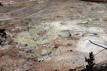
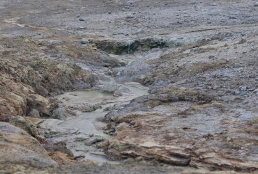
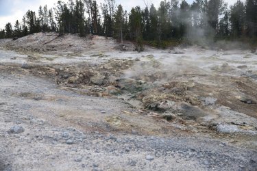
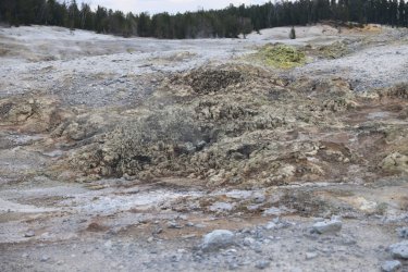
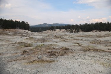
Features encountered on the way back to Shallow Creek.
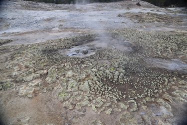
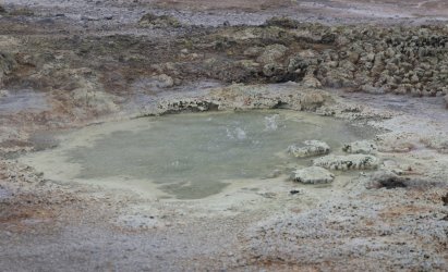
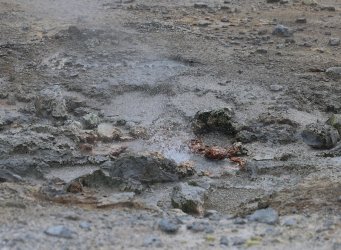
Consider me impressed if you made it through all those pictures. If they somehow left you wanting more here is a short collection of Hot Springs Basin video clips.
All good day hikes must come to an end; when we reached Shallow Creek we followed it back to our campsite at Wapiti Lake. The clouds were beginning to thicken once more and sure enough rain would grace us with its presence, but not before we started another fire and celebrated a beautiful day spent in the backcountry before heading to our tents.
I took three pictures of this scene -- Hugh's position/facial expression never changed. That is Scatman at his happiest in case you were wondering.
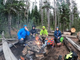
Day Five: Friday September 16, 2022
Today was the day we would be hiking back to the trailhead and civilization. There was 16+ miles between us and a shower, proper hot food, and a beer. We more or less followed the official NPS trail the full distance so I will not bother posting a map, but I can tell you we covered 16.6 miles over seven hours and forty minutes.
Hugh was up early this morning. In fact we all were. We knew there were restrictions on what times we were allowed in Pelican Valley, so we wanted to be punctual with our exit. After Hugh ate his breakfast, he began the long walk back to the car while the rest of us finished tidying up camp. We figured we'd catch him in a mile or so.
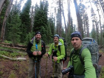
Cody, Patrick, and I just as we were leaving campsite 4W2. The day started out overcast, but dry.
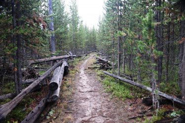
We had to follow the trail North before making a 180 degree turn to then start heading South. It makes more sense when you are hiking that vs. when you are reading it.
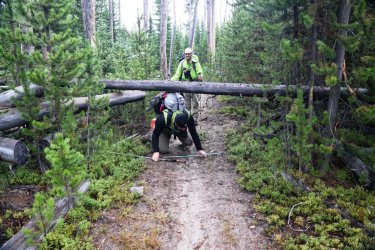
A lot of down fall along this part of the trail. I am glad we did not have to climb over most of it.
Still there were some obstacles.
Some more alive than others.
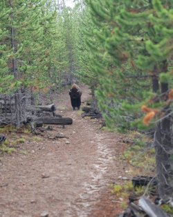
We climbed into the thin barrier of trees along the side of the trail to let the behemoth pass.
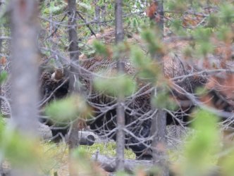
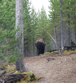
Open views of the upper reaches of Pelican Valley.


Beginnings of Pelican Creek.
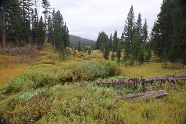
Our first crossing of Pelican Creek. That bridge is spoiling us.
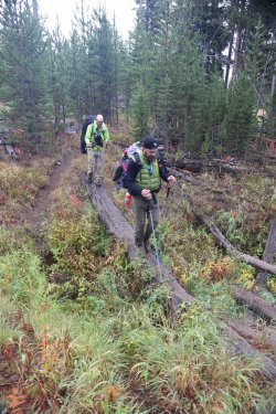
Our trail would alternate between woods and open views.
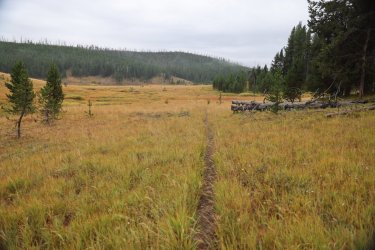
Doubt this is how they met their fate.
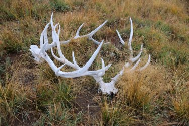
Quite the view.
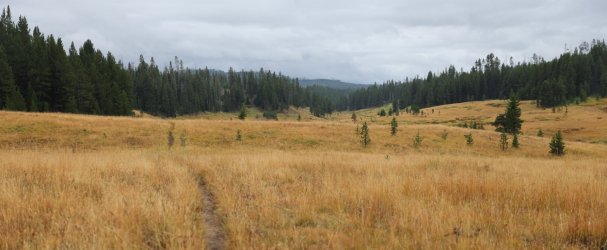
We were walking at a rather good pace and were a bit surprised we had not caught up with Hugh. We would see one of his footprints now and again, and there was no blood so we knew he was ok.
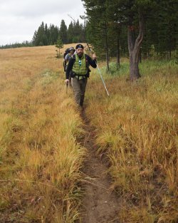

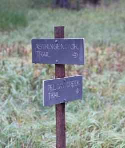
Its the Pelican Creek Trail for us.
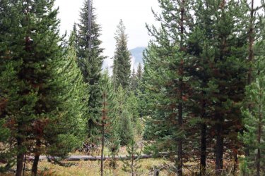
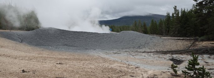
One of the reasons I wanted to take the Pelican Creek Trail is because it travels nearby what I'm calling the "Pelican Valley Mud Volcano." We could see large clouds of steam and then could begin to hear it -- a short off trail jaunt is required to see it.
Steam thru the trees. Sort of blends in with the clouds.
The mud volcano was magnificent. I could have spent an hour or better here, but instead took advantage of 20 minutes or so to take a lot of pictures.
Note Cody for scale.
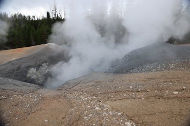
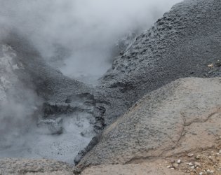
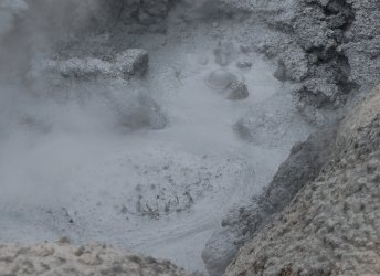
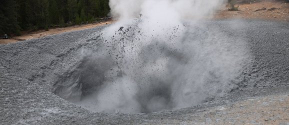
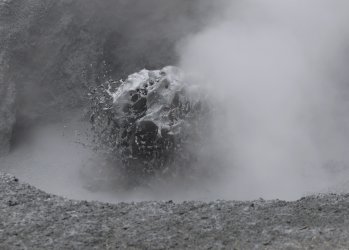
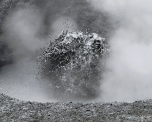
I had been thinking about this day and this moment for weeks before our trip, and I was not disappointed. Patrick's turn to take a look.
Video of Splashing Mud:
We left the Mud Volcano behind -- we thought we might see Hugh there but apparently he just kept on trucking.
Continuing South brought us to a more substantial crossing of Pelican Creek.
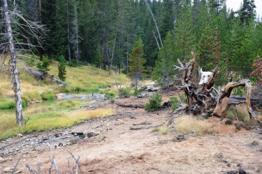
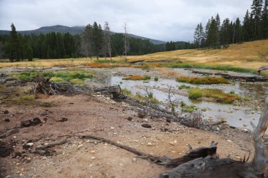
We put our rain gear on here as the drops were beginning to fall. Temperatures were feeling a cooler as well.
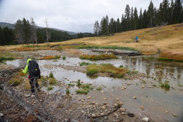
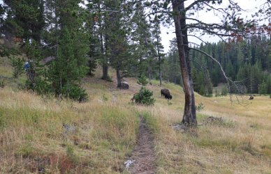
Several more bison had to be dealt with. Can you see the hikers among the trees?
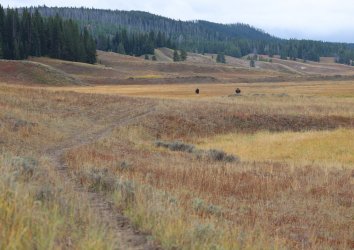
These two bison gave us the most trouble. You might notice the trail leads right to them.
Actually it was just the bison on the right that we had an issue with. As we walked around them -- giving them plenty of space -- this fella decided he was going to walk along with us. We ended up having a slow race between man and bison to the hill in front of us.
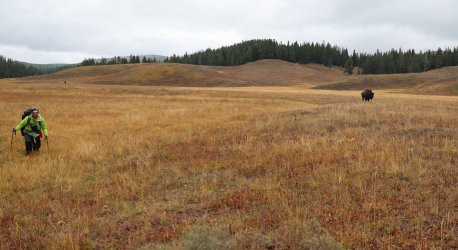
Pulling slightly ahead of the bison.
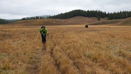
Once we were up and over yhe small hill the bison continued to follow us. The best we can figure is that he was attracted to Poncho's lovely blue hump and was trying to get a closer look.
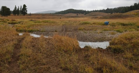
The mid-upper sections of Pelican Valley were filled with thermal features. Normally I'd investigate such areas, but I knew the clock was ticking and the rain/cold was starting to get annoying, so we kept moving.
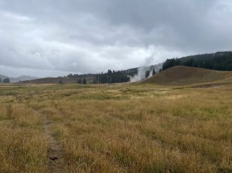
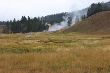
Our race with the bison may have taken us off the proper trail for a stint. We were now faced with crossing a mucky portion around Pelican Creek.
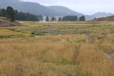
To make things even more interesting the terrain was dotted with numerous little thermal vents. I was not losing a foot to boiling ground on this day!
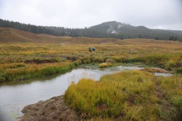
Our feet and legs were thoroughly soaked by this time.
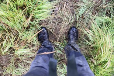
See?
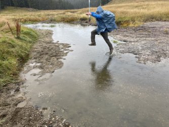
Who knew a poncho could generate so much lift?
When the rain would fall in more significant amounts we would try to take shelter under a large tree. I was able to get a couple pictures of thermal stuff during those times.
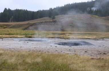
The Mushpots? or The Mudkettles?
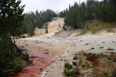
Pretty Colors.
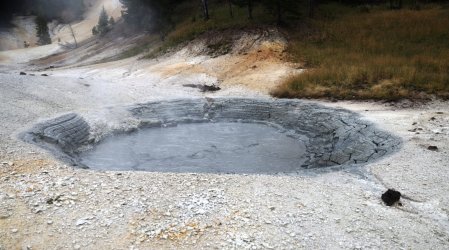
We were starting to notice a lot of tracks along our trail. These in particular had the blood pumping a bit.
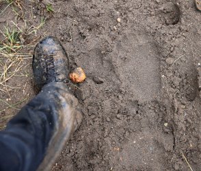
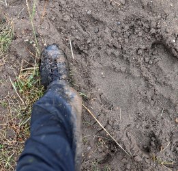
I had my hand on the bear spray as we climbed each hill and turned each corner. Never had a need to use it though.
Pelican Valley would begin to open up in front of and below us. We were past halfway!
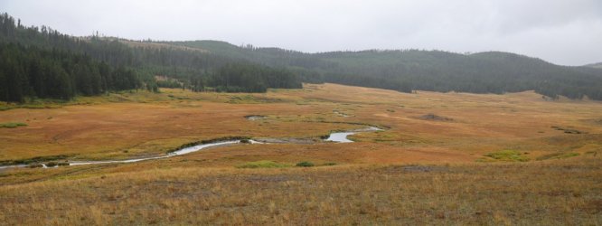
As we dropped down into the valley the largest herd of bison I've seen in Yellowstone was in the distance in front of us.

I would later learn that Hugh was almost trampled by those bison.
The next number of miles were tough. I more or less put the cameras away and focused on the walk ahead. I was wet and starting to feel some tingles in my fingers from the cold. I did not want to stop and put another layer on and neither did Cody or Patrick, so we just kept walking. The trail was beginning to fill with water and it was easier to walk along side it than on it.
The only bright spot was that we finally caught a glimpse of Hugh. We could see his pack cover lumbering about way off in the distance. Mosey mode my a**. We knew at that moment that Hugh had been holding out on us and had a higher hiking gear to be that far ahead.
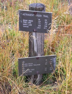
Eventually we reached a trail marker.
And then what was left of Pelican Creek Bridge.
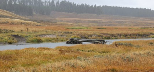
I was in a bit of zombie mode when it came time to cross Pelican Creek and just sloshed thru the water. Cody and Patrick did the same. Once past the bridge there was another three plus miles to the trailhead. One foot in front of the other. Just. Keep. Walking.
I'd been watching the trail ahead and I could see Hugh in front of me. I made it my mission to catch him before reaching the trailhead, so I dug deep, picked up the pace, and was able to catch up with the legend with about a mile to go.
Catching up with Scatman.
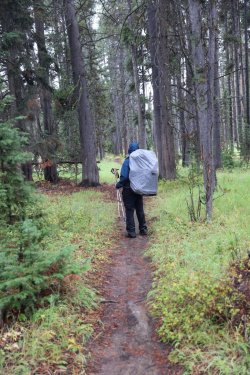
Patrick and Cody would catch up too. A look back at the three of them and our lovely trail conditions. I wonder what Patrick is thinking at this moment? Maybe "I sure hope Dave has the car keys."
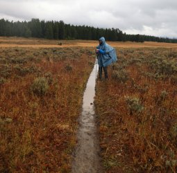
I arrived at the trailhead exhausted yet fulfilled.
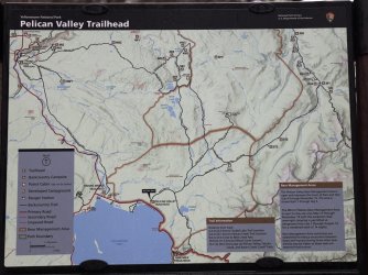
A picture of the trailhead marker.
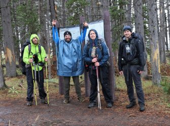
Victory Group Shot.
We would make the drive up to Canyon and more or less trash the cabin I had rented us for the night. Don't worry, I left housekeeping a nice tip.
I will have more commentary in some posts to follow, but I've been at this report for a good while and want to get it posted before my computer crashes and I lose it all. I'll also go back and edit any of my spelling or grammar errors as needed.
In summary I want to say that I'm proud of Cody and Patrick for how they handled themselves on this crazy experience, and that I grateful to have Hugh as a friend to think up these crazy adventures with. Yellowstone 2022 would not have been the same without any of you. The good times, the bad times, the wet times, and the heavy times. . . touring the wilderness with you guys has been one of the highlights of my year.
Thanks again for reading along!
Day Three: Wednesday, September 14, 2022.
We left off at Joseph's Coat Hot Springs and campsite 4B1 at Broad Creek. Here is a picture to refresh your memories.

I woke up to the sound of something I had been fortunate not to hear on my past September Yellowstone trips. . . rain.
I tend to wake up early on most mornings. I watched the rain drops roll off the tent for a while even though I was eager to get out and explore the Joseph's Coat area. I passed the time by packing up as much of my gear as I could. Here is what the scene looked like while I waited for a break in the rain.

My impatience finally took over and I put on my rain gear. No one else was up and about yet so I started walking North from the campsite. The big camera stayed in the dry for most of the day, so the pictures that follow are either cell phone or GoPro images.
There is some distance between the campsite and the colorful stuff at Joseph's Coat. I walked passed Hugh's tent to make sure the bear did not come to visit him after gnawing some hide from the nearby carcass. No punctures in his tent so I took that as a positive.
Breaking thru the trees brings a familiar scene. Just more steamy and more selfie than before.

I found a small paintbrush still in bloom. Yay flowers!

The slope is steeper than it looks.

A nice waterfall on Broad Creek. Normally I take pictures of everyone else. Because they were still sheltered in their tents you get me.

A similar view to our opening image. I wonder if that bank erosion on the lower left is from this year's heavy rains.

I walked my way down to the level of Broad Creek. Once there I took a 360 video.
Several still shots from my morning walk.
Another cool waterfall.

These rocks look suspiciously hand placed, but the silt built up behind them makes me think it had to been done long ago.

Areas of the ground were covered in these tiny pillar-like structures. I will call them Sulfur Castles.

A view looking West after I had walked down Broad Creek.

All sorts of interesting things covering the ground here.


Somehow I missed getting a still shot of the most active feature at Joseph's Coat: Spring Number 2. Fortunately, you get to see it in this next video.
I could have wandered around Joseph's Coat all day. In fact, I had wanted to walk a mile downstream to see the large waterfall on Broad Creek as it worked its way North. I knew I should get back to camp though to see what the others were up to, so that is what I did.
The rain let up just enough for us to have a dry breakfast and pack up our gear.
Breakfast of Participants. I'm not sure I qualify as Champion.

Just as we packed up the rain began to fall steadily. It would continue to do so for the majority of the day. A picture of our group as we were ready to head off.

You'll notice Patrick looking a bit plump in that previous photo. I put "pack cover" on the gear list I gave him during our trip preparations. Patrick, in typical Patrick fashion, thought outside the box and opted to utilize a poncho for this purpose. His choice of attire did function to keep him dry. It also had the unexpected benefit of keeping Hugh, Cody, and I entertained. How can one not smile while watching a round, blue man scramble thru the backcountry? From here on out Patrick would be known as "Poncho." It was either that or blueberry.
Patrick, as well as the rest of us, would need every bit of protection that our rain gear could give today. Our goal was to travel from our campsite at Joseph's Coat to our next campsite, 4W2, at Wapiti Lake. In planning, Hugh decided our route should follow Broad Creek. That sounded simple enough. . . almost as if it would be an easy day. What we could not know was how many times we'd have to cross Broad Creek. . . as well as what the terrain would be like along the way. Only one way to find out!
The map below does not necessarily show our exact route, but it was the best I could do in my simple paint program.

Shortly after leaving Campsite 4B1. Morale is high as Hugh might say, even if Cody and Patrick's body language says otherwise.

A look down on Broad Creek. Broad Creek has a tendency to meander from hillside to hillside as we worked up the little valley it lives in.

The view just a short distance South of Campsite 4B1.

Some areas were flat enough to allow walking in a straight line. Even when the rain would let up the wet grass would still try to soak our feet.

Hugh ended up taking the lead for most of the day. Can you see his trail in this picture?

This picture reveals one of the reason's Hugh was so quick. Crossing Broad Creek would happen so frequently that we did not bother to change shoes. Instead, we would try to find a stable log to use as a bridge. Early on Hugh had a bit of a misstep and plunged his feet into the water. From here forward he would just splash across the creek crossings while Cody, Patrick, and I would take our time with the log crossings.
Hugh riding a log across Broad Creek. Yee-Haw!

Cody showing Hugh how it is done. He only has one pole because he let me use the other one.

Poncho's Turn.

I would try to follow Hugh's trail as best I could, then wait for Cody and Patrick. It is either raining here or my lens is smudged. Or both.

Many times Broad Creek cut right into a hillside and we had to walk the line between wet and dry. The line would be razor thin in some spots.

I think Poncho's feet were rather wet by this time.

More wet grasses to walk through. This may have been in the vicinity of old campsite 4B2. I do not believe the park service offers it as an option anymore.

More log bridges to cross.

More of Broad Creek cutting right into a steep hillside.

Patrick's feet were wet enough that he began taking Hugh's approach to crossing Broad Creek.

One of my favorite parts of the hike up Broad Creek was crossing this steep, orange hillside. It was a long way down to the bottom should you trip up.

Hugh took the low road.

Cody and Patrick went high. I was somewhere in the middle. Wish I had taken some video here!

There were actually several orange hillsides, but none were as special as the first.
Following Hugh down the Banks of Broad Creek. The word that kept coming to mind as I watched his pack sway back and forth while he walked was "lumbering." That is what happens when one has to carry a heavy spoon.

This was the spot where I gave in to Hugh and Patrick's creek crossing technique. No logs were available and I was too tired to continue looking upstream, so I did what any already saturated hiker would do and sloshed across. I did not realize how not wet my feet were before until I started walking after the crossing.

As the valley began to open up Patrick and Cody were glad that the worst was behind us. Or was it?

I took a quick side trip to check out campsite 4B3. You can still reserve this one, but I'd recommend approaching from the South.

We caught up with Hugh and took this group photo. I believe it does a good job of displaying the day's saturation factor.

The sun actually gave us a small window for a well-deserved snack break. Cody was still trying to hand out his energy bars, so I ate another one. Patrick avoided anything that resembled a burrito.

Hugh took a moment to be one with his surroundings and enjoy the view surrounding Broad Creek. It was here that he told us to move on ahead to the campsite at Wapiti Lake and that he would catch up. He said he did not want to hold us back (even though he led the way the entire day). I was not sure if Hugh's words were a command or a suggestion, but Cody, Patrick, and I were not taking any chances. I think he just wanted us to have the campfire going by the time he arrived at camp.

Looking back down the Broad Creek Valley. Those ominous clouds would get into a shoving match with the sun. . . and the clouds would win.

After leaving Broad Creek we started walking on official NPS trail. The first time in over a day!

The hike to Wapiti Lake climbs a hillside and provided a nice view down to the Broad Creek Valley.

Somewhere down there was a lonely Scatman, lumbering his way towards us.

The hike up the hillside felt like a lot more work than it probably was. Wet, squishy boots did not help.
Our first views of fishless Wapiti Lake.

Our campsite was up ahead on a little peninsula emerging from the right. Cody, Patrick, and I picked up our pace because the clouds looked like trouble.

We arrived in camp just in time to get caught in a heavy rain shower. All we could do was stand under a dryish tree and wait.

As we waited Hugh arrived in camp. It was not long after that a break in the rain took place and we scurried to set up our tents. The rain held off long enough to allow the starting of a fire. This was my first Yellowstone backcountry fire -- normally Septembers have been too dry to risk burning down the park. A fire was definitely in order after today's events and we thoroughly enjoyed it. Except maybe Hugh. I can see he is struggling with his nemesis in this picture. . . every mouthful of his Chad Mendes Bison Mashers burned more calories lifting it from the bag than Hugh gained from eating it.

No @Bob , we are not cooking our boots in this picture, we are simply trying to dry out some of the wetness.

We watched the fire until darkness was upon us. After putting out the flames we headed back to our tents with our semi-dry boots. Tomorrow would be a good day because camp was staying put so no rush to break things down in the morning. I fell asleep just as I had woken up -- to the sound of raindrops on my tent, but now I was tired enough not to care and slept thru the racket.
Day Four: Thursday September 15, 2022.
Thankfully the rain stopped sometime in the night. Just as day was breaking, I could hear something splashing around in the lake water. I was too comfortable in my tent to investigate. It could have been a water bird, a grizzly along the shore, or Hugh taking a morning swim. Some mysteries will never have an answer.
When I did roll out to greet the day I walked down to the lake shore. Early morning Wapiti Lake water provided some nice reflections for photographs.


Wet tents at campsite 4W2.

During breakfast a pleasant display of sun rays warmed our faces, but not our footwear.

While filtering water I took a minute to represent Backcountry Post at Wapiti Lake.

A quick tour of camp. Hugh chose the spot furthest from the lake shore on the peninsula. I have to assume that it was the flattest spot.

Cody and Patrick, probably arguing about who's boots where the wettest.

Patrick taking a moment to admire his "Pownching." Some sort of Awning/Poncho hybridization.

We could have easily enjoyed a leisurely morning relaxing at our campsite by the shores of Wapiti Lake. . . but that is not how Hugh and I roll. We planned a lolli-pop loop day hike to the Hot Springs Basin. We had originally intended to make the trip all the way up to Rainbow Springs but decided to save that destination for another day. Hot Springs Basin would be enough.
Once again, this map shows a rough outline of our route. Simple paint program and all.

Our route started by following the Wapiti Lake Trail North a short distance. Hugh told us to take a left thru the trees after a short distance, which he did.

Cody, Patrick and I must have taken the trail a little too far and we had to navigate thru some of this before finding Hugh and the meadow on the other side.

Once out of the trees we walked the meadows lining Shallow Creek.

Looking back towards where Shallow Creek meets Wapiti Lake.

Hugh patiently waiting on us up ahead. He is standing just to the right of center. I wondered if he had brought the spoon along for the day hike, but I did not dare ask.

Our path forward.

We stirred up a group of Sandhill Cranes as we walked and they provided us with a noisy flyover.

Thermal features began to line the banks of Shallow Creek rather quickly.


Patrick, getting the shot.


Heading downstream.

Looking downstream.

Hugh kept reminiscing about a bison skull he saw in the area years ago. I was able to capture the reunion.

I found these barber pole trees fascinating.

Nice waterfall on Shallow Creek.

North of the waterfall the ground begins to get more thermally.

Look at Hugh go! He must have left the spoon back at camp.

We would walk up the little hill in front of Hugh in the last picture and cut thru a small cluster of trees to this view.

And this.

And this.

A ginormous hole in the earth was one of the first things that greeted us.

A look down inside.

Hot Springs Basin covers a very large area. I would go so far as to say that it might cover an area as large as the Upper Geyser Basin. It may not contain the spritzy geysers for which Upper Geyser Basin deservedly gets attention, but it does contain a significant number of hot springs and mud pots I've not seen in similar numbers anywhere else in Yellowstone. At least not as of yet.
What will follow will be a lot of pictures from Hot Springs Basin. I'll keep the comments to a minimum. . . unless I cannot help myself. We only covered a portion of the basin during our day's exploration. . . I would not mind making a return trip to see what we missed.


No lie, Patrick was actually communicating with people back home in this area. We actually had cell service in most locations -- I was able to call home at least once a day. The carrier is AT+T for the curious.


These little sulfur stacks covered the ground in many areas.

Interesting Mud Pot with a milky surface but dark gray bubbles.

Water marks on the ground/down wood suggest this area would look very different in June or July.

Reminds me of a cracked egg.


Hurdling trees while touring the basin.

I love a good mud pot. Hot Springs Basin is full of them.


So many colors. . .

And Textures. . .

Even the down wood has character here.


Cody for scale.


Patrick is wondering who lined up all those rocks.


We turned a corner and for a moment I thought I was in canyon country.

Canyon Country in miniature, that is. Hands down this was my favorite feature/visual of the entire day.


In case you were counting, I brought three picture taking devices with me on this trip.
1. Big Camera:

#2. Cell Phone.

#3. GoPro.

I'll understand if you skip ahead past all the thermal pictures.
Another lively mud pot.


Hugh was starting to get a little hungry and I failed to pack him some extra snacks, so he had to resort to what nature could provide.

Eventually we wandered our way to one of the main stretches of Hot Springs Basin.


I wandered off while Hugh, Cody, and Patrick took a rest. Can you find them?

How about now?

I walked a hillside ridge to view the thermal awesomeness below.

Looking downstream on Shallow Creek. We have almost closed our loop. Fumaroles are fun.

I spied with my little eye what I thought was a small geyser erupting. Could have easily been a perpetual spouter too.

Features encountered on the way back to Shallow Creek.


Consider me impressed if you made it through all those pictures. If they somehow left you wanting more here is a short collection of Hot Springs Basin video clips.
All good day hikes must come to an end; when we reached Shallow Creek we followed it back to our campsite at Wapiti Lake. The clouds were beginning to thicken once more and sure enough rain would grace us with its presence, but not before we started another fire and celebrated a beautiful day spent in the backcountry before heading to our tents.
I took three pictures of this scene -- Hugh's position/facial expression never changed. That is Scatman at his happiest in case you were wondering.

Day Five: Friday September 16, 2022
Today was the day we would be hiking back to the trailhead and civilization. There was 16+ miles between us and a shower, proper hot food, and a beer. We more or less followed the official NPS trail the full distance so I will not bother posting a map, but I can tell you we covered 16.6 miles over seven hours and forty minutes.
Hugh was up early this morning. In fact we all were. We knew there were restrictions on what times we were allowed in Pelican Valley, so we wanted to be punctual with our exit. After Hugh ate his breakfast, he began the long walk back to the car while the rest of us finished tidying up camp. We figured we'd catch him in a mile or so.
Cody, Patrick, and I just as we were leaving campsite 4W2. The day started out overcast, but dry.

We had to follow the trail North before making a 180 degree turn to then start heading South. It makes more sense when you are hiking that vs. when you are reading it.
A lot of down fall along this part of the trail. I am glad we did not have to climb over most of it.

Still there were some obstacles.

Some more alive than others.

We climbed into the thin barrier of trees along the side of the trail to let the behemoth pass.


Open views of the upper reaches of Pelican Valley.


Beginnings of Pelican Creek.

Our first crossing of Pelican Creek. That bridge is spoiling us.

Our trail would alternate between woods and open views.

Doubt this is how they met their fate.

Quite the view.

We were walking at a rather good pace and were a bit surprised we had not caught up with Hugh. We would see one of his footprints now and again, and there was no blood so we knew he was ok.


Its the Pelican Creek Trail for us.

One of the reasons I wanted to take the Pelican Creek Trail is because it travels nearby what I'm calling the "Pelican Valley Mud Volcano." We could see large clouds of steam and then could begin to hear it -- a short off trail jaunt is required to see it.
Steam thru the trees. Sort of blends in with the clouds.

The mud volcano was magnificent. I could have spent an hour or better here, but instead took advantage of 20 minutes or so to take a lot of pictures.
Note Cody for scale.


I had been thinking about this day and this moment for weeks before our trip, and I was not disappointed. Patrick's turn to take a look.

Video of Splashing Mud:
We left the Mud Volcano behind -- we thought we might see Hugh there but apparently he just kept on trucking.
Continuing South brought us to a more substantial crossing of Pelican Creek.


We put our rain gear on here as the drops were beginning to fall. Temperatures were feeling a cooler as well.

Several more bison had to be dealt with. Can you see the hikers among the trees?

These two bison gave us the most trouble. You might notice the trail leads right to them.

Actually it was just the bison on the right that we had an issue with. As we walked around them -- giving them plenty of space -- this fella decided he was going to walk along with us. We ended up having a slow race between man and bison to the hill in front of us.

Pulling slightly ahead of the bison.

Once we were up and over yhe small hill the bison continued to follow us. The best we can figure is that he was attracted to Poncho's lovely blue hump and was trying to get a closer look.

The mid-upper sections of Pelican Valley were filled with thermal features. Normally I'd investigate such areas, but I knew the clock was ticking and the rain/cold was starting to get annoying, so we kept moving.


Our race with the bison may have taken us off the proper trail for a stint. We were now faced with crossing a mucky portion around Pelican Creek.

To make things even more interesting the terrain was dotted with numerous little thermal vents. I was not losing a foot to boiling ground on this day!

Our feet and legs were thoroughly soaked by this time.

See?

Who knew a poncho could generate so much lift?

When the rain would fall in more significant amounts we would try to take shelter under a large tree. I was able to get a couple pictures of thermal stuff during those times.
The Mushpots? or The Mudkettles?

Pretty Colors.


We were starting to notice a lot of tracks along our trail. These in particular had the blood pumping a bit.


I had my hand on the bear spray as we climbed each hill and turned each corner. Never had a need to use it though.
Pelican Valley would begin to open up in front of and below us. We were past halfway!

As we dropped down into the valley the largest herd of bison I've seen in Yellowstone was in the distance in front of us.

I would later learn that Hugh was almost trampled by those bison.
The next number of miles were tough. I more or less put the cameras away and focused on the walk ahead. I was wet and starting to feel some tingles in my fingers from the cold. I did not want to stop and put another layer on and neither did Cody or Patrick, so we just kept walking. The trail was beginning to fill with water and it was easier to walk along side it than on it.
The only bright spot was that we finally caught a glimpse of Hugh. We could see his pack cover lumbering about way off in the distance. Mosey mode my a**. We knew at that moment that Hugh had been holding out on us and had a higher hiking gear to be that far ahead.
Eventually we reached a trail marker.

And then what was left of Pelican Creek Bridge.

I was in a bit of zombie mode when it came time to cross Pelican Creek and just sloshed thru the water. Cody and Patrick did the same. Once past the bridge there was another three plus miles to the trailhead. One foot in front of the other. Just. Keep. Walking.
I'd been watching the trail ahead and I could see Hugh in front of me. I made it my mission to catch him before reaching the trailhead, so I dug deep, picked up the pace, and was able to catch up with the legend with about a mile to go.
Catching up with Scatman.

Patrick and Cody would catch up too. A look back at the three of them and our lovely trail conditions. I wonder what Patrick is thinking at this moment? Maybe "I sure hope Dave has the car keys."

I arrived at the trailhead exhausted yet fulfilled.
A picture of the trailhead marker.

Victory Group Shot.

We would make the drive up to Canyon and more or less trash the cabin I had rented us for the night. Don't worry, I left housekeeping a nice tip.
I will have more commentary in some posts to follow, but I've been at this report for a good while and want to get it posted before my computer crashes and I lose it all. I'll also go back and edit any of my spelling or grammar errors as needed.
In summary I want to say that I'm proud of Cody and Patrick for how they handled themselves on this crazy experience, and that I grateful to have Hugh as a friend to think up these crazy adventures with. Yellowstone 2022 would not have been the same without any of you. The good times, the bad times, the wet times, and the heavy times. . . touring the wilderness with you guys has been one of the highlights of my year.
Thanks again for reading along!
Last edited:

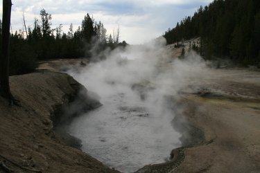
 Maybe you could have erected a cross for me using the heavy spoon?
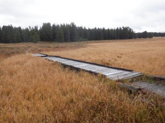
 I guess you could say that I was dumfungled.