- Joined
- Aug 21, 2018
- Messages
- 677
Day Six: August 14, 2023
There was a buzz of excitement in camp this morning, and it was originating from the area of @scatman 's tent. He was in the early stages of Majo Fever, and the only known cure is to nibble on some Chocolonely at the top of Majo Pass. Majo Pass was the name supposedly given to the divide that separates the Thorofare Creek drainage from the waters flowing down to the North Fork of the Yellowstone River. Because I can be annoying and like to push people's buttons (Mrs. TractorDoc can confirm that ) I would periodically call it Mojo Pass. Through day five our route had been relatively tame with minimal elevation gain, but that was about to change. Did I have the Mojo to make it up Majo? You will find out by the end of this post.
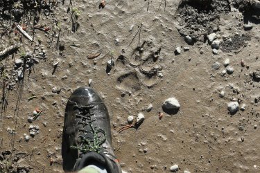
Nice trail track noted early on. That is an impressive wolf print if you ask me.
It could be said that I have a long stride. This trait meant that on occasion I would push ahead on the trail, then wait a minute or two for the rest of the group to catch up to my position. This is not to say that Hugh, Bob, or Scott have short strides. They could be rather speedy if they wanted to be. Hugh took extra time taking his pictures, Scott often wandered off trial to check out the surroundings, and by now we know that Bob likes his mid-hike naps. Thinking back, the three of those guys seemed rather content to let me walk ahead and scout out the terrain. Maybe there was more to it than me just being quick. . .
Such was the case early on day six. I was walking ahead of the group, wondering how much of a challenge getting up Majo Pass would be. I kept a sharp eye on my surroundings and up ahead noticed what I thought was a lone bison grazing near the tree line. I stood and watched it for a minute while thinking to myself that I had not seen a bison over the last five days. This was certainly a strange place to find one.
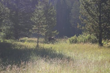
It took several seconds for me to make the connection that this was not a bison, and I slowly began to walk backwards while waving my hands at Bob who was not far behind. What I thought was a bison was actually a very large Grizzly Bear!
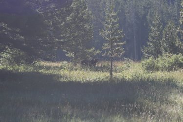
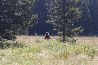
The picture above shows the bear saw us, but Bob and I must not have looked like much of a threat so it kept grazing. Hugh and Scott had been examining some beaver dams a little farther back on the trail and luckily the bear continued to do bear stuff as they walked up. For the next couple of minutes you would have thought the paparazzi had found its way into the Teton Wilderness from the sound of all the camera clicks. The four of us stood side by side and watched the bear for a couple minutes. It was a lot farther away and difficult to see at the time, but cropping the pictures might suggest the bear has a rough look to it. I hope it survives the winter.
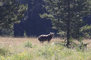
Eventually the sight of four fascinated men must have been too much; the bear gave us a good look and rolled up/back into the trees. An amazing start to day six.
Somewhere in the excitement I lost the one thing I failed to pack out with me on this trip -- my camera's lens cap. We were standing in some tall grasses and I spent a couple minutes looking for it without success. It is an 82mm Canon cap; if you happen to be out this way and find it I'll gladly pay the postage to get it back.
@Bob heading towards Yellow Mountain.
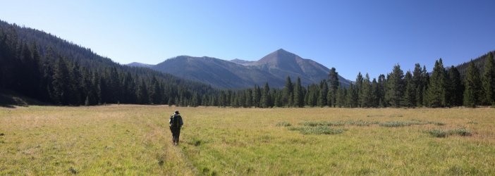
Looking back towards @wsp_scott and @scatman .

Breaking thru a cluster of trees gives us our first hints of where Majo Pass might be (near center of picture), but I don't think we realized it at the time.
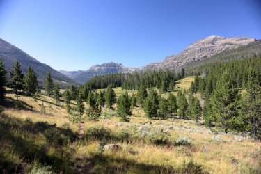
Not far from here I told Hugh that this was some real "Sound of Music" scenery we had walked into.
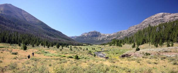
This was his response. Spinning and singing are all side effects of Majo Fever no doubt.
@Rockskipper made an appearance to see what the commotion was all about.
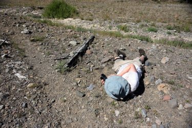
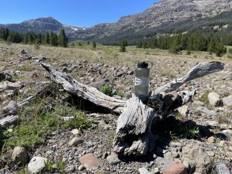
As I waited for Hugh to get up off the ground I took the opportunity to take a picture for the "Swag in the Wild" thread.
Getting closer to the pass.
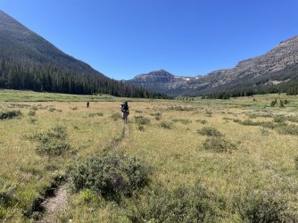
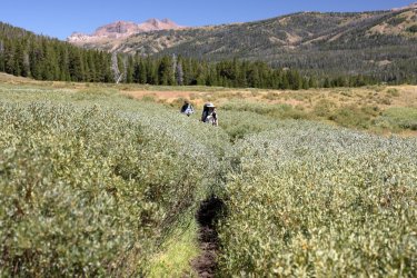
See the trail thru the willows?
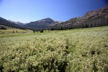
The willows were at least as tall as a Scatman's elbow.
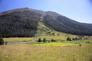
My mediocre grasp on geology has me thinking a large landslide happened here. . . or maybe an avalanche. . . or maybe just a lot of washout. The mature trees flanking the open grassy slope are definitely telling a story.
Our time along Thorofare Creek was coming to an end.
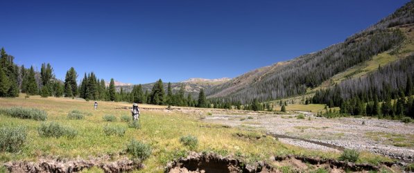
Drainage gullies washed out the trail in this section. We followed the grassy flat to the right of the creek.
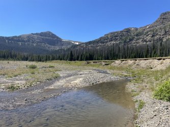
Majo Pass is just around the corner. I do not think I knew it at the time, but this picture captured a beary special moment.
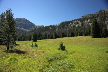
I distinctly remember @scatman was looking at his GPS when I looked up the hill and nonchalantly said "Hugh, there is a bear up there." The Teton Paparazzi then made another appearance. This was a healthy looking blonde haired Grizzly. In the previous picture, the bear is the light dot at the tree line below the sheer rock face towards the left side -- sort of between two pine trees.
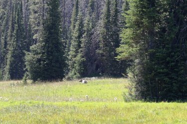
We watched the bear for a couple minutes before it caught our scent and ran up into the trees. We should have followed it.
Instead we chose to follow something that resembled a trail into the trees at an Easterly direction. The next hour or so was a bit of a blur. If I remember correctly, @scatman had heard from his hairdresser, who heard it from his brother, who heard it from his cousin (twice removed), who heard it from a friend at work, who heard it from a bartender, who heard it from Kevin Bacon that there was a trail leading up to Majo Pass from our approximate location.
Or maybe he heard it from Lone Eagle Woman. Either way, our mission (we had no choice but to accept it) was to find that trail.
Things started to look promising as our faint trail began to turn into a recognizable trail with fresh tree cuts and everything. Even though we continued to head in the wrong direction we held out hope that the trail would eventually contour back around to the West. It did not. We ultimately gave into the idea that this was an outfitter's trail that continued up the Thorofare Creek Valley and not the trail that would take us up to Majo Pass.
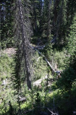
Rather than retrace our steps down the hillside we decided to bushwhack across the slope in the general direction of the pass. Every @scatman adventure that I have been on has involved hiking thru steep, brushy terrain covered in downfall and this stretch checked that box. I packed the big camera away to make maneuvering easier, so not many pictures were taken during this step of the journey.
This was one I did manage to take.
After an unrecorded amount of time pushing thru thick undergrowth we emerged into a clearing and were able to get a first good look at the pass.
Fair warning: many different views of a similar scene forthcoming.
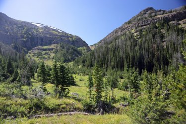
Looking back towards Thorofare Creek and Yellow Mountain. @Bob is downhill a little to the right of Hugh's hat.
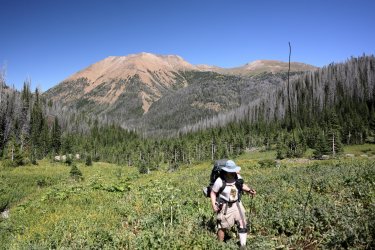
@scatman and Yellow Mountain.
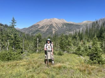
@wsp_scott looking up Majo Pass.
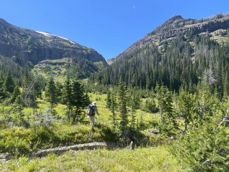
While I had the cell phone out I figured I might as well take my picture too.
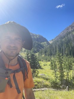
We were happy to have a visual of the pass, but there was still no sign of a trail. We surmised it must be somewhere on the other side of the valley. Rather than search it out we simply took the path of least resistance up the drainage/thru the watershed.
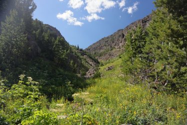
Follow the gray cobble road!

My long stride must have been a factor as I ended up at the front of our group. I was worried the altitude would have me holding everyone up as we approached 10,000 feet but somehow I kept going.
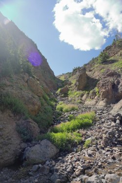
Same picture side by side with the Canon on the left and cell phone on the right. Sometimes the cell phone with its multiple lenses does a better job of blending the bright/dark spots in an image.
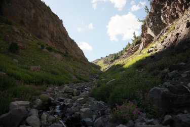
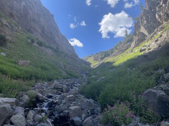
Looking back down the pass.
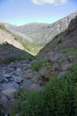
A short cell phone video of some ascent action:
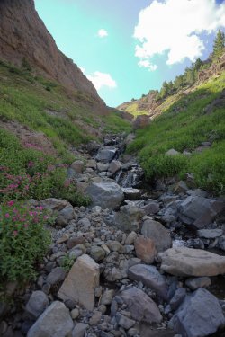
Half trail and half cascade.
I saw the snow accumulation up the drainage and noted the large hollow area under it. I don't have much experience in alpine ascents but I did not think walking across a thin snow crust was a good idea. Instead of continuing up the center of the drainage I headed towards the notch in the rocks at the upper right. This was probably not the best approach either as the rocks were loose, crumbly, and at a steeper angle than they looked. I crawled up on my hands and knees and somehow made it to the top without losing my balance and falling back down into the jumble of pointy surfaces below.
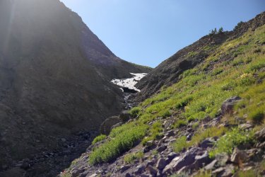
From this vantage point I was able to make out the faint presence of a trail to my left. I shouted down to Hugh so he might have an easier time finding it from his location. He looks like a dark gray rock near the center of this picture.
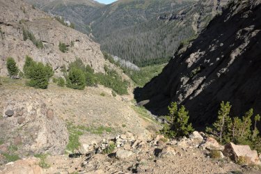
Looking up and at the trail. I don't think any people or horses had been here for some time.
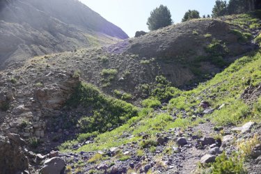
The steepness finally gave way to more gentle terrain towards the top. I chose to wait for the others on the little hill at center right to take advantage of the trees and some shade.
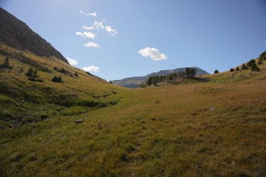
Looking back down the pass from the hill. The angle of the sun highlights the trail nicely.
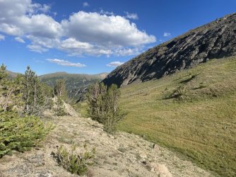
@scatman was the next to arrive. It was a good thing too, as I doubt he could have sustained the effects of Majo Fever much longer. Walking with your arms in the air is one of the signs in the later stages of the disease.
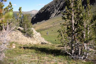
Glad to be at the top. I neglected to zip my pantlegs back on before today's off trail adventure and my legs showed it. I'm pretty sure Hugh is smiling on this one.
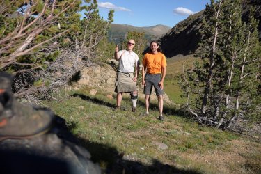
Group shot! Nothing but happy campers here. We took a rest and Hugh offered everyone some celebratory Chocolonely. I think chocolate bars are more flavorful when one is over 10,000 feet in elevation.
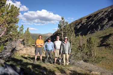
It had been a long day and as the symptoms of Mojo Fever began to fade thoughts turned to finding a campsite. We could see a nice spot from the pass and descended down to what would ultimately be my favorite campsite of the trip.
Looking back up at Mojo Pass from the West side.
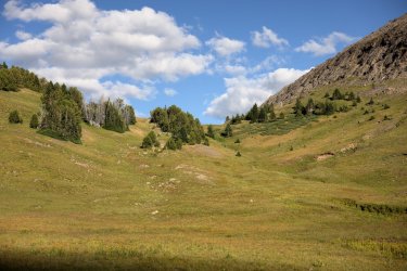
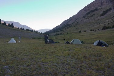
We set up camp next to a small tributary that drained into the North Fork of the Yellowstone River. This spot must have been popular with those that came before us. The ground was littered with small pieces of chert that were likely leftovers from the making of tools, arrow points, etc.
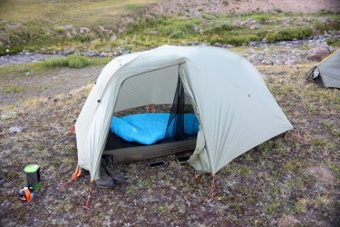
Camp's water source.
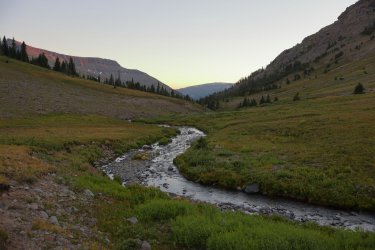
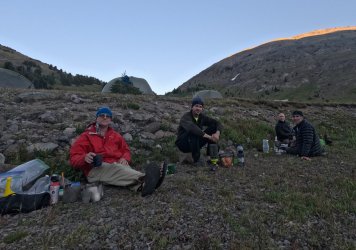
The sun and subsequently the temperature dropped quickly so we dressed in our finest outerwear for dinner. Hopefully we still look like a bunch of bada**es instead of a bunch of jacka**es. @Jackson will let us know either way.
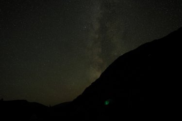
During the night I attempted another round of astrophotography. I had strategically set up several rocks to use as tripods before darkness fell. Seeing the night sky at this remote location and this elevation was truly something special. The occasional shooting star darted across the sky and I think I saw a string of Starlink satellites before they dispersed.
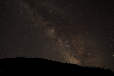
For round two (of taking night pictures) I woke up a little late to catch the Milky Way before it snuck behind the mountain. The green blob is the result of a small led light on the phone charger in my tent.
Day Six was truly deserving of being called epic. Bear sightings, off trail adventures, a remote mountain pass, and an ultra special campsite would be welcomed and appreciated on their own. . . combine them into one amazing day and I cannot think of a better adjective to describe it.
The unknowns of ascending Majo had been conquered and I felt confident I could handle anything else the next days might throw at us. We were still ahead of schedule as tonight's campsite was intended to be at the bottom of the pass (the East side). I am glad the plan was adjusted and I think it jumpstarted us for tomorrow -- day seven would be another great day that included a descent, an ascent, and a campsite by a lake. Read about it in my next post!
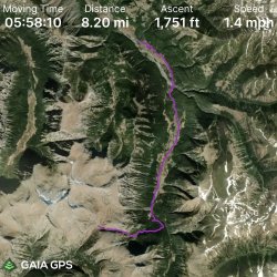
GPS Track for Day Six. I paused the track at the top of the pass during our rest and forgot to start it right away when we got going (in case you were wondering why there was a break in the line).
There was a buzz of excitement in camp this morning, and it was originating from the area of @scatman 's tent. He was in the early stages of Majo Fever, and the only known cure is to nibble on some Chocolonely at the top of Majo Pass. Majo Pass was the name supposedly given to the divide that separates the Thorofare Creek drainage from the waters flowing down to the North Fork of the Yellowstone River. Because I can be annoying and like to push people's buttons (Mrs. TractorDoc can confirm that
Nice trail track noted early on. That is an impressive wolf print if you ask me.

It could be said that I have a long stride. This trait meant that on occasion I would push ahead on the trail, then wait a minute or two for the rest of the group to catch up to my position. This is not to say that Hugh, Bob, or Scott have short strides. They could be rather speedy if they wanted to be. Hugh took extra time taking his pictures, Scott often wandered off trial to check out the surroundings, and by now we know that Bob likes his mid-hike naps. Thinking back, the three of those guys seemed rather content to let me walk ahead and scout out the terrain. Maybe there was more to it than me just being quick. . .
Such was the case early on day six. I was walking ahead of the group, wondering how much of a challenge getting up Majo Pass would be. I kept a sharp eye on my surroundings and up ahead noticed what I thought was a lone bison grazing near the tree line. I stood and watched it for a minute while thinking to myself that I had not seen a bison over the last five days. This was certainly a strange place to find one.

It took several seconds for me to make the connection that this was not a bison, and I slowly began to walk backwards while waving my hands at Bob who was not far behind. What I thought was a bison was actually a very large Grizzly Bear!

The picture above shows the bear saw us, but Bob and I must not have looked like much of a threat so it kept grazing. Hugh and Scott had been examining some beaver dams a little farther back on the trail and luckily the bear continued to do bear stuff as they walked up. For the next couple of minutes you would have thought the paparazzi had found its way into the Teton Wilderness from the sound of all the camera clicks. The four of us stood side by side and watched the bear for a couple minutes. It was a lot farther away and difficult to see at the time, but cropping the pictures might suggest the bear has a rough look to it. I hope it survives the winter.


Eventually the sight of four fascinated men must have been too much; the bear gave us a good look and rolled up/back into the trees. An amazing start to day six.

Somewhere in the excitement I lost the one thing I failed to pack out with me on this trip -- my camera's lens cap. We were standing in some tall grasses and I spent a couple minutes looking for it without success. It is an 82mm Canon cap; if you happen to be out this way and find it I'll gladly pay the postage to get it back.
@Bob heading towards Yellow Mountain.

Looking back towards @wsp_scott and @scatman .

Breaking thru a cluster of trees gives us our first hints of where Majo Pass might be (near center of picture), but I don't think we realized it at the time.

Not far from here I told Hugh that this was some real "Sound of Music" scenery we had walked into.

This was his response. Spinning and singing are all side effects of Majo Fever no doubt.
@Rockskipper made an appearance to see what the commotion was all about.

As I waited for Hugh to get up off the ground I took the opportunity to take a picture for the "Swag in the Wild" thread.

Getting closer to the pass.

See the trail thru the willows?

The willows were at least as tall as a Scatman's elbow.

My mediocre grasp on geology has me thinking a large landslide happened here. . . or maybe an avalanche. . . or maybe just a lot of washout. The mature trees flanking the open grassy slope are definitely telling a story.

Our time along Thorofare Creek was coming to an end.

Drainage gullies washed out the trail in this section. We followed the grassy flat to the right of the creek.

Majo Pass is just around the corner. I do not think I knew it at the time, but this picture captured a beary special moment.

I distinctly remember @scatman was looking at his GPS when I looked up the hill and nonchalantly said "Hugh, there is a bear up there." The Teton Paparazzi then made another appearance. This was a healthy looking blonde haired Grizzly. In the previous picture, the bear is the light dot at the tree line below the sheer rock face towards the left side -- sort of between two pine trees.

We watched the bear for a couple minutes before it caught our scent and ran up into the trees. We should have followed it.
Instead we chose to follow something that resembled a trail into the trees at an Easterly direction. The next hour or so was a bit of a blur. If I remember correctly, @scatman had heard from his hairdresser, who heard it from his brother, who heard it from his cousin (twice removed), who heard it from a friend at work, who heard it from a bartender, who heard it from Kevin Bacon that there was a trail leading up to Majo Pass from our approximate location.
Or maybe he heard it from Lone Eagle Woman. Either way, our mission (we had no choice but to accept it) was to find that trail.
Things started to look promising as our faint trail began to turn into a recognizable trail with fresh tree cuts and everything. Even though we continued to head in the wrong direction we held out hope that the trail would eventually contour back around to the West. It did not. We ultimately gave into the idea that this was an outfitter's trail that continued up the Thorofare Creek Valley and not the trail that would take us up to Majo Pass.
Rather than retrace our steps down the hillside we decided to bushwhack across the slope in the general direction of the pass. Every @scatman adventure that I have been on has involved hiking thru steep, brushy terrain covered in downfall and this stretch checked that box. I packed the big camera away to make maneuvering easier, so not many pictures were taken during this step of the journey.
This was one I did manage to take.

After an unrecorded amount of time pushing thru thick undergrowth we emerged into a clearing and were able to get a first good look at the pass.
Fair warning: many different views of a similar scene forthcoming.

Looking back towards Thorofare Creek and Yellow Mountain. @Bob is downhill a little to the right of Hugh's hat.

@scatman and Yellow Mountain.

@wsp_scott looking up Majo Pass.

While I had the cell phone out I figured I might as well take my picture too.

We were happy to have a visual of the pass, but there was still no sign of a trail. We surmised it must be somewhere on the other side of the valley. Rather than search it out we simply took the path of least resistance up the drainage/thru the watershed.

Follow the gray cobble road!

My long stride must have been a factor as I ended up at the front of our group. I was worried the altitude would have me holding everyone up as we approached 10,000 feet but somehow I kept going.

Same picture side by side with the Canon on the left and cell phone on the right. Sometimes the cell phone with its multiple lenses does a better job of blending the bright/dark spots in an image.


Looking back down the pass.

A short cell phone video of some ascent action:
Half trail and half cascade.

I saw the snow accumulation up the drainage and noted the large hollow area under it. I don't have much experience in alpine ascents but I did not think walking across a thin snow crust was a good idea. Instead of continuing up the center of the drainage I headed towards the notch in the rocks at the upper right. This was probably not the best approach either as the rocks were loose, crumbly, and at a steeper angle than they looked. I crawled up on my hands and knees and somehow made it to the top without losing my balance and falling back down into the jumble of pointy surfaces below.

From this vantage point I was able to make out the faint presence of a trail to my left. I shouted down to Hugh so he might have an easier time finding it from his location. He looks like a dark gray rock near the center of this picture.

Looking up and at the trail. I don't think any people or horses had been here for some time.

The steepness finally gave way to more gentle terrain towards the top. I chose to wait for the others on the little hill at center right to take advantage of the trees and some shade.

Looking back down the pass from the hill. The angle of the sun highlights the trail nicely.

@scatman was the next to arrive. It was a good thing too, as I doubt he could have sustained the effects of Majo Fever much longer. Walking with your arms in the air is one of the signs in the later stages of the disease.

Glad to be at the top. I neglected to zip my pantlegs back on before today's off trail adventure and my legs showed it. I'm pretty sure Hugh is smiling on this one.

Group shot! Nothing but happy campers here. We took a rest and Hugh offered everyone some celebratory Chocolonely. I think chocolate bars are more flavorful when one is over 10,000 feet in elevation.

It had been a long day and as the symptoms of Mojo Fever began to fade thoughts turned to finding a campsite. We could see a nice spot from the pass and descended down to what would ultimately be my favorite campsite of the trip.
Looking back up at Mojo Pass from the West side.

We set up camp next to a small tributary that drained into the North Fork of the Yellowstone River. This spot must have been popular with those that came before us. The ground was littered with small pieces of chert that were likely leftovers from the making of tools, arrow points, etc.


Camp's water source.

The sun and subsequently the temperature dropped quickly so we dressed in our finest outerwear for dinner. Hopefully we still look like a bunch of bada**es instead of a bunch of jacka**es. @Jackson will let us know either way.

During the night I attempted another round of astrophotography. I had strategically set up several rocks to use as tripods before darkness fell. Seeing the night sky at this remote location and this elevation was truly something special. The occasional shooting star darted across the sky and I think I saw a string of Starlink satellites before they dispersed.

For round two (of taking night pictures) I woke up a little late to catch the Milky Way before it snuck behind the mountain. The green blob is the result of a small led light on the phone charger in my tent.

Day Six was truly deserving of being called epic. Bear sightings, off trail adventures, a remote mountain pass, and an ultra special campsite would be welcomed and appreciated on their own. . . combine them into one amazing day and I cannot think of a better adjective to describe it.
The unknowns of ascending Majo had been conquered and I felt confident I could handle anything else the next days might throw at us. We were still ahead of schedule as tonight's campsite was intended to be at the bottom of the pass (the East side). I am glad the plan was adjusted and I think it jumpstarted us for tomorrow -- day seven would be another great day that included a descent, an ascent, and a campsite by a lake. Read about it in my next post!
GPS Track for Day Six. I paused the track at the top of the pass during our rest and forgot to start it right away when we got going (in case you were wondering why there was a break in the line).


