- Joined
- Aug 21, 2018
- Messages
- 735
Day Seven: August 15, 2023.
During the planning stages of this trip I had a good feel for what our surroundings might be. . . up to today. The trails thru Yellowstone and along Thorofare Creek were mostly level, documented on maps/in some guide books (Yellowstone anyway), and could be followed to some degree on Google Earth. Even getting up Majo Pass was an understandable objective, even if we did not have a proven path to navigate.
Ahead of us lay sections of off trail travel and undulating terrain that I feel one has to experience to become familiar with. Short of several trip reports here on the forum and the occasional YouTube video I could not find a lot of information describing the contents of the Teton Wilderness. Perhaps this was/is a good thing. Luckily Bob and Hugh have been here before and planned us a route full of awesomeness. All I had to do was not wander too far from them to experience it. You often see me wearing bright colors in this and other trip reports. . . that is because I tend to wander and if I do get lost I'll then be easy to spot.
Things get bright/warm quickly when the sun rises and you are camped up high. I had enough time to check out a small waterfall cascading down a nearby hillside. This was the view looking back at camp and Majo Pass.
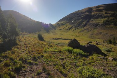
Looking away from camp in the direction we would start today's hike.
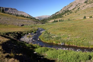
Bob and Hugh leading the way.
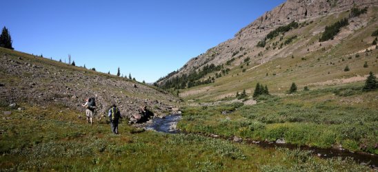
Today we had to go down to be able to go up. We followed our small tributary as it wound its way down to the North Fork of the Yellowstone. Sometimes there would be evidence of a trail, sometimes not. I believe Hugh originally wanted to cut across the wooded hillside at the left, but I'm thinking that did not happen as a result of our forest bushwhack experience from yesterday.
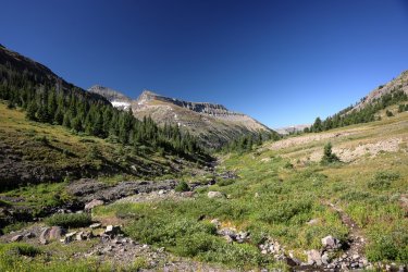
Looking back at Majo Pass. I somehow managed to work my way to the front of the group again.
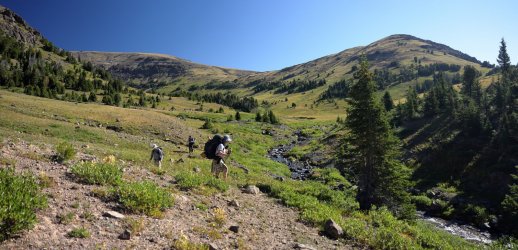
Probably because there was a visible trail to follow.
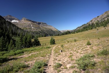
Possibly my second favorite picture of the day. Our first view of the pass that separates the North and South Forks of the Yellowstone. We would be climbing up and over the little green dip in the center of the picture. Hugh was hoping there would be scores of Grizzlies looking for cutworm moths in the bowl area to the right of the pass.
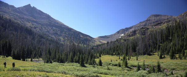
GoPro View.
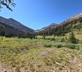
Zoomed in.
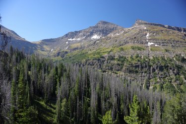
Looking downstream on the North Fork.
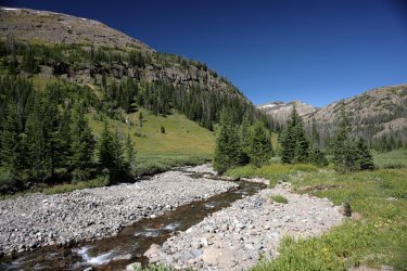
I wonder what Scott and Bob are talking about today?
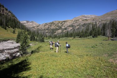
Similar but changing view alert! Just like yesterday, be ready for a cluster of pictures as we climbed up the pass.
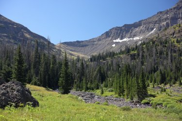
View of the terrain on our right. The map shows two ponds/lakes somewhere up above the green hillside but we did not take a side trip to see them. Maybe next time.
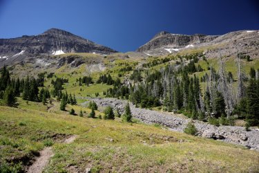
I did take the time to appreciate this nice cascade that may be draining from one (or both) of the lakes though.
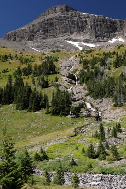
Getting closer. This was a much gentler ascent than the one to get up Mojo Pass. There is even a decent trail to follow. This part of the journey looked familiar because @TheMountainRabbit had posted a trip report covering the same area.
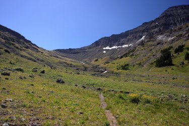
Down valley view.
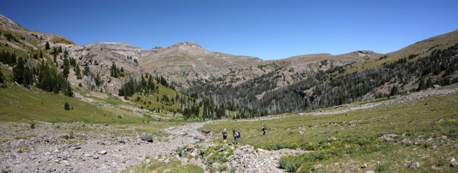
The sound of moving water had been the soundtrack of this trip. This number is brought to you by Double Gully and the Cascades.
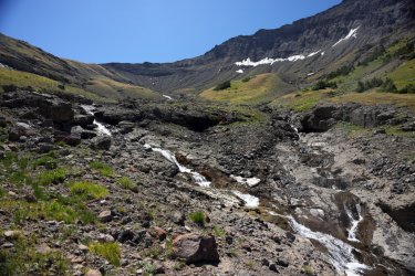
@wsp_scott was right on my heels. If I had moved any slower I think he would have started poking me with his trekking poles.
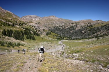
By now it was apparent that no Grizzlies were on the hunt for moths. This made Hugh sad.
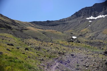
Did they take a sunscreen break and not tell me?
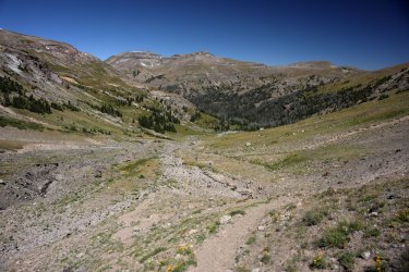
One last view of the cirque (?) before walking on by. Hugh and I heard several large rocks fall/roll down the basin but did not see what, if anything, dislodged them.
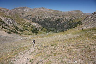
Three men and a valley. Possibly my second favorite picture of the day.
GoPro Selfie. I tried standing so you couldn't see Hugh but he must have run sideways at the last minute for a photobomb.
You can sort of see how I carried the big camera/Canon in this picture. It fits nicely in a water bottle holder on my left hip.
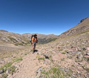
Would you have known that @Bob and @wsp_scott are in this picture if I had not told you?
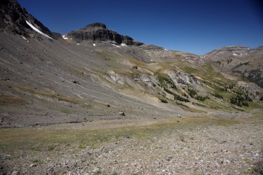
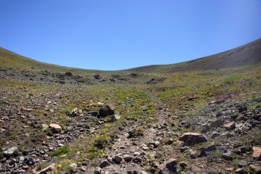
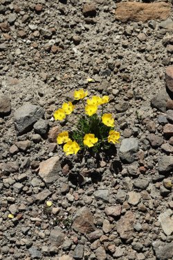
Almost there. I tried taking pictures of the wildflowers along this part of the trail but did a poor job focusing. Perhaps the thin air did not agree with the camera.
The best I can do for now.
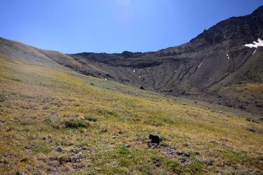
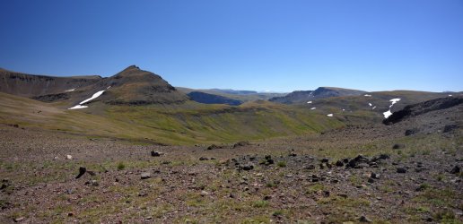
I did not know what I was going to see once I reached the top but I can tell you I was not disappointed with what I saw. The day was still early so there would be no campsite near the top of this mountain pass. The next phase of day seven was to make our way to the pass near the center of the picture just to the left of the small patches of snow. The valley to the right of this pass held the South Fork of the Yellowstone River. Water flowing down the other side of the pass found its way to Younts Creek or Marston Creek (if I've read my map correctly).
Group shot with a terrible sun angle.
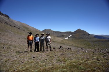
In unknown terrain I would follow Hugh until he became annoyed with the sound of me sucking air (I'm a flat-lander you see). When he had enough he would point to a rock or other object in the distance and tell me to head there. This must have been one of the less annoying moments.
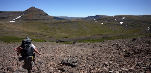
The wildflowers continued to impress even above 10,000 feet.
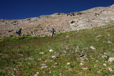
Our goal was to skirt around the valley rather than go down and back up. Somewhere on that hillside we found a partial trail that led us over to the pass.
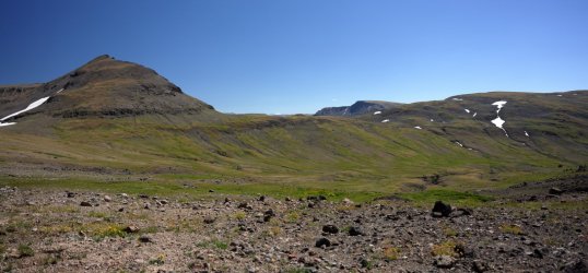
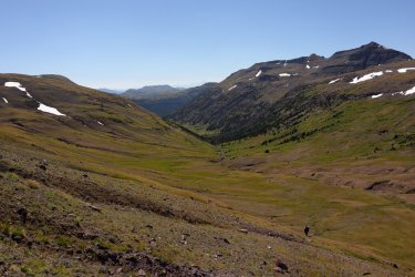
Looking down into the South Fork of the Yellowstone.
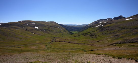
Bob knows the way!
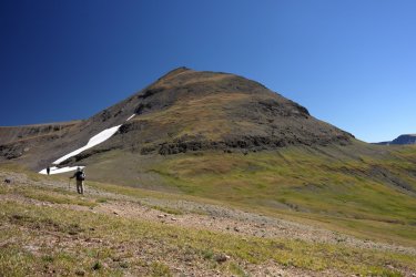
The view back to the pass we had just come over.
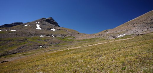
Look close and you might see the Tetons.
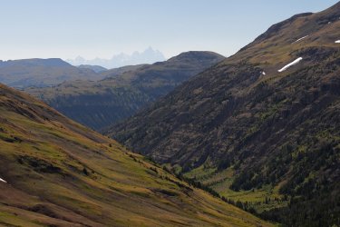
Cropped in. We were fortunate to have good days of visibility on this trip.
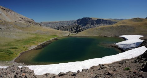
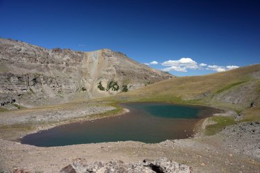
I wonder what the water temperature is in that tarn? For a brief moment we crossed into the Washakie Wilderness at this spot.
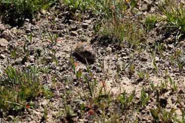
Wildlife sighting!
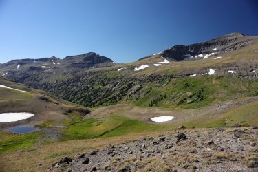
The view to our right. That could be the Yellowstone River Trail heading downhill.
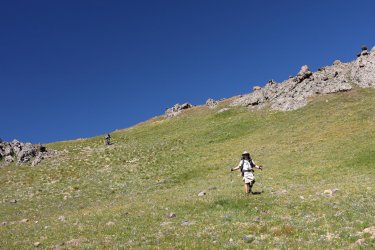
Its all downhill from here, right?
Some fun colors paint that mountain behind the tarn.
Officially on the Marston Pass Trail I think.
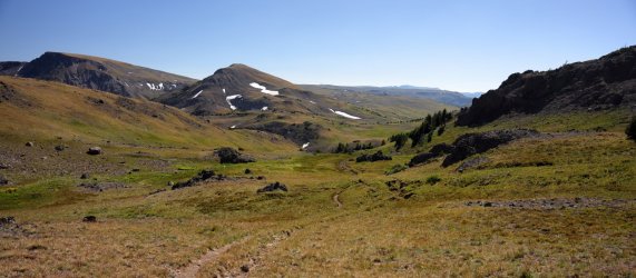
Have I mentioned that getting a picture of these three spaced out on the trail is difficult?
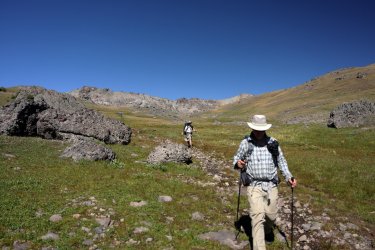
Looking into the Washakie Wilderness. The trail leading up/down that mountain holds a value of at least eight out of ten on the butt-pucker scale.
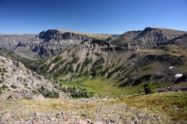
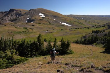
Hugh was practically running down the trail on day seven. We took a sunscreen break near the little group of trees ahead of the trail at the right.
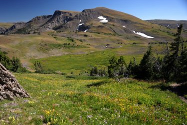
I spent more time taking pictures of the carpet of wildflowers than I did applying sunscreen.
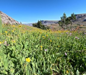
GoPro perspective.
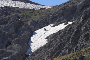
Shortly after the sunscreen break Scott's sharp eyes spotted a Grizzly Bear upslope from the trail. When it saw us it ran up and over the mountain rather quickly. Impressive!
We started out the day at 10,000 feet, dropped down to 9300, then climbed back up to 11,000 feet, and now we were dropping back down near 10,000 again.
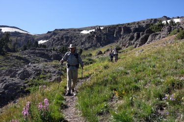
The Washakie Wilderness might be worth checking out some day. . .
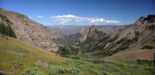
Good thing none of us had wildflower allergies.
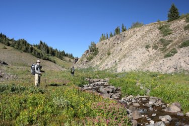
Hugh had planned for tonight's campsite to be near a small pond he had camped at on a previous adventure. It was the original campsite that was planned for the night of day seven so we were back on schedule. I think I was starting to feel some of the day's ups and downs so when Hugh pointed to the direction of the pond I kicked out of Mosey Mode and into Eager to Get There Mode.
I made sure I could still see everyone in case I veered off course.
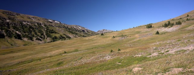
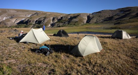
Setting up camp for night seven. This nice little flat spot looked over the pond and the Buffalo Plateau loomed in the distance. The pond water was cold, but not cold enough to keep me from taking a quick swim. I made sure to stay on the other side from where we obtained/filtered water but I'm not sure which side @Bob washed his socks on.
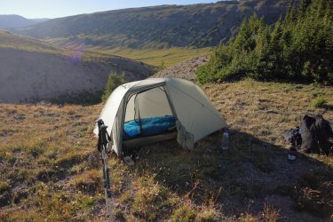
Marking my tent footprint as to which side the door is on pays off again. I might have emerged from my tent and rolled down the hill should it have been on the opposite side.
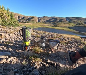
Supper for night seven. Biscuits and Gravy for supper?!! Why not? I do like biscuits and gravy but I find the dehydrated versions to be more than what I can eat in the mornings while camping. I finished the bag off without a problem this evening though. Socks and Crocs are my go-to camp footwear on chilly evenings. That goes for home too.
Day seven wrapped up as another success. The original plan for day seven was to start at the base of Majo Pass and end up here. I think my legs were glad we did not incorporate both pass climbs into the same day. Tomorrow we would be venturing out onto the Buffalo Plateau on which I found out live very few (if any) buffalo. It was to be our longest distance hiking day so we needed to rest up. There was some discussion between Hugh and Bob as to how we would descend from the plateau (I'm not the only one that was suggesting adjustments ) and we will cover those details in the next post/report.
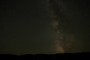
Before darkness fell I set up a few more tripod rocks to have one more go at some star photos. This is one of the clearer shots I was able to take. Many of the others have an airplane or some other space junk floating thru it.
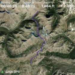
GPS Track for Day Seven. Neat to see the North and South Forks of the Yellowstone. Me eyes think the valleys look like high points even though they are of course the low points.
During the planning stages of this trip I had a good feel for what our surroundings might be. . . up to today. The trails thru Yellowstone and along Thorofare Creek were mostly level, documented on maps/in some guide books (Yellowstone anyway), and could be followed to some degree on Google Earth. Even getting up Majo Pass was an understandable objective, even if we did not have a proven path to navigate.
Ahead of us lay sections of off trail travel and undulating terrain that I feel one has to experience to become familiar with. Short of several trip reports here on the forum and the occasional YouTube video I could not find a lot of information describing the contents of the Teton Wilderness. Perhaps this was/is a good thing. Luckily Bob and Hugh have been here before and planned us a route full of awesomeness. All I had to do was not wander too far from them to experience it. You often see me wearing bright colors in this and other trip reports. . . that is because I tend to wander and if I do get lost I'll then be easy to spot.
Things get bright/warm quickly when the sun rises and you are camped up high. I had enough time to check out a small waterfall cascading down a nearby hillside. This was the view looking back at camp and Majo Pass.

Looking away from camp in the direction we would start today's hike.

Bob and Hugh leading the way.

Today we had to go down to be able to go up. We followed our small tributary as it wound its way down to the North Fork of the Yellowstone. Sometimes there would be evidence of a trail, sometimes not. I believe Hugh originally wanted to cut across the wooded hillside at the left, but I'm thinking that did not happen as a result of our forest bushwhack experience from yesterday.

Looking back at Majo Pass. I somehow managed to work my way to the front of the group again.

Probably because there was a visible trail to follow.

Possibly my second favorite picture of the day. Our first view of the pass that separates the North and South Forks of the Yellowstone. We would be climbing up and over the little green dip in the center of the picture. Hugh was hoping there would be scores of Grizzlies looking for cutworm moths in the bowl area to the right of the pass.

GoPro View.

Zoomed in.

Looking downstream on the North Fork.

I wonder what Scott and Bob are talking about today?

Similar but changing view alert! Just like yesterday, be ready for a cluster of pictures as we climbed up the pass.

View of the terrain on our right. The map shows two ponds/lakes somewhere up above the green hillside but we did not take a side trip to see them. Maybe next time.

I did take the time to appreciate this nice cascade that may be draining from one (or both) of the lakes though.

Getting closer. This was a much gentler ascent than the one to get up Mojo Pass. There is even a decent trail to follow. This part of the journey looked familiar because @TheMountainRabbit had posted a trip report covering the same area.

Down valley view.

The sound of moving water had been the soundtrack of this trip. This number is brought to you by Double Gully and the Cascades.

@wsp_scott was right on my heels. If I had moved any slower I think he would have started poking me with his trekking poles.

By now it was apparent that no Grizzlies were on the hunt for moths. This made Hugh sad.

Did they take a sunscreen break and not tell me?

One last view of the cirque (?) before walking on by. Hugh and I heard several large rocks fall/roll down the basin but did not see what, if anything, dislodged them.

Three men and a valley. Possibly my second favorite picture of the day.

GoPro Selfie. I tried standing so you couldn't see Hugh but he must have run sideways at the last minute for a photobomb.
You can sort of see how I carried the big camera/Canon in this picture. It fits nicely in a water bottle holder on my left hip.

Would you have known that @Bob and @wsp_scott are in this picture if I had not told you?

Almost there. I tried taking pictures of the wildflowers along this part of the trail but did a poor job focusing. Perhaps the thin air did not agree with the camera.

The best I can do for now.

I did not know what I was going to see once I reached the top but I can tell you I was not disappointed with what I saw. The day was still early so there would be no campsite near the top of this mountain pass. The next phase of day seven was to make our way to the pass near the center of the picture just to the left of the small patches of snow. The valley to the right of this pass held the South Fork of the Yellowstone River. Water flowing down the other side of the pass found its way to Younts Creek or Marston Creek (if I've read my map correctly).

Group shot with a terrible sun angle.

In unknown terrain I would follow Hugh until he became annoyed with the sound of me sucking air (I'm a flat-lander you see). When he had enough he would point to a rock or other object in the distance and tell me to head there. This must have been one of the less annoying moments.

The wildflowers continued to impress even above 10,000 feet.

Our goal was to skirt around the valley rather than go down and back up. Somewhere on that hillside we found a partial trail that led us over to the pass.

Looking down into the South Fork of the Yellowstone.

Bob knows the way!

The view back to the pass we had just come over.

Look close and you might see the Tetons.

Cropped in. We were fortunate to have good days of visibility on this trip.

I wonder what the water temperature is in that tarn? For a brief moment we crossed into the Washakie Wilderness at this spot.

Wildlife sighting!

The view to our right. That could be the Yellowstone River Trail heading downhill.

Its all downhill from here, right?

Some fun colors paint that mountain behind the tarn.

Officially on the Marston Pass Trail I think.

Have I mentioned that getting a picture of these three spaced out on the trail is difficult?

Looking into the Washakie Wilderness. The trail leading up/down that mountain holds a value of at least eight out of ten on the butt-pucker scale.


Hugh was practically running down the trail on day seven. We took a sunscreen break near the little group of trees ahead of the trail at the right.

I spent more time taking pictures of the carpet of wildflowers than I did applying sunscreen.

GoPro perspective.

Shortly after the sunscreen break Scott's sharp eyes spotted a Grizzly Bear upslope from the trail. When it saw us it ran up and over the mountain rather quickly. Impressive!

We started out the day at 10,000 feet, dropped down to 9300, then climbed back up to 11,000 feet, and now we were dropping back down near 10,000 again.

The Washakie Wilderness might be worth checking out some day. . .

Good thing none of us had wildflower allergies.

Hugh had planned for tonight's campsite to be near a small pond he had camped at on a previous adventure. It was the original campsite that was planned for the night of day seven so we were back on schedule. I think I was starting to feel some of the day's ups and downs so when Hugh pointed to the direction of the pond I kicked out of Mosey Mode and into Eager to Get There Mode.
I made sure I could still see everyone in case I veered off course.

Setting up camp for night seven. This nice little flat spot looked over the pond and the Buffalo Plateau loomed in the distance. The pond water was cold, but not cold enough to keep me from taking a quick swim. I made sure to stay on the other side from where we obtained/filtered water but I'm not sure which side @Bob washed his socks on.

Marking my tent footprint as to which side the door is on pays off again. I might have emerged from my tent and rolled down the hill should it have been on the opposite side.

Supper for night seven. Biscuits and Gravy for supper?!! Why not? I do like biscuits and gravy but I find the dehydrated versions to be more than what I can eat in the mornings while camping. I finished the bag off without a problem this evening though. Socks and Crocs are my go-to camp footwear on chilly evenings. That goes for home too.

Day seven wrapped up as another success. The original plan for day seven was to start at the base of Majo Pass and end up here. I think my legs were glad we did not incorporate both pass climbs into the same day. Tomorrow we would be venturing out onto the Buffalo Plateau on which I found out live very few (if any) buffalo. It was to be our longest distance hiking day so we needed to rest up. There was some discussion between Hugh and Bob as to how we would descend from the plateau (I'm not the only one that was suggesting adjustments
Before darkness fell I set up a few more tripod rocks to have one more go at some star photos. This is one of the clearer shots I was able to take. Many of the others have an airplane or some other space junk floating thru it.

GPS Track for Day Seven. Neat to see the North and South Forks of the Yellowstone. Me eyes think the valleys look like high points even though they are of course the low points.


 That might have been the reason for my illness on day nine?
  Between his sock water and his elk wallow water sources, I'm pretty sure I'm immune to all known diseases at this point.
