- Joined
- Aug 21, 2018
- Messages
- 677
Day Four -- August 12, 2023.
Day four ranks near the top when it comes to my favorite day of this trip. Each day was unique and had it's own special moments, but day four stands out. How you say? It all begins at campsite 6Y2 so let's start there.
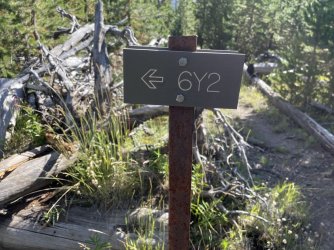
We chose campsite 6Y2 to accommodate another of my adjustment requests to Hugh's plan. This campsite is one of the closest to Falcon Creek, and on Falcon Creek is another backcountry waterfall. We thought we might try to hike over to that waterfall on the afternoon of day three, but by the time we had arrived/set up camp we agreed it might be too much to squeeze in. Scott and I talked things over and decided to try a hike over to the falls in the morning. We had come all this way; it would be a shame to skip seeing a significant backcountry waterfall when we were so close.
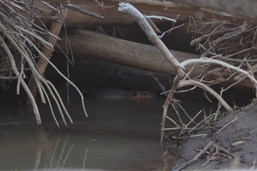
I was up early as usual and waited for the sunrise on the riverbank. I probably jumped two feet in the air when I heard an explosive splash to my left. After some investigating I realized the beaver we had seen last night was hanging out in what I thought was a log jam; it turned out to be a beaver lodge/house at the side of the river. I caught a picture of it looking annoyed before splashing off for good.
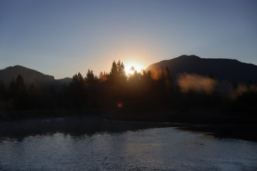
Sunrise on the river was nice.
Over breakfast Scott and I confirmed our intent to visit the waterfall on Falcon Creek. Hugh and Bob passed on this side trip and made some adjustments to the master plan of their own. Originally our group was going to hike to the general area of Hidden Creek in the Teton Wilderness, but after some discussion it was decided to cut down the mileage and find a new campsite when we felt it was right. Hugh and Bob were going to stop at the Thorofare Ranger Station first. We planned locations where we would meet (depending on the time) later in the day.
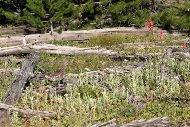
Scott and I headed West out of camp with cameras and bear spray, crossed the Yellowstone River, and navigated our way towards Falcon Creek. Our off trail route passed thru willows, groups of trees, and downfall. Just in case the coffee had not kicked in this grouse made sure we were awake and aware of our surroundings.
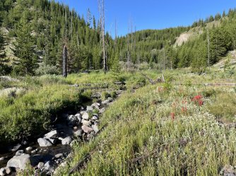
Falcon Creek! A channel of it anyway.
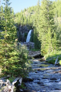
Once we found Falcon Creek it was a matter of walking upstream to what is known as "Isolation Falls."
Isolation Falls is one of the most remote waterfalls in all of Yellowstone. It drops 50 feet in a single plunge from a rocky conglomerate cliff. This was another destination that I had spent many days researching and thinking about. I am sure they are out there, but I was not able to find any pictures posted on the web of this waterfall. Wouldn't that be something if these were the first!
Scott and I could hear falling water long before having a visual. I remember walking out of a stand of trees and there it was. . . a magnificent sight!
Waterfall fever kicked in again and Scott and I each went our separate ways to investigate. We had just arrived but I knew right away making this side trip was the right thing to do. Isolation Falls was real and it was spectacular!
I started out on the North bank of Falcon Creek but eventually crossed it to take pictures from a number of different angles.
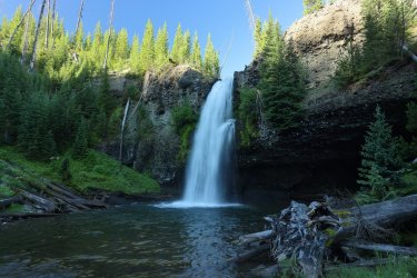
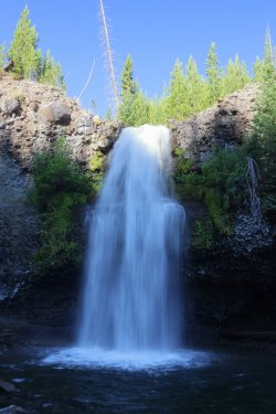
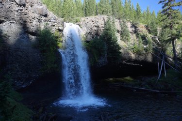
The sun was rising quickly and started to kiss the brink of the falls.
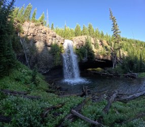
By the time we had to head back half of the waterfall was illuminated.
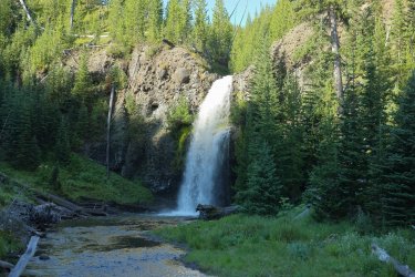
I have written these words before, but I would like to return here one day and spend some time hanging out around this waterfall. There is a large cavern at the back of the falls that a person could probably walk into. . . put that on my to-do list.
If you like the sight and sound of falling water, here is some video.
As much as Scott and I wanted to stay at the falls we knew we had to get moving if there was any chance of catching Bob and Hugh at the ranger station. We navigated back to the campsite, packed up our gear, and hit the trail at a brisk and determined pace.
Part of the journey to the Thorofare Ranger Station involved retracing our steps from yesterday. Heading away from Two Ocean Plateau.
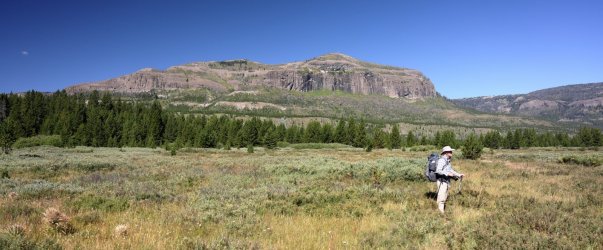
We hiked thru willows, thru stands of trees, and occasionally thru a clearing on the way to the ranger station. The clearings provided some nice views to the North.

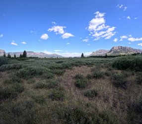
Getting Close!
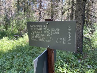
Getting Closer!
Would Hugh and Bob be there, or did we hang out too long at Isolation Falls?
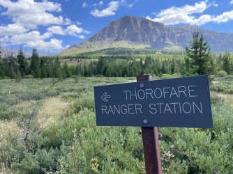
Made it!
We caught Hugh and Bob just as they were about to leave. In fact, Hugh had just mounted his pack and was walking down the porch stairs when I yelled for him to hold up. I bet he was thinking they should have left five minutes earlier.
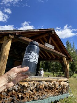
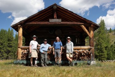
I wanted the group to be here. . . for a group picture of course.
You'll have to read Hugh's trip report to see the PG-13 rated version. Some might say his picture features our better sides.
Scott and I wrote our entries into the logbook then took some time to investigate the ranger station and the barn. Hugh and Bob headed down the trail knowing that we could probably catch up to them.
The station was unmanned, or at least it appeared to be. Perhaps the residents bolted the door when they saw us coming. . . can't say I'd blame them.
Scott and I left the Thorofare Ranger Station 15-20 minutes after Bob and Hugh had. We continued South on the Thorofare Trail and I could not help but notice how the environment gained a warmer/dryer feel.
A last look up into Yellowstone National Park before crossing into the Teton Wilderness.
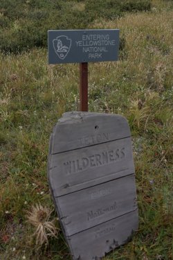
Park/Wilderness Boundary. I think one of the signs is facing the wrong way.
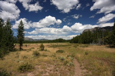
I was not sure what to expect going forward. This was my first time entering the Teton Wilderness. I was eager to see what lie ahead. The large cliffs to the left/center are like a giant wall on the Southern border of YNP.
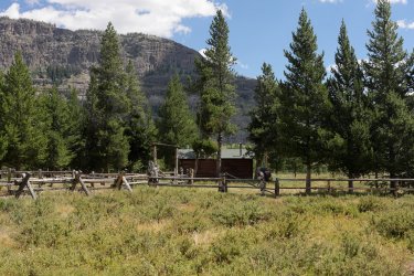
Hugh and Bob stopped at the Thorofare Patrol Cabin (not to be Confused with the Thorofare Ranger Station). Hugh was just leaving and you might catch a glimpse of Bob's blue shirt behind the fence.
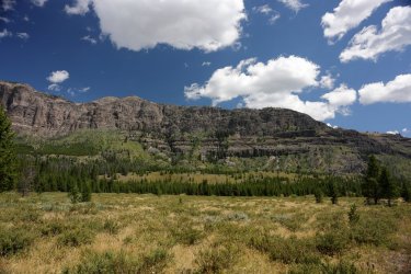
The wall between us and YNP.
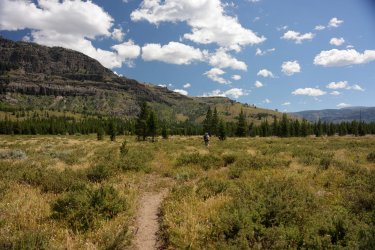
@scatman must have been feeling good today. Keeping up with him proved to be a challenge.
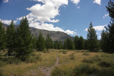
Looking back West. Scott and Bob are out there somewhere.
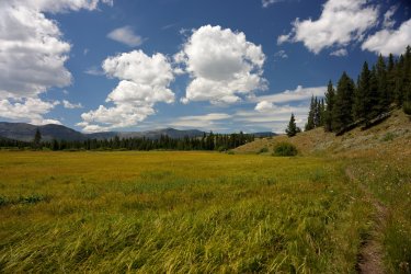
The low ground and willows surrounding Thorofare Creek began to appear on our right. Be prepared for a series of pictures that look similar but have a changing perspective as we progressed down the trail.
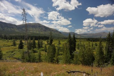
I am glad the trail does not lead us down into all those willows.
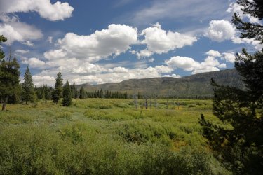
This picture may just be my favorite from the entire journey. I set the camera on a log (as a tripod) and tried taking a couple 400-megapixel images of this view. . . just in case I want to cover a wall in my house or office.
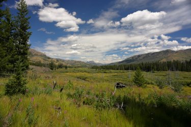
Of course you get a GoPro shot of a similar view.
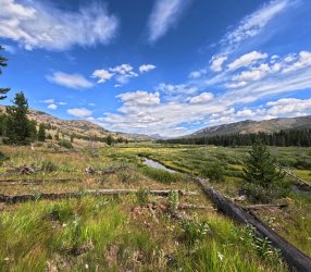
Starting to see the water of Thorofare Creek.
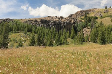
Some interesting geology to our left. Looks like the kind of place an old west outlaw might be hiding in.
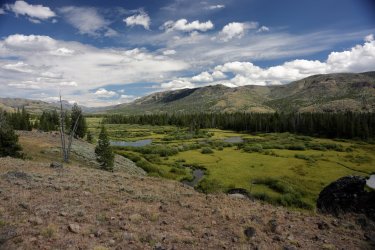
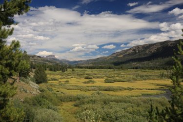
With a view like this, I would hide out around here too. This just might be my favorite picture of the trip. I'm allowed to have more than one favorite, right?
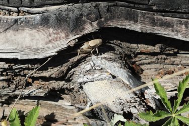
A Mormon Cricket.
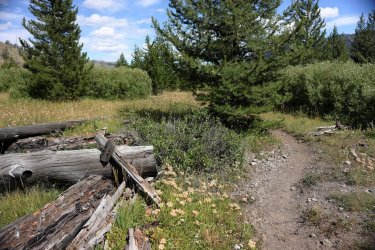
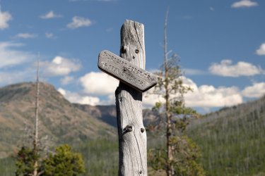
An old marker that simply says "Trail." Why write more than needs to be written.
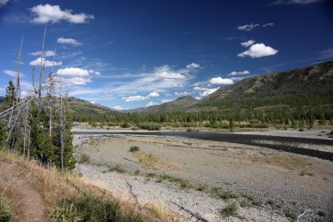
A clear view of Thorofare Creek.
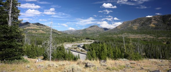
Gaining some elevation as we approach Open Creek.
Bob and Scott. . . solving the world's problems again.
Or are they just trying to decide which way to turn?
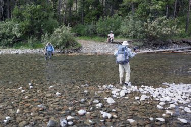
We took the right on the Thorofare Creek Trail, which led us a crossing of Open Creek. Bob took his shoes off this time.
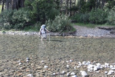
Upstream view of Open Creek.
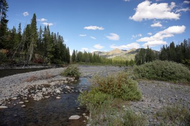
The makings of a nice campsite were found on the opposite bank of Open Creek, so we took advantage of it.
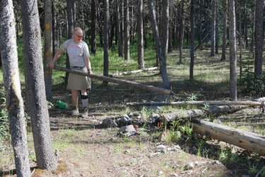
Hugh decided to get a fire going. It is not the size of the flame that matters, but the size of the stoker that is important.
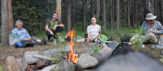
Supper by the fire. That Bob guy has a nice head of hair, doesn't he?
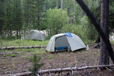
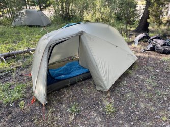
Home for night number four. Set up my tent facing the right way this time thanks to "door" being written on the footprint.
We had some time in the afternoon to relax and enjoy our surroundings. Exploring the creek bed found a number of tumbled petrified wood specimens. I added a couple pieces to the small pile that was already accumulated near the fire ring. Campsite TW1 (Teton Wilderness #1) was a good one.
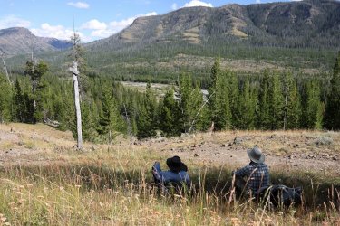
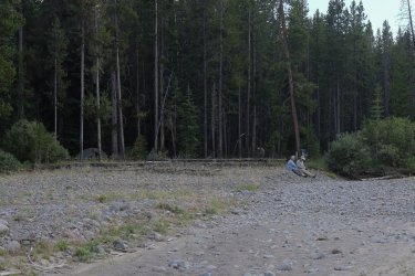
Scott and Bob watching for elk on the ridge across the creek.
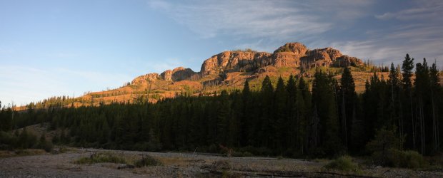
A view of what they were looking at.
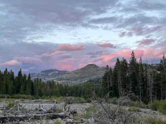
Upstream cell phone picture of some sunset color.
That concludes day four. Seeing Isolation Falls and the views up Thorofare Creek were highlights to another amazing day. My pack was getting lighter, my legs were still holding me up, and only two of the five camera batteries I had brought with me had been depleted. I was starting to feel confident that the time and effort I put into planning/training/packing would get me to Brooks Lake. . . even if we were not halfway there yet.
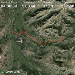
GPS Track from Day Four:
The End. (Of Day Four).
Day four ranks near the top when it comes to my favorite day of this trip. Each day was unique and had it's own special moments, but day four stands out. How you say? It all begins at campsite 6Y2 so let's start there.

We chose campsite 6Y2 to accommodate another of my adjustment requests to Hugh's plan. This campsite is one of the closest to Falcon Creek, and on Falcon Creek is another backcountry waterfall. We thought we might try to hike over to that waterfall on the afternoon of day three, but by the time we had arrived/set up camp we agreed it might be too much to squeeze in. Scott and I talked things over and decided to try a hike over to the falls in the morning. We had come all this way; it would be a shame to skip seeing a significant backcountry waterfall when we were so close.
I was up early as usual and waited for the sunrise on the riverbank. I probably jumped two feet in the air when I heard an explosive splash to my left. After some investigating I realized the beaver we had seen last night was hanging out in what I thought was a log jam; it turned out to be a beaver lodge/house at the side of the river. I caught a picture of it looking annoyed before splashing off for good.

Sunrise on the river was nice.

Over breakfast Scott and I confirmed our intent to visit the waterfall on Falcon Creek. Hugh and Bob passed on this side trip and made some adjustments to the master plan of their own. Originally our group was going to hike to the general area of Hidden Creek in the Teton Wilderness, but after some discussion it was decided to cut down the mileage and find a new campsite when we felt it was right. Hugh and Bob were going to stop at the Thorofare Ranger Station first. We planned locations where we would meet (depending on the time) later in the day.
Scott and I headed West out of camp with cameras and bear spray, crossed the Yellowstone River, and navigated our way towards Falcon Creek. Our off trail route passed thru willows, groups of trees, and downfall. Just in case the coffee had not kicked in this grouse made sure we were awake and aware of our surroundings.

Falcon Creek! A channel of it anyway.

Once we found Falcon Creek it was a matter of walking upstream to what is known as "Isolation Falls."
Isolation Falls is one of the most remote waterfalls in all of Yellowstone. It drops 50 feet in a single plunge from a rocky conglomerate cliff. This was another destination that I had spent many days researching and thinking about. I am sure they are out there, but I was not able to find any pictures posted on the web of this waterfall. Wouldn't that be something if these were the first!
Scott and I could hear falling water long before having a visual. I remember walking out of a stand of trees and there it was. . . a magnificent sight!

Waterfall fever kicked in again and Scott and I each went our separate ways to investigate. We had just arrived but I knew right away making this side trip was the right thing to do. Isolation Falls was real and it was spectacular!
I started out on the North bank of Falcon Creek but eventually crossed it to take pictures from a number of different angles.


The sun was rising quickly and started to kiss the brink of the falls.

By the time we had to head back half of the waterfall was illuminated.

I have written these words before, but I would like to return here one day and spend some time hanging out around this waterfall. There is a large cavern at the back of the falls that a person could probably walk into. . . put that on my to-do list.
If you like the sight and sound of falling water, here is some video.
As much as Scott and I wanted to stay at the falls we knew we had to get moving if there was any chance of catching Bob and Hugh at the ranger station. We navigated back to the campsite, packed up our gear, and hit the trail at a brisk and determined pace.
Part of the journey to the Thorofare Ranger Station involved retracing our steps from yesterday. Heading away from Two Ocean Plateau.

We hiked thru willows, thru stands of trees, and occasionally thru a clearing on the way to the ranger station. The clearings provided some nice views to the North.


Getting Close!

Getting Closer!
Would Hugh and Bob be there, or did we hang out too long at Isolation Falls?

Made it!
We caught Hugh and Bob just as they were about to leave. In fact, Hugh had just mounted his pack and was walking down the porch stairs when I yelled for him to hold up. I bet he was thinking they should have left five minutes earlier.

I wanted the group to be here. . . for a group picture of course.
You'll have to read Hugh's trip report to see the PG-13 rated version. Some might say his picture features our better sides.

Scott and I wrote our entries into the logbook then took some time to investigate the ranger station and the barn. Hugh and Bob headed down the trail knowing that we could probably catch up to them.
The station was unmanned, or at least it appeared to be. Perhaps the residents bolted the door when they saw us coming. . . can't say I'd blame them.
Scott and I left the Thorofare Ranger Station 15-20 minutes after Bob and Hugh had. We continued South on the Thorofare Trail and I could not help but notice how the environment gained a warmer/dryer feel.
A last look up into Yellowstone National Park before crossing into the Teton Wilderness.

Park/Wilderness Boundary. I think one of the signs is facing the wrong way.

I was not sure what to expect going forward. This was my first time entering the Teton Wilderness. I was eager to see what lie ahead. The large cliffs to the left/center are like a giant wall on the Southern border of YNP.

Hugh and Bob stopped at the Thorofare Patrol Cabin (not to be Confused with the Thorofare Ranger Station). Hugh was just leaving and you might catch a glimpse of Bob's blue shirt behind the fence.

The wall between us and YNP.

@scatman must have been feeling good today. Keeping up with him proved to be a challenge.

Looking back West. Scott and Bob are out there somewhere.

The low ground and willows surrounding Thorofare Creek began to appear on our right. Be prepared for a series of pictures that look similar but have a changing perspective as we progressed down the trail.

I am glad the trail does not lead us down into all those willows.

This picture may just be my favorite from the entire journey. I set the camera on a log (as a tripod) and tried taking a couple 400-megapixel images of this view. . . just in case I want to cover a wall in my house or office.

Of course you get a GoPro shot of a similar view.

Starting to see the water of Thorofare Creek.

Some interesting geology to our left. Looks like the kind of place an old west outlaw might be hiding in.

With a view like this, I would hide out around here too. This just might be my favorite picture of the trip. I'm allowed to have more than one favorite, right?

A Mormon Cricket.

An old marker that simply says "Trail." Why write more than needs to be written.

A clear view of Thorofare Creek.

Gaining some elevation as we approach Open Creek.

Bob and Scott. . . solving the world's problems again.

Or are they just trying to decide which way to turn?

We took the right on the Thorofare Creek Trail, which led us a crossing of Open Creek. Bob took his shoes off this time.


Upstream view of Open Creek.

The makings of a nice campsite were found on the opposite bank of Open Creek, so we took advantage of it.
Hugh decided to get a fire going. It is not the size of the flame that matters, but the size of the stoker that is important.

Supper by the fire. That Bob guy has a nice head of hair, doesn't he?

Home for night number four. Set up my tent facing the right way this time thanks to "door" being written on the footprint.


We had some time in the afternoon to relax and enjoy our surroundings. Exploring the creek bed found a number of tumbled petrified wood specimens. I added a couple pieces to the small pile that was already accumulated near the fire ring. Campsite TW1 (Teton Wilderness #1) was a good one.
Scott and Bob watching for elk on the ridge across the creek.

A view of what they were looking at.

Upstream cell phone picture of some sunset color.

That concludes day four. Seeing Isolation Falls and the views up Thorofare Creek were highlights to another amazing day. My pack was getting lighter, my legs were still holding me up, and only two of the five camera batteries I had brought with me had been depleted. I was starting to feel confident that the time and effort I put into planning/training/packing would get me to Brooks Lake. . . even if we were not halfway there yet.
GPS Track from Day Four:

The End. (Of Day Four).

