Yellowstone, Lamar River - August 2015

Jon Carbaugh

Member
.
Joined
Jul 8, 2015
Messages
251
On August 10th 2015 my wife Rose and I embarked on our first big, (big to us) rookie backpacking trip. We started at the Lamar River /Soda Butte trailhead. When we arrived at the trailhead the Wolfwatchers were out in full force so we had to wait over an hour until someone left to get a parking spot. When we did finally get on the trail we came upon the Wolfwatchers within a little less than a half mile on Soda Butte creek all looking to the north with huge binoculars and spotting scopes. They said they had had been following a pair of wolves on the west side slopes of Druid Peak and a large male grizzly on the east side.

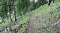
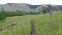
I feel a little explanation is in order first as to why I am posting this with the video and only a few pictures. I purchased a Sony Handycam HD camcorder for the trip and took several still pictures at home that looked really good. Believing that I could record HD video and take good still shots with this one camera, I opted to leave the Cannon SLR in the truck. This was a mistake that I will not duplicate. As you will see, the pictures are not good at all. My cell phone takes much better pictures that this. So I’ve included the video that was really for the friends and family that thought we were crazy to want to do this.


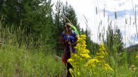
At the trailhead
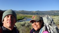
Day 1 A1 Rose and I at Strat of Hike.jpg
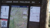
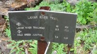
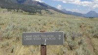
Day 1 A2 Lamar River Trail Board.JPG

Some bison grazing in the valley. Druid Peak in the background.
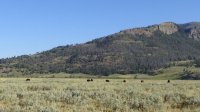
Day 1 A3 Bison Near Trail.JPG

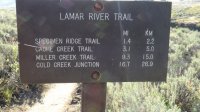
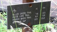
Day 1 A3 Lamar River Trail Marker.JPG

Looking to the east with the morning sun.
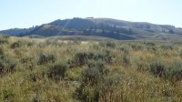
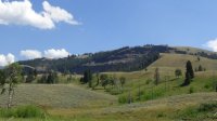
Day 1 A4 A Hills On Lamar Valley.JPG

The first trail marker before Cache Creek
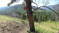
Day 1 A4 First Trail Marker.JPG

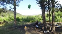
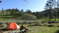
Tent setup at campsite 3L4 on our first night. The Lamar River is just a few yards behind me taking the picture.
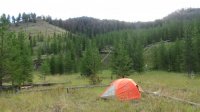
Day 1 A5 Campsite 1 3L4.JPG

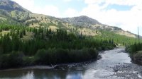
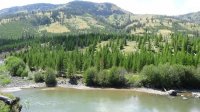
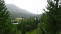
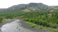
Day 2 was another beautiful day, sunny and warm. Looking south up the Lamar River.
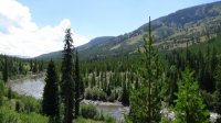
Day 2 A1 Lamar River 1.JPG

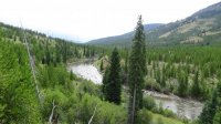
looking north back towards the valley.
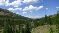
Day 2 A3 Lamar River 5.JPG

Day 2 A5 Lamar River 2.JPG

Day 2 A6 Lamar River 3.JPG

Day 2 A7 DSC00696.JPG

Day 2 A8 DSC00697.JPG

Taking a break out of the sun before reaching camp for night 2.
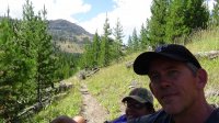
Day 2 Trail Break.JPG

A jawbone at campsite 3L8, unfortunately I have no other pictures from this campsite, only video. When we arrived at this camp on our second night, we hung the food bag and immediately headed down to the river to filter water. As soon as we stepped out onto the small beach near the river we looked to the left and saw a large black bear was also coming down to the river about 50 to 60 yards away. I immediately thought of pulling out the video camera, nope... it's in my backpack at the food prep area! I asked Rose to get it while I kept an eye on the bear, however she was not inclined to leave my side at that time. I'm sure thoughts of Lance Crosby, who had been attacked and killed by a grizzly bear only a few days before we began our trip, held her a bit hostage. I clapped so he would notice us and he looked over and seemed unaffected by our presence other than taking a little sharper angle towards the river where he crossed and headed up into the tree line on the other side. We were both a little freaked out the rest of the evening and kept our heads on a swivel.
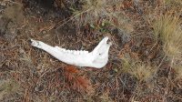
Day 3 A1 3L8 Jawbone.JPG

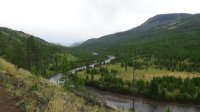
Day 3 started out overcast and was a welcomed change from the heat and sun of the previous two days. Heading back down river towards the valley.
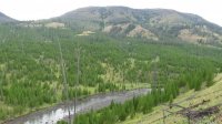
Day 3 A4 DSC00701.JPG

We were eventually rained on a little, nothing very heavy.
Day 3 A5 Lamar River 4.JPG

Day 3 A6 DSC00705.JPG

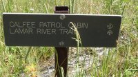
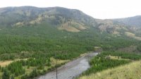
Calfee Creek patrol cabin in the lower right side.
Day 3 A7 A Calfee Creek Patrol Cabin.JPG

Day 3 A7 B Patrol Cabin Marker.JPG

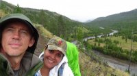
Day 3 A8 Rose n Jon 1.JPG

Day 3 A10 DSC00717.JPG

Day 3 A11 DSC00720.JPG

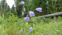
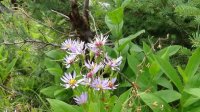
There were many flowers blooming on the side of the trail and in the meadows.
Day 3 A12 DSC00725.JPG

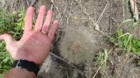
We have dandelions in Georgia, but not near this large!
Day 3 A13 DSC00727.JPG

Day 3 A14 DSC00728.JPG

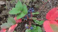
Does anyone know what these berries are?
Day 3 A15 DSC00732.JPG

Day 3 A16 DSC00733.JPG

Day 3 A17 DSC00736.JPG

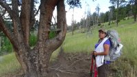
A wild looking tree just before reaching Cache Creek.
Day 3 A18 DSC00738.JPG

Day 3 A19 Lamar River 5.JPG

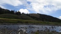
Cache Creek. Our campsite for the night 3L1 is just on the other side.
Day 3 A20 Cache Creek DSC00741.JPG

The food prep area at campsite 3L1.
Day 3 A21 Camp site 3L1.JPG

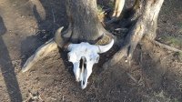
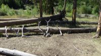
The campsite comes with a bison skull and several Elk antlers.
Day 4 A1 Bison Scull 1.jpg

I found some antlers in the brush near the river, along with a lot other elk bones from a carcass, and added them to the collection.
Day 4 A2 DSC00759.JPG

Tent site on the morning of day 4.
Day 4 A3 CS 3L1 Tent.JPG

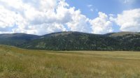
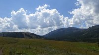
Looking back up the Lamar River, almost back to the valley.
Day 4 A4 DSC00770.JPG

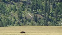
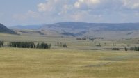
A lone bison in the valley grazing.
Day 4 A5 DSC00781.JPG

Day 4 A6 Lamar valley.JPG

Day 4 A7 Lamar Valley 3.JPG

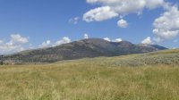
Druid Peak
Day 4 A8 Druid peak.JPG

Day 4 A9 Last trail mark.JPG

Day 4 A10 hike out.JPG

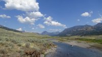
Back at Soda Butte creek and the truck. Sad that it is over, but we had a great time and are looking forward to many more adventures.
Day 4 Lamar River TH Soda Butte Creek.JPG

Here is a link to the video. Cheers!

 
Last edited:
Nice trip photos! Looks like you had a great time. A great trip for your first backpack, congrats!

To clarify, that is not a dandelion, it is salsify (Tragopogon dubius). Same family, entirely different species. It is non-native to the U.S.

The berry is creeping Oregon grape (Berberis repens), a small shrub. It is edible but not real good, not poisonous either. Apparently some people make jam out of it. Grouse and other small animals eat the berries, as do bears. Elk, deer, moose, bighorns, mountain goats feed on the leaves some.
 
Last edited:
Nice trip photos! Looks like you had a great time. A great trip for your first backpack, congrats!

To clarify, that is not a dandelion, it is salsify (Tragopogon dubius). Same family, entirely different species. It is non-native to the U.S.

The berry is creeping Oregon grape (Berberiso repens), a small shrub. It is edible but not real good, not poisonous either. Apparently some people make jam out of it. Grouse and other small animals eat the berries, as do bears. Elk, deer, moose, bighorns, mountain goats feed on the leaves some.

Thank you @Outdoor_Fool ! Yes, we had an awesome trip! We were quite intimidated at first, Yellowstone is vastly different in scale that what we are used to, but that quickly faded away and the peace of it all took over. Thanks also for the clarification and information on the salsify and creeping Oregon grape. Do you know if the salsify leaves are edible like dandelion? I don't really plan on eating it necessarily, but it's good to know. ;)
 
Really well done, thanks for sharing. If you come to Jackson great Georgia bartender at the Silver Dollar.

Thanks @Absarokanaut we will definitely be there again soon and will check it out. I wonder if it's someone I've seen around Atlanta in the past 24 years... :)
 
The roots, leaves and flowers are edible but are better at various stages of plant development. There's plenty of sources for this on the web.

I am not knocking your trip at all but continuing over Mist Creek Pass and down into Pelican Valley to the road is a great trip also. Tough to do with only one vehicle, though. Again, great job and what an awesome first backpack.
 
I am not knocking your trip at all but continuing over Mist Creek Pass and down into Pelican Valley to the road is a great trip also. Tough to do with only one vehicle, though. Again, great job and what an awesome first backpack.

Well, it's funny you say that actually... I left a lot out in the TR. The original plan was to start at fishing bridge and do the route you just mentioned backwards. I sent the request in on April the 1st at 6:00 am eastern time and when I received my confirmation letter we did not get either of the 2 Mist Creek meadows campsites and our first night was on Cold Creek 17+ miles from that direction. Unless those campsites were just closed, I have no idea how neither of those were available for us, I imagine I had to have been close to the first request. Anyway, I didn't know if my wife could, or would want to, handle that, and being the rookie that I am I opted to just go the shorter 15 miles from the Lamar Valley to Cold Creek and end up back at the truck when done. In hind sight, it was probably more difficult to go up the Lamar River like we did. It was slow going and when I told her how far we still had, she was getting a little freaked. We ended up turning around and going back to 3L4 so not to give her a panic attack, I really didn't want to turn her off to hiking because of this. The next day we headed on up to where our 2nd night was supposed to be at 3L8... We learned a lot, we had underestimated the altitude and overestimated our abilities. But it all worked out in the end. We're both dedicated to go back and do that original route we planned in the future after we move out west. :twothumbs:
Thanks again. Cheers
 
Sorry it did not work out for you but you made a lot of great decisions concerning your experience and abilities. Nice work. You both look so happy on the trail.

FYI, on my annual trips to the Yellowstone area, I only plan 6-8 miles the first day to let my legs and back become accustomed to carrying a pack and my lungs a slight adjustment to the altitude (probably more mental than real). As the days go by and my pack becomes lighter, I can increase the mileage substantially. I live at 400 feet elevation and moving up to 7000 - 8000 feet is a challenge.
 
@Jon Carbaugh - Nice report! It looks like you both had a great trip. I watched your video last night and it looks like you ran into a few bison along your route. It's always great to have them keep you company while in the Yellowstone backcountry. It's neat that you got to see a black bear too. It's always the highlight of my trips if I get to see a bear. How were the mosquitoes along the Lamar in August? Did you happen to look to the west on your way down the Lamar and see how steep of a climb we are going to have to do to get up onto the Mirror Plateau this coming July! :) By the way, I'll be sending off the request for a permit in about three weeks.

Thanks for sharing!
 
Thanks @scatman ! Yes, lots of bison, it was great. Those few on the trail early on were running down the trail right at us! We went off trail up the hill and luckily they went down the hill. We had almost no mosquitoes at all surprisingly, some flies were around, but that's about it. I did look over towards the Specimen Ridge trail, and was dreaming about going up to the Mirror Plateau even then. I can't wait until July! It really didn't "look" all that bad, and I'm sure I'll be eating those words come July coming from my 1,200 ft out here... :) I think it's about 2,400 ft gain in about 3 miles if I'm not mistaken? It'll be tough! That long day hike the day before will hopefully help in getting acclimated. :thumbsup:
Thanks again sir!
 
Similar threads
Thread starter Title Forum Replies Date
travel2walk Lamar River, Pelican Valley, & Speciman Ridge loop - Yellowstone, Jun 29 to Jul 3, 2021 Backpacking 15
BackpackingtheSierras Republic Pass Trail North Absaroka into Yellowstone Cache Creek and Lamar River Trip Planning 1
beaver-one Yellowstone advice: Lamar River - Pelican Valley - Mirror Plateau loop this summer Trip Planning 6
TheMountainRabbit Lamar River, Mirror Plateau, and Pelican Valley (Yellowstone NP) - mid-September 2020 Backpacking 28
scatman Mirror Plateau and the Lamar River Loop - Yellowstone National Park - July 7, 2016 Backpacking 38
scatman Invite Mirror Plateau - Upper Lamar River - Hoodoo Basin - Yellowstone National Park Meet Up (Members Only) 27
Joey Yellowstone's Lamar River, Hoodoo Basin, and Eastern Boundary Loop Backpacking 24
H Yellowstone/Beartooths Mid-July - Lamar Valley or Bearthooths? Or something else? Trip Planning 6
isaac Yellowstone NP Campsite Reccs Trip Planning 3
Bob Island Park / Yellowstone Private Airport Development General Discussion 8
TheMountainRabbit News Release: Yellowstone National Park increases protection for bears and visitor safety by implementing changes to two bear management areas General Discussion 14
TractorDoc Yellowstone's Gallatin River -- September 7-9th 2023 Backpacking 12
wsp_scott Yellowstone Lake to Brooks Lake (Aug 2023) Backpacking 16
TractorDoc Yellowstone's Thorofare and the Teton Wilderness 08/09/2023 - 08/18/2023 Part Nine / Day Nine + Ten! Backpacking 20
TractorDoc Yellowstone's Thorofare and the Teton Wilderness 08/09/2023 - 08/18/2023 Part Eight / Day Eight Backpacking 14
TractorDoc Yellowstone's Thorofare and the Teton Wilderness 08/09/2023 - 08/18/2023 Part Seven / Day Seven Backpacking 13
TractorDoc Yellowstone's Thorofare and the Teton Wilderness 08/09/2023 - 08/18/2023 Part Six / Day Six Backpacking 28
TractorDoc Yellowstone's Thorofare and the Teton Wilderness 08/09/2023 - 08/18/2023 Part Five / Day Five Backpacking 16
LarryBoy Select Peaks of the Greater Yellowstone - Second Edition (coupon code for pre-order) General Discussion 12
TractorDoc Yellowstone's Thorofare and the Teton Wilderness 08/09/2023 - 08/18/2023 Part Four / Day Four Backpacking 15
scatman The Gallatin River, Bighorn and Fawn Passes, Yellowstone National Park - September 7, 2023 Backpacking 14
TractorDoc Yellowstone's Thorofare and the Teton Wilderness 08/09/2023 - 08/18/2023 Part Three / Day Three Backpacking 10
TractorDoc Yellowstone's Thorofare and the Teton Wilderness 08/09/2023 - 08/18/2023 -- Part Two / Day Two Backpacking 6
TractorDoc Yellowstone's Thorofare and the Teton Wilderness 08/09/2023 - 08/18/2023 --Part One / Day One Backpacking 10
scatman Yellowstone's Thorofare, Headwaters of Thorofare Creek, Majo Pass, Younts Peak, Bob's Canyon, and Cub Creek - August 9, 2023 - Days 7 through 10 Backpacking 34
scatman Yellowstone's Thorofare, Headwaters of Thorofare Creek, Majo Pass, Younts Peak, Bob's Canyon, and Cub Creek - August 9, 2023 - Days 1 through 6 Backpacking 56
F Hat Recovered-Yellowstone Backcountry General Discussion 0
J South Crandall Creek and the Hoodoos Wyoming and Yellowstone? Trip Planning 3
RockyMntCol Trip Planning Younts Peak / South Fork Yellowstone Trip Planning 12
F Shakedown - Yellowstone Thorofare Trip Planning 13
Rockskipper @Bob or anyone know why they closed down part of the forest near W. Yellowstone? General Discussion 6
I Rescue Creek - Yellowstone National Park - June 3, 2023 Backpacking 15
Bob Bear charge - Yellowstone General Discussion 1
scatman Rescue Creek - Yellowstone National Park - June 3, 2023 Backpacking 56
I Slough Creek - Yellowstone June 5 & 6 Meet Up (Members Only) 19
Bob Yellowstone 5/8/23 - UPDATE General Discussion 9
Parashakti Late July in Yellowstone Trip Planning 9
scatman Rescue Creek - Yellowstone National Park Meet Up (Members Only) 19
E Weeklong+ backpacking recs in Yellowstone NP? Trip Planning 11
Jackson Yellowstone Backcountry Lottery Results General Discussion 45
BobFink Yellowstone South Entrance to Fox Creek via Basin Creek Cutoff - Labor Day 2022 Trip Reports 4
Bob Snakes in Yellowstone General Discussion 11
shredhiker Yellowstone Heart Lake September 2022 Backpacking 9
Janice Yellowstone Yurt Camp - Feb. 19-23, 2023 Trip Reports 15
TheMountainRabbit Northern Yellowstone NP - January 2023 Winter Sports 6
Ymyr Suggestions in a Yellowstone and a Beartooth trip Trip Planning 29
scatman A Yellowstone Love Story (Bog Creek Euphoria) - September 12, 2022 Backpacking 28
TractorDoc Yellowstone's Wrangler Lake, Bog Creek, Joseph's Coat Springs, Broad Creek, Wapiti Lake, Hot Springs Basin, and Pelican Valley. The Second Half. Backpacking 15
Georgia Yankee Where to see/hear wolves Yellowstone NP backcountry in September? Trip Planning 16
TractorDoc Yellowstone's Wrangler Lake, Bog Creek, Joseph's Coat Springs, Broad Creek, Wapiti Lake, Hot Springs Basin, and Pelican Valley. Part One of Two. Backpacking 61

Similar threads

Back
Top