- Joined
- Jul 23, 2013
- Messages
- 1,666
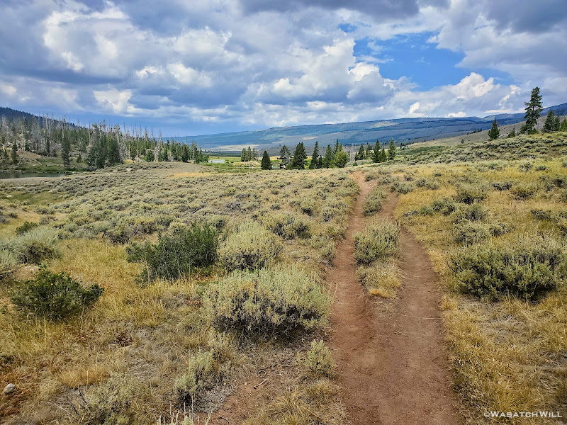
All good things come to an end. Today was our last day and it was set up to be less dramatic, mostly through a long green tunnel to our exit, or was it?
Thursday - July 29, 2021
Day 7: Beaver Park to Green River Lakes
MILES: 10 | GAIN: 735 ft
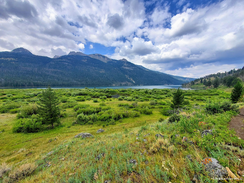
As expected, I woke up to tons of condensation on my tent. There simply was no escaping it with how wet the ground was from the rainstorm the previous day. Typically, I don't have issues with the silnylon material my Tarptent Notch is made. It generally does its job and does it well, but a weak point of the fabric is that it can absorb moisture, especially in heavily humid environments. This last camp became one of those rare times in the usually dry and arid mountain west climate that it would do so. In fact, it's actually one of the only times I've ever had to pack out a wet tent. Had we hung out a little longer, we would have gotten enough sun to actually dry it out before packing it up, but we were down in a canyon and eager to get back to the trailhead sooner than later. Rather than packing lesser weight out than the night before, I'd be packing out about the same with the added moisture content. Boo! Fortunately, only ten miles remained and those ten miles were rather flat and somewhat downhill.
Easy coasting, relatively speaking.
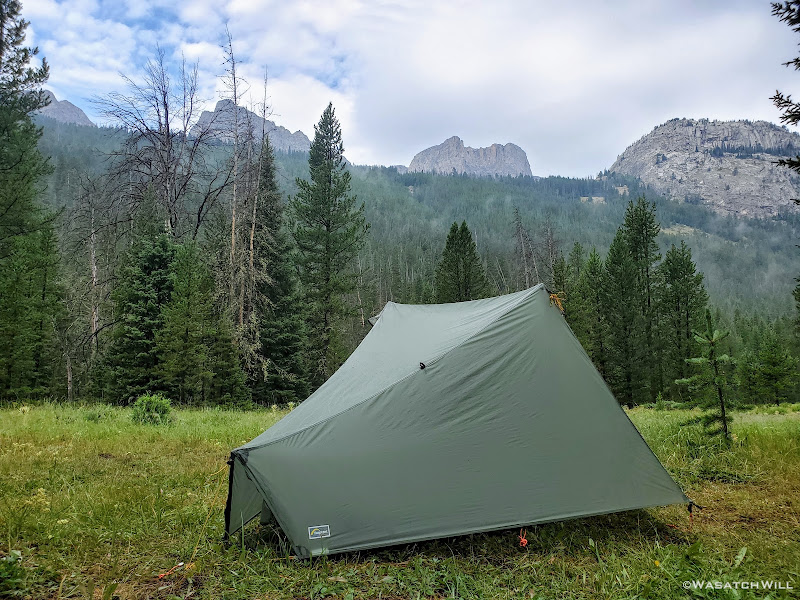
Morning at Beaver Park
Looking upstream of Green River
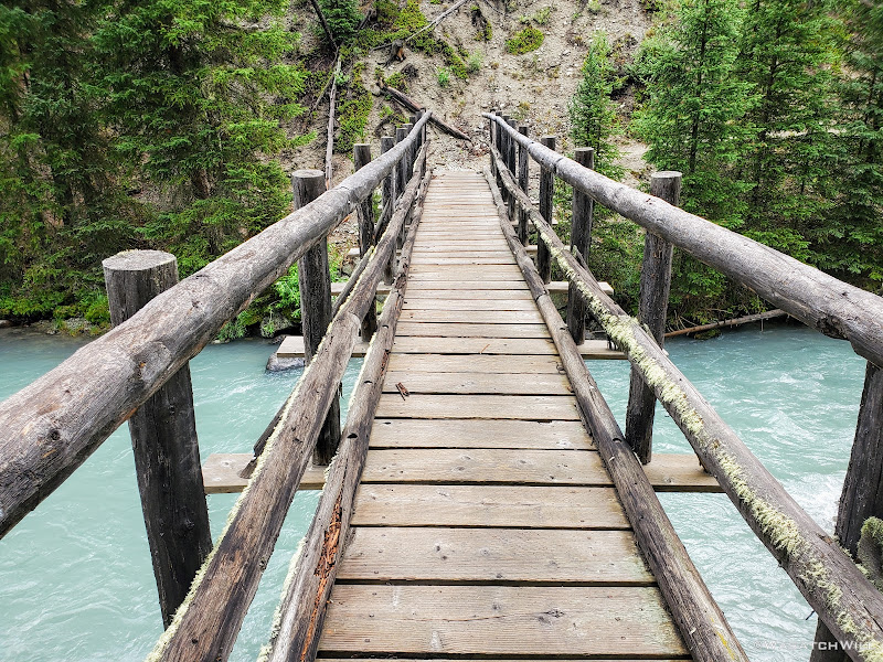
Bridge over the Green River
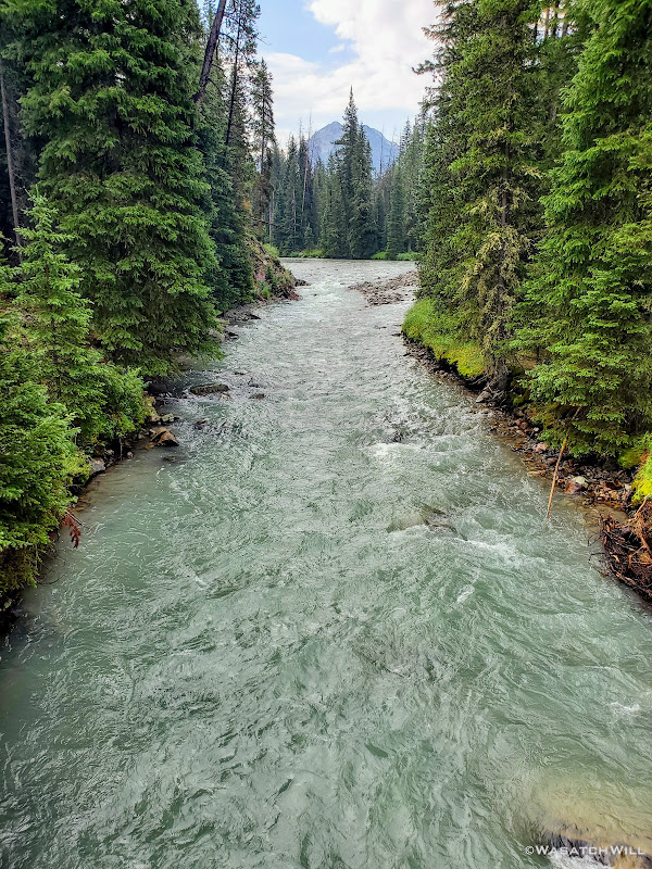
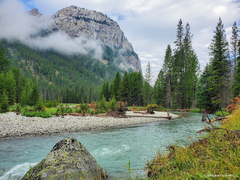
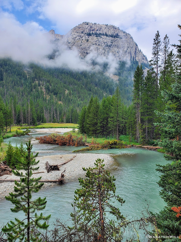
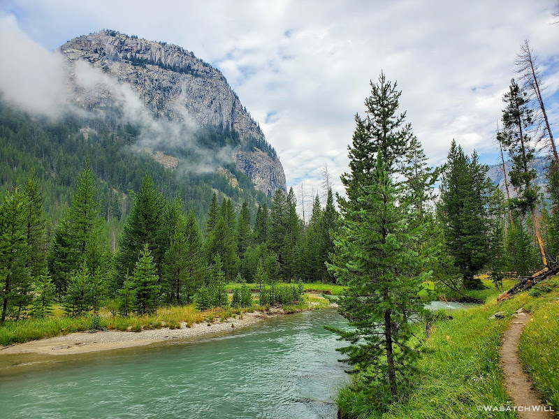
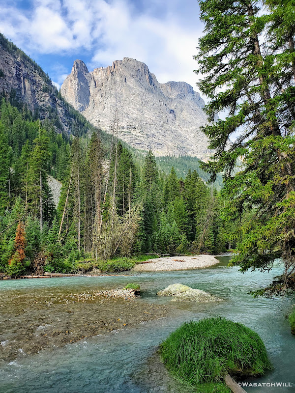
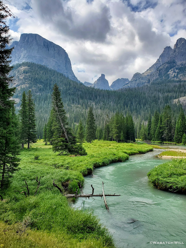
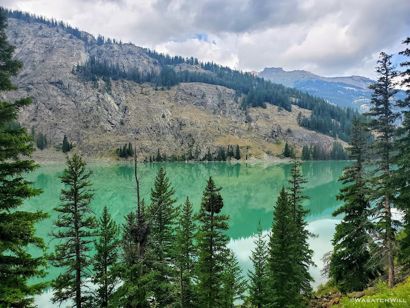
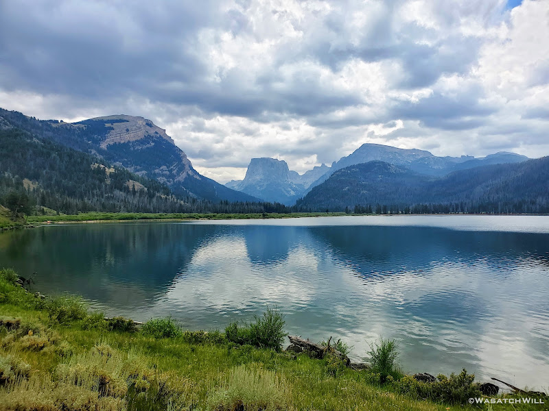
Shortly after leaving our last camp behind us, we were treated to a dazzling view of Granite Peak with clouds drifting across its face and the bright turquoise waters of the Green River flowing beneath. It was both a misty and mystical view.
Granite Peak and the Green River
Portrait shot of Granite Peak and Green River
Looking back upstream with some unknown or unnamed peaks above
Granite Peak, Green River, and the trail
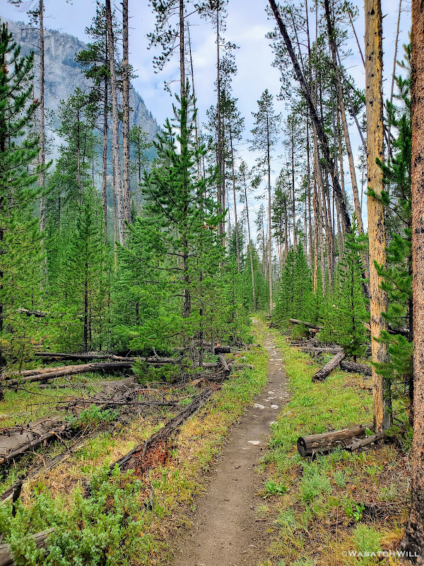
Into the woods!
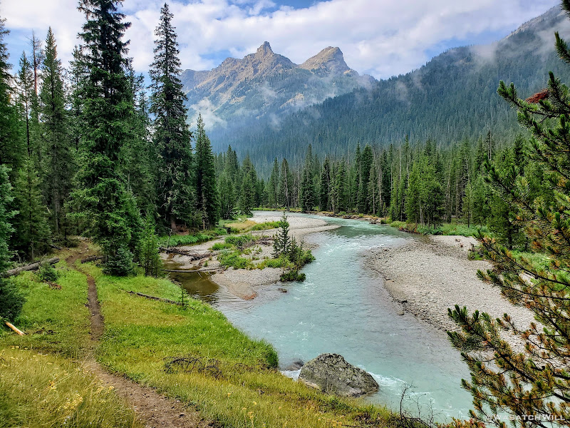
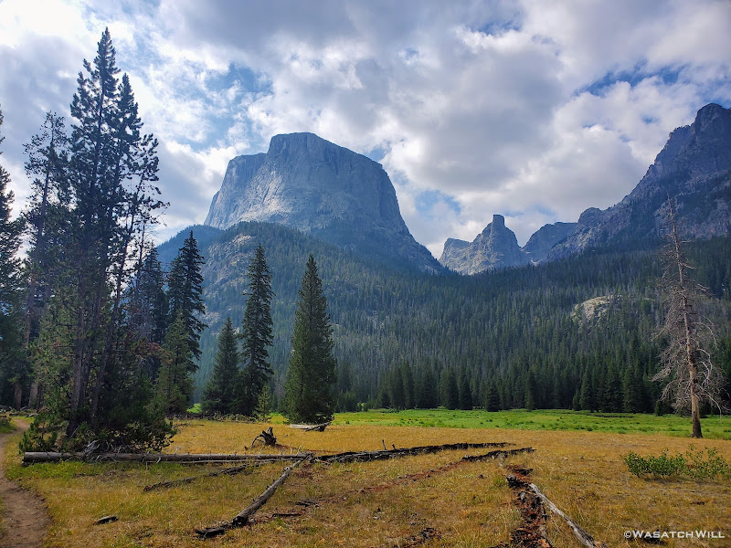
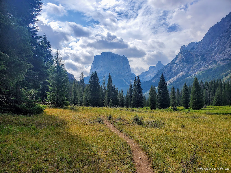
A little while later, after passing through a section of trees, the back side, er south side, of Square Top came into view. It made for another picturesque spot worthy of pausing for a few moments to soak in the view.
Squaretop Mountain
Back into a more forested section, I found a patch of clover. Unknowingly, I managed to capture one of the four-leaf variety. Lucky Day! I took a few moments to capture some of the other bits of plant life to be found along the forest floor.
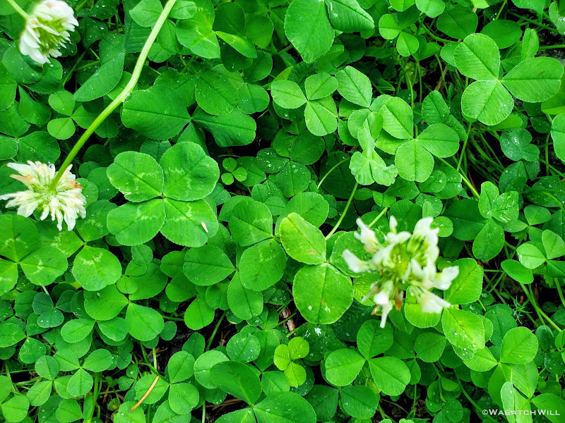
Clover patch w/ four-leaf clover
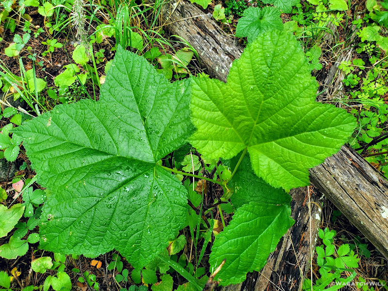
Thimbleberry (edible fruit)
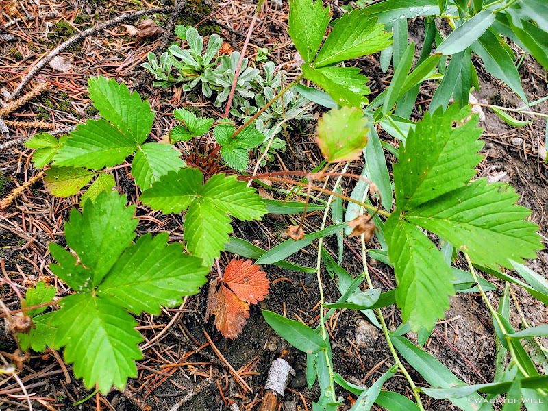
Alpine Strawberry (edible fruit)
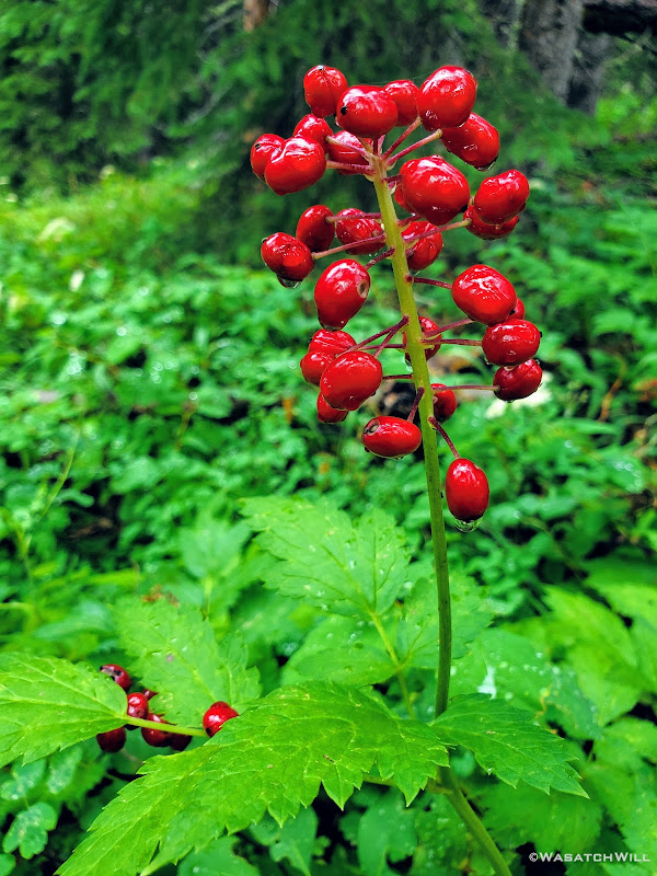
Red Baneberries (NOT edible!!!)
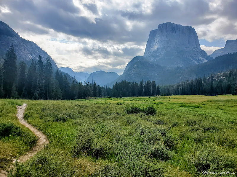
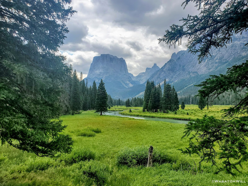
After drifting through the forest for a good bit, we emerged into more clearings where we could now look back up and start to see the more typical view of Squaretop Mountain from the north. This would be a prominent landmark to look back upon for the remainder of our course. The Green River also continued to meander on through lush green meadows as it made its way for the two large lakes sharing the same namesake.
Clouds loom above Squaretop Mountain and the Green River
Squaretop Mountain from across the meadows
Looking back uptrail to Squaretop
Another shot uptrail looking at the iconic Squaretop Mountain
Further down I looked down at a plant and had to a do a double-take because its leaves stood out to me as something known for its...uhhh...medicinal properties. While this plant does appear to be a great doppelganger look-alike of the more well-known celebrity plant, Mary Jane, I believe what I was looking at was actually a flowering plant called Slender Cinquefoil, or Potentilla gracilis to be more scientific. I could be wrong though.
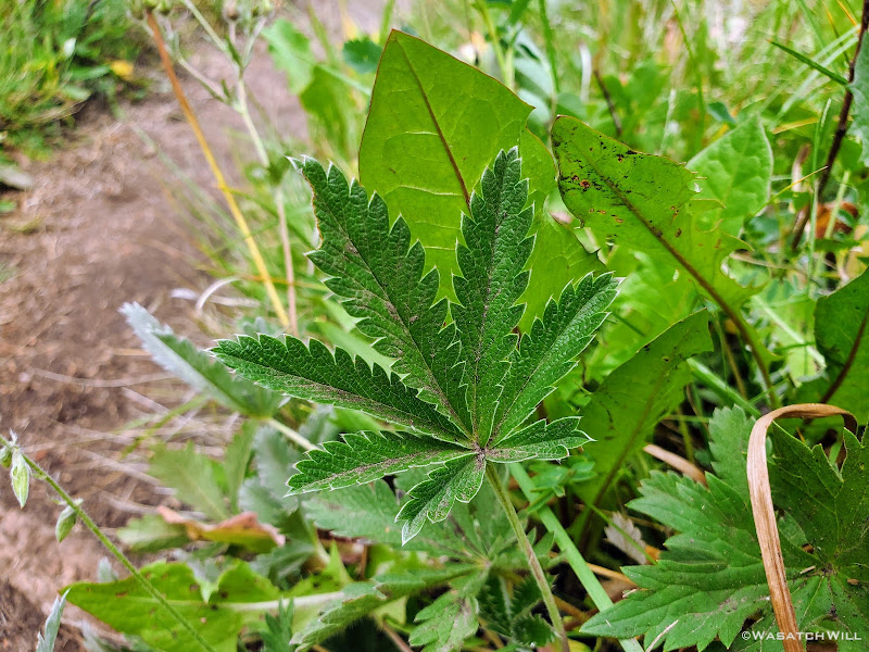
Slender Cinquefoil (Potentilla gracilis)???
We continued on between patches of forest, meadows, open views of the river and occasional glances back to Squaretop.
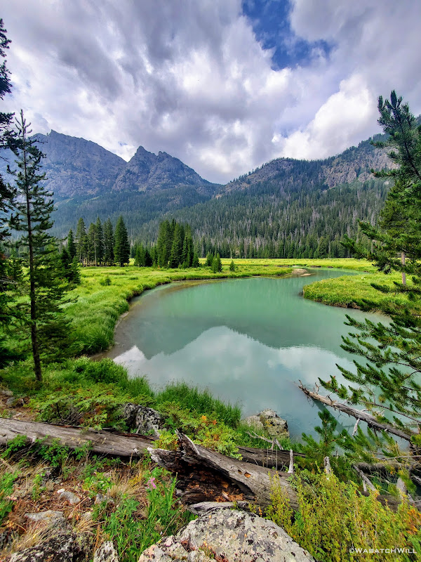
Green River reflection
Squaretop from across lush green meadows
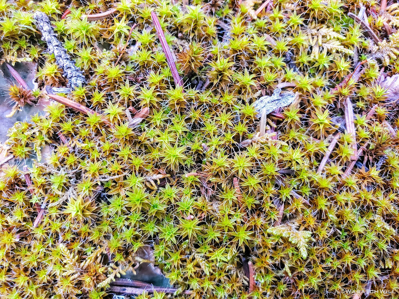
Star Moss - Syntrichia ruralis
A sure sign of being closer to the trailhead, upper Green River Lake now came into view. We continued down the trail skirting around its eastern shore. Along this corridor and the rest of the way out, we'd start to see a few more people. We were now within suitable distance for an average day-hiker.
Upper Green River Lake
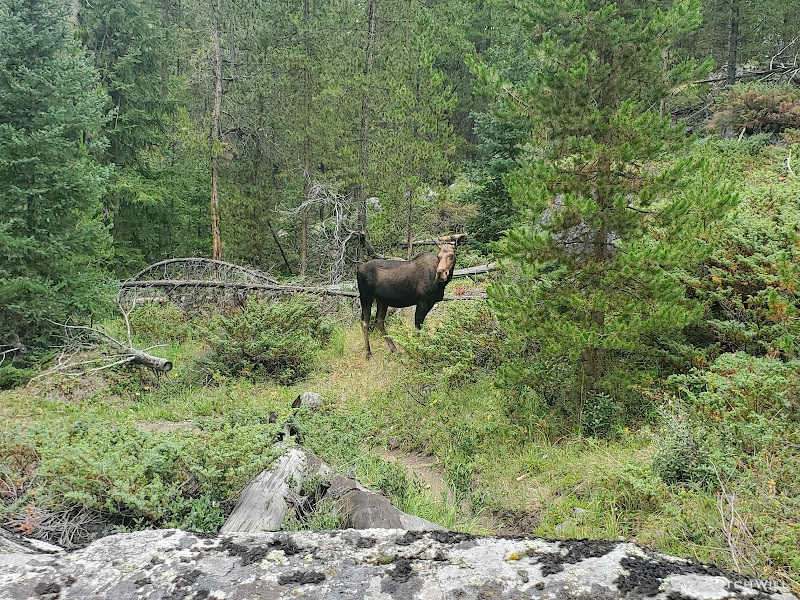
Between the upper and lower of the Green Lakes, we finally got to see our first wildlife sighting of an animal larger than a marmot, a moose cow. Content to occupy the trail while it continued to eat its lunch, we ended up surrendering the trail and veering off to scramble over some down logs followed by a bit of bushwhacking to get around the moose and back on trail beyond it.
Moose on the loose
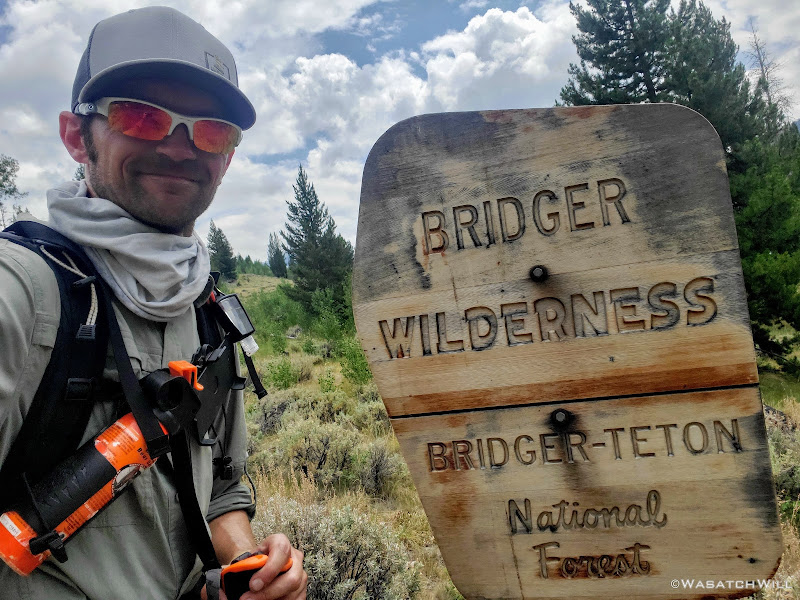
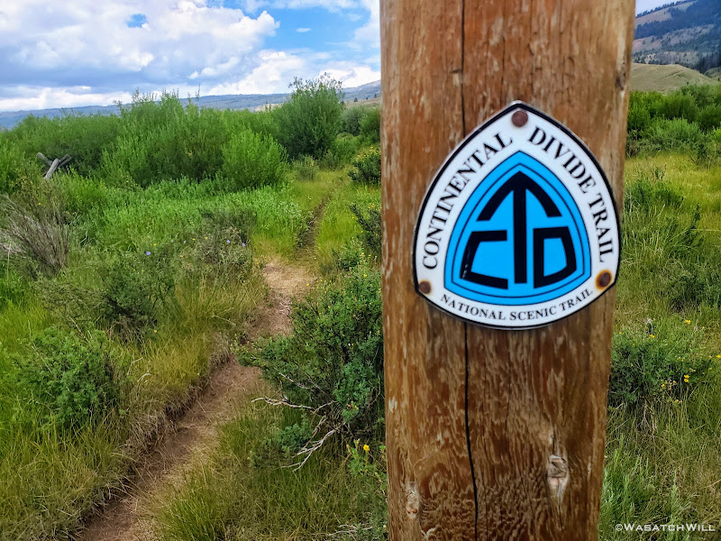
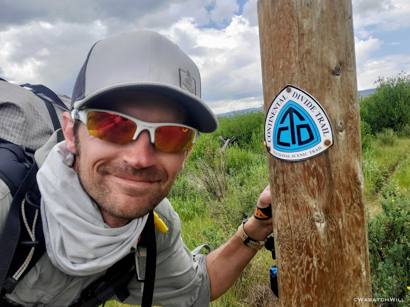
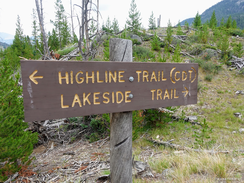
At this point, CDT markers started showing up along the trail. CDT stands for Continental Divide Trail and it sure was fun to be able to say I hiked the CDT...even if it was only a small sliver of it amounting to a section that was only a few miles long.
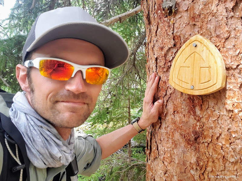
CDT selfie
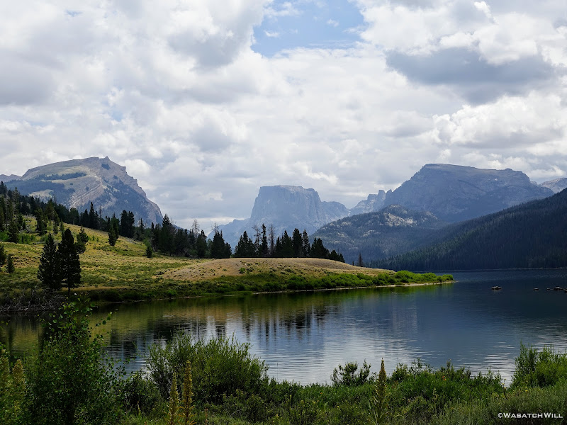
And then, there it was, the lower and larger of the Green River Lakes came into view. The trailhead and my car awaited us on the opposite end. You could say we were now on the homestretch with a good two and a half miles to go to wrap it all up.
Lower Green River Lake out in the distance
Look back at Squaretop from along lower Green River Lake
Exiting the wilderness boundary
The trailhead now in view
Still on the CDT
Another CDT selfie
Now around the long and large lake but prior to arriving at the trailhead, I stepped off trail for a few minutes to check out the old
Osborn Homestead. What a place for someone to have been able to call home at one point!
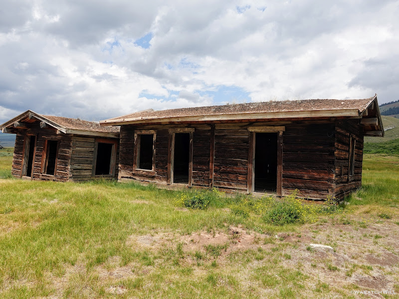
Osborn Cabins
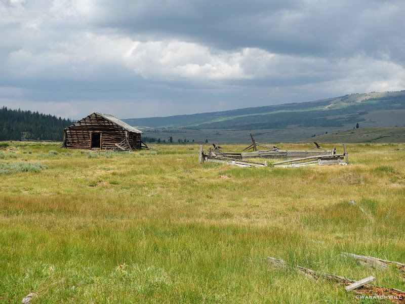
Another cabin out a little further out
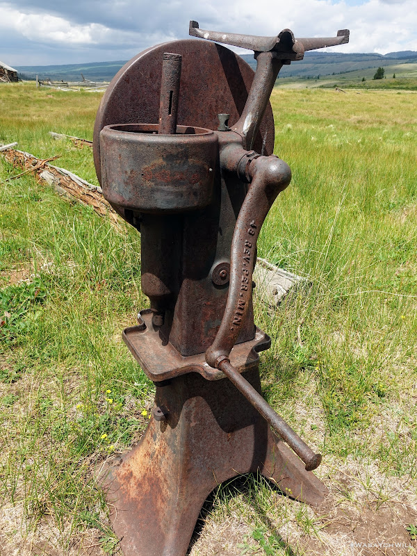
Some sort of old pump or cream separator?
However, when it came to the outhouse for this old settlement, I think an opportunity was missed here. Turn this outhouse around to face ol' Square Top Mountain and you'd have a classic 'loo with a view while you poo'. Not only that, but it'd also have exposure to the southern sun to warm that seat up a bit in the winter. Why it was built to face the north, I'll never know. Had this been my land, I would have been certain to turn it around to behold the view of Squaretop out in the distance.
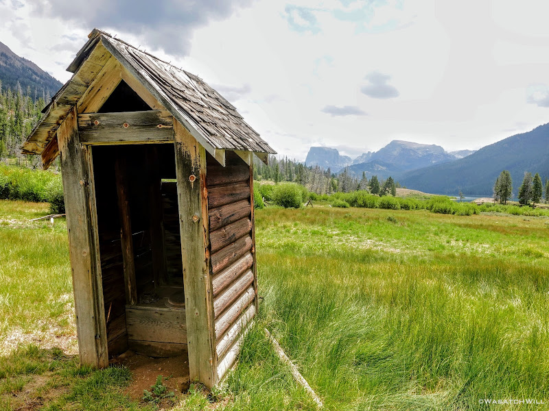
A loo and a view
Squaretop Mountain...again
At last, we arrived at the trailhead and my 4Runner, all safe and sound. I did not get any photos at the actual trailhead though. Guess I was just exhausted to think of it while also being more focused on documenting the end on video.
Back on the Highline Trail...I mean the CDT...wait, where are we!?!?
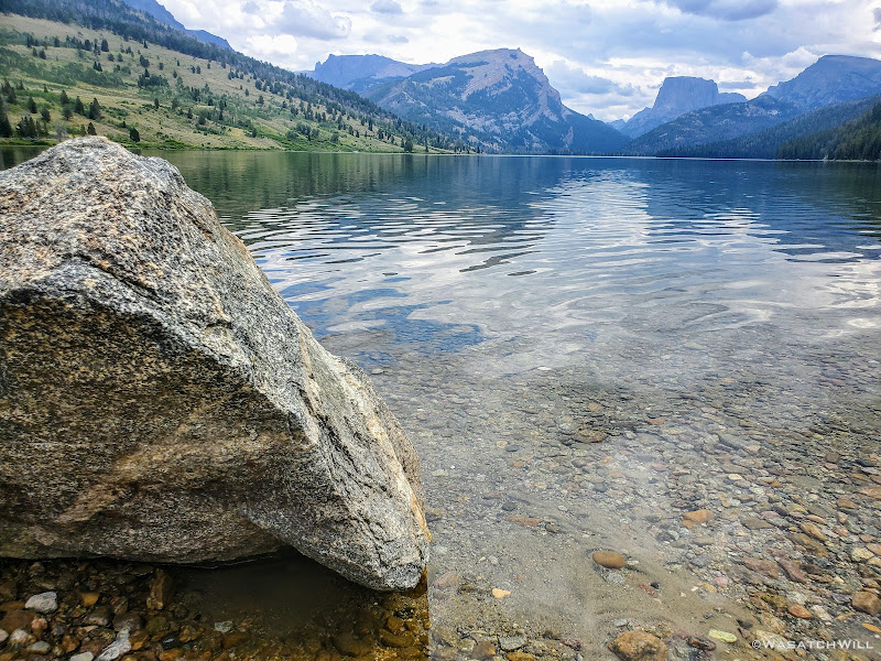
The shore of Lower Green River Lake
On the drive out, we made a quick side trip out to New Fork Lakes. It was here that I got my first ever taste and experience of the Wind River Mountains many years ago now. It was back in the mid-1990's when I was a young teenager and got the opportunity to attend a BSA Scout camp along the shoreline for a full week each during the summer in two back to back years. I had dreamed of wandering and exploring deeper in the range when I was still a kid back then. It was a treat to have now come full circle on that dream, having now made it happen in reality.
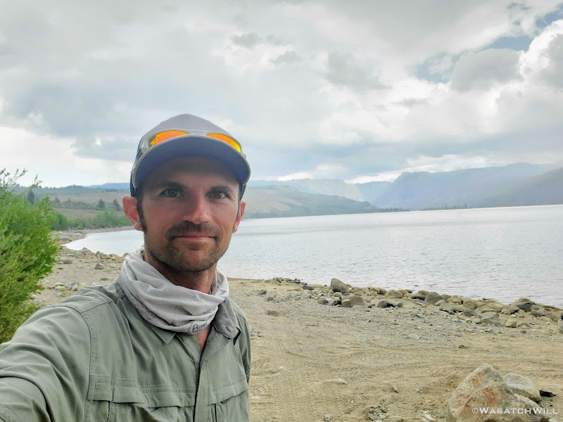
Selfie at New Fork Lakes
However, the scout camp itself was now a ghost town by all appearances looking in from outside the gate. Whether stemming from the COVID pandemic or the drastic decline of participants in the Boy Scout program across the West over the last couple of decades, especially in the more recent years, I was not sure of the cause. Rather than hearing shouts of fun and laughter, Camp New Fork was now destitute, quiet and somber.
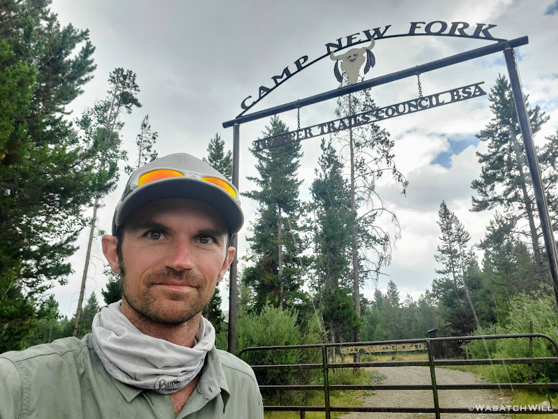
Selfie at Camp New Fork
A short while later, we arrived in the town of Pinedale. There we paid a small fee to make use of the shower facilities at the local recreation center and immediately followed that up with a well-earned meal at Wrangler Cafe.
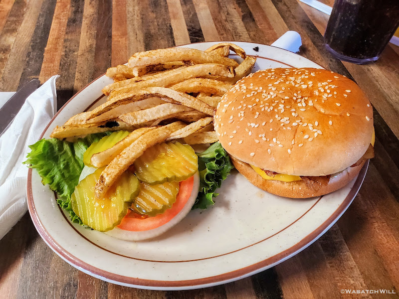
Cheeseburger and fries at the Wrangler Cafe
Prior to this trip, the longest trip I had done in both miles and duration was when I had the opportunity to hike a majority of the Uinta Highline Trail back in 2016. That trip spanned 6 days and 5 nights over a course of 75 miles. The most strenuous trip I had ever undertaken however was the Beehive Traverse route found in Capitol Reef National Park. While that one covers only half as many miles and half as many days to do it, the terrain is nearly all off trail with a comparable amount of elevations gains and losses.
This trip had now displaced both of those to become both the longest and most strenuous backcountry backpacking trip I have done to date. 80 miles, 7 days, 6 nights, and so much more elevation gain and loss, much of it off trail through some rather course and rocky terrain. It gave me a heightened sense of confidence in my abilities but also beat me up more than any other trip I had taken.
If I was very sore over the past few days, I was extremely sore all over now. Blake too! While that pain Blake and I suffered together forged a deeper friendship with each other, it also forged a deeper friendship with Vitamin 'I'.
We now had a four hour drive to get back home to our families. Well...four for me. Blake had yet another hour or two for his. So eager to reunite with our respective families, we put Pinedale and the Wyoming high country in the rear view mirror and returned home, battered and bruised, but very much alive and well.
The end.
Need to catch up?...
WRHR: DAY 1 - BIG SANDY TO CIRQUE OF THE TOWERS
WRHR: DAY 2 - CIRQUE OF THE TOWERS TO DESOLATION VALLEY
WRHR: DAY 3 - DESOLATION VALLEY TO HALLS LAKE
WRHR: DAY 4 - HALLS LAKE TO CAMP LAKE
WRHR: DAY 5 - CAMP LAKE TO TITCOMB BASIN
WRHR: DAY 6 - TITCOMB BASIN TO BEAVER PARK
Thursday - July 29, 2021
Day 7: Beaver Park to Green River Lakes
MILES: 10 | GAIN: 735 ft
As expected, I woke up to tons of condensation on my tent. There simply was no escaping it with how wet the ground was from the rainstorm the previous day. Typically, I don't have issues with the silnylon material my Tarptent Notch is made. It generally does its job and does it well, but a weak point of the fabric is that it can absorb moisture, especially in heavily humid environments. This last camp became one of those rare times in the usually dry and arid mountain west climate that it would do so. In fact, it's actually one of the only times I've ever had to pack out a wet tent. Had we hung out a little longer, we would have gotten enough sun to actually dry it out before packing it up, but we were down in a canyon and eager to get back to the trailhead sooner than later. Rather than packing lesser weight out than the night before, I'd be packing out about the same with the added moisture content. Boo! Fortunately, only ten miles remained and those ten miles were rather flat and somewhat downhill.
Easy coasting, relatively speaking.

Morning at Beaver Park

Looking upstream of Green River

Bridge over the Green River
Shortly after leaving our last camp behind us, we were treated to a dazzling view of Granite Peak with clouds drifting across its face and the bright turquoise waters of the Green River flowing beneath. It was both a misty and mystical view.

Granite Peak and the Green River

Portrait shot of Granite Peak and Green River

Looking back upstream with some unknown or unnamed peaks above

Granite Peak, Green River, and the trail

Into the woods!
A little while later, after passing through a section of trees, the back side, er south side, of Square Top came into view. It made for another picturesque spot worthy of pausing for a few moments to soak in the view.

Squaretop Mountain
Back into a more forested section, I found a patch of clover. Unknowingly, I managed to capture one of the four-leaf variety. Lucky Day! I took a few moments to capture some of the other bits of plant life to be found along the forest floor.

Clover patch w/ four-leaf clover

Thimbleberry (edible fruit)

Alpine Strawberry (edible fruit)

Red Baneberries (NOT edible!!!)
After drifting through the forest for a good bit, we emerged into more clearings where we could now look back up and start to see the more typical view of Squaretop Mountain from the north. This would be a prominent landmark to look back upon for the remainder of our course. The Green River also continued to meander on through lush green meadows as it made its way for the two large lakes sharing the same namesake.

Clouds loom above Squaretop Mountain and the Green River

Squaretop Mountain from across the meadows

Looking back uptrail to Squaretop

Another shot uptrail looking at the iconic Squaretop Mountain
Further down I looked down at a plant and had to a do a double-take because its leaves stood out to me as something known for its...uhhh...medicinal properties. While this plant does appear to be a great doppelganger look-alike of the more well-known celebrity plant, Mary Jane, I believe what I was looking at was actually a flowering plant called Slender Cinquefoil, or Potentilla gracilis to be more scientific. I could be wrong though.

Slender Cinquefoil (Potentilla gracilis)???
We continued on between patches of forest, meadows, open views of the river and occasional glances back to Squaretop.

Green River reflection

Squaretop from across lush green meadows

Star Moss - Syntrichia ruralis
A sure sign of being closer to the trailhead, upper Green River Lake now came into view. We continued down the trail skirting around its eastern shore. Along this corridor and the rest of the way out, we'd start to see a few more people. We were now within suitable distance for an average day-hiker.

Upper Green River Lake
Between the upper and lower of the Green Lakes, we finally got to see our first wildlife sighting of an animal larger than a marmot, a moose cow. Content to occupy the trail while it continued to eat its lunch, we ended up surrendering the trail and veering off to scramble over some down logs followed by a bit of bushwhacking to get around the moose and back on trail beyond it.

Moose on the loose
At this point, CDT markers started showing up along the trail. CDT stands for Continental Divide Trail and it sure was fun to be able to say I hiked the CDT...even if it was only a small sliver of it amounting to a section that was only a few miles long.

CDT selfie
And then, there it was, the lower and larger of the Green River Lakes came into view. The trailhead and my car awaited us on the opposite end. You could say we were now on the homestretch with a good two and a half miles to go to wrap it all up.

Lower Green River Lake out in the distance

Look back at Squaretop from along lower Green River Lake

Exiting the wilderness boundary

The trailhead now in view

Still on the CDT

Another CDT selfie
Now around the long and large lake but prior to arriving at the trailhead, I stepped off trail for a few minutes to check out the old
Osborn Homestead. What a place for someone to have been able to call home at one point!

Osborn Cabins

Another cabin out a little further out

Some sort of old pump or cream separator?
However, when it came to the outhouse for this old settlement, I think an opportunity was missed here. Turn this outhouse around to face ol' Square Top Mountain and you'd have a classic 'loo with a view while you poo'. Not only that, but it'd also have exposure to the southern sun to warm that seat up a bit in the winter. Why it was built to face the north, I'll never know. Had this been my land, I would have been certain to turn it around to behold the view of Squaretop out in the distance.

A loo and a view

Squaretop Mountain...again
At last, we arrived at the trailhead and my 4Runner, all safe and sound. I did not get any photos at the actual trailhead though. Guess I was just exhausted to think of it while also being more focused on documenting the end on video.

Back on the Highline Trail...I mean the CDT...wait, where are we!?!?

The shore of Lower Green River Lake
On the drive out, we made a quick side trip out to New Fork Lakes. It was here that I got my first ever taste and experience of the Wind River Mountains many years ago now. It was back in the mid-1990's when I was a young teenager and got the opportunity to attend a BSA Scout camp along the shoreline for a full week each during the summer in two back to back years. I had dreamed of wandering and exploring deeper in the range when I was still a kid back then. It was a treat to have now come full circle on that dream, having now made it happen in reality.

Selfie at New Fork Lakes
However, the scout camp itself was now a ghost town by all appearances looking in from outside the gate. Whether stemming from the COVID pandemic or the drastic decline of participants in the Boy Scout program across the West over the last couple of decades, especially in the more recent years, I was not sure of the cause. Rather than hearing shouts of fun and laughter, Camp New Fork was now destitute, quiet and somber.

Selfie at Camp New Fork
A short while later, we arrived in the town of Pinedale. There we paid a small fee to make use of the shower facilities at the local recreation center and immediately followed that up with a well-earned meal at Wrangler Cafe.

Cheeseburger and fries at the Wrangler Cafe
Prior to this trip, the longest trip I had done in both miles and duration was when I had the opportunity to hike a majority of the Uinta Highline Trail back in 2016. That trip spanned 6 days and 5 nights over a course of 75 miles. The most strenuous trip I had ever undertaken however was the Beehive Traverse route found in Capitol Reef National Park. While that one covers only half as many miles and half as many days to do it, the terrain is nearly all off trail with a comparable amount of elevations gains and losses.
This trip had now displaced both of those to become both the longest and most strenuous backcountry backpacking trip I have done to date. 80 miles, 7 days, 6 nights, and so much more elevation gain and loss, much of it off trail through some rather course and rocky terrain. It gave me a heightened sense of confidence in my abilities but also beat me up more than any other trip I had taken.
If I was very sore over the past few days, I was extremely sore all over now. Blake too! While that pain Blake and I suffered together forged a deeper friendship with each other, it also forged a deeper friendship with Vitamin 'I'.
We now had a four hour drive to get back home to our families. Well...four for me. Blake had yet another hour or two for his. So eager to reunite with our respective families, we put Pinedale and the Wyoming high country in the rear view mirror and returned home, battered and bruised, but very much alive and well.
The end.
Need to catch up?...
WRHR: DAY 1 - BIG SANDY TO CIRQUE OF THE TOWERS
WRHR: DAY 2 - CIRQUE OF THE TOWERS TO DESOLATION VALLEY
WRHR: DAY 3 - DESOLATION VALLEY TO HALLS LAKE
WRHR: DAY 4 - HALLS LAKE TO CAMP LAKE
WRHR: DAY 5 - CAMP LAKE TO TITCOMB BASIN
WRHR: DAY 6 - TITCOMB BASIN TO BEAVER PARK
Last edited:

