HomerJ
Member
- Joined
- Jan 19, 2012
- Messages
- 1,199
To experience the Wind Rivers you need to backpack them. That being said, welcome to my car camping TR of the Winds! Ha!
Originally this trip was going to be a backpacking trip to the Wind Rivers. The plan was to go in at Big Sandy and then head north and camp at Shadow Lake. Then at the beginning of August my friend asked me if I wanted to go to Glacier National Park instead. I said sure since I had always wanted to go to GNP and I had another trip to the Winds planned the next week! Well, as things got closer some of the guys dropped out and with the price of gas going up we decided to stay closer to home and go check out the east side of the Winds. We had talked in the past about checking out the areas around Worthen Meadows and decided to camp at the campground there and explore the area around.
Wednesday:
Not being in a huge hurry we put off buying our food until the day of our trip. We picked up our groceries at the store that morning and headed off towards Lander, making it to Worthen Meadows in about 5 hours. There we setup camp and then drove down the road toward Lander to Bruce's Parking Lot. From there we hiked up to the Popo Agie Falls. It's an easy 1.5 miles to the falls and well worth it!!
Popo Agie River
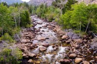
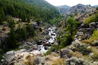
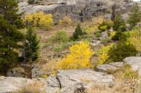
I was surprised to see that some of the quakies had turned already... Must be the dry year.
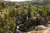
We soon came to the falls. It was at this point I realized my tripod was back up at camp! I'm still kicking myself for not bringing it two weeks later.
  The Falls are actually many falls in a close area. There are more falls that you can't see from here.
I was able to take this by resting the camera on a hand rail.
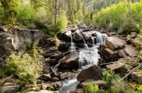
The next 3 photos I was able to rest my camera on some rocks to get these shots.
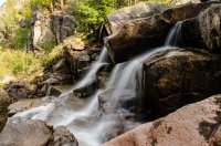
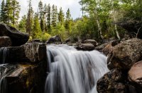
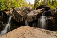
I really wished I would have remember the tripod, I would have been able to get some much better shots if I had it!!!
After taking a few photos we headed back.
I really like the shadow of the foot bridge in this photo!
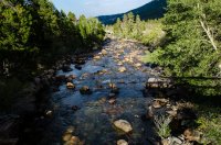
On the drive back to camp I snapped this photo. The Popo Agie River runs through the bottom of the gorge you can see. The smoke from the fires made the mountains look neat!
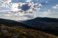
Back at camp we made dinner (dutch oven pizza!) and I took a few photos as the sun set. There wasn't much of a sunset unfortunately...
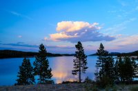
The next morning we had planned to hike to Leg Lake which is at the top of the Roaring Fork drainage. The hike starts out easy and soon you're at Roaring Fork Lake.
Roaring Fork Lake isn't that deep and the south/west sides where mossy, but it was still pretty. Leg Lake sits just below the cliffs on the far left side.

After Roaring Fork Lake the trail really starts to climb. You also start to lose the "trail" as well. After climbing what felt like quite a bit in elevation we made it to the first of many smaller lakes. This one is probably the biggest of these small lakes. Here we met a guy fishing with his not so friendly dogs. This was the only person we would see until we got back to camp.
Lake 1 above Roaring Fork Lake.

After heading upstream from Lake 1 we got off the drainage the "trail" goes up. We should have went up the left (east side), but instead headed up the right side and missed where the stream turned east and instead we headed up a small seep that came down and joined the drainage. After realizing we were off course I pulled out the GPS and found we could scramble up this narrow chute to the ridge and drop down into the correct drainage. The chute was fairly steep and had lots of down trees to scramble over. We "bush whack" it up and over and then back down to the creek. If I wouldn't have had the GPS I would have been really nervous about getting lost. The forest was so thick that you couldn't see very far and everything looked the same.
Looking below to one of the many small lakes we passed.
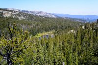
Eventually we joined up with the creek and were back on course. You would still lose the "trail" and have to bush whack and boulder hop to get anywhere. It was very tiring and slow moving.
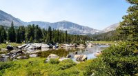
More small lakes as we near Leg Lake. This last bit was a boulder scramble up the drainage out of Leg Lake. The drainage goes up the ridge on the bottom left.
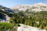
We finally made it to Leg Lake!!! The GPS said 5 miles, but it felt much more like 6 or 7 miles! I'm pretty sure it was more than 5 miles because the GPS does capture all weaving left and right while bush whacking and boulder hopping. We fished Leg Lake for about 2 hours and didn't even get a bite! We kept trying different flies and spinners and nothing worked! It was so frustrating to see the fish right there and not have a single bite. We threw almost everything we had at them and nothing! If I would have had dynamite I would have used it!
Leg Lake. I named the rock in the dip along the ridge just left of center, tank rock, because it kind of looked like a tank!

After almost 2 hours we decided we'd better get going as we didn't want to be up here in the dark! Plus we had seen lots of bear scat on the way up, although it was all old. It seemed to take forever to get back down to Roaring Fork Lake. Again there was lots of bush whacking and boulder hopping, but this time I kept us on the right drainage! Eventually we made it back to camp and both of us were thoroughly exhausted! My feat and legs ached. I took off my shoes and socks and promptly fell asleep in my camp chair until the breeze picked up and made me cold. After that we got up and made dinner.
On Friday we hiked up over a ridge and down to the Pop Agie River to fish it. The trail climbs up over a ridge and then drops down to the Popo Agie River. Shortly up the ridge there was a nice view back to the south to the cirque where we were the day before at Leg Lake.
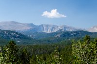
The trail climbs up to the ridge and then drops down down to the river. One section the trail is a bit rocky and steep and we were dreading having to hike back up it on the way back to camp. It ended up not being that bad.
Eventually we made it to the "Sheep Bridge" over the Popo Agie River. We crossed over and headed up the trail for about 1.5 miles where we cut over to the river and started fishing it back down towards this bridge.
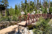
The fishing was really good although mostly smaller fish. Lots of small 6-10" with a few bigger. There was both Brookies and Rainbows in the creek! I didn't take many photos and the ones I did didn't turn out that great. We were having too much fun fishing and didn't stop until around 2pm for lunch. I took my shoes and socks off and noticed a blister was forming on my heal. I put a foam donut on it secured it with some medical tape (I had left the duct tape at camp). It ended up working great! While I was doing this a gust of wind came up and blew one of my socks into the creek. Luckily it was a calm spot and I was able to grab it although it did soak up a lot of water. I couldn't imagine walking back to camp (about 4 miles away) without a sock. I ringed the water out best I could and then laid it out to dry in the sun on the rock. I placed my shoe on the top part so it wouldn't blow into the creek again. Being wool the sun dried it out pretty quick and I was good to go!
After having a bite to eat for lunch, we fished on down the creek, making slow progress as we were catching a lot of fish. One of the nicer holes we pulled about 15 or so fish out before it went cold. Eventually we decided to head back to the trail and back to camp. The hike back was easier than expected and we made it back in good time. This day (9 miles round trip) was so much easier than the 10+ miles the day before!
Nice easy section of trail
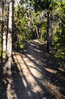
That evening we made dutch oven potatoes with kielbasa sausage. It was really good! :twothumbs:
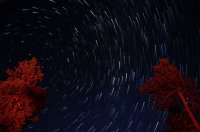
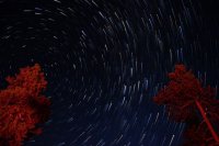
Later that evening I took some star photos and even managed to capture the milky way (my first)!

I didn't notice where the North Star was when I set up this shot and lucked out that it was behind the tree on the left making the star rotate around the top of the tree!
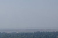
The next morning we packed up and headed out. We decided to go home the long way going north to Dubois, then over Togwotee Pass and down through Jackson, and home. The further we drove north the worse the smoke from the fires got. It was pretty thick by the time we got to Dubois and we were regretting heading this way. You could hardly see the cool cliffs on Togwotee Pass. The smoke was so thick in the Jackson Hole valley that you couldn't even see the Tetons from the Highway. Having seen the Tetons so many times I thought it was kind of funny to not be able to see them. I did feel bad for the tourists that aren't from nearby and hadn't seen them before.
We had to stop and take a picture of the sign showing the names of the peaks with just smoke in the background.
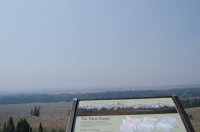
If you look very close you can barely see the snow from the glaciers.
EDIT:Forgot to add the map/gps paths!
View larger map.
Featured image for home page:
Originally this trip was going to be a backpacking trip to the Wind Rivers. The plan was to go in at Big Sandy and then head north and camp at Shadow Lake. Then at the beginning of August my friend asked me if I wanted to go to Glacier National Park instead. I said sure since I had always wanted to go to GNP and I had another trip to the Winds planned the next week! Well, as things got closer some of the guys dropped out and with the price of gas going up we decided to stay closer to home and go check out the east side of the Winds. We had talked in the past about checking out the areas around Worthen Meadows and decided to camp at the campground there and explore the area around.
Wednesday:
Not being in a huge hurry we put off buying our food until the day of our trip. We picked up our groceries at the store that morning and headed off towards Lander, making it to Worthen Meadows in about 5 hours. There we setup camp and then drove down the road toward Lander to Bruce's Parking Lot. From there we hiked up to the Popo Agie Falls. It's an easy 1.5 miles to the falls and well worth it!!
Popo Agie River


I was surprised to see that some of the quakies had turned already... Must be the dry year.

We soon came to the falls. It was at this point I realized my tripod was back up at camp!
 I'm still kicking myself for not bringing it two weeks later.
I was able to take this by resting the camera on a hand rail.

The next 3 photos I was able to rest my camera on some rocks to get these shots.


I really wished I would have remember the tripod, I would have been able to get some much better shots if I had it!!!
After taking a few photos we headed back.
I really like the shadow of the foot bridge in this photo!

On the drive back to camp I snapped this photo. The Popo Agie River runs through the bottom of the gorge you can see. The smoke from the fires made the mountains look neat!

Back at camp we made dinner (dutch oven pizza!) and I took a few photos as the sun set. There wasn't much of a sunset unfortunately...


The next morning we had planned to hike to Leg Lake which is at the top of the Roaring Fork drainage. The hike starts out easy and soon you're at Roaring Fork Lake.
Roaring Fork Lake isn't that deep and the south/west sides where mossy, but it was still pretty. Leg Lake sits just below the cliffs on the far left side.

After Roaring Fork Lake the trail really starts to climb. You also start to lose the "trail" as well. After climbing what felt like quite a bit in elevation we made it to the first of many smaller lakes. This one is probably the biggest of these small lakes. Here we met a guy fishing with his not so friendly dogs. This was the only person we would see until we got back to camp.
Lake 1 above Roaring Fork Lake.

After heading upstream from Lake 1 we got off the drainage the "trail" goes up. We should have went up the left (east side), but instead headed up the right side and missed where the stream turned east and instead we headed up a small seep that came down and joined the drainage. After realizing we were off course I pulled out the GPS and found we could scramble up this narrow chute to the ridge and drop down into the correct drainage. The chute was fairly steep and had lots of down trees to scramble over. We "bush whack" it up and over and then back down to the creek. If I wouldn't have had the GPS I would have been really nervous about getting lost. The forest was so thick that you couldn't see very far and everything looked the same.
Looking below to one of the many small lakes we passed.

Eventually we joined up with the creek and were back on course. You would still lose the "trail" and have to bush whack and boulder hop to get anywhere. It was very tiring and slow moving.

More small lakes as we near Leg Lake. This last bit was a boulder scramble up the drainage out of Leg Lake. The drainage goes up the ridge on the bottom left.

We finally made it to Leg Lake!!! The GPS said 5 miles, but it felt much more like 6 or 7 miles! I'm pretty sure it was more than 5 miles because the GPS does capture all weaving left and right while bush whacking and boulder hopping. We fished Leg Lake for about 2 hours and didn't even get a bite! We kept trying different flies and spinners and nothing worked! It was so frustrating to see the fish right there and not have a single bite. We threw almost everything we had at them and nothing!

Leg Lake. I named the rock in the dip along the ridge just left of center, tank rock, because it kind of looked like a tank!

After almost 2 hours we decided we'd better get going as we didn't want to be up here in the dark! Plus we had seen lots of bear scat on the way up, although it was all old. It seemed to take forever to get back down to Roaring Fork Lake. Again there was lots of bush whacking and boulder hopping, but this time I kept us on the right drainage! Eventually we made it back to camp and both of us were thoroughly exhausted! My feat and legs ached. I took off my shoes and socks and promptly fell asleep in my camp chair until the breeze picked up and made me cold. After that we got up and made dinner.
On Friday we hiked up over a ridge and down to the Pop Agie River to fish it. The trail climbs up over a ridge and then drops down to the Popo Agie River. Shortly up the ridge there was a nice view back to the south to the cirque where we were the day before at Leg Lake.

The trail climbs up to the ridge and then drops down down to the river. One section the trail is a bit rocky and steep and we were dreading having to hike back up it on the way back to camp. It ended up not being that bad.
Eventually we made it to the "Sheep Bridge" over the Popo Agie River. We crossed over and headed up the trail for about 1.5 miles where we cut over to the river and started fishing it back down towards this bridge.

The fishing was really good although mostly smaller fish. Lots of small 6-10" with a few bigger. There was both Brookies and Rainbows in the creek! I didn't take many photos and the ones I did didn't turn out that great. We were having too much fun fishing and didn't stop until around 2pm for lunch. I took my shoes and socks off and noticed a blister was forming on my heal. I put a foam donut on it secured it with some medical tape (I had left the duct tape at camp). It ended up working great! While I was doing this a gust of wind came up and blew one of my socks into the creek. Luckily it was a calm spot and I was able to grab it although it did soak up a lot of water. I couldn't imagine walking back to camp (about 4 miles away) without a sock. I ringed the water out best I could and then laid it out to dry in the sun on the rock. I placed my shoe on the top part so it wouldn't blow into the creek again. Being wool the sun dried it out pretty quick and I was good to go!
After having a bite to eat for lunch, we fished on down the creek, making slow progress as we were catching a lot of fish. One of the nicer holes we pulled about 15 or so fish out before it went cold. Eventually we decided to head back to the trail and back to camp. The hike back was easier than expected and we made it back in good time. This day (9 miles round trip) was so much easier than the 10+ miles the day before!
Nice easy section of trail

That evening we made dutch oven potatoes with kielbasa sausage. It was really good! :twothumbs:
Later that evening I took some star photos and even managed to capture the milky way (my first)!

I didn't notice where the North Star was when I set up this shot and lucked out that it was behind the tree on the left making the star rotate around the top of the tree!

The next morning we packed up and headed out. We decided to go home the long way going north to Dubois, then over Togwotee Pass and down through Jackson, and home. The further we drove north the worse the smoke from the fires got. It was pretty thick by the time we got to Dubois and we were regretting heading this way. You could hardly see the cool cliffs on Togwotee Pass. The smoke was so thick in the Jackson Hole valley that you couldn't even see the Tetons from the Highway. Having seen the Tetons so many times I thought it was kind of funny to not be able to see them. I did feel bad for the tourists that aren't from nearby and hadn't seen them before.
We had to stop and take a picture of the sign showing the names of the peaks with just smoke in the background.

If you look very close you can barely see the snow from the glaciers.

EDIT:Forgot to add the map/gps paths!
View larger map.
Featured image for home page:

