danger02ward
Love the Mountains!
- Joined
- Mar 1, 2016
- Messages
- 402
Thursday morning I was excited to get up and head into Indian Basin so I could climb Fremont Peak. There is something about climbing a peak that is just down right exciting. I've never really considered myself a peakbagger. However, as I've gotten into better shape I seem to enjoy it more and more. There is nothing like the feeling of climbing a peak huffing and puffing out of breath. I often have to stop and remind myself why I like to do this. The best way I can explain it is twofold. One is setting a tough goal and the wonderful feeling of accomplishment when you get to the top. The other reason is the views are always incredible and well worth the effort. Being surrounded by this beautiful place I couldn't wait to see the awesome views from the top of Fremont Peak. Yes I had looked at pictures but that just doesn't cut it. Nothing like seeing it in person. I had the opportunity to climb Kings Peak which is the tallest peak in Utah in 2013. So the thought of climbing Wyoming's 3rd tallest peak at 13,743 and going 216 feet higher sounded exciting. Adding to the excitement was the chance to look down into the beautiful Titcomb Basin I had been in the day before and to see the beautiful glaciers on the other side of the continental divide. The only thing that made me nervous was the weather. We had heard from other hikers that Thursday and Friday there was a chance of snow above 12,000 feet. Watching the sky closely there were dark clouds all day long which I feared might keep me from reaching my goal. Luckily they seemed to stay to the East of the continental divide, so we pressed on. I was hoping my friend would join me as far as the saddle to take in the views of the Titcomb Basin. However, after the last two days he was ready to sit by a lake in the Indian Basin and read a good book, so I pressed on.
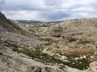
Looking back at the trail heading into Indian Basin
View attachment 50252
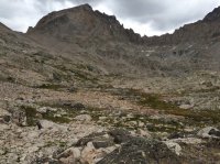
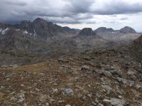
Fremont Peak from Indian Basin.
View attachment 50253
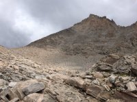
Getting closer to the Mighty Fremont Peak.
View attachment 50254
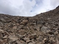
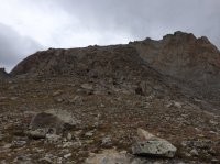
Last view looking up before hitting the saddle.
View attachment 50255
The views from the saddle are incredible. It was awesome looking back down into beautiful Titcomb Basin where we had just been the day before. Looking down into Mistake Lake and upper and lower Titcomb Lakes.
View attachment 50256
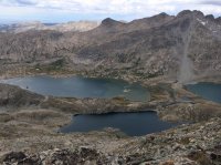
View of beautiful Indian Basin with Elephant Head in the center.
View attachment 50257
Looking up to Fremont Peak from the saddle.
View attachment 50258
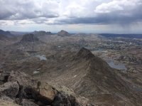
Looking back at the saddle with beautiful Indian Basin and Elephant Head on the left and lower part of beautiful Titcomb Basin on the right. You can see the lovely Island lake middle right.
View attachment 50259
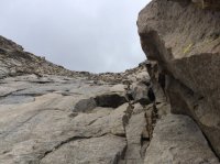
Towards the top you hit a nice rock slab that's more fun to climb than weaving in and out of the many large boulders.
View attachment 50260
The views from the top were incredible! Well worth the climb! I highly recommend it!
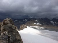
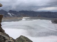
Looking North towards Gannet Peak Wyoming's tallest peak in the center with the snow on it and the beautiful Fremont Glaciers.
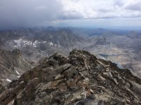
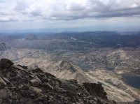
View looking South you can see Elephant Head right above one of the Indian Basin Lakes.
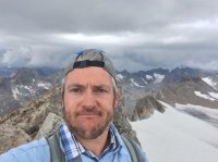
Obligatory Summit Selfie
Beautiful to see the glaciers of the East side of the Continental Divide.
Awesome view looking South. You can see Indian Basin with Elephant Head on the left. The lovely Island lake right in the center and Fremont Lake in the top center.
On the Peak there is a sign in canister.
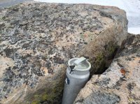
Unfortunately I didn't have time to open it. I got to the top and started taking pictures admiring the awesome views. I was overcome with gratitude to my Father in Heaven for allowing me to be able to take in these magnificent awe inspiring views for myself. What a truly beautiful and spectacular place. I was grateful that I was able to make the trip due to my back issues earlier in the year and concerns over the weather. I had been watching the clouds and weather all day. I texted my wife to let her know all was well. Then my phone quit typing. It had gotten water under the otter box cover so it wouldn't type until I took it apart and wiped it off. That's when I noticed the dark clouds from the North were moving my way. I only had a short time on the peak to enjoy the views. It started lightly snowing. It was time to get off the peak before the storm hit.
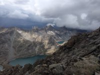
On the way down I took my favorite picture of the trip. You can't beat a hike down off a mountain with views like this. This is upper Titcomb Lake with Summer Ice Lake.
 The snow was very light until I got to the saddle then it started hailing pretty hard. Time to put on the rain suit. Interesting to watch the weather patterns up there. At that moment Titcomb Basin looked nice and clear and Indian Basin where my friend sat reading a book was socked in with a storm. As I got back down to him in the Indian Basin the hail turned to rain. We enjoyed rain all the way back to Island Lake. It lasted for several hours.
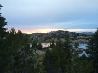
Later that night the storm and clouds cleared and we were able to watch a beautiful sunset at Island Lake.
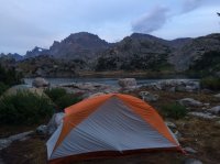
This is our campsite for the night. It was awesome to eat a warm dinner after a nice long day and stare at that magnificent peak I had just climbed.
Love this amazing place!
Looking back at the trail heading into Indian Basin
View attachment 50252
Fremont Peak from Indian Basin.
View attachment 50253
Getting closer to the Mighty Fremont Peak.
View attachment 50254
Last view looking up before hitting the saddle.
View attachment 50255
The views from the saddle are incredible. It was awesome looking back down into beautiful Titcomb Basin where we had just been the day before. Looking down into Mistake Lake and upper and lower Titcomb Lakes.
View attachment 50256
View of beautiful Indian Basin with Elephant Head in the center.
View attachment 50257
Looking up to Fremont Peak from the saddle.
View attachment 50258
Looking back at the saddle with beautiful Indian Basin and Elephant Head on the left and lower part of beautiful Titcomb Basin on the right. You can see the lovely Island lake middle right.
View attachment 50259
Towards the top you hit a nice rock slab that's more fun to climb than weaving in and out of the many large boulders.
View attachment 50260
The views from the top were incredible! Well worth the climb! I highly recommend it!
Looking North towards Gannet Peak Wyoming's tallest peak in the center with the snow on it and the beautiful Fremont Glaciers.

View looking South you can see Elephant Head right above one of the Indian Basin Lakes.

Obligatory Summit Selfie

Beautiful to see the glaciers of the East side of the Continental Divide.

Awesome view looking South. You can see Indian Basin with Elephant Head on the left. The lovely Island lake right in the center and Fremont Lake in the top center.

On the Peak there is a sign in canister.

Unfortunately I didn't have time to open it. I got to the top and started taking pictures admiring the awesome views. I was overcome with gratitude to my Father in Heaven for allowing me to be able to take in these magnificent awe inspiring views for myself. What a truly beautiful and spectacular place. I was grateful that I was able to make the trip due to my back issues earlier in the year and concerns over the weather. I had been watching the clouds and weather all day. I texted my wife to let her know all was well. Then my phone quit typing. It had gotten water under the otter box cover so it wouldn't type until I took it apart and wiped it off. That's when I noticed the dark clouds from the North were moving my way. I only had a short time on the peak to enjoy the views. It started lightly snowing. It was time to get off the peak before the storm hit.
On the way down I took my favorite picture of the trip. You can't beat a hike down off a mountain with views like this. This is upper Titcomb Lake with Summer Ice Lake.
 The snow was very light until I got to the saddle then it started hailing pretty hard. Time to put on the rain suit. Interesting to watch the weather patterns up there. At that moment Titcomb Basin looked nice and clear and Indian Basin where my friend sat reading a book was socked in with a storm. As I got back down to him in the Indian Basin the hail turned to rain. We enjoyed rain all the way back to Island Lake. It lasted for several hours.
 Later that night the storm and clouds cleared and we were able to watch a beautiful sunset at Island Lake.

This is our campsite for the night. It was awesome to eat a warm dinner after a nice long day and stare at that magnificent peak I had just climbed.

Love this amazing place!

