OldBill
Member
- Joined
- Aug 18, 2015
- Messages
- 584
I felt lucky to be out on the trail this year after a major hip injury at the beginning of the year that rendered even a short walk of 20' impossible. But, PT and a nerve ablation minimized the pain spikes. This year's WY trip had wildfires, near and far, and a pesky omega blocking weather pattern - kept spinning off cold rain and snow every few days. Still, good times were had. The smoke and haze impacted photo quality, but there were still some salvageable shots.
PART 1 - Ink Wells
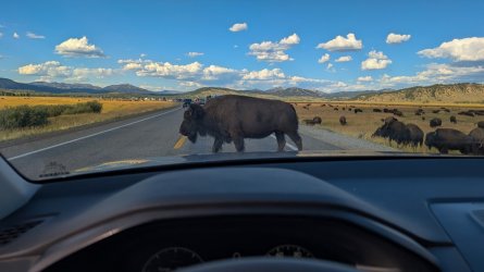
I arrived in Jackson Aug 18 but my nephew Glenn got stuck overnight in Chicago. He'd been scheduled to arrive an hour before me and the airline played the usual delay game. I went ahead and picked up the car, shopped for supplies and by that time it was apparent that he'd be delayed overnight. I headed for Dubois to set up my tent and was ready to return if necessary. First I had to deal with the usual summer Jackson traffic
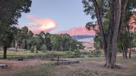
By the time I'd gotten over Togwotee Pass the airline had cancelled the flight. That let me at least have a good night's sleep and we'd allowed some leeway for acclimation before meeting @Bob for our planned trip over Horse Ridge to Dry Creek. The Longhorn had converted the tent sites along the river to RV sites, but I got a site on the far side with a decent view
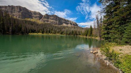
After getting Glenn and supplies the next day we did a short acclimation hike at Brooks L but missed the turnoff to Upper Jade. Ran out of time so we went back the next day. I found the spot where I had my first bear encounter 20 years ago, just 50 yds from this spot
I dropped off Glenn the next day at the Torrey Ck TH and walked the first 2 miles with him. It would be his first overnight alone. I gave him my Garmin Mini 2 but knew he had a good sense of direction and enough skill to do it. He was looking forward to the test (and probably not having to wait for his old uncle to constantly catch up). The plan was for him to go to Double L and meet Bob and I at the Stetter outfitters camp on the Dinwoody the next day.
We went to the ranch that night to get the details finalized. The weather after the first few days was rain, and highs of 40's-50. Not weather I enjoy fishing in, especially with Raynaud's so I pulled the fishing gear from my pack at the last minute. Bob ready to go
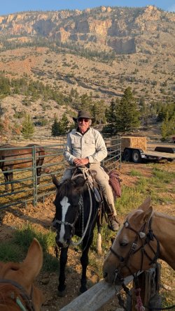
Bob has already posted great photos of the ride. I only took a few - difficult to shoot with the phone in one hand and reins in the other. Hadn't ridden in years so it was nice to be back in the saddle again. I was surprised I could sit that long without major pain, but it was infinitely more comfortable than sitting on the plane.
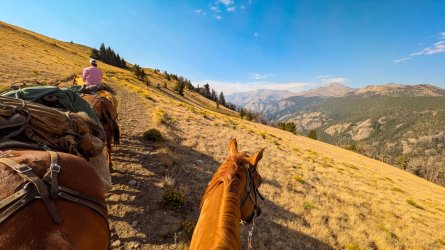
A few drops of rain along the way, though it was dark near the divide. Glenn arrived at the camp by 2pm and took this shot at the bridge
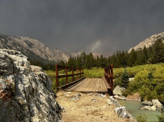
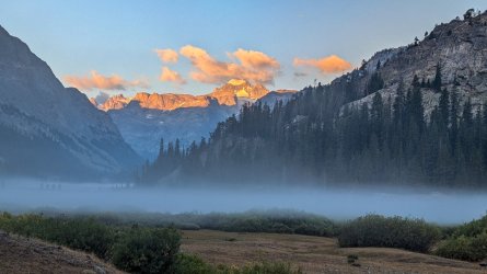
The storm had lifted by the time we arrived at around 4. My deep-lugged boot caught in the stirrup on the final dismount and I flopped to ground. I was thinking: this is a perfect @scatman moment. But, no one recorded it as I was reassuring all I was perfectly fine. Instead of continuing to Ink Wells we accepted the Stetter's kind invitation to remain there. They even had 2 tents available for use. Begin the lazy person I am, I opted to sleep in the tent while Bob and Glenn pitched nearby. I got up early the next morning and managed to get this shot while getting water:
We had great weather, views and conversation on the short but steep climb to Ink Wells
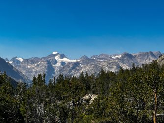
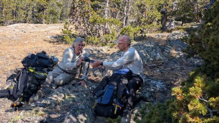
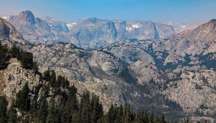
However, as the day progressed, the smoky haze got progressively worse. Not unexpected due to the NW wind pattern sending Canadian and NW US smoke our way. This is the view looking NW towards Arrow Mtn.
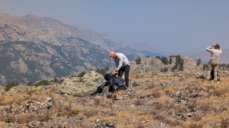
Bob found a good place to camp on a small knoll. Glenn set up his tent there as well. It takes me awhile to find an acceptable spot to set up my Dipole DW. It needs deeply set stakes (no rocks or roots for at least 5") has a larger footprint (I'm a bit claustrophobic) and I like level ground as well. Had to go to the next county to find something suitable. But, at least it had an outcrop with a decent view. There was a very large plume of smoke that Bob said was a fire on the west side of the range, near Green River Lakes. Bob has better photos of that but this view is towards that direction
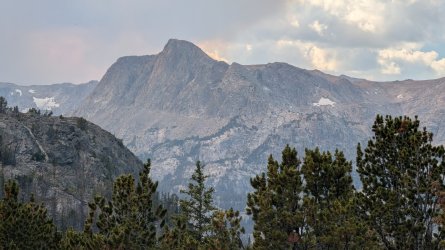
Bob stayed and fished the 2 nearest Ink Well lakes while Glenn and I headed to Scenic Pass the next morning. Views all along the way were outstanding and we were lucky the smoke was much less than the night before. Horse Ridge looked like a series of ridges.
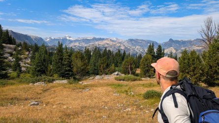
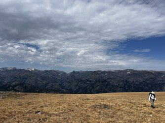
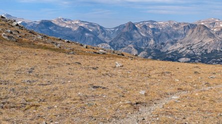
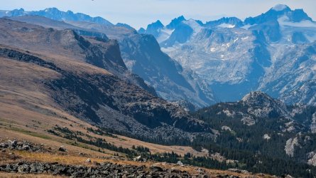
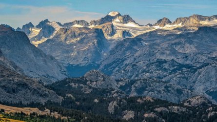
We returned to camp and found Bob had caught endless amounts of fish.
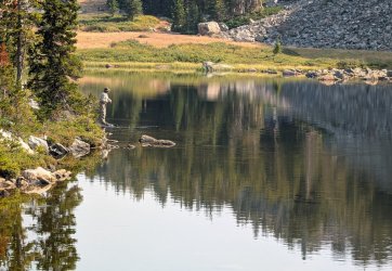
Smoke on the morning of our 4th day out (5 for Glenn) was getting bad. Cold and rain was due to start the next day and continue so it was time to start heading back.
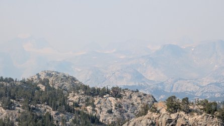
I wish I'd thought to take this when we were headed up. Walked right passed it.
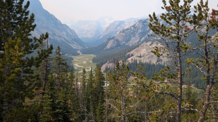
When we reached the outfitters camp the tents were still unoccupied. The Stetters kindly invited to use them and visit with them after we'd settled in. Glenn and I headed up the Glacier Trail to get a better view while Bob relaxed. We only made about 2 miles before the thunder started, forcing a turn around. It was worth it though. Later we all enjoyed some good conversation with Laura and Dustin.
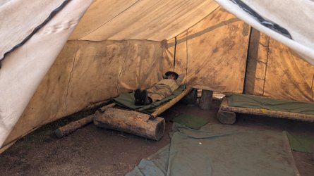
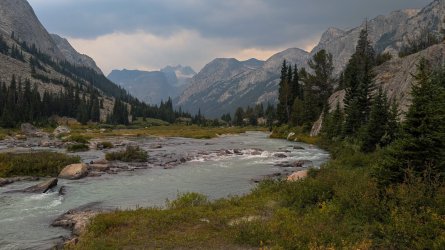
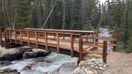
We broke camp at a leisurely pace in the morning. Pardon my laundry drying out. I tend to spread my gear everywhere. Picture of the new Down's Fk bridge (with a few loose boards already).
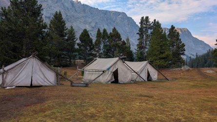
Got lucky and had no significant rain. The climb up and around Honeymoon was exhausting but we made it to Double Lake in plenty of time. Once again it took me awhile to find a good spot, only to have Bob point out a large number of dead trees right over me. I've stayed under worse and there wasn't any wind, but Bob knows this stuff better than I do, so we moved my setup to option B. A check of next day's weather on the Garmin looked worse so I was happy we weren't pinned down in Dry Ck.
Bob and Glenn discussed what time they'd be getting ready to pull out. I'd been getting up earlier so thought to myself I'd just make my decision then. Being a bit claustrophobic, I'm not a fan of sitting in a tent for long periods. Rain came much earlier than predicted. At 4:30 I heard it on my tent. Pulled the pack inside, ate a bar and loaded gear. Made a lot of noise shaking off the polycro groundsheet but didn't wake anyone. Saw no any movement or lights in their tents so figured I'd let them sleep. At 5:45 I took this shot and headed out.
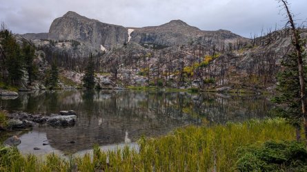
While I was at Burro Flats I looked back toward Scenic Pass and took the only other worthy shot that day. Took a break at the junction of Glacier and Old Glacier trail. We'd decided to use the new trail so I stayed on it. Scratched "Bill --> Out" at the earliest opportunity to let them know I'd taken the new trail. After a bit further I turned and saw 2 hikers behind me. But the gear and clothes didn't match Bob and Glenn's so I kept going.
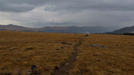
Got back to the car at 1. Cleaned up and didn't expect they'd be out for another hour so left the gear I'd borrowed from Bob on his truck. Drove down to get enough cell signal to change a motel reservation in Dubois I'd made since we came out 2 days early. Had to go all the way to the highway for that. Wanted to be there when then came out so flew back up the road to the TH.
Was starting to get worried around 3 but finally saw them. Glenn was convinced that instead of just leaving early, I'd moved my tent again! So he spent a bunch of time looking for me at the lake. Felt bad I'd caused anyone to worry. Should have scratched a message or awakened them. What I thought was obvious wasn't.
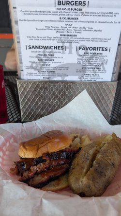
Bob didn't want to eat in Dubois and we weren't heading to Jackson until Saturday. So we discussed next year's plans and parted ways. Glenn and I spent the next day recovering in Dubois. On the way to Jackson we took a hike up Death Canyon. Bob had recommended the Big Hole BBQ. Great food. They were out of the pulled pork, but the brisket was excellent - lean and flavorful.
Since motels in Jackson are far more than what we were willing to pay, we stayed at the Snake R RV/campground. Nice location, but the sites are really tight. Got up at 3:30 and dropped Glenn off at the airport for a 7:30 flight. I headed back to town to get a few supplies when Glenn texted that the flight was just delayed. Travel nightmare. He decided to wait it out so I took off for Pinedale.
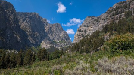
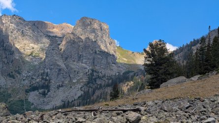
PART 2 - Elbow Lake
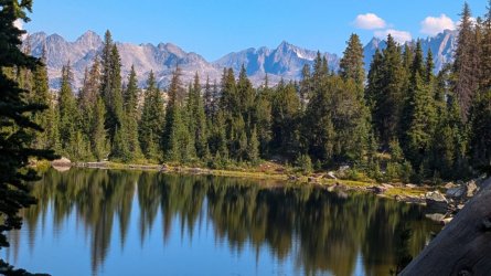
When I started backpacking some 25 years ago, one of the destinations was Elbow L. Had to abort that trip after the first night, so I wanted to try it again. There was a 4 day window of good weather so I made a plan and took off. Surprisingly, the parking lot at Elkhart was only 1/4 full early morning. I'll skip the usual photo from Photographer's Point as that's been posted so much. I do like the view from Barbara Lake though
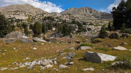
The trail wasn't too busy past Photographer's Point. Saw 2 pairs of folks on the Seneca L trail heading out. One tent at Little Seneca Lake. Saw an outfitters camp that seemed too close to the trail shortly after I turned onto the Highline.
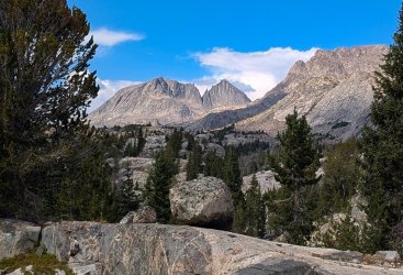
It was a long but pleasant day. I set up just over the bridge on Fremont Ck, seeing a total of 7 people in 3 different groups heading south.
Stopped at Lower Jean Lake for photos. 2 guys fishing. Another guy heading south stops for a chat. Mentioned I help admin the Wind R Facebook page. When I told him my handle on that he said "Holy S**t! I admin that as well. Been wanting to meet you for years!" So, we chatted about trails, history, tourist increase, etc for awhile. Chance encounters like that are great. Parted ways and enjoyed new scenery.
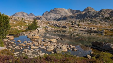
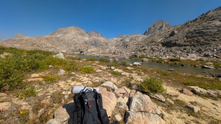
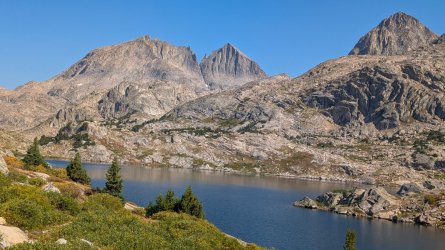
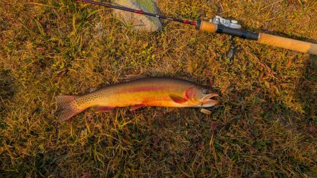
Set up near the top of the lake and got ready to fish. Had a small golden on after about 3 casts but it jumped and through the lure. I debarb hooks and cut the trebles down to a single hook, so that's not unexpected. 3 casts later I had a good strike. That one didn't jump and could tell it was decent size. Measured 18" on my rod. Finally!! Released unharmed. Another 1/2 hour of casting resulted in nothing but it didn't matter.
Walked back to camp and saw a huge plume of smoke coming over Shannon Pass. Photos of my tent are about 2 hours apart:
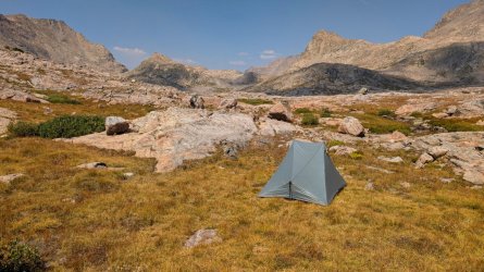
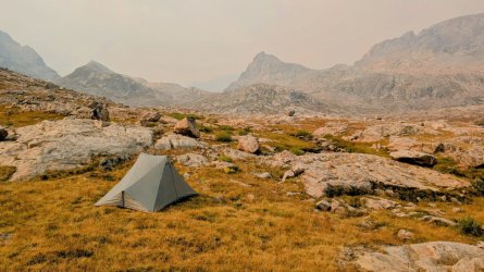
Didn't note any shift in the wind. It had been coming from the north and the Dollar L fire was to the NW so the sudden change got my attention. The sky to the East, towards Titcomb was just as dark. Ash and burnt cinders were falling frequently. Bob had mentioned those cinders can spark a new fire. So, I pulled my pack under the vestibules and checked with Bob, Glenn, my brother and girlfriend to see if any new fires had sprung up. All came back negative but I also knew websites take awhile to post something new. Found out when I got back that the Dollar L fire had rounded Big Sheep Mtn. A slight westerly shift in the wind probably sent the smoke up the canyon of the Green, channeling it over Shannon Pass and maybe Knapsack Col.
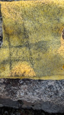
The next morning it wasn't any better. I wiped the tent down with my washcloth. Decided I'd rather not be inhaling any more of this.
I only went a few miles south when the sky got noticeably better. A look back towards the pass shows significant smoke towards the west side.
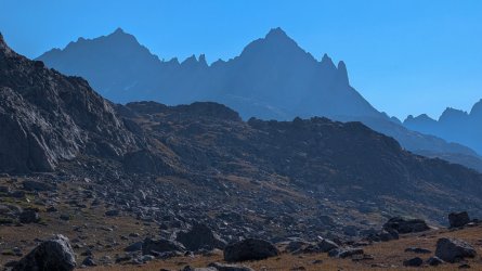
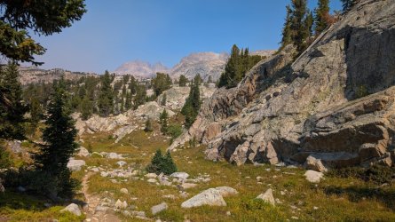
It was nice weather, but disappointed I couldn't stay longer at Elbow. I kept going past the junction to Island L and just couldn't get motivated to camp elsewhere along the route. More rain and cold was expected the next day, so I continued to the TH, roughly 18 miles from camp +2000'/-3400'. Waited out the rain the next day in town. Snow up high so glad I got out.
PART 3 - Atlantic Ck & Union Pass
Cleared up and had a good moon set at Fremont L CG the next day.
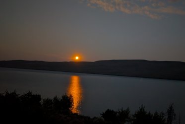
More checking of the weather and I convinced myself that a few days in Atlantic Canyon would be good. I enjoy that route - quiet, easy 8 m on trail, 2m off trail. So I drove to Lander via South Pass and headed in the next day.
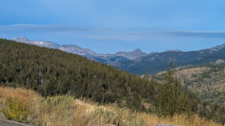
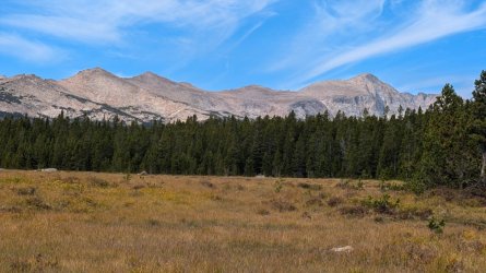
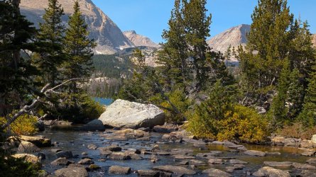
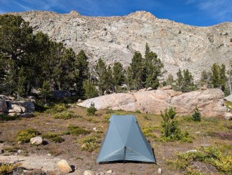
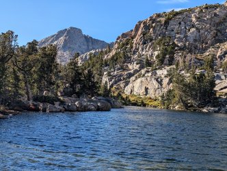
Usually, the brook trout are easy to catch at this lake, but they weren't that afternoon. It was still nice being up back there, but a weather update showed a much larger chance of rain and cold the next day. Since I don't care for fishing in wind and rain, especially when temps are in the 40's, this would be a short trip.
Yet again, the storm came in several hours before Garmin predicted (or even the NWS forecast I'd checked before leaving). I was greeted with lots of graupel early morning. That let up while I broke camp, slamming down a pop-tart for breakfast. Threw a packet of instant coffee in a liter of water for caffeine. Wanted to get through the off trail part before it got too bad. There's a few steep sections and some rock that can get slippery. Separated my AC joint nearby on one trip. Not something I wanted to repeat. Meandered my way back to the creek crossing. Somehow missed the easier crossing, but once on the other side it's a short way back to the trail. Rain had let up a that point so I pulled off the rain paints and had a bit to eat. Still dark up the canyon. There's some bear boxes at Christina L so I used one as a windbreak to make some hot coffee before continuing on.
A few days later back at Fremont L, sleeping in the car I heard a thump, shaking the car. Nothing obvious. Thought a tree branch fell & I'd deal with it in the morning. Did see some mud (maybe black lichen on aspen) on the driver's side the next day. Some scattered bark but nothing big - maybe it bounced off into the woods. Aspen above me looked ok. Odd, but whatever...
I wanted to try fishing my favorite spot on the Upper Green R. It was just inside the Forest boundary, well away from the fire zone, with signs saying road and Union Pass Rd open. But, when I got there a red cone was at the upper parking spot and I saw several campers just off the only other way down, so I figured this wasn't the best idea. But, instead of turning around, I decided to head up to Union Pass instead. Hadn't traveled that road in years. The fire coordination center at the Union Pass bridge was impressive. Tents scattered everywhere.
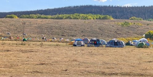
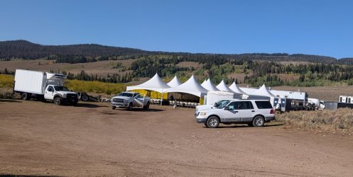
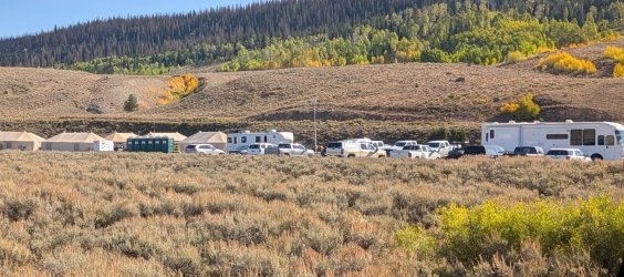
The road was in much worse shape than I remembered. Had to be careful with just a mid-sized SUV. It was slow going. Nearer the pass it got much better, though at one point a tree was leaning completely across the road. A FS worker was there and waved me under it. Hazy and storms were building yet again, but still great views and a historic site.
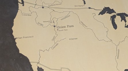
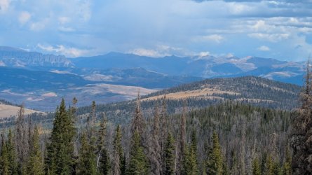
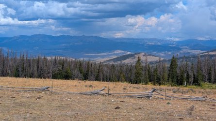
The road on the east side of the pass was in much better shape. They even had a grader out improving it. Plenty more summer homes had been constructed since I last went over this. Not the day I'd planned but still worthwhile for a drive.
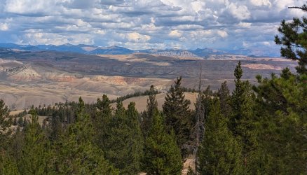
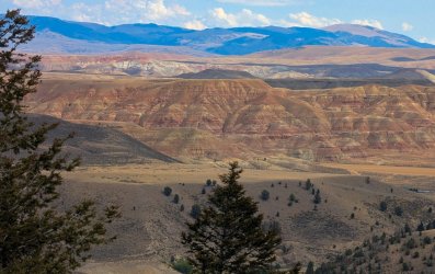
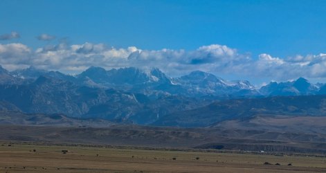
Didn't feel like returning via Union or South Pass so took the easy way and headed towards Jackson. Maybe see a griz off the road. Nope, just more Jackson traffic. Stopped for a quick photo at the Snake R viewpoint. Rain opened up after I'd gotten into Hoback Canyon. Good - car needed a washing. More snow up high in the range.
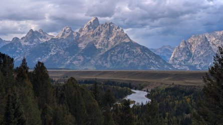
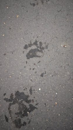
Early the next morning at Fremont L a small black bear emerged onto the road about 20' from me. I stopped. It stopped. Looked at me, took a few steps at angling away (fortunately), stopped, turned and looked again, repeated that and then headed off. I wanted to say "wait, let me walk past you back to the car so I can get my phone/camera". Decided that was a bad idea so after it had departed, I got the camera and shot the wet footprints.
It wasn't until it got light enough that I noticed this while packing the car:
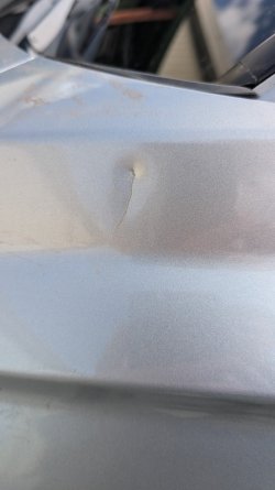
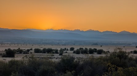
The rain from the prior day had washed the dirt away and I put the evidence together. That thump several days back was this bear taking a whack at the car! All the food was in the bear box, but maybe there was enough food scent left or maybe it was just a curious youngster. Wasn't happy about getting charged for that, but the scratch went to the metal and there wasn't anything I could do about the dent. Got the closest matching touch up pen I could find, measured and documented. Found out after I returned that the rental company did not end up charging me. So, until next year
PART 1 - Ink Wells
I arrived in Jackson Aug 18 but my nephew Glenn got stuck overnight in Chicago. He'd been scheduled to arrive an hour before me and the airline played the usual delay game. I went ahead and picked up the car, shopped for supplies and by that time it was apparent that he'd be delayed overnight. I headed for Dubois to set up my tent and was ready to return if necessary. First I had to deal with the usual summer Jackson traffic

By the time I'd gotten over Togwotee Pass the airline had cancelled the flight. That let me at least have a good night's sleep and we'd allowed some leeway for acclimation before meeting @Bob for our planned trip over Horse Ridge to Dry Creek. The Longhorn had converted the tent sites along the river to RV sites, but I got a site on the far side with a decent view

After getting Glenn and supplies the next day we did a short acclimation hike at Brooks L but missed the turnoff to Upper Jade. Ran out of time so we went back the next day. I found the spot where I had my first bear encounter 20 years ago, just 50 yds from this spot

I dropped off Glenn the next day at the Torrey Ck TH and walked the first 2 miles with him. It would be his first overnight alone. I gave him my Garmin Mini 2 but knew he had a good sense of direction and enough skill to do it. He was looking forward to the test (and probably not having to wait for his old uncle to constantly catch up). The plan was for him to go to Double L and meet Bob and I at the Stetter outfitters camp on the Dinwoody the next day.
We went to the ranch that night to get the details finalized. The weather after the first few days was rain, and highs of 40's-50. Not weather I enjoy fishing in, especially with Raynaud's so I pulled the fishing gear from my pack at the last minute. Bob ready to go

Bob has already posted great photos of the ride. I only took a few - difficult to shoot with the phone in one hand and reins in the other. Hadn't ridden in years so it was nice to be back in the saddle again. I was surprised I could sit that long without major pain, but it was infinitely more comfortable than sitting on the plane.

A few drops of rain along the way, though it was dark near the divide. Glenn arrived at the camp by 2pm and took this shot at the bridge

The storm had lifted by the time we arrived at around 4. My deep-lugged boot caught in the stirrup on the final dismount and I flopped to ground. I was thinking: this is a perfect @scatman moment.

We had great weather, views and conversation on the short but steep climb to Ink Wells


However, as the day progressed, the smoky haze got progressively worse. Not unexpected due to the NW wind pattern sending Canadian and NW US smoke our way. This is the view looking NW towards Arrow Mtn.

Bob found a good place to camp on a small knoll. Glenn set up his tent there as well. It takes me awhile to find an acceptable spot to set up my Dipole DW. It needs deeply set stakes (no rocks or roots for at least 5") has a larger footprint (I'm a bit claustrophobic) and I like level ground as well. Had to go to the next county to find something suitable. But, at least it had an outcrop with a decent view. There was a very large plume of smoke that Bob said was a fire on the west side of the range, near Green River Lakes. Bob has better photos of that but this view is towards that direction

Bob stayed and fished the 2 nearest Ink Well lakes while Glenn and I headed to Scenic Pass the next morning. Views all along the way were outstanding and we were lucky the smoke was much less than the night before. Horse Ridge looked like a series of ridges.


We returned to camp and found Bob had caught endless amounts of fish.

Smoke on the morning of our 4th day out (5 for Glenn) was getting bad. Cold and rain was due to start the next day and continue so it was time to start heading back.

I wish I'd thought to take this when we were headed up. Walked right passed it.

When we reached the outfitters camp the tents were still unoccupied. The Stetters kindly invited to use them and visit with them after we'd settled in. Glenn and I headed up the Glacier Trail to get a better view while Bob relaxed. We only made about 2 miles before the thunder started, forcing a turn around. It was worth it though. Later we all enjoyed some good conversation with Laura and Dustin.


We broke camp at a leisurely pace in the morning. Pardon my laundry drying out. I tend to spread my gear everywhere. Picture of the new Down's Fk bridge (with a few loose boards already).


Got lucky and had no significant rain. The climb up and around Honeymoon was exhausting but we made it to Double Lake in plenty of time. Once again it took me awhile to find a good spot, only to have Bob point out a large number of dead trees right over me. I've stayed under worse and there wasn't any wind, but Bob knows this stuff better than I do, so we moved my setup to option B. A check of next day's weather on the Garmin looked worse so I was happy we weren't pinned down in Dry Ck.
Bob and Glenn discussed what time they'd be getting ready to pull out. I'd been getting up earlier so thought to myself I'd just make my decision then. Being a bit claustrophobic, I'm not a fan of sitting in a tent for long periods. Rain came much earlier than predicted. At 4:30 I heard it on my tent. Pulled the pack inside, ate a bar and loaded gear. Made a lot of noise shaking off the polycro groundsheet but didn't wake anyone. Saw no any movement or lights in their tents so figured I'd let them sleep. At 5:45 I took this shot and headed out.

While I was at Burro Flats I looked back toward Scenic Pass and took the only other worthy shot that day. Took a break at the junction of Glacier and Old Glacier trail. We'd decided to use the new trail so I stayed on it. Scratched "Bill --> Out" at the earliest opportunity to let them know I'd taken the new trail. After a bit further I turned and saw 2 hikers behind me. But the gear and clothes didn't match Bob and Glenn's so I kept going.

Got back to the car at 1. Cleaned up and didn't expect they'd be out for another hour so left the gear I'd borrowed from Bob on his truck. Drove down to get enough cell signal to change a motel reservation in Dubois I'd made since we came out 2 days early. Had to go all the way to the highway for that. Wanted to be there when then came out so flew back up the road to the TH.
Was starting to get worried around 3 but finally saw them. Glenn was convinced that instead of just leaving early, I'd moved my tent again! So he spent a bunch of time looking for me at the lake. Felt bad I'd caused anyone to worry. Should have scratched a message or awakened them. What I thought was obvious wasn't.
Bob didn't want to eat in Dubois and we weren't heading to Jackson until Saturday. So we discussed next year's plans and parted ways. Glenn and I spent the next day recovering in Dubois. On the way to Jackson we took a hike up Death Canyon. Bob had recommended the Big Hole BBQ. Great food. They were out of the pulled pork, but the brisket was excellent - lean and flavorful.
Since motels in Jackson are far more than what we were willing to pay, we stayed at the Snake R RV/campground. Nice location, but the sites are really tight. Got up at 3:30 and dropped Glenn off at the airport for a 7:30 flight. I headed back to town to get a few supplies when Glenn texted that the flight was just delayed. Travel nightmare. He decided to wait it out so I took off for Pinedale.


PART 2 - Elbow Lake
When I started backpacking some 25 years ago, one of the destinations was Elbow L. Had to abort that trip after the first night, so I wanted to try it again. There was a 4 day window of good weather so I made a plan and took off. Surprisingly, the parking lot at Elkhart was only 1/4 full early morning. I'll skip the usual photo from Photographer's Point as that's been posted so much. I do like the view from Barbara Lake though

The trail wasn't too busy past Photographer's Point. Saw 2 pairs of folks on the Seneca L trail heading out. One tent at Little Seneca Lake. Saw an outfitters camp that seemed too close to the trail shortly after I turned onto the Highline.

It was a long but pleasant day. I set up just over the bridge on Fremont Ck, seeing a total of 7 people in 3 different groups heading south.

Stopped at Lower Jean Lake for photos. 2 guys fishing. Another guy heading south stops for a chat. Mentioned I help admin the Wind R Facebook page. When I told him my handle on that he said "Holy S**t! I admin that as well. Been wanting to meet you for years!" So, we chatted about trails, history, tourist increase, etc for awhile. Chance encounters like that are great. Parted ways and enjoyed new scenery.


Set up near the top of the lake and got ready to fish. Had a small golden on after about 3 casts but it jumped and through the lure. I debarb hooks and cut the trebles down to a single hook, so that's not unexpected. 3 casts later I had a good strike. That one didn't jump and could tell it was decent size. Measured 18" on my rod. Finally!! Released unharmed. Another 1/2 hour of casting resulted in nothing but it didn't matter.

Walked back to camp and saw a huge plume of smoke coming over Shannon Pass. Photos of my tent are about 2 hours apart:


Didn't note any shift in the wind. It had been coming from the north and the Dollar L fire was to the NW so the sudden change got my attention. The sky to the East, towards Titcomb was just as dark. Ash and burnt cinders were falling frequently. Bob had mentioned those cinders can spark a new fire. So, I pulled my pack under the vestibules and checked with Bob, Glenn, my brother and girlfriend to see if any new fires had sprung up. All came back negative but I also knew websites take awhile to post something new. Found out when I got back that the Dollar L fire had rounded Big Sheep Mtn. A slight westerly shift in the wind probably sent the smoke up the canyon of the Green, channeling it over Shannon Pass and maybe Knapsack Col.
The next morning it wasn't any better. I wiped the tent down with my washcloth. Decided I'd rather not be inhaling any more of this.

I only went a few miles south when the sky got noticeably better. A look back towards the pass shows significant smoke towards the west side.


It was nice weather, but disappointed I couldn't stay longer at Elbow. I kept going past the junction to Island L and just couldn't get motivated to camp elsewhere along the route. More rain and cold was expected the next day, so I continued to the TH, roughly 18 miles from camp +2000'/-3400'. Waited out the rain the next day in town. Snow up high so glad I got out.
PART 3 - Atlantic Ck & Union Pass
Cleared up and had a good moon set at Fremont L CG the next day.

More checking of the weather and I convinced myself that a few days in Atlantic Canyon would be good. I enjoy that route - quiet, easy 8 m on trail, 2m off trail. So I drove to Lander via South Pass and headed in the next day.


Usually, the brook trout are easy to catch at this lake, but they weren't that afternoon. It was still nice being up back there, but a weather update showed a much larger chance of rain and cold the next day. Since I don't care for fishing in wind and rain, especially when temps are in the 40's, this would be a short trip.
Yet again, the storm came in several hours before Garmin predicted (or even the NWS forecast I'd checked before leaving). I was greeted with lots of graupel early morning. That let up while I broke camp, slamming down a pop-tart for breakfast. Threw a packet of instant coffee in a liter of water for caffeine. Wanted to get through the off trail part before it got too bad. There's a few steep sections and some rock that can get slippery. Separated my AC joint nearby on one trip. Not something I wanted to repeat. Meandered my way back to the creek crossing. Somehow missed the easier crossing, but once on the other side it's a short way back to the trail. Rain had let up a that point so I pulled off the rain paints and had a bit to eat. Still dark up the canyon. There's some bear boxes at Christina L so I used one as a windbreak to make some hot coffee before continuing on.
A few days later back at Fremont L, sleeping in the car I heard a thump, shaking the car. Nothing obvious. Thought a tree branch fell & I'd deal with it in the morning. Did see some mud (maybe black lichen on aspen) on the driver's side the next day. Some scattered bark but nothing big - maybe it bounced off into the woods. Aspen above me looked ok. Odd, but whatever...
I wanted to try fishing my favorite spot on the Upper Green R. It was just inside the Forest boundary, well away from the fire zone, with signs saying road and Union Pass Rd open. But, when I got there a red cone was at the upper parking spot and I saw several campers just off the only other way down, so I figured this wasn't the best idea. But, instead of turning around, I decided to head up to Union Pass instead. Hadn't traveled that road in years. The fire coordination center at the Union Pass bridge was impressive. Tents scattered everywhere.


The road was in much worse shape than I remembered. Had to be careful with just a mid-sized SUV. It was slow going. Nearer the pass it got much better, though at one point a tree was leaning completely across the road. A FS worker was there and waved me under it. Hazy and storms were building yet again, but still great views and a historic site.


The road on the east side of the pass was in much better shape. They even had a grader out improving it. Plenty more summer homes had been constructed since I last went over this. Not the day I'd planned but still worthwhile for a drive.


Didn't feel like returning via Union or South Pass so took the easy way and headed towards Jackson. Maybe see a griz off the road. Nope, just more Jackson traffic. Stopped for a quick photo at the Snake R viewpoint. Rain opened up after I'd gotten into Hoback Canyon. Good - car needed a washing. More snow up high in the range.


Early the next morning at Fremont L a small black bear emerged onto the road about 20' from me. I stopped. It stopped. Looked at me, took a few steps at angling away (fortunately), stopped, turned and looked again, repeated that and then headed off. I wanted to say "wait, let me walk past you back to the car so I can get my phone/camera". Decided that was a bad idea so after it had departed, I got the camera and shot the wet footprints.

It wasn't until it got light enough that I noticed this while packing the car:

The rain from the prior day had washed the dirt away and I put the evidence together. That thump several days back was this bear taking a whack at the car! All the food was in the bear box, but maybe there was enough food scent left or maybe it was just a curious youngster. Wasn't happy about getting charged for that, but the scratch went to the metal and there wasn't anything I could do about the dent. Got the closest matching touch up pen I could find, measured and documented. Found out after I returned that the rental company did not end up charging me. So, until next year

Last edited:
