OldBill
Member
- Joined
- Aug 18, 2015
- Messages
- 567
One item in my list from To Do in 2024 was to spend 5 weeks in WY, mostly in the Winds. Not everything went as planned:
(a) Lead a few from my local hiking group on a 40 m S. Winds loop - Done, but a second group had to cancel
(b) Attempt some tougher destinations before I get any older - Nope. Bear Basin and/or Flying Monkey didn't happen
(c) Catch a bigger golden trout - Nope. Routes, weather and usual luck prevented that
(d) Not to become griz bait - Well, got closer than usual.
Planning started November, 2023 and by this July I had 3 backpacks set. 2 with local hiking friends (over Texas and Washakie passes, respectively) and a trip with @Bob and my nephew through Bear Basin. Unfortunately, the group going over Washakie had to cancel, as did 2 friends from those planning to go over Texas. The tough journey of the now infamous Hidden Creek Expedition also meant that @Bob couldn't make the brutal route through Bear Basin planned for the last week of August. So my nephew and I did the loop over Washakie, with a side trip to East Fork (about 50 miles total).
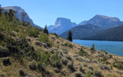
Smoke affected long distance views, but a nice day to start acclimation.
As popular as this trail is, we only passed a few others and only one after we turned off the Highline to Clear Ck. It was an older gent with his dog. Seeing the climbing helmet and full backpack, I asked where he was headed: Klondike Peak up in Bear Basin. Think he said it'd be about 5 days total. That ain't easy. We continued up the canyon to the Natural Bridge.
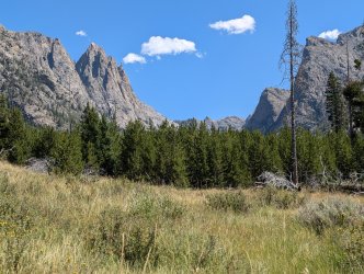
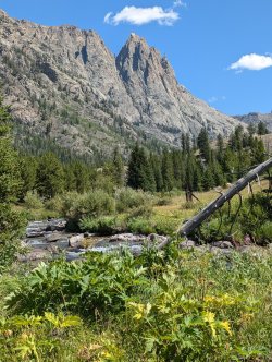
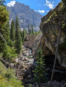
Always enjoy this hike, but it was time to head back.
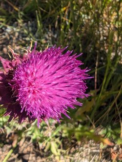
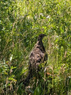
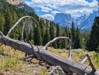
The next day we did a loop out of Elkhart TH. As expected, it was crowded until we branched off towards Miller Lake. Only saw 2 others after that until we reconnected with the Pole Ck trail above the Sweeney Lakes.
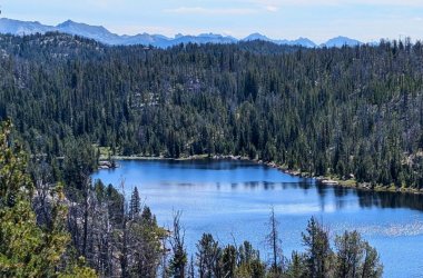
Different from the usual shots taken from Photographers Point. Less people too.
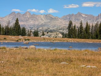
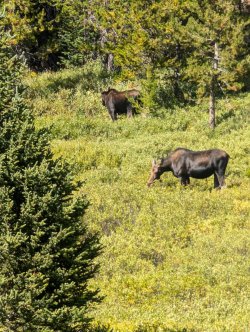
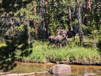
The moose seemed undisturbed by all the traffic we encountered as we returned to the trailhead.
Day 1 - Big Sandy TH to Skull L
The weather was predicted to be mostly good for the next 5 days so we headed out to Big Sandy TH early. Predictably for late Aug, parking was a problem. Managed to squeeze into a small spot off the road, but a good 1/4 mile from the trailhead. We left most of the crowd after turning off the Big Sandy Lake Trail. One advantage of this route is views open up quickly.
We had a few folks being packed in that passed us but we caught up to them as at least one of them had dismounted. Eventually they disappeared from view.
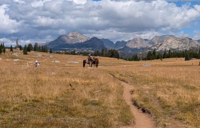
My nephew was having a great time. We got stopped by snow when we last attempted this route.
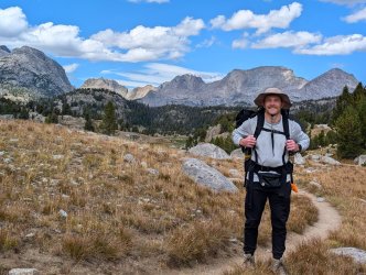
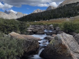
Great views towards Shadow L as well.
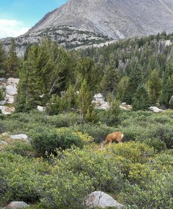
We spotted this deer wearing a collar. Not sure why it's being tracked.
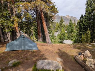
I felt the final 400' climb from crossing the Washakie to Skull L. The route is easy-little gain, but it's 10 m with a full pack and only a few days acclimation. Didn't like the spots I'd targeted by Caltopo and Google Earth, so we scouted around and found one that was reasonable. Had to set my tent up under a pine shedding a lot of needles but it was one of the few level spots I could get a decent stake set. This is my 3rd trip to Skull. Though a few weeks earlier than normal, there were a *lot* more people - at least 4 groups just near the base of the lake.
Day 2: East Fork Day Hike
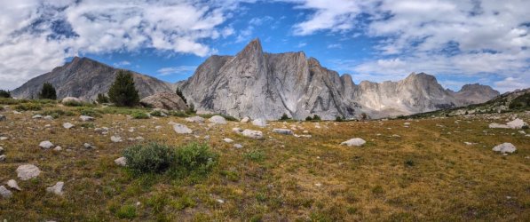
Had a leisurely breakfast and headed out for a day hike to East Fork. Passed a few camps near the Hailey Pass junction.
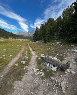
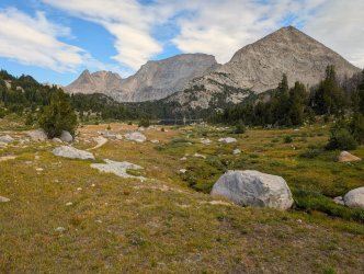
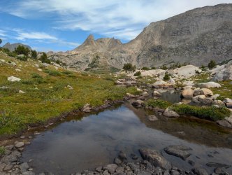
My nephew noticed a few climbers on Midsummer Dome. I didn't have a good enough zoom to capture them.
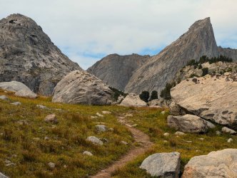
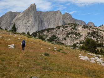
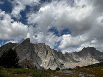
One person passed by headed towards Raid (PITA) Pass but it was otherwise relative solitude from the crowds at Skull. We ate lunch and headed back to camp.
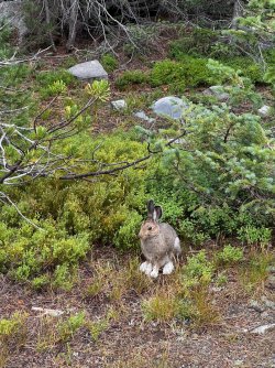
Had a visitor in camp. Probably wanted to escape the noise of some of the other campers.
Day 3. Skull to Upper Valentine
A storm came in early morning. Thunder, sleet and snow for a few hours. That delayed our start. I don't like carrying wet gear unless absolutely necessary and wanted to wait to see if the weather was going to clear as forecast. Luckily the sun came out to help dry gear and views towards Washakie Pass were more encouraging than the last time we got hit with snow. Even the high peaks in East Fork were mostly melted out by the time we were ready.
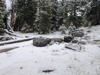
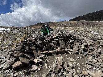
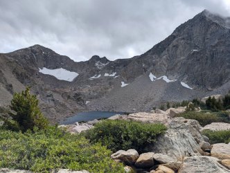
It was a pleasant climb to Washakie Pass, though I was slow on the 1350' ascent. Easy footing on the west side with a lot of rock and grades of 40-50% in the top sections on the east side. Surprised to see wind shelters built near the top sections. Took a lot of effort to build - even flat stone seats- but manmade structures in a designated Wilderness area?
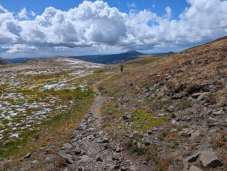
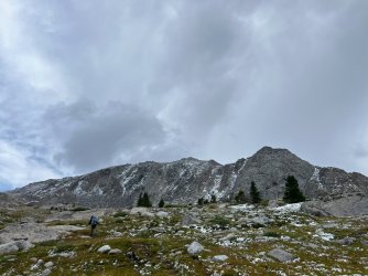
The clouds were still dark near the pass, but clearing nicely in the valley of the South Fork. Some new territory for both of us.
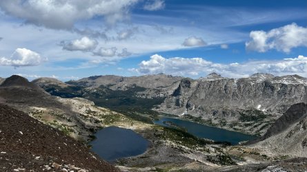
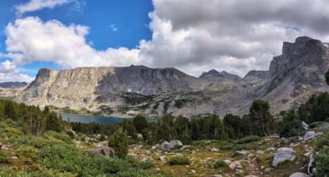
Filling up at Macon L, my nephew's sharp eyes spotted several horses coming over the pass. Looked to be about 8. We went on past Washakie L and crossed S. Fk. One of us didn't get soaking wet boots. The moment was captured on video, though the photo clip from it isn't high quality.
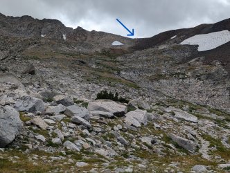
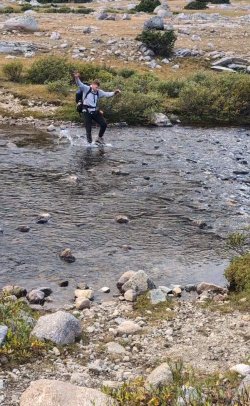
Luckily, not the same outcome that @scatman had on the Hidden Creek outing! We continued on, wet boots and all.
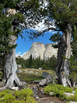
I'd heard Valentine gets a lot of use so we left the trail on a use trail to Upper Valentine. Went farther than I expected from the maps and satellite but found a nice spot on a ridge not far from the lake. Later we did hear other campers further up the lake. View near camp wasn't bad even with trees screening most of the view of South Fork.
Day 4: Upper Valentine to Lizard Head Meadows
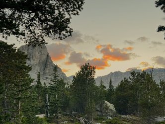
Had a leisurely breakfast with nice views across the lake. Got on the trail around 10.
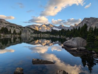
It's a steady 1130' climb to the junction with the Lizard Head trail. Great views back towards the Divide along the way.
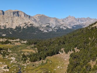
We stopped near Cathedral Peak to take in the views. My nephew was blown away - "best views ever". It's not often you get 30 mile views along the Divide without having to ascend a high peak. Impressive, but I still have special fondness for the many lakes and meadows where the peaks tower overhead.
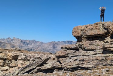
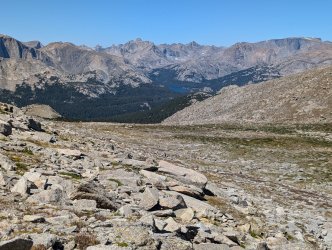
We left the trail to get a closer look at the top of South Fork Basin.
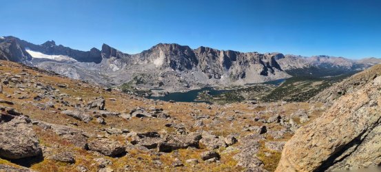
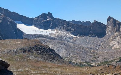
Great views on both sides of Lizard Head. We began the long descent to the Meadows, with great views towards the south and Wind River Peak.
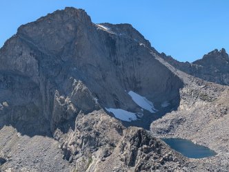
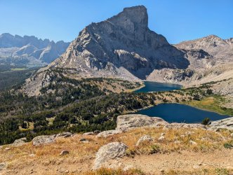
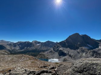
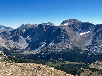
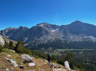
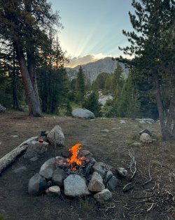
We set up camp below Lizard Head, near Bear Ck. I wanted a cleaner water supply than the North Fk flowing through the meadows. Good views and finally soft and even ground I could get all 4 stakes properly positioned in the Tarptent Dipole DW. Outfitters clearly used the site often though the firepit area left a lot to be desired.
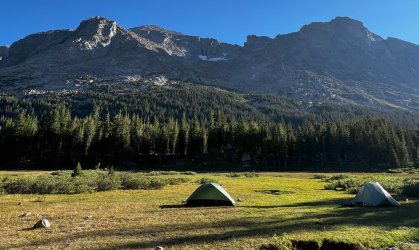
Day 5. Exit
Sunrise near camp. I liked this spot enough to return again with the group. It makes for a longer exit than camping closer to Lonesome L but the (relative) quiet makes it worth it.
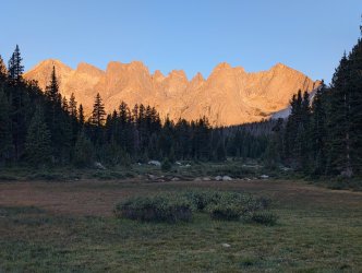
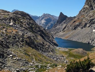
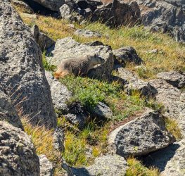
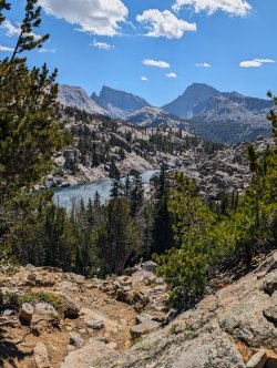
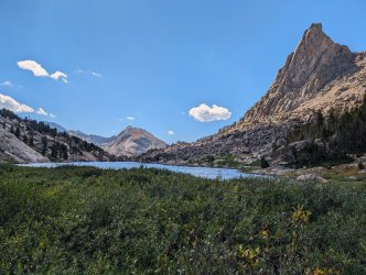
The Cirque was busy, but we only stopped long enough for a few photos. It is a scenic area, though I've been through it a number of times and was destined to see it again in the next week when I'd lead my friends over Texas Pass. We started the long ascent to Jackass Pass. Ran into a marmot with a fluffy tail that was willing to pose for a shot. It got seriously windy at the pass and again past North Lake. On some of the exposed rock sections we had to lean into the wind to keep upright. Found out the next day gusts were above 40 mph.
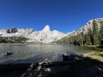
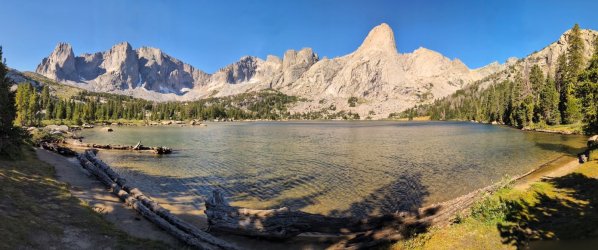
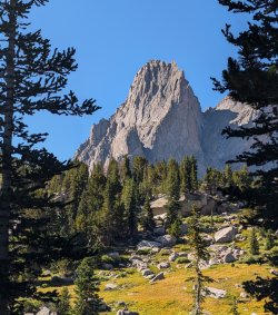
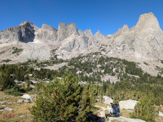
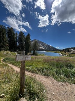
After the long descent from Jackass Pass, my knees were pleased to see this sign. From here it's just a long slog back to the trailhead. We paused occasionally for water, food and a pair of moose near the trailhead. We wanted to get back at a reasonable hour so we picked up the pace for the last 3 miles. Then it was limping to a picnic table, dumping the packs while I made the extra 1/4 mile walk to get the car.
While not the challenge that Bear Basin would have been, this worked out to be a good fallback. Particularly as I had the route already planned from our prior attempt and we got to see some spectacular new territory. Part 2 covers a lot of the same ground as it does the shorter loop over Texas Pass and my time solo where weather nixed almost all my fallback plans. Hope to post that at some point as well.
(a) Lead a few from my local hiking group on a 40 m S. Winds loop - Done, but a second group had to cancel
(b) Attempt some tougher destinations before I get any older - Nope. Bear Basin and/or Flying Monkey didn't happen
(c) Catch a bigger golden trout - Nope. Routes, weather and usual luck prevented that
(d) Not to become griz bait - Well, got closer than usual.
Planning started November, 2023 and by this July I had 3 backpacks set. 2 with local hiking friends (over Texas and Washakie passes, respectively) and a trip with @Bob and my nephew through Bear Basin. Unfortunately, the group going over Washakie had to cancel, as did 2 friends from those planning to go over Texas. The tough journey of the now infamous Hidden Creek Expedition also meant that @Bob couldn't make the brutal route through Bear Basin planned for the last week of August. So my nephew and I did the loop over Washakie, with a side trip to East Fork (about 50 miles total).
Smoke affected long distance views, but a nice day to start acclimation.

As popular as this trail is, we only passed a few others and only one after we turned off the Highline to Clear Ck. It was an older gent with his dog. Seeing the climbing helmet and full backpack, I asked where he was headed: Klondike Peak up in Bear Basin. Think he said it'd be about 5 days total. That ain't easy. We continued up the canyon to the Natural Bridge.


Always enjoy this hike, but it was time to head back.


The next day we did a loop out of Elkhart TH. As expected, it was crowded until we branched off towards Miller Lake. Only saw 2 others after that until we reconnected with the Pole Ck trail above the Sweeney Lakes.

Different from the usual shots taken from Photographers Point. Less people too.

The moose seemed undisturbed by all the traffic we encountered as we returned to the trailhead.

Day 1 - Big Sandy TH to Skull L
The weather was predicted to be mostly good for the next 5 days so we headed out to Big Sandy TH early. Predictably for late Aug, parking was a problem. Managed to squeeze into a small spot off the road, but a good 1/4 mile from the trailhead. We left most of the crowd after turning off the Big Sandy Lake Trail. One advantage of this route is views open up quickly.
We had a few folks being packed in that passed us but we caught up to them as at least one of them had dismounted. Eventually they disappeared from view.

My nephew was having a great time. We got stopped by snow when we last attempted this route.

Great views towards Shadow L as well.

We spotted this deer wearing a collar. Not sure why it's being tracked.

I felt the final 400' climb from crossing the Washakie to Skull L. The route is easy-little gain, but it's 10 m with a full pack and only a few days acclimation. Didn't like the spots I'd targeted by Caltopo and Google Earth, so we scouted around and found one that was reasonable. Had to set my tent up under a pine shedding a lot of needles but it was one of the few level spots I could get a decent stake set. This is my 3rd trip to Skull. Though a few weeks earlier than normal, there were a *lot* more people - at least 4 groups just near the base of the lake.


Day 2: East Fork Day Hike
Had a leisurely breakfast and headed out for a day hike to East Fork. Passed a few camps near the Hailey Pass junction.


My nephew noticed a few climbers on Midsummer Dome. I didn't have a good enough zoom to capture them.


One person passed by headed towards Raid (PITA) Pass but it was otherwise relative solitude from the crowds at Skull. We ate lunch and headed back to camp.

Had a visitor in camp. Probably wanted to escape the noise of some of the other campers.

Day 3. Skull to Upper Valentine
A storm came in early morning. Thunder, sleet and snow for a few hours. That delayed our start. I don't like carrying wet gear unless absolutely necessary and wanted to wait to see if the weather was going to clear as forecast. Luckily the sun came out to help dry gear and views towards Washakie Pass were more encouraging than the last time we got hit with snow. Even the high peaks in East Fork were mostly melted out by the time we were ready.

It was a pleasant climb to Washakie Pass, though I was slow on the 1350' ascent. Easy footing on the west side with a lot of rock and grades of 40-50% in the top sections on the east side. Surprised to see wind shelters built near the top sections. Took a lot of effort to build - even flat stone seats- but manmade structures in a designated Wilderness area?


The clouds were still dark near the pass, but clearing nicely in the valley of the South Fork. Some new territory for both of us.


Filling up at Macon L, my nephew's sharp eyes spotted several horses coming over the pass. Looked to be about 8. We went on past Washakie L and crossed S. Fk. One of us didn't get soaking wet boots. The moment was captured on video, though the photo clip from it isn't high quality.


Luckily, not the same outcome that @scatman had on the Hidden Creek outing! We continued on, wet boots and all.

I'd heard Valentine gets a lot of use so we left the trail on a use trail to Upper Valentine. Went farther than I expected from the maps and satellite but found a nice spot on a ridge not far from the lake. Later we did hear other campers further up the lake. View near camp wasn't bad even with trees screening most of the view of South Fork.

Day 4: Upper Valentine to Lizard Head Meadows
Had a leisurely breakfast with nice views across the lake. Got on the trail around 10.

It's a steady 1130' climb to the junction with the Lizard Head trail. Great views back towards the Divide along the way.

We stopped near Cathedral Peak to take in the views. My nephew was blown away - "best views ever". It's not often you get 30 mile views along the Divide without having to ascend a high peak. Impressive, but I still have special fondness for the many lakes and meadows where the peaks tower overhead.


We left the trail to get a closer look at the top of South Fork Basin.


Great views on both sides of Lizard Head. We began the long descent to the Meadows, with great views towards the south and Wind River Peak.


We set up camp below Lizard Head, near Bear Ck. I wanted a cleaner water supply than the North Fk flowing through the meadows. Good views and finally soft and even ground I could get all 4 stakes properly positioned in the Tarptent Dipole DW. Outfitters clearly used the site often though the firepit area left a lot to be desired.

Day 5. Exit
Sunrise near camp. I liked this spot enough to return again with the group. It makes for a longer exit than camping closer to Lonesome L but the (relative) quiet makes it worth it.

The Cirque was busy, but we only stopped long enough for a few photos. It is a scenic area, though I've been through it a number of times and was destined to see it again in the next week when I'd lead my friends over Texas Pass. We started the long ascent to Jackass Pass. Ran into a marmot with a fluffy tail that was willing to pose for a shot. It got seriously windy at the pass and again past North Lake. On some of the exposed rock sections we had to lean into the wind to keep upright. Found out the next day gusts were above 40 mph.


After the long descent from Jackass Pass, my knees were pleased to see this sign. From here it's just a long slog back to the trailhead. We paused occasionally for water, food and a pair of moose near the trailhead. We wanted to get back at a reasonable hour so we picked up the pace for the last 3 miles. Then it was limping to a picnic table, dumping the packs while I made the extra 1/4 mile walk to get the car.


While not the challenge that Bear Basin would have been, this worked out to be a good fallback. Particularly as I had the route already planned from our prior attempt and we got to see some spectacular new territory. Part 2 covers a lot of the same ground as it does the shorter loop over Texas Pass and my time solo where weather nixed almost all my fallback plans. Hope to post that at some point as well.
Last edited:
