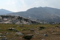
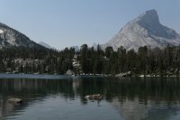
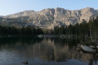
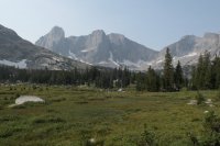
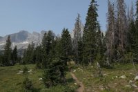
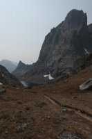
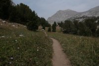
Wind River Range, South - Sept 2-6, 2017

fiber

Member
Joined
May 18, 2013
Messages
80
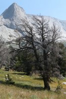
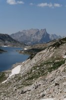
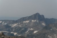
I created this route based on one posted by LarryBoy. He was absolutely right, it is a great route and once you leave the Big Sandy Lake area, there are very few people. This was labor day weekend and Big Sandy TH was packed with +50 cars. We had to park half a mile from the TH in a field. Surprisingly, there were few mosquitoes or biting flies. Only used bug spray a few times. Nights were in the 40's with day time temps in the 80's, with lots of smoke!

We did the loop in 5 days and never hiked longer than 6 hours. We could have made it a 4 day loop, but I brought my fishing rod and wanted time to fish. Unfortunately I only caught a few fish along the way, nothing was biting. I would consider it a moderate route. All off trail navigation is straight forward.

Click here to view on CalTopo
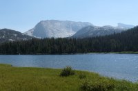
P1010028_tn.jpg

P1010031_tn.jpg

P1010037_tn.jpg

P1010054_tn.jpg

P1010061_tn.jpg

P1010069_tn.jpg

P1010077_tn.jpg

P1010103_tn.jpg

P1010177_tn.jpg

P1010197_tn.jpg

P1010200_tn.jpg

P1010205_tn.jpg

P1010221_tn.jpg

P1010244_tn.jpg
 
Nice trip.... Try going from Sweetwater TH.....way less traffic
 
Awesome trip. I like the variant you introduced of going down via the southwest ramp instead of the northwest. It really is a beauty of a route and I'm glad you got to hike it!
 
I just got back from completing your loop @fiber and it was most excellent. I would like to thank you and @LarryBoy for the fantastic loop. The views from East temple peak and wind river peak are awesome!
 
I'm considering doing a variation on this route late this summer, and have a few questions if you don't mind (tagging @danger02ward and @LarryBoy as well in case they know):
  1. How was the E ridge of Wind River Peak? And would you consider the Ice Lakes area a must-see location? I imagine the standard NE ramp approach for the peak is easier, and that's what I'm leaning towards, but I may do that East ridge like you if the Ice Lakes area is worth it (since the NE ramp avoids that area). We would be doing this portion of the route in the opposite direction as you, at the end of a big loop through the Southern Winds.
  2. I'm assuming the S/SE slope of Wind River Peak wouldn't be too hard going the opposite direction? I'm guessing the preferred direction for this is the way you went, but I would rather do this at the end of our big trip when packs are lighter rather than the beginning when packs are heavier, so I think pack weight will trump direction of travel.
  3. How hard is the Coon Lake Pass? If you can compare to other well-known passes in the area, I would appreciate it (for example, I'm guessing that it's a little harder than Texas Pass but much easier than Knapsack Col). Again, we will be going in the opposite direction, which may be a bit harder.
Thanks!
Ryan
 
Difficulty is an individual thing. Even Almost 70 places I think are not difficult another would think it's terrible.
 
Difficulty is an individual thing. Even Almost 70 places I think are not difficult another would think it's terrible.
Very true---that's why I was inquiring about relative difficulty, comparing that pass to other, more well-known, passes in the region
 
Well.... Example..... I didn't think knapsack col was bad......
 
I'm considering doing a variation on this route late this summer, and have a few questions if you don't mind (tagging @danger02ward and @LarryBoy as well in case they know):
  1. How was the E ridge of Wind River Peak? And would you consider the Ice Lakes area a must-see location? I imagine the standard NE ramp approach for the peak is easier, and that's what I'm leaning towards, but I may do that East ridge like you if the Ice Lakes area is worth it (since the NE ramp avoids that area). We would be doing this portion of the route in the opposite direction as you, at the end of a big loop through the Southern Winds.
  2. I'm assuming the S/SE slope of Wind River Peak wouldn't be too hard going the opposite direction? I'm guessing the preferred direction for this is the way you went, but I would rather do this at the end of our big trip when packs are lighter rather than the beginning when packs are heavier, so I think pack weight will trump direction of travel.
  3. How hard is the Coon Lake Pass? If you can compare to other well-known passes in the area, I would appreciate it (for example, I'm guessing that it's a little harder than Texas Pass but much easier than Knapsack Col). Again, we will be going in the opposite direction, which may be a bit harder.
Thanks!
Ryan
1. Haven't done the due-E ramp, so I can't really say.
2. It's possible yes. I would vastly prefer to go up the S ramp rather than down though. There are some larger boulders to climb up, which are definitely easier up than down. I did it in an almost zero-vis situation though so it's possible that I didn't take the best line.
3. Honestly it's been a few years, so I could totally be wrong. But honestly I didn't think it was bad at all. It's in the trees, and doesn't involve a ton of vert. The main challenge is picking a good line to avoid the steeps and the worst of the vegetation.
Thanks!
 
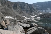
1. There is a short cliff band along the South side of the E-Ramp near the lake. Follow it until you see a class 2-3 section, a ramp, that you can use to climb through the cliff band. There where a few breaks if I remember right, just pick one. The Ice Lakes area is nice, but it is not spectacular.
2. You could do the route either way. Going up or down the S/SE side of Wind River Peak isn't going to change the difficulty at all. That side of the Peak is mostly a boulder field turning to grass as you move away from the Peak.
3. I've never done Texas pass, but I have seen it from the bottom. I would think Coon pass would be easier, at least it looks easier from the bottom. Again, I don't believe it matters which direction you do Coon pass from, same difficulty.
Awesome, thanks! Sounds like we'll stick to my original plan, going up the NE ramp and down the S/SE side, then down Coon pass.
 
Back
Top