AbinadiWitness
Member
- Joined
- Oct 25, 2017
- Messages
- 33
***Another "I'm new here/catch-up post" from 2016 (posted here Oct. 2017): This was my first real foray into the stunning Wind River Range in Wyoming. The week before this trip I had packed out to Island Lake in a day from Elkhart Park but had to turn back the very next morning because my hiking partner got altitude sickness, so I cancelled my trip scheduled the following week to the Beartooth Range in Montana where I had planned to climb Granite Peak out there in order to allow me to come back and really get into the Wind River Range, which is my favorite mountainous area on the planet, and this is that story. Amazing place; excited and hopeful to make many more trips out to this range as the years go on. ") ***
***
This has to go down as one of the most interesting, if not the most interesting backpacking trip I've ever done, for multiple reasons...If you've read my "Wind River Range - Chasing Dreams - Part 1 - 8-10 August 2016" trip report (http://peakwalker.blogspot.com/2016/08/wind-river-range-chasing-dreams-part-1.html) then you know a fair amount of the prelude to my return to the Wind River Range and why it occupies such a singular place in my consciousness...I'll endeavor to "pick up where I left off" (as it were) and relate the tale of one of the grandest adventures I've had in the mountains and the fulfillment of a long-treasured dream at last attained...
***This has to go down as one of the most interesting, if not the most interesting backpacking trip I've ever done, for multiple reasons...If you've read my "Wind River Range - Chasing Dreams - Part 1 - 8-10 August 2016" trip report (http://peakwalker.blogspot.com/2016/08/wind-river-range-chasing-dreams-part-1.html) then you know a fair amount of the prelude to my return to the Wind River Range and why it occupies such a singular place in my consciousness...I'll endeavor to "pick up where I left off" (as it were) and relate the tale of one of the grandest adventures I've had in the mountains and the fulfillment of a long-treasured dream at last attained...

Titcomb Basin, my high mountain paradise, and a place I'd been dreaming of seeing with my own eyes for many years.
Upon returning from my unfortunately-slighted trip to the Wind River Range the previous week I reached out to the various individuals who had expressed interest in accompanying me to Montana to climb the highest peak in that state to let them know of the circumstances necessitating my cancelling of that event and my replacement of it with a return to the Winds during the same time frame already scheduled for the Granite Peak trip in Montana. Of the several people contacted, most had to drop out because of work conflicts (and so wouldn't have been able to attend during that time regardless of destination); there was one older gentleman, a 65 year old, strong hiker named Claron, who was really excited for Granite Peak, MT, but at least open to the idea of the Wind River trip...After Claron made an unsuccessful attempt to gather a group to go to Granite Peak in Montana he contacted me and expressed interest in coming on the Wind River Range trip, which, after I let him know this trip would not be cancelled or altered for anything less than a life-threatening emergency (I was determined to realize this dream at last) I agreed to have him along on this great pursuit of adventure.
As agreed, I picked Claron up at his house Monday evening and had an opportunity to meet his lovely wife as well. Claron and I had hiked previously on two occasions up to some of the great Wasatch 11,000+ foot peaks (Monte Cristo and Mount Superior via Lake Blanche: http://peakwalker.blogspot.com/2016/08/mount-superior-and-monte-cristo-via.html and up the Broads Fork Twin Peaks' Robinson Variation route: http://peakwalker.blogspot.com/2016/08/broads-fork-twin-peaks-robinson.html) and though he's not the fastest hiker he's also not the slowest, and he's both competent on challenging terrain and adventurous; I enjoy hiking with him and was glad to have him along on this trip.
We had a pleasant drive out to the Wind Rivers, just over four hours drive from Claron's location, and were able to find an available campsite at the nearby semi-formalized sites near the Elkhart Park trailhead. We set up after midnight and got a few hours of sleep before rising fairly early and heading up the very busy looking trailhead at Elkhart Park (there were probably about 150 cars there) somewhere in the mid-to-later morning.
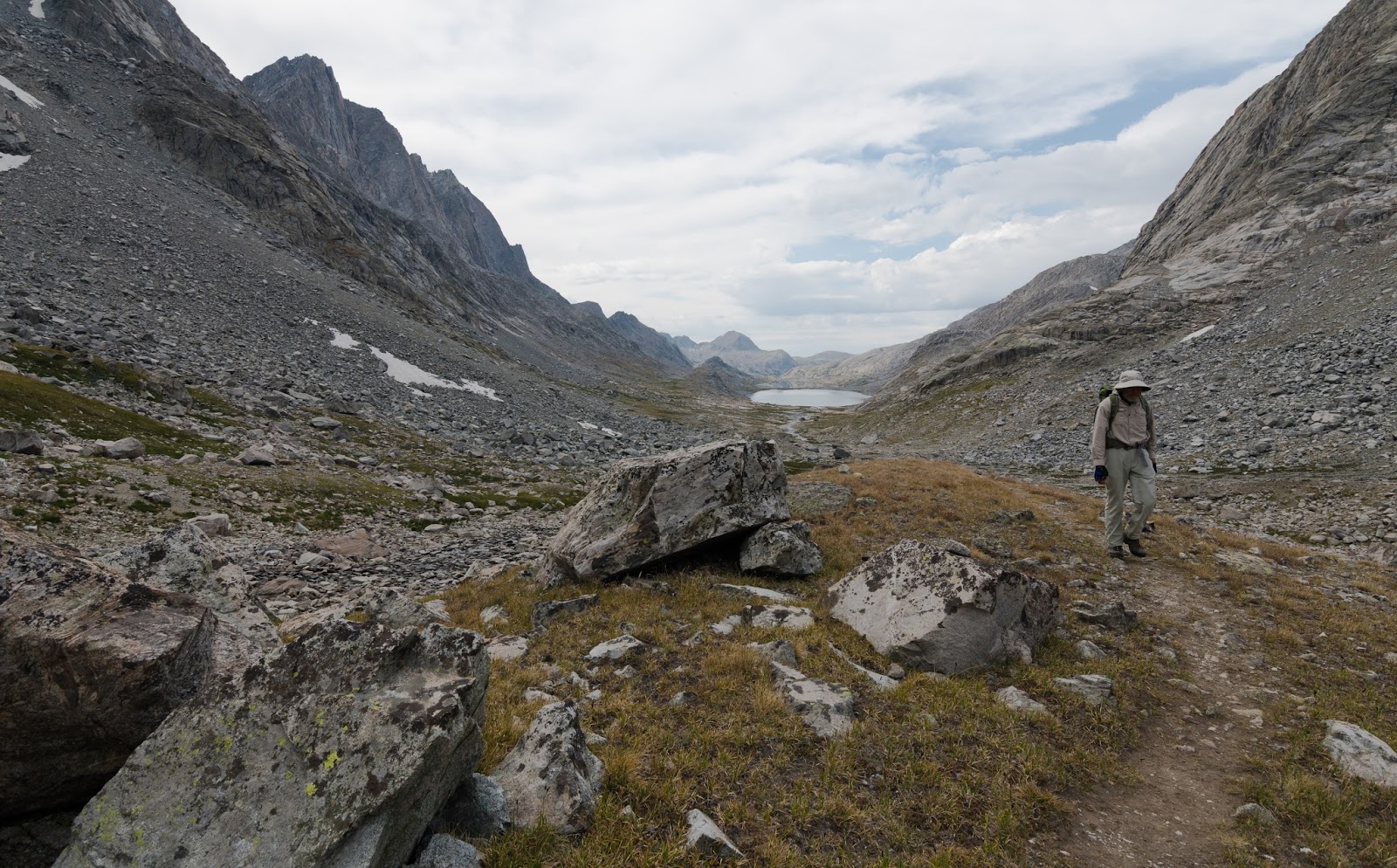
I won't spend much time describing the approach into the Island Lake area in this trip report (you can check out my "Part 1" of this two part report for that detail and more pictures of the hike in, etc.); I'll only say that by the time we came into the Island Lake area those 13 miles later it was getting into the golden hours of the evening, when photographers start loving the light even more...and it was a joy to come into the ever-glorious view of Island Lake with its surrounding ruggedness under such stunning conditions; 'twas a sight not to be missed and remains one not to be forgotten.
As agreed, I picked Claron up at his house Monday evening and had an opportunity to meet his lovely wife as well. Claron and I had hiked previously on two occasions up to some of the great Wasatch 11,000+ foot peaks (Monte Cristo and Mount Superior via Lake Blanche: http://peakwalker.blogspot.com/2016/08/mount-superior-and-monte-cristo-via.html and up the Broads Fork Twin Peaks' Robinson Variation route: http://peakwalker.blogspot.com/2016/08/broads-fork-twin-peaks-robinson.html) and though he's not the fastest hiker he's also not the slowest, and he's both competent on challenging terrain and adventurous; I enjoy hiking with him and was glad to have him along on this trip.
We had a pleasant drive out to the Wind Rivers, just over four hours drive from Claron's location, and were able to find an available campsite at the nearby semi-formalized sites near the Elkhart Park trailhead. We set up after midnight and got a few hours of sleep before rising fairly early and heading up the very busy looking trailhead at Elkhart Park (there were probably about 150 cars there) somewhere in the mid-to-later morning.
I won't spend much time describing the approach into the Island Lake area in this trip report (you can check out my "Part 1" of this two part report for that detail and more pictures of the hike in, etc.); I'll only say that by the time we came into the Island Lake area those 13 miles later it was getting into the golden hours of the evening, when photographers start loving the light even more...and it was a joy to come into the ever-glorious view of Island Lake with its surrounding ruggedness under such stunning conditions; 'twas a sight not to be missed and remains one not to be forgotten.
Epicness at Photographer's Point.
Epicness at Photographer's Point (Sans me).

JUMP!
One of the many lakes you pass after Photographer's Point on the way out to Island Lake.

My hiking partner, Claron (center-right), coming through one of the many dips and rises of the trail between Photographer's Point and Island Lake.

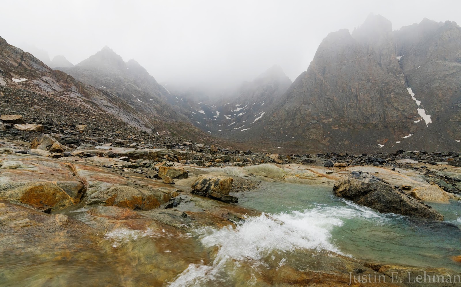
This is really the only substantial stream-crossing on the way in to Island Lake and it's exceedingly straightforward. There are some major stream/river crossings in the Wind River Range that can represent significant challenges on some routes, but you won't find anything like that on this approach.
Nice views of Lester Pass, which is either part of or very near to the Continental Divide Trail's course as it goes through parts of this range.

Getting close to Island Lake...
This is either Mount Sacajawea or Mount Helen...I'm not sure; both are large, somewhat similarly-shaped peaks along the eastern side of Titcomb Basin and from this vantage point I wasn't sure which this was, though I can tell you easily from within Titcomb Basin which is which; seen here very zoomed-in while we were still hiking to Island Lake. If I was to venture a guess (as I now am) I'd say this was Mount Sacajawea; I don't believe you have a full view of Mount Helen from this area...
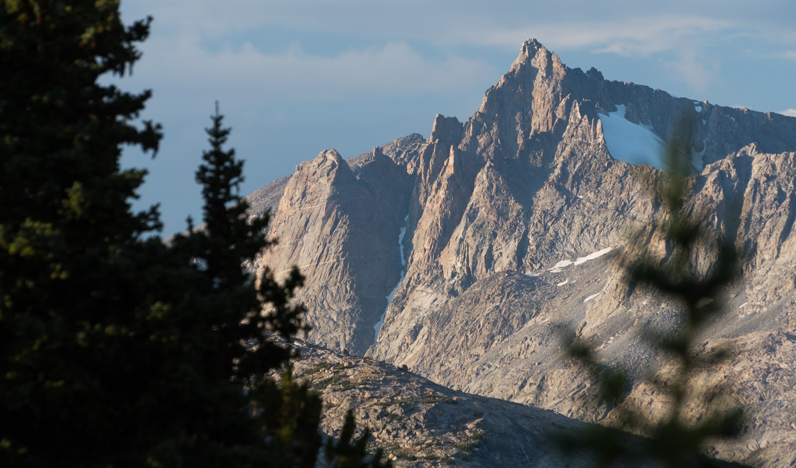
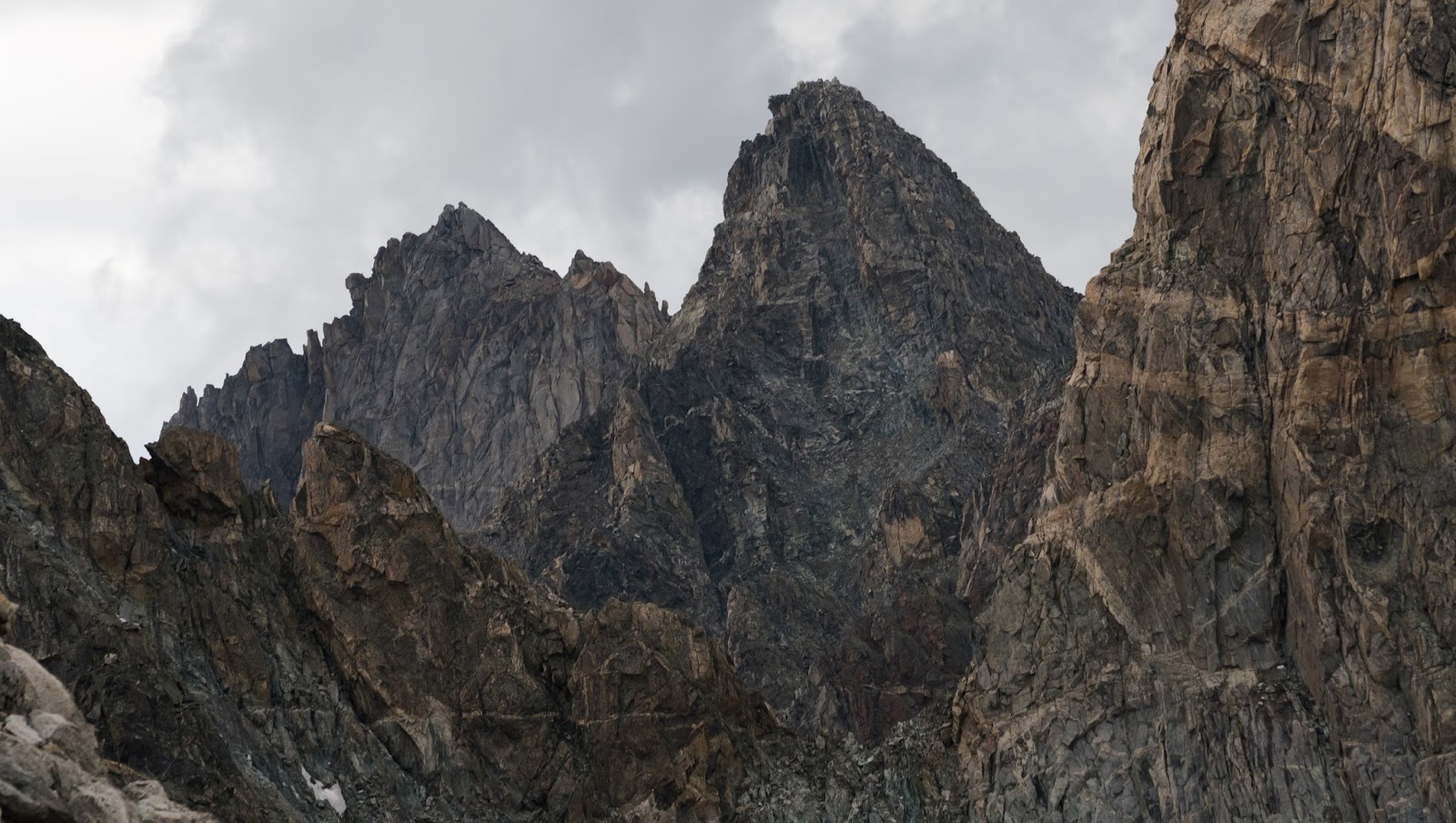
Mount Woodrow Wilson (13,502 feet) is an especially eye-catching peak in the Titcomb Basin area; from the approach to Island Lake.

Fremont Peak (13,745 feet), the tallest peak with a non-technical route option in Wyoming; only Gannet Peak (13,804 feet) and the Grand Teton (13,770 feet) are taller and are both peaks typically requiring some kind of specialized equipment to summit.

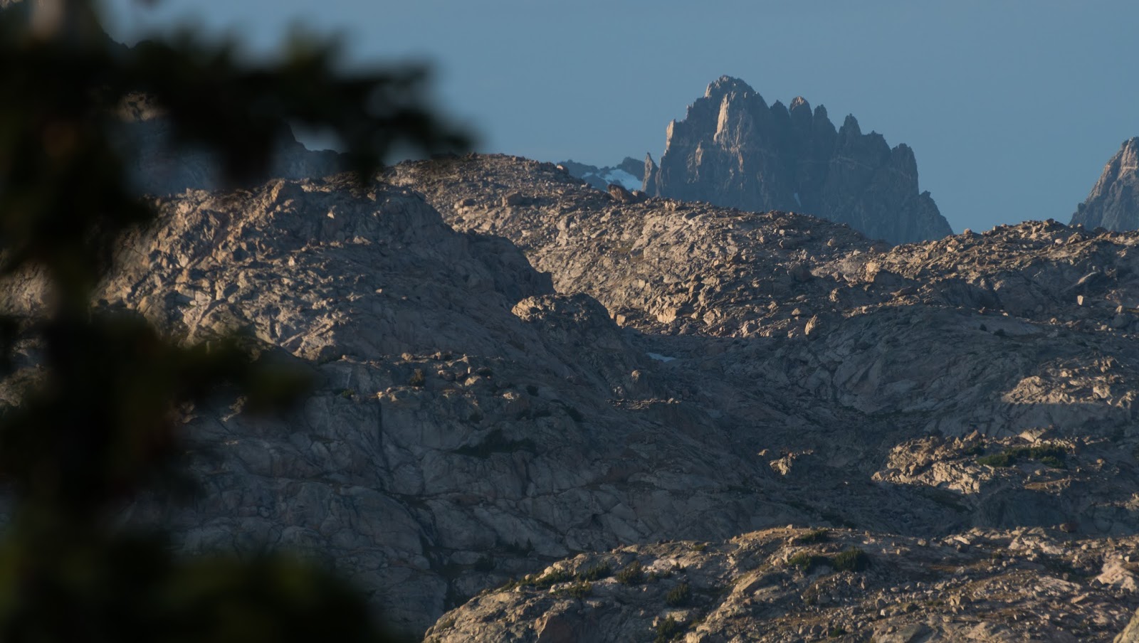
Not sure which peaks these are, but they're beautiful parts of the Titcomb Basin neighborhood.

Mount Lester (12,251 feet) ridge detail; Mount Lester is the most significant peak visible beyond Seneca Lake as one is hiking by that large body of water.
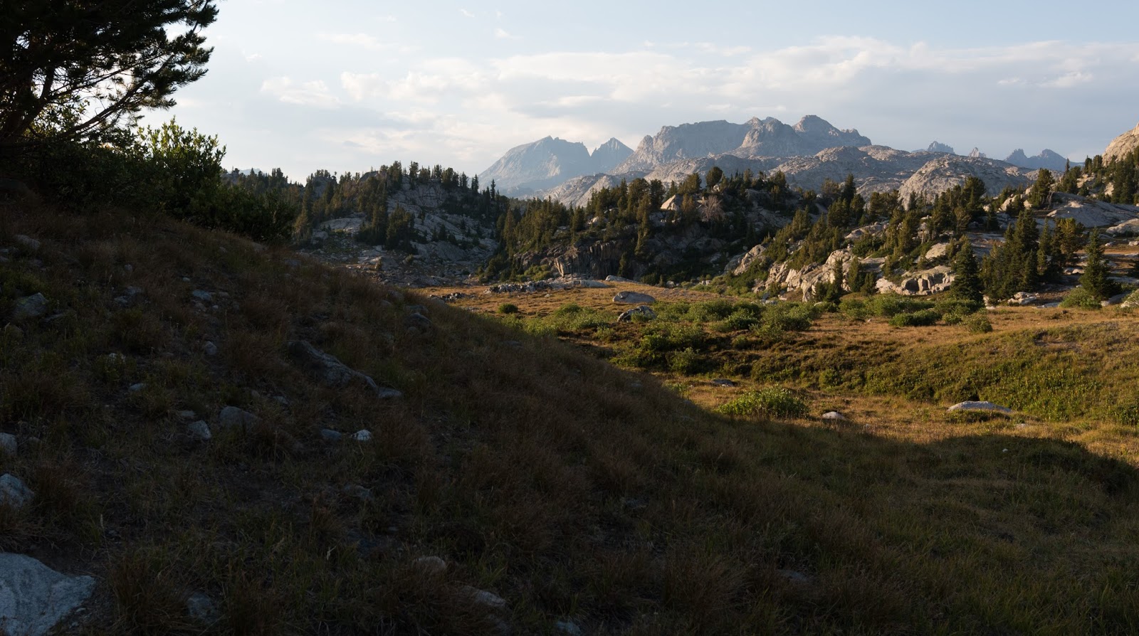
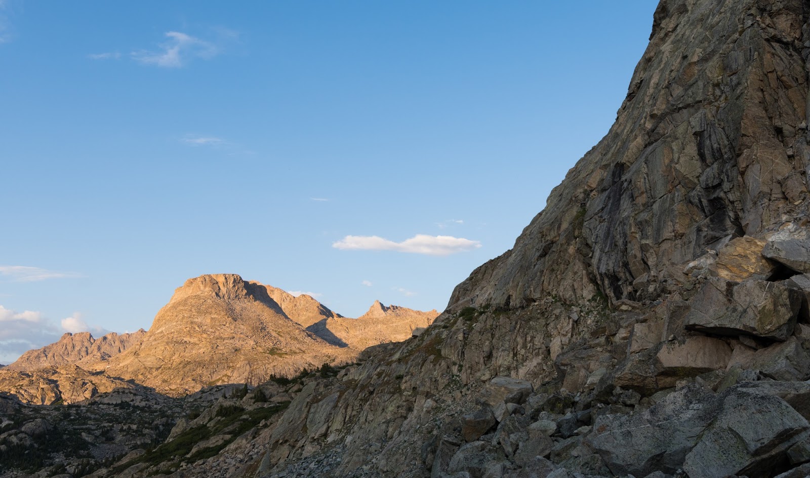
Beautiful lighting over distant rugged country on the way to Island Lake.
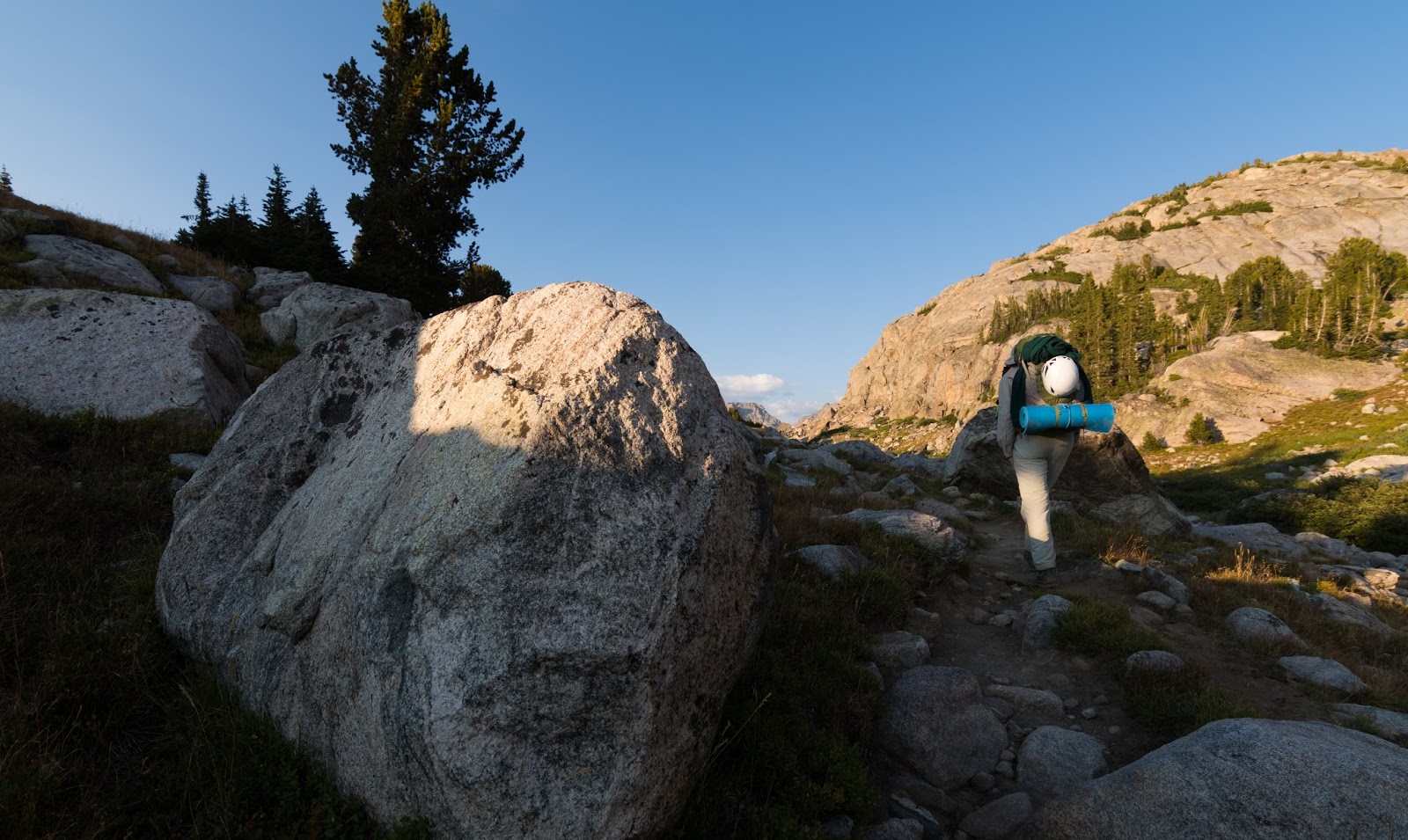
Claron's still pushing along; it's a long hike in to Island Lake with a full pack on; we tracked it at 13 miles one way...almost there in this shot...
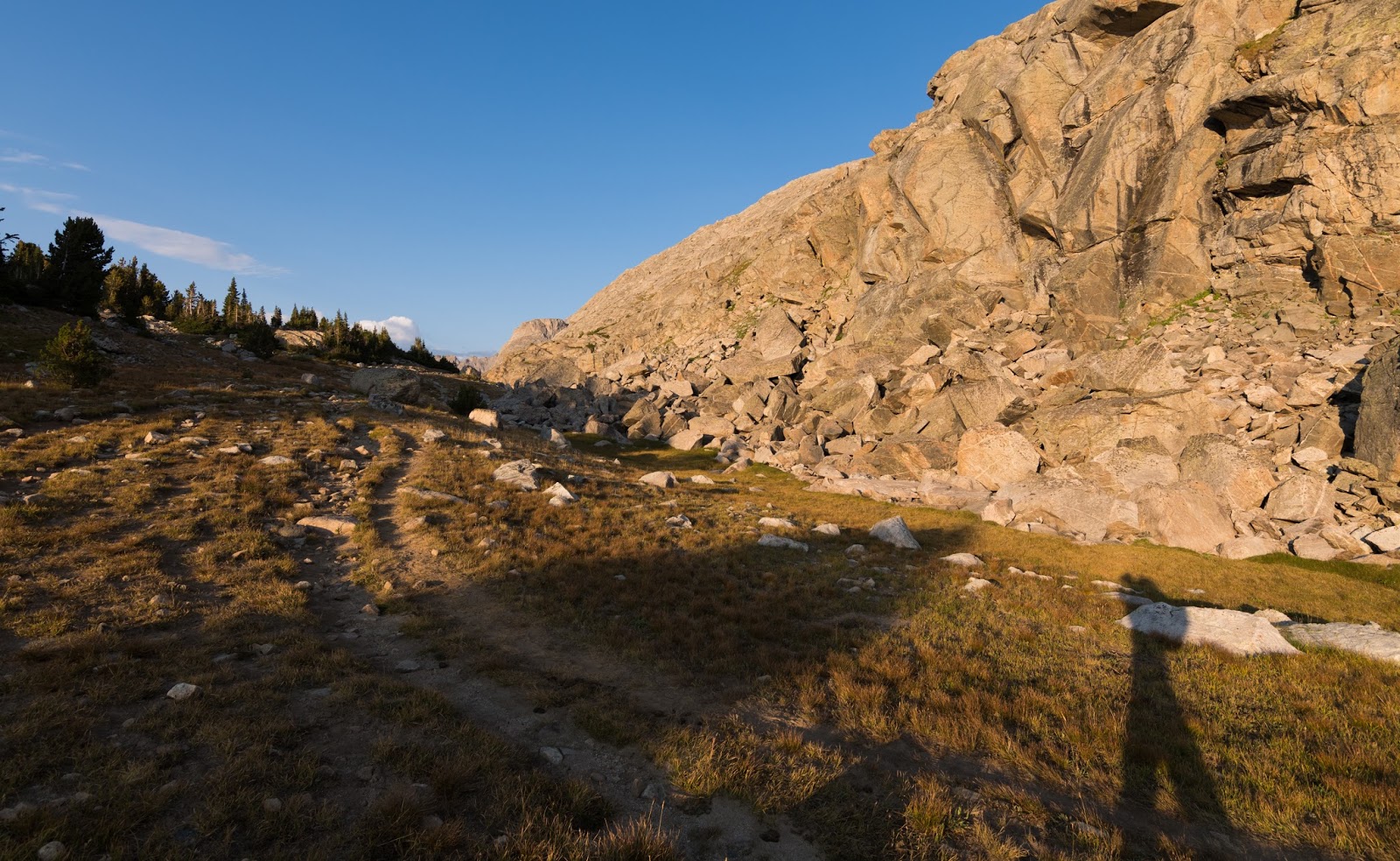
Self-portrait in shadow on the way to Island Lake...still almost there...
Elephant Head (12,160 feet) catches the evening light nicely as we make our final approach into the Island Lake area...even more almost there...

There at last! Coming to this overlook and seeing Island Lake and the big peaks beyond it robed in the golden light of the evening ranks among the most sublime experiences I've ever had in the outdoors...it was a beautiful gift.
Another view from the shores of Island Lake on the way to our campsite, which was on the light yellow hill above the water visible center-right here.

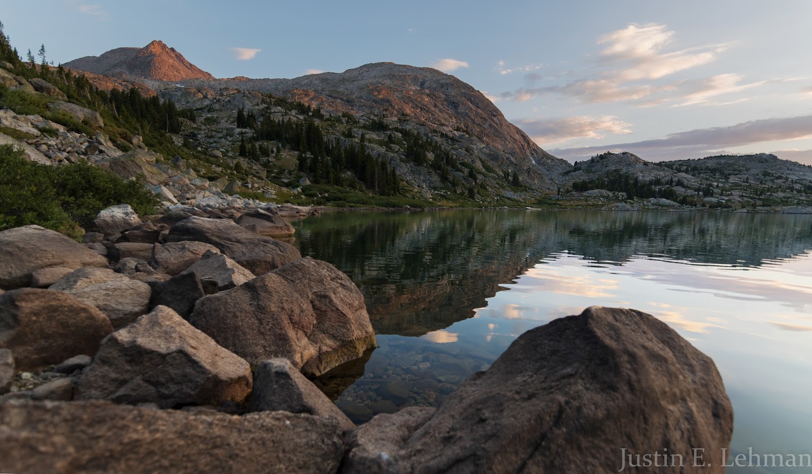
A lovely sunset at Island Lake on our first night.
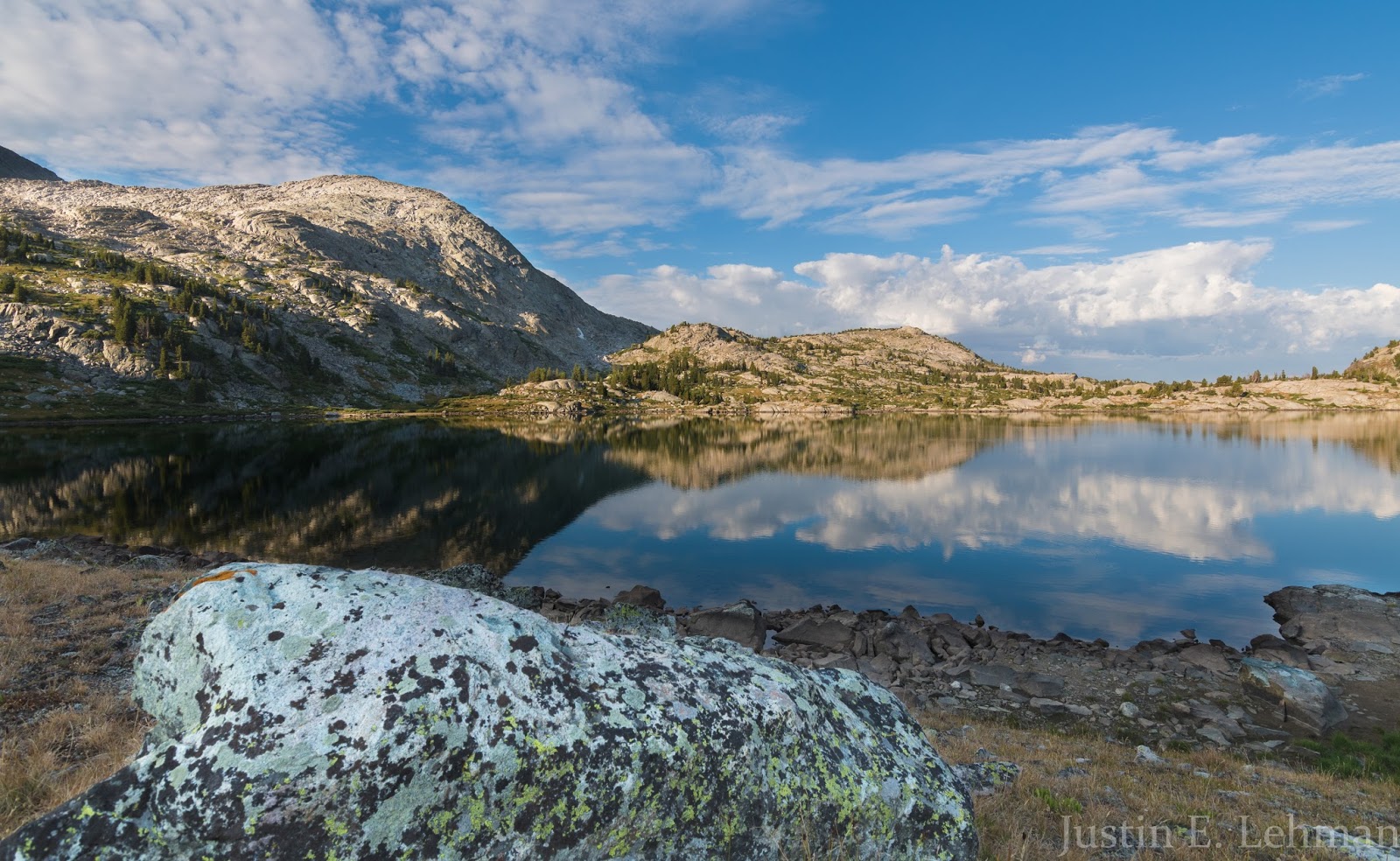
Looking toward the south-southeast from our campsite on the southeast shores of Island Lake.
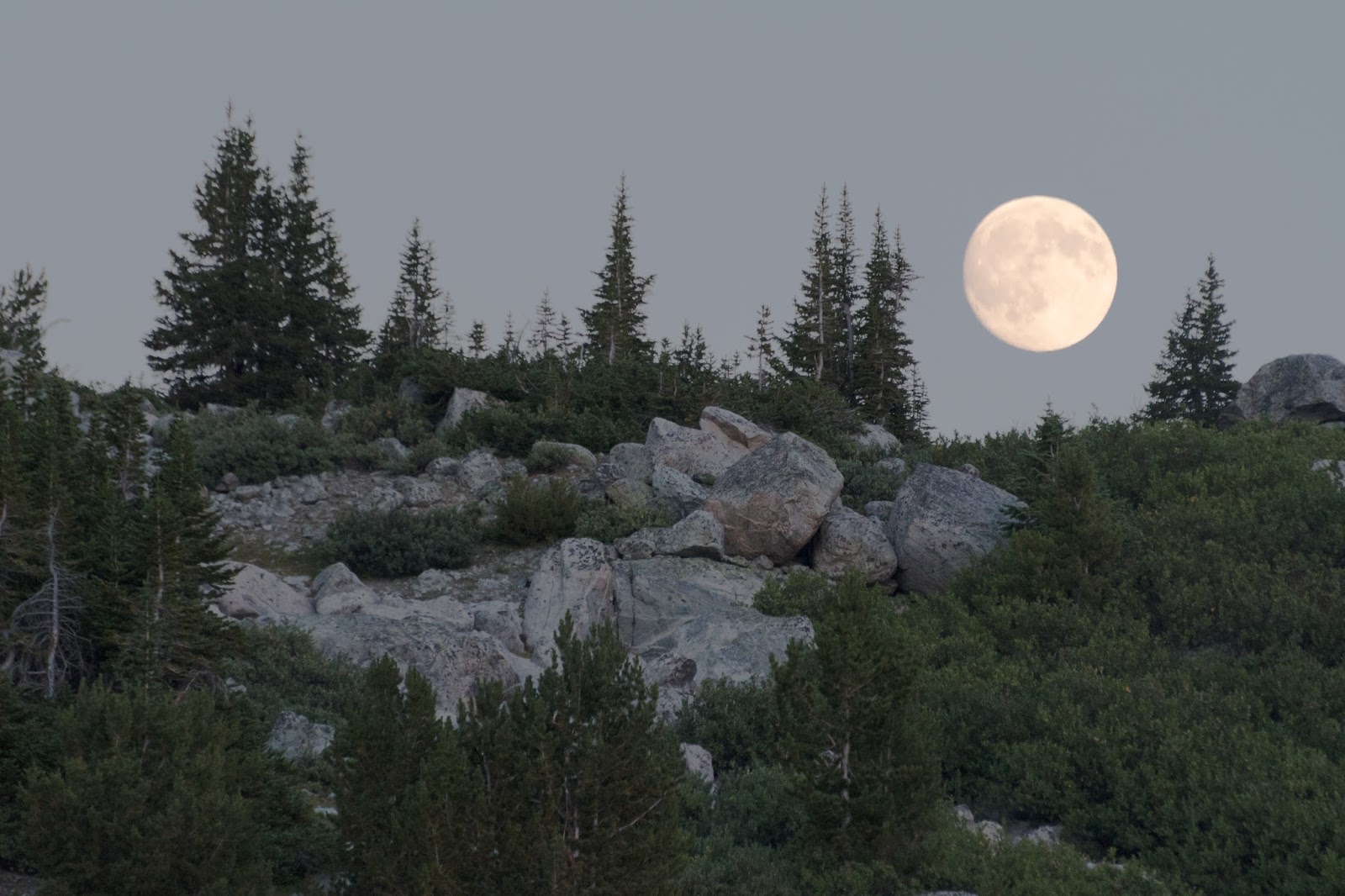
Caught a beautiful moonrise over a nearby ridge shortly before heading to bed.
Sunrise from camp - Day 2.
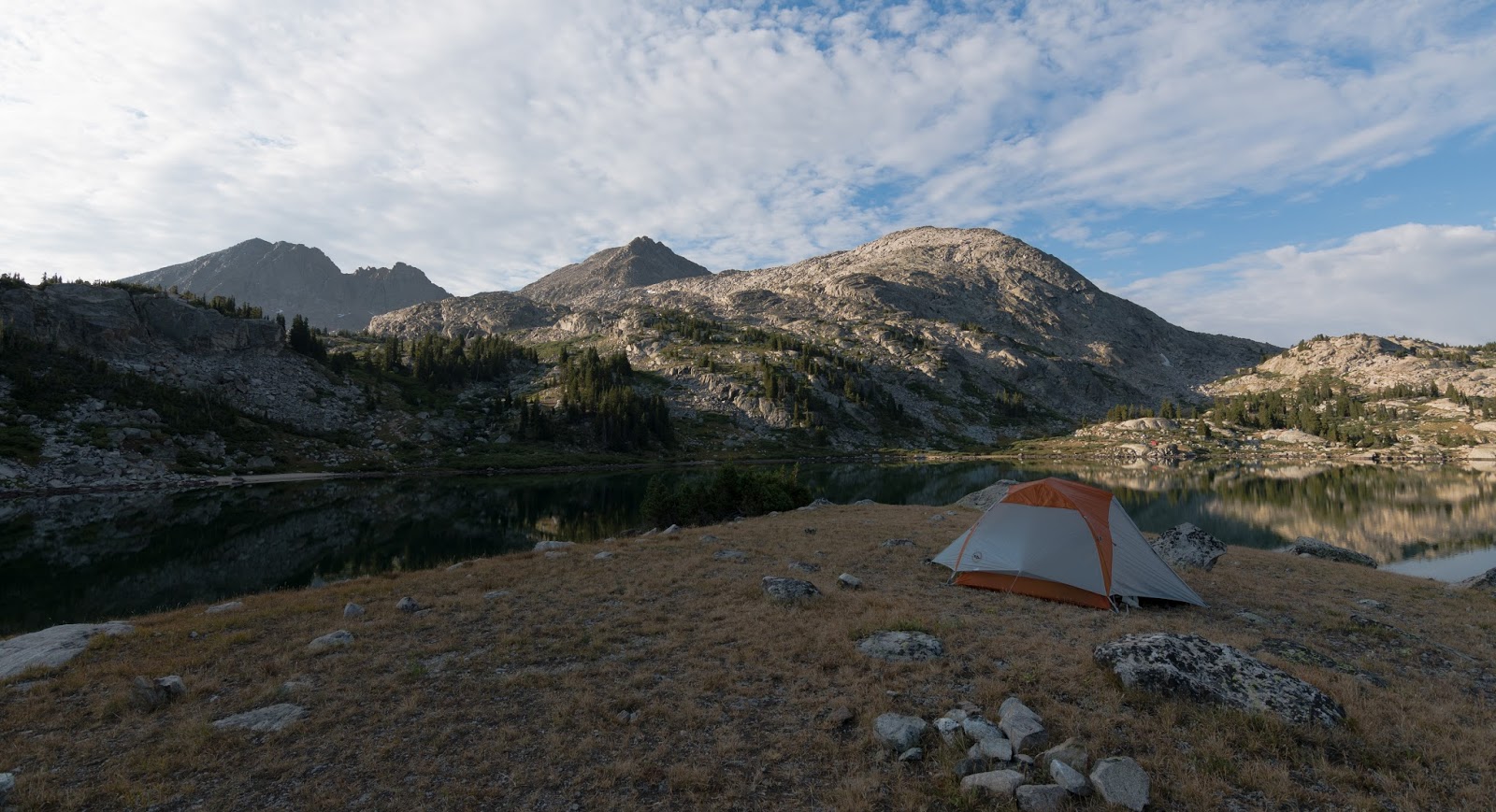
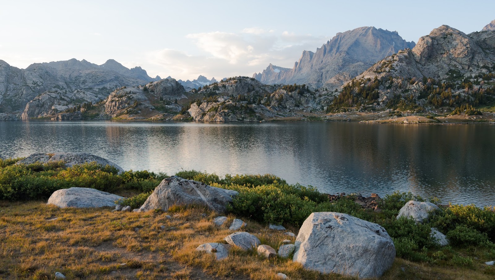
Our campsite on the shores of Island Lake - how about those views!
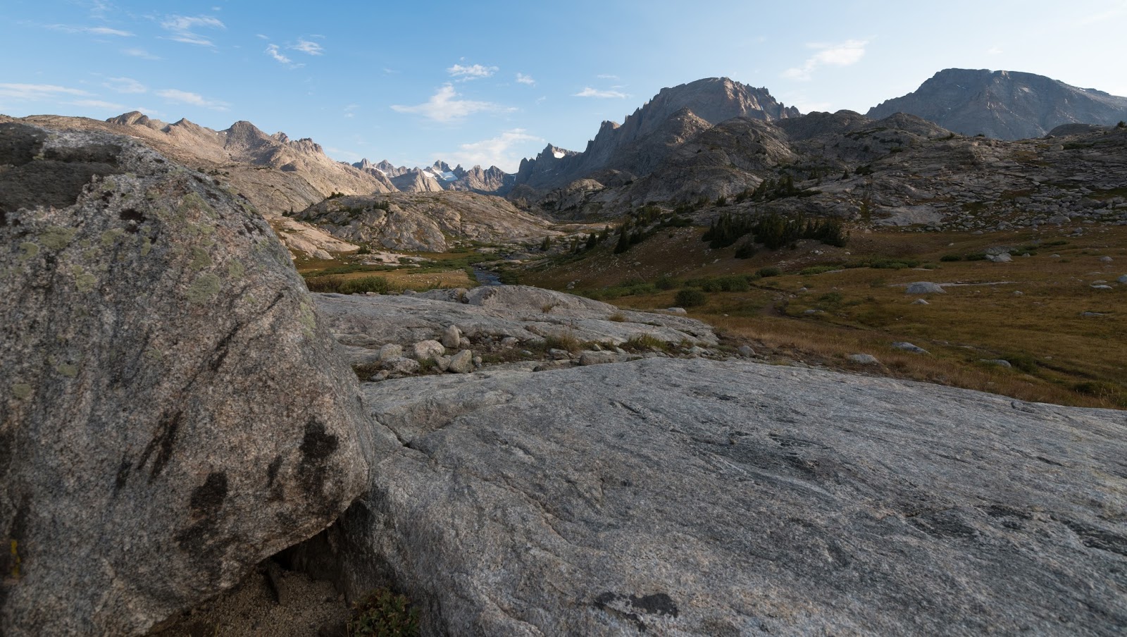
Beautiful views on the approach to Indian Basin; Titcomb Basin is straight ahead here and Indian Basin is over a pass to the right in this view.

Heading toward Indian Basin; Jackson Peak (13,517 feet) is the prominent peak in the upper center here.

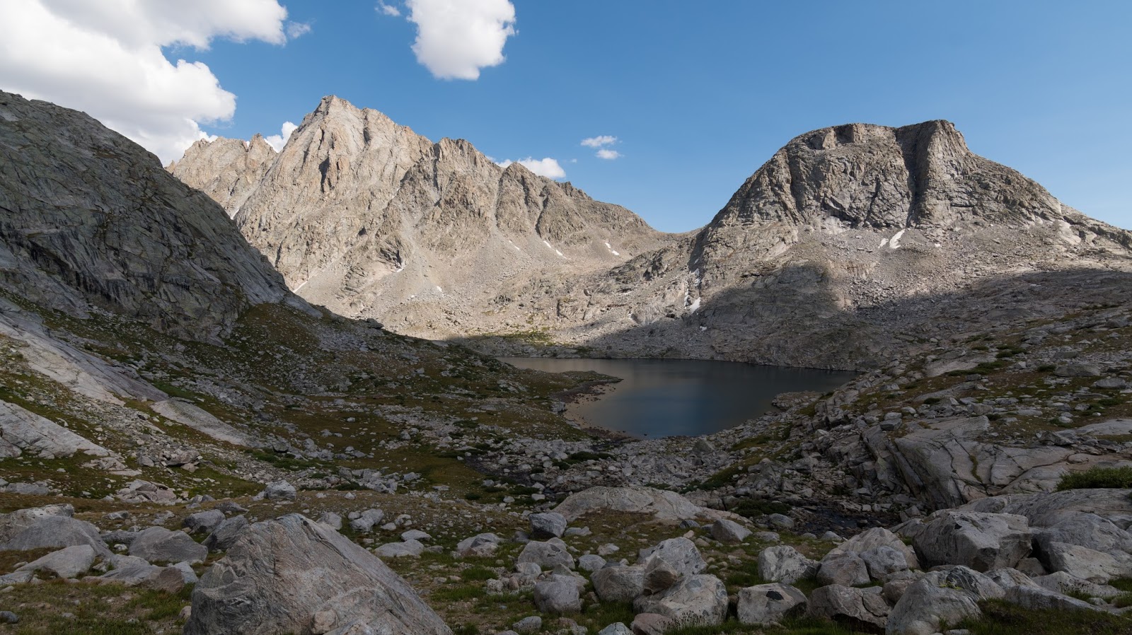
Looking toward Ellingwood Peak (13,052 feet; also known as Harrower Peak) stands imposingly across Indian Basin as we work our way further in toward Fremont Peak.
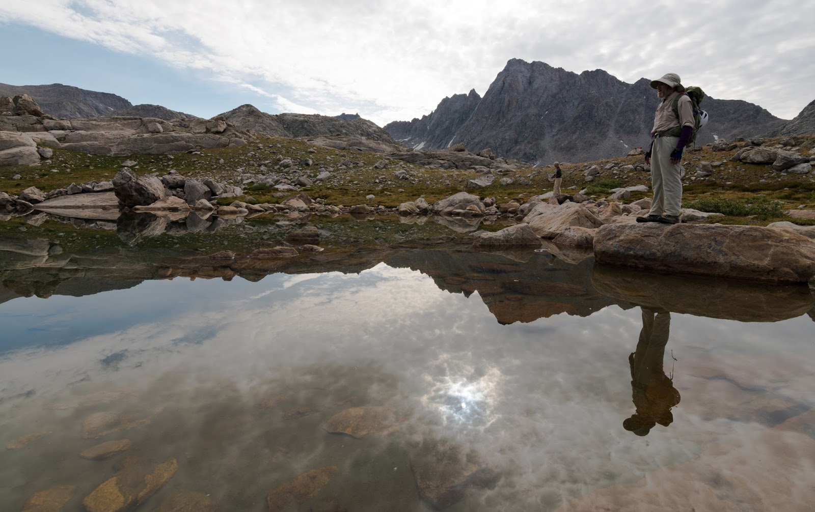
Claron, feeling a little reflective...
Fantastic reflection I caught off a small tarn in Indian Basin - absolutely stunning view!

Claron refilling his waterbottle during our hike through Indian Basin on the way up Fremont Peak.
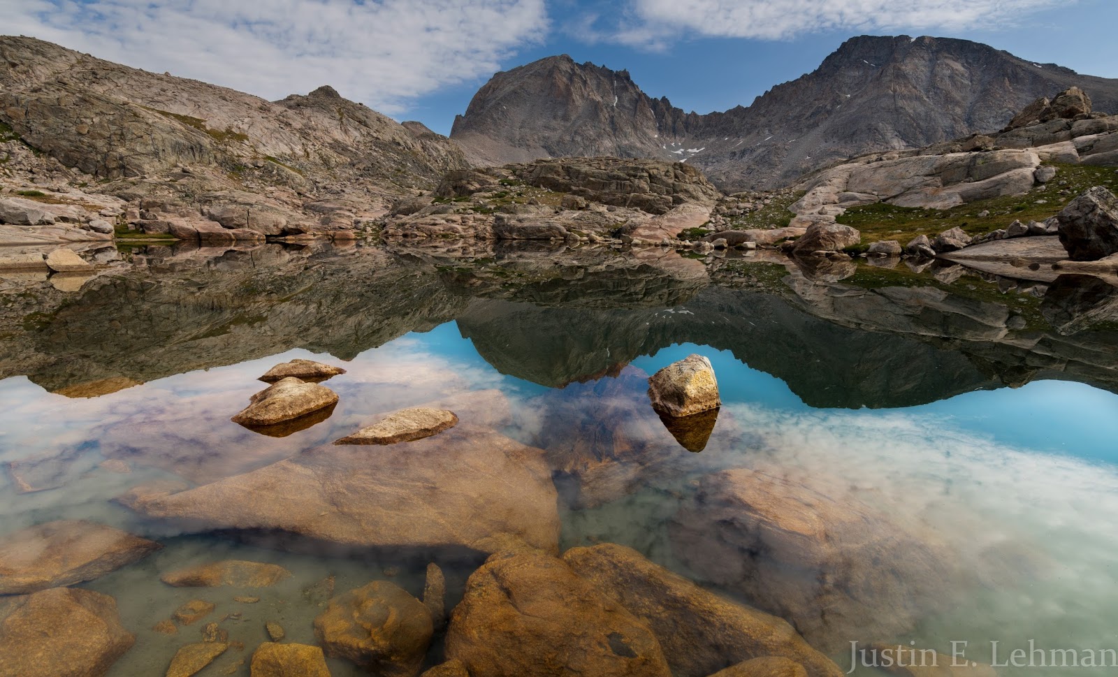
Beautiful reflection of Ellingwood Peak across a small lake in Indian Basin.
Nice perspective on Elephant Head as we start gaining elevation on our way to Fremont Peak.
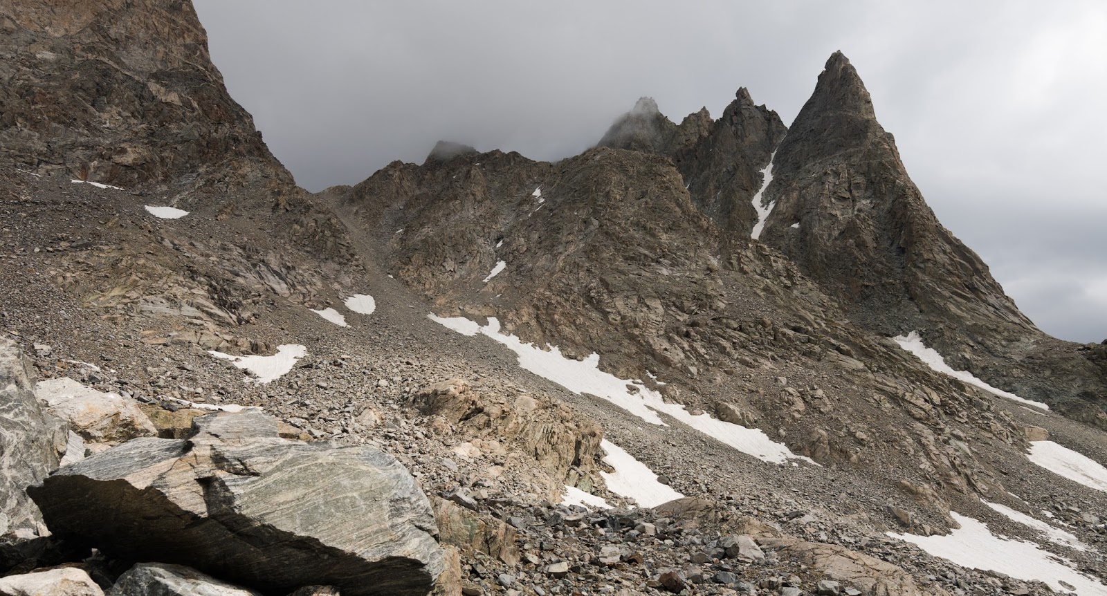
Terrain's getting more rugged here...this is amazing country, pretty much everywhere you look...

Getting closer to Fremont Peak (the large peak to the left here); our aim is the saddle on the left of Fremont Peak at about 12,000 feet above sea level.
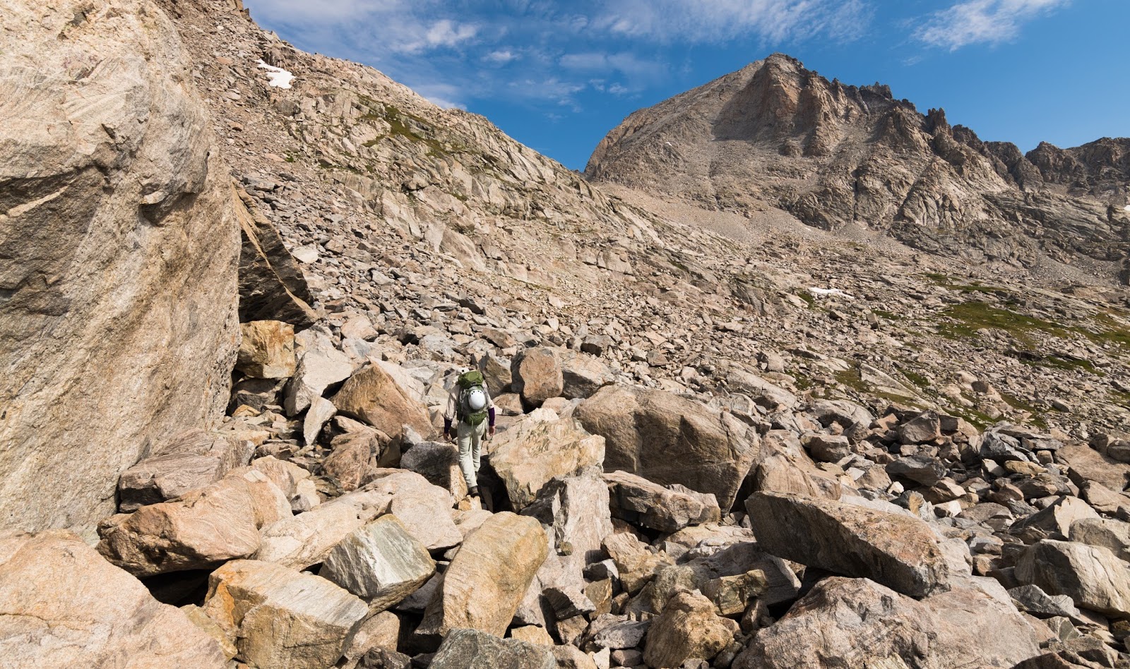
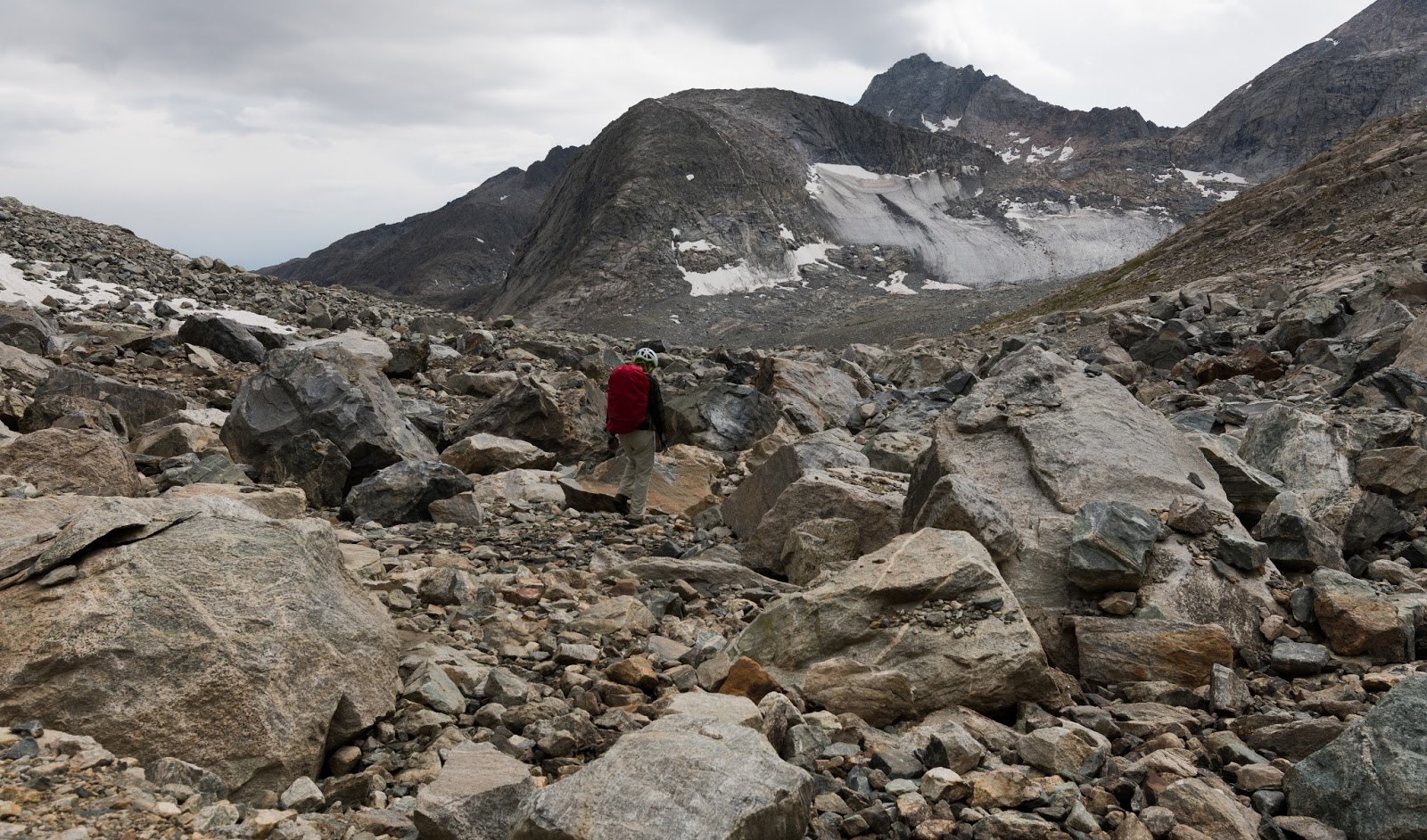
Lots of boulder hopping on the way up to Fremont Peak. Can you see Claron just left of center?

Gradually getting closer...lots more boulders ahead before we begin working directly up the ridge to the saddle.
Claron tops out at the high saddle on Fremont Peak, approximately 12,000 feet up.
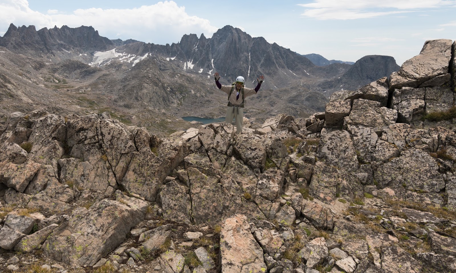
Enjoying my first glimpse of Titcomb Basin from the high saddle on Fremont Peak - spectacular!
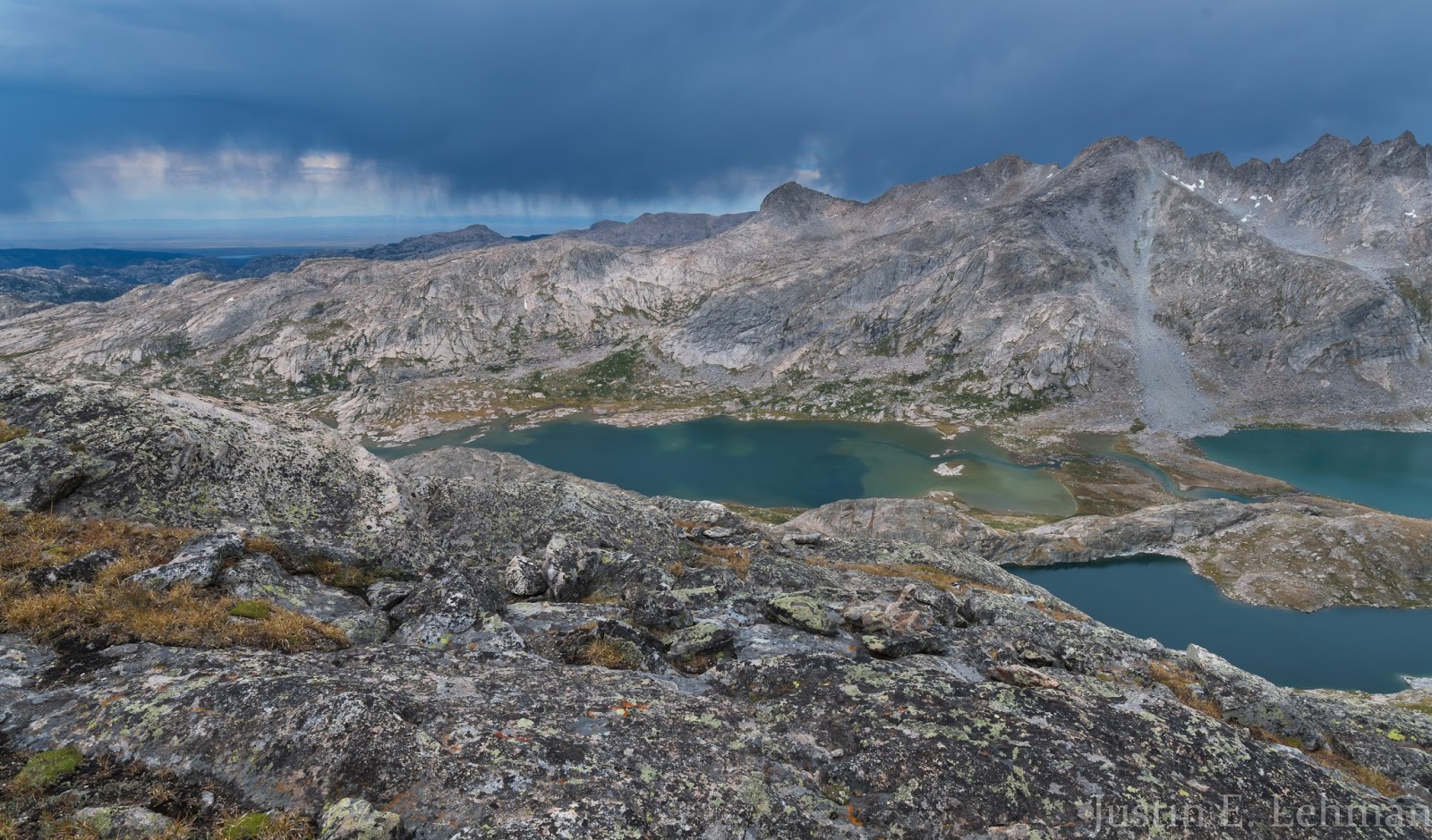
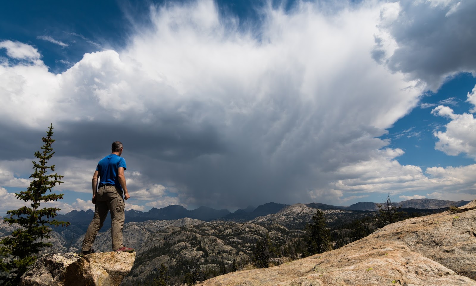
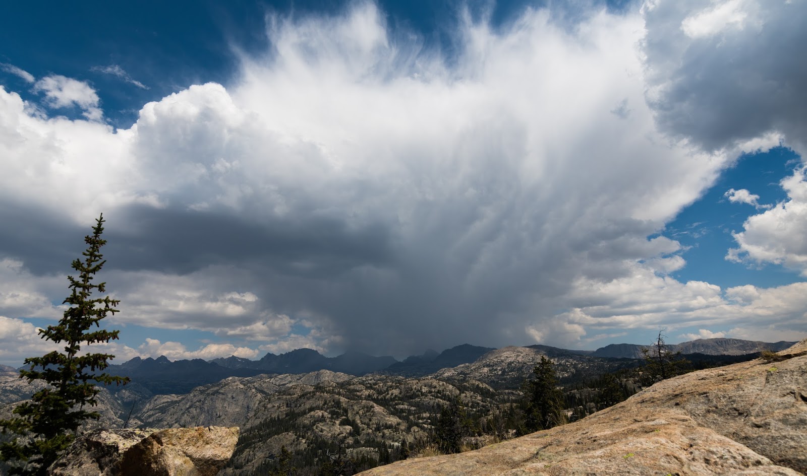
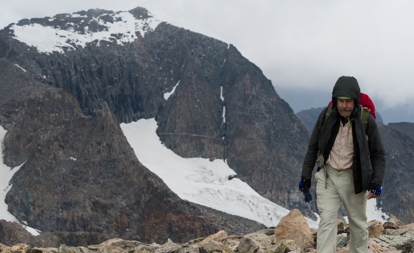
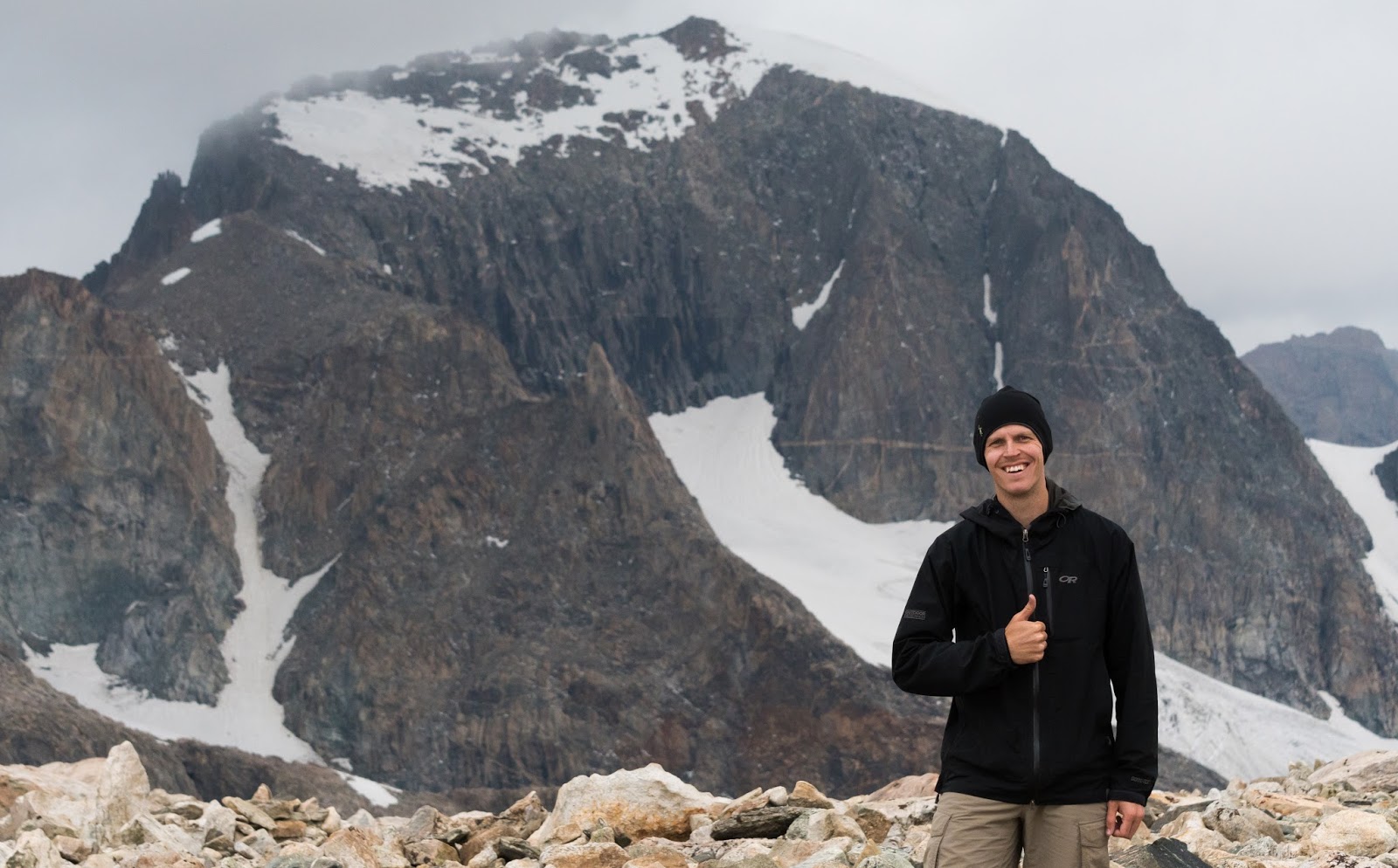
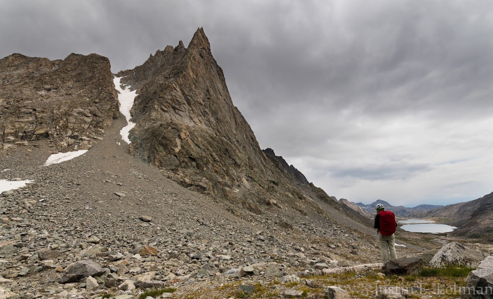
The wall of storm clouds sweeping in from the west, seen here beyond lower Titcomb Basin, that ultimately led us to abandon our attempt on summiting Fremont Peak.
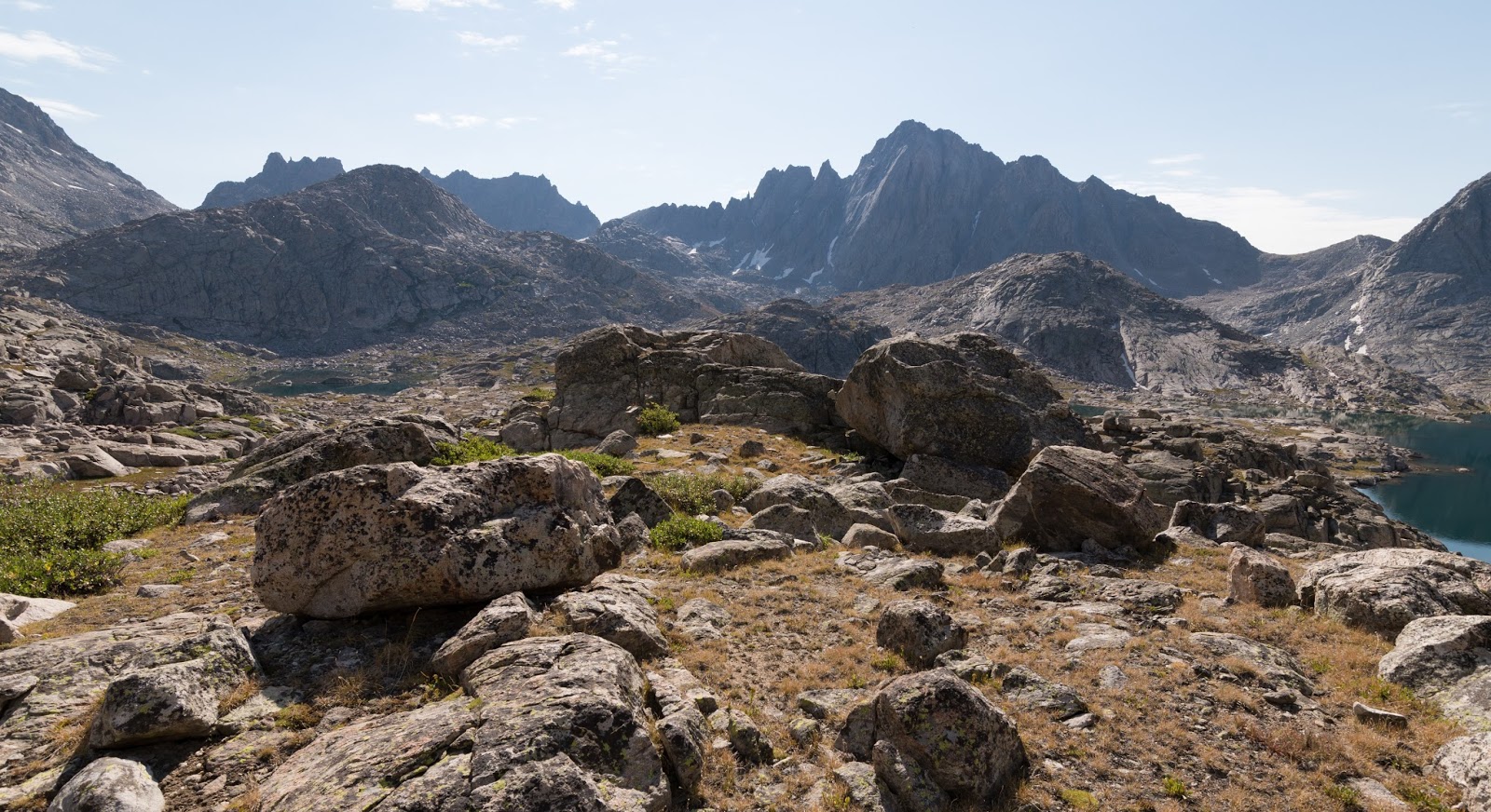
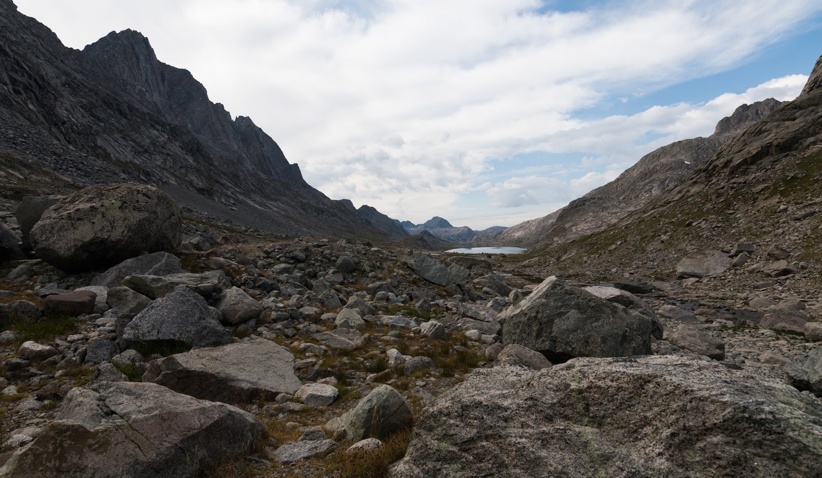
Titcomb Basin from 12,000 feet. Amazing country; and these pictures don't do it justice.
Jackson Peak (left), and Ellingwood Peak (right) frame in this view of upper Indian Basin from the high saddle of Fremont Peak.

Views of Ellingwood Peak (left), Elephant Head (center), and other area peaks beyond Indian Basin from the high saddle on Fremont Peak.
Very zoomed-in view of Gannett Peak, Wyoming's tallest peak, standing well beyond the nearer rugged peaks along Titcomb Basin's northern end, from Fremont Peak's saddle.
Mount Woodrow Wilson, from Fremont Peak's saddle.
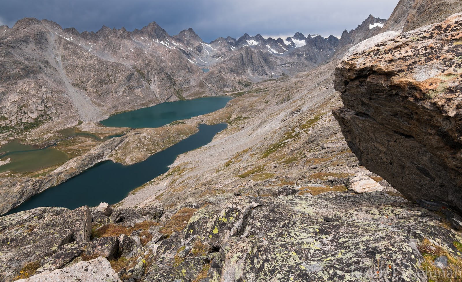
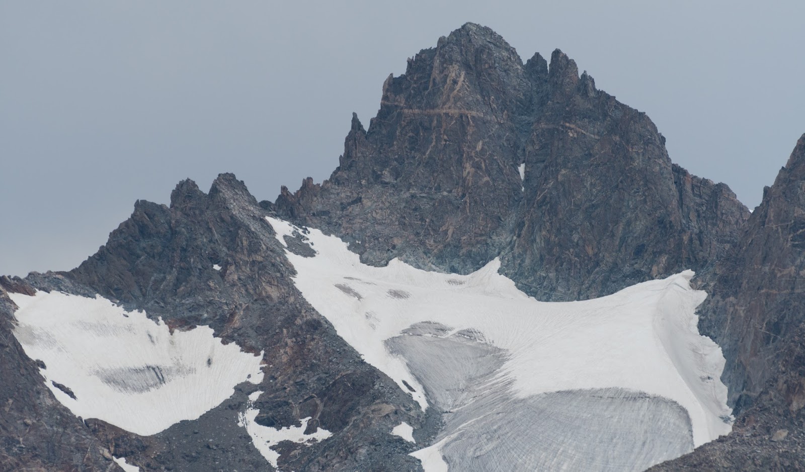
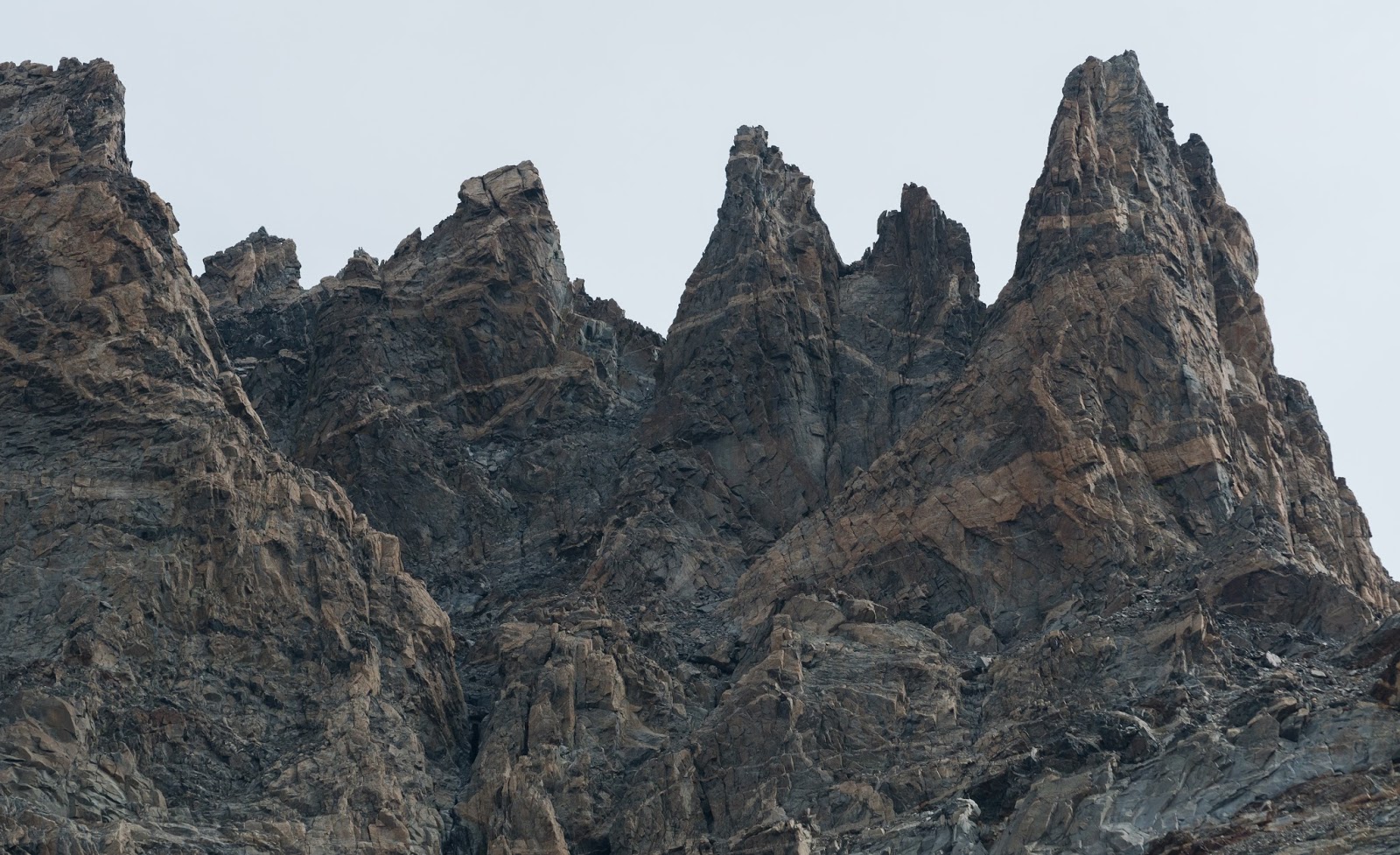
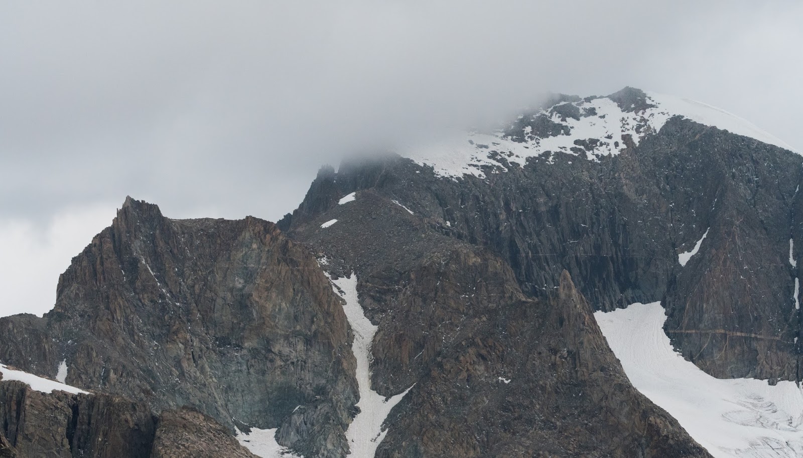
Big peaks on the edge of Titcomb Basin, from Fremont Peak's saddle.
Big peaks on the edge of Titcomb Basin, from Fremont Peak's saddle.
Big peaks on the edge of Titcomb Basin, from Fremont Peak's saddle.
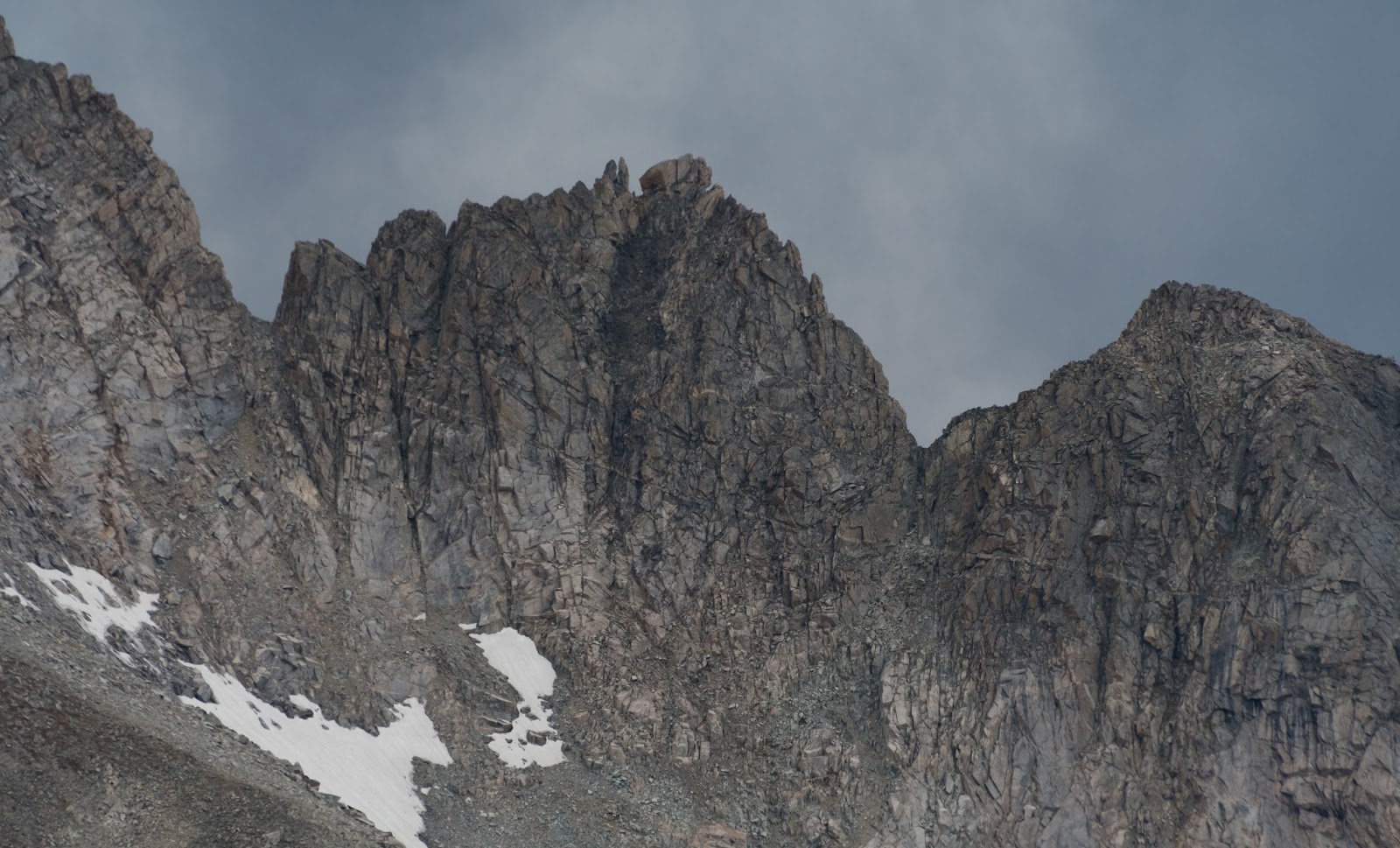
Big peaks on the edge of Titcomb Basin, from Fremont Peak's saddle.
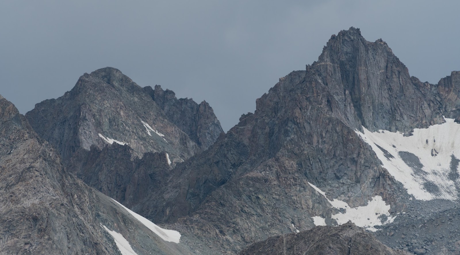
The summit of Mount Helen peeks over the edge of nearer terrain along the edge of Titcomb Basin, from the high saddle on Fremont Peak.
Big peaks on the edge of Titcomb Basin, from Fremont Peak's saddle.
A little telephoto action on a nearby rock high above Titcomb Basin, from Fremont Peak's saddle.

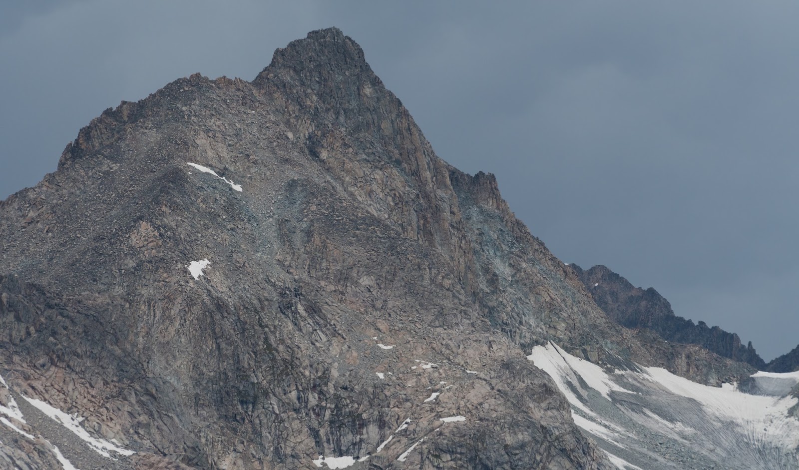
Big peaks on the edge of Titcomb Basin, from Fremont Peak's saddle.
Big peaks on the edge of Titcomb Basin, from Fremont Peak's saddle.

Big peaks on the edge of Titcomb Basin, from Fremont Peak's saddle.
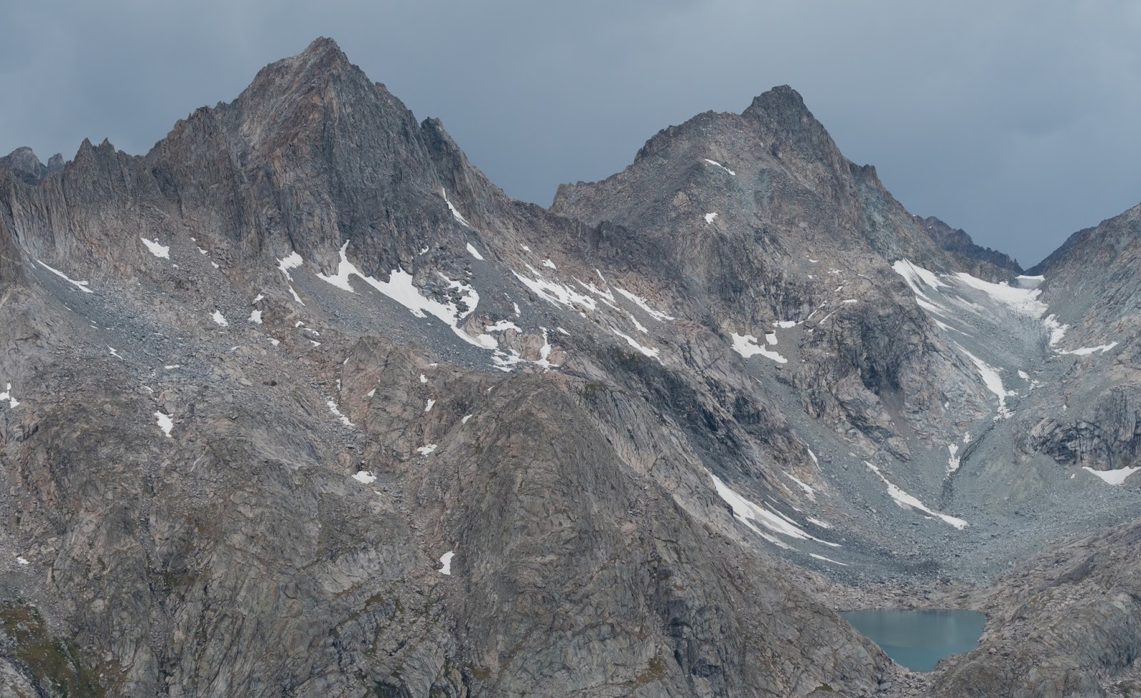
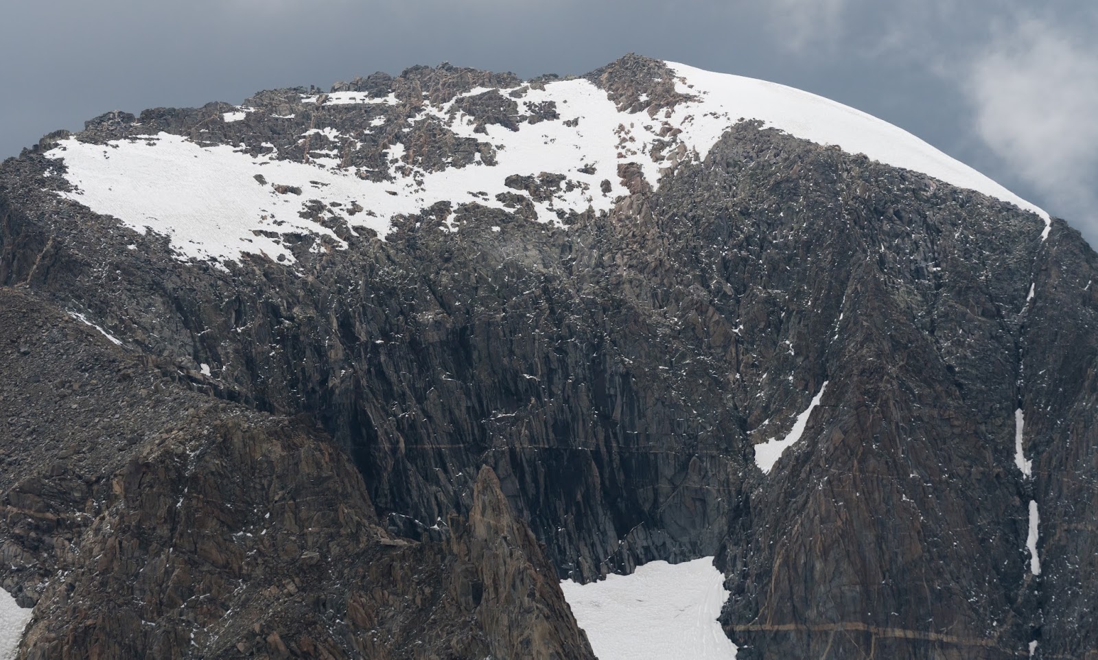
Zoomed-in view of a peak across Titcomb Basin along with the wall of rain that appeared to be gradually moving closer to our position...
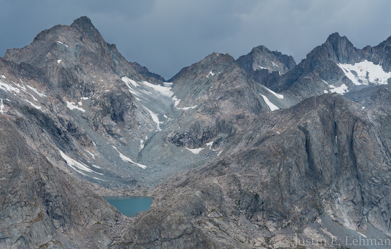
The lake seen here is hundreds of feet above the main floor of Titcomb Basin along its western edge and is called Summer Ice Lake; there's a sizable cascading waterfall that runs from the lake to the basin floor down the steep wall below the lake. It's amazing how rugged this area is...and this is still just looking at it from a distance...but we'd get into the basin up close and personal later in this trip and things get even more amazing then...

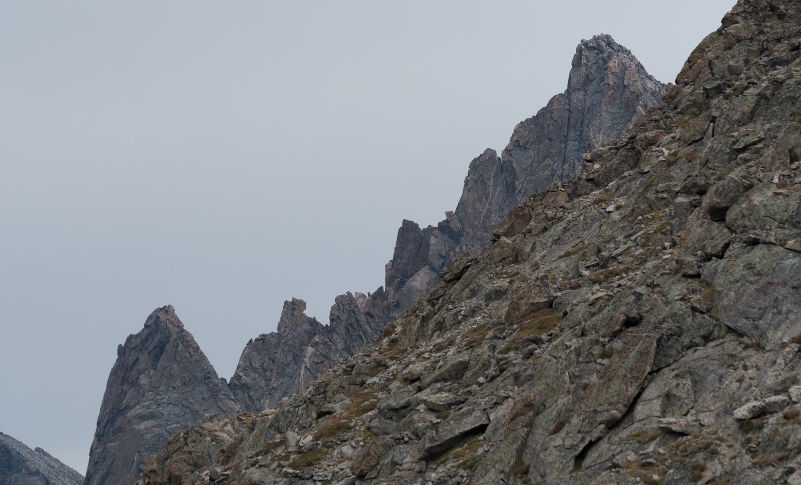
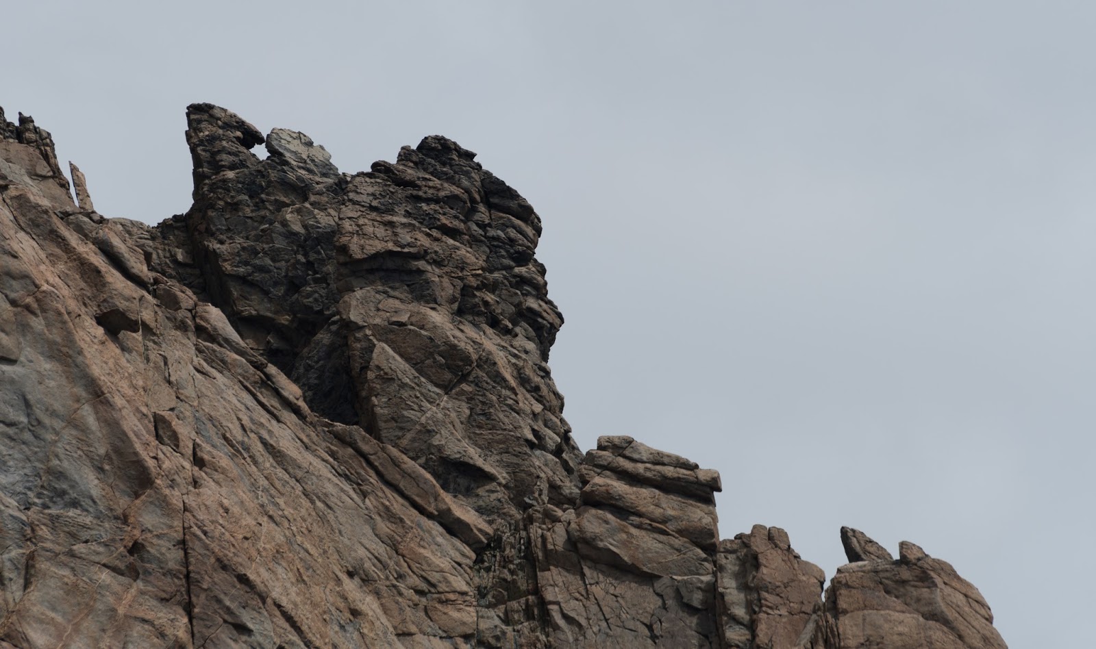
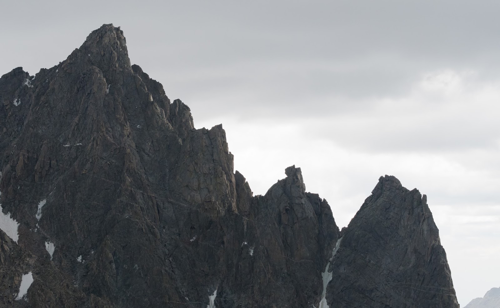
The narrow rock spine left of center was very impressive to me; sometimes I see things like that and wonder if a human has ever stood on top of such areas...I'm not a hardcore technical climber or anything like that, but it's an interesting thought, to wonder if some person has ever dared such challenging terrain in an area as remote as this one is...
Here's a closer view of Elephant Head from the flanks of Fremont Peak.
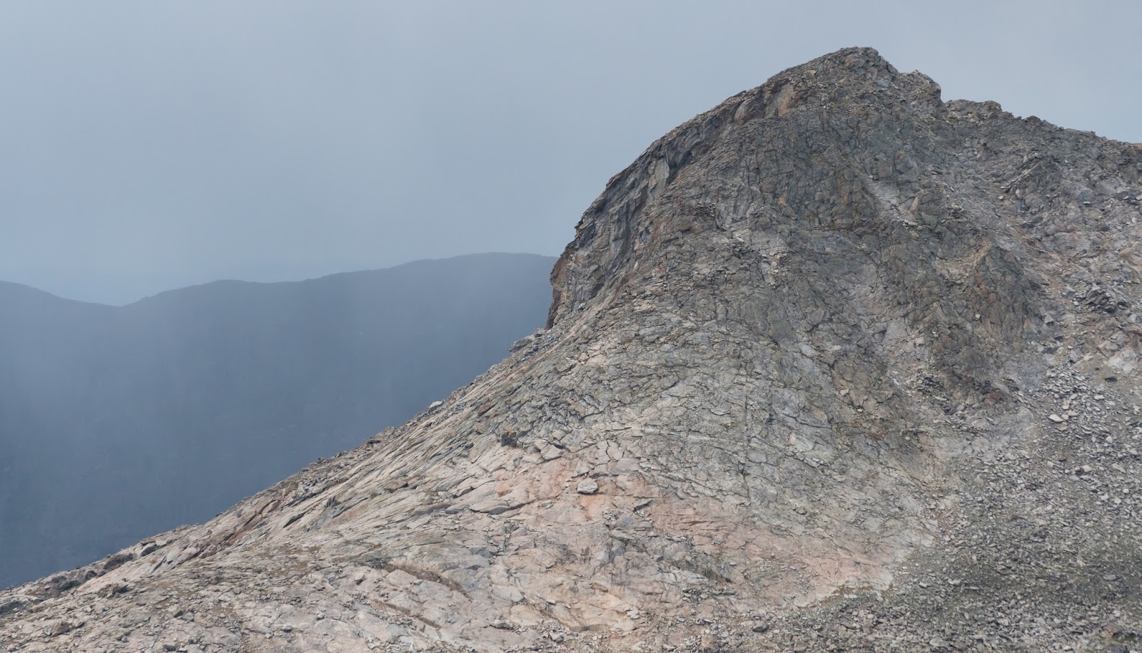
Fremont Peak ridge detail (along one of the many technical lines that could be taken up the peak).

Not sure what this formation's name is (if it is named) but it is along the eastern edge of Indian Basin, immediately adjacent to Ellingwood Peak.
Close-shot of Ellingwood Peak from Fremont's high saddle.

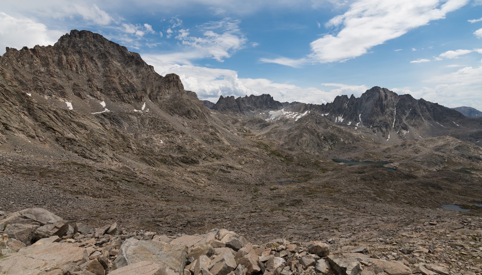
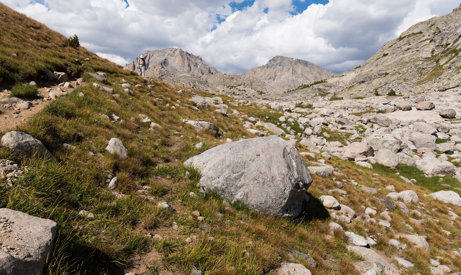
Wider view of Indian Basin as we were working our way down from Fremont Peak; already the skies to the east were clearing, though the west (behind us here) was still pretty dark looking...
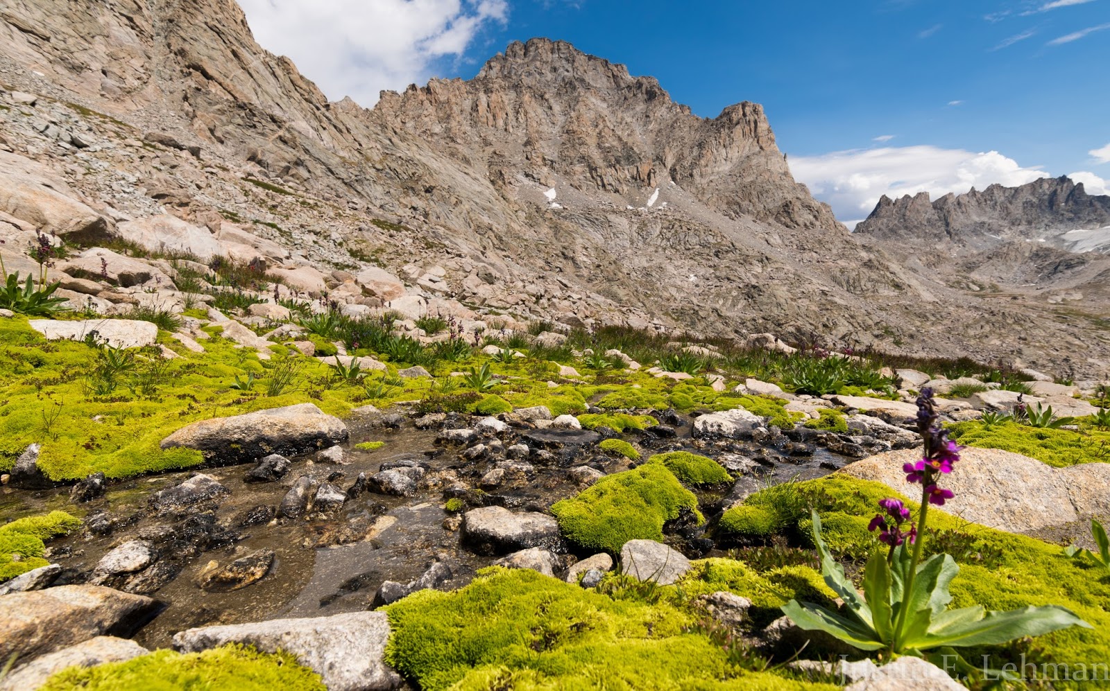
We'd come across these patches of intensely vibrant green moss near streams in various places in the high basins; I loved the contrasts between this vivid moss and the stark peaks; the occasional wildflowers were a real treat too.

Claron takes in some views as we hike back through Indian Basin after our weather-frustrated summit bid on Fremont Peak.

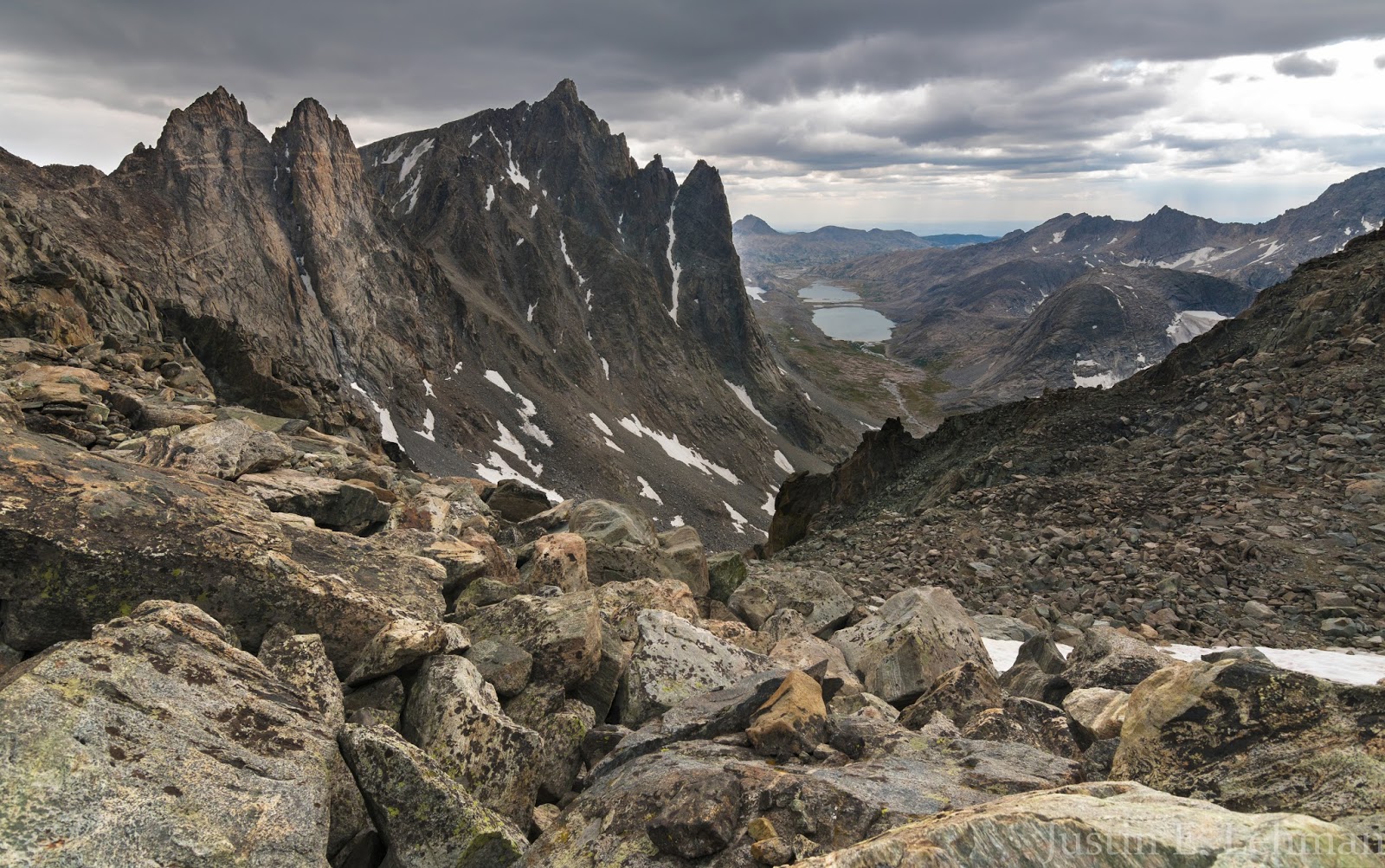
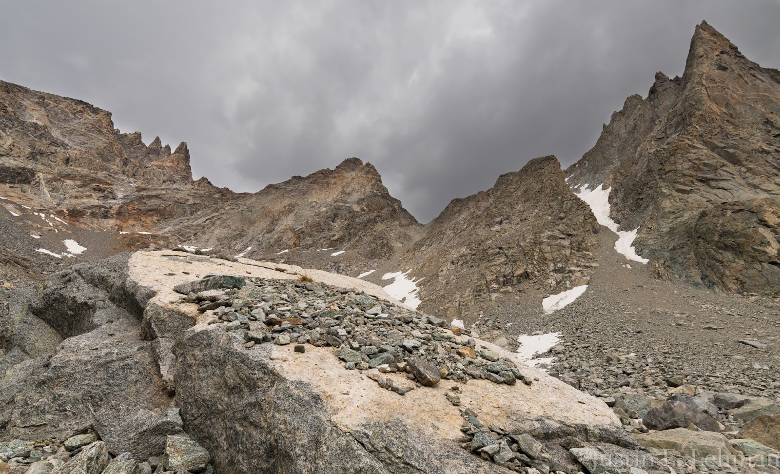
This is how Fremont Peak looks on the approach to the saddle from Indian Basin; having been there now, I'd stick lower within the main part of the basin as long as possible (instead of traversing through the boulders and slabs on the upper west of Indian Basin like we did), and I'd stay low until I was about right in line with the saddle on Fremont Peak and then work my way straight up toward the saddle - either way would work, but I believe the option of staying toward the more level parts of Indian Basin until one was about in line with the saddle itself would be the best course from the Indian Basin approach to Fremont. We found a series of broken (non-continuous) use-trails toward the left (south) side of the saddle that helped a bit on the descent, but the route-finding isn't hard to the saddle as long as you know generally where you're heading, and the saddle is quite obvious on the approach once you get into Indian Basin a bit.
Our hike through Indian Basin was beautiful; it's stunning country here, and you're pretty well surrounded by massive, rugged peaks of exceptional beauty. I took a lot of pictures on the way out through here and enjoyed a solid view of Jackson Peak and Ellingwood (or Harrower) Peak - some area 13ers as well as many other very aggressive looking peaks and formations; the sheer quantity of ruggedness here in this part of the Wind River Range is powerfully impressive. To our surprise, all the weather blew over, and soon we were under only partly blue skies...well...
Sometimes you've got to make your judgment calls on weather when you're considering a big peak - you could gamble on the chance that things will get better (as they did this day after hours of looking worse and worse) or whatever you'd like, but the storm won't wait for you to get to safety on or off the mountain if you're wrong. I don't feel bad about our choice to leave, just a little irritated with myself for the alarm snafu in the morning that likely cost us our summit that day; still, the experiential beta that was gained on the way would be worth it for the return trip up Fremont.
Sometimes you've got to make your judgment calls on weather when you're considering a big peak - you could gamble on the chance that things will get better (as they did this day after hours of looking worse and worse) or whatever you'd like, but the storm won't wait for you to get to safety on or off the mountain if you're wrong. I don't feel bad about our choice to leave, just a little irritated with myself for the alarm snafu in the morning that likely cost us our summit that day; still, the experiential beta that was gained on the way would be worth it for the return trip up Fremont.

Indian Paintbrush in Indian Basin; Ellingwood Peak is the tall peak in the upper center. Supposedly there is a class 3-4 scrambling route that goes up the west ridge of Ellignwood (on the right of the peak from this viewpoint)...might be something to check out in years to come...
Ellingwood Peak and some little lakeside grass patches in Indian Basin.

Looking back toward Fremont Peak (left) and part of Jackson Peak (right) from somewhere in Indian Basin.
Beautiful views of Ellingwood Peak and other rugged terrain within Indian Basin.
Ellingwood Peak is such a neat-looking mountain; it's very eye-grabbing as one travels through Indian Basin, especially when heading south through the basin...very photogenic, like so much of this area...
Claron working onward through Indian Basin's rugged terrain; plenty of good trail to follow once you get down from the peaks a ways. On the way out we took a more circuitous route that led us farther out through the basin before wrapping back toward the path we'd take to get back to our Island Lake campsite.
Another shot of Fremont Peak (left) and Jackson Peak (right) with some lovely cloud shadows on them...
A different perspective on Ellingwood Peak (left) and Elephant Head (right) as we were leaving Indian Basin; it was a really neat area, and a joy to explore a bit firsthand.
See ya' later, Indian Basin, you've been great!
I have a device that allows me to send and receive text messages via the iridium satellite network from way out in the wilderness; I used this device to request some weather updates, which my Mom kindly sent to me...According to the forecast Thursday was the last decent weather day we'd be able to functionally use for area hikes...Friday had a 70% chance of rain and thunderstorms and substantially cooler temperatures, enough so that snow was likely on the high peaks if there was precipitation early or late in the day. After some deliberation, Claron and I decided we'd pack out Friday so we wouldn't be faced with the prospect of an entire day in the tent...and after additional conversation and relation of some things that were on my mind we altered our plan for hiking on Thursday.
I related to Claron my long-standing desire to explore Titcomb Basin firsthand; I explained this was the initial impetus for the entire trip to the Wind Rivers that I had planned...Fremont Peak and other areas had been added on to this but were, in the initial design, subsequent to this opportunity to not only see but get up into and explore Titcomb Basin intimately. I realized, given our plan to hike out on Friday instead of our originally-planned Saturday departure, this exploration would preclude our summiting Fremont Peak, which was our most significant peak-related goal, but we couldn't do both, and I couldn't abide the idea of only glancing over Titcomb Basin to get in the summit of Fremont...
After some discussion we decided to devote Thursday to exploring Titcomb Basin; we planned our initial and main objective would be getting up very early (retaining our 4:00 AM rise time that was previously planned...actually setting alarms this time...) and working to get to the top of Bonney Pass to get a view of Gannett Peak, Wyoming's tallest peak at 13,804 feet - we'd sight-see on the way in, route-find up to Bonney Pass, take lots of photos, and explore the basin on the way out. With a nice meal concluding our day we made an early retreat for bed in anticipation of our coming early morning.
Happily (?), we woke up when our alarms went off at 4-ish AM, had some breakfast (already having our daypacks assembled from the day prior saved time Thursday morning), and we were underway well before the sunrise.
From our campsite we went up several hundred feet of vertical rise on our way out to Titcomb Basin. Along the way the morning was pretty overcast, but we had hope it would clear up a bit for some decent morning lighting pictures.
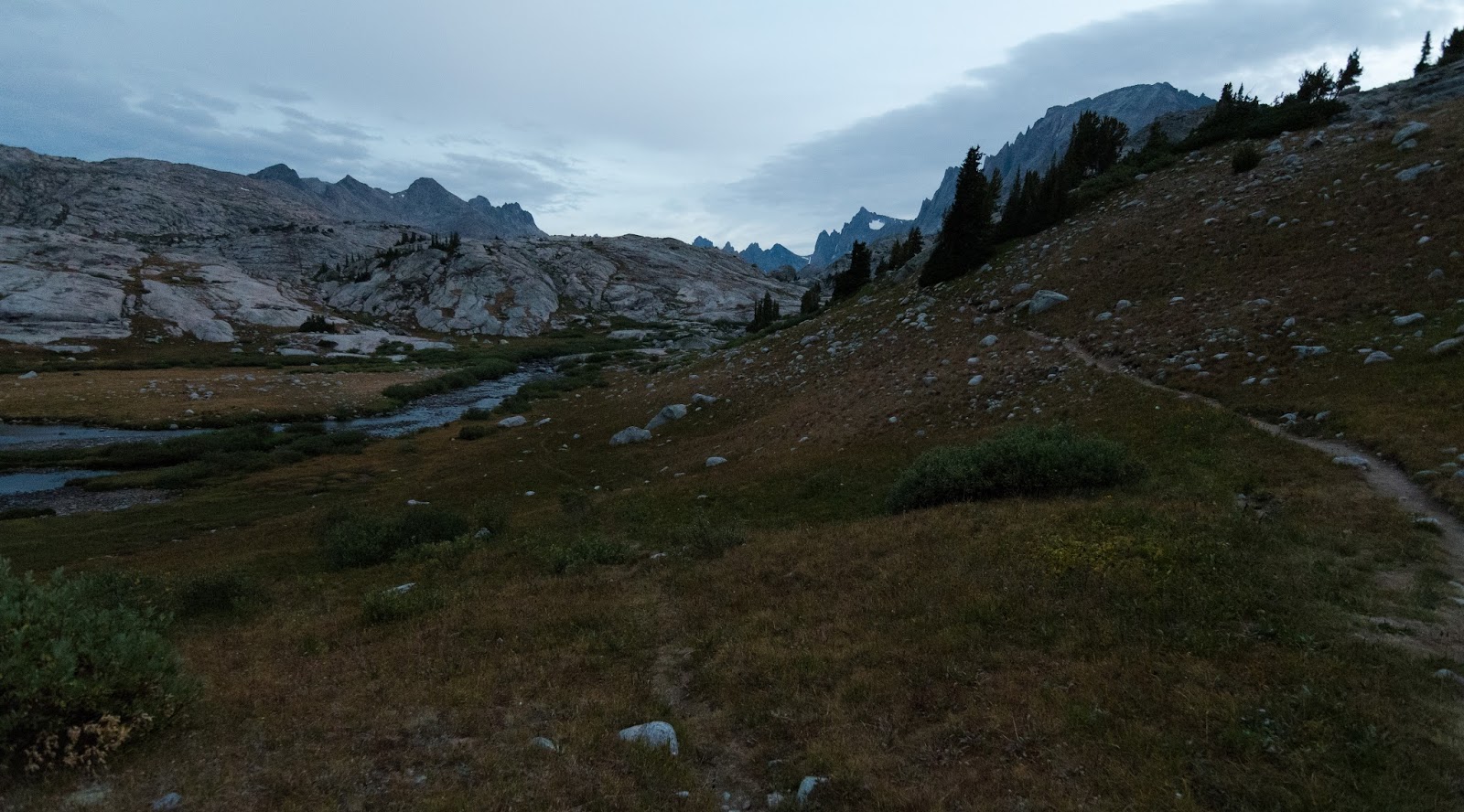
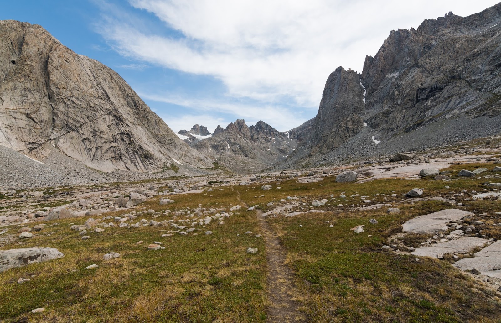
Titcomb Basin exploration day...this was taken when it was finally light enough to take a picture (still a bit pre-dawn) as we headed out toward Titcomb Basin to fulfill my long-held dreams of exploring that area personally...there was a lot of anticipation heading out there...after all, it's not every day a dream you've had for years and years is about to be literally realized...
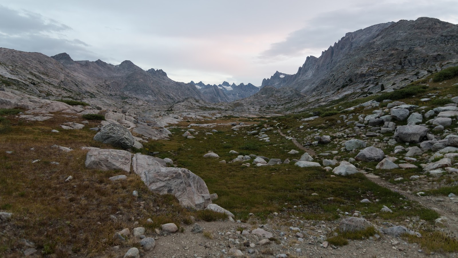
Getting into the southern end of Titcomb Basin now...
Coming into Titcomb Basin was a singular experience for me; I'd been anticipating the area so much that to actually be there - standing on the very threshold of my dreams - was surreal...not just to be thinking about being there but being there for real...it was, in many ways, beyond words...
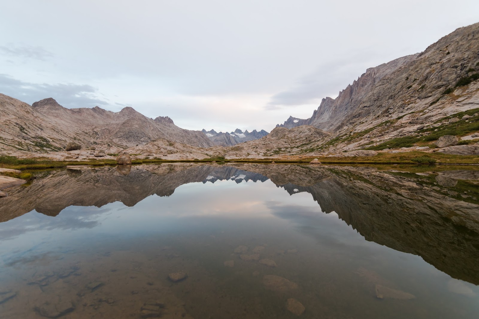
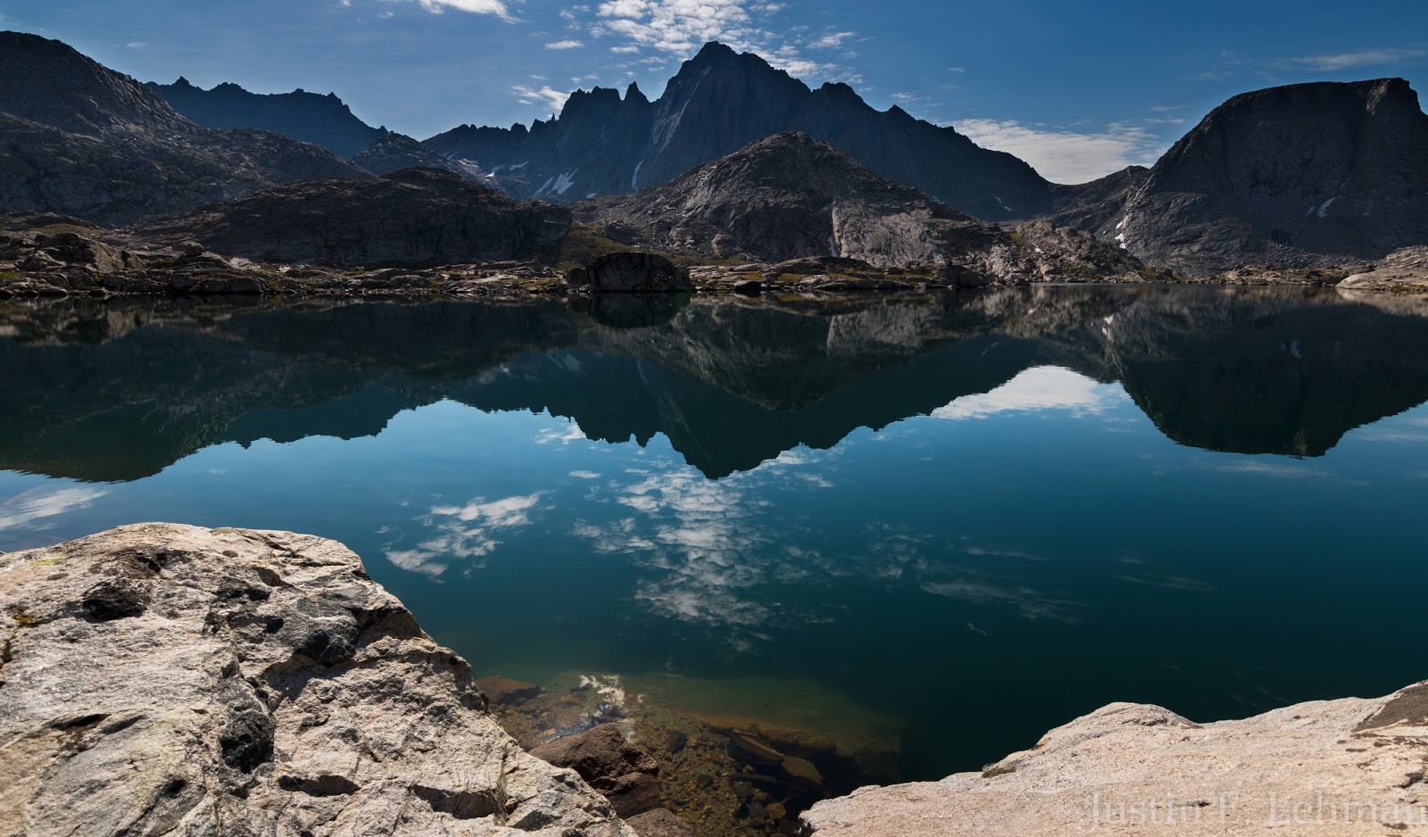
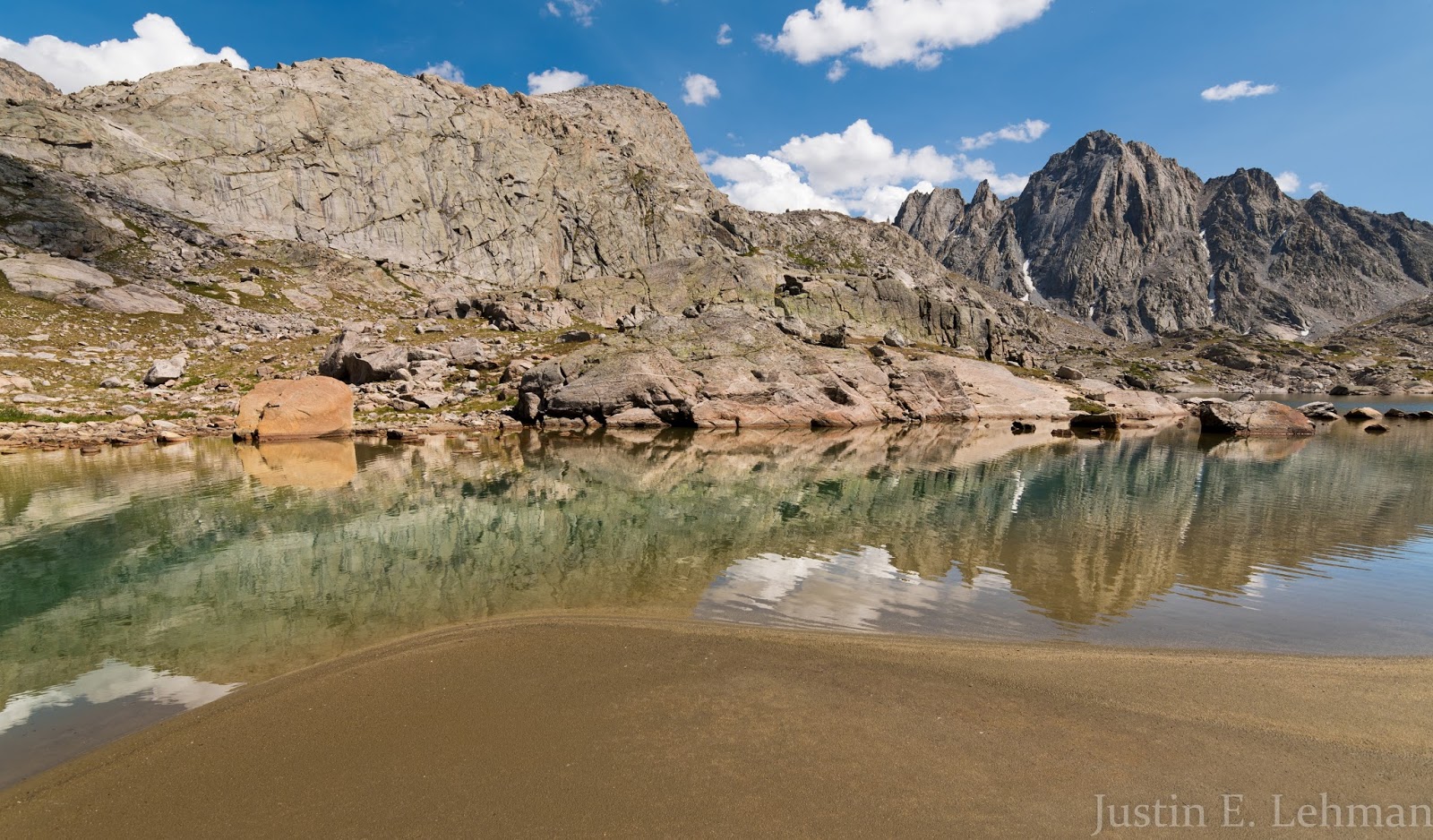
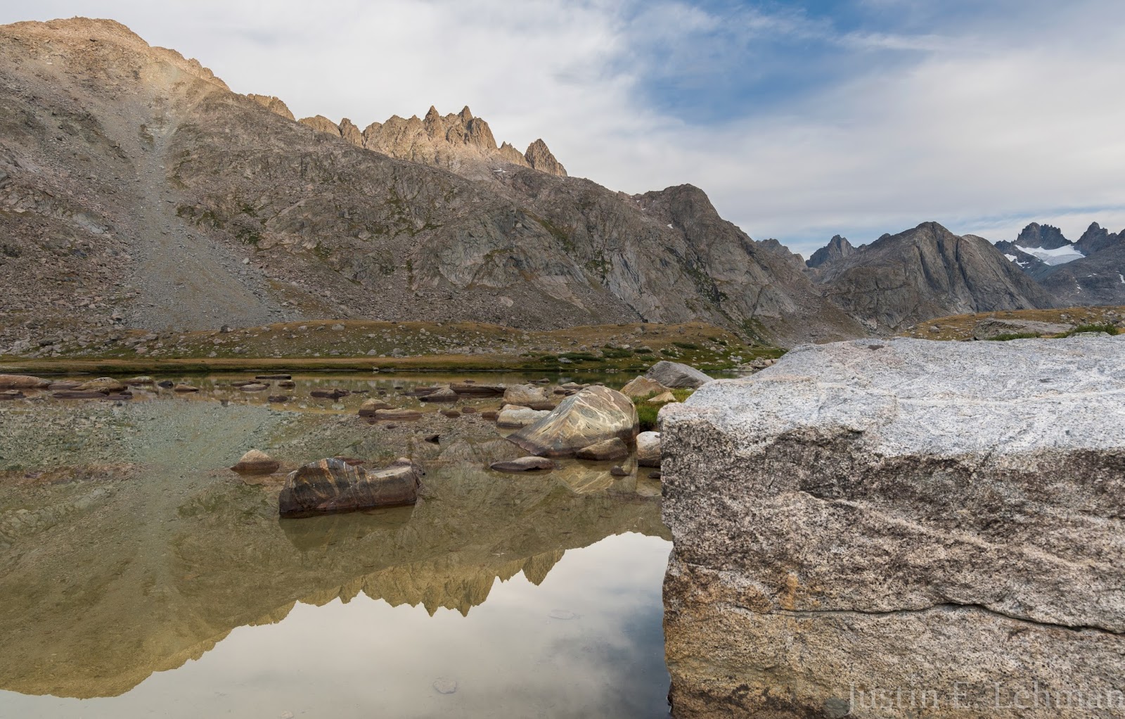
Opportunities for excellent reflection shots were abundant in the early morning as we worked further and further into Titcomb Basin. Bonney Pass, our major objective for the day is in line with the distant line of tall peaks seen furthest out in this image, so we had plenty of ground to cover between here and there - and I was loving it!
Titcomb Basin Reflections.
Titcomb Basin Reflections.
A somewhat infrequent view from Titcomb Basin, looking south.
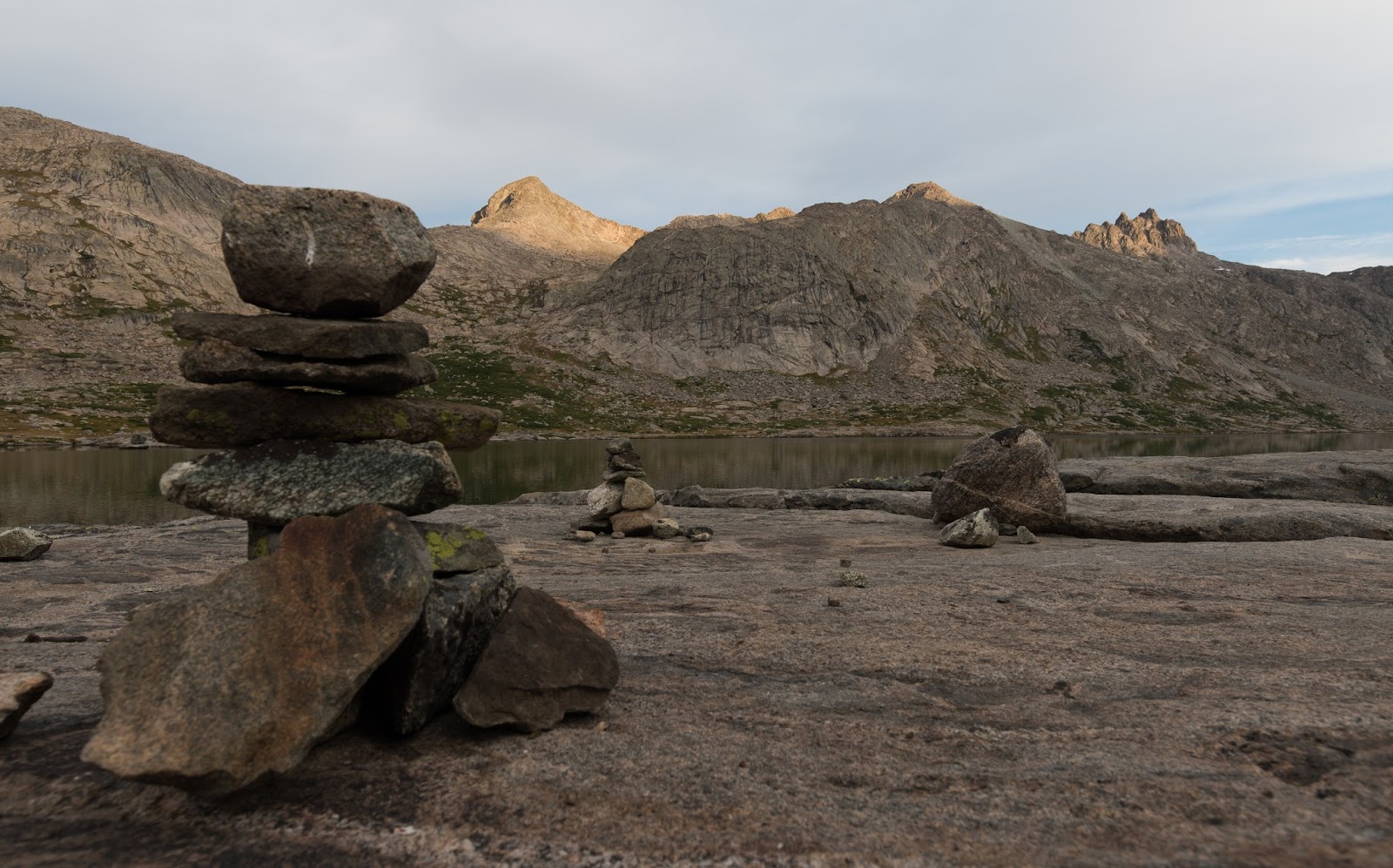
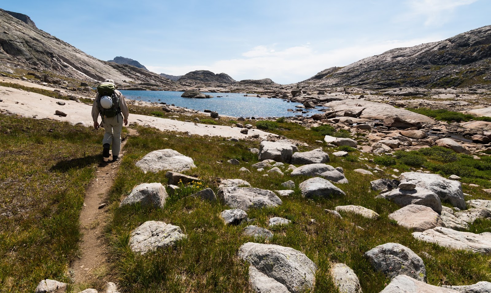
Cairns were abundant along the way through Titcomb Basin, though they were usually unnecessary. Once you get into the "basin proper" you're on wide, open, gently-rising ground with expansive, above-treeline views that help make the route-finding simple and enjoyable when it is (infrequently) required, but good trail exists to the end of the Upper Titcomb Lake and pretty decent use-trail exists beyond that point for a ways toward the boulder field near the base of Bonney Pass.
These views, though...the quantity of them - how common this uncommon beauty is out here is staggering...my soul was singing just about the whole way through Titcomb Basin...except, perhaps, through a few muddy patches of trail on the way in...but these views, along with the sounds and the spirit of the place, were worth the cost of any effort and inconvenience experienced to get there, at least 1,000 times over...
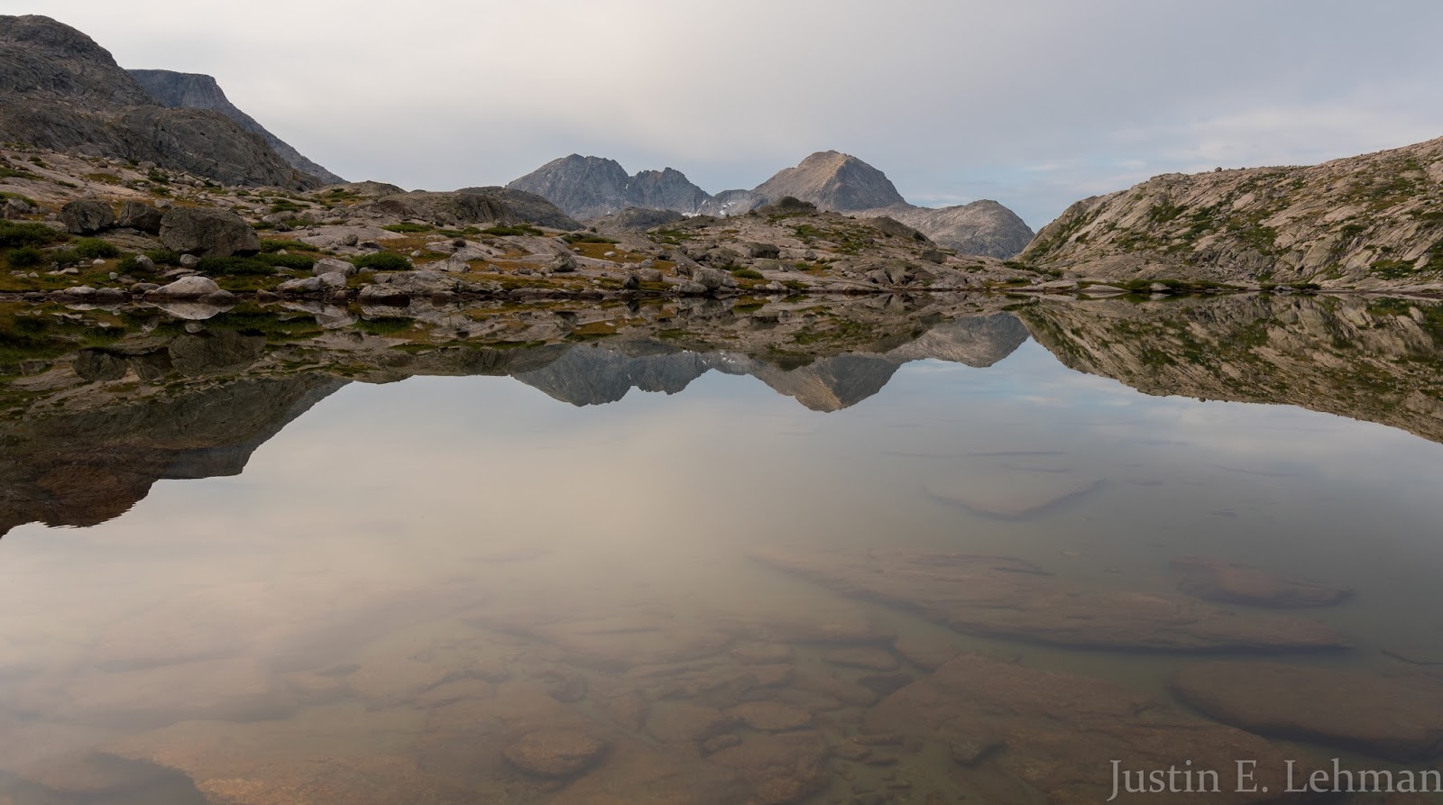
This is my favorite reflection shot I captured on our hike into Titcomb Basin; for me, it speaks of the stillness that can be there, and the wildness that is always there...This same lake, at other times, might be violently tossed with white caps and the air shaken by powerful winds...but here, in this moment, all was still ...and it's a memory I'll treasure my whole life through...
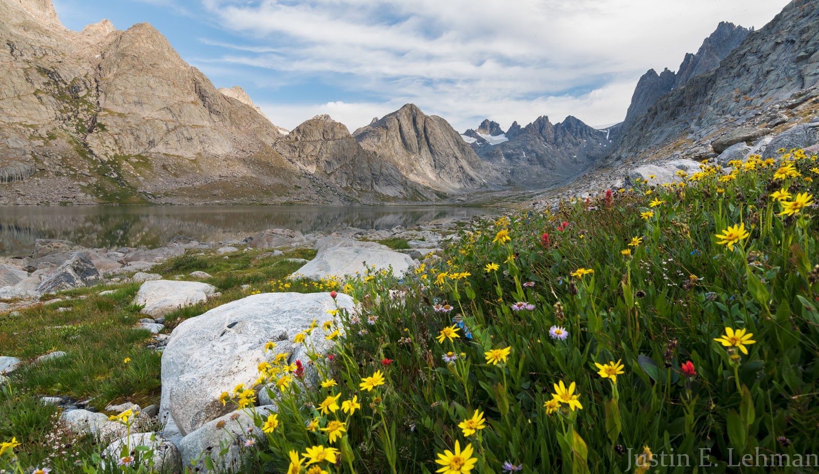
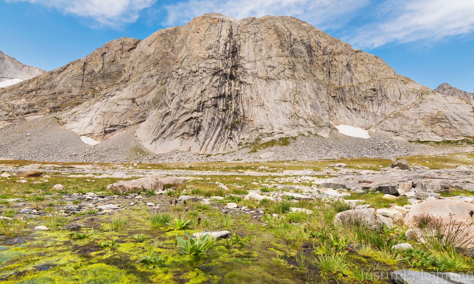
While wildflowers weren't abundant for us on this trip, generally speaking (and thinking somewhat comparatively of other areas I'd hiked through previously) we did come through this nice patch on the way into Titcomb Basin. The Buttress (12,205 feet) has a class 2 - 3 route on it and is seen here just above upper-center.

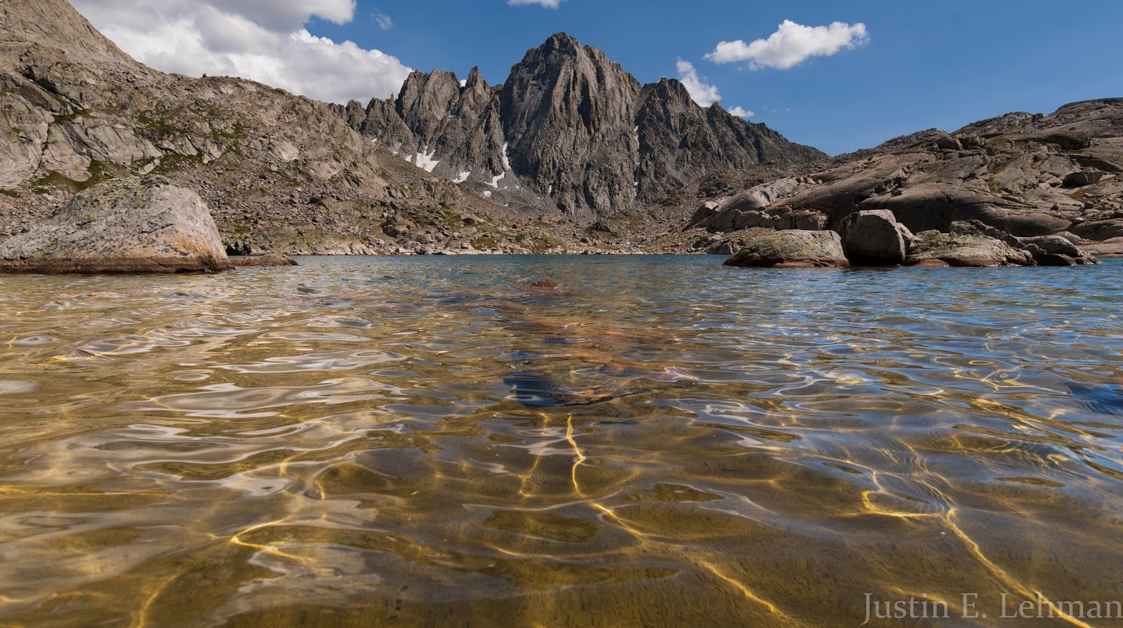
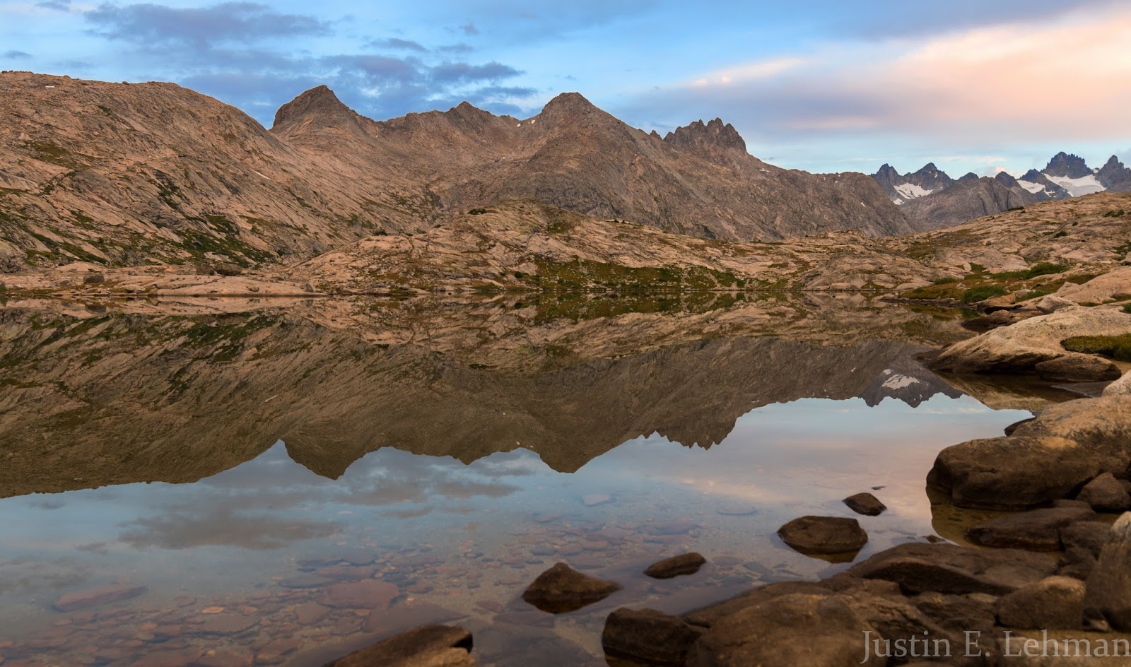
Another neat reflection shot from one of the fairly infrequent moments when the sun broke through the clouds and lit the peaks around us directly; most of our approach was fairly overcast, but still stunning.
Taking advantage of a break in the clouds that allowed some direct lighting on some of the peaks in Titcomb Basin...You can see a section of the very well-traveled trail here. Even looking back at these images while putting this report together takes me right back to that area: the sights, the sounds, and the feelings of the place...
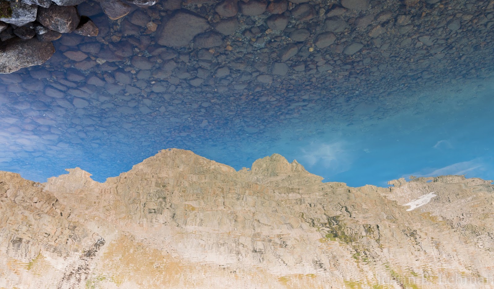
A semi-impressionistic inverted reflection shot - wavy peaks beneath a rocky sky...
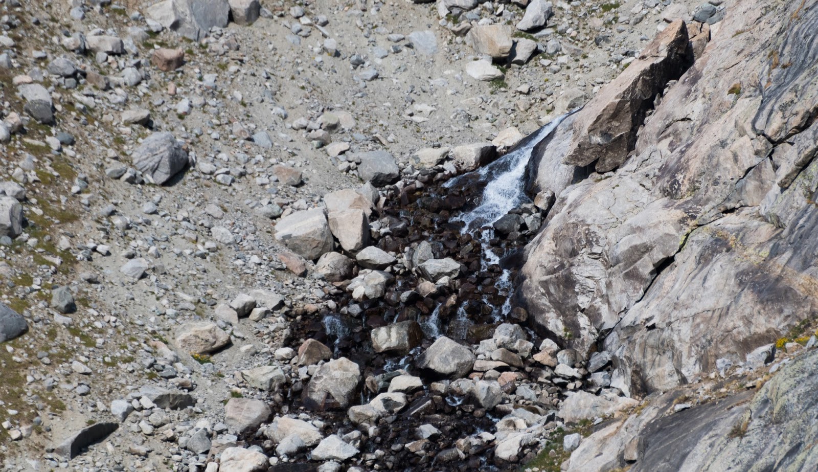
Part of the waterfall that runs down into Titcomb Basin from Summer Ice Lake.

Close-views of Mount Woodrow Wilson's summit from somewhere in Titcomb Basin.
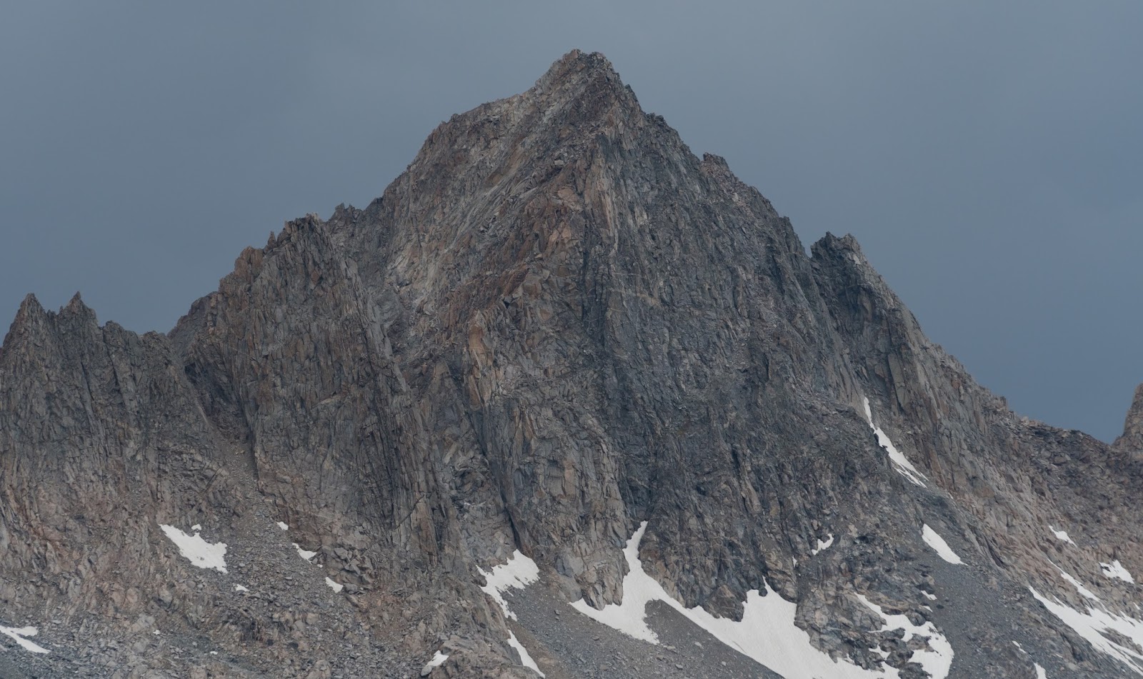
Detail-shot of some of the big peaks along the edge of Titcomb Basin.
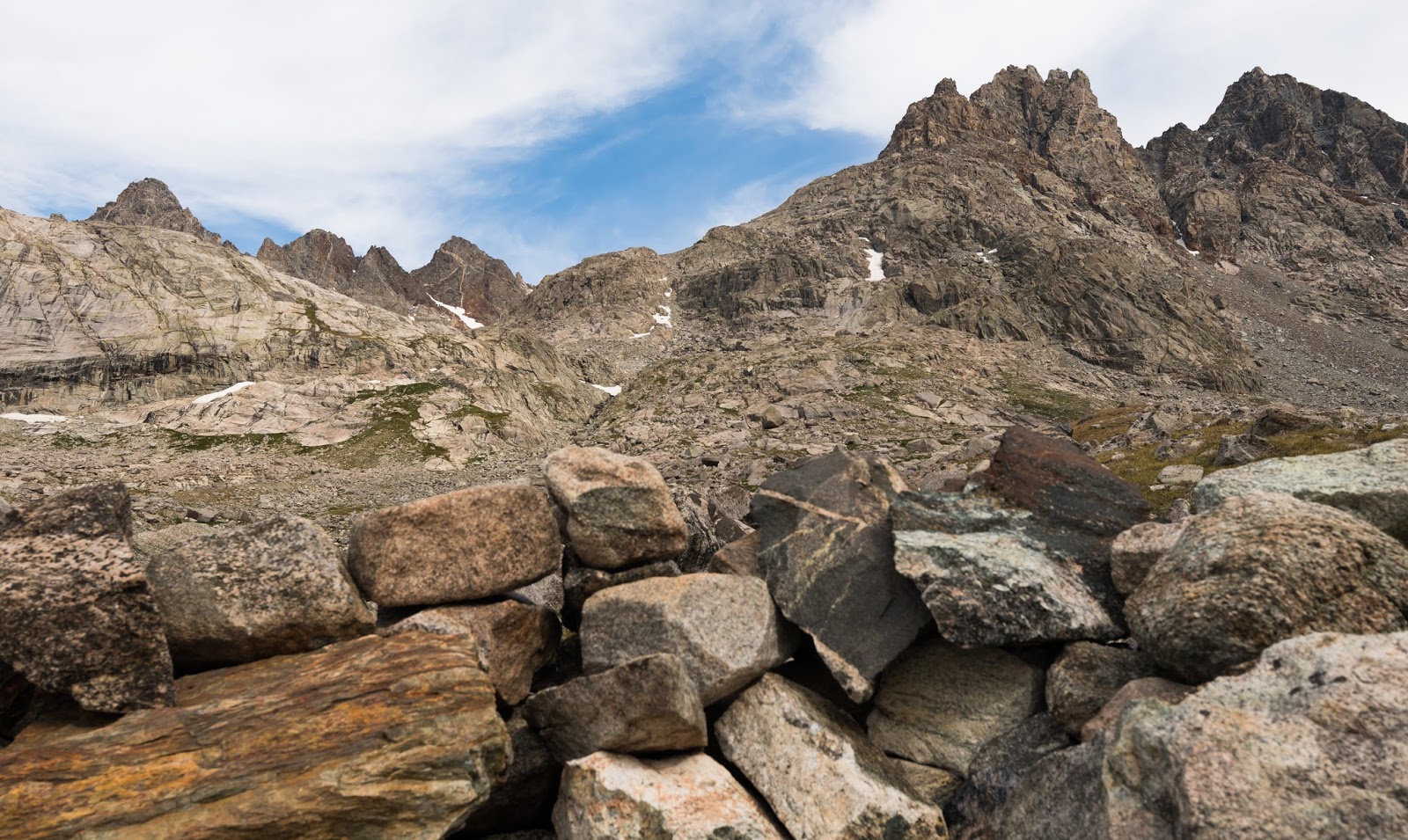
Epic country...and things only get more and more rugged as you get further and further into the basin...
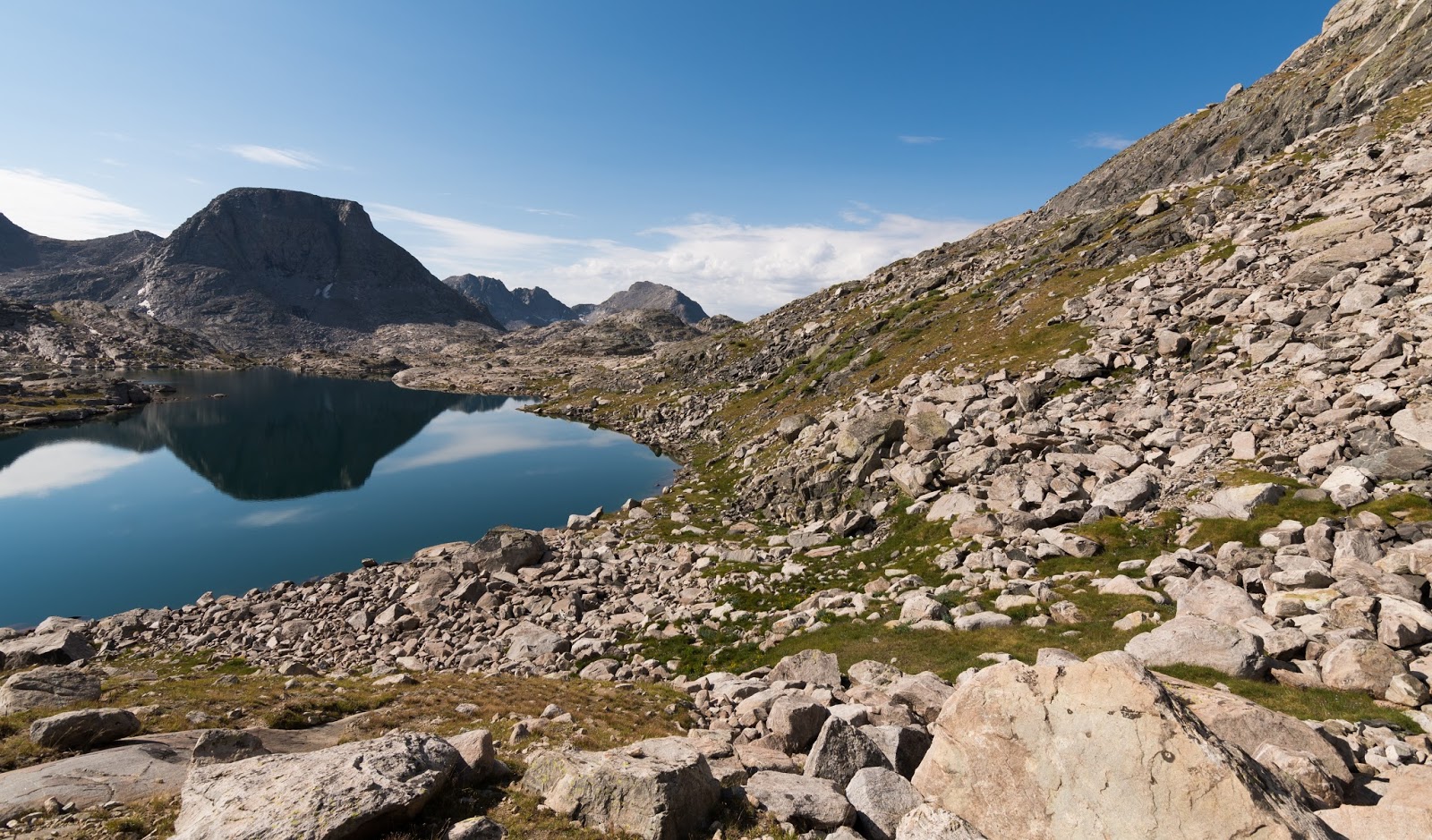
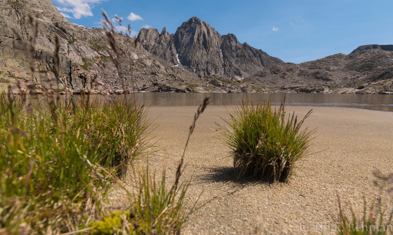
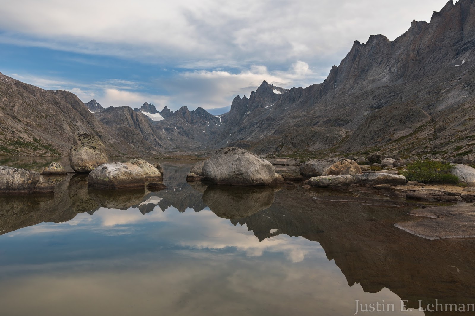
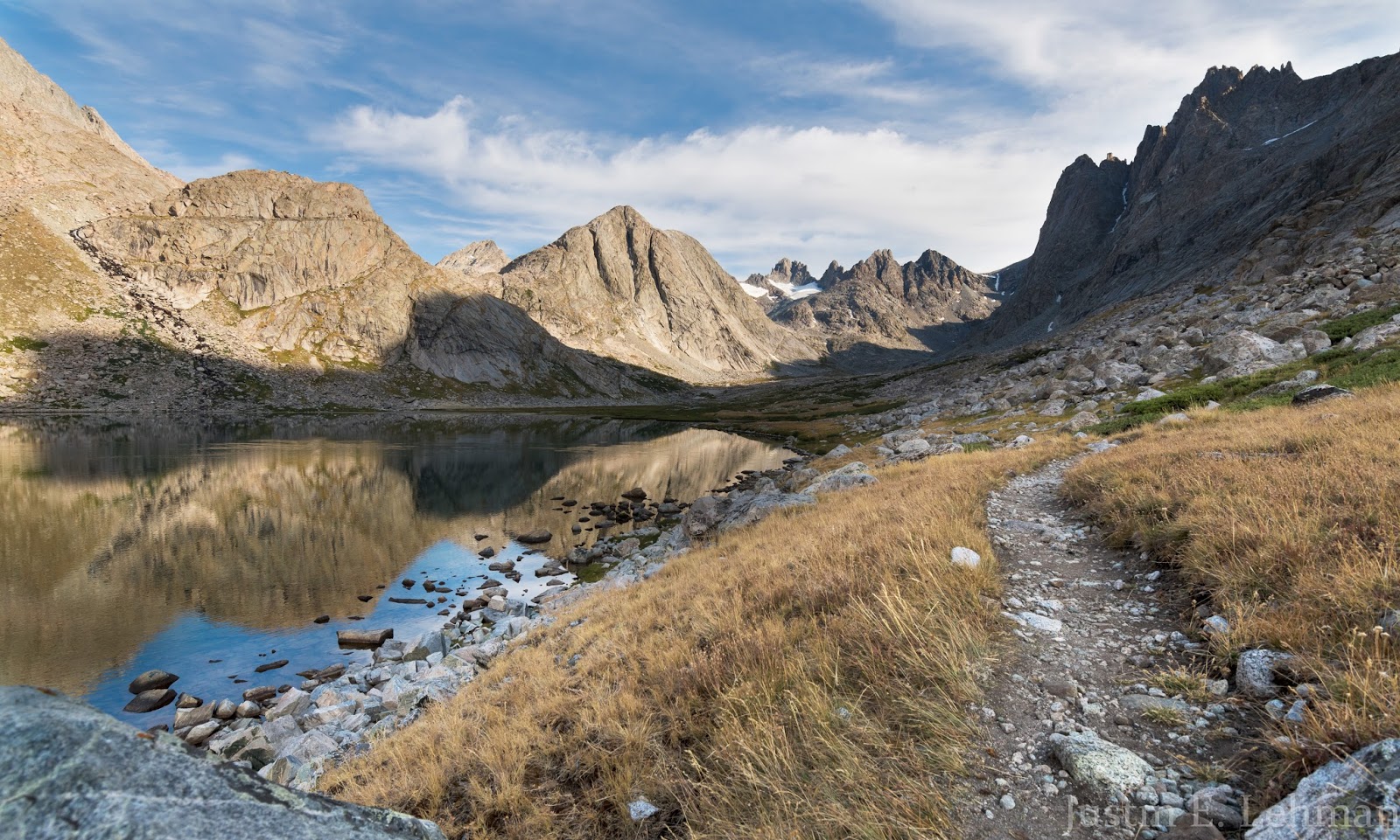
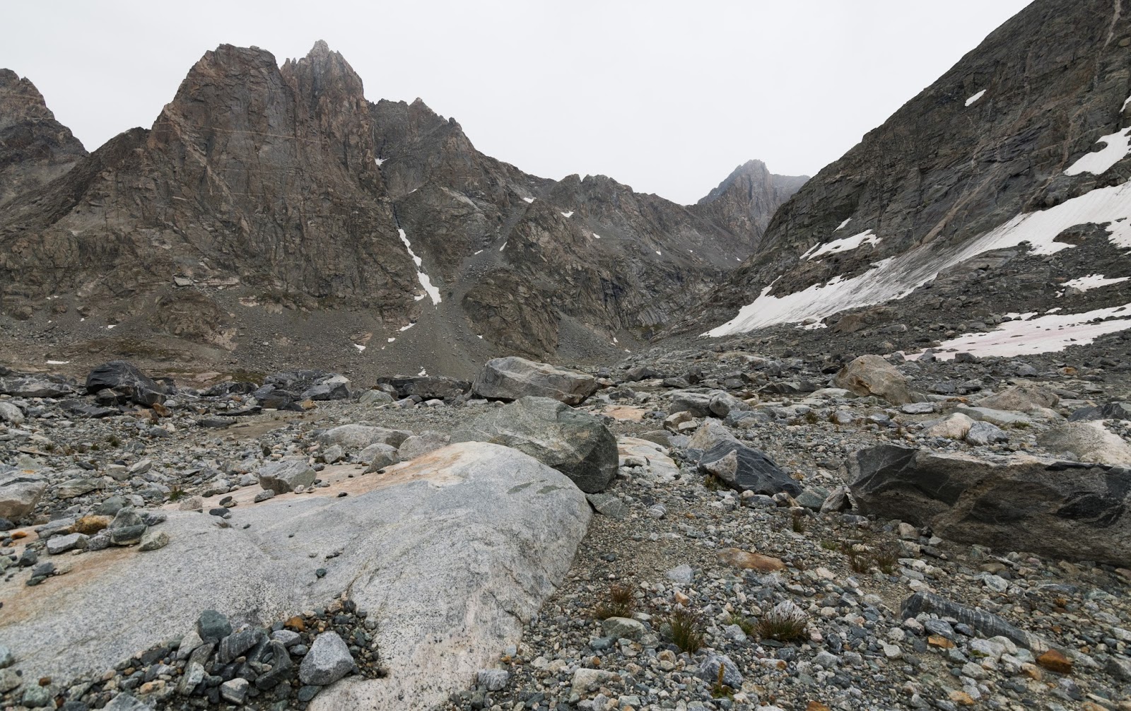
After passing a smaller lake near the southern end of Titcomb Basin we were soon hiking along the shores of the Lower and Upper Titcomb Lakes, which are both quite large. The peaks surrounding Titcomb Basin on three sides (the fourth side is open) are immensely rugged, and to be in the midst of, encompassed by, so much concentrated ruggedness was a blissful experience for my mountain-loving soul. The fun part was knowing that the further into the basin we went the more rugged the terrain around us would become...

Zoom-shot looking south from well-into Titcomb Basin.
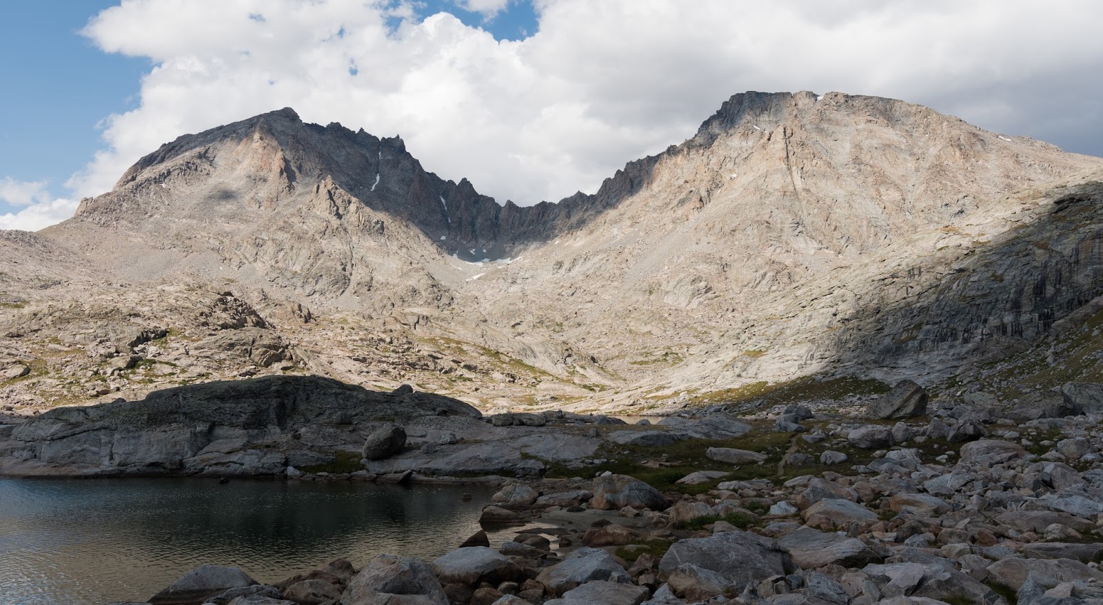
Views of upper Titcomb Basin, beyond the Upper and Lower Titcomb Lakes.
More of that fantastically green moss around a small stream, contrasted nicely against the granite of The Buttress' eastern face and that nice blue sky...
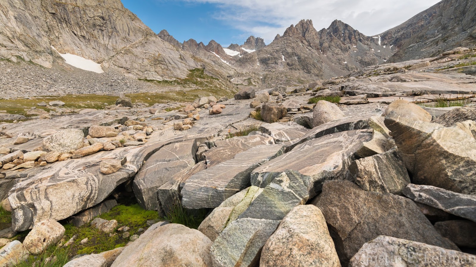
The color-banding in these large, slabby rocks was very neat to see as we continued through the basin toward Bonney Pass.
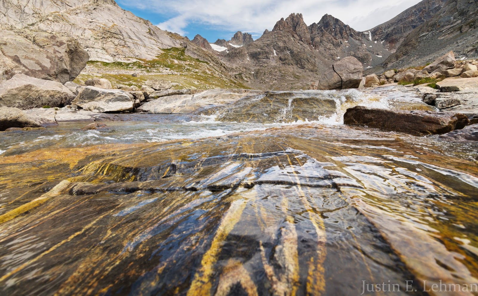
Flowing water is abundant in Titcomb Basin - far more so than I supposed before going there. I particularly enjoyed the colored bands in these rocks; Claron had hiked ahead a little bit while I was photographing other areas but was kind enough to pause near this area to make sure I saw it and didn't pass up this beautiful photographic opportunity.
Looking back down Titcomb Basin across terrain we'd already hiked through. The lake visible in the distance is Upper Titcomb Lake, the more northern of the two large lakes in Titcomb Basin. There are several lakes between the walls of Titcomb Basin, but the Upper and Lower Titcomb Lakes are the most significant in size.
Getting up into ever more bouldery country as we continue toward Bonney Pass...

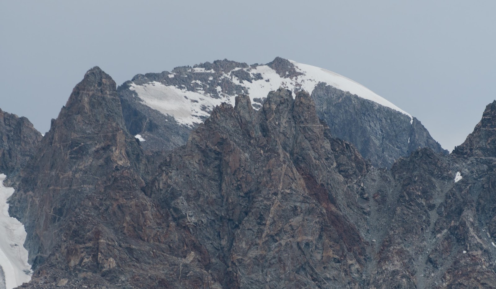
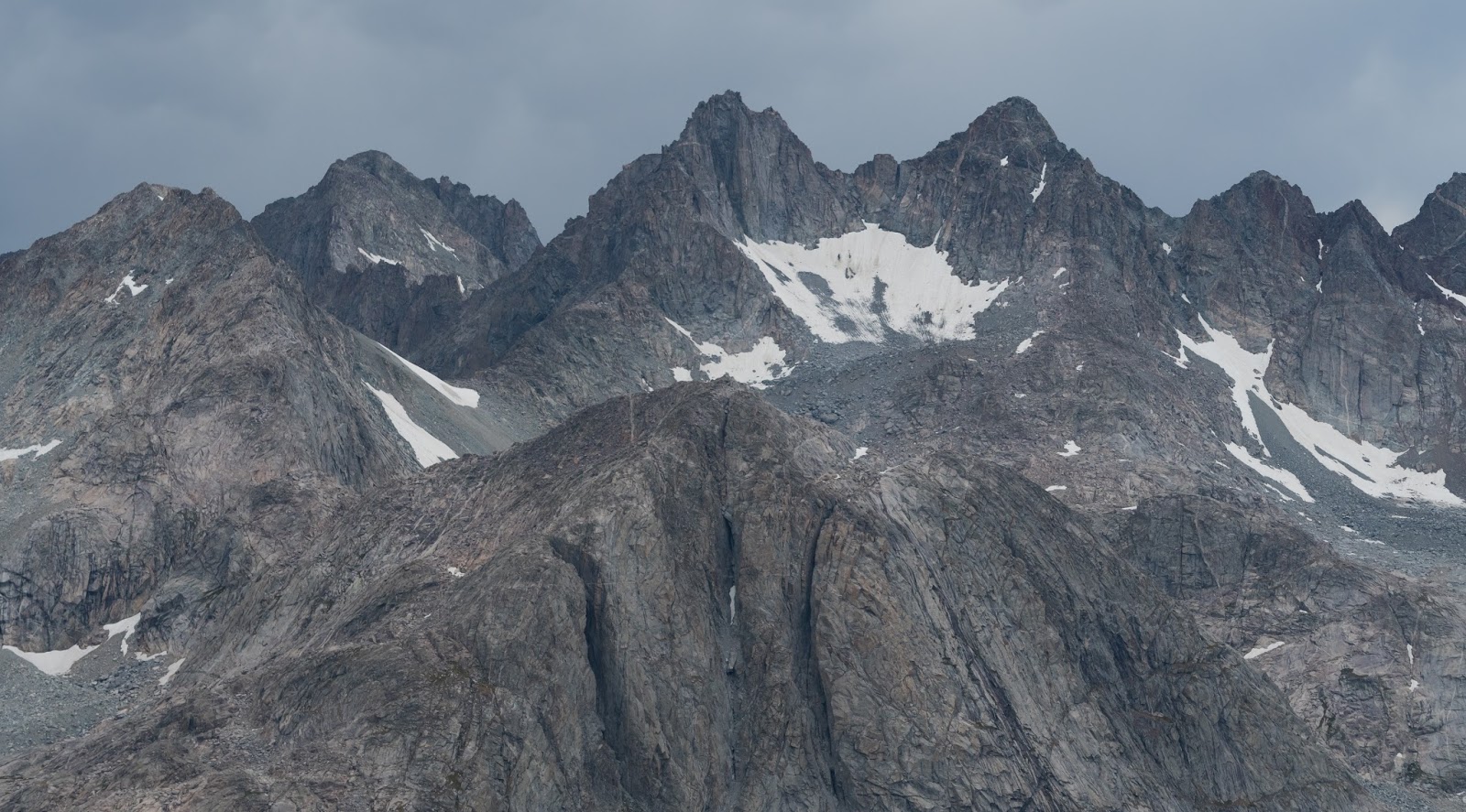
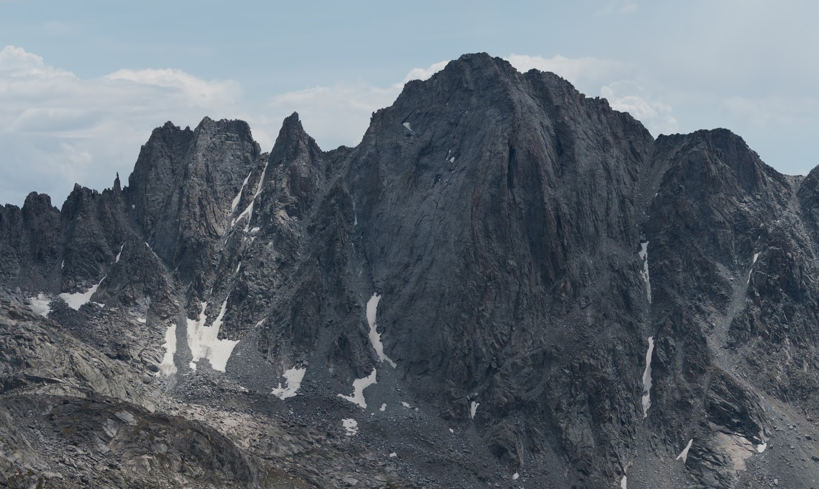
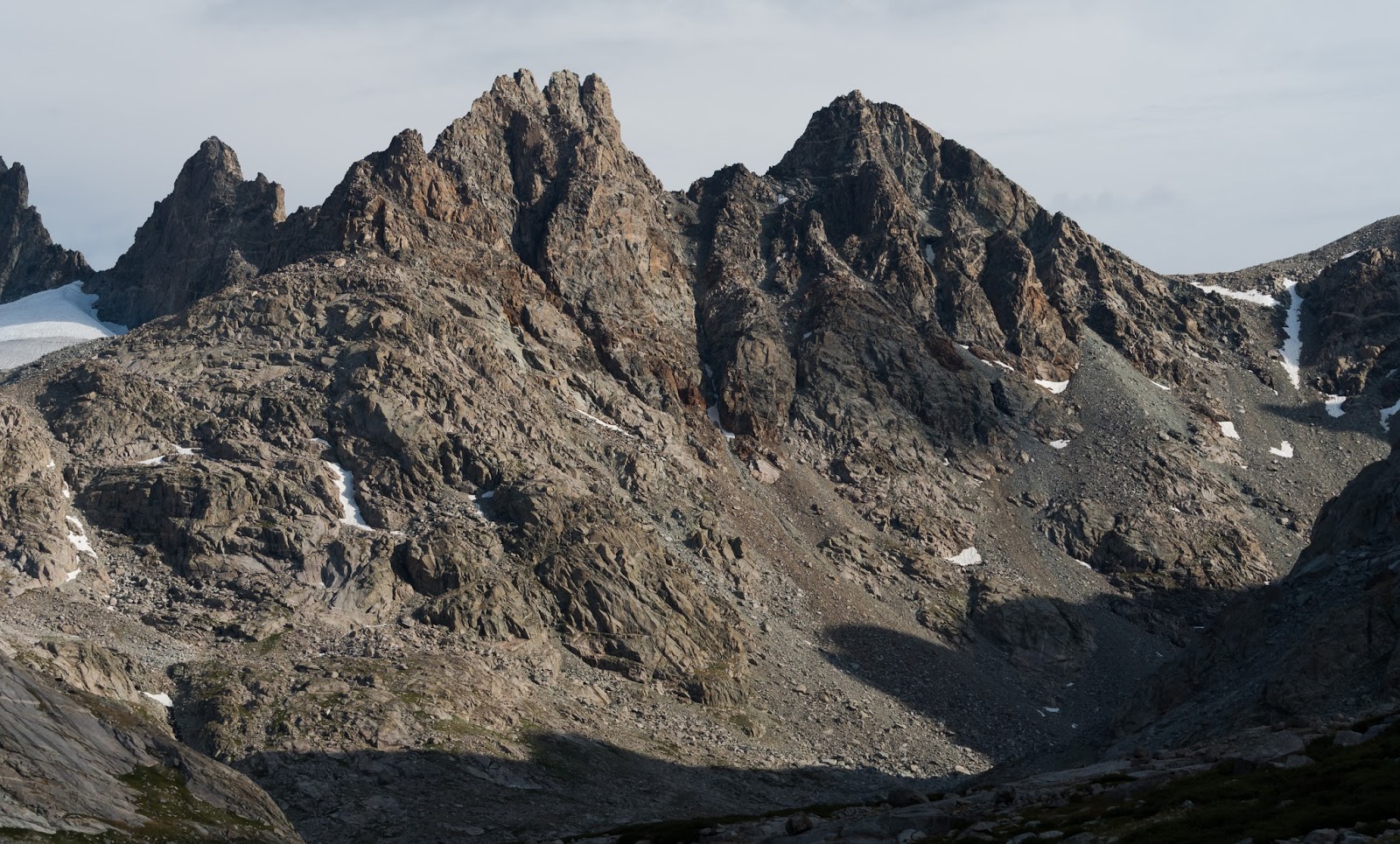
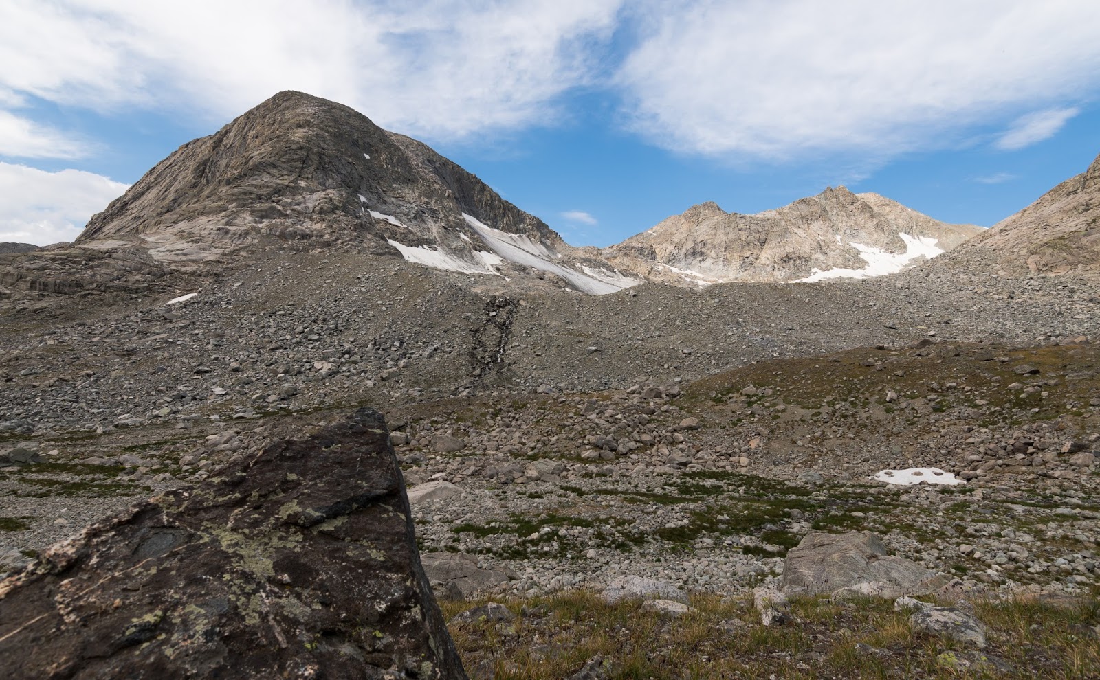
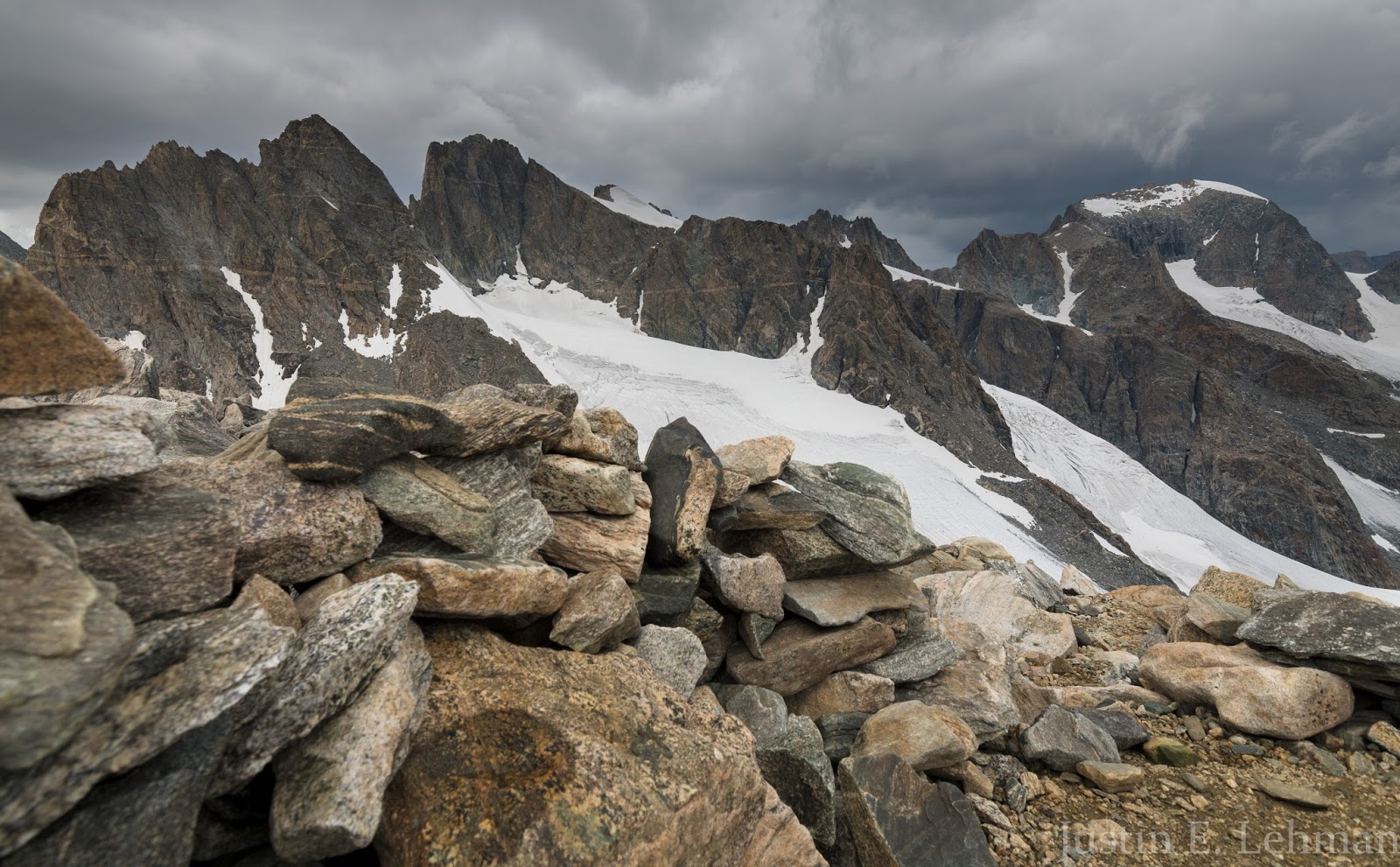
Dinwoody Peak (13,540 feet., just left of center) and the Spearhead Pinnacle (right of center) stand sharply near the north end of Titcomb Basin. Bonney Pass, our high goal, is the "low" area visible toward the upper-left...This image is overlooking a small rock wind-shelter someone had built up in the basin. (As a note to interested parties, Dinwoody Peak would be a relatively easy summit from Bonney Pass, class 2 to class 3 at most; I would've liked to have summited it while we were on Bonney Pass but the weather proved too volatile at that time to afford a safe ascent to a 13,000+ foot peak's summit.)
Spectacularly rugged terrain all around toward the northern end of Titcomb Basin, as seen from inside an improvised wind shelter further up in the basin.
Claron hikes on into the upper reaches of Titcomb Basin as we get nearer to Bonney Pass.
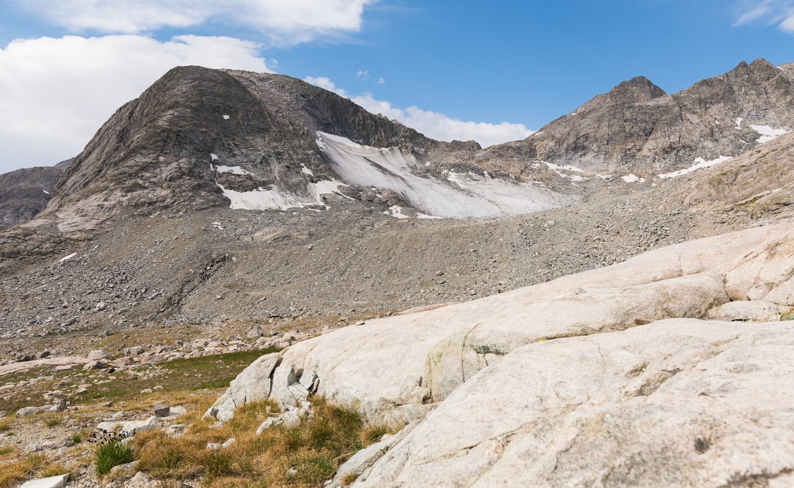
This is the Twins Glacier, which is located on the northwest side of The Buttress.
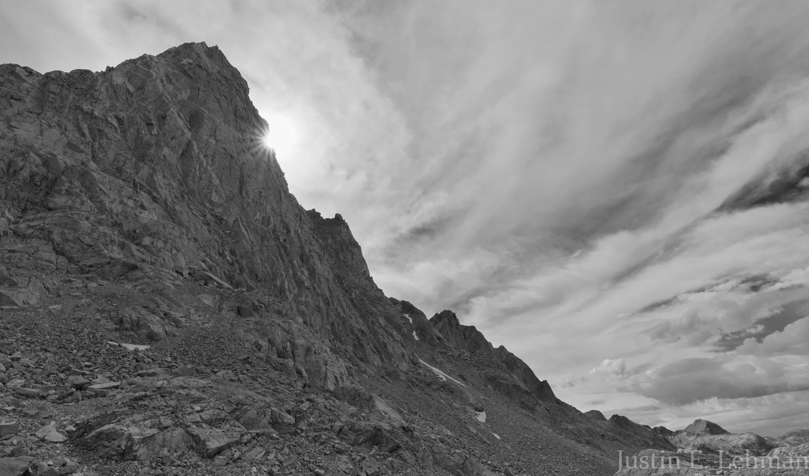
Claron wanted to catch a little sunburst off the side of Mount Helen's stunningly imposing walls with his own camera; this was my version . I tried both color and black and white here and thought the black and white worked better for this particular scene.
We took a little break here at some improvised campsites near a set of large boulders in upper Titcomb Basin; looking ahead is the extensive boulder field extending out to the tall peaks at the end of the basin. Bonney Pass is just visible in the upper left; not looking very challenging here, but it is very steep and covered with boulders and loose talus that has to be negotiated up about a 1,200 foot rise to the top of the pass, so it does require a careful ascent from about 11,600 feet to just over 12,800 feet at the crest of the pass.
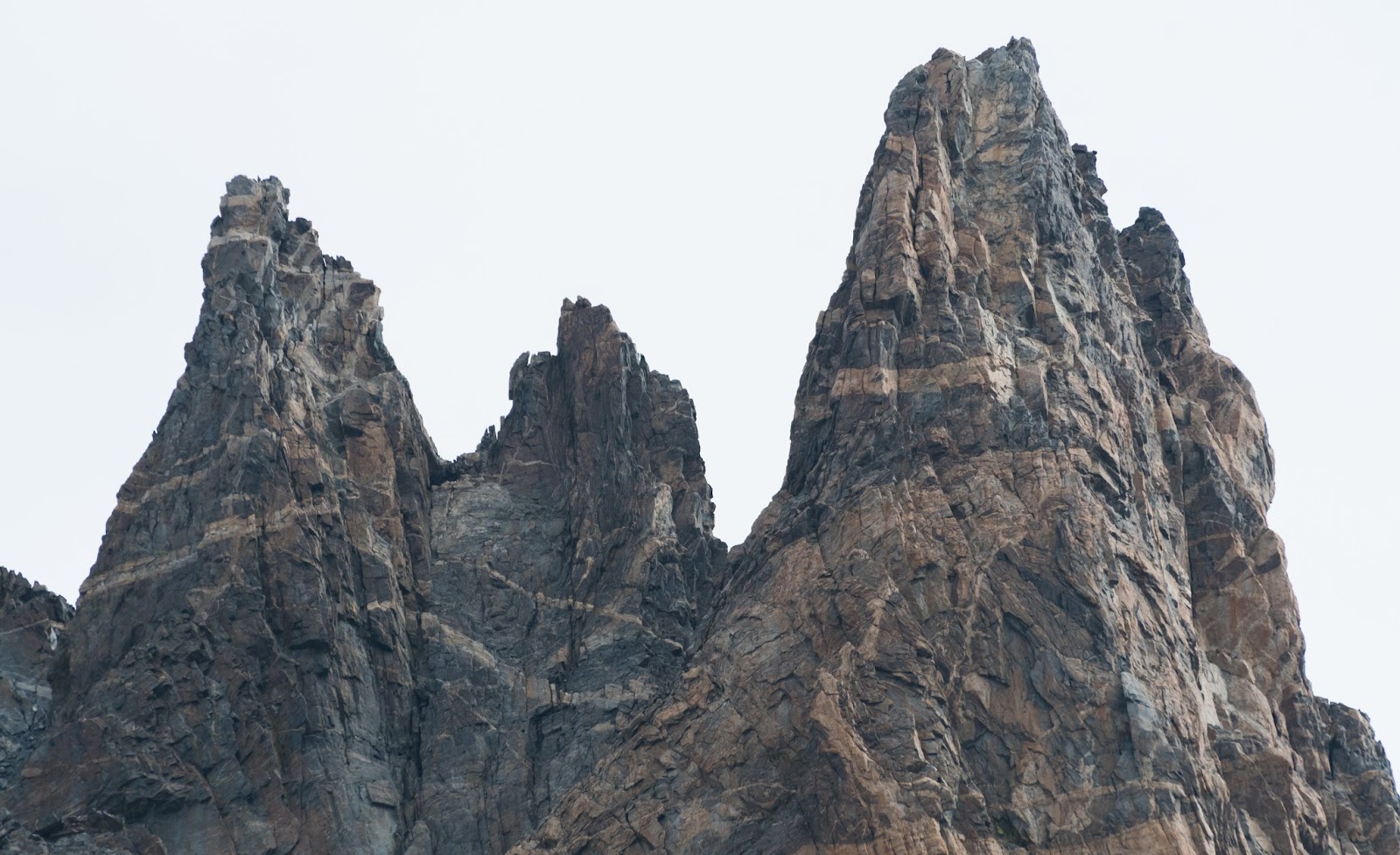
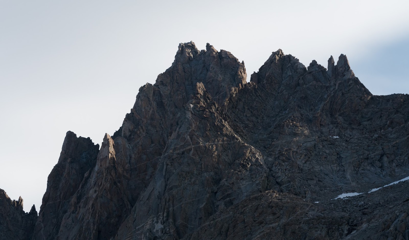
Close-up view of the top of the Spearhead Pinnacle, located just south of Dinwoody Peak. Crazy!
A bit of a wider shot on the Spearhead Pinnacle; part of Dinwoody Peak is just visible in the upper left.
Well, as we were standing at the base of the pass, we noticed a big line of rough weather sweeping in from the south behind us and decided we'd work up the pass anyway, and that we'd take shelter, if necessary, under or around some of the larger boulders along the way (of which there were many).
From our little lunch/snack spot we had to do a good bit of boulder-hopping across large boulders arrayed across a big boulder field...this type of terrain continued all the way out to the lower edge of Bonney Pass.
The ascent up Bonney Pass was about as expected - tedious and careful; the gain here is steep - and sustained - you pick up all 1,200 or so feet in a pretty short horizontal distance, so it's more of a climb than a hike, and sometimes there is boulder scrambling, but nothing excessively terrible. I'm not a huge fan of steep, loose slopes, but the climb up Bonney Pass is only sporadically loose in a problematic way, but it's one you'll want to be mentally on-point for so you don't end up slipping or tripping - it could be a long and jagged tumble down a steep hillside if a mistake were made...
While we were working our way up Bonney Pass the storm clouds sweeping in from the south finally started catching up to us and so we found a small cave formed between two or three massive boulders and I scrunched up in the back, fetal-position-esque, and Claron crammed in next to me as much as he could and we used my waterproof emergency blanket to cover what of ourselves wasn't directly shielded from the rain and hail by the rocks...there was also some pretty good thunder happening, and hearing the thunder booming through the air and echoing off the surrounding cliff walls was one of the sweet treats of the trip, even if I was listening from a cramped spot between boulders while looking out through a tiny gap between Claron and the rocks while trying to dodge a slow, cold drip from the ongoing rain...We stayed in this little improvised shelter for about 30 minutes till the storm passed and we resumed our course up the pass.
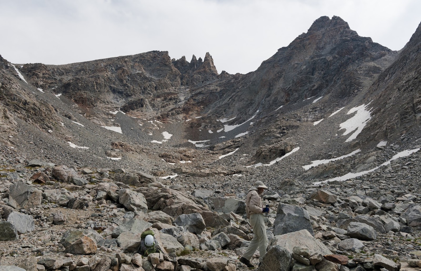
We found, at various times, intermittent use-trails from the many who'd used this course on their way up to Gannett Peak; none of the use-trails was totally consistent, so we'd take some from one patch of boulders or loose scree to the next as we worked up and up. Also, to avoid sending rocks down on one another in various places, we spread out a bit so we weren't climbing right in line with each other. Finally, after plenty of effort, we found ourselves about to "top out" on Bonney Pass; I had arrived slightly earlier than Claron and stopped to wait for him just shy of the viewpoint that would be revealed ahead...Once Claron got up to where I was we both advanced together; I figured we should share the experience of coming to what would likely be the premier view of our trip together, since we'd both invested a lot of mutual effort to be there - Claron appreciated the gesture.
With a few more steps across gently rising, but very, rocky terrain we found ourselves gazing upon what I eventually determined was the most rugged vista I had, to that point, ever seen in any mountain location...There, before us, stood the hulking majesty of Gannett Peak, Wyoming's tallest peak at 13,804 feet above sea level. Reaching up Gannett's massive cliffs and ridges and extending out from its base were massive glaciers that ran across the ground far below us and climbed up the sides of adjacent peaks, each of which neighboring summit was stunningly rugged...The raw wildness and focused austerity of the place was jaw-dropping...breathtaking...
From our little lunch/snack spot we had to do a good bit of boulder-hopping across large boulders arrayed across a big boulder field...this type of terrain continued all the way out to the lower edge of Bonney Pass.
The ascent up Bonney Pass was about as expected - tedious and careful; the gain here is steep - and sustained - you pick up all 1,200 or so feet in a pretty short horizontal distance, so it's more of a climb than a hike, and sometimes there is boulder scrambling, but nothing excessively terrible. I'm not a huge fan of steep, loose slopes, but the climb up Bonney Pass is only sporadically loose in a problematic way, but it's one you'll want to be mentally on-point for so you don't end up slipping or tripping - it could be a long and jagged tumble down a steep hillside if a mistake were made...
While we were working our way up Bonney Pass the storm clouds sweeping in from the south finally started catching up to us and so we found a small cave formed between two or three massive boulders and I scrunched up in the back, fetal-position-esque, and Claron crammed in next to me as much as he could and we used my waterproof emergency blanket to cover what of ourselves wasn't directly shielded from the rain and hail by the rocks...there was also some pretty good thunder happening, and hearing the thunder booming through the air and echoing off the surrounding cliff walls was one of the sweet treats of the trip, even if I was listening from a cramped spot between boulders while looking out through a tiny gap between Claron and the rocks while trying to dodge a slow, cold drip from the ongoing rain...We stayed in this little improvised shelter for about 30 minutes till the storm passed and we resumed our course up the pass.
We found, at various times, intermittent use-trails from the many who'd used this course on their way up to Gannett Peak; none of the use-trails was totally consistent, so we'd take some from one patch of boulders or loose scree to the next as we worked up and up. Also, to avoid sending rocks down on one another in various places, we spread out a bit so we weren't climbing right in line with each other. Finally, after plenty of effort, we found ourselves about to "top out" on Bonney Pass; I had arrived slightly earlier than Claron and stopped to wait for him just shy of the viewpoint that would be revealed ahead...Once Claron got up to where I was we both advanced together; I figured we should share the experience of coming to what would likely be the premier view of our trip together, since we'd both invested a lot of mutual effort to be there - Claron appreciated the gesture.
With a few more steps across gently rising, but very, rocky terrain we found ourselves gazing upon what I eventually determined was the most rugged vista I had, to that point, ever seen in any mountain location...There, before us, stood the hulking majesty of Gannett Peak, Wyoming's tallest peak at 13,804 feet above sea level. Reaching up Gannett's massive cliffs and ridges and extending out from its base were massive glaciers that ran across the ground far below us and climbed up the sides of adjacent peaks, each of which neighboring summit was stunningly rugged...The raw wildness and focused austerity of the place was jaw-dropping...breathtaking...
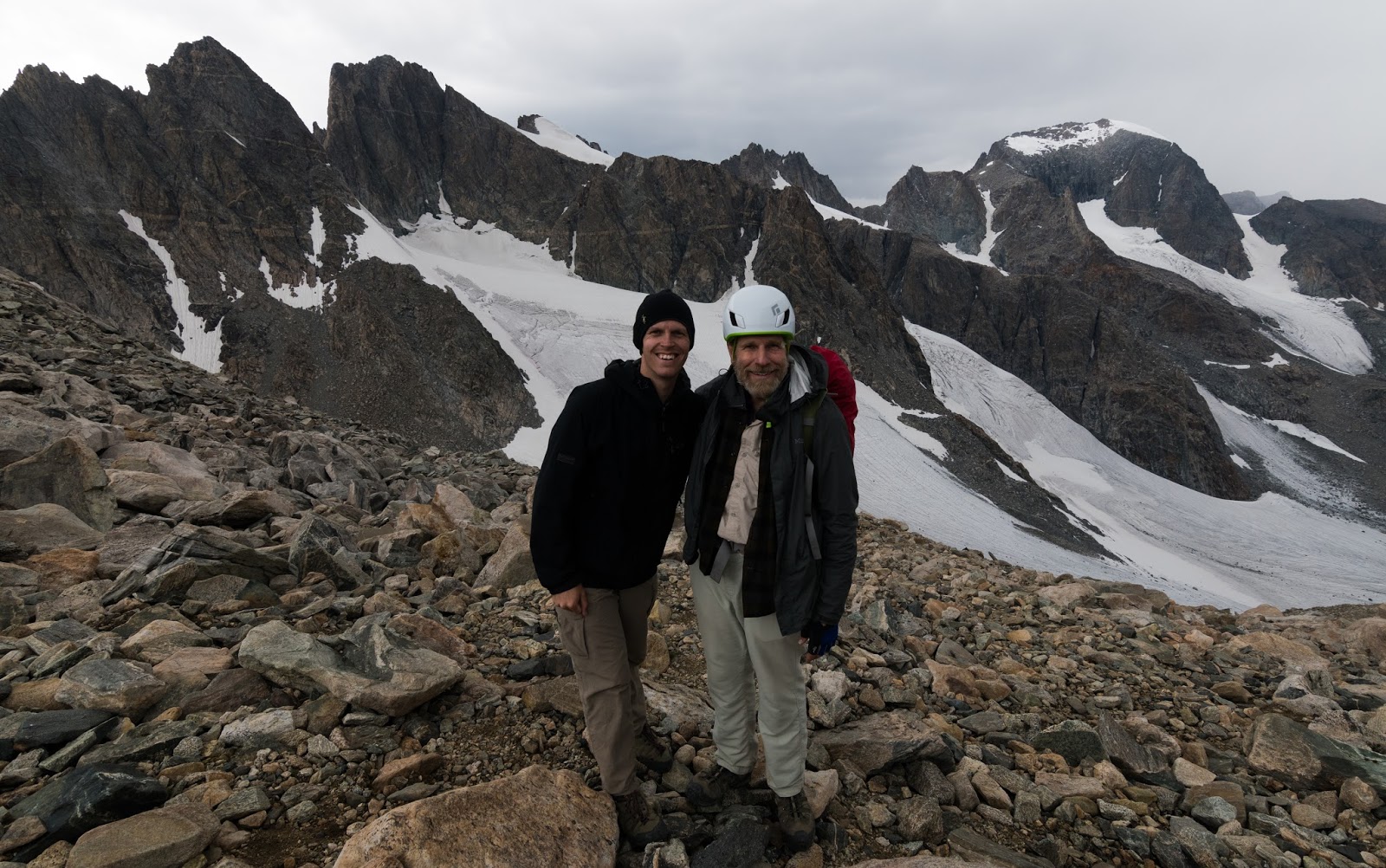
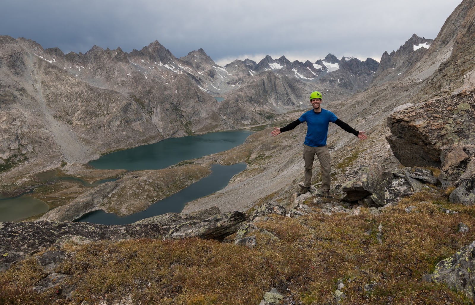
At the top of Bonney Pass (12,800+ feet) with Claron - with absolutely wild terrain, including some of the largest glaciers in the lower 48 states and Wyoming's highest point (Gannett Peak, upper right) behind us!
After standing in stillness for a few moments and taking in the scene the inevitable stream of photographs soon began. Claron took one of his customary videos of the scene as he is wont to do from the summits of peaks (and, make no mistake, getting to the top of Bonney Pass is not too dissimilar from summiting a peak in effort and time required). I also scrambled around for various photos, since there was so much there almost yearning to be photographed!
The weather was still displaying a threatening, generally ominous, atmosphere and dark, aggressive-looking clouds were all around us...As we looked to the valley that extended to the northeast across the glacial fields below us we saw thick hail pounding down, largely obscuring our view in that direction - I was pretty happy that heavy hail decided to stay over there away from us...During our time on the crest of Bonney Pass, we were only menaced by the low'ring clouds encompassing us - it didn't rain or hail on us while we were there, thankfully.
The weather was still displaying a threatening, generally ominous, atmosphere and dark, aggressive-looking clouds were all around us...As we looked to the valley that extended to the northeast across the glacial fields below us we saw thick hail pounding down, largely obscuring our view in that direction - I was pretty happy that heavy hail decided to stay over there away from us...During our time on the crest of Bonney Pass, we were only menaced by the low'ring clouds encompassing us - it didn't rain or hail on us while we were there, thankfully.
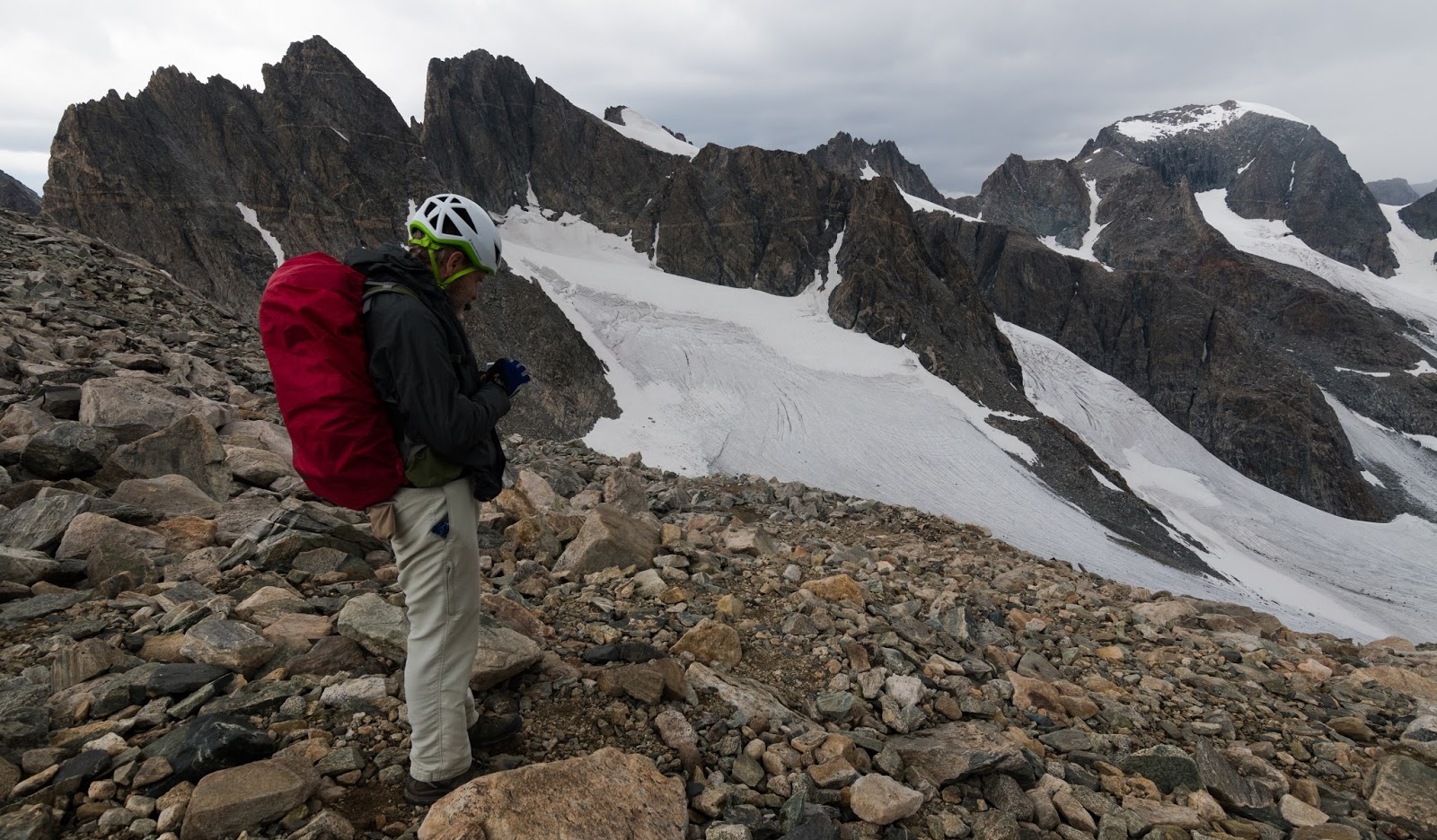
Claron looking at some pictures he'd taken up at Bonney Pass.
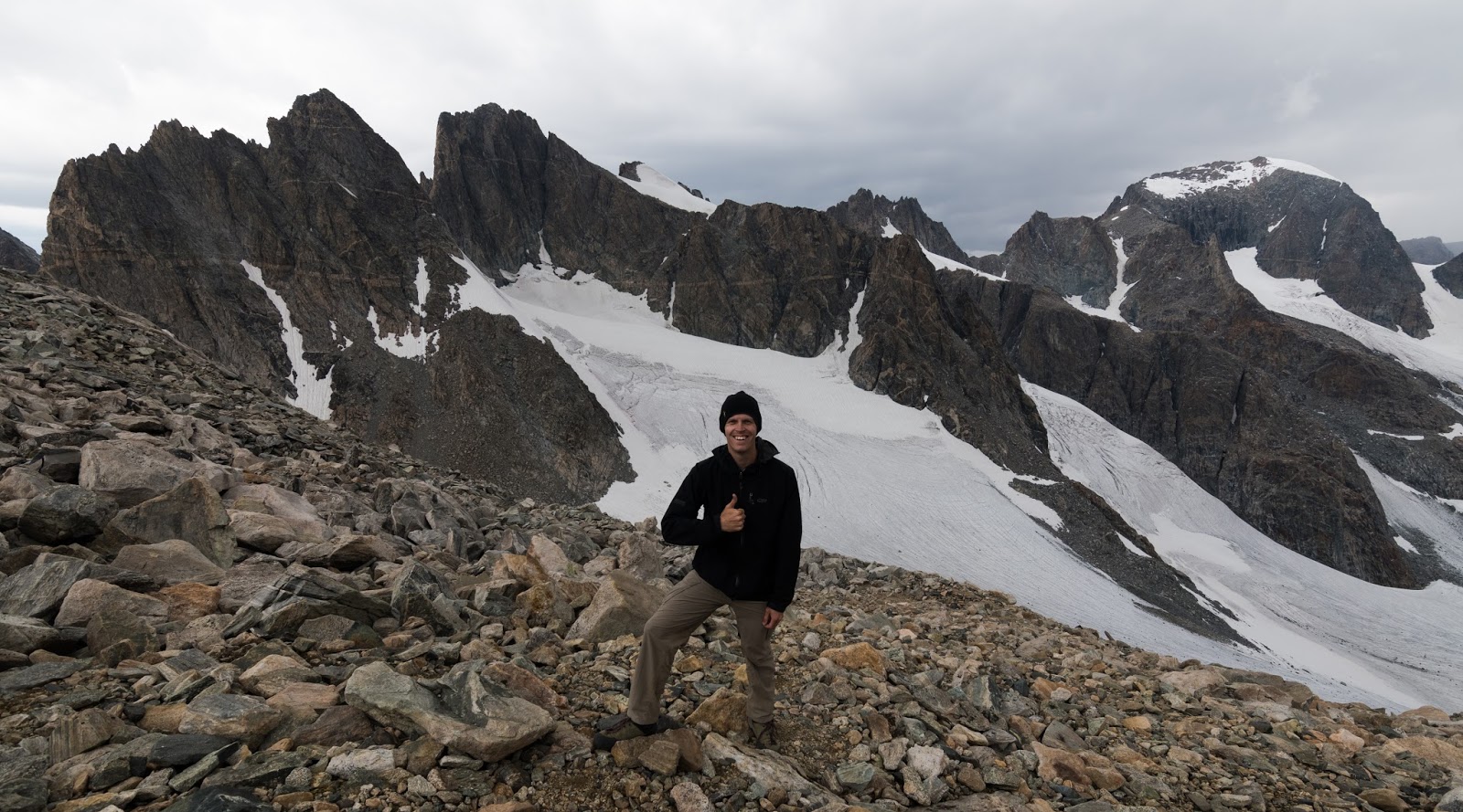
Me, at Bonney Pass, with the deep heart of the Wind River Range rising behind me.

Scenes from Bonney Pass. Almost unbelievably rugged out here...

Scenes from Bonney Pass. Almost unbelievably rugged out here...
Scenes from Bonney Pass. Almost unbelievably rugged out here...

A lone hiker traversing the Dinwoody Glacier below Gannett Peak, and about 1,200 feet below our position on Bonney Pass.
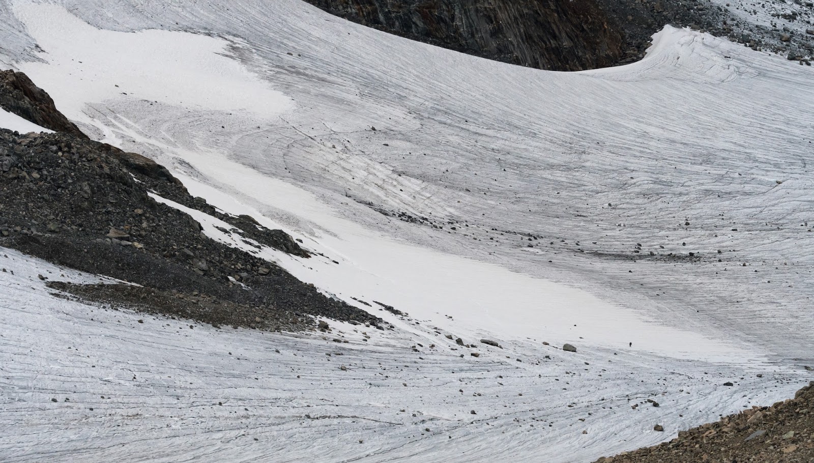
This is a wider shot of the Dinwoody Glacier seen in the previous image. If you look close in the lower-right quadrant here you might be able to pick out the hiker in the previous zoomed-image - gives you a sense of the scale of this glacier, of which only a small section is visible here. Massive!

Close-up on Gannett Peak, Wyoming's tallest point at 13,804 feet. It's an amazing-looking peak and a world-class mountain. Fantastic to see it first hand; I'd like to get out and summit it one of these days.
This was my favorite shot looking toward Gannett Peak from Bonney Pass. I felt the tumultuously stormy skies over these peaks really added to the scene, perhaps the most austere view I've ever had the privilege of beholding to this point. It was unforgettable just being in the midst of such country...
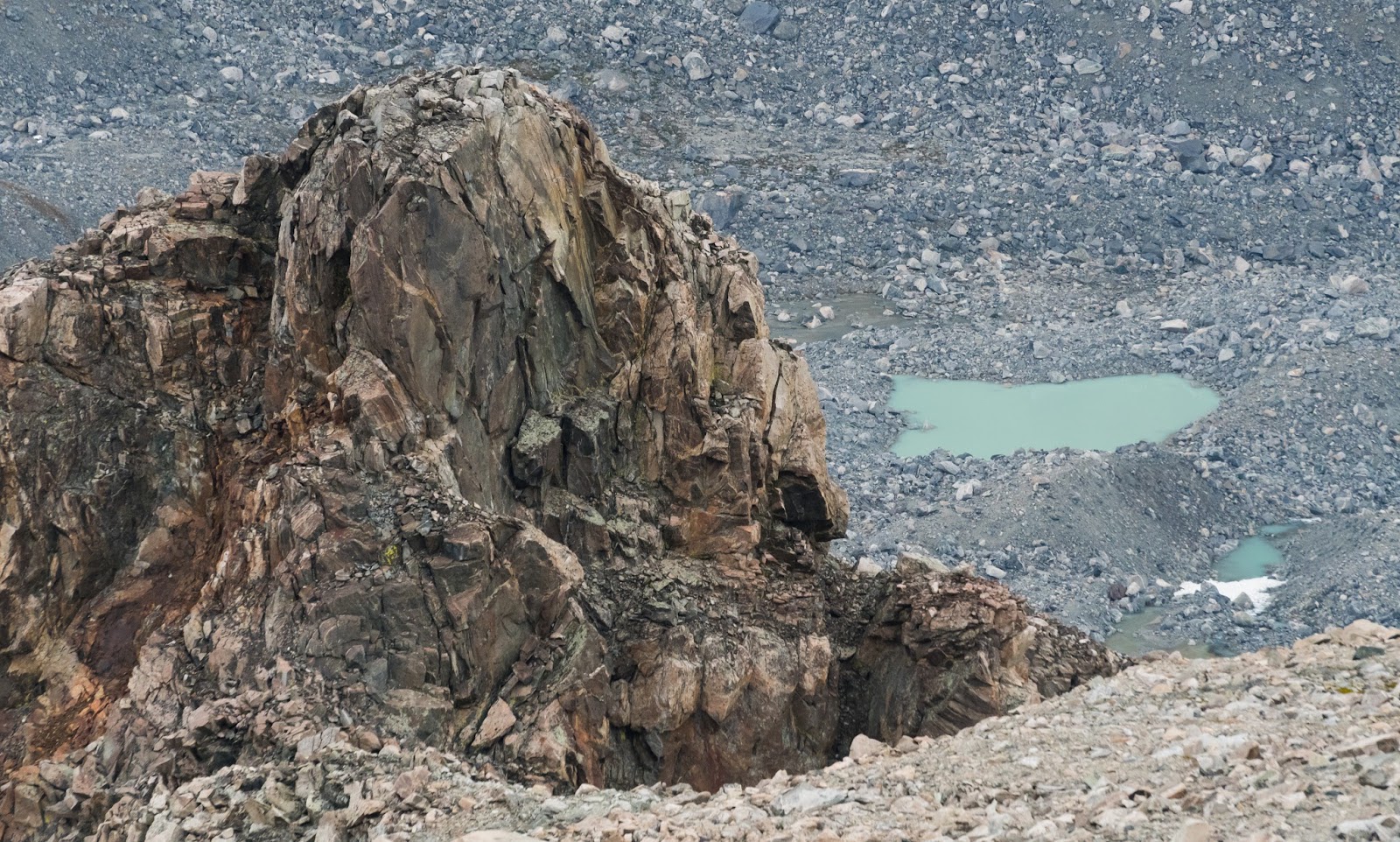
Milky blue-green lake filled with glacial meltwater down below the Dinwoody Glacier and Gannett Peak. The atypical color is the result of extremely fine sand particles suspended in the water that have been ground down and melted off of the surrounding glaciers; these suspended particles catch the light differently, giving these lakes their more unique appearance.
Scenes from Bonney Pass. Almost unbelievably rugged out here...
Here's a close shot of Gannett Peak's summit area from Bonney Pass.
Claron walking back up the pass a little bit as we make plans to start heading back down; the weather was really threatening and the wind was higher in the pass and it was getting cold since we'd been up there relatively stationary for a little bit.
Me and Gannett Peak - Wyoming's highest point.
Snagged this as clouds began to close in on Gannett Peak's summit...
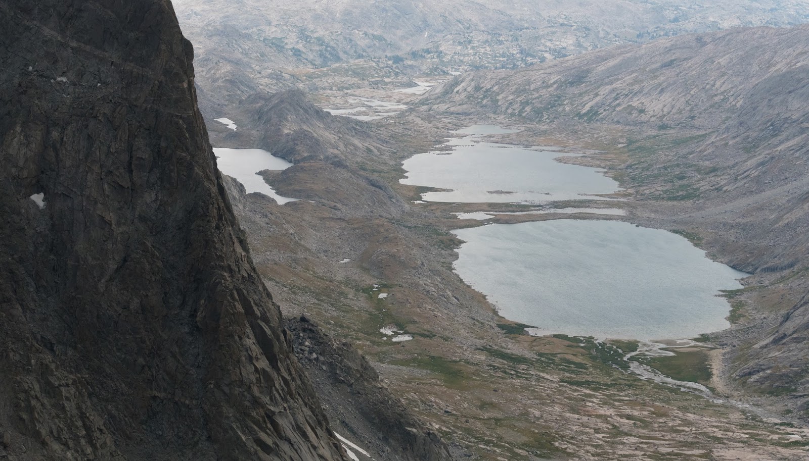
Nice view of the Titcomb Lakes and Mistake Lake, higher up on the left a few hundred feet above the main basin floor. The prominent rock outcropping on the left is part of Mount Helen.

Apparently this formation is called Forked-Tongue Pinnacle; it's between Dinwoody Peak and Mount Helen.

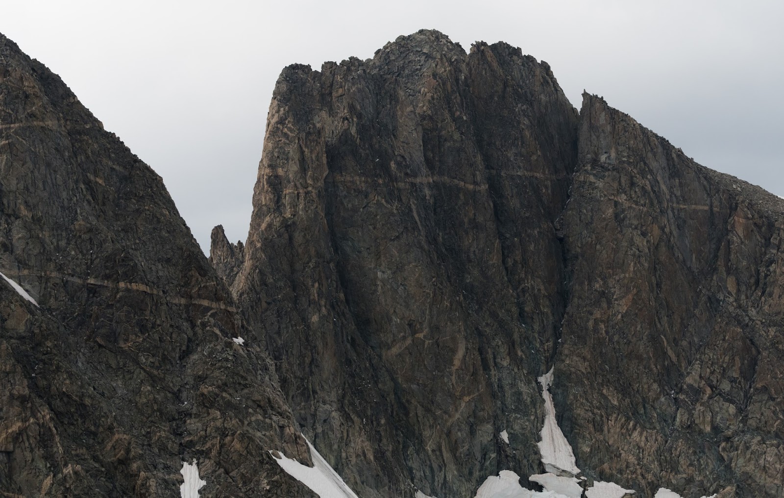
Not sure which peak this is, but it's got an amazing face.
Zoom-shot on Mount Helen's impressive and aggressive ridgeline.
Another of my favorite shots from the entire trip; when I saw this scene I thought it looked like something that would be at home in J.R.R. Tolkien's "The Lord of the Rings". Here, again, the stormy skies actually add to the scene. What a treat!

Looking across at the bouldery-but-relatively-straightforward terrain between the boulder field at the base of Bonney Pass and the Twins Glacier across Titcomb Basin, somewhat to the southwest.
We had some neat moments when the storm clouds were blowing over the peaks around Bonney Pass, moving pretty quickly from north to south; you see a little bit of it here over part of Mount Helen. The effect was much stronger on the peaks to the left, but the viewing angle was poorer, so this impressive angle on Mount Helen won out. Actually, there was a moment, as we were descending Bonney Pass, maybe 300 - 500 feet below the crest of the pass on the Titcomb Basin side, when a wall of clouds came rushing over the top of the pass and crashed against the peaks on either side and curled down through the air right in front of us - the movement was sudden and only lasted for maybe a minute or less, but it was striking to be witness to that kind of cloud movement exactly where we were...

This was my favorite shot of the low clouds blowing over Bonney Pass and the adjacent peaks - it was neat to see the clouds coming across the peaks and appearing and disappearing as they came into and out of view.

This was more a view to the north where the blowing clouds were thicker but the peaks were somewhat less-interesting to view from this particular angle (where from other angles they would be as stunning as other area peaks).
After a few minutes the low clouds lifted and we had some more extensive clearer views under a still-overcast sky; Claron gives this scene a bit of scale as we work through more boulders on the way over to the Twins Glacier ahead to the upper-right.
It's still a bit difficult for me to actually comprehend, even though I was eyewitness to it, the fact of so much rugged terrain in one place...the impressions of the area are unforgettable...
Claron enjoying the stunning view of the northwest aspect of Mount Helen as Titcomb Basin stretches on into the distance.
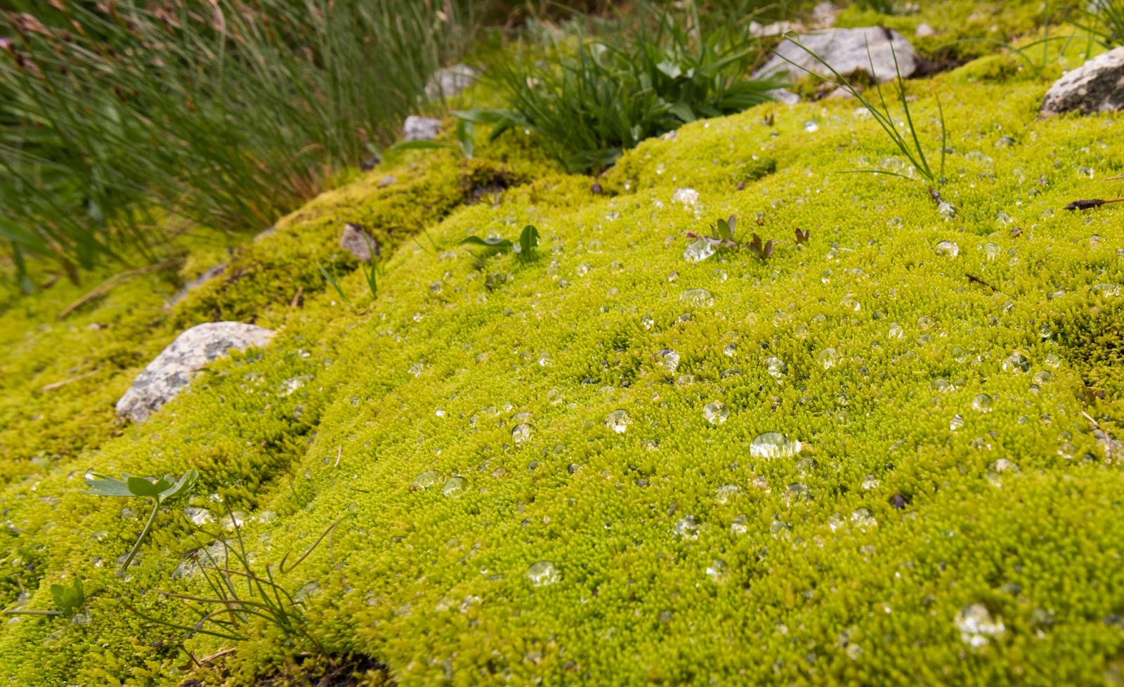
Close-up on some of that vivid green moss we'd come across at sundry times on this trip - this little patch was in the upward parts of northern Titcomb Basin between Bonney Pass and the Twins Glacier; the water droplets are leftovers from the rain/hail storm that happened earlier while we were working up Bonney Pass and had to hide in the little boulder cave...lovely scenes.
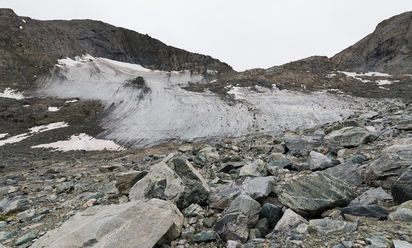
A wider view of the Twins Glacier across another boulder field from the far side of the upper-basin it rests in above the main part of the much larger Titcomb Basin.
Upper Titcomb Basin detail.
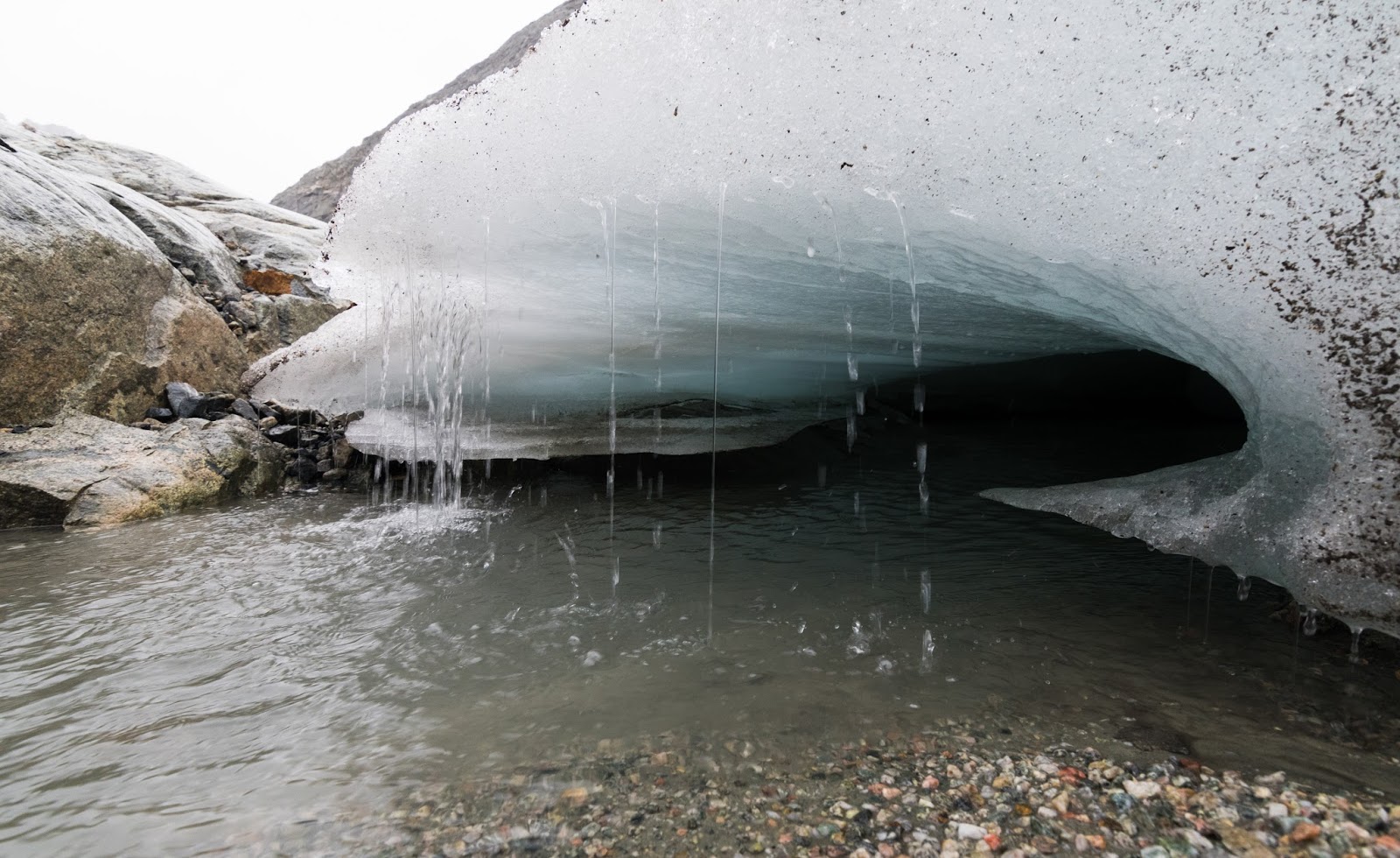
There were impressive amounts of water pouring out of the glacier across the plain/hanging basin near its base, and we spotted, a bit in the distance, a sizeable ice cave at the base of the glacier as well, so we decided to make this the area we would aim for...and, soon enough, we were there, standing at the base of a massive glacier stretching up and across the rugged cliffs before us and around us...
It was an impressive scene; not as striking to me personally as the sublimity of Bonney Pass, but impressive all the same. Neither Claron nor I had been this close to a glacier previously, and here we were completely in the wild - no guardrails, no protections, no rules...On the glacier itself were consistent signs of massive rockfall - huge boulders, large landslides, etc., and there were some signs of some parts of the lower glacier separating and preparing to calve off of the main glacier...There was no lake near the base of this glacier, just a vigorously-flowing stream coursing off from the glacier to eventually form a sizable cascade down the northwest part of Titcomb Basin, which cascade we had both seen and heard on our approach towards Bonney Pass earlier in the day.
It was an impressive scene; not as striking to me personally as the sublimity of Bonney Pass, but impressive all the same. Neither Claron nor I had been this close to a glacier previously, and here we were completely in the wild - no guardrails, no protections, no rules...On the glacier itself were consistent signs of massive rockfall - huge boulders, large landslides, etc., and there were some signs of some parts of the lower glacier separating and preparing to calve off of the main glacier...There was no lake near the base of this glacier, just a vigorously-flowing stream coursing off from the glacier to eventually form a sizable cascade down the northwest part of Titcomb Basin, which cascade we had both seen and heard on our approach towards Bonney Pass earlier in the day.
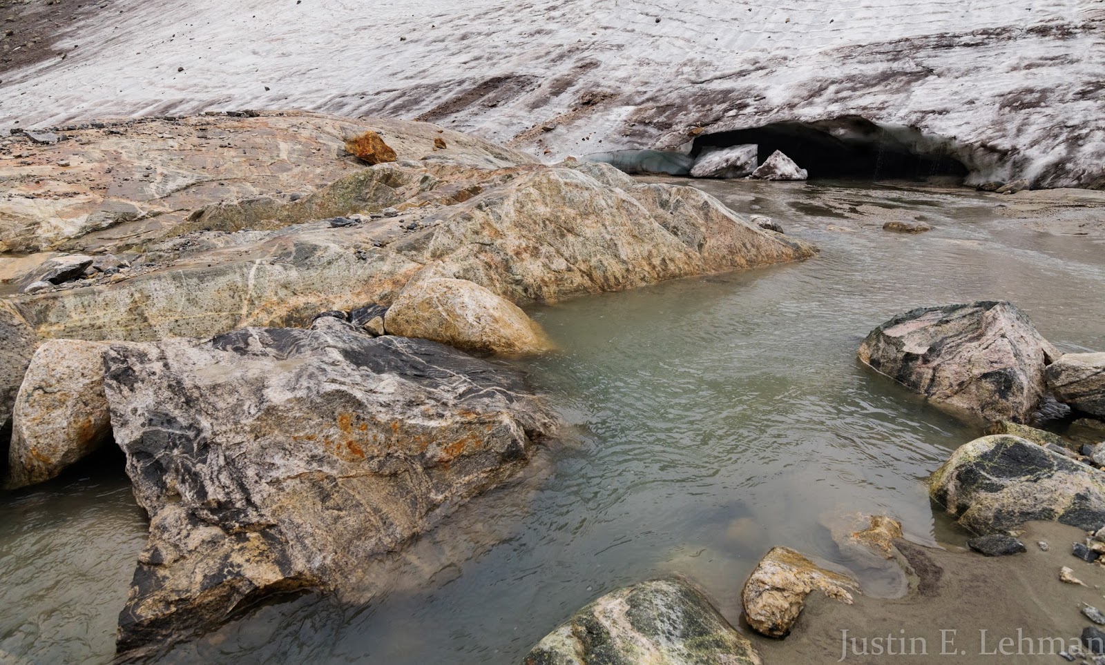
We went over to this fairly large ice cave at the base of the glacier, from which a vigorous stream of meltwater was flowing out across the upper basin by the glacier before cascading down several hundred feet to the main part of Titcomb Basin. The stream looks pretty gentle here, but it is also deeper and wider here; when the channel narrows a bit further out in the upper basin you can easily tell how much water is pouring out of this glacier.
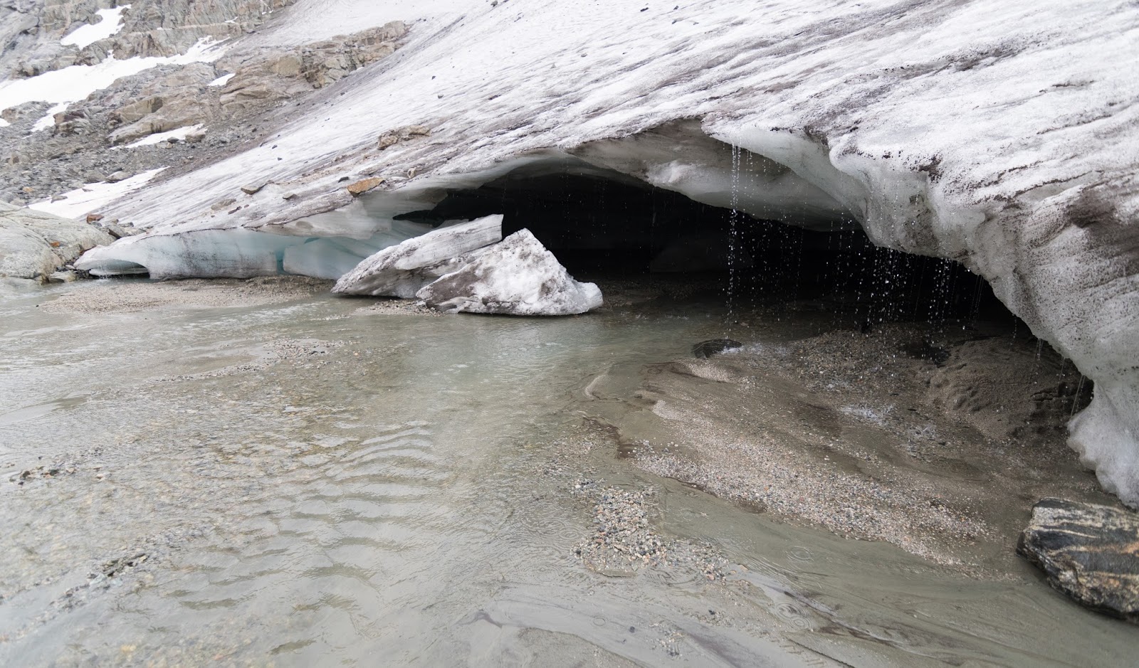
Closer view of the ice cave at the base of the Twins Glacier and a curtain of meltwater streaming off the top edge also. You don't really get a sense of the size of the cave here, but it was about 20 feet across, maybe 6 - 8 feet tall at the tallest part of the mouth, and deep enough and wide enough inside Claron and I figured you could probably fit at least 50 people in there very comfortably. We did not go into the cave for fear of potential collapse, but did take pictures at the mouth of it.
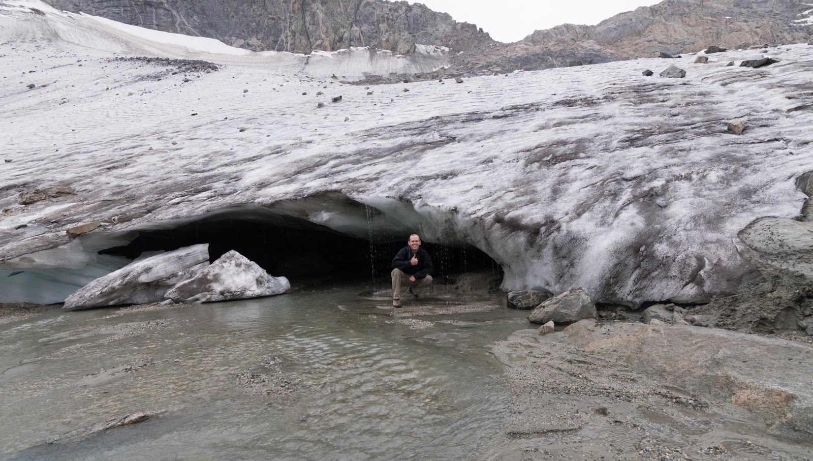
Claron snagged this picture of me with my camera. Having me right next to the glacier's cave gives it a bit more scale; I'm just barely under six feet tall and I'm not immediately next to the cave opening (because of the falling water) but I'm as close as I could be without getting too wet. If I was standing up my head would be about even with the edge of the ice cave's upper part, except for at the center, where the opening is a little taller than at either edge.

Up to this point, as we were taking our pictures with the glacier and such, it had been lightly sprinkling, but now heavier rain was starting to sweep in from the north; the boiling clouds we'd seen out around Gannett Peak were finally moving over the ridge and into Titcomb Basin, so we knew we'd soon be getting rather more wet than we were already at the time since we had about six miles between us and our campsite...
Claron snapping a few more pictures as the rain moves in closer from the north end of Titcomb Basin. If you look close you can see the small plastic bag he would tuck his phone into to waterproof it while we were out hiking.
Close-up of one of the edge of the glacial ice cave; I like the wave-like contour of the ice here.
This was the last picture I took before we started heading out of Titcomb Basin as the wall of rain swept in to our area and forward through the basin. It was actually raining decently on us here, but somehow, somewhat miraculously, my lens didn't get any waterspots on it (again, thank you, lens hood). Our time exploring Titcomb Basin and getting out beyond the terrain most hikers to the area see (the regular walk up to the lakes and back), getting us into some more backcountry locations, was a great treat and a literal dream come true for me. I'm looking forward, already, to revisiting the area in future years and thank God for this opportunity to taste the sweet fulfillment of something so beautiful so long desired and, at long last, attained. Alleluia!
At this point the rain was falling really good and I had stashed my camera safely away in my pack (even though it was already quite wet); I wasn't worried about the camera, I just wanted to make sure it wasn't getting excessively wet, and the rain was falling so heavily after the initial stages of the storm that more pictures of Titcomb Basin weren't really feasible to show anything I hadn't already shown.
We hiked through the chilling rain, largely protected by our rain gear but still plenty wet (as anyone who's hiked in a good backcountry storm knows will happen). This continued all the way out of Titcomb Basin, originally dropping a few hundred feet down from the base of the Twins Glacier into Titcomb Basin proper, and then doing some light route-finding back to the trail that runs down the center and then the east side of the basin below. The rain did stop as we were nearing the southern end of Titcomb Basin, around the lakes, but all the vegetation was so wet and we were well-soaked by this time, so we didn't dry off too much, but we were - thankfully - slightly more dry than we would've been by the time we made it back to camp.
I ate a much smaller dinner than normal (I didn't even prepare one of my backpacking meals that evening, which is very unusual for me); I wasn't really nauseous, I was just tired and cold. We'd gone about fifteen fairly arduous miles that day and I wanted to get into my one change of dry clothes, and get into my sleeping bag to warm up, since I had been cold for hours and was now both wet and cold. Soon enough I was changed and in my sleeping bag and Claron headed to bed fairly shortly thereafter.
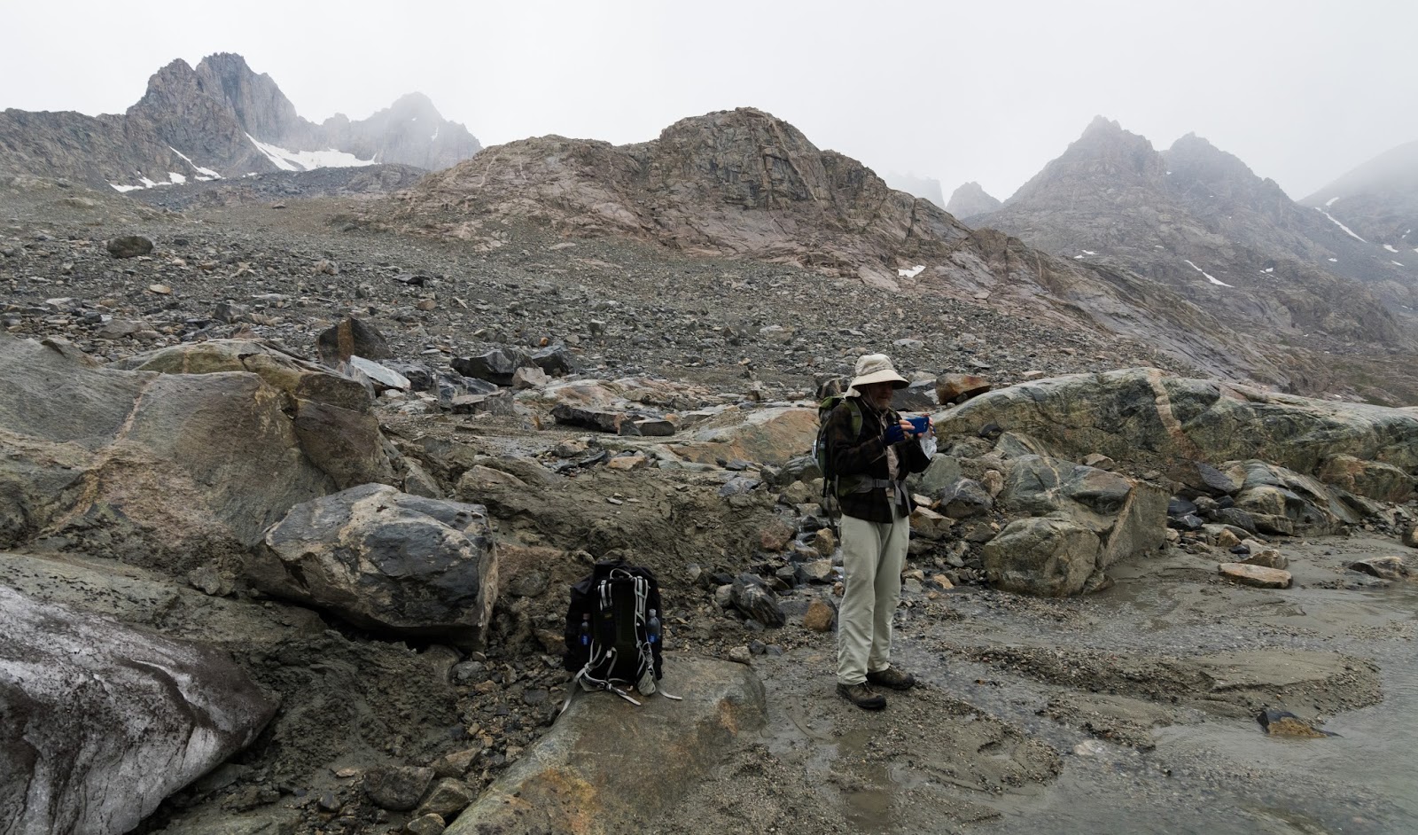
Friday we packed out as planned and didn't have much issue with the weather on our way out apart from a few passing rain showers, arriving at the Elkhart Park trailhead/parking area as the sunset was beginning, having enjoyed some very fine conversation along the way. Claron and I both took note of the multiplicity of states represented by the various license plates in this area; we saw plates from east coast states, the south, the midwest, the southwest, the mountain west, and the west coast. Folks from all across America and further out had made the journey to experience this amazing area firsthand, but despite the crowded look of the trailhead here, both at the outset and at the conclusion of our trip, we never felt crowded. Indian Basin was largely ours to enjoy, or felt that way at least as we explored that area. Our entire day in Titcomb Basin the following day we only saw five other people the entire time we were in the basin; two were hikers headed to Bonney Pass at the same time we were for their first time who turned back when they saw the inherent difficulties of the place and went somewhere more easily accessible in the basin, two were campers we saw near the mouth of Titcomb Basin on the southern end on our way out after the rain, and the other was a lone hiker working back across the glacier beneath Gannett Peak well-below where we were up at Bonney Pass. So we felt like we had the place largely to ourselves the entire day, which was a real treat, considering how objectively fantastic this area really is. We made a stop at a recently-favorite pizza place in Pinedale, Wyoming and took advantage of their offered free wi-fi before beginning the long drive home.
The return journey was straightforward; I drove from Pinedale to Evanston, WY, then Claron drove the rest of the way to his house. After exchanging yet another set of thanks and parting ways I drove myself the last near-hour home and got back late into the night after what was, certifiably, one of the finest adventures I've ever had. I look forward to many return journeys to the Wind River Range, and I thank God not only for crafting such amazing wilderness, not just for planting within me the burning desire to see and experience this and other similar areas personally, but for Him actually bringing me there and opening the way for me to attain this dearly held, long-anticipated dream of experiencing the great wilderness of the Wind River Range and Titcomb Basin for myself! Soli Deo Gloria!
We hiked through the chilling rain, largely protected by our rain gear but still plenty wet (as anyone who's hiked in a good backcountry storm knows will happen). This continued all the way out of Titcomb Basin, originally dropping a few hundred feet down from the base of the Twins Glacier into Titcomb Basin proper, and then doing some light route-finding back to the trail that runs down the center and then the east side of the basin below. The rain did stop as we were nearing the southern end of Titcomb Basin, around the lakes, but all the vegetation was so wet and we were well-soaked by this time, so we didn't dry off too much, but we were - thankfully - slightly more dry than we would've been by the time we made it back to camp.
I ate a much smaller dinner than normal (I didn't even prepare one of my backpacking meals that evening, which is very unusual for me); I wasn't really nauseous, I was just tired and cold. We'd gone about fifteen fairly arduous miles that day and I wanted to get into my one change of dry clothes, and get into my sleeping bag to warm up, since I had been cold for hours and was now both wet and cold. Soon enough I was changed and in my sleeping bag and Claron headed to bed fairly shortly thereafter.
Friday we packed out as planned and didn't have much issue with the weather on our way out apart from a few passing rain showers, arriving at the Elkhart Park trailhead/parking area as the sunset was beginning, having enjoyed some very fine conversation along the way. Claron and I both took note of the multiplicity of states represented by the various license plates in this area; we saw plates from east coast states, the south, the midwest, the southwest, the mountain west, and the west coast. Folks from all across America and further out had made the journey to experience this amazing area firsthand, but despite the crowded look of the trailhead here, both at the outset and at the conclusion of our trip, we never felt crowded. Indian Basin was largely ours to enjoy, or felt that way at least as we explored that area. Our entire day in Titcomb Basin the following day we only saw five other people the entire time we were in the basin; two were hikers headed to Bonney Pass at the same time we were for their first time who turned back when they saw the inherent difficulties of the place and went somewhere more easily accessible in the basin, two were campers we saw near the mouth of Titcomb Basin on the southern end on our way out after the rain, and the other was a lone hiker working back across the glacier beneath Gannett Peak well-below where we were up at Bonney Pass. So we felt like we had the place largely to ourselves the entire day, which was a real treat, considering how objectively fantastic this area really is. We made a stop at a recently-favorite pizza place in Pinedale, Wyoming and took advantage of their offered free wi-fi before beginning the long drive home.
The return journey was straightforward; I drove from Pinedale to Evanston, WY, then Claron drove the rest of the way to his house. After exchanging yet another set of thanks and parting ways I drove myself the last near-hour home and got back late into the night after what was, certifiably, one of the finest adventures I've ever had. I look forward to many return journeys to the Wind River Range, and I thank God not only for crafting such amazing wilderness, not just for planting within me the burning desire to see and experience this and other similar areas personally, but for Him actually bringing me there and opening the way for me to attain this dearly held, long-anticipated dream of experiencing the great wilderness of the Wind River Range and Titcomb Basin for myself! Soli Deo Gloria!