- Joined
- May 5, 2012
- Messages
- 1,732
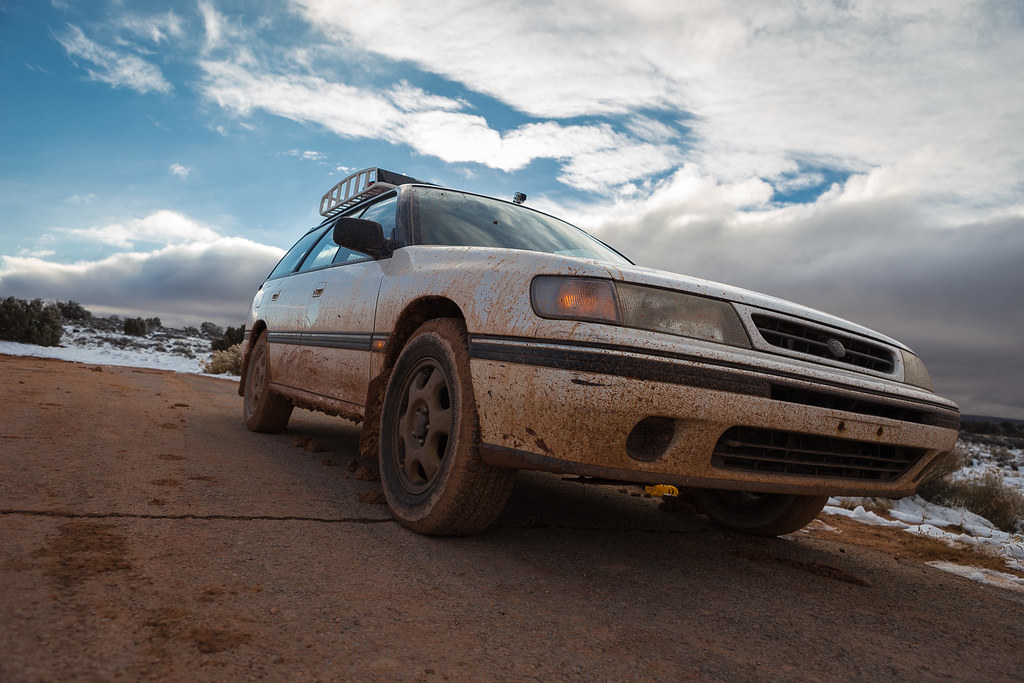
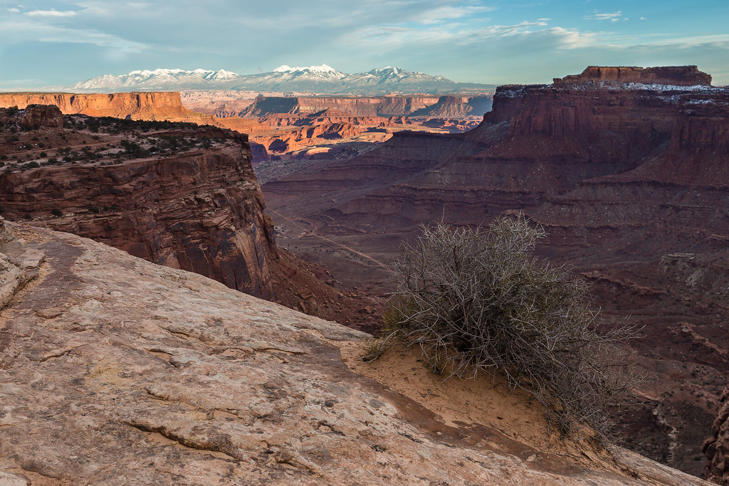
The White Rim in a wagon: yes, it can be done; no, you shouldn't try it.

Those were my thoughts upon completing a winter circuit of the White Rim Road in a lightly modified 1994 Subaru Legacy Touring Wagon during early December of 2013.
The trip was proof enough that a street car could handle the road even in less-than-ideal conditions, with proper preparation and a driver stupid enough to attempt it.
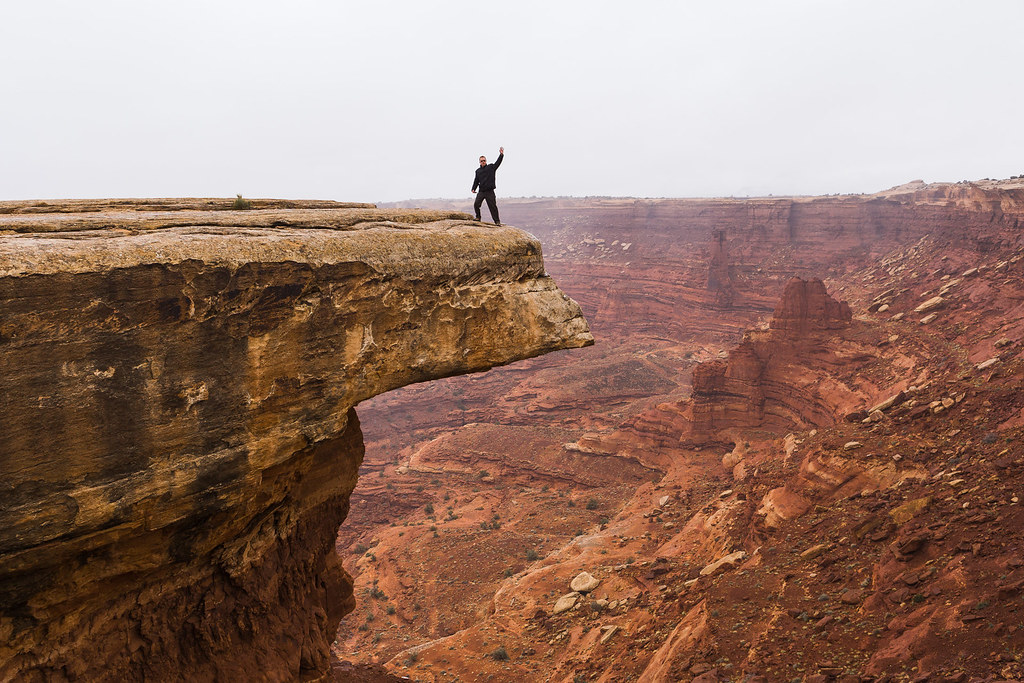
Hi Mom by ashergrey, on Flickr
That being said, I wouldn't recommend it.

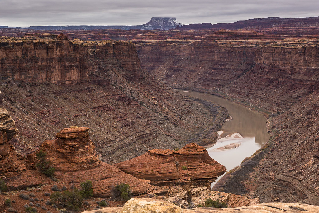
A little history: the first time I remember seeing the Colorado River was on a boyhood trip with my father and brother. We stopped along the river near Hite following a visit to Natural Bridges National Monument. As we bathed in the muddy brown water, I remember my dad telling me about the confluence, a mystical place upstream in the great gorges where the green and red rivers joined into one.
Most photos you'll ever see of the confluence come from the Colorado side in the Needles district of Canyonlands National Park. The angle of this viewpoint is, in my opinion, rather uninspiring. Terrain from the opposing side of the river in the Maze makes it nearly impossible to see the actual confluence from there.
But what about from the north?
In the fall of 2013 I became aware of a possible route to a viewpoint of confluence from the north, via an old mining road that once spurred off the White Rim Road. Information about this route online is scant. The National Park Service does not promote this route on their published literature for Island in the Sky.
I wanted to see it, and photograph it, for myself.
But as was the case with most all of my 2013 outings, the weather did not cooperate. The week before I departed for Canyonlands, a winter storm dumped wet snow across the region. I grew increasingly nervous that the White Rim Road would be made impassable or would be closed. In fact, the NPS closed the Shafer switchbacks just days before I intended to drive down them.
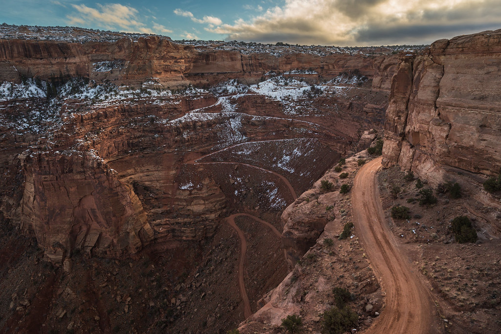
Snowy Shafer by ashergrey, on Flickr

This left me very nervous as to what I'd find on the far side of my 100+ mile route, assuming I could make it all the way around to the Mineral Bottom switchbacks.
Skies across northern Utah were mostly clear as I set out early the morning of November 30th. That all changed as I crested Soldier Summit on US-6. The overcast hit like a wall. The sun disappeared behind a thick fog.

A quick stop in Moab for fuel and I embarked on the route proper. As Shafer was closed, I had to take the longer dirt access in on the Potash Road.
A married couple on mountain bikes stopped to watch me ascend the hill just east of the potash evaporation ponds. They'd heard the rumble of the boxer engine and wanted to see whether or not I'd get stuck. Both cheered and pumped their fists at me as I crested the rise. Buoyed by their enthusiasm, I stopped for a chat. They confessed to owning a Forester and praised my chutzpah for taking the Subaru onto rough terrain. They asked how far I intended to go.
"Oh, the whole way 'round. I have a reservation tonight at White Crack."
Their faces fell and they glanced at each other with that knowing, half-lidded look that couples who've spent years together have a way of using. It seemed obvious that while they saw novelty in my taking the Subaru off the asphalt, they thought me a bit foolhardy.
"On the White Rim? Do you think you'll make it?"
"I'm not sure," I said, shrugging from the driver's seat. "I've got extra fuel, a full-size spare and a hi-lift. I'll go as far as I can. Worse comes to worse, I have extra food and water and I'll hike out if I get stuck."
They wished me luck and we parted ways at a giant mud pit.

A couple of SUVs sat at the Colorado River overlook as I passed. They would be the last traffic I'd encounter on the entire trip around the White Rim. Soon after, I entered the park proper.


I made the obligatory stop at Musselman Arch...


…and then the daylight started to falter. Rough conditions meant slow-going.
The Washer Woman looks quite a bit different from below.
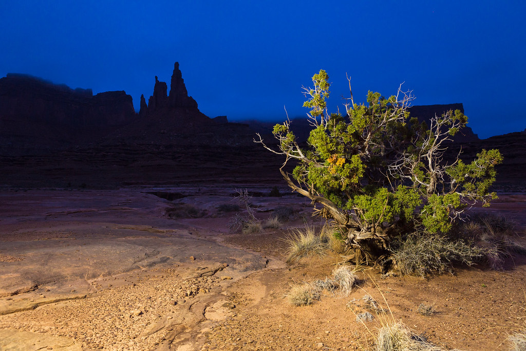
Blue Juniper by ashergrey, on Flickr
With no moon or stars the night's dark turned inky, making it difficult to judge the road much beyond the reach of the headlights. The crests of little hills turn into really worrisome obstacles when you can't see the horizon beyond them. In some cases, this made it seem like you might be driving off the side of a cliff.

All of the ups-and-downs in the dark had me feeling a bit motion sick by the time I arrived at White Crack. After a little dinner I rolled out the bed in the back of the wagon and went to sleep.
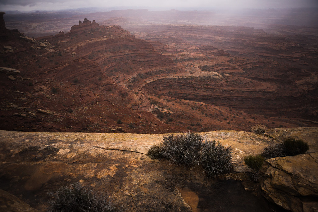
[PARSEHTML]<iframe src="http://www.mappingsupport.com/p/gmap4.php?q=https://dl.dropboxusercontent.com/u/3847512/GPS/Potash_to_White_Crack.kml&t=t4" frameborder="0" marginheight="0" scrolling="no" width="800" height="800"></iframe><br><br>[/PARSEHTML]Sunday morning dawned cold and gray. Light flakes of snow slipped out of sagging clouds that obscured the towering plateau to the north. This was to be my hiking day, but conditions appeared so miserable that I considered bagging the exploration. Being caught in a snowstorm this far out seemed a legitimate threat.
I walked out to the rim near White Crack and looked into the Lower Basin area. It wasn't encouraging. Storms were sweeping up from the south.
Winter Storm over White Crack by ashergrey, on Flickr
I consumed a breakfast consisting of a peanut butter and honey sandwich, grit my teeth and decided to go for it.

The walk down from White Crack impresses upon a person the dangerous lives sheepherders, cattlemen and uranium miners once lived on these lands. Erosion is in the process of wiping out the path these people used to step below the White Rim.
However, the old road grade is in remarkably good shape once down off the slope. There are sections where one could still easily drive a Jeep today.

There were obvious signs of recent use on this trail, which surprised me given it seems little known and little documented online. Most of the foot tracks petered out after a mile or so, leaving me to believe that many people who walk down the White Crack route do so out of idle curiosity, not to reach any particular destination.
More than half-century-old litter from the mining days still sits right along the road grade.

The walking is pretty easy by hiking standards, as it's mostly level. The views are outstanding, though probably more so without the solid gray overcast I encountered.
As time ticked by, I set a turnaround time in my head: 2 p.m. That would give me enough time to make it back to the car by nightfall. I didn't want to be below the White Rim in the December cold after sundown.
Gray Over the Green by ashergrey, on Flickr
The unfortunate part of this route is its circuitous design. It has to continually head around drainages, adding mileage to what would otherwise be a relatively short jaunt. That means I didn't make it to the old miner's camp until about 1:45 p.m.
Room With a View by ashergrey, on Flickr

A rusting miner's oven.

Modern potsherds in the making.

Detail on one of the remaining bed frames.
After poking around the camp a little while, I spotted this bleaching bighorn skeleton a little way down on a ledge. I couldn't tell if it had died near this spot, or if the carcass had been washed down from up above.
Ominous by ashergrey, on Flickr
The jawbone remained but it seemed somewhat telling that the top half of the skull with the horns was missing. I figure it was either carted off by a scavenger, left where the animal had died or looted by another hiker.

My turnaround time had come and gone by the time I huffed it up to the brushy flat above the miner's camp, looking for the old airfield. I couldn't see it from the ground but my GPS track shows I walked right across it.
From this point I was only about two miles from the confluence overlook, mostly easy walking from what I could see. However, that meant four miles roundtrip before even starting back to the camp at White Crack. The light would be failing by the time I reached the overlook and it was pretty terrible gray light anyway. Had I carried down my backpacking gear I could have set camp here and struck out in the morning, but all that stuff was back in the car.
I made a phone call to my mother via Globalstar sat phone from Skycall Satellite (highly recommended) to inform her of my plan to head back.

Dark fell just as I reached the foot of the long climb back up to White Crack. I later learned my parents were watching my track from the DeLorme unit, trying to figure out how I was going to scale what appeared to be a sheer cliff on the Google map.
Total distance walked for the day was around 15 miles. An out-and-back to the confluence would come in around 20 miles, which makes for a real push in the shortened winter days.
It was frustrating to miss my goal of seeing the confluence from the north but I've confirmed that the route does go. At some point in the future I'd like to return. I believe it's also possible to come up from the river at the mining camp, meaning one could do the confluence overlook from a Stillwater trip and cut the hiking mileage about in half.
[PARSEHTML]<iframe src="http://www.mappingsupport.com/p/gmap4.php?q=https://dl.dropboxusercontent.com/u/3847512/GPS/Mining_Camp.kml&t=t4" frameborder="0" marginheight="0" scrolling="no" width="800" height="800"></iframe><br><br>[/PARSEHTML]Monday started just as gray as had Sunday. I packed up the car and set out to what I figured would be the biggest obstacle of the trip — Murphy Hogback. Before I could even reach that dreaded hill though I had to run the wagon up some muddy ascents.
On one, the hill climbed to a flat then made a 90-degree turn to the left. The car made the climb to the midway point, navigated the turn but then bogged down right at the top of the hill. I backed down to the turn and prepared to make a run at it, only to have the wheels spin in the mud.
A little cursing and praying along with some successful positioning of the tires allowed the wagon to successfully make the climb.
When Murphy finally came into view, my gut sank. Pictures don't do that hill justice. It's steep and narrow. The surface was slicked with mud. Here I was alone, with just this car and no form of support.
What was I thinking?
I called my parents again, mostly to psych myself up for the drive. They could tell just by the fact that I'd called that I was nervous.
I walked the slope to make sure there were no hidden surprises then gathered my courage and made a run at it.

The Green came into view from the top, where I checked in on the sat phone to report my successful ascent.
Lonely Road by ashergrey, on Flickr
Then came the descent. Without a low range, I practically had to stand on the brakes.

After returning from this trip, I learned one of the front brake caliper pistons had seized. I'm not surprised.
After Murphy Hogback, the White Rim Road gradually drops toward river level.
Tuxedo Bottom by ashergrey, on Flickr
In some places you feel like you could jump off the cliff right into the river.
Rio Verde by ashergrey, on Flickr
I stopped at the Holeman slot but it was full of water and I didn't really feel like getting stuck in a stinking pothole so I opted not to drop down into it.

Walking along the rim I could see locations where bars for handholds had once stood. They'd been sawed off at the base, leaving the portion driven into the rock to rust. I wondered how much time had past since their removal.
The next section of the drive proved my favorite, as the road ran along ledges that at times overhung the river.
Siren Song of the Stillwater by ashergrey, on Flickr
The wagon proved sure-footed up and over Hardscrabble Hill, which was in some ways more nerve-wracking than the Hogback. I was really grateful not to encounter any traffic on this portion. It must be a nightmare when mountain bikers and vehicles are both using it during the busier months.
Clouds finally started to break north of Hardscrabble around the mouth of Taylor Canyon.

Some deep sections of sand and mud were all that was left between me and Mineral Bottom. I'd modified the wagon specifically for these conditions by adding a switch that engaged a duty solenoid in the transmission.
This, in turn, locked up the clutch packs responsible for the variable power split between the front and rear axles. The ghetto "locking" center differential took the lag out of the Subaru AWD system, lessening the chances of becoming bogged down in soft stuff.

That mod really proved its worth up on top of the Mineral Bottom switchbacks. The snow from the week prior had still not melted off entirely, making the dirt road back to SR-313 an absolute mess. The entire length of it can usually be cruised comfortably at 50 mph.
I had to run it at near that speed it a mixture of slush and mud, at the very limit of control. At one point the car started to fishtail and I careened about 200 yards counter-steering from side to side to avoid running off the road.
Wagon>WhiteRim by ashergrey, on Flickr
Elated to be back on pavement, I stepped out to air up the tires. Slop kept falling off the underside of the car.

As I had the hood popped to run the compressor, a rather odd fellow stopped to offer his "help". He told me how he was working for an oil company and had been sent out of Colorado to a drill site up on the mesa. Problem was, he couldn't find it.
He had no concept of where he was, as evidenced by the awed look he gave when I explained he was very near to both a national park and a state park. He asked what the "big mountains" he'd seen from Moab were.
I spread out a paper map to give him a sense of his location but he still didn't seem to grasp it.
Then he started taking note of my car. He asked questions about the GoPro mounted on the rack. I saw him eyeing the iPad I'd used to remotely control the camera, along with two DSLRs and other gear in the front seat.
And he wouldn't leave. I stopped airing the tires because I didn't want to turn my back to him. Still he didn't take the hint. I started feeling really nervous and wished for the first time in my solo travels that I'd had a firearm.
Not that I wanted to shoot the guy, mind you. But I would have liked him to have seen that I was prepared to defend myself.
Shafer Canyon by ashergrey, on Flickr
He did leave at last, much to my relief. Under breaking skies I headed into the park to see if sundown would offer any decent light.
Shafer-Potash-White Rim by ashergrey, on Flickr
The High Road by ashergrey, on Flickr
Distant Buttes by ashergrey, on Flickr
I can't stand the zoo that is sunrise at Mesa Arch but it was pretty much deserted for sunset.
Repose in Relief by ashergrey, on Flickr
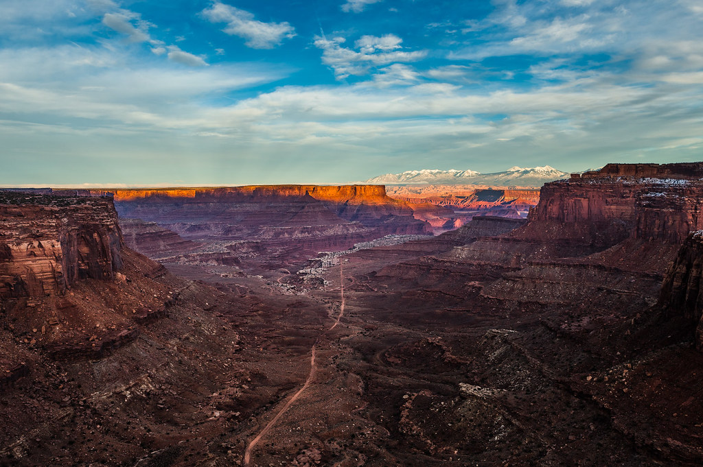
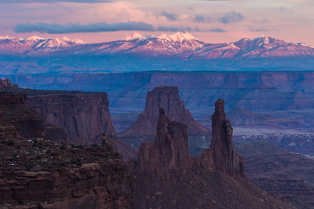
Peering down into that expanse from above after having driven through it changes one's perspective. Looking at Washer Woman, I tried to remember how inaccessible the high plateau had seemed from along the White Rim.
The White Rim by ashergrey, on Flickr
Back at the car in the deepening dark, I emptied my supplemental fuel into the tank for the drive back to Moab.

Along the way, a raging campfire over toward Dead Horse lit up the dark like a candle. The oil camp. As if to prove my supposition correct, one of their work trucks fell in behind the wagon. Its bright headlights lit up the thick fog layer that had formed after sundown between the mesa top and lowlands.
Feeling both road and trail weary, I grabbed a motel room for the night. While in the grocery store I bumped into the oil field worker again. I mentioned to him I'd seen their camp. He confided that he didn't dare drive through the fog layer. His decision to wait out the night at the Motel 6 seemed a wise one to me, especially since I was staying in a different motel.
[PARSEHTML]<iframe src="http://www.mappingsupport.com/p/gmap4.php?q=https://dl.dropboxusercontent.com/u/3847512/GPS/White_Rim_2.kml&t=t4" frameborder="0" marginheight="0" scrolling="no" width="800" height="800"></iframe><br><br>[/PARSEHTML]That brief glimpse of winter glory I'd seen from Mesa Arch the evening prior vanished by Tuesday morning. Skies had grayed over again. A front was forecast to sweep down from the north and a cold wind testified to its approach.
My original plan for the trip was to continue south to Cedar Mesa and spend the rest of the week hiking there. Instead, I decided to just enter Arches and wait out the day in order to see if the conditions would improve.

I had to park next to this guy for effect.
The park staff were not pleased with my decision to go into the Fiery Furnace, since I'd not been in before and had never been on one of their little ranger walks.
"I'm an experienced backcountry hiker," I explained.
The guy handling the permit book scoffed.
"You don't know how many 'experienced hikers' we've had to rescue after they got lost."
"I'm sure it's a lot. But really, I'll be fine."
In the end, they granted the permit in protest.

Dropping into the furnace was actually nice because it cut the wind. With no set agenda I wandered at whim, ending up back at Surprise Arch. Nearby, I found a little cove and spent some time shooting self portraits.


By afternoon it grew apparent that the weather would not improve.

I'd already checked out of the motel and didn't really feel like spending money to sit another night in Moab.
Golden Arches by ashergrey, on Flickr
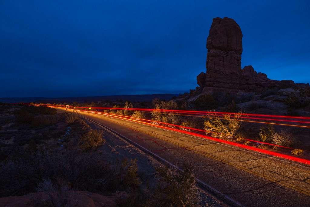
On my way out of the park I stopped by Balanced Rock to shoot some low-light stuff with the 6D.
Golden Spike by ashergrey, on Flickr
Coyotes yipped and howled in the dark as I waited for a car to come along for this shot.
Arches Scenic Drive by ashergrey, on Flickr
I made it back to 191 at about 7 p.m. and decided to start the drive home. Cedar Mesa would have to wait until February.
The cold front hit around Green River, where strong crosswinds ripped across I-70. I spent most of the ride up to Price behind a semi truck trying to draft in his wake. Then came one of the ugliest white-knuckle drives I've experienced going up and over Soldier Summit. The whole stretch was covered with wind-blown snow to the point you couldn't make out the lanes or the edges of the road.
But even as I crested that frightening drive I could only think to myself, at least it's not Murphy Hogback. In a wagon.
Featured image for home page:

Those were my thoughts upon completing a winter circuit of the White Rim Road in a lightly modified 1994 Subaru Legacy Touring Wagon during early December of 2013.
The trip was proof enough that a street car could handle the road even in less-than-ideal conditions, with proper preparation and a driver stupid enough to attempt it.
Hi Mom by ashergrey, on Flickr
That being said, I wouldn't recommend it.
A little history: the first time I remember seeing the Colorado River was on a boyhood trip with my father and brother. We stopped along the river near Hite following a visit to Natural Bridges National Monument. As we bathed in the muddy brown water, I remember my dad telling me about the confluence, a mystical place upstream in the great gorges where the green and red rivers joined into one.
Most photos you'll ever see of the confluence come from the Colorado side in the Needles district of Canyonlands National Park. The angle of this viewpoint is, in my opinion, rather uninspiring. Terrain from the opposing side of the river in the Maze makes it nearly impossible to see the actual confluence from there.
But what about from the north?
In the fall of 2013 I became aware of a possible route to a viewpoint of confluence from the north, via an old mining road that once spurred off the White Rim Road. Information about this route online is scant. The National Park Service does not promote this route on their published literature for Island in the Sky.
I wanted to see it, and photograph it, for myself.
But as was the case with most all of my 2013 outings, the weather did not cooperate. The week before I departed for Canyonlands, a winter storm dumped wet snow across the region. I grew increasingly nervous that the White Rim Road would be made impassable or would be closed. In fact, the NPS closed the Shafer switchbacks just days before I intended to drive down them.
Snowy Shafer by ashergrey, on Flickr
This left me very nervous as to what I'd find on the far side of my 100+ mile route, assuming I could make it all the way around to the Mineral Bottom switchbacks.
Skies across northern Utah were mostly clear as I set out early the morning of November 30th. That all changed as I crested Soldier Summit on US-6. The overcast hit like a wall. The sun disappeared behind a thick fog.
A quick stop in Moab for fuel and I embarked on the route proper. As Shafer was closed, I had to take the longer dirt access in on the Potash Road.
A married couple on mountain bikes stopped to watch me ascend the hill just east of the potash evaporation ponds. They'd heard the rumble of the boxer engine and wanted to see whether or not I'd get stuck. Both cheered and pumped their fists at me as I crested the rise. Buoyed by their enthusiasm, I stopped for a chat. They confessed to owning a Forester and praised my chutzpah for taking the Subaru onto rough terrain. They asked how far I intended to go.
"Oh, the whole way 'round. I have a reservation tonight at White Crack."
Their faces fell and they glanced at each other with that knowing, half-lidded look that couples who've spent years together have a way of using. It seemed obvious that while they saw novelty in my taking the Subaru off the asphalt, they thought me a bit foolhardy.
"On the White Rim? Do you think you'll make it?"
"I'm not sure," I said, shrugging from the driver's seat. "I've got extra fuel, a full-size spare and a hi-lift. I'll go as far as I can. Worse comes to worse, I have extra food and water and I'll hike out if I get stuck."
They wished me luck and we parted ways at a giant mud pit.
A couple of SUVs sat at the Colorado River overlook as I passed. They would be the last traffic I'd encounter on the entire trip around the White Rim. Soon after, I entered the park proper.
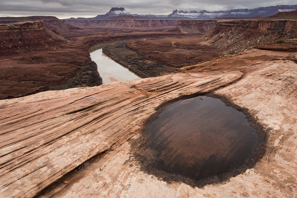
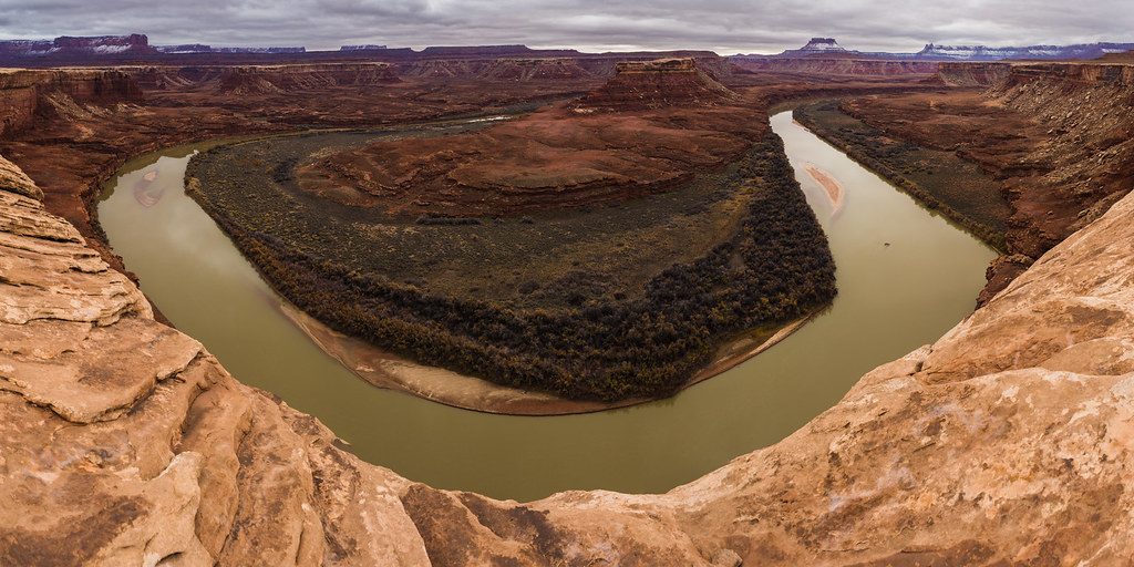
I made the obligatory stop at Musselman Arch...
…and then the daylight started to falter. Rough conditions meant slow-going.
The Washer Woman looks quite a bit different from below.
Blue Juniper by ashergrey, on Flickr
With no moon or stars the night's dark turned inky, making it difficult to judge the road much beyond the reach of the headlights. The crests of little hills turn into really worrisome obstacles when you can't see the horizon beyond them. In some cases, this made it seem like you might be driving off the side of a cliff.
All of the ups-and-downs in the dark had me feeling a bit motion sick by the time I arrived at White Crack. After a little dinner I rolled out the bed in the back of the wagon and went to sleep.
[PARSEHTML]<iframe src="http://www.mappingsupport.com/p/gmap4.php?q=https://dl.dropboxusercontent.com/u/3847512/GPS/Potash_to_White_Crack.kml&t=t4" frameborder="0" marginheight="0" scrolling="no" width="800" height="800"></iframe><br><br>[/PARSEHTML]Sunday morning dawned cold and gray. Light flakes of snow slipped out of sagging clouds that obscured the towering plateau to the north. This was to be my hiking day, but conditions appeared so miserable that I considered bagging the exploration. Being caught in a snowstorm this far out seemed a legitimate threat.
I walked out to the rim near White Crack and looked into the Lower Basin area. It wasn't encouraging. Storms were sweeping up from the south.
Winter Storm over White Crack by ashergrey, on Flickr
I consumed a breakfast consisting of a peanut butter and honey sandwich, grit my teeth and decided to go for it.
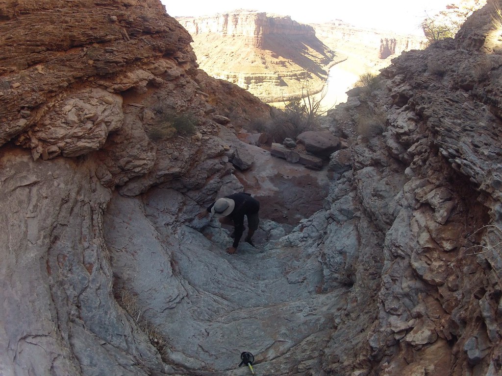
The walk down from White Crack impresses upon a person the dangerous lives sheepherders, cattlemen and uranium miners once lived on these lands. Erosion is in the process of wiping out the path these people used to step below the White Rim.
However, the old road grade is in remarkably good shape once down off the slope. There are sections where one could still easily drive a Jeep today.
There were obvious signs of recent use on this trail, which surprised me given it seems little known and little documented online. Most of the foot tracks petered out after a mile or so, leaving me to believe that many people who walk down the White Crack route do so out of idle curiosity, not to reach any particular destination.
More than half-century-old litter from the mining days still sits right along the road grade.
The walking is pretty easy by hiking standards, as it's mostly level. The views are outstanding, though probably more so without the solid gray overcast I encountered.
As time ticked by, I set a turnaround time in my head: 2 p.m. That would give me enough time to make it back to the car by nightfall. I didn't want to be below the White Rim in the December cold after sundown.
Gray Over the Green by ashergrey, on Flickr
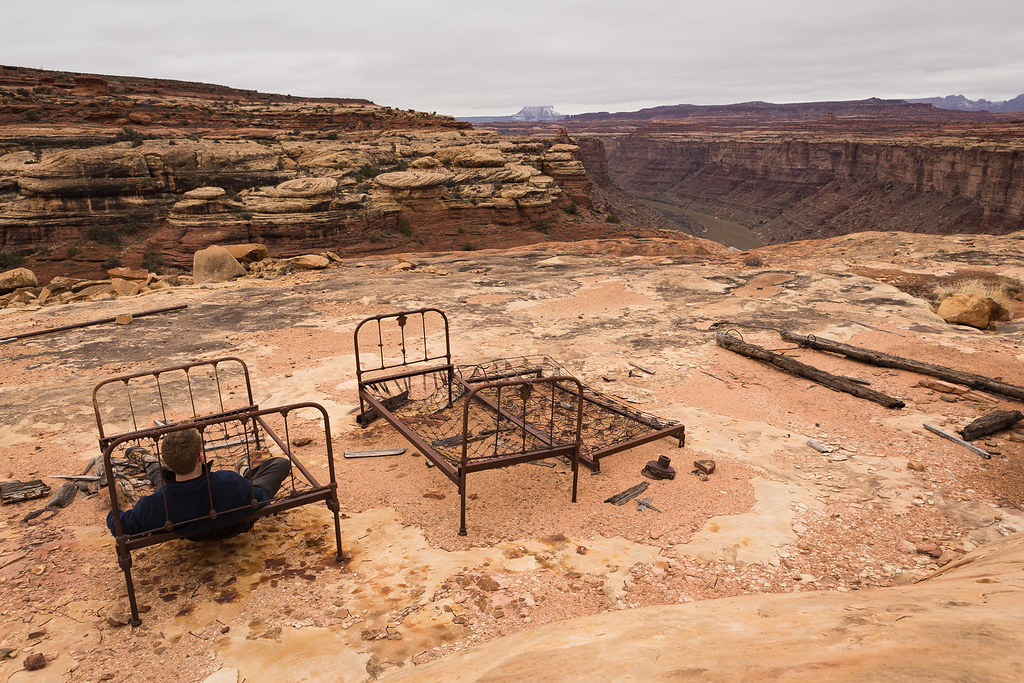
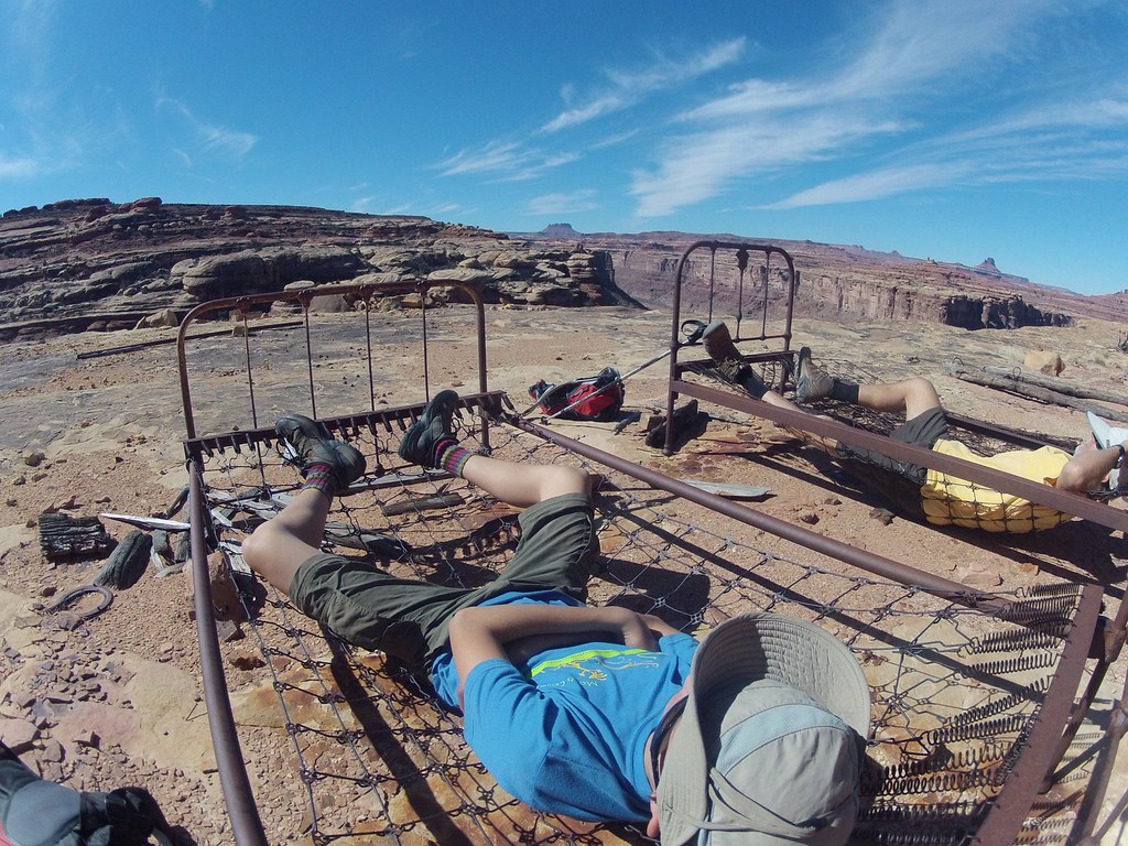
The unfortunate part of this route is its circuitous design. It has to continually head around drainages, adding mileage to what would otherwise be a relatively short jaunt. That means I didn't make it to the old miner's camp until about 1:45 p.m.
Room With a View by ashergrey, on Flickr
A rusting miner's oven.
Modern potsherds in the making.
Detail on one of the remaining bed frames.
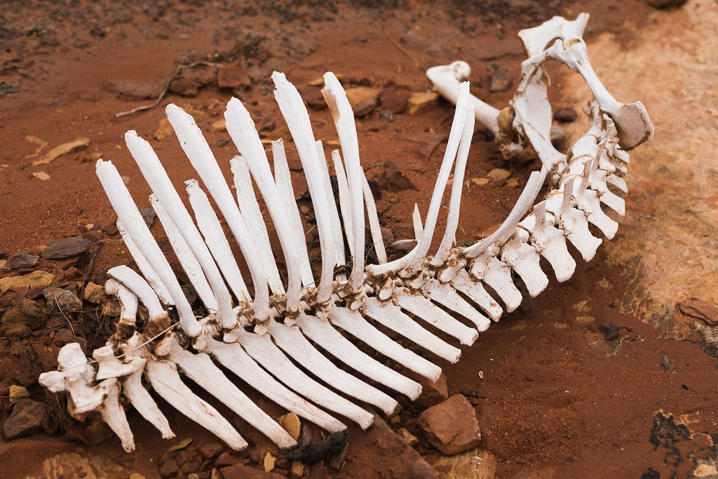
After poking around the camp a little while, I spotted this bleaching bighorn skeleton a little way down on a ledge. I couldn't tell if it had died near this spot, or if the carcass had been washed down from up above.
Ominous by ashergrey, on Flickr
The jawbone remained but it seemed somewhat telling that the top half of the skull with the horns was missing. I figure it was either carted off by a scavenger, left where the animal had died or looted by another hiker.
My turnaround time had come and gone by the time I huffed it up to the brushy flat above the miner's camp, looking for the old airfield. I couldn't see it from the ground but my GPS track shows I walked right across it.
From this point I was only about two miles from the confluence overlook, mostly easy walking from what I could see. However, that meant four miles roundtrip before even starting back to the camp at White Crack. The light would be failing by the time I reached the overlook and it was pretty terrible gray light anyway. Had I carried down my backpacking gear I could have set camp here and struck out in the morning, but all that stuff was back in the car.
I made a phone call to my mother via Globalstar sat phone from Skycall Satellite (highly recommended) to inform her of my plan to head back.
Dark fell just as I reached the foot of the long climb back up to White Crack. I later learned my parents were watching my track from the DeLorme unit, trying to figure out how I was going to scale what appeared to be a sheer cliff on the Google map.
Total distance walked for the day was around 15 miles. An out-and-back to the confluence would come in around 20 miles, which makes for a real push in the shortened winter days.
It was frustrating to miss my goal of seeing the confluence from the north but I've confirmed that the route does go. At some point in the future I'd like to return. I believe it's also possible to come up from the river at the mining camp, meaning one could do the confluence overlook from a Stillwater trip and cut the hiking mileage about in half.
[PARSEHTML]<iframe src="http://www.mappingsupport.com/p/gmap4.php?q=https://dl.dropboxusercontent.com/u/3847512/GPS/Mining_Camp.kml&t=t4" frameborder="0" marginheight="0" scrolling="no" width="800" height="800"></iframe><br><br>[/PARSEHTML]Monday started just as gray as had Sunday. I packed up the car and set out to what I figured would be the biggest obstacle of the trip — Murphy Hogback. Before I could even reach that dreaded hill though I had to run the wagon up some muddy ascents.
On one, the hill climbed to a flat then made a 90-degree turn to the left. The car made the climb to the midway point, navigated the turn but then bogged down right at the top of the hill. I backed down to the turn and prepared to make a run at it, only to have the wheels spin in the mud.
A little cursing and praying along with some successful positioning of the tires allowed the wagon to successfully make the climb.
When Murphy finally came into view, my gut sank. Pictures don't do that hill justice. It's steep and narrow. The surface was slicked with mud. Here I was alone, with just this car and no form of support.
What was I thinking?
I called my parents again, mostly to psych myself up for the drive. They could tell just by the fact that I'd called that I was nervous.
I walked the slope to make sure there were no hidden surprises then gathered my courage and made a run at it.
The Green came into view from the top, where I checked in on the sat phone to report my successful ascent.
Lonely Road by ashergrey, on Flickr
Then came the descent. Without a low range, I practically had to stand on the brakes.
After returning from this trip, I learned one of the front brake caliper pistons had seized. I'm not surprised.
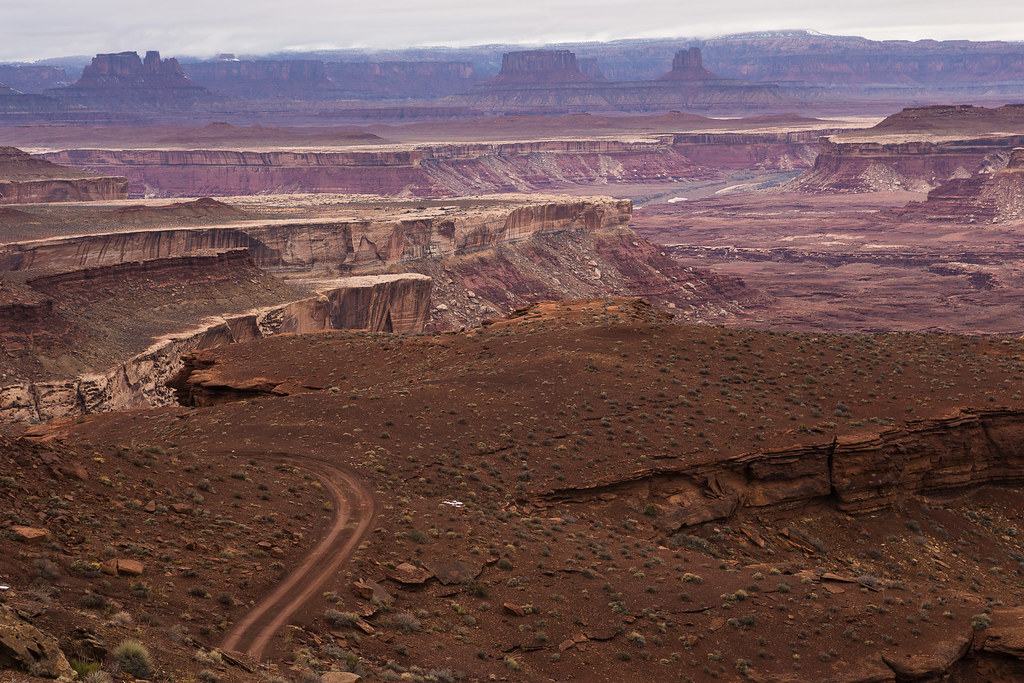
After Murphy Hogback, the White Rim Road gradually drops toward river level.
Tuxedo Bottom by ashergrey, on Flickr
In some places you feel like you could jump off the cliff right into the river.
Rio Verde by ashergrey, on Flickr
I stopped at the Holeman slot but it was full of water and I didn't really feel like getting stuck in a stinking pothole so I opted not to drop down into it.
Walking along the rim I could see locations where bars for handholds had once stood. They'd been sawed off at the base, leaving the portion driven into the rock to rust. I wondered how much time had past since their removal.
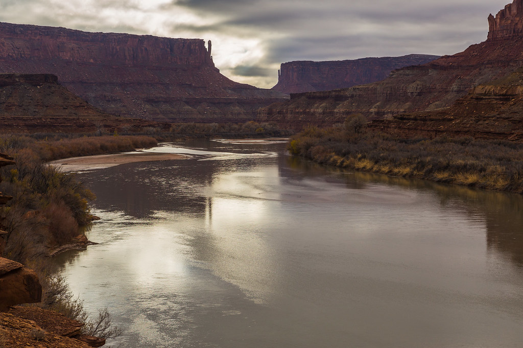
The next section of the drive proved my favorite, as the road ran along ledges that at times overhung the river.
Siren Song of the Stillwater by ashergrey, on Flickr
The wagon proved sure-footed up and over Hardscrabble Hill, which was in some ways more nerve-wracking than the Hogback. I was really grateful not to encounter any traffic on this portion. It must be a nightmare when mountain bikers and vehicles are both using it during the busier months.
Clouds finally started to break north of Hardscrabble around the mouth of Taylor Canyon.
Some deep sections of sand and mud were all that was left between me and Mineral Bottom. I'd modified the wagon specifically for these conditions by adding a switch that engaged a duty solenoid in the transmission.
This, in turn, locked up the clutch packs responsible for the variable power split between the front and rear axles. The ghetto "locking" center differential took the lag out of the Subaru AWD system, lessening the chances of becoming bogged down in soft stuff.
That mod really proved its worth up on top of the Mineral Bottom switchbacks. The snow from the week prior had still not melted off entirely, making the dirt road back to SR-313 an absolute mess. The entire length of it can usually be cruised comfortably at 50 mph.
I had to run it at near that speed it a mixture of slush and mud, at the very limit of control. At one point the car started to fishtail and I careened about 200 yards counter-steering from side to side to avoid running off the road.
Wagon>WhiteRim by ashergrey, on Flickr
Elated to be back on pavement, I stepped out to air up the tires. Slop kept falling off the underside of the car.
As I had the hood popped to run the compressor, a rather odd fellow stopped to offer his "help". He told me how he was working for an oil company and had been sent out of Colorado to a drill site up on the mesa. Problem was, he couldn't find it.
He had no concept of where he was, as evidenced by the awed look he gave when I explained he was very near to both a national park and a state park. He asked what the "big mountains" he'd seen from Moab were.
I spread out a paper map to give him a sense of his location but he still didn't seem to grasp it.
Then he started taking note of my car. He asked questions about the GoPro mounted on the rack. I saw him eyeing the iPad I'd used to remotely control the camera, along with two DSLRs and other gear in the front seat.
And he wouldn't leave. I stopped airing the tires because I didn't want to turn my back to him. Still he didn't take the hint. I started feeling really nervous and wished for the first time in my solo travels that I'd had a firearm.
Not that I wanted to shoot the guy, mind you. But I would have liked him to have seen that I was prepared to defend myself.
Shafer Canyon by ashergrey, on Flickr
He did leave at last, much to my relief. Under breaking skies I headed into the park to see if sundown would offer any decent light.
Shafer-Potash-White Rim by ashergrey, on Flickr
The High Road by ashergrey, on Flickr
Distant Buttes by ashergrey, on Flickr
I can't stand the zoo that is sunrise at Mesa Arch but it was pretty much deserted for sunset.
Repose in Relief by ashergrey, on Flickr
Peering down into that expanse from above after having driven through it changes one's perspective. Looking at Washer Woman, I tried to remember how inaccessible the high plateau had seemed from along the White Rim.
The White Rim by ashergrey, on Flickr
Back at the car in the deepening dark, I emptied my supplemental fuel into the tank for the drive back to Moab.
Along the way, a raging campfire over toward Dead Horse lit up the dark like a candle. The oil camp. As if to prove my supposition correct, one of their work trucks fell in behind the wagon. Its bright headlights lit up the thick fog layer that had formed after sundown between the mesa top and lowlands.
Feeling both road and trail weary, I grabbed a motel room for the night. While in the grocery store I bumped into the oil field worker again. I mentioned to him I'd seen their camp. He confided that he didn't dare drive through the fog layer. His decision to wait out the night at the Motel 6 seemed a wise one to me, especially since I was staying in a different motel.
[PARSEHTML]<iframe src="http://www.mappingsupport.com/p/gmap4.php?q=https://dl.dropboxusercontent.com/u/3847512/GPS/White_Rim_2.kml&t=t4" frameborder="0" marginheight="0" scrolling="no" width="800" height="800"></iframe><br><br>[/PARSEHTML]That brief glimpse of winter glory I'd seen from Mesa Arch the evening prior vanished by Tuesday morning. Skies had grayed over again. A front was forecast to sweep down from the north and a cold wind testified to its approach.
My original plan for the trip was to continue south to Cedar Mesa and spend the rest of the week hiking there. Instead, I decided to just enter Arches and wait out the day in order to see if the conditions would improve.
I had to park next to this guy for effect.
The park staff were not pleased with my decision to go into the Fiery Furnace, since I'd not been in before and had never been on one of their little ranger walks.
"I'm an experienced backcountry hiker," I explained.
The guy handling the permit book scoffed.
"You don't know how many 'experienced hikers' we've had to rescue after they got lost."
"I'm sure it's a lot. But really, I'll be fine."
In the end, they granted the permit in protest.
Dropping into the furnace was actually nice because it cut the wind. With no set agenda I wandered at whim, ending up back at Surprise Arch. Nearby, I found a little cove and spent some time shooting self portraits.
By afternoon it grew apparent that the weather would not improve.
I'd already checked out of the motel and didn't really feel like spending money to sit another night in Moab.
Golden Arches by ashergrey, on Flickr
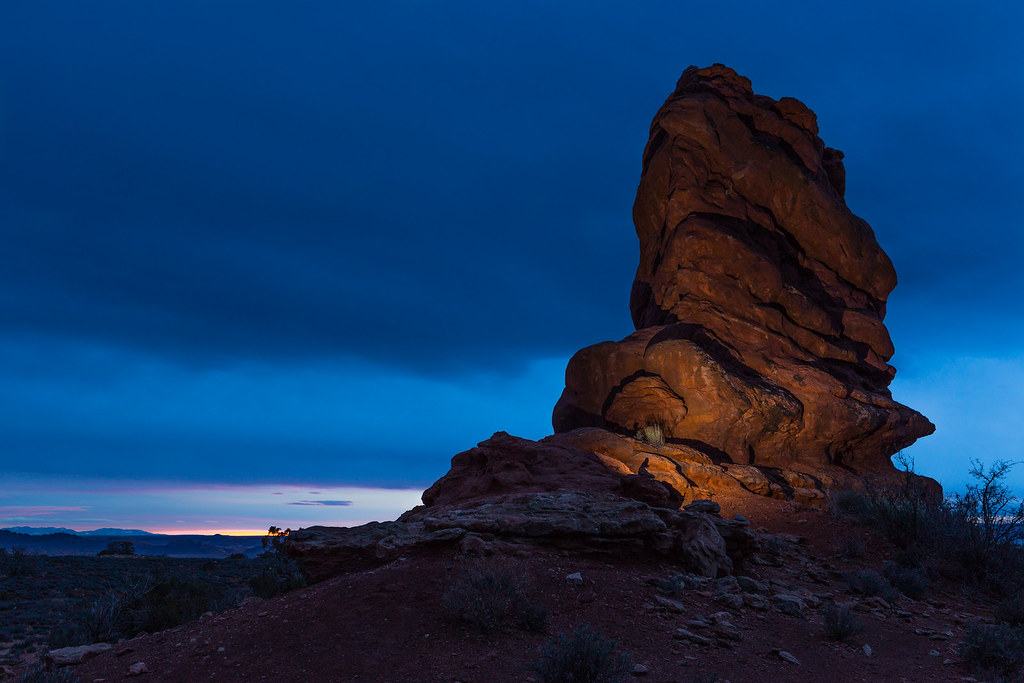
On my way out of the park I stopped by Balanced Rock to shoot some low-light stuff with the 6D.
Golden Spike by ashergrey, on Flickr
Coyotes yipped and howled in the dark as I waited for a car to come along for this shot.
Arches Scenic Drive by ashergrey, on Flickr
I made it back to 191 at about 7 p.m. and decided to start the drive home. Cedar Mesa would have to wait until February.
The cold front hit around Green River, where strong crosswinds ripped across I-70. I spent most of the ride up to Price behind a semi truck trying to draft in his wake. Then came one of the ugliest white-knuckle drives I've experienced going up and over Soldier Summit. The whole stretch was covered with wind-blown snow to the point you couldn't make out the lanes or the edges of the road.
But even as I crested that frightening drive I could only think to myself, at least it's not Murphy Hogback. In a wagon.
Featured image for home page:
 Loved the photos and video.
") Thanks so much for sharing! Loved the video. And a car hack to top it off.
Thanks so much for sharing! Loved the video. And a car hack to top it off.

