IntrepidXJ
ADVENTR
- Joined
- Jan 17, 2012
- Messages
- 3,493
Labor Day Weekend | Saturday & Sunday, August 30 - 31, 2014
When I asked Diane what she wanted to do over Labor Day weekend she suggested that we go on another backpacking trip. I guess it's safe to say that she enjoys backpacking since she only went on her very first trip back in June. After a little research we decided on an overnight backpacking trip into Wetterhorn Basin within the Uncompahgre Wilderness. We figured it probably wouldn't be too busy in this area over the holiday weekend because most people climb Wetterhorn Peak from the other side.
On Saturday morning we left home and drove over Owl Creek Pass to the West Fork of the Cimarron River trailhead. We put on our packs and climbed up to West Fork Pass (12,500 feet) before dropping down into Wetterhorn Basin. As we neared the pass it rained enough that we got out the rain gear, but the precipitation was short-lived. When we reached a group of trees down in the basin we found a place to setup camp under Wetterhorn Peak just in time to get out of another rain storm. It was the last time it would rain on this trip. When the rain had stopped we had dinner and then I climbed to the summit of an unnamed 13er near our camp so I could catch the sunset from up there. I'm glad I did because the sunset was spectacular and it was great to view it from the high vantage point. When the light show was over I hiked back down to camp in the dark and went right to bed.
Entering the Uncompahgre Wilderness along the West Fork of the Cimarron River.
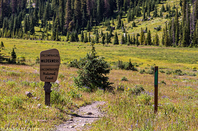
Uncompahgre Wilderness by IntrepidXJ, on Flickr
View back along Dike Ridge towards Precipice Peak (13,144 feet), Dunsinane Mountain (12,742 feet) and Turret Ridge in spotted light.
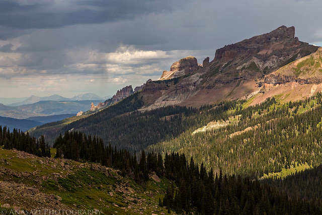
West Fork Rain by IntrepidXJ, on Flickr
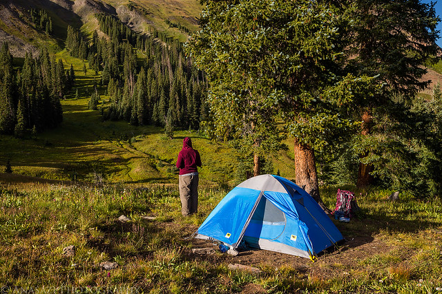
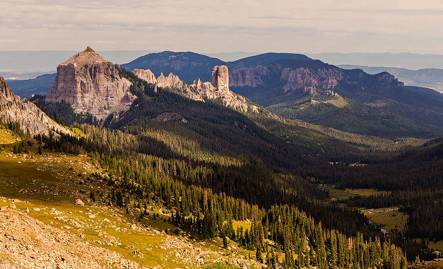
Our campsite in Wetterhorn Basin with Wetterhorn Peak (14,015 feet) towering above.
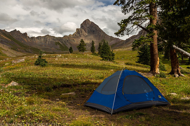
Wetterhorn Basin Camp by IntrepidXJ, on Flickr
Another view without the tent after camp was setup.
Wetterhorn Afternoon by IntrepidXJ, on Flickr
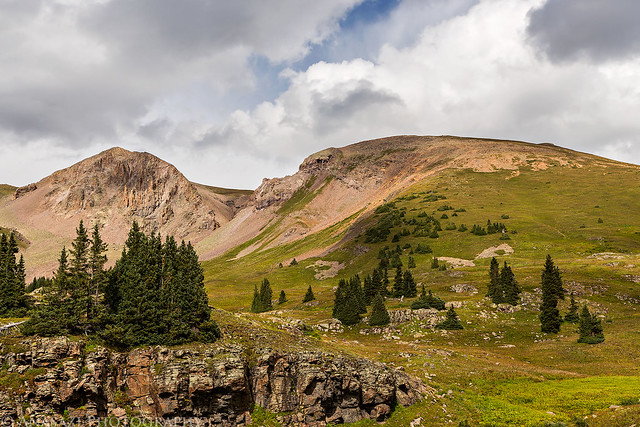
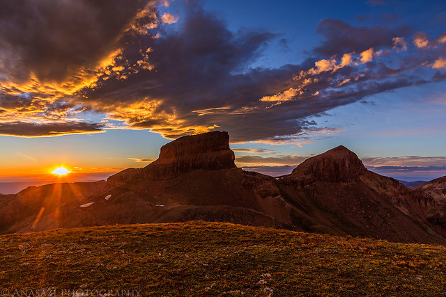
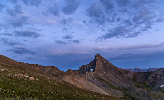
The rounded mountain on the right side of this photo is an unnamed 13,206 foot peak that I planned on climbing in the evening to catch the sunset. This photo was taken near our camp.
Unnamed 13,206 by IntrepidXJ, on Flickr
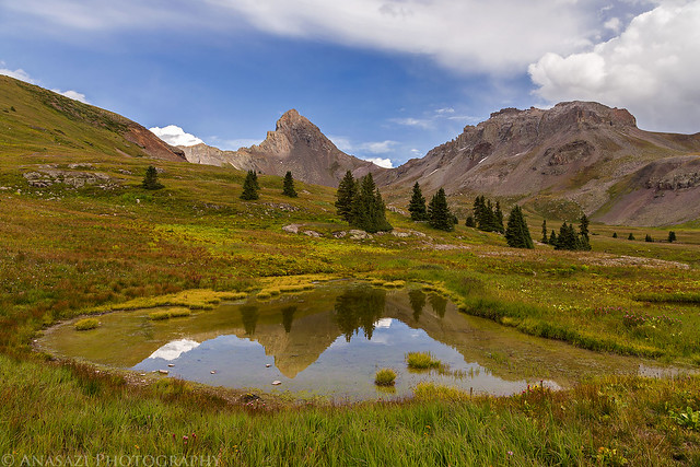
A reflection of Wetterhorn Peak in a small tarn in the basin.
Wetterhorn Reflection by IntrepidXJ, on Flickr
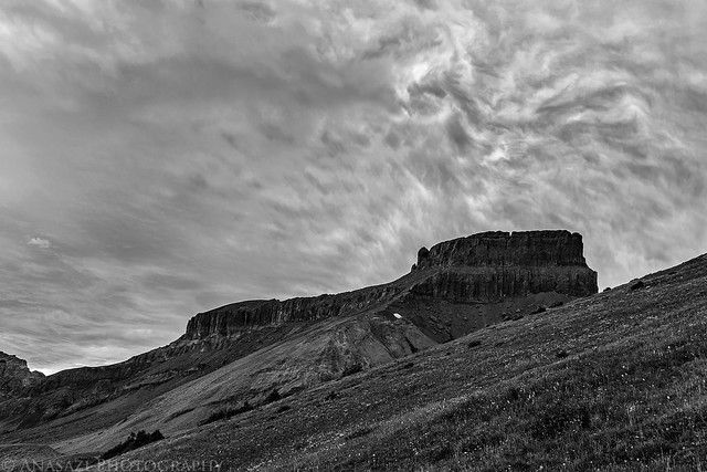
As I began climbing the unnamed 13er after dinner I noticed this unusual texture in the clouds above Coxcomb Peak. There wasn't much color at this time with the overcast sky blocking the sun, so I converted it to black and white to accentuate the texture.
Coxcomb Sky by IntrepidXJ, on Flickr
When I started climbing the 13er from camp the sky was pretty overcast above, but I noticed that the western horizon had a gap below the clouds that would allow the sun to drop below them which might produce an amazing sunset. As I neared the top the sun did drop below the clouds and lit up everything around me nicely, including the texture in the clouds that had moved away from Coxcomb Peak and was right above me now.
To the Top by IntrepidXJ, on Flickr
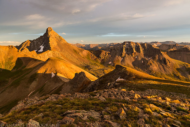
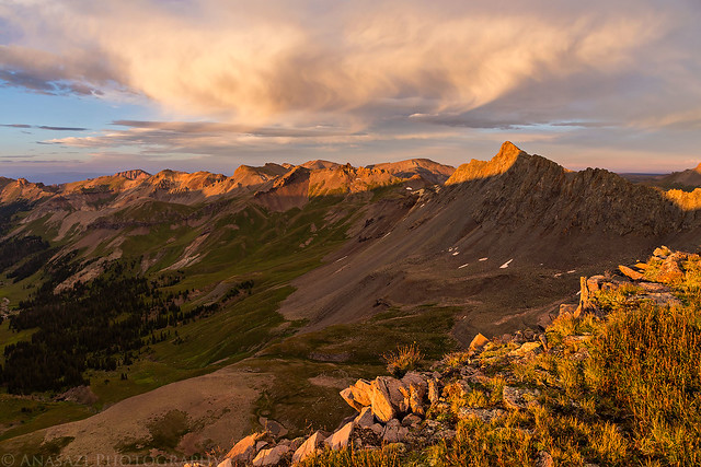
The light on the landscape was pretty amazing when it came back out.
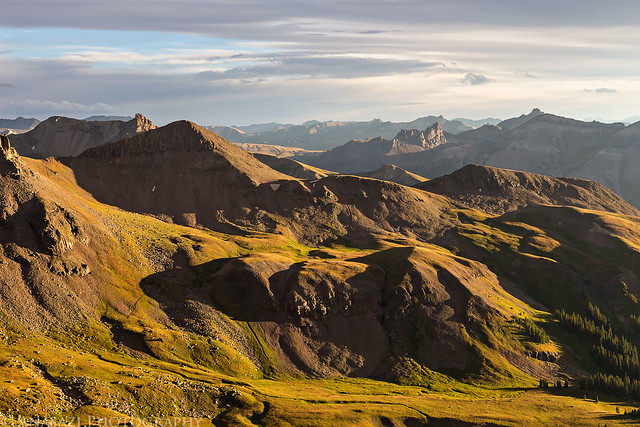
Over Wetterhorn Basin by IntrepidXJ, on Flickr
When I first reached the top, I was greeting with a beautiful view down into the Middle Fork of the Cimarron and noticed the shadow of Coxcomb peak was projected onto Heisshorn (13,411 feet) for a short time.
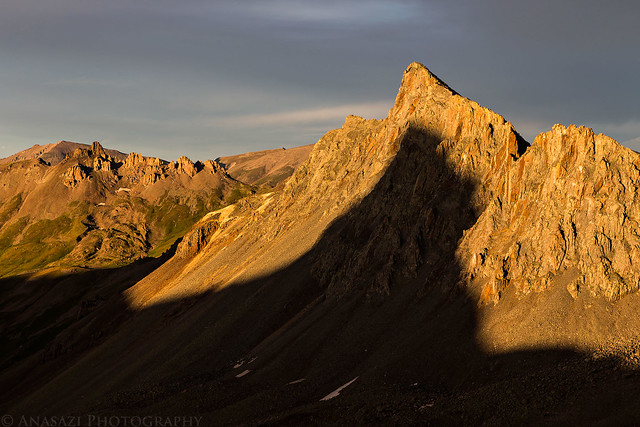
Coxcomb Shadow by IntrepidXJ, on Flickr
I had great views in all directions including this one looking towards the Sneffels Range.
Sneffels Range by IntrepidXJ, on Flickr
Evening Light by IntrepidXJ, on Flickr
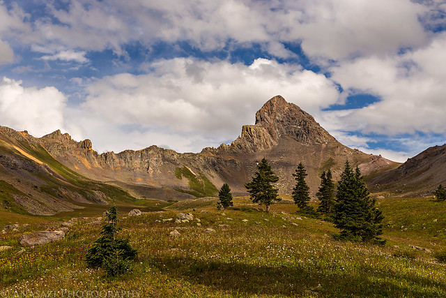
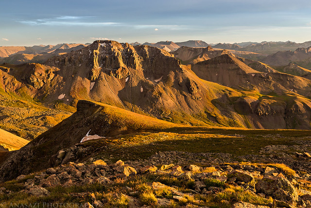
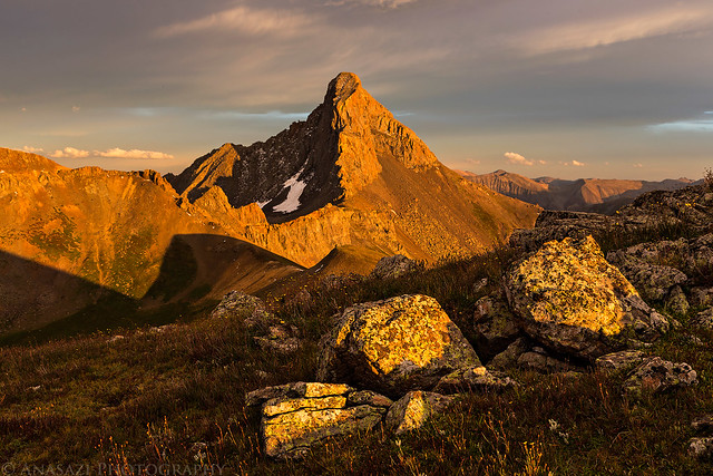
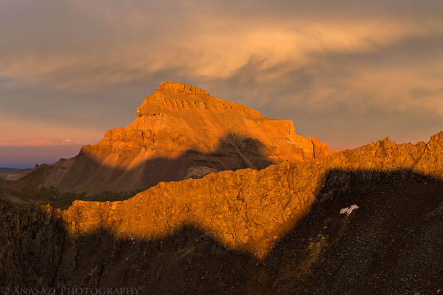
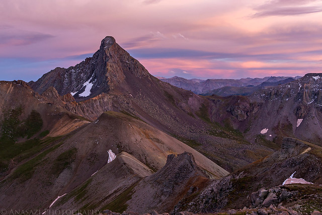
The view of Wetterhorn Peak from up here was pretty great, too.
Unnamed 13,206 Summit by IntrepidXJ, on Flickr
Boulder Light by IntrepidXJ, on Flickr
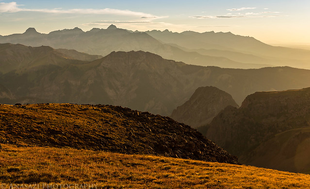
A beautiful scene over the Middle Fork of the Cimarron from the summit.
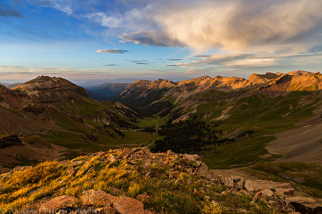
Summit View by IntrepidXJ, on Flickr
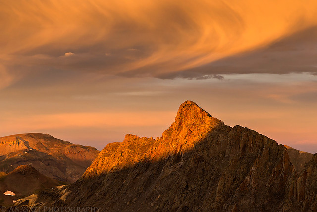
I probably took a few too many photos of Wetterhorn as the light continued to change...
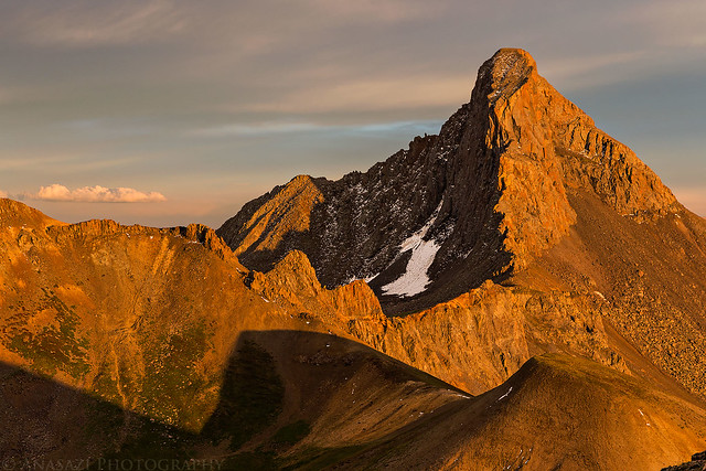
Wetterhorn Evening by IntrepidXJ, on Flickr
Middle Fork Sunset by IntrepidXJ, on Flickr
I even had a nice view of Uncompahgre Peak (14,309 feet) from up here. The highest peak in the San Juan Mountains.
Uncompahgre Shadows by IntrepidXJ, on Flickr
Heisshorn under interesting clouds.
Peak & Clouds by IntrepidXJ, on Flickr
Middle Fork of the Cimarron by IntrepidXJ, on Flickr
Finally, the sun is almost ready to set for the evening next to Coxcomb Peak (13,656 feet) and Redcliff (13,642 feet).
Coxcomb & Redcliff by IntrepidXJ, on Flickr
Pink Wetterhorn by IntrepidXJ, on Flickr
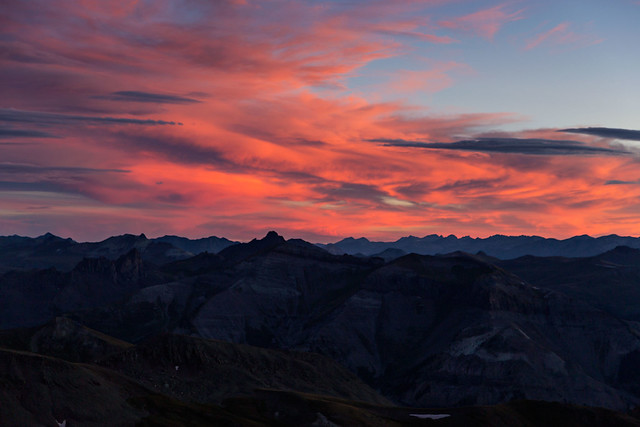
The sky changed many colors this evening.
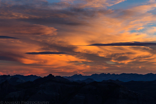
Orange Sky by IntrepidXJ, on Flickr
Beautiful clouds above Coxcomb Peak.
Coxcomb Sunset by IntrepidXJ, on Flickr
Magenta Sky by IntrepidXJ, on Flickr
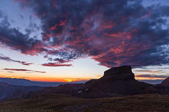
Wetterhorn in the subtle light of dusk as I hiked back down the mountain to camp.
Wetterhorn Dusk by IntrepidXJ, on Flickr
A slim crescent moon in the clouds above the San Juan Mountains.
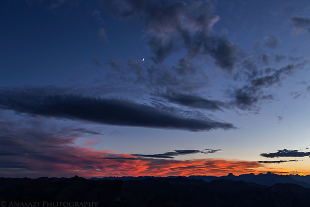
Moon & Clouds by IntrepidXJ, on Flickr
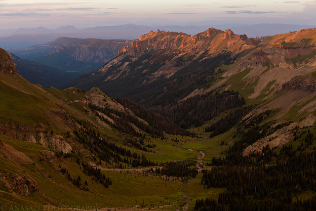
On Sunday morning I did get up early to photograph the sunrise, but really wasn't happy with any of my shots, so I went back to sleep again for a little while longer. When we finally woke up for the day we packed up camp and hiked back over West Fork Pass to the trailhead under clouds that were moving very quickly. It was a little cooler and windier out on the way back.
View down Wetterhorn Basin after waking up for the second time.
Wetterhorn Basin by IntrepidXJ, on Flickr
Diane enjoys the scenery in Wetterhorn Basin after a good night of sleep.
Morning by IntrepidXJ, on Flickr
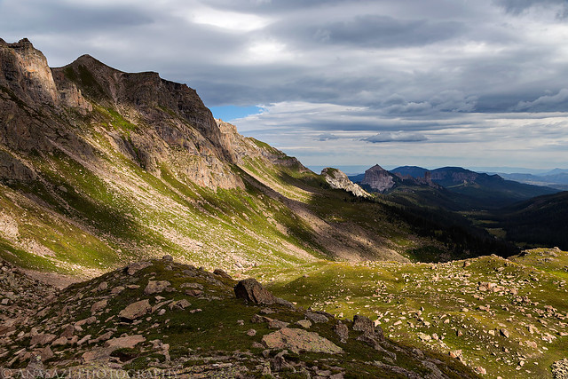
Following the trail back up to West Fork Pass under Coxcomb Peak.
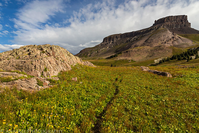
Leaving the Basin by IntrepidXJ, on Flickr
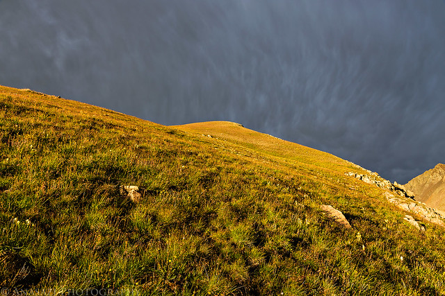
The color of the tundra at West Fork Pass reminded me that fall is just around the corner.
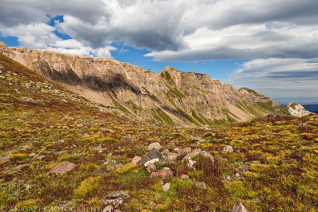
Touch of Fall by IntrepidXJ, on Flickr
Dropping back down into the West Fork from the pass.
West Fork Descent by IntrepidXJ, on Flickr
Courthouse Mountain and Chimney Rock lit up in the distance.
Courthouse Mountain by IntrepidXJ, on Flickr
The clouds were moving very quickly today and the light and shadows on the landscape was constantly changing.
West Fork Shadows by IntrepidXJ, on Flickr
Following the trail through the trees back to the trailhead.
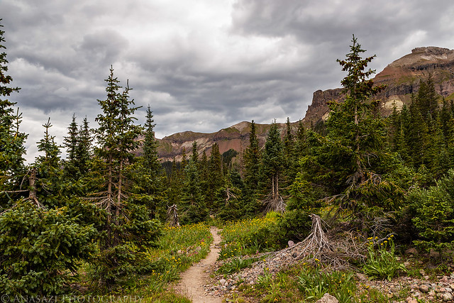
West Fork Trail by IntrepidXJ, on Flickr
When we reached the trailhead again we got back into my Jeep and drove back over Owl Creek Pass to Ouray and had a nice lunch at Maggie's Kitchen.
>> Wetterhorn Basin Photo Gallery
>> The Original Trip Report on ADVENTR.CO
Featured image for home page:

When I asked Diane what she wanted to do over Labor Day weekend she suggested that we go on another backpacking trip. I guess it's safe to say that she enjoys backpacking since she only went on her very first trip back in June. After a little research we decided on an overnight backpacking trip into Wetterhorn Basin within the Uncompahgre Wilderness. We figured it probably wouldn't be too busy in this area over the holiday weekend because most people climb Wetterhorn Peak from the other side.
On Saturday morning we left home and drove over Owl Creek Pass to the West Fork of the Cimarron River trailhead. We put on our packs and climbed up to West Fork Pass (12,500 feet) before dropping down into Wetterhorn Basin. As we neared the pass it rained enough that we got out the rain gear, but the precipitation was short-lived. When we reached a group of trees down in the basin we found a place to setup camp under Wetterhorn Peak just in time to get out of another rain storm. It was the last time it would rain on this trip. When the rain had stopped we had dinner and then I climbed to the summit of an unnamed 13er near our camp so I could catch the sunset from up there. I'm glad I did because the sunset was spectacular and it was great to view it from the high vantage point. When the light show was over I hiked back down to camp in the dark and went right to bed.
Entering the Uncompahgre Wilderness along the West Fork of the Cimarron River.
Uncompahgre Wilderness by IntrepidXJ, on Flickr
View back along Dike Ridge towards Precipice Peak (13,144 feet), Dunsinane Mountain (12,742 feet) and Turret Ridge in spotted light.
West Fork Rain by IntrepidXJ, on Flickr
Our campsite in Wetterhorn Basin with Wetterhorn Peak (14,015 feet) towering above.
Wetterhorn Basin Camp by IntrepidXJ, on Flickr
Another view without the tent after camp was setup.
Wetterhorn Afternoon by IntrepidXJ, on Flickr
The rounded mountain on the right side of this photo is an unnamed 13,206 foot peak that I planned on climbing in the evening to catch the sunset. This photo was taken near our camp.
Unnamed 13,206 by IntrepidXJ, on Flickr
A reflection of Wetterhorn Peak in a small tarn in the basin.
Wetterhorn Reflection by IntrepidXJ, on Flickr
As I began climbing the unnamed 13er after dinner I noticed this unusual texture in the clouds above Coxcomb Peak. There wasn't much color at this time with the overcast sky blocking the sun, so I converted it to black and white to accentuate the texture.
Coxcomb Sky by IntrepidXJ, on Flickr
When I started climbing the 13er from camp the sky was pretty overcast above, but I noticed that the western horizon had a gap below the clouds that would allow the sun to drop below them which might produce an amazing sunset. As I neared the top the sun did drop below the clouds and lit up everything around me nicely, including the texture in the clouds that had moved away from Coxcomb Peak and was right above me now.
To the Top by IntrepidXJ, on Flickr
The light on the landscape was pretty amazing when it came back out.
Over Wetterhorn Basin by IntrepidXJ, on Flickr
When I first reached the top, I was greeting with a beautiful view down into the Middle Fork of the Cimarron and noticed the shadow of Coxcomb peak was projected onto Heisshorn (13,411 feet) for a short time.
Coxcomb Shadow by IntrepidXJ, on Flickr
I had great views in all directions including this one looking towards the Sneffels Range.
Sneffels Range by IntrepidXJ, on Flickr
Evening Light by IntrepidXJ, on Flickr
The view of Wetterhorn Peak from up here was pretty great, too.
Unnamed 13,206 Summit by IntrepidXJ, on Flickr
Boulder Light by IntrepidXJ, on Flickr
A beautiful scene over the Middle Fork of the Cimarron from the summit.
Summit View by IntrepidXJ, on Flickr
I probably took a few too many photos of Wetterhorn as the light continued to change...
Wetterhorn Evening by IntrepidXJ, on Flickr
Middle Fork Sunset by IntrepidXJ, on Flickr
I even had a nice view of Uncompahgre Peak (14,309 feet) from up here. The highest peak in the San Juan Mountains.
Uncompahgre Shadows by IntrepidXJ, on Flickr
Heisshorn under interesting clouds.
Peak & Clouds by IntrepidXJ, on Flickr
Middle Fork of the Cimarron by IntrepidXJ, on Flickr
Finally, the sun is almost ready to set for the evening next to Coxcomb Peak (13,656 feet) and Redcliff (13,642 feet).
Coxcomb & Redcliff by IntrepidXJ, on Flickr
Pink Wetterhorn by IntrepidXJ, on Flickr
The sky changed many colors this evening.
Orange Sky by IntrepidXJ, on Flickr
Beautiful clouds above Coxcomb Peak.
Coxcomb Sunset by IntrepidXJ, on Flickr
Magenta Sky by IntrepidXJ, on Flickr
Wetterhorn in the subtle light of dusk as I hiked back down the mountain to camp.
Wetterhorn Dusk by IntrepidXJ, on Flickr
A slim crescent moon in the clouds above the San Juan Mountains.
Moon & Clouds by IntrepidXJ, on Flickr
On Sunday morning I did get up early to photograph the sunrise, but really wasn't happy with any of my shots, so I went back to sleep again for a little while longer. When we finally woke up for the day we packed up camp and hiked back over West Fork Pass to the trailhead under clouds that were moving very quickly. It was a little cooler and windier out on the way back.
View down Wetterhorn Basin after waking up for the second time.
Wetterhorn Basin by IntrepidXJ, on Flickr
Diane enjoys the scenery in Wetterhorn Basin after a good night of sleep.
Morning by IntrepidXJ, on Flickr
Following the trail back up to West Fork Pass under Coxcomb Peak.
Leaving the Basin by IntrepidXJ, on Flickr
The color of the tundra at West Fork Pass reminded me that fall is just around the corner.
Touch of Fall by IntrepidXJ, on Flickr
Dropping back down into the West Fork from the pass.
West Fork Descent by IntrepidXJ, on Flickr
Courthouse Mountain and Chimney Rock lit up in the distance.
Courthouse Mountain by IntrepidXJ, on Flickr
The clouds were moving very quickly today and the light and shadows on the landscape was constantly changing.
West Fork Shadows by IntrepidXJ, on Flickr
Following the trail through the trees back to the trailhead.
West Fork Trail by IntrepidXJ, on Flickr
When we reached the trailhead again we got back into my Jeep and drove back over Owl Creek Pass to Ouray and had a nice lunch at Maggie's Kitchen.
>> Wetterhorn Basin Photo Gallery
>> The Original Trip Report on ADVENTR.CO
Featured image for home page: