JDWalters
Member
- Joined
- Apr 21, 2017
- Messages
- 120
Living here in Maryland, in close proximity to Washington DC, one must get creative in order to have that "backcountry" feel. A few years ago, I set out for an afternoon hike that seemed like it should work, based on what I could see from satellite views, and my limited knowledge of the area. I decided to hike along the long-abandoned Western Maryland Railway, in an area best known for the Chesapeake & Ohio Canal. While the WMR has been turned into a rail trail further east, it was very much in a dilapidated state here. My plan was to hike east along the WMR, crossing the Potomac on 4 bridges and passing through a tunnel, and then take the C&O Canal towpath back to my starting point. All in all, I estimated that it would probably be around a 10 mile hike.
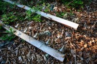
I began at 4 PM. After parking at the Paw Paw Tunnel parking area for the C&O Canal, I walked down Oldtown Rd a few hundred feet to the WMR crossing, and then climbed up to the tracks.
.JPG")
There had been some measures taken to prevent people from getting onto the tracks, but I was able to get around those.
.JPG")
My first crossing of the Potomac River on the WMR. This was only a hundred yards or so from where I climbed up onto the tracks. Looking at Google Maps now, it appears that maybe this bridge has been opened up as a pedestrian bridge? It is labeled as Paw Paw Footbridge, with one review saying "It was okay.", (while giving it 5 stars).
.JPG")
Once across the bridge, it was about a half mile until I reached another crossing of the Potomac. The railroad bed was fairly easy to follow here, and not too overgrown.
.JPG")
The farther I went, the more overgrown the track was. Still, it was not difficult to follow.
.JPG")
Approaching Potomac River crossing #2...
.JPG")
Potomac River crossing #2.
.JPG")
This bridge had a few spots that were a little dicey, but the wide steel beams were always available to walk on, even if the wooden ties were not.
.JPG")
The banks of the Potomac River are quite steep throughout this entire area.
.JPG")
Looking downstream from the bridge.
.JPG")
Not too long after crossing the second bridge, I neared the tunnel. There was no description online that I could find of this trek, but I had expected a tunnel from the satellite views. I actually could feel the cold air from the tunnel before I was able to see it.
.JPG")
I didn't see much wildlife on this hike. Even this snake wasn't alive.
.JPG")
When I reached the tunnel, I was disappointed to see that it was flooded. I was not interested in walking through that water, so I decided to climb up and over.
.JPG")
I climbed up the ridge and then down. I came across a fire road and figured that it must cross the railroad bed, so I followed it in the direction that I needed to go. However, I had not gone far enough and actually ended up going over the tunnel while on the road.
.JPG")
After a while, it became clear that I wasn't going to connect with the WMR -- especially when the road topped out on top of the peninsula. I was able to see the B&O Railroad bridge in the distance, which told me that I was on the wrong side of the peninsula. It was getting late in the day and I did not have time to fool around, so I decided to climb down to that and follow that over to Magnolia, WV, where I thought I could easily get back on the WMR.
.JPG")
The fire road went in the direction that I wanted, so I continued to follow it. It actually gave me a great view of the Potomac River -- one of the best that I've found.
.JPG")
.JPG")
The fireroad passed under old telegraph lines at the top of the hill. The CSX railroad tracks passed through a tunnel under this spot, so I knew that I needed to find a way down.
.JPG")
I wanted to head towards Magnolia (pictured below), but the hill was very steep on this side. I decided to explore the other side of the ridge and see if that was a better route.
.JPG")
Shortly after passing the telegraph wires, the fire road ended. I had hoped that it would go down to the same level as the CSX, but it didn't. I would have to find my own path.
.JPG")
I was able to make my way down to the railroad tracks, but the hill was quite steep. I was glad for trees to grab onto while trying not to slip.
.JPG")
View of the Potomac River
.JPG")
I made it down to the CSX Railroad. I had been in this area once before, and knew that these tracks were very active. I was glad that there were two tracks, but nervous because I had to pass through a tunnel and then almost immediately, another bridge.
.JPG")
While I was walking through the tunnel, a train came through. Thankfully there was only one, but he saw me and wasn't happy. He blasted me with his horn. I was happy to get out of there. I only had a short distance before I would have to cross another bridge.
.JPG")
Right before I began to cross the bridge, I heard another train in the distance, so I waited. Another train came through. I had never seen one like it -- all engines!.JPG")
.JPG")
After the train had passed, I quickly made my way across the bridge. In the distance, I could see the Western Maryland Railway bridge -- the bridge that I had originally planned to be crossing.
.JPG")
Shortly after crossing the Potomac and climbing down from the CSX railroad tracks, another train came through.
.JPG")
There was an unpaved road along the river that I followed until reaching the WMR tracks.
.JPG")
.JPG")
I climbed up the hill to rejoin the WMR track, but saw that the old railroad bed was much more overgrown than what I had been hiking on earlier. I had suspected this might be the case, based on the satellite imagery, and knew that I could continue taking the road around the peninsula to where the tracks crossed the Potomac again -- it would just be a longer walk.
.JPG")
.JPG")
After walking along the road for several miles, curving around the peninsula, I came to the next WMR bridge.
.JPG")
View from the last WMR bridge that I crossed -- the fourth bridge of the day. It was 8:30 PM and was already getting dark. I planned to get on the C&O Canal towpatch once across the river and take that back to the parking lot. I had a flashlight, and didn't expect to have any trouble following the towpath.
.JPG")
.JPG")
This was probably the hardest section of any of the bridges that I crossed. The WMR bridge that I missed (and took the CSX bridge instead) would have been the most difficult to cross, by far, as there was a lengthy section with no railroad ties.
.JPG")
After crossing the Potomac River, I realized that I might have a problem. The C&O Canal towpath was on the opposite side of canal from where I was able to get down from the bridge. While the majority of the 184 canal has no water in it, this section does (or did that evening). I did not want to cross it and get all wet, so I continued following the WMR, though its pathway was not very clear anymore.
Shortly after passing the canal, I came to an unpaved road. I had no cell phone reception here, and was not at all familiar with this road. Thankfully, I was able to use my hiking GPS and find a way back to the parking lot by following the road, and several otherss. I ended up walking around ten miles on roads to get back to my car. I didn't see any cars the entire time, but I saw more wildlife than I had all day. My flashlight frequently illuminated eyes, watching me from the woods along the road. I got back to my car around 12:50 AM.
.JPG")
My planned route (in blue) vs my actual route (in red).
.JPG")
I began at 4 PM. After parking at the Paw Paw Tunnel parking area for the C&O Canal, I walked down Oldtown Rd a few hundred feet to the WMR crossing, and then climbed up to the tracks.
There had been some measures taken to prevent people from getting onto the tracks, but I was able to get around those.
My first crossing of the Potomac River on the WMR. This was only a hundred yards or so from where I climbed up onto the tracks. Looking at Google Maps now, it appears that maybe this bridge has been opened up as a pedestrian bridge? It is labeled as Paw Paw Footbridge, with one review saying "It was okay.", (while giving it 5 stars).
Once across the bridge, it was about a half mile until I reached another crossing of the Potomac. The railroad bed was fairly easy to follow here, and not too overgrown.
The farther I went, the more overgrown the track was. Still, it was not difficult to follow.
Approaching Potomac River crossing #2...
Potomac River crossing #2.
This bridge had a few spots that were a little dicey, but the wide steel beams were always available to walk on, even if the wooden ties were not.
The banks of the Potomac River are quite steep throughout this entire area.
Looking downstream from the bridge.
Not too long after crossing the second bridge, I neared the tunnel. There was no description online that I could find of this trek, but I had expected a tunnel from the satellite views. I actually could feel the cold air from the tunnel before I was able to see it.
I didn't see much wildlife on this hike. Even this snake wasn't alive.
When I reached the tunnel, I was disappointed to see that it was flooded. I was not interested in walking through that water, so I decided to climb up and over.
I climbed up the ridge and then down. I came across a fire road and figured that it must cross the railroad bed, so I followed it in the direction that I needed to go. However, I had not gone far enough and actually ended up going over the tunnel while on the road.
After a while, it became clear that I wasn't going to connect with the WMR -- especially when the road topped out on top of the peninsula. I was able to see the B&O Railroad bridge in the distance, which told me that I was on the wrong side of the peninsula. It was getting late in the day and I did not have time to fool around, so I decided to climb down to that and follow that over to Magnolia, WV, where I thought I could easily get back on the WMR.
The fire road went in the direction that I wanted, so I continued to follow it. It actually gave me a great view of the Potomac River -- one of the best that I've found.
The fireroad passed under old telegraph lines at the top of the hill. The CSX railroad tracks passed through a tunnel under this spot, so I knew that I needed to find a way down.
I wanted to head towards Magnolia (pictured below), but the hill was very steep on this side. I decided to explore the other side of the ridge and see if that was a better route.
Shortly after passing the telegraph wires, the fire road ended. I had hoped that it would go down to the same level as the CSX, but it didn't. I would have to find my own path.
I was able to make my way down to the railroad tracks, but the hill was quite steep. I was glad for trees to grab onto while trying not to slip.
View of the Potomac River
I made it down to the CSX Railroad. I had been in this area once before, and knew that these tracks were very active. I was glad that there were two tracks, but nervous because I had to pass through a tunnel and then almost immediately, another bridge.
While I was walking through the tunnel, a train came through. Thankfully there was only one, but he saw me and wasn't happy. He blasted me with his horn. I was happy to get out of there. I only had a short distance before I would have to cross another bridge.
Right before I began to cross the bridge, I heard another train in the distance, so I waited. Another train came through. I had never seen one like it -- all engines!
After the train had passed, I quickly made my way across the bridge. In the distance, I could see the Western Maryland Railway bridge -- the bridge that I had originally planned to be crossing.
Shortly after crossing the Potomac and climbing down from the CSX railroad tracks, another train came through.
There was an unpaved road along the river that I followed until reaching the WMR tracks.
I climbed up the hill to rejoin the WMR track, but saw that the old railroad bed was much more overgrown than what I had been hiking on earlier. I had suspected this might be the case, based on the satellite imagery, and knew that I could continue taking the road around the peninsula to where the tracks crossed the Potomac again -- it would just be a longer walk.
After walking along the road for several miles, curving around the peninsula, I came to the next WMR bridge.
View from the last WMR bridge that I crossed -- the fourth bridge of the day. It was 8:30 PM and was already getting dark. I planned to get on the C&O Canal towpatch once across the river and take that back to the parking lot. I had a flashlight, and didn't expect to have any trouble following the towpath.
This was probably the hardest section of any of the bridges that I crossed. The WMR bridge that I missed (and took the CSX bridge instead) would have been the most difficult to cross, by far, as there was a lengthy section with no railroad ties.
After crossing the Potomac River, I realized that I might have a problem. The C&O Canal towpath was on the opposite side of canal from where I was able to get down from the bridge. While the majority of the 184 canal has no water in it, this section does (or did that evening). I did not want to cross it and get all wet, so I continued following the WMR, though its pathway was not very clear anymore.
Shortly after passing the canal, I came to an unpaved road. I had no cell phone reception here, and was not at all familiar with this road. Thankfully, I was able to use my hiking GPS and find a way back to the parking lot by following the road, and several otherss. I ended up walking around ten miles on roads to get back to my car. I didn't see any cars the entire time, but I saw more wildlife than I had all day. My flashlight frequently illuminated eyes, watching me from the woods along the road. I got back to my car around 12:50 AM.
My planned route (in blue) vs my actual route (in red).