West Fork Blacks Fork, week of June 29th

JoshuaDyal

Member
Joined
Mar 16, 2015
Messages
186
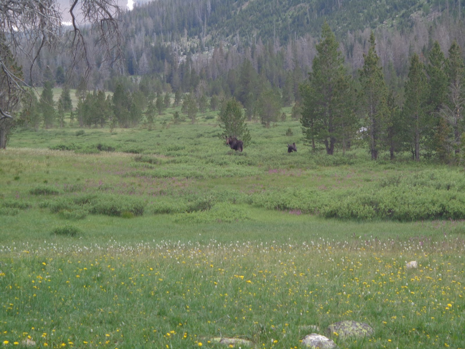
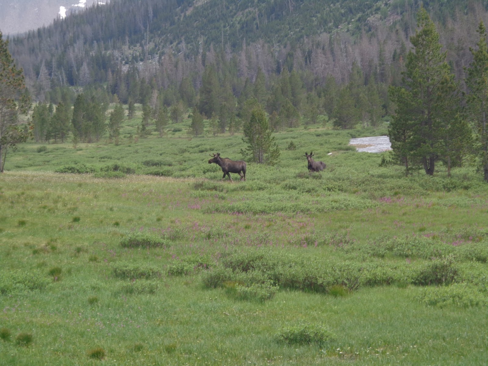
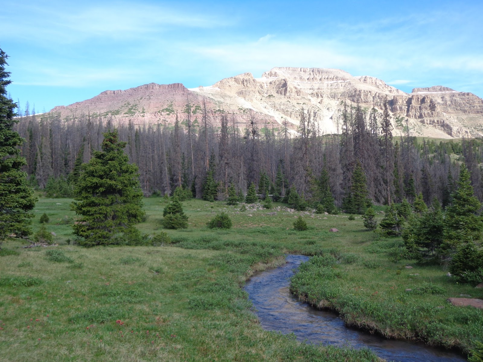
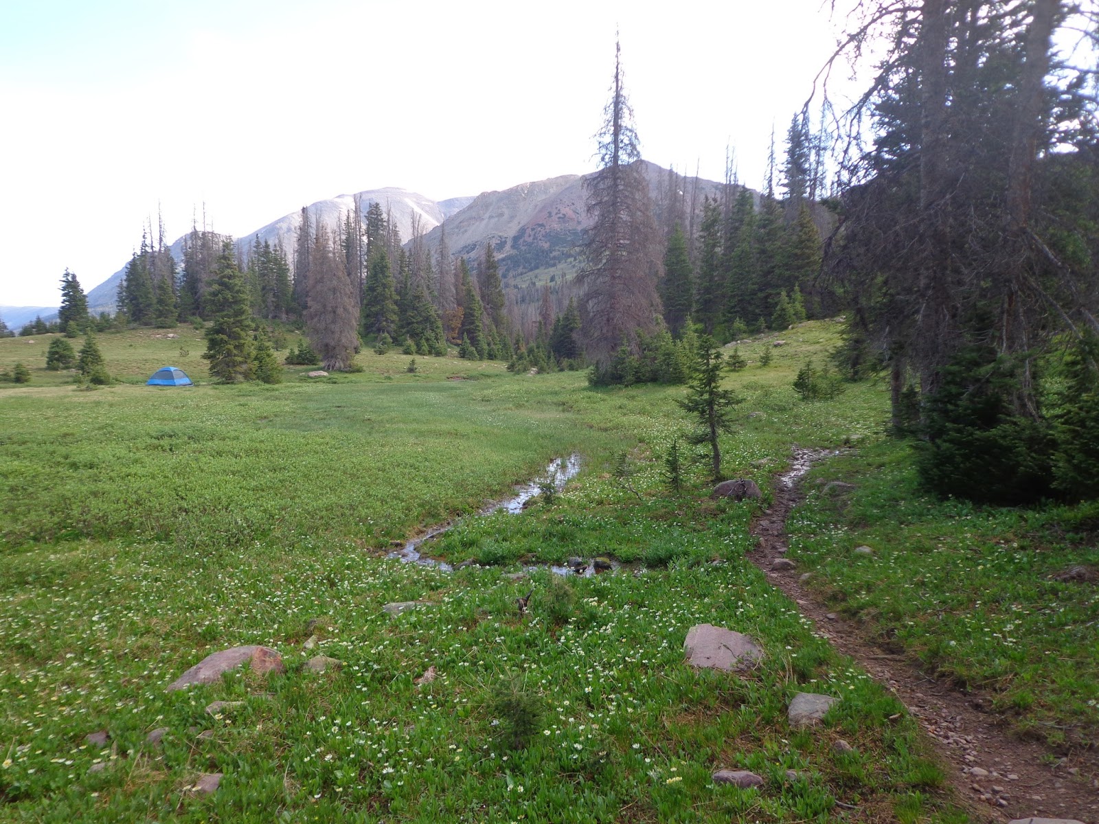
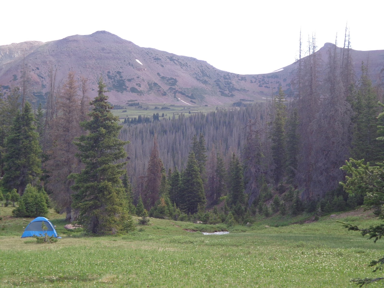
Spent the last week at West Fork Blacks Fork, after a day of getting acclimated at Bear River Campground first. Took my 13 year old son and explored the Mirror Lake Highway for a bit, and then dove into the back country for a few days.

My son decided that backpacking may not be for him; he was tired of being dirty, tired of being smelly, tired of being tired, and tired of eating backpackers food--even though this was a much less ambitious trip than my original plans called for. Still, we had a great time.

First post: our "altitude acclimatization day" where we scampered around Bald Mountain Pass, the Provo River falls and stayed the night at the Bear River campsite.

DSC03055.JPG

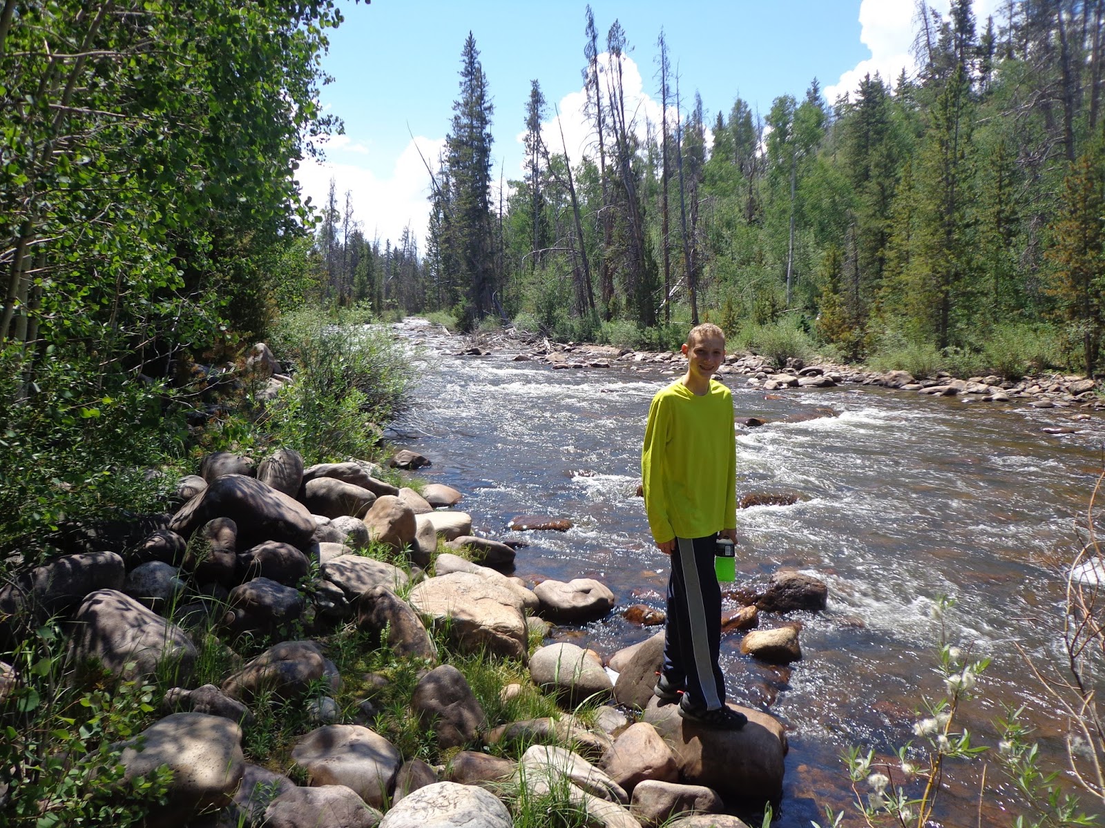
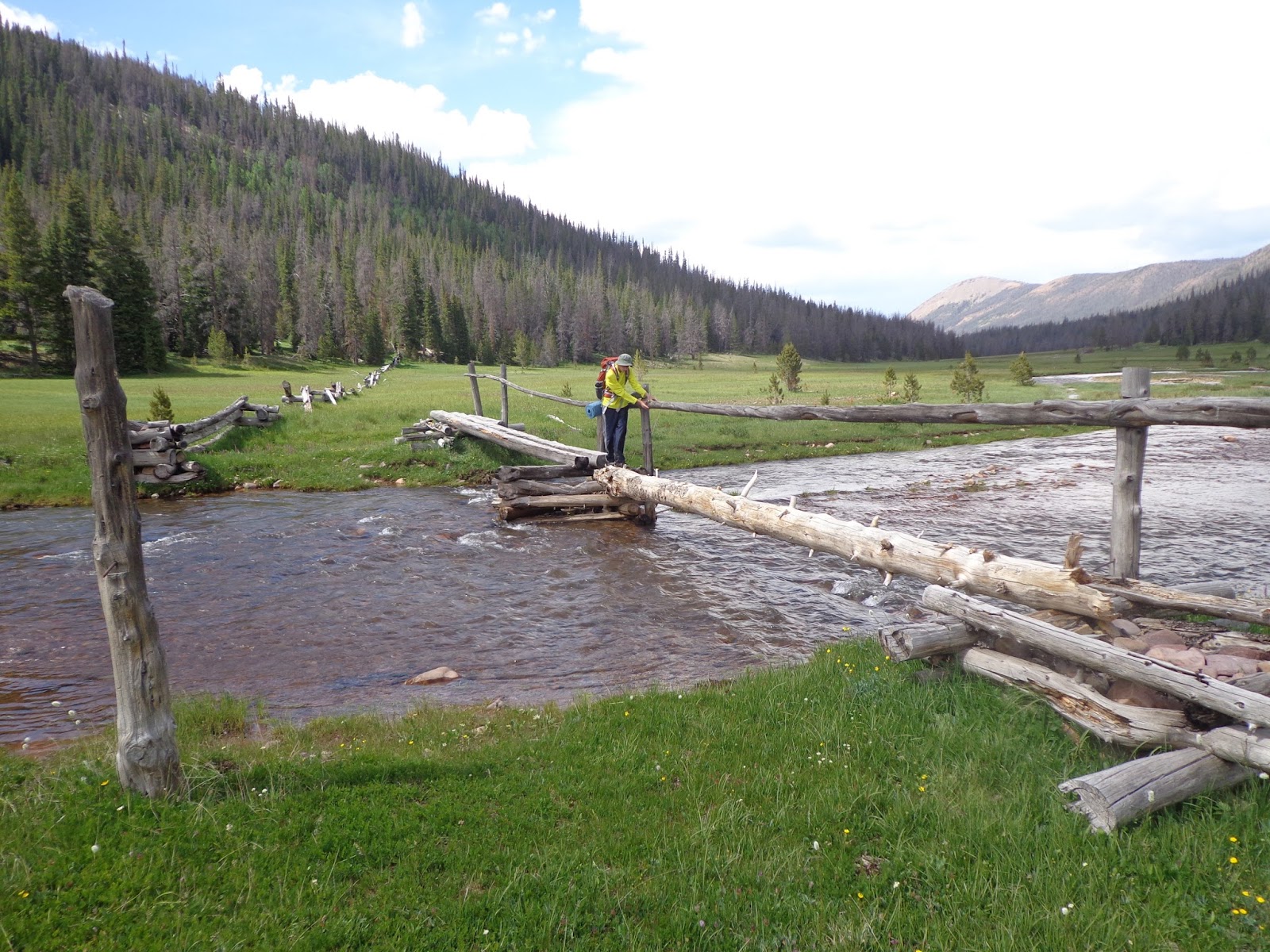
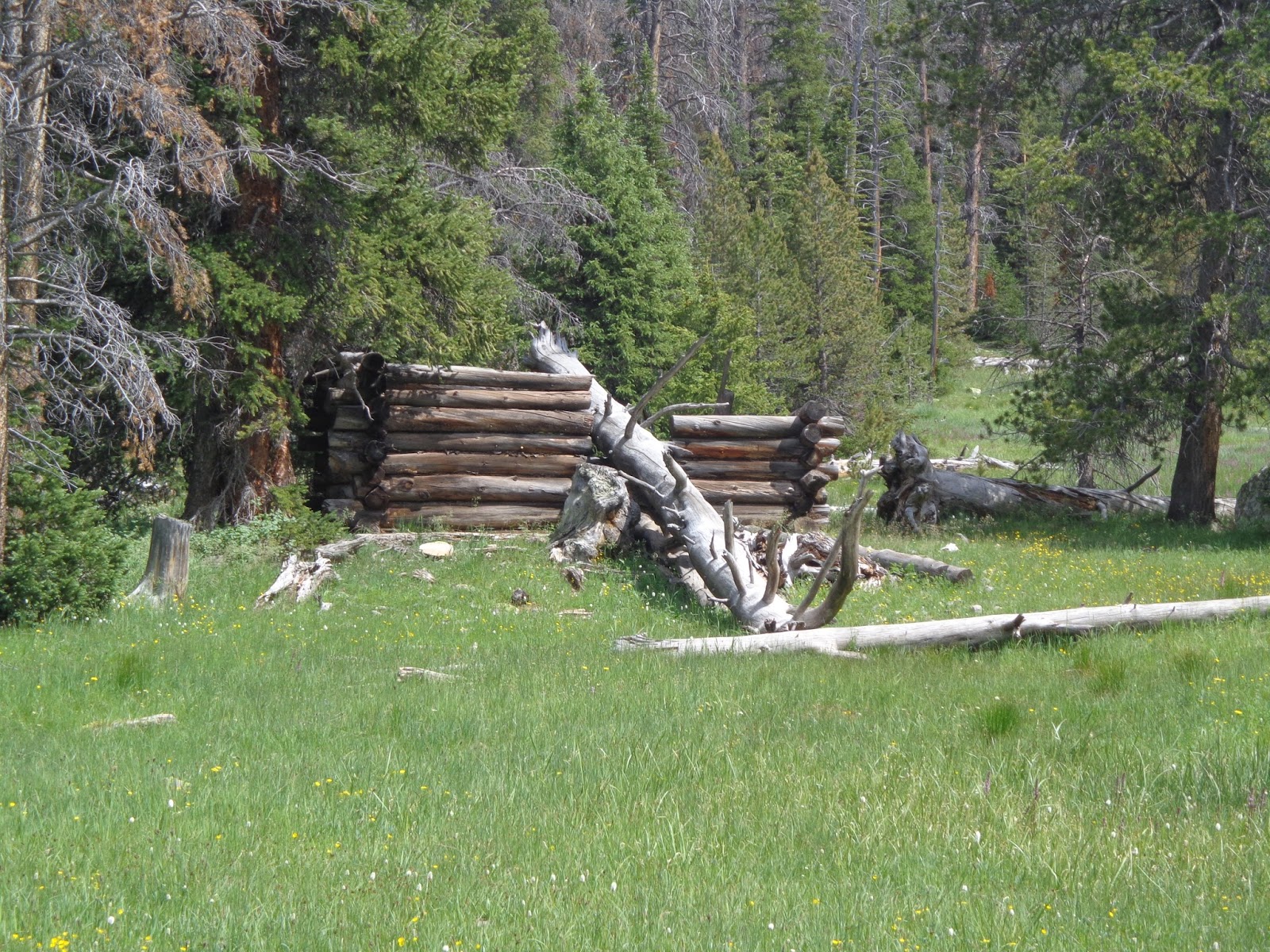
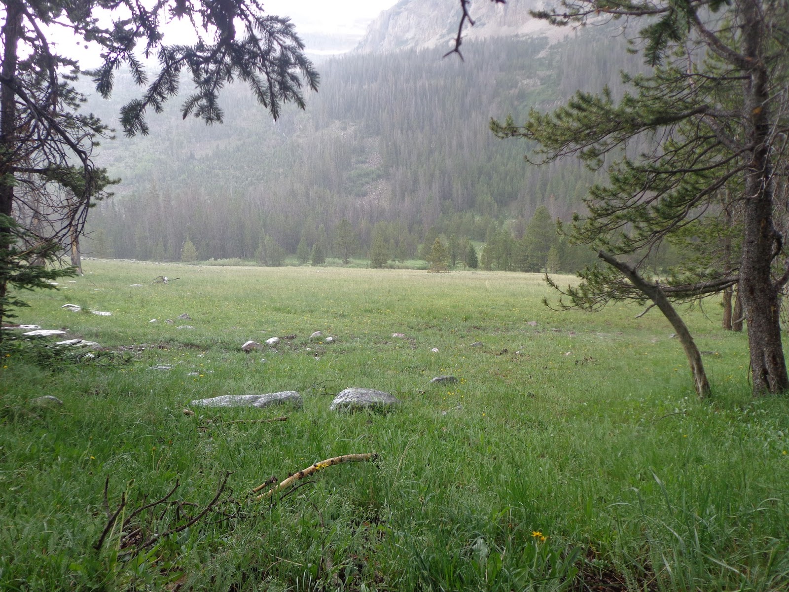
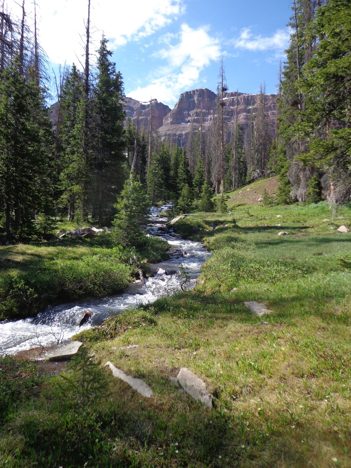
Set up camp and checked out the Bear River before we did anything else.

DSC03061.JPG

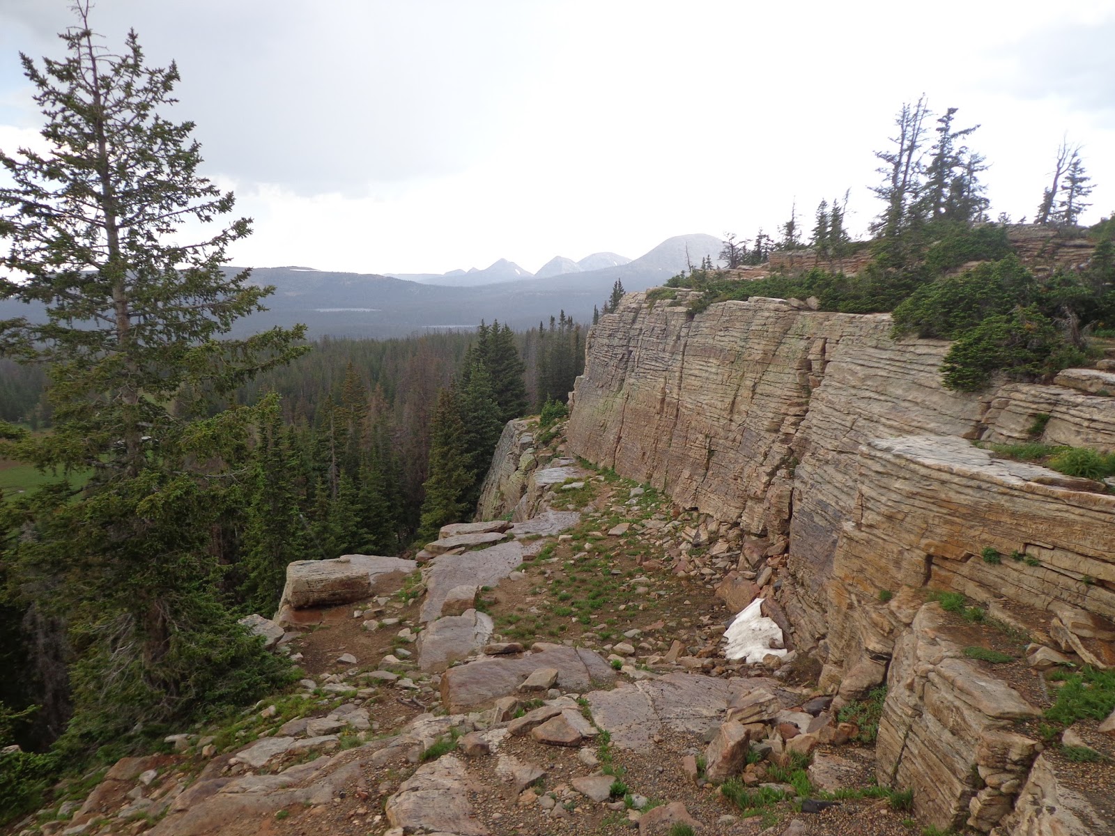
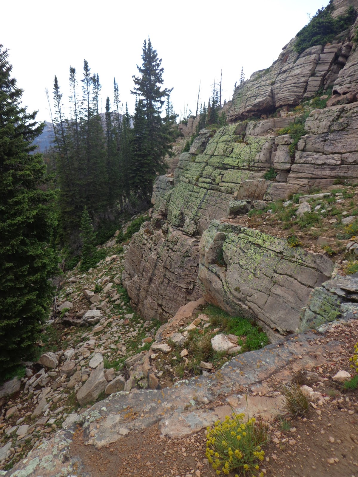
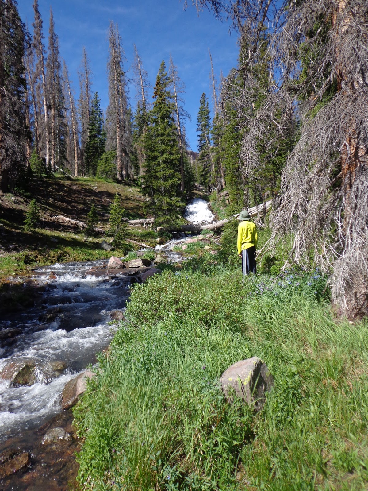
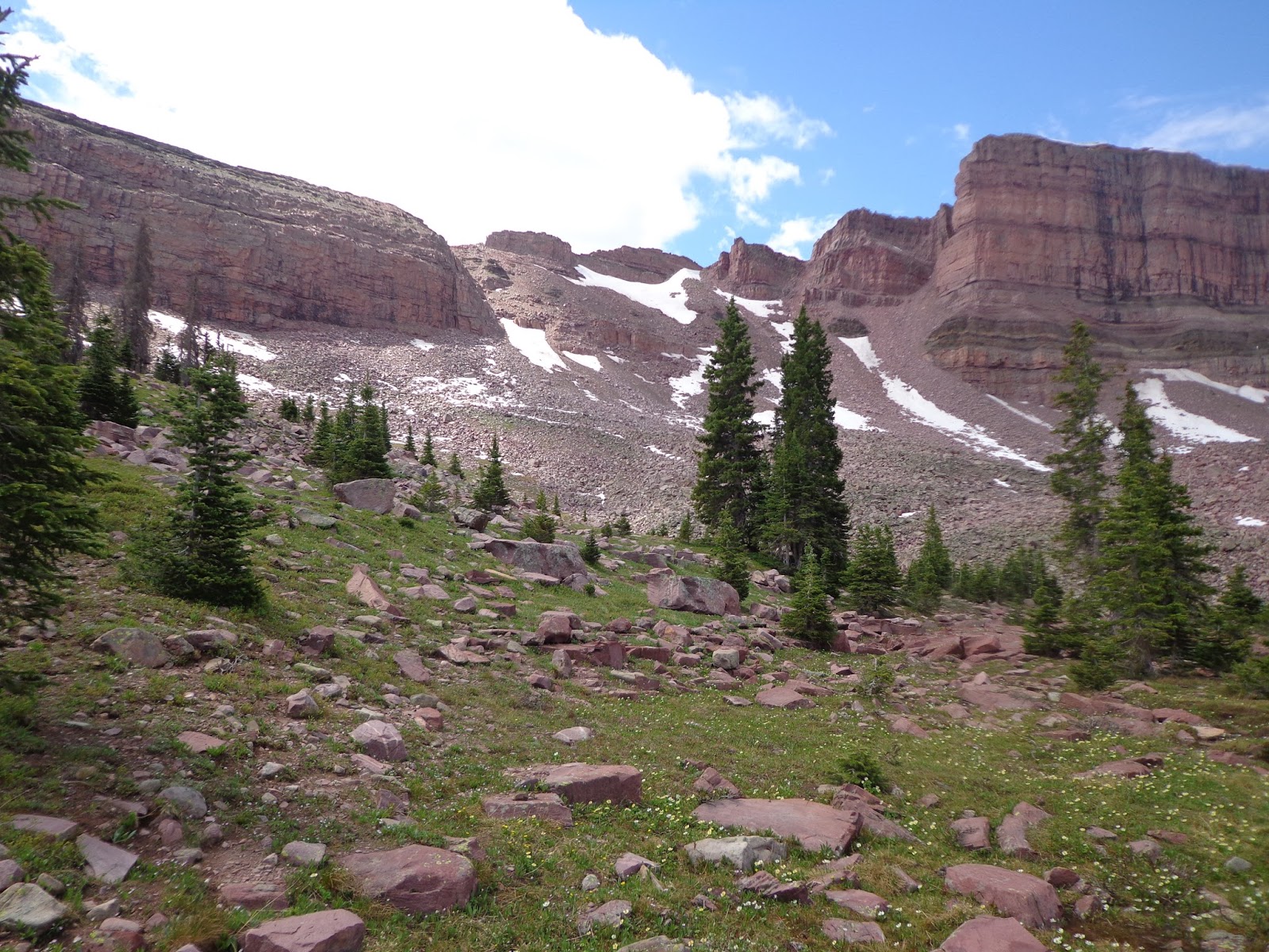
We got chased off Bald Mountain pass by a passing hailstorm, but after it blew over, we came back and scrambled around on these cliffs and at the Provo falls.

DSC03069.JPG

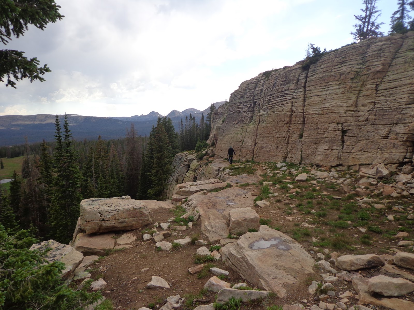
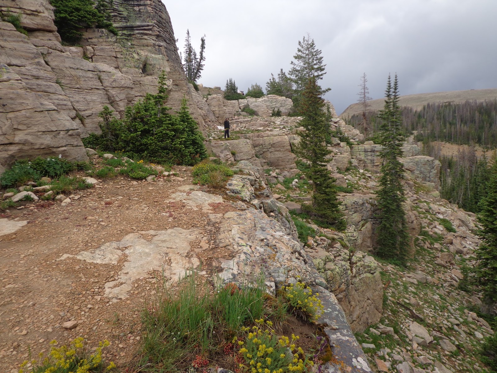
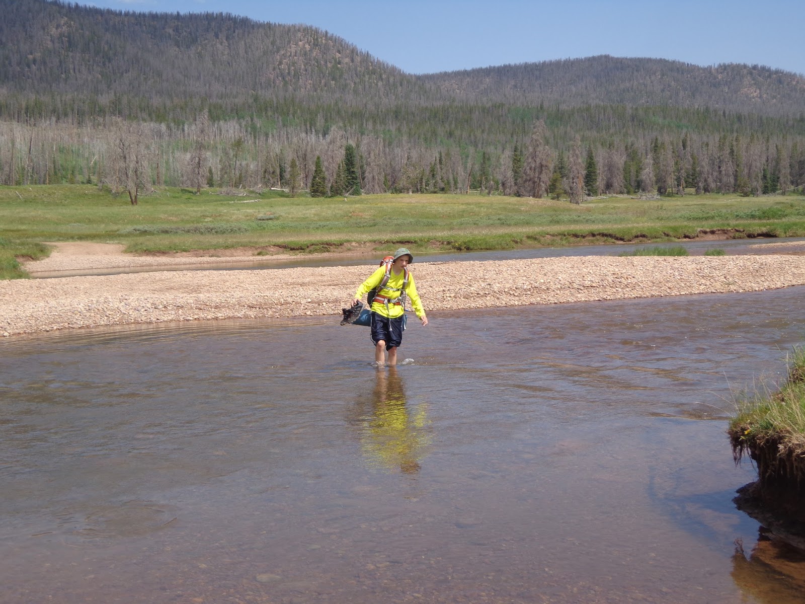
I sent Alex a bit away to give the picture a little bit of a sense of scale. The bench and ledge system right below the parking lot was a fun place to scramble and explore. Curiously, based on an old fire ring, somebody had camped on a ledge right below the parking lot not too long ago.
DSC03072.JPG


DSC03073.JPG


DSC03078.JPG

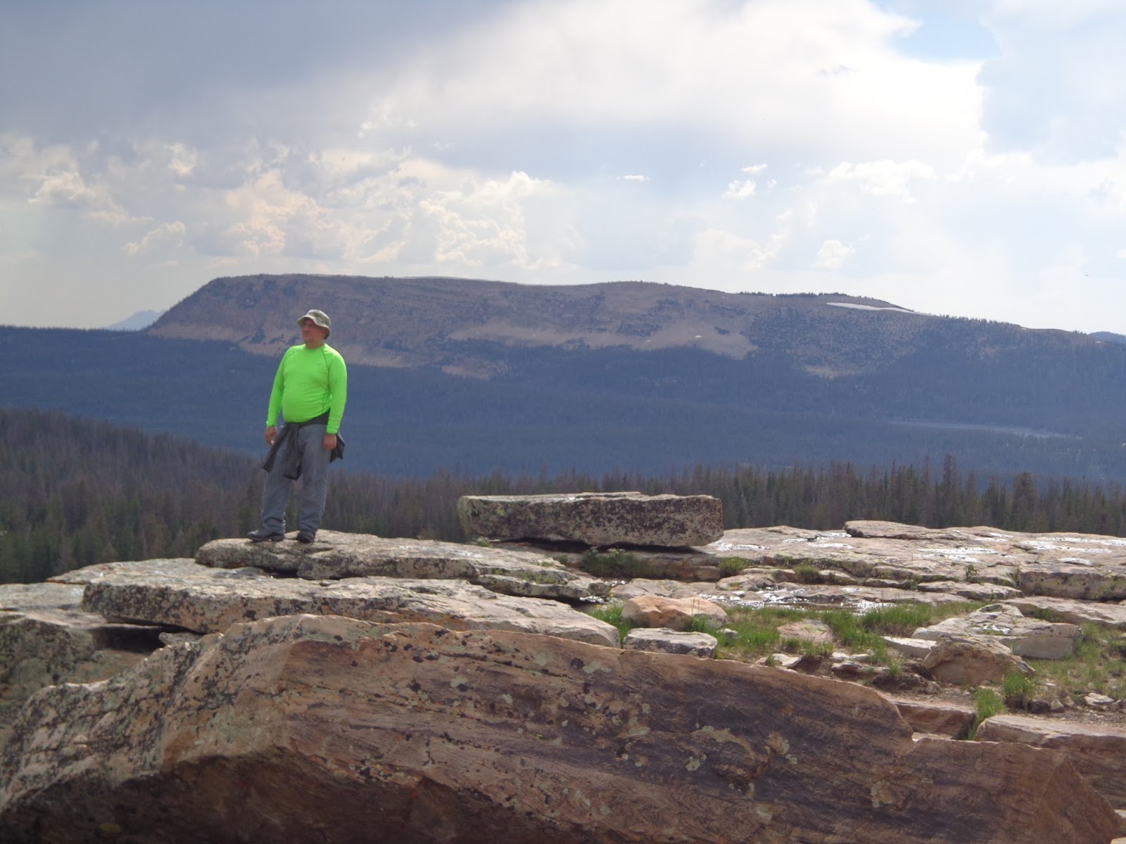
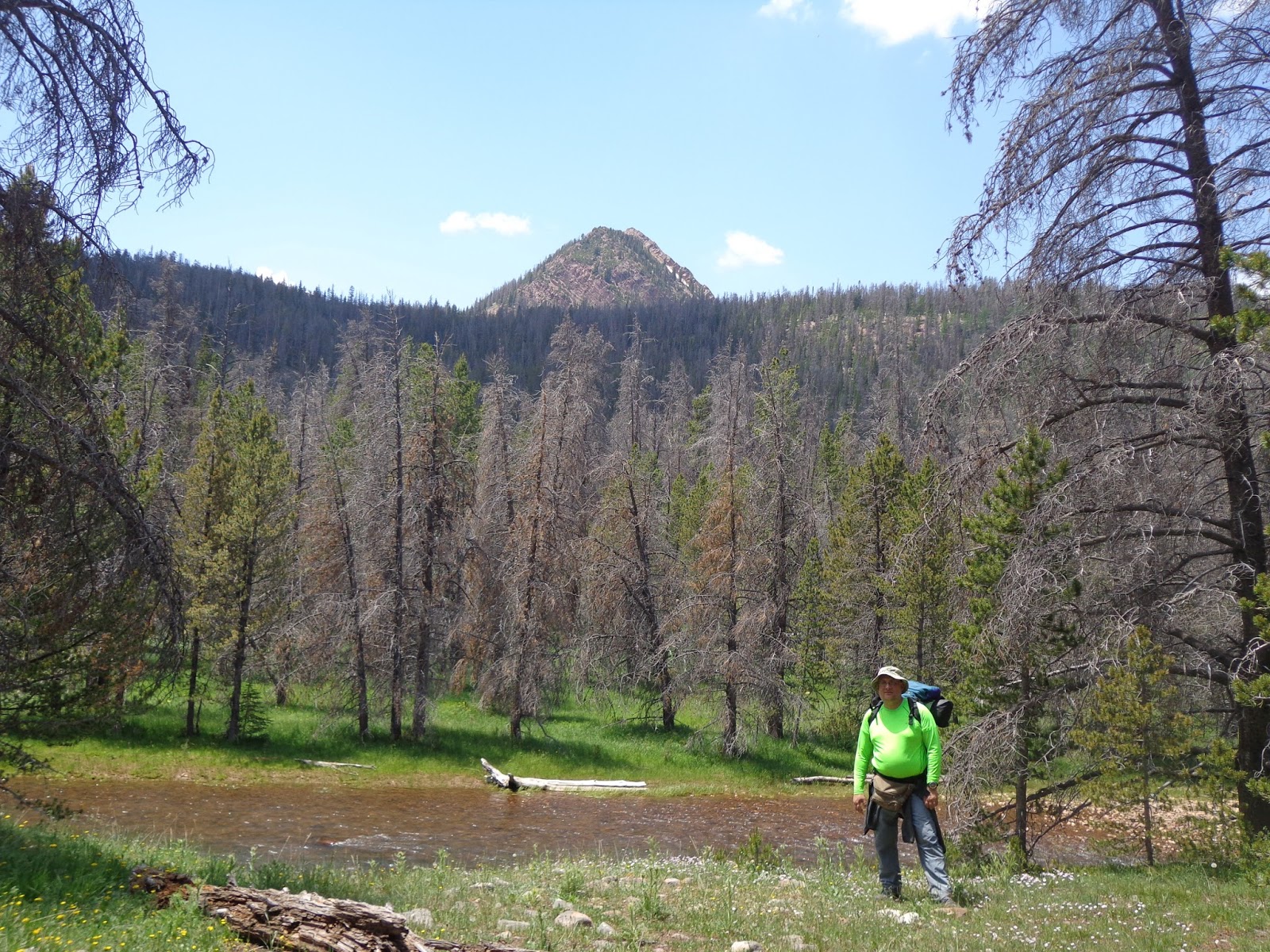
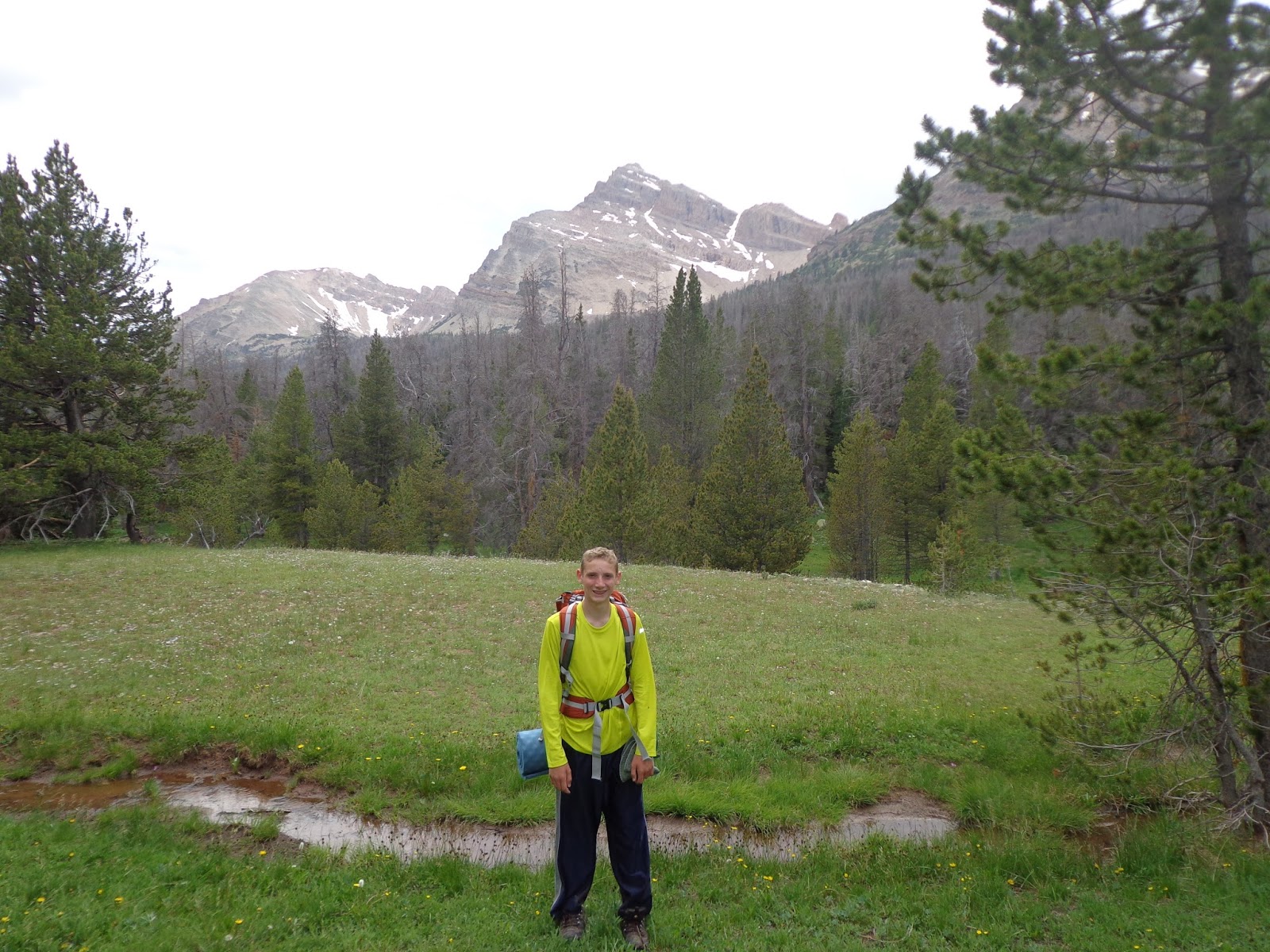
My radioactive green shirt. I didn't even bother to double check, but the mountain behind me is Haystack, right?
DSC03081.JPG

DSC03085.JPG

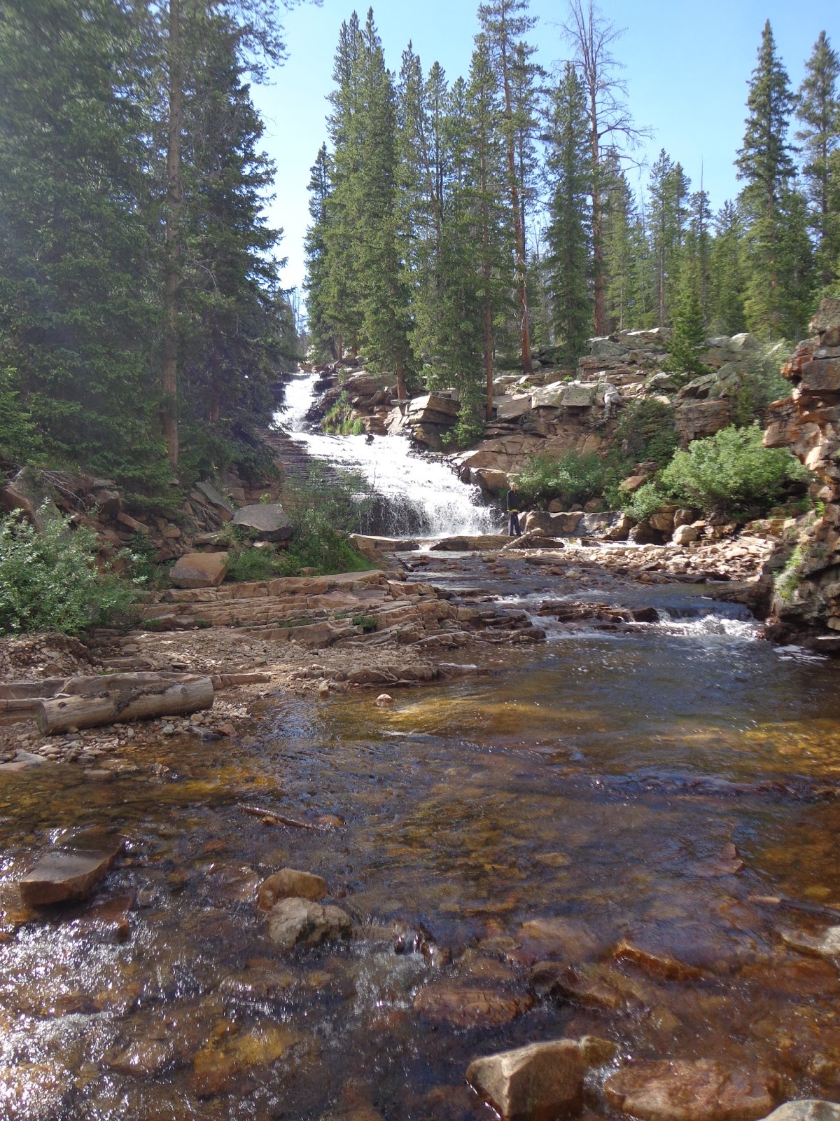
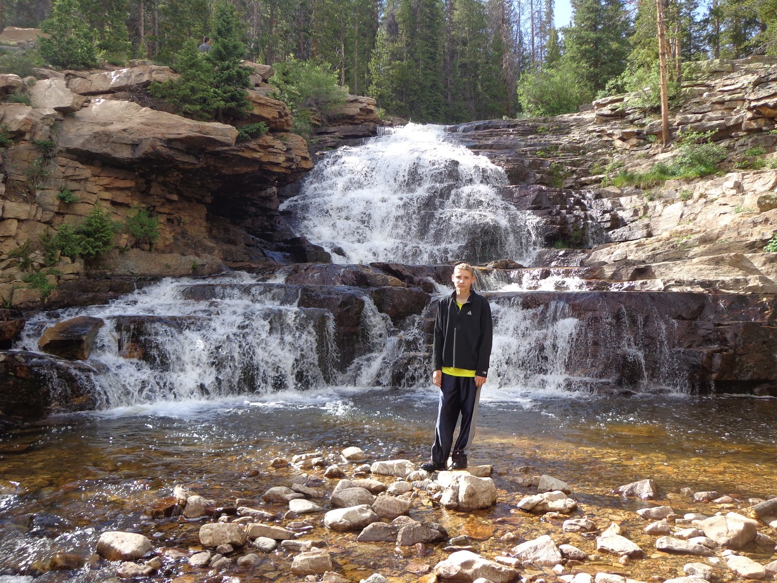
Nice view of the falls.
DSC03086.JPG

DSC03087.JPG

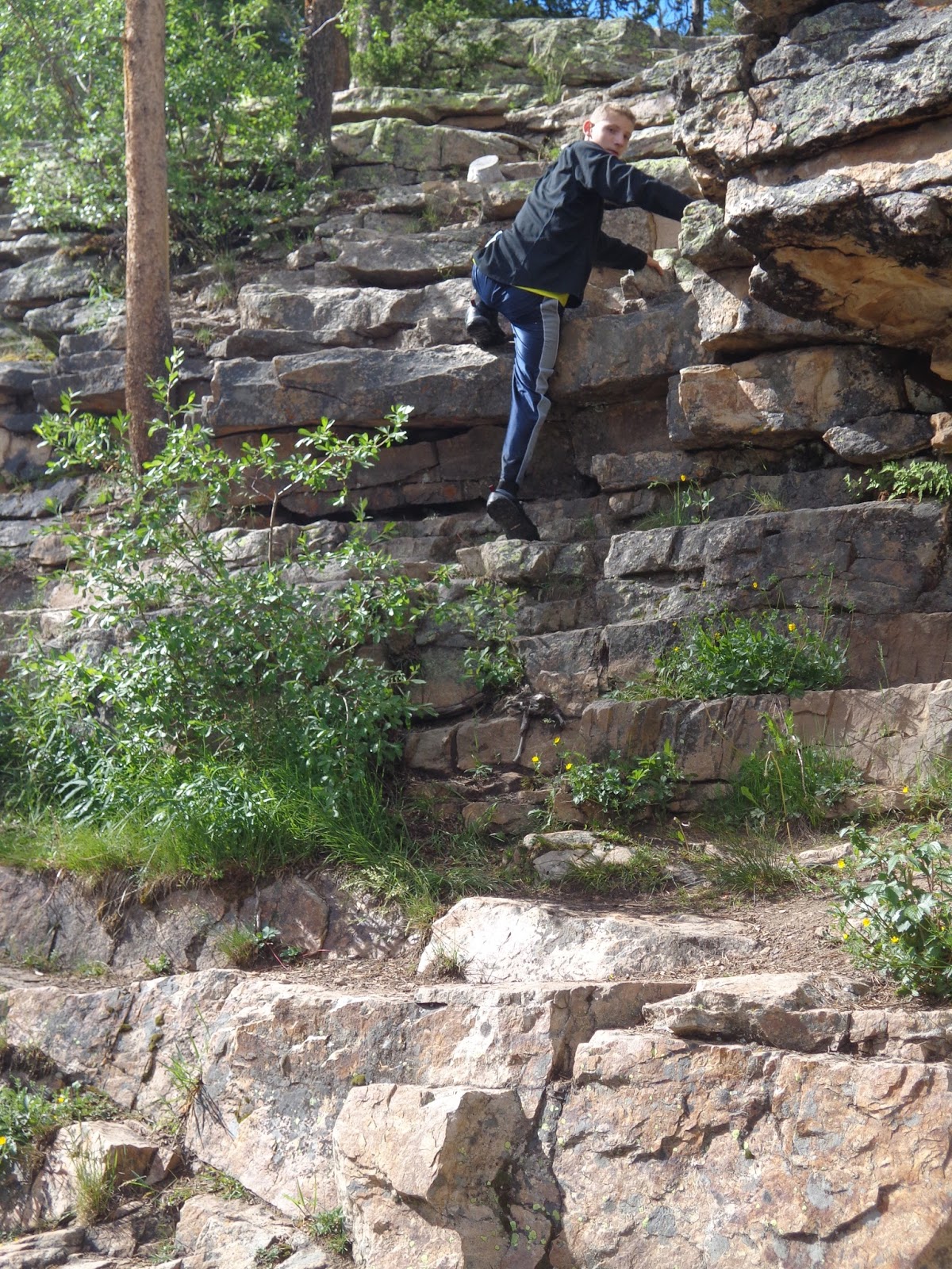
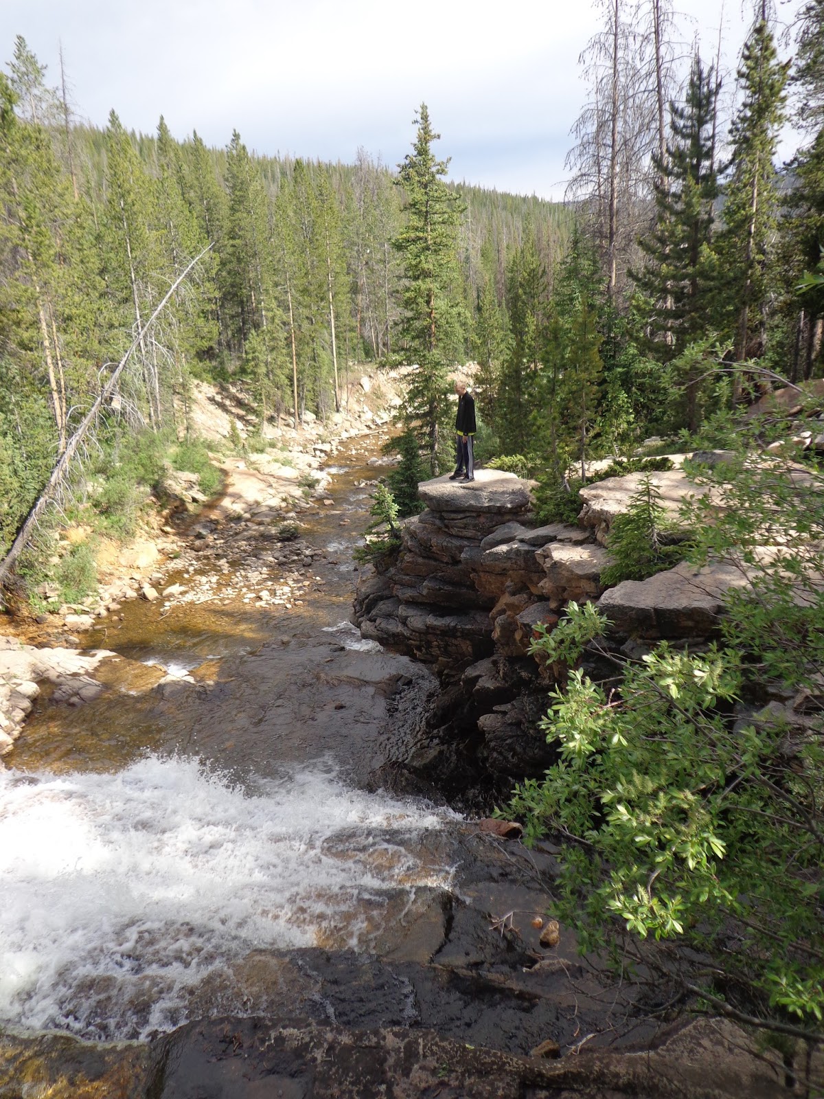
Getting back up from the lower falls was a bit easier said than done, but some fun scrambling. My son actually had more fun on "altitude acclimatization day" than he did in the next few days backpacking. I think the scrambling was part of the fun there. Plus, we weren't dirty, smelly, wet, or tired of the food yet, and we still had yet to spend a night in the tent...

DSC03089.JPG

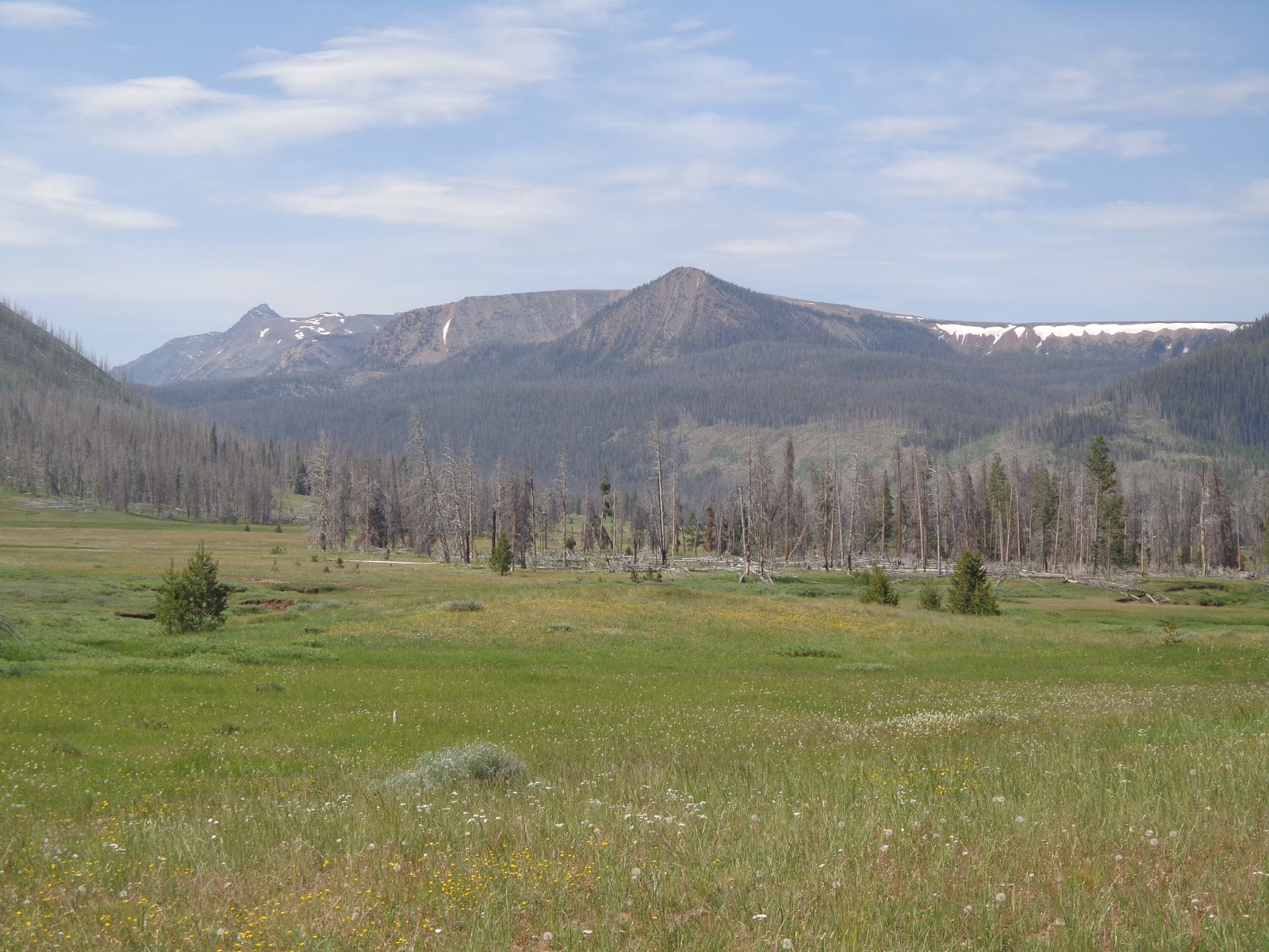
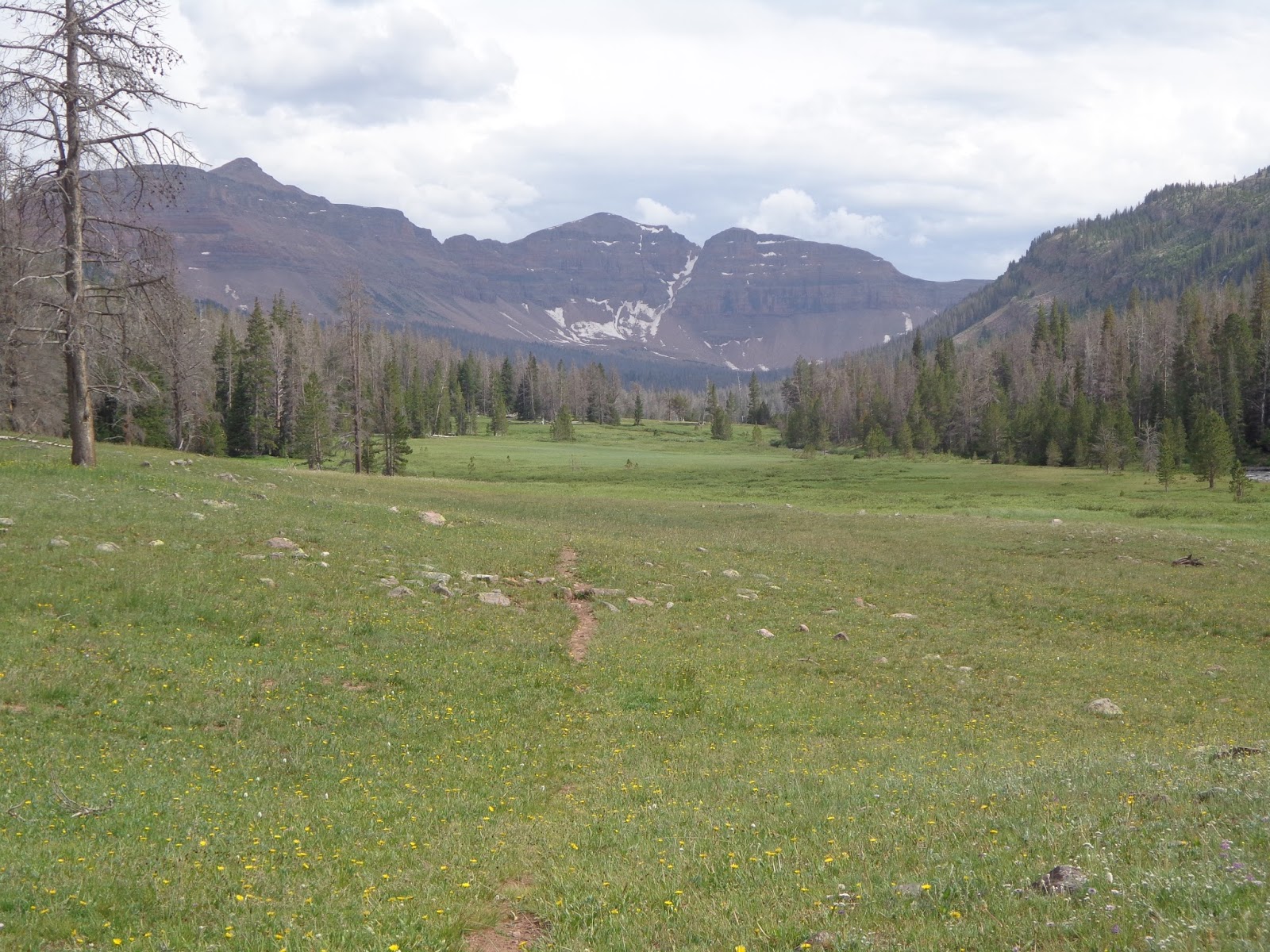
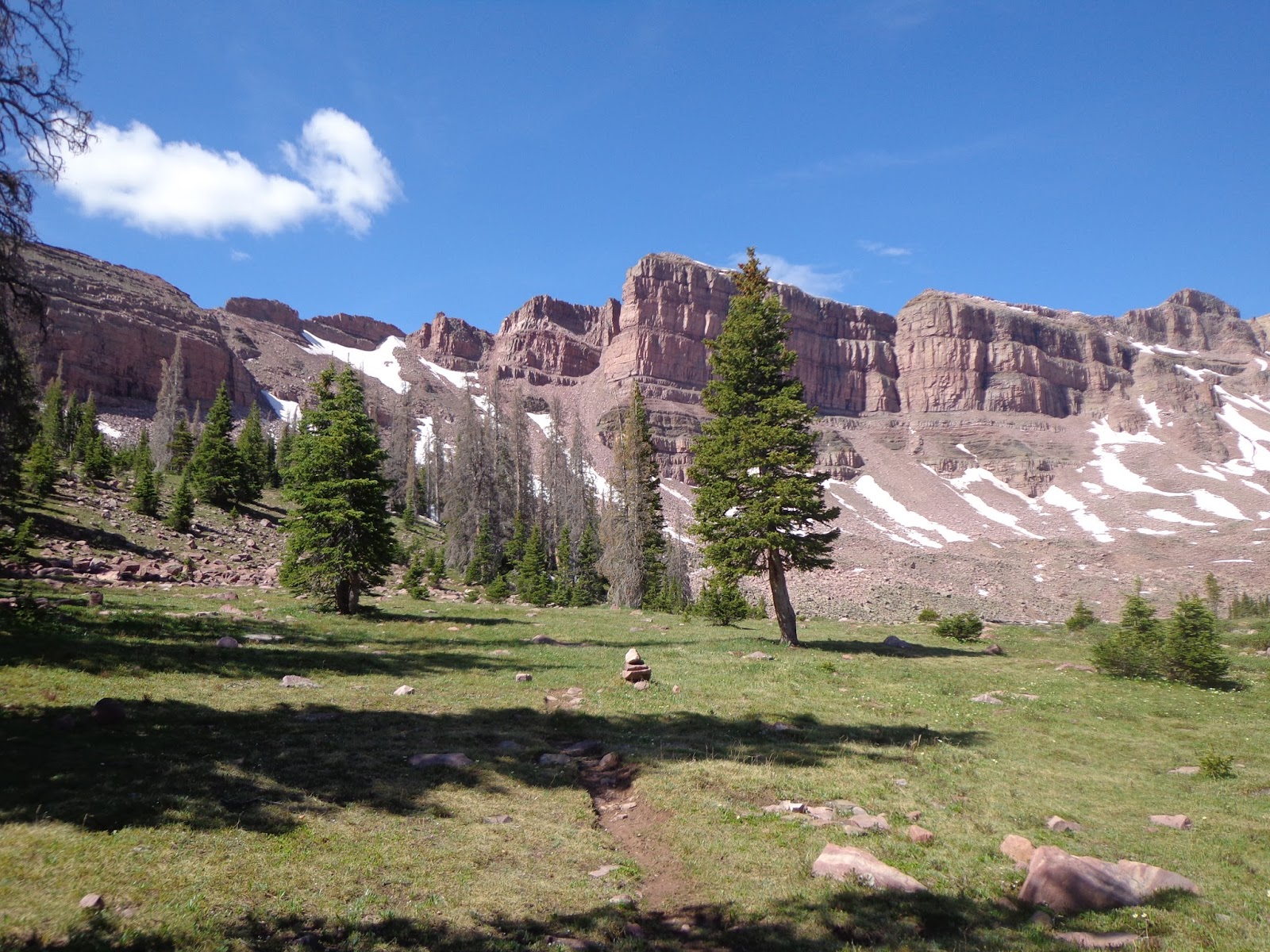
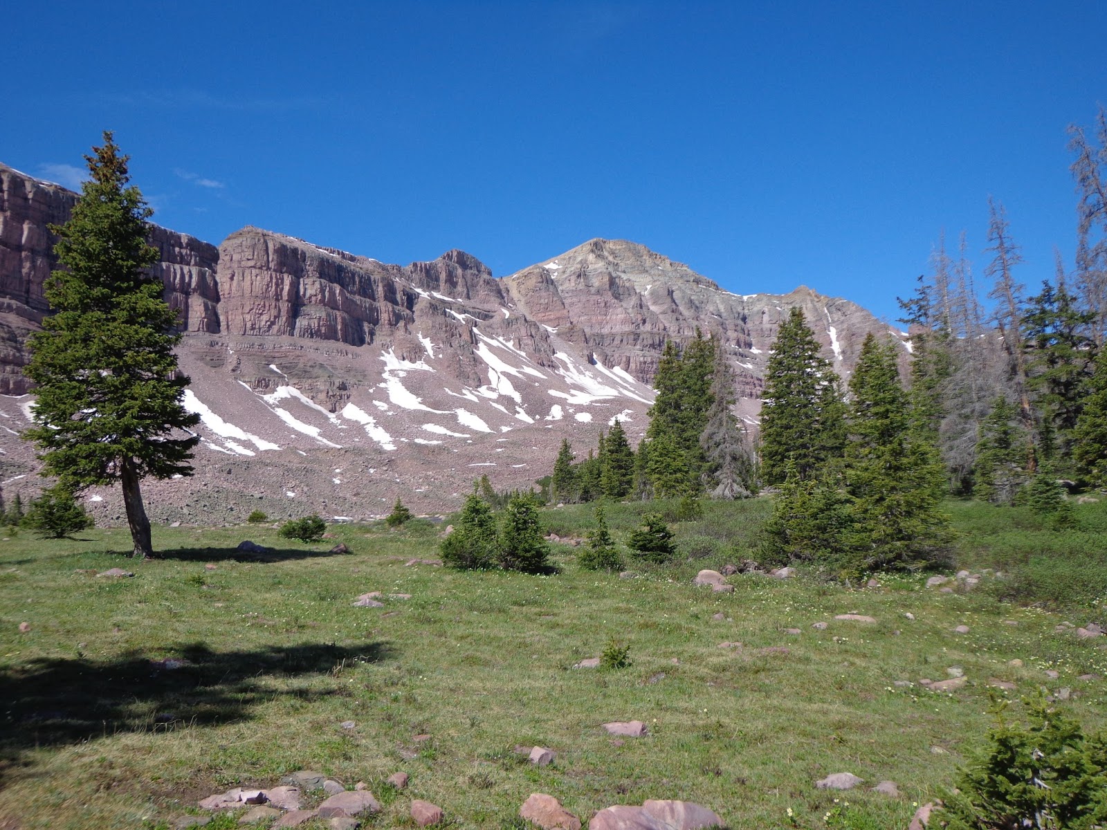
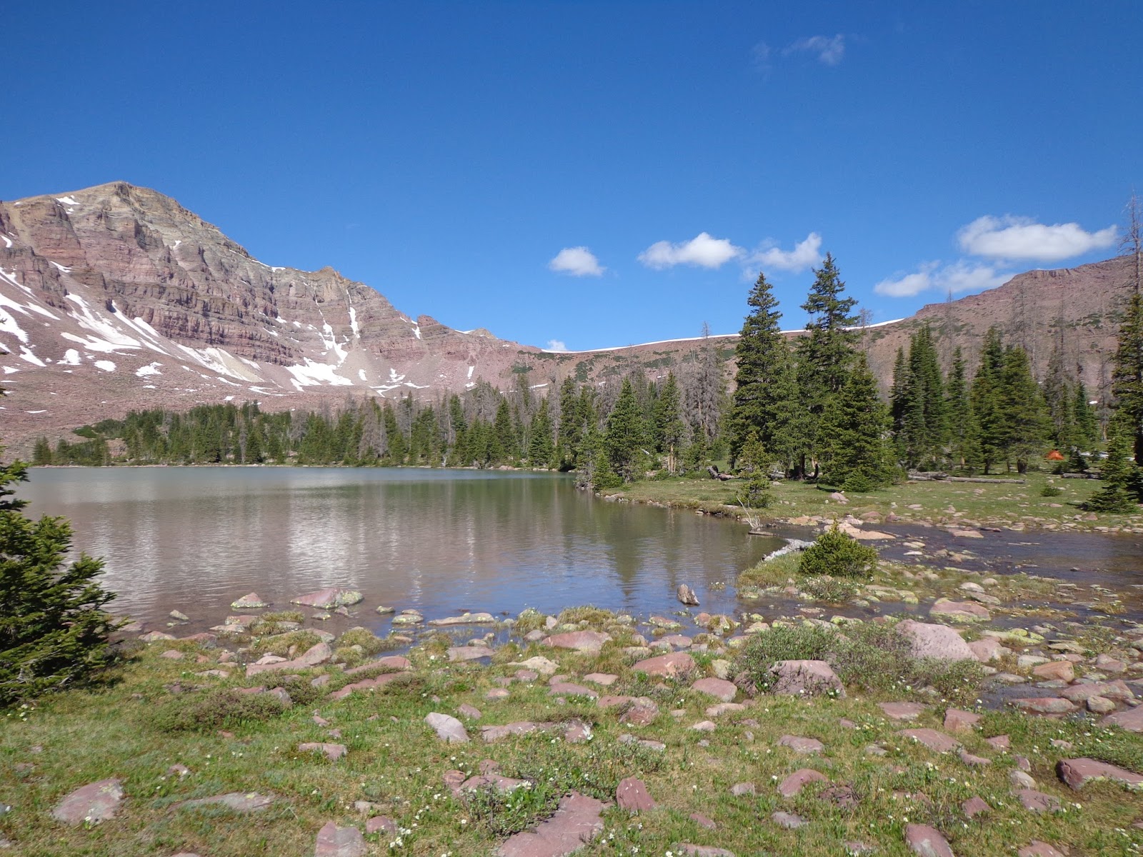
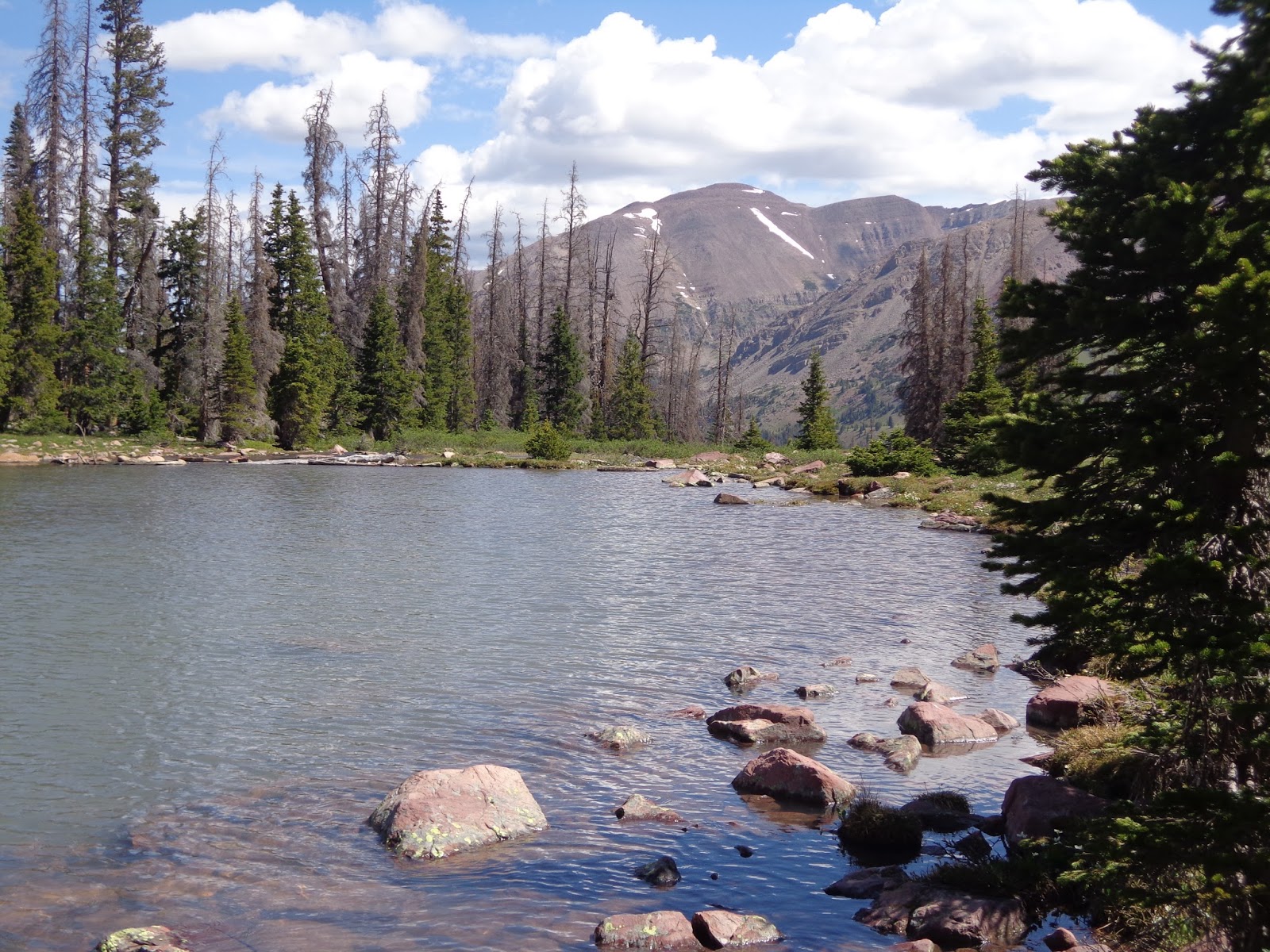
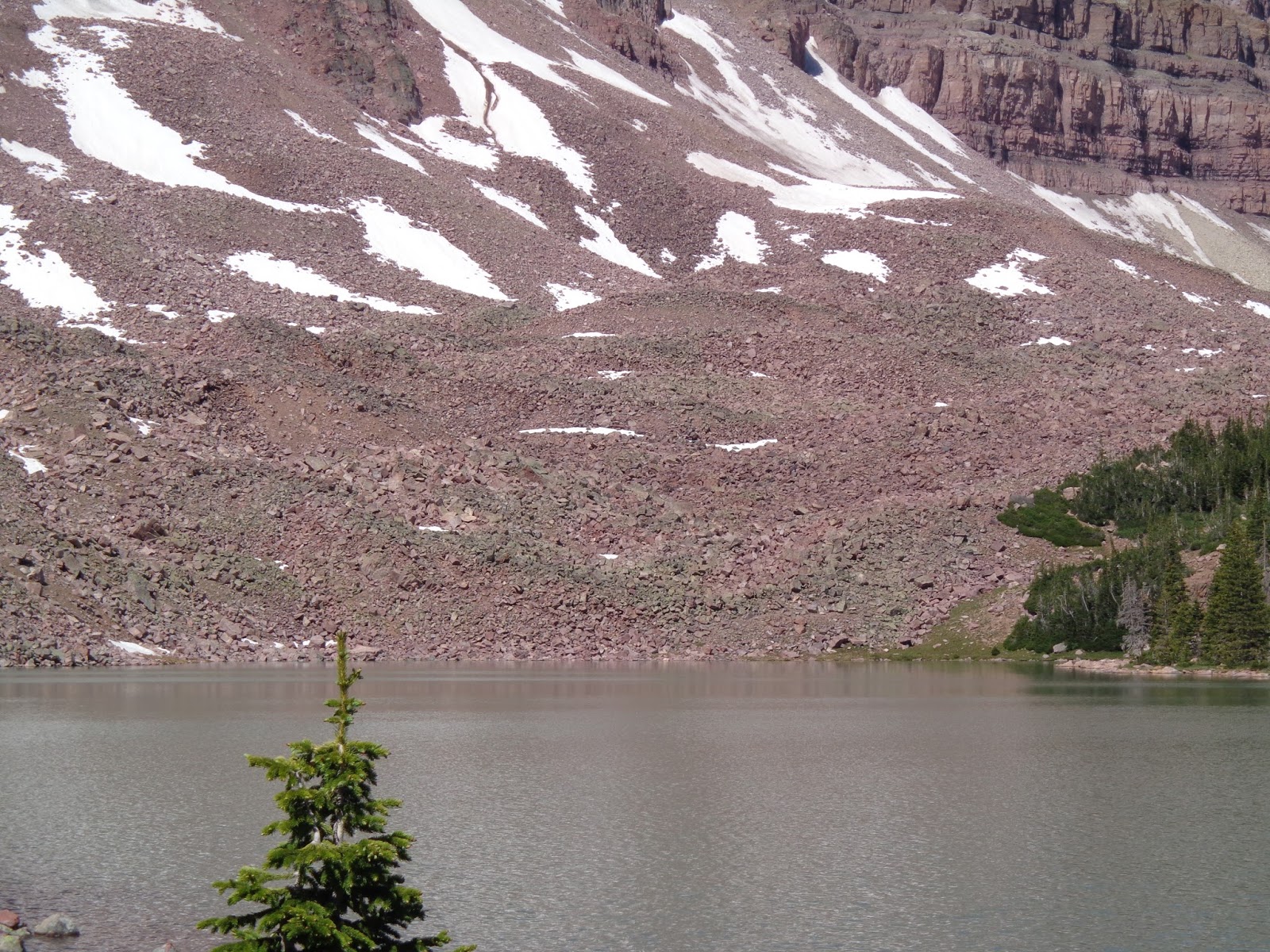
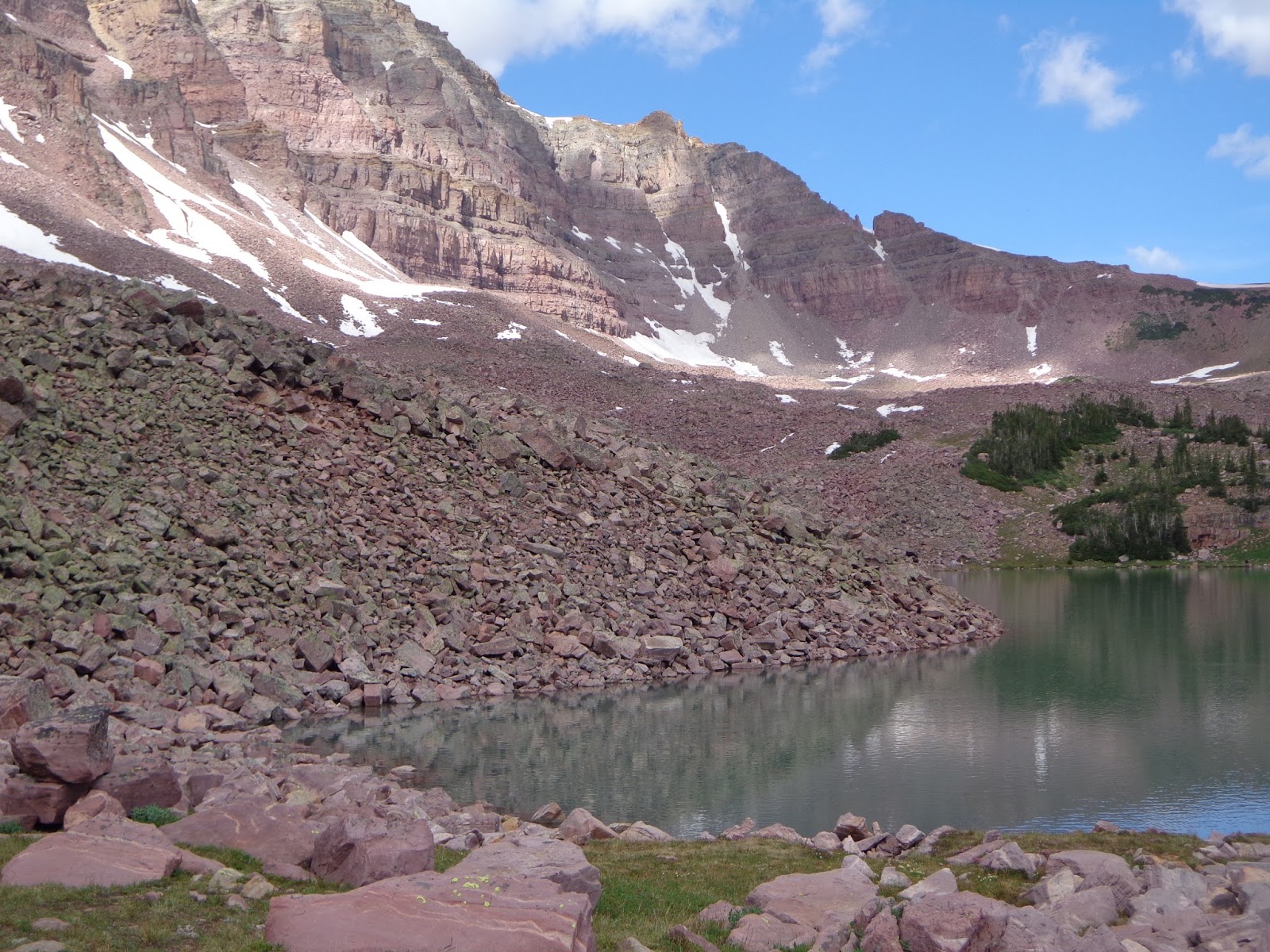
My destination from last year; went around Agassiz to Naturalist Basin. By now the storm was completely gone and the skies were fairly sunny again.
DSC03094.JPG

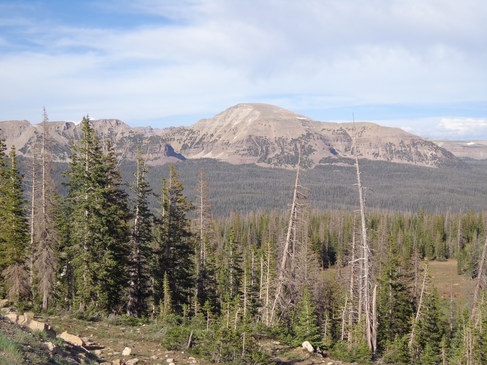
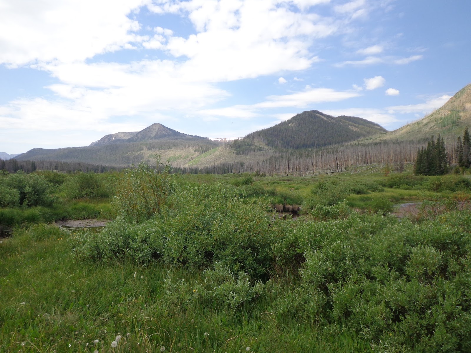
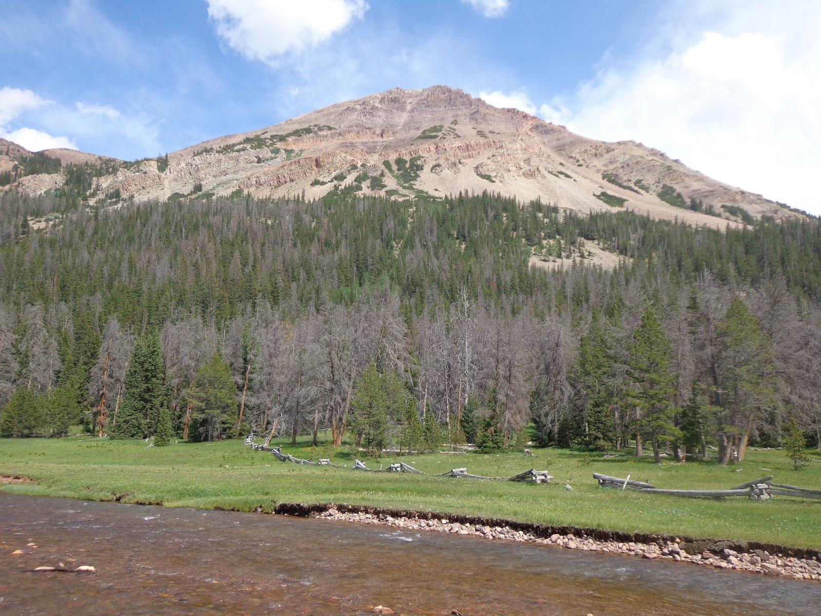
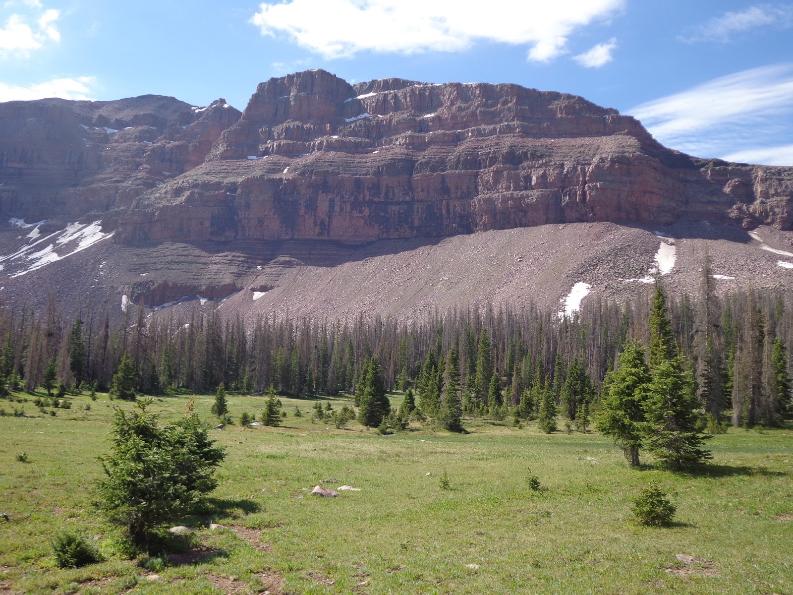
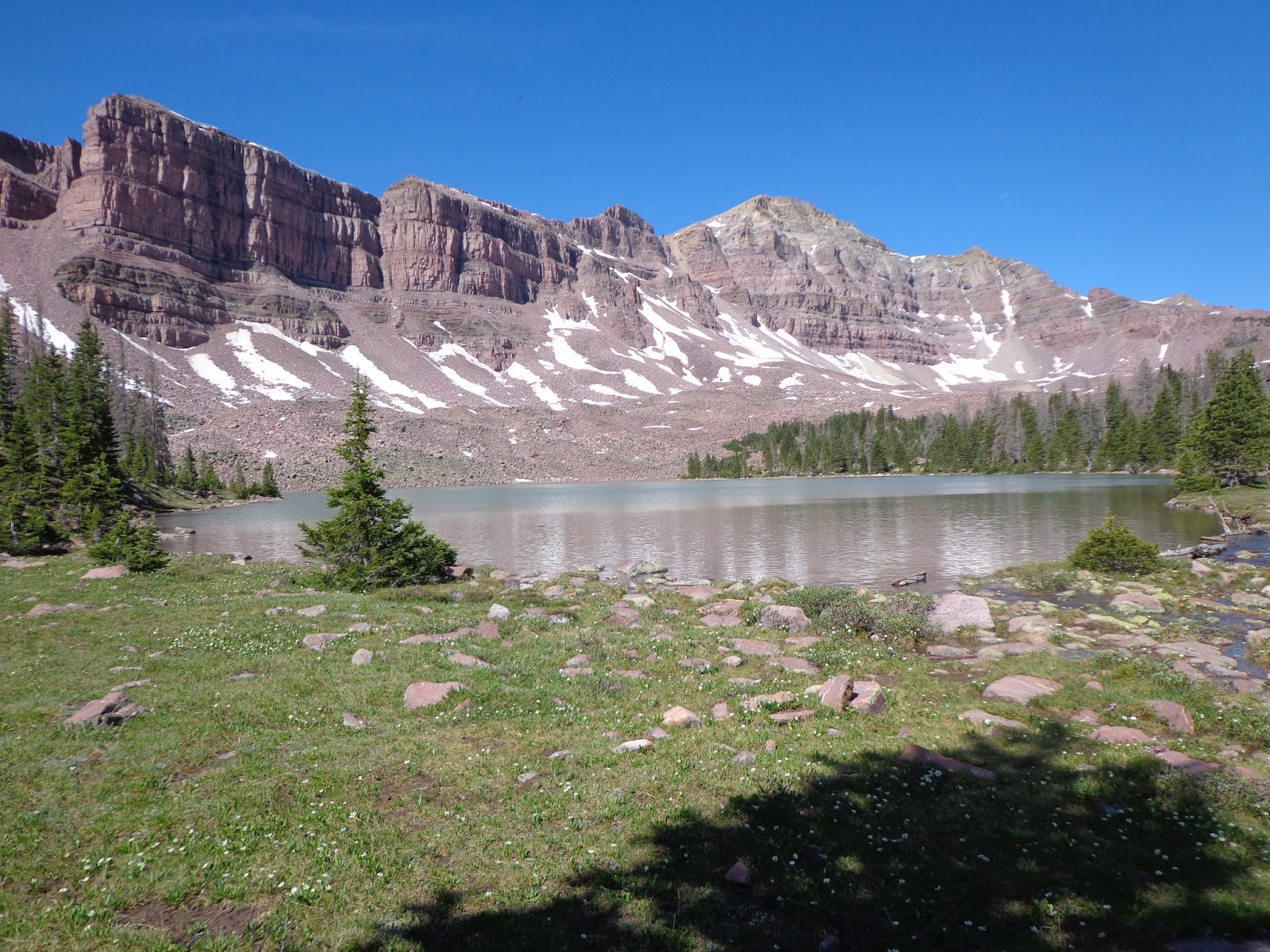
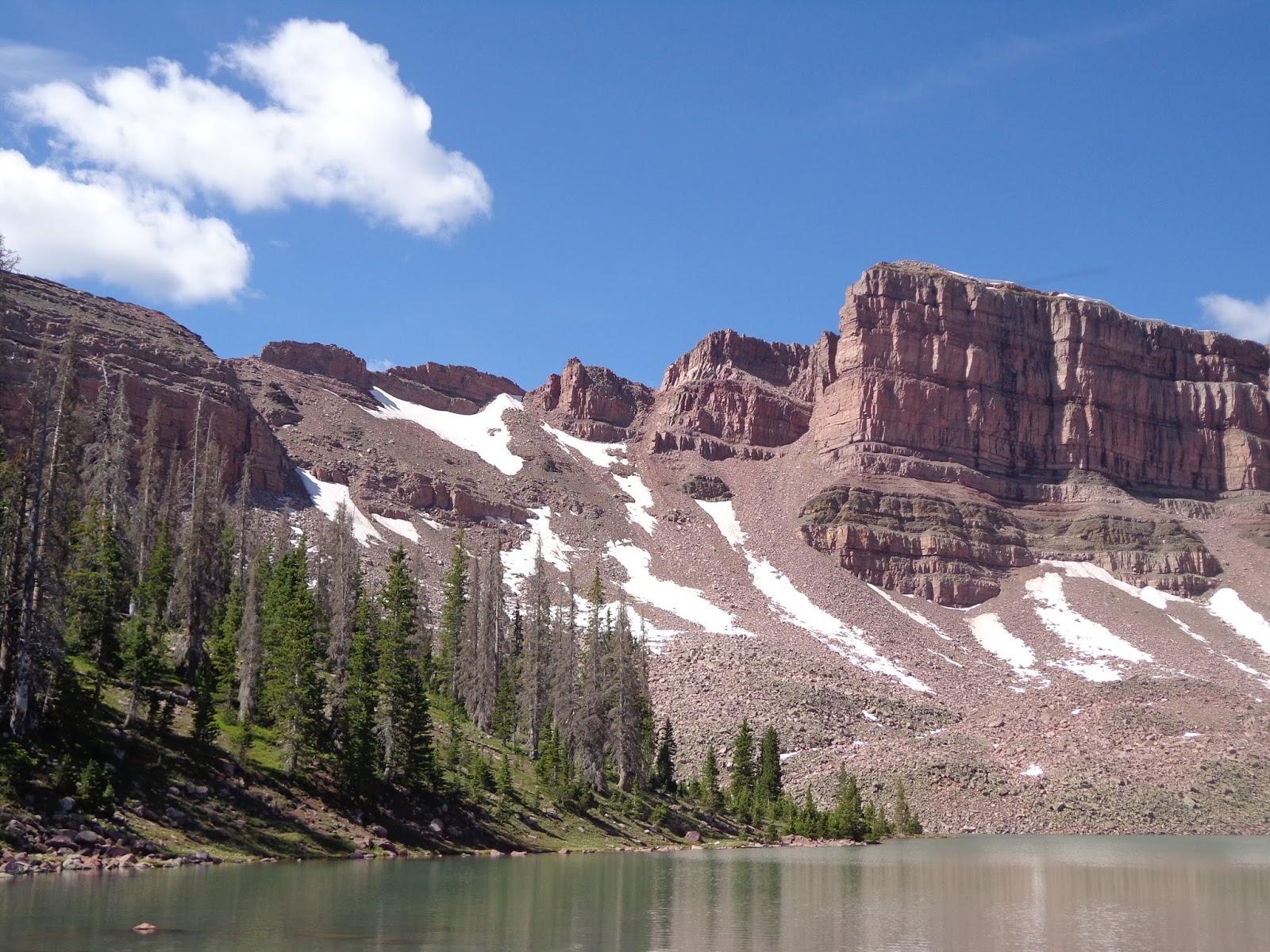
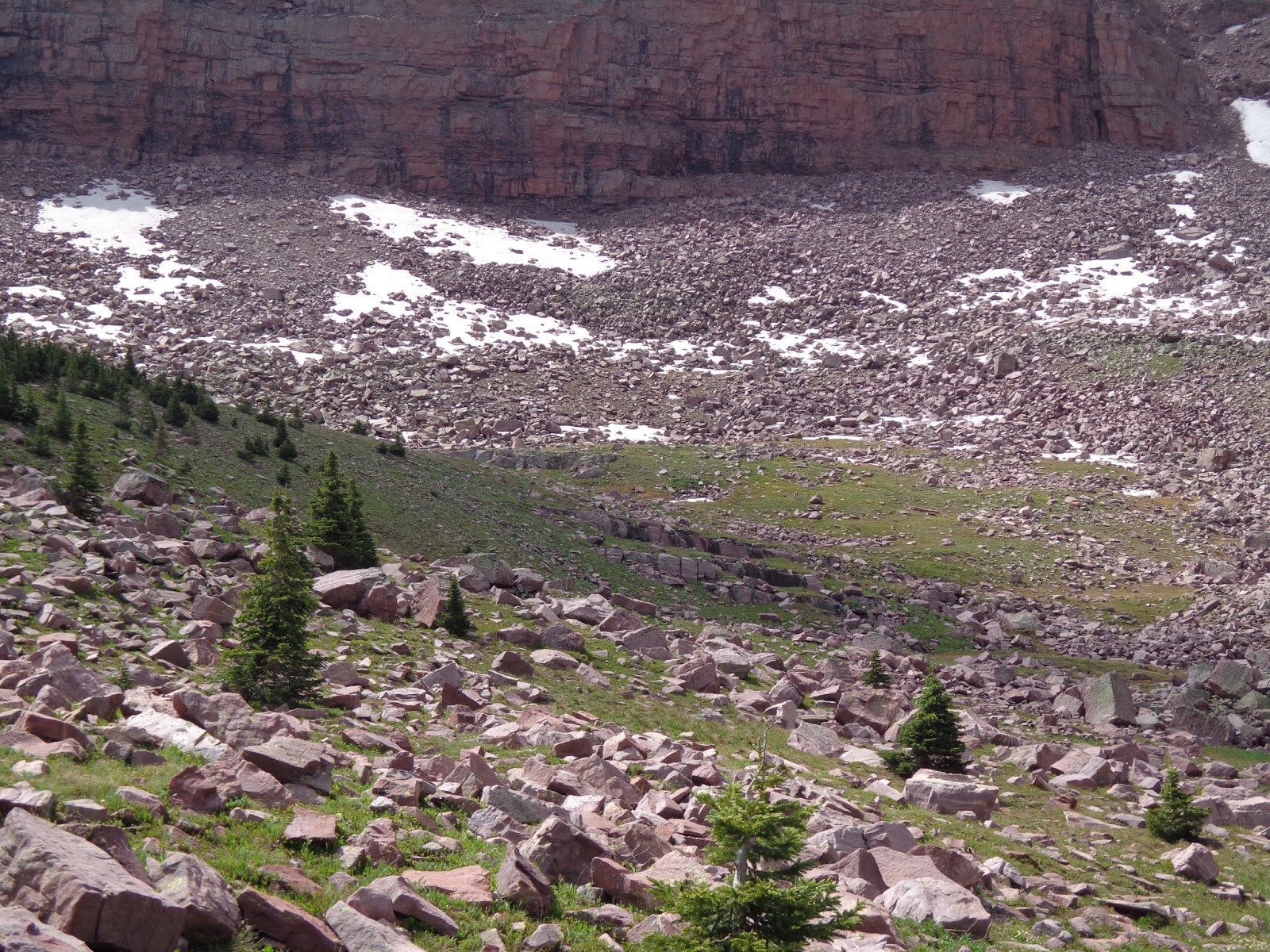
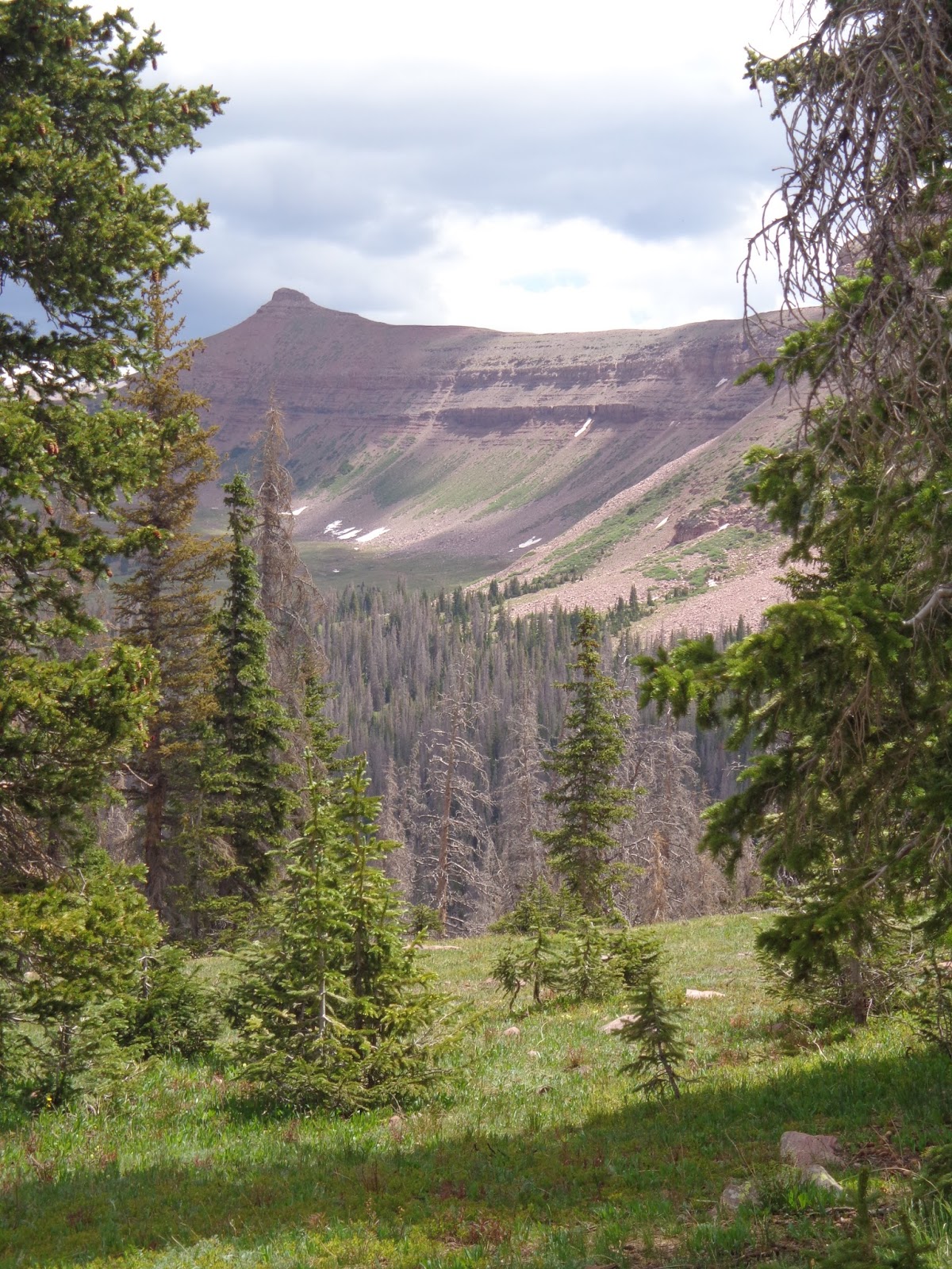
Last year, I also spent about 24 hours in Hell Hole. It was my intention to summit Kletting, pictured here, from the other side, but from the Hell Hole basin, it wasn't clear to me which of the two peaks was the higher one. Once I was almost at the top, I realized I had gone for the wrong one, but due to timing constraints, I didn't feel like I was ready to go back down, and start over with the proper route, so the summit eluded me last year. Anyway, here's a nice view of the mountain from the other side.
DSC03098.JPG

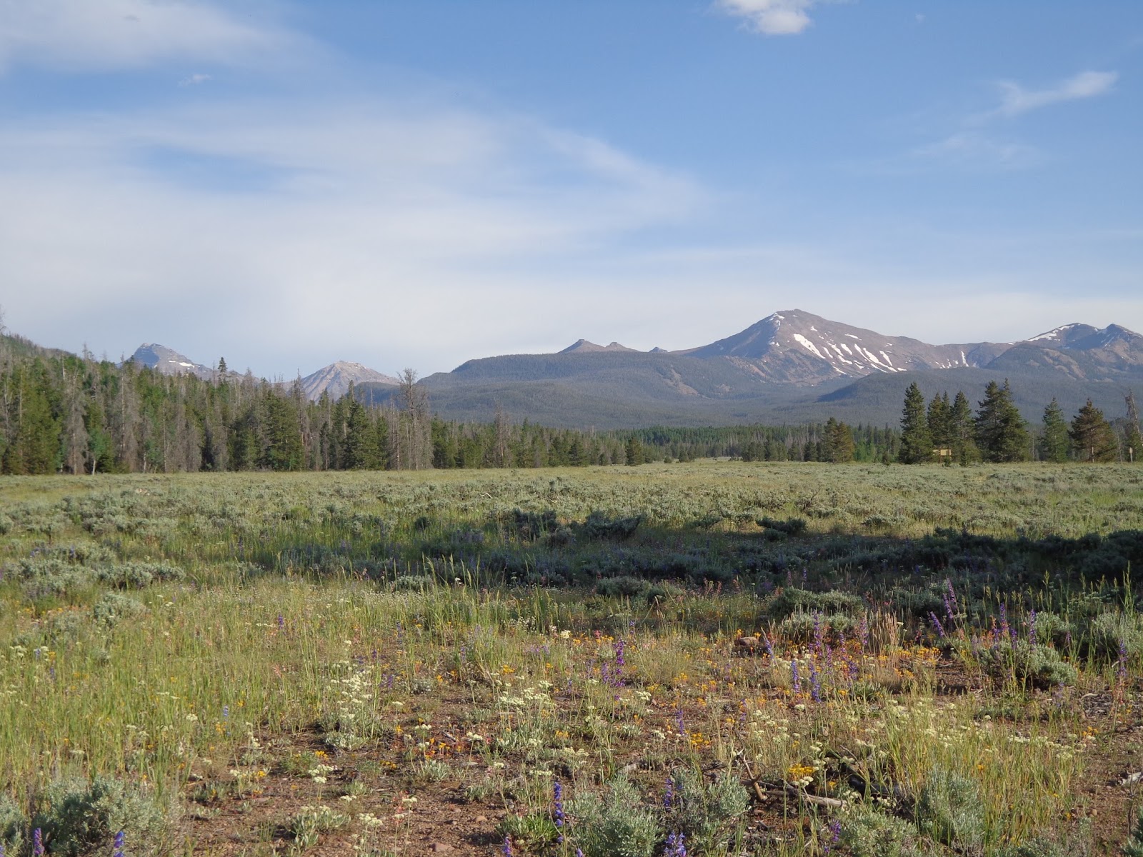
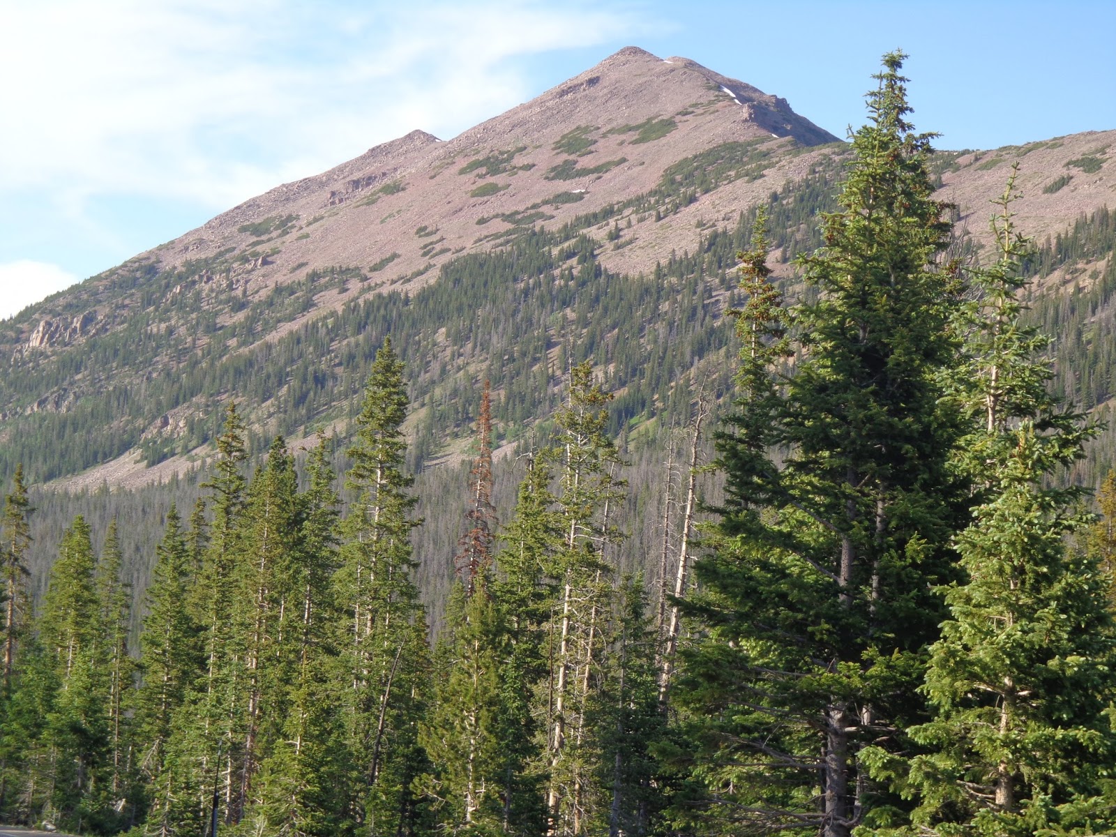
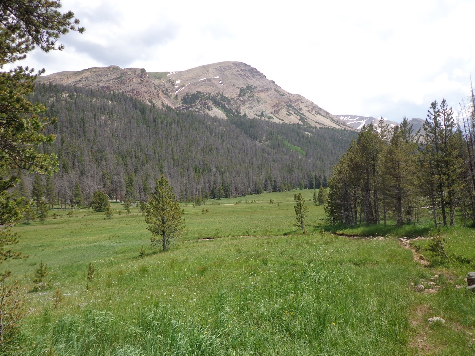
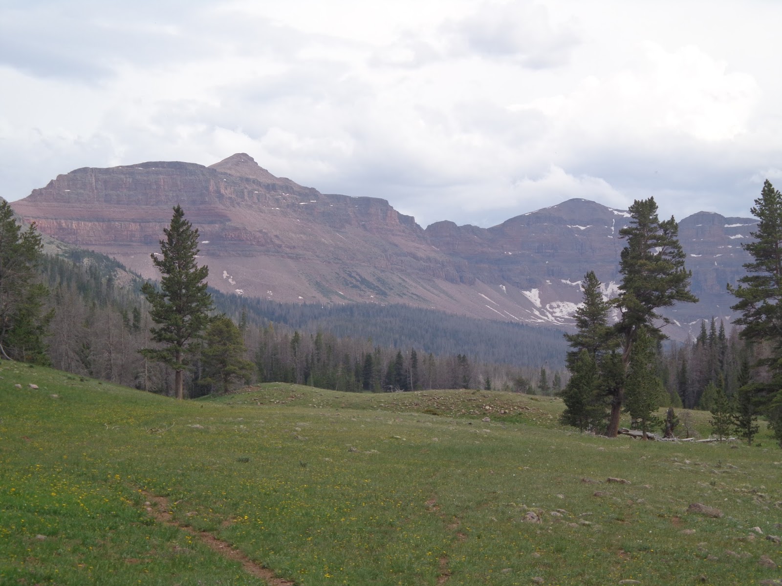
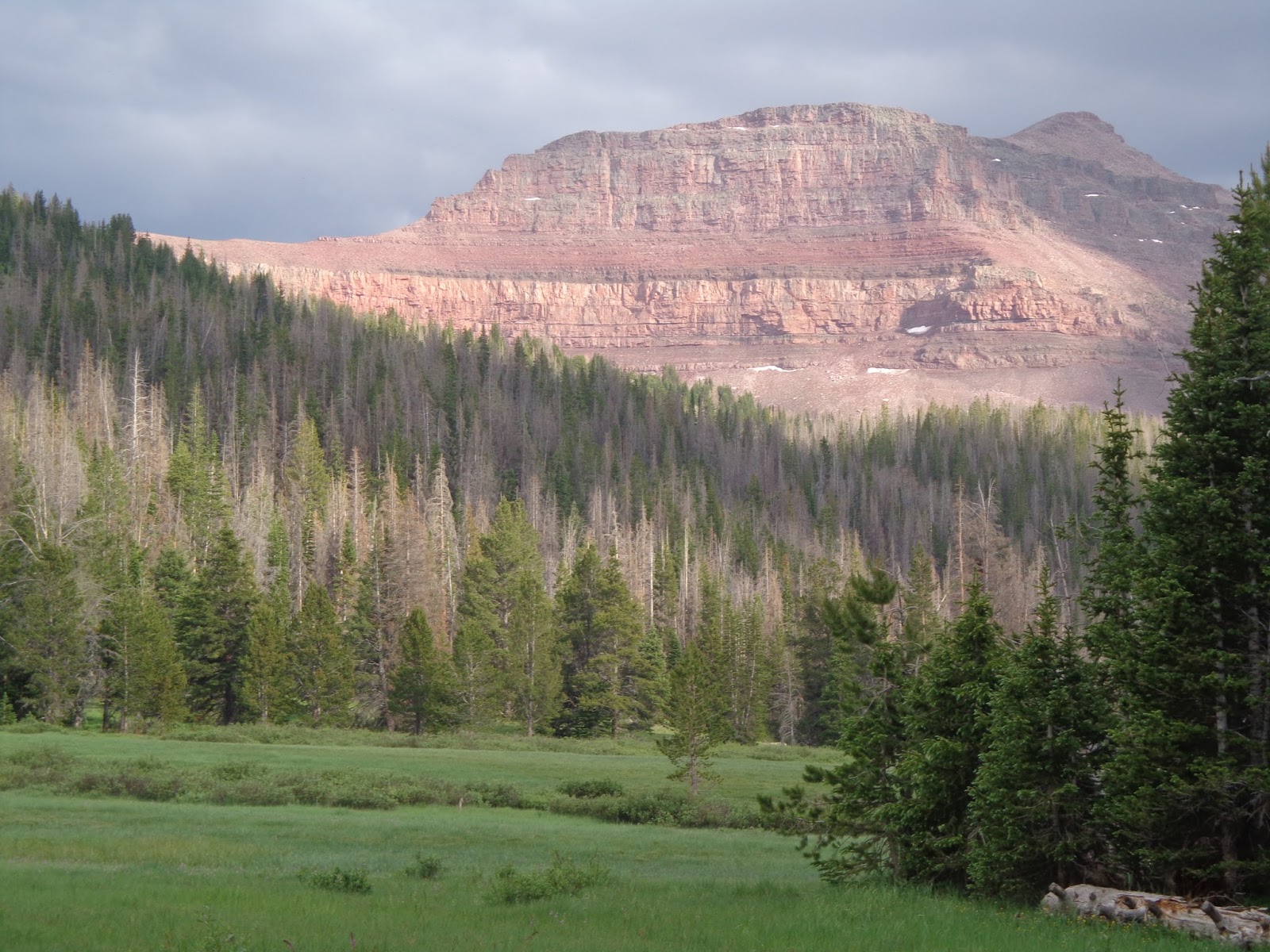
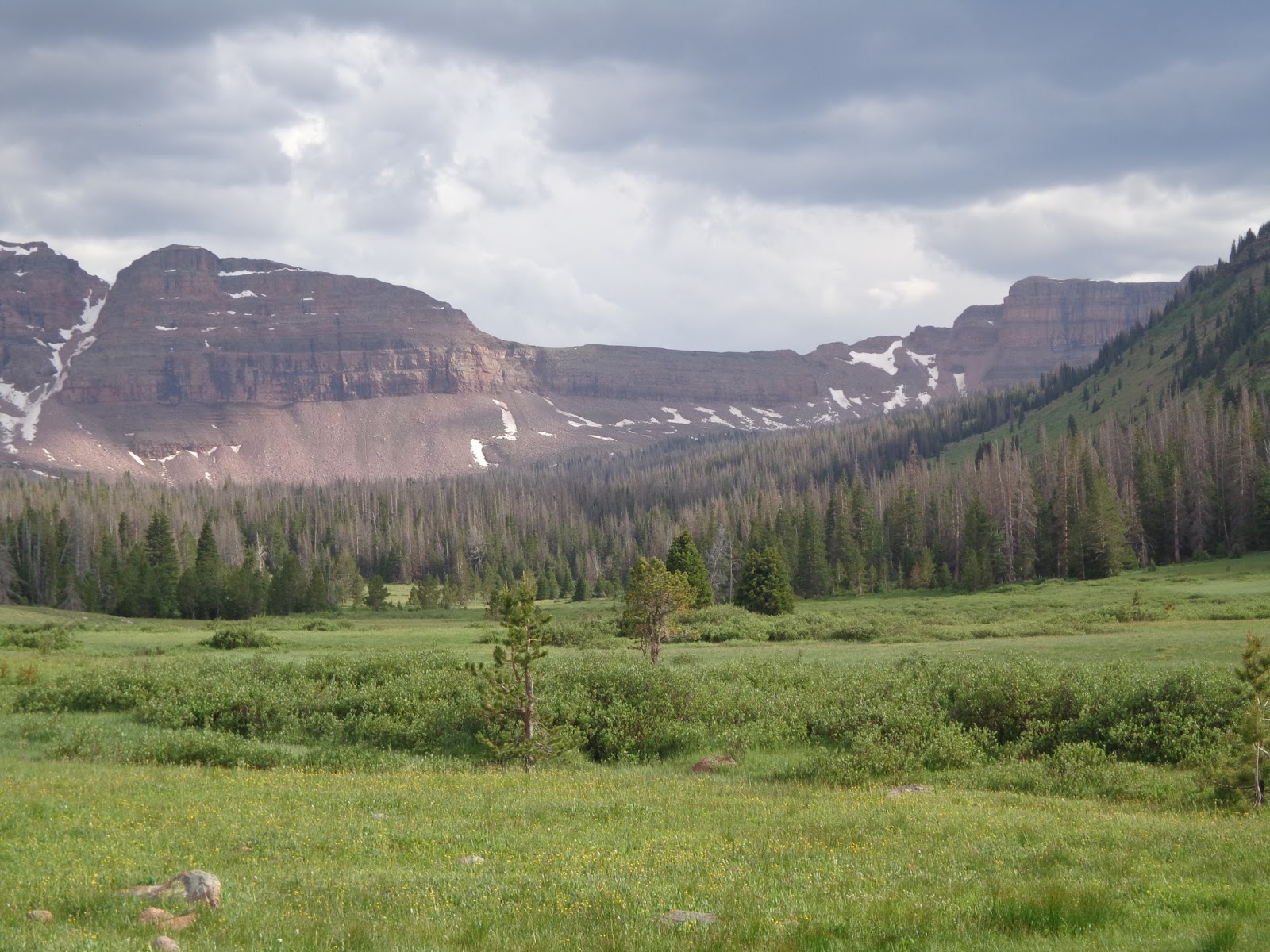
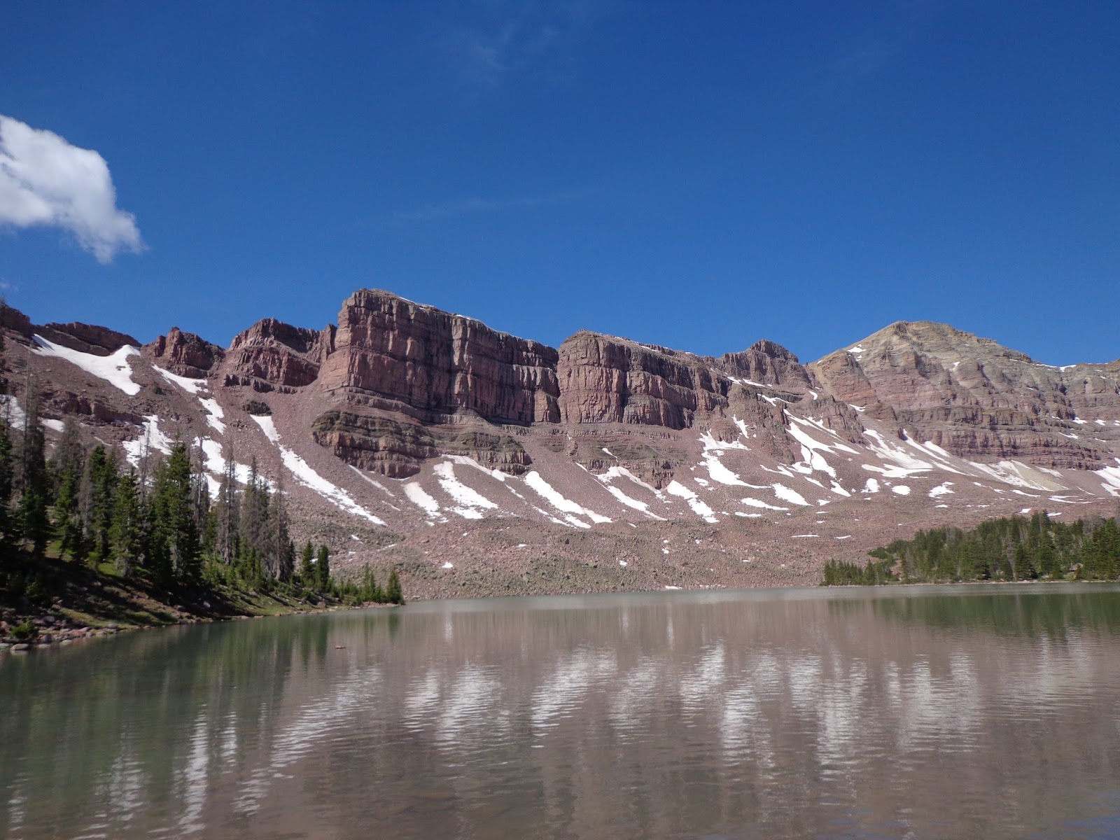
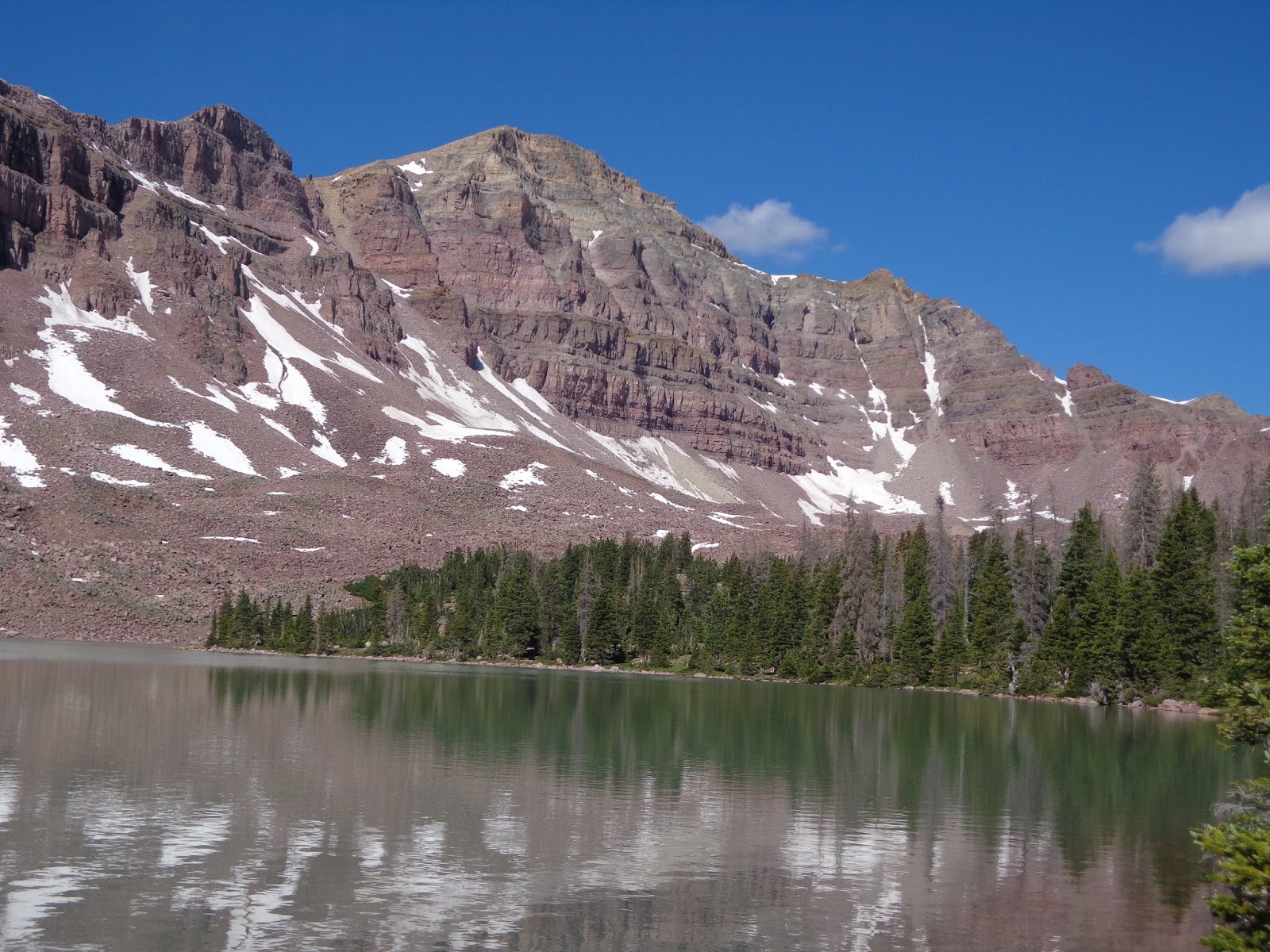
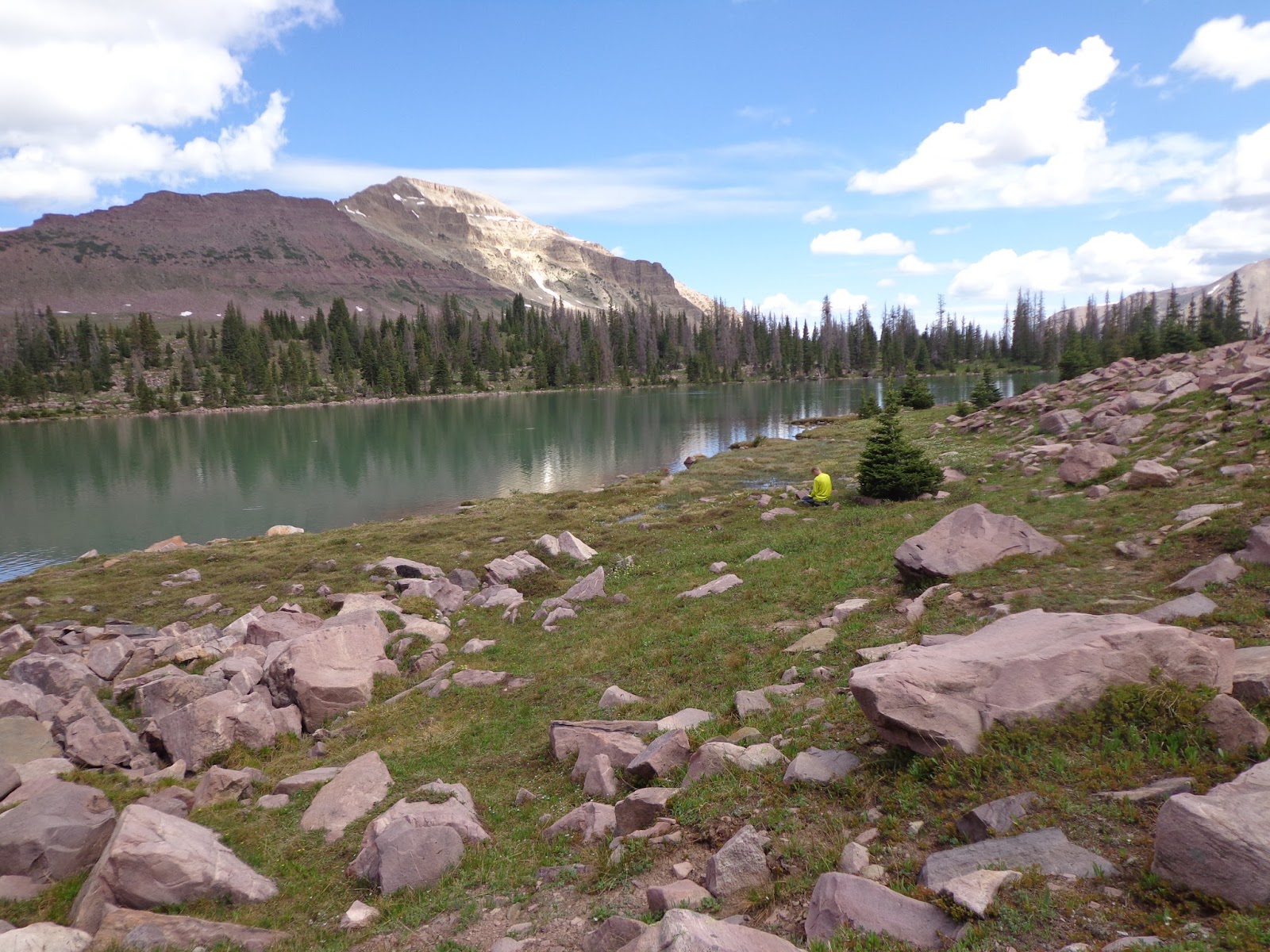
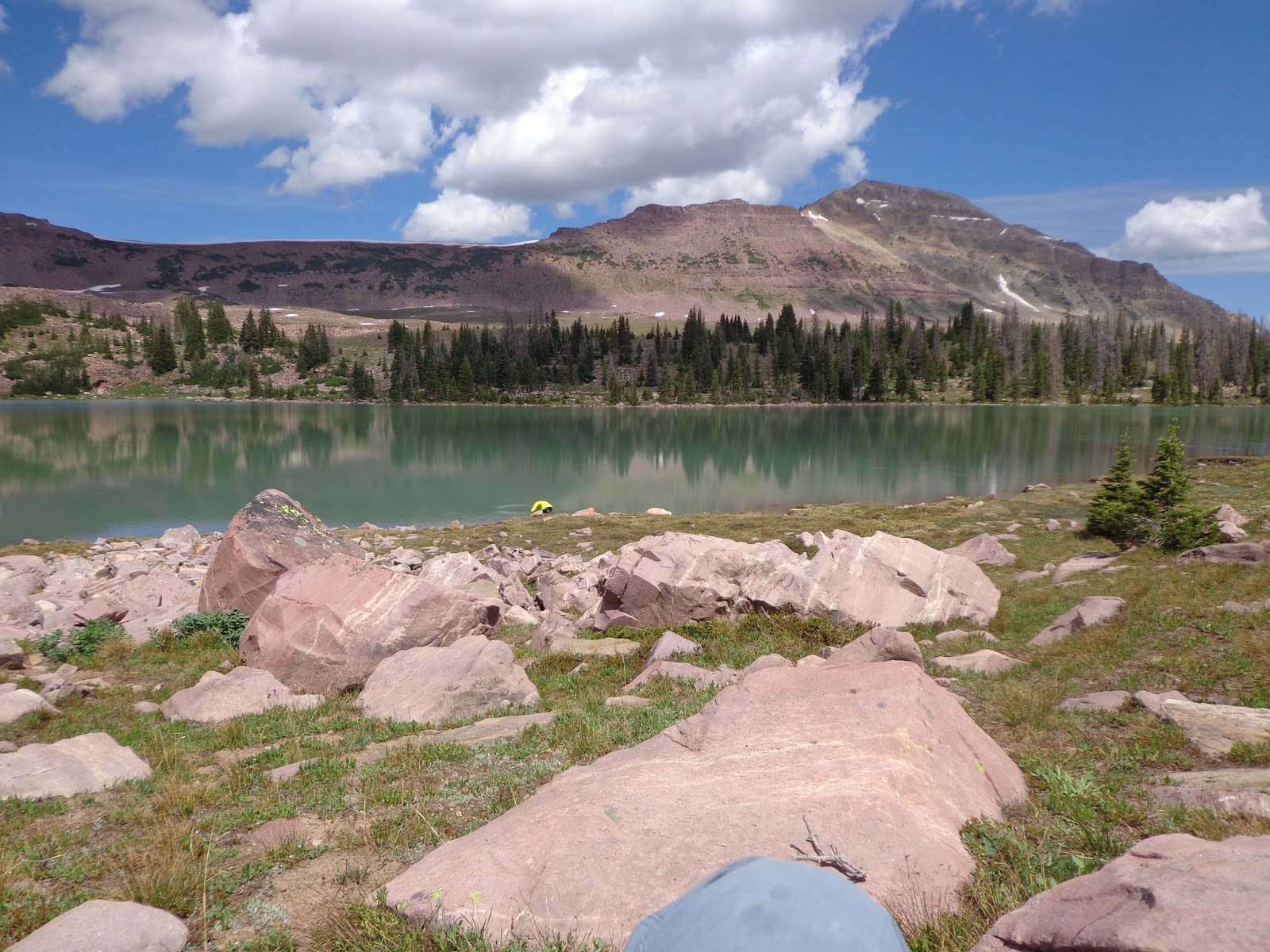
Ostler, Spread Eagle, A-1 and Kletting from near the Bear River ranger station.

Featured image for home page:
slide.jpg
 
Due to some unforeseen complications, we didn't get nearly as early a start the next morning as I wished. We drove to the West Fork Blacks Fork trailhead--or, well, to be technical we drove to the ford and parked there, walking an extra mile and a half or so to the actual trailhead. By coincidence, we ended up about a mile and a half short of our planned destination and didn't quite get to Dead Horse Lake after all until the next day, and we spent a few days at a nice bend in the river well up into the cirque, past Red Knob and Beulah.

DSC03100.JPG

Approaching the Woodpile. I presume that that name predates the big pine beetle bloom of ten years or so ago; what caused all of the tree deaths in this area, anyway?

DSC03103.JPG

Near the ford. No relation to the Ford Focus that I drove in...

DSC03107.JPG

First stream crossing. It ended up being a big hassle to switch shoes out, so we quit after a while. Then we had wet shoes and socks the rest of the trip, though.

It probably couldn't have been avoided anyway. The trail was extremely soggy for much of the way in, and we crossed all kinds of feeder streams coming down off the mountains to add their volume to the West Fork Blacks Fork river, as well as marshy bogs and patches of mud that came up past our ankles and threatened to pull our shoes right off.

DSC03111.JPG

The second stream crossing and my radioactive green shirt, which has the added bonus of showing how out of shape I am still.

DSC03116.JPG


DSC03119.JPG

Tokewanna completely filled our field of view from here at the third stream crossing, where we switched to the other side of the valley and started getting view of Beulah instead. My rinky-dink camera makes it look like a little rock pile in the horizon, but keep in mind that the summit is over 13k feet, the valley floor is only a little over 10k, and the mountain probably isn't much more than half a mile away. When I was looking at it, the peak was barely visible at the top edge of my vision, and the base was equally barely visible at the bottom.

DSC03121.JPG

Third stream crossing came with this handy-dandy footbridge.

DSC03122.JPG

The ruins of an old cabin which I presume once belonged to a tie-hacker.

DSC03123.JPG

Clouds were starting to roll in over Beulah.

DSC03125.JPG

Our destination, still several miles away. Nice view of "Meadow Peak."

DSC03126.JPG


DSC03129.JPG

These two young bull moose came to within about a hundred yards of us.

DSC03130.JPG


DSC03131.JPG


And shortly after that, we had to hunker down in the trees while a hailstorm passed over us. This marks the spot where my momentum for the day started to flag.

DSC03132.JPG


Sun on Meadow Peak after the storm.

DSC03133.JPG


And coming around a corner in the trail, the buttresses of Dead Horse Lake and Dead Horse pass finally come into view. I knew we were close to our destination, but it was getting darker than I liked, and the altitude sickness and general exhaustion were starting to get to me. We ended up not quite getting to the lake after all tonight. Which was fine; there was another party camped there, we discovered the next day, and we had a beautiful, secluded spot all to ourselves for the next couple of days anyway.

DSC03137.JPG

Our camp site, already in shadow, but before we set up the tent. The many cliffs of Mount Beulah all seem to fold into each other at this angle, making it look more like a gentle, shallow pyramid. I really like the forward sub peak in the foreground, though, with its much more reddish color than the main massif behind it.

DSC03142.JPG

Our tent, set up and ready for the approach of sundown.

DSC03144.JPG

Red Knob Pass made up our backdrop.
 
Last edited:
The next day, we went to Dead Horse Lake and otherwise explored the basin. My camera battery was running low, so after taking tons of pictures at the lake, I toned it way down. I ended up letting my son talk me out of going very high up the pass or going in search of Lake Ejod, and instead we spent much of the afternoon just lazing around camp. Which, don't get me wrong, was pretty nice. But it's a bit of a regret. I guess that gives me an excuse to head back some time.

DSC03146.JPG

It's hard to think of this as anything other than "Dead Horse Lake outlet stream" but this really is very early stage West Fork Blacks Fork River here.

DSC03149.JPG

The treeline isn't very far from here.

DSC03151.JPG

Contemplating how to cross the river. We ended up using the fallen tree you can see just ahead.

DSC03157.JPG

The lake is just over this small rise.

DSC03158.JPG

DSC03160.JPG

West Fork Blacks Fork flowing out of Dead Horse Lake here to the right.

DSC03161.JPG

Allsop Pass and the other guy's tent. All in all, we had a lot of solitude on this trip, but there was another party at the lake, which in retrospect made our earlier stopping point turn out to be a good idea after all.

DSC03162.JPG

Although I've never really heard anyone talk about it before, the fact that Dead Horse Lake is obviously colored by rock flour means that this must be a rock glacier at the foot of those cliffs.

DSC03164.JPG


Dead Horse Pass, still a bit snowy.

DSC03166.JPG

"Dead Horse Peak". Again, the camera does a number on scale. The lake is 10,878, and the peak is 12,642.

DSC03169.JPG

Looking back towards "NW Wasatch" and Red Knob.

DSC03170.JPG

Across the lake at an extremely foreshortened Mount Beulah.

DSC03172.JPG

A close up of the (presumed) rock glacier.

DSC03173.JPG

A close up of the pass.

DSC03182.JPG

This view gives some sense of the scale that the other pictures fail to convey.

DSC03183.JPG


A beautiful place to sit and think.

DSC03185.JPG

The main reason I gave up my plan to circumnavigate the entire lake on foot. Scrambling over those boulders didn't look as fun in person as it did in theory.

DSC03188.JPG

Too bad I accidentally got my knee in frame. This would otherwise be one of my favorite pictures.

DSC03194.JPG

Headed back down from the lake towards camp, around lunchtime, with Red Knob Pass looming above us.

Anyway, I have a few more pictures, but they mostly repeat the same scenes I already posted, since we just retraced our steps back out again.

The West Fork Blacks Fork basin is one of the most beautiful I've ever been in. Even in the week of a holiday (July 4th was Saturday; we came out on Friday the 3rd) it was pretty quiet; we saw one guy heading out on our way in, we saw another dad with a few teenagers at the lake while we were there (we walked out together, actually--leapfrogging past each other every time we stopped for a break) and one other guy on the way out who had set up camp even further from the destination than us, with three dogs. Nice and quiet, and I presume on a normal week, even more so. At the trailhead, we saw tons of ATVs getting ready to drive around through the Woodpile, however. Which was actually good--my son had left his Kindle plugged into the car charger at Bear River and the battery was dead on Tuesday morning (part of our delay getting started, as I had to flag down some helpful guy to give us a jump.) I had become a bit paranoid on the way out that the car was going to be dead when we got to it on our way out, and that we wouldn't see anyone at the trailhead for days. The car was fine, but I was actually a little encouraged that had it not been, we would have had a few options, at least.

The ford is fairly deep; knee deep, and although you're supposed to drive through it, without a high clearance vehicle I certainly wouldn't want to, which means that you have to walk almost two extra miles on the little track that has the arrogance to call itself a road. Curiously, after you get to the actual trailhead and pass through the gate, the "trail" looks just like the road, complete with double tracks. I suspect that it was the road, and the forest service just declared by fiat that the road ended sooner and converted a few miles of road into trail by executive order, thus freeing them up from having to keep it quite as maintained.

Once you get well into the forest however, and certainly by the time you cross the official wilderness boundary, the trail is often quite hard to follow, as it disappears into meadows and bogs with some regularity. As I pointed out to my son, it doesn't matter too much; with big mountain ridges on either side of you and a river going the same place you are, it's hard to get actually lost, but having a trail to follow is easier and faster than simply bushwhacking up the valley, so we made an effort to try and follow it as much as we could.

Due to timing issues related to my vacation, we came out a bit earlier in the season than I would have liked. The trails were very muddy and boggy, and the passes had enough snow on them that I decided to give them a... heh, pass rather than climb up them to have nice views towards Lovenia to the east or into Rock Creek in the west. We also had the unfortunate timing to hit peak mosquito bloom, I think. Although we were well prepared and didn't get a single bite, they were all over the place and were extremely aggravating.
 
I suspect that it was the road, and the forest service just declared by fiat that the road ended sooner and converted a few miles of road into trail by executive order, thus freeing them up from having to keep it quite as maintained.

The ranchers that run sheep there have access to and still use that road. One came and opened the gate when I was starting there one year. He gave me a lift on the back of his flatbed to the end. In the rush to catch a ride, I forgot my camera. I was kicking myself for the next ~35 miles.

Also, even late in the year after things have dried out, that lower section of Buck Pasture is a soggy mess like you described.

Nice report.
 
You are correct about the rock glacier. Google around about the glacial history of the Uinta Mountains and you can find an old PDF that talks about it.

Too bad you didn't make it to Ejod. I think it's more scenic than Dead Horse and not all that far away, either.
 
That's my biggest regret too. I'm kind of kicking myself that a combination of three things kept me away: 1) menacing clouds starting to form over Red Knob pass that looked like they were headed our way (turns out they weren't--we didn't get a single drop of rain all day), 2) my son starting to turn a little whiny and not wanting to do much, and since I didn't have a firm plan already in mind, I made the dubious decision to let his attitude influence my decision, and 3) how tired I had been, while still suffering from a bit of altitude sickness, the day before, which made me leery of pushing very hard myself.

All three of them ended up being non-issues, but I didn't know that at the time, and I kind of feel like we totally wasted that whole afternoon. Ah, well. Like I said, now I have an excuse to go back and explore it more thoroughly some time in the future.
 
Nice report and beautiful looking lakes and campsite. I wouldn't put too much stock in your son proclaiming that backpacking isn't for him. I recall complaining about camping among other activities that I eventually grew to love when I was his age.
 
Looks like fun! Give your son another shot or two. Often with kids they need a few days to process things and decide that they really did have a good time when they didn't think so at the time.

Several years ago I took a sedan through the ford. It was awesome being the only low clearance vehicle at the trailhead. The water was ankle deep at the time since it was late in the year.
 
It was knee deep last week. I probably made the right call in walking the extra mile and a half or so. Although I wasn't so sure later in the day when it was starting to get dark, altitude sickness was kicking in, and I was feeling really exhausted.
 
This is great intel because I'm probably headed there in a few weeks. Awesome report. I used to be like your son in that I didn't like camping or anything that made me dirty or smelly. He'll change his mind :).

And a question. You mentioned you drove a Focus to the ford (so much potential for puns there). Was the drive at all sketchy for a little car like that? I drive a Civic, and I've never been on that side of the Uintas, so I don't exactly know what to expect.
 
This is great intel because I'm probably headed there in a few weeks. Awesome report. I used to be like your son in that I didn't like camping or anything that made me dirty or smelly. He'll change his mind :).
It would help if he hadn't stuffed wet socks in a pocket in his pack on the first day and let them sit there getting worse and worse smelling all of the time.

I agree; he'll probably remember this trip fondly and be ready to do it again sometime. I was about his age (just a year older, I think) when I did my first big hiking trip with some other guys, out to Coyote Gulch. Although I enjoyed it immediately, it probably took me a little while to really "get it" too.
Jackson said:
And a question. You mentioned you drove a Focus to the ford (so much potential for puns there). Was the drive at all sketchy for a little car like that? I drive a Civic, and I've never been on that side of the Uintas, so I don't exactly know what to expect.
I did OK. Forest Road 058 is a decent road. Forest Road 063 has a lot of chutzpah calling itself a road. It's a mess. But if you go really slowly and carefully, you should be OK on it. All in all, it takes a lot longer to get from Mirror Lake Hwy to the trailhead (or the ford, in my case, since I didn't go all the way to the TH) than I thought. In fact, part of my complication is that after I started on 058, I started to get worried about how much gas I had in the tank; I actually turned around, drove back to Evanston and filled up just so I wasn't limping back into town on fumes when I was done; or worse yet, not actually making it back without hitting dead empty.

But I didn't bottom out or anything. It just took the better part of two hours to get there, because I had to drive really slowly and carefully.
 

Here's the movie version, for those curious. Includes pictures of Chimney Rock and Scott's Bluff on our way out west, as well as Fantasy Canyon after we were done. Plus; moody spaghetti western style music! What's not to like?

I actually told my son two or three times that trails were for sissies when he was complaining about the clarity of trails we were trying to follow. I thought it was kind of a catchy catch-phrase.
 
Great trip report. This is a place that is on my bucket list to hike to someday. I loved your pictures and the video is Awesome!
 
Similar threads
Thread starter Title Forum Replies Date
Perry West Fork Blacks Fork River Crossing 2017 Trip Planning 9
travel2walk Gros Ventre Wilderness: Granite Creek, West Fork Crystal Creek, Crystal Creek, & Swift Creek - June 2021 Backpacking 8
P West fork of Salt Creek? Trip Planning 4
George_Washington_Hayduke White Roost Canyons (east and west forks) & North Fork of Robbers Roost Canyon Canyoneering 3
WasatchWill UHT - Day 5: West Fork Black Fork to Olga Lake Backpacking 2
WasatchWill UHT - Day 1: West Fork Whiterocks to Fox Lake Backpacking 8
Udink West Fork of Moonshine Wash Hiking & Camping 9
Ross Misery Canyon just east of Zion - west or east fork? Trip Planning 5
DrNed West Fork Black's Fork Trail Head Directions Trip Planning 6
Bill Big West Fork of Red Breaks to The Cosmic Navel Hiking & Camping 48
alene Red Breaks Big West Fork Canyoneering 11
Nick Unnamed lakes of West Fork Black's Fork Trip Planning 15
leatherman West Fork Black's Fork 8/15-8/18 Backpacking 3
Dave West Fork Black's Fork, July 13-14 2012 Backpacking 25
Nick Uintas: Highline TH to West Fork Black's Fork Backpacking 51
W Greetings from the West Side of the Winds (Wind River range) Noobs: Introduce yourself! 5
kwc Fall paddle on the West Branch of the Sacandaga River 10/23/22 On The Water 0
Ellen Zion West Rim Trail, December 2022 Trip Planning 3
scatman West Millcreek Ridge - July 10, 2022 Hiking & Camping 22
Rockskipper Outlook poor for fires in the West General Discussion 8
Titans CEDAR MESA VISITS: OPEN AGAIN// (Extended bridge closure, west of Blanding, on SR-95) General Discussion 5
Bushwacker West Clear Creek Ruin Trip Planning 9
scatman Grandeur Peak, The West Slope Approach - October 31, 2020 Hiking & Camping 7
BJett Dolly Sods Wilderness - West Virginia Backpacking 17
McKee80 Roaring Plains West Wilderness Backpacking 8
Blair Ballard West Temple 3.7.20 Hiking & Camping 2
andyjaggy Bikepacking West Desert Trip Planning 16
westy Cave Canyon, Grand Canyon west Hiking & Camping 5
Yvonne Snow Hike up the West Rim, December 15, 2019 Hiking & Camping 7
SteveR Blueberry Hill and West Elk Pass, Alberta Winter Sports 1
LarryBoy A Route In Between: Mexico to Canada Through the Heart of the West Backpacking 50
chandlerwest Zion - West Rim Loop...........in July???? Hiking & Camping 7
regehr Deseret Peak West Twin Couloir Hiking & Camping 14
DuneElliot Backpacking Scotland's West Highland Way Trip Reports 5
mofca Hello from West Virginia! Noobs: Introduce yourself! 2
Chuck the Mauler Trip ideas near or west of Vegas Trip Planning 8
M Zion West Rim Trail, Early April 2019 Trip Planning 40
Titans Wasson Peak via Hugh Norris trail - Tucson Mountains - SAGUARO NP (WEST) Hiking & Camping 0
scatman Grandeur Peak - West Slope Route - September 3, 2018 Hiking & Camping 12
tomcat32 Backpacking the West Elk Wilderness Backpacking 9
Ross West Canyon hiking Backpacking 2
Ross West Canyon quicksand (a/one want to go lower West/Face/Labyrinth August? Trip Planning 3
blueeyes West Desert Bikepacking Everything Else 13
David Rule Greetings from the Mid-West Noobs: Introduce yourself! 22
Tim Valentine Catalina Island West Side Everything Else 1
Perry Uinta Highline trail - East to West - Mission Accomplished! Backpacking 24
Outdoors24 Zion West Rim Trail in winter Trip Planning 6
powderglut A Day at the West Clark Bench Hiking & Camping 11
JoshuaDyal Beckwith Pass in the West Elks Backpacking 0
Perry West Utah Desert Hiking Opportunities? Trip Planning 7

Similar threads

Back
Top