- Joined
- Dec 11, 2015
- Messages
- 2,094
This trip has been on the back burner for a few years and I made a few adjustments before submitting my permit application in July. As I submitted the application relatively late, the Backcountry office called and let me know that a few campsites I requested were not available. She suggested that I reverse the trip to open up a few campsites which I agreed to. I headed to Yellowstone in September. This is a solo trip and I am really looking forward to it.
After flying into Jackson, I hitchhiked north. The hitchhiking went really well, I wait between 30 seconds and 10 minutes for rides. Then I reach the Colter Bay Visitor Center area. I walk over to the gas station and pick up some snacks and a drink, then walk back to the road. While standing along the road, a couple of Park Rangers pull over in their patrol rigs and, not sure what's up, I pull out my ID and have it out ready for them. They approach, tell me that hitchhiking is not allowed in Grand Teton or Yellowstone and one of them takes my ID and goes back to his car. I explain that hitchhiking is perfectly legal in Yellowstone and that I have a copy of the memorandum on my computer at home. I know that doesn't help but I felt the need to say it. He says it is not legal in either park, and I decide not to argue the point, but tell him that it is legal in Yellowstone. It's a pretty jovial conversation so I'm not too worried. We talk about the Parks and how the summer has been.
The other Ranger exits his vehicle and hands me my ID. He says that they are not going to ticket me but he recommends that I walk to the Visitor Center (VC) and see if a Park employee is headed to Yellowstone. At that point a car slows down and yells at the Rangers that the Suburban ahead of him is driving like an idiot and needs to be pulled over. They tell me that they need to move on, but that one of them will be back in a bit. Rather than walk to the VC, I decide to transfer my gear from my duffel bag to my pack in case I end up having to walk somewhere. I do this really slowly and somehow my thumb keeps sticking out whenever a car goes by. After 20 minutes with no rides, I see a Ranger vehicle headed my way, so I drop my thumb and continue busily packing my backpack. He rolls up, says they had a discussion with the driver, and tells me to throw my gear in back and that he'll give me a ride to the South Entrance. For security reasons, I have to sit in the back seat, but off we go. We have a really interesting conversation about his career, and how lucky he is to have his dream job in his dream location. Real nice guy. He drops me off at the YNP sign, we shake hands, and he turns around and heads south.
I catch another ride within minutes to Grant Village and the guy drops me off at the CG entrance booth. I pay for my site and walk over to my campsite. I have dinner, walk to Yellowstone Lake and back, set up the tent and crawl in. The elk are bugling like crazy to the west and I go to sleep with that.

Day 1
I wake up the next morning, pack my stuff and walk to the gas station/convenience store for breakfast. After that
I walk across the road and head into the trees. My destination is Beaver Creek CS on the north shore of Heart Lake.
Using my compass, I head south, eventually finding this elk trail.

I'm fighting my way through a lodgepole thicket when a bull elk unleashed a bugle. He is hidden in the
trees but sounds like he is about 50 yards away. I pop out into a small meadow and scan the area. My eyes
settle on this pine marten. We inspect each other and it lets me approach to within maybe 30 yards, then
he moves off into the trees.

I continue back into the thicket which lasts longer than I wanted. My goal is to spend as little time as possible
on the trails so that's the price to pay.

In one small clear area, I come upon this lodgepole stripped and broken off by an elk.

I eventually reach a meadow, then a trail and know I am approaching Riddle Lake. I follow the trail to the lake,
skirt along the east side, and continue on past off-trail again. There are these visible swans, as well as some
Canada geese, goldeneye ducks, a pair of osprey, and some sandhill cranes,

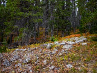
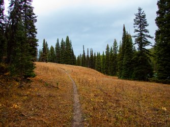
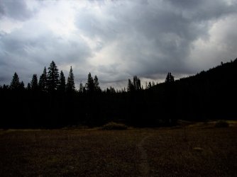
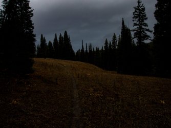
After hiking through some much-easier stands of lodgepoles intermixed with small meadows, I reach the
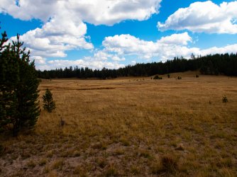
meadow flanking Solution Creek, where I stop for a snack and water. I glass the meadow but see no wildlife.

After crossing the meadow, I head into the lodgepoles again. Most of it is fairly open and mixed with more
small meadows. There are pockets of thicker trees but nothing too bad.

I find several of these lodgepoles along the way. Trees stripped of their bark so bears can lick the sap-rich
cambium layer underneath. From what I can tell, this is sort of a last-resort option when their other food
sources are scarce.

I also pass a lot of logs ripped open by bears looking for ants or yellow jackets and other members of the
bee family.

I come upon this pinedrops plant. It is a saprophyte which means it obtains nourishment from live plants,
in this case, the roots of lodgepole pines.

This is the 5th or 6th ruffed grouse I have seen today. Must be a good year for them.

The last couple of hours are hiking through a beautiful lodgepole forest toward Heart Lake. As evening approached
the elk bugling started up. I continued on, approaching 2-3 bulls bugling. They were moving along pretty quickly
and I never saw them.

A quarter mile or so from the trail I passed this nest. I am guessing an osprey nest.

I arrive at the campsite, have some dinner, set up camp, and crawl into the tent. I listen to a wolf howling for
a while. It sounds like its coming from the northwest part of Heart Lake. I can also hear some distant elk
bugling for a short while.
At some point in the night, I awake to hear something running through the campsite, then down the hill to the lake.
It has soft foot pads, not hooves.
Day 2.
The next morning I walk around the campsite a bit and find this web attached to the campsite sign.

I take the short trail down to the lake by Beaver Creek to pick up some more water for breakfast. A few feet
from the creek I see this wolf track on top of my boot prints from last night. While the water is boiling, I
walk around some more and find tracks heading down the slope to the lake. This wolf must have been what
I heard last night.

Earlier in the morning there was a mist floating above the lake. It burned off pretty soon, leaving this view of
Mt. Sheridan. Somewhere in this photo are 2 loons. I spent an hour earlier watching these loons, another
family of loons to the south, and some mergansers,

I eat breakfast, pack, and hit the trail that leads from camp to the main trail, backtracking wolf tracks the whole
way out. When I hit the main trail, I can see that the tracks come into the trail to camp from the west.
Heading east along the trail, there are no wolf tracks but soon see that the wolf came back onto the trail
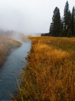
as I near Beaver Creek. This is a view of Beaver Creek looking toward Mt Sheridan and Factory Hill.

I end up following these wolf tracks for most of the morning.

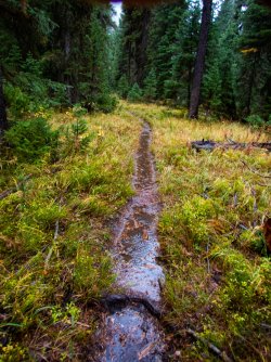
The trail winds mostly through young lodgepole forest but occasionally it passes through a more mature
forest with lodgepoles and spruce. This is a picture of where a porcupine had a meal or two on this lodgepole.

The crossing at Surprise Creek.

Some fall color along the trail. Aside from this spot, there are very few aspens along the way.

An Oregon grape plant with some fall color.

Outlet Creek valley. There's a campsite in the lower end of the valley and one at the top of the valley near
Outlet Lake. I hike past the lower campsite and continue up to where my camp for the night is at the lake.
Chicken Ridge and the Continental Divide are across the valley.

I reach the lake. There are several social trails around the lake and I can't find any signs designating the campsite.
My permit has the coordinates for the campsite so I pull out the Garmin and plug in the coordinates and hit
Go To. This tells me that my camp is actually the lower one, a mile and a half back.
So its dilemma time. I decide that instead of heading back, I'm going to camp somewhere between here and
tomorrow night's camp. I climb up to the main trail and continue on.

I reach the small pass east of the lake and check out a few places to camp. Its a beautiful area but finding an
out of the way place to camp proves difficult. I continue on down off the pass and reach Grouse Creek, which
looks inviting.

I look around for an hour and finally decide on a flat spot away from the creek. I have to admit that I'm not
comfortable camping away from my assigned campsite but know that I will leave no trace of my camping here. A
little before this picture, a lone wolf broke out into a howling session from the ridge you can see to the right
in this picture. I crash in my tent soon after I take this picture.

Day 3
I continue down Grouse Creek leaving the trail when it heads into the trees. It is a beautiful morning and I'd
prefer to stay in the meadows bordering the creek. I can hear sandhill cranes trumpeting as I continue down
valley.

My first view of the South Arm of Yellowstone Lake.

Approaching the South Arm of Yellowstone Lake. There are 2 adult sandhill cranes and at least one youngster
in Grouse Creek at it drains across this delta between me and the South Arm. On the lake, there are swans,
geese, and ducks.

Peale Island in the South Arm. I am back on the trail. There are hundreds of ducks on the lake here. A few
minutes earlier, an elk was bugling to the south.

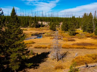
Chipmunk Creek. A new looking beaver dam has created a nice pond upstream. I hang out here awhile. The day
is incredibly gorgeous and I just feel like relaxing a bit here.

I eventually move on from Chipmunk Creek. I am approaching the north end of Two Ocean Plateau. The sun is
really hot as I cross the meadow but also feels good.

I reach the trail that takes me to tonight's camp on the Southeast Arm of Yellowstone Lake. The point of land just
left of the center of the photo is where camp is. If I remember correctly, Langford Cairn is the name of the peak
to the right.

After arriving at camp, the waterfowl started swimming and flying by headed a little south to roost for the night.
This group of pelicans was the first I saw but over the next hour or so, several groups swam south to the southeast
extreme of Southeast Arm. By the time I turned in for the evening, there were dozens of pelicans, and hundreds
of swans, geese, and ducks. I believe that is Mt Schultz in the far back.

Day 4
Another gorgeous day. This is a family of river otters swimming past. For much of the morning, the bird life that
had swum/flew past heading south last evening now headed back north for the day. A virtual parade it was.

After a leisurely morning, I packed and headed back west retracing some of yesterday's travels. Once I reached the
trail heading up Chipmunk Creek I headed south. I followed black bear tracks back to the meadow west of Two
Ocean Plateau. I was surprised that the bear stayed in the open so long but as soon as it neared a stringer of trees it left
the trail toward them.

This wetland was mostly dry, another testament to the hot dry summer.

The lower section of trail heading up Chipmunk Creek. Not much of a trail here but further up it becomes a real trail.
Although not so apparent here, this valley is, IMHO, one of the prettiest in Yellowstone.

Chipmunk Creek.

Further up the valley.

A log ripped up by a bear fairly recently. There was evidence of a lot of recent bear activity along this trail. No bears
were seen though.

A close-up of the bear log. You can see a few yellow jackets, as well as a piece of the nest in the upper right, in this
photo. In years of poor berry crops, ants and bees seem to become really important to the bears here. I saw only
one bear scat filled with berries on this trip, leading me to think the huckleberry crop was poor.

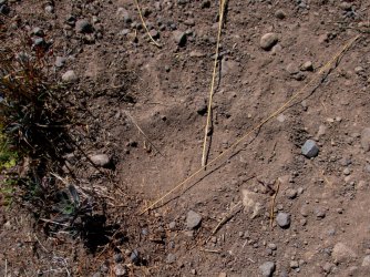
A wolf track alongside a griz track. Looks like a busy trail.

Grizzly hair. I found a couple more trees along the way with hair on them.

Another bear shredded tree.

Nearing the top of the Chipmunk Creek watershed. Chipmunk Creek is off to the right (east) but this area drains into
it. I love this type of landscape, treed, yet open.

At the next campsite, Upper Passage Creek. This is the first day I haven't seen anyone. I've seen 6 people so far. I
won't see anyone else until tomorrow evening.

I leave camp and hike up near the headwaters of Passage Creek. There's lots of recent elk sign around. Hopefully I
hear some bugling tonight.

After exploring Passage Creek I head north from camp a bit. The west face of Eagle Peak is to the left, Table Mountain
is the broad plateau in the middle, and The Turret is the outcrop to the right. According to the YNP website, this area
in front burned in 1988. Scanning the area with binoculars, I eventually find a group of ~20 elk moving out to feed
off to the right of this photo.

Some old snags left over from the fires. Another beautiful evening.

I returned to camp. Just before dark, the bugling began. Three - four bulls raising a ruckus. The bugles were sounding
out with great frequency for 10 minutes or so. I figured I'd be more comfortable listening to the bugling in my sleeping
bag. As I walked to my tent, feeling very concealed (within the trees) from the elk out in the meadows, a cow barked
the alarm and everything went quiet. I heard one more bugle that night.
Day 5
Another beautiful day. I left camp early (for me). It is a cool morning, but the climb out quickly warmed me. Soon I
was on the ridge and headed to the Snake River. Looking NE.

I reach the pass - Passage Creek/Chipmunk Creek drainage to the north, Crooked Creek to the west, Plateau Creek to
the south. The clouds look threatening, at one point the the winds picked up leading me to think that rain was imminent,
but no rain fell. At this point I decide to head off trail to the west and work my way to the next campsite at Fox Creek.

The terrain and forest were very inviting. It should be a nice easy downhill hike to camp.

I hike through several meadows like this. The terrain is filled with little drainages, wet seeps, and small ridges to keep
it interesting. Much better than slogging along the trail.

I run into this mule deer along the way. She moves off quietly barely acknowledging my presence.

I come upon this pine squirrel midden that has been raided by a grizzly. These squirrels spent a lot of time gathering
whitebark pine cones for winter and in an hour or so, the grizzly has dug out a lot of the supply. The seeds in these
cones are vital to Yellowstone Ecosystem grizzlies.

As I move lower down the ridge, I enter a large burned area. For the most part, the going is pretty easy.

I continue down slope for much of the afternoon. I eventually reach this unnamed creek that soon flows into the
Snake River. Just west (left) of here I ran into 2 elderly men with backpacks. One of them was hiking the CDT from
Canada to as far south as he could reach before winter set in. He was hoping to reach Steamboat before having to
quit. His friend had joined him for several weeks of the trek. His trail name was Poptart; I can't remember his friend's
trail name. They were having a great time.

So I overshot camp by 1/4 mile west and a bit south. I hike back up to camp and spend much longer than usual
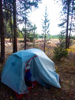
figuring out where to camp. I end up about 100 yards west of this sign, by the same creek the above picture was taken.
Where I camped the creek was much smaller than seen above.

I have a nice view from the campsite and the creek is only 100 feet away.

During the night, something hits one of the guy lines to the tent fly. My head is right next to where the guy line attaches
to the fly, so it wakes me up. I listen. I can hear the soft foot steps of something moving around the tent. It is slow
and methodical, the way a bear moves. At one point, I can hear that it is 2 animals moving around. I listen for a few
minutes as they move around then away from the tent. They walk away in the direction of the campsite sign, and
where, I assume most people camp.
It is quiet for another 10 minutes or so, then I hear them approaching my tent again. One of them hits another guy
line with their leg, I assume it is the cub. They mill around for a few minutes, then start walking up the creek drainage. Once
I can no longer hear them walking, the cub did something that irked the sow, as she let out one of her warning growls.
A minute or so later, she lets out another one, this one noticeably farther away. I assume that cub is lagging behind a
bit and she wants it to keep up. I check the time. it is around 3:30 am. I smile to myself, and soon fall asleep.
Day 6
I wake up to yet another beautiful morning. After breakfast I pack and hit the trail. I am heading down to the Snake
River trail at this point.

The Snake River valley. I will spend all day hiking along the Snake River.

Looking over the Snake River at the east ridge of Barlow Peak.

This is where the trail crosses the Snake River. The easier crossing was off to the right a bit. I grab some water while I'm here.

An elk wallow. Looks and smells like a busy fall here.

Hiking along, I spot porcupine tracks in the trail. They have such a unique foot pad. It looks like a couple of claw
marks in the sand a bit above the foot pad. The porcupine is traveling in the opposite direction as me. I end up on its
back trail for nearly an hour.

Below are marks left by the tail drag. One of the few times I have seen this.

Mount Hancock over the Snake River valley. This side of the valley has burned in the last few years and the sun is baking
me. I am guzzling water at this point.

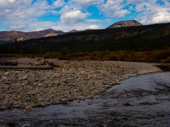
Some rough water on the Snake River about 1 mile upstream of Sickle Creek.

Mt Sheridan dominates the vistas in this area.

Sickle Creek just before it dumps into the Snake R. The slope is the south terminus of Chicken Ridge, the same Chicken
Ridge that runs east along the Outlet Creek valley.

Camp 6 along the Snake River.

The Snake R by camp with the top of Mt Sheridan looming over.

Day 7
After crossing the Snake River close to camp, this trail winds its way through the trees to the next crossing.

The view back after the second crossing.

I continued on to the junction of the Snake River trail and the Basin Creek Cutoff trail. I followed the Basin Creek trail a bit, then
go off-trail again.

Within a few minutes I arrived at this meadow and Basin Creek.

I crossed the creek and headed up the adjacent slope. This is looking at the upper end of the meadow.

I head into the lodgepole forest. Lots of bear sign in here. A real pleasant hike over the ridge to camp at Basin Creek Lake.

Young huckleberry plants showing their fall colors.

As I gained altitude on the ridge, the views opened up. Mt. Hancock in the back right, the long ridge is part of Big
Game Ridge North. The Snake River winds through the bottom.

There are a few small basins on the ridge. This one is pretty empty but the other one that I passed was dry. There were
some elk and deer tracks in the sand and mud.

Here is the other one. Bone dry. Chicken Ridge in the way back.

Camp 7 is in the trees left of center. Behind are the lower slopes of Mt Sheridan, which is to the back right.

The afternoon is cloudy with on and off rain. I decide to start a fire to ward off the chill. Same elk antlers as were in
@scatman's Heart Lake TR, if I remember correctly.

Later in the day, I decide to take a hike on the lower slopes of Mt Sheridan. Looking down on Basin Creek Lake with
the ridge I hiked over earlier this day, in the back.

The slopes above camp. I expected to run into some elk up here but no luck. Lots of sign though. I had to turn around
soon after this photo due to oncoming darkness.

Day 8
After leaving my tent, it was apparent that a storm system was moving in. I ate a couple granola bars, packed and left.
This was my last day out on this trip and didn't feel like enduring who knows what. A few minutes later I was hunkered
down under some spruce trees as the first squall blasted through. That cleared after 15 minutes.
After the squall, I heard some bugling from the ridge to the west. I pulled out the binoculars and scanned the ridge. I
ended up watching a loose group of 7-8 bulls moving around the upper slopes. Several more bugles rang out as I
watched them. Eventually they moved down the slopes and most of them were hidden by trees or terrain. I decided
to move on. So much for getting out of here ASAP.

Soon after I reach this meadow.

When the clouds lifted, the light hitting the meadow was spectacular. As I wound my way around the meadow, I reached
the correct angle for this rainbow to become visible. Since Red Creek is the only named creek to run into this meadow,
seems like it should be called Red Creek Meadow.

The trail on the ridge along Red Creek. Lots of elk, bear, and wolf sign through here.

I am guessing but maybe this is why it's called Red Creek.

A subalpine fir marked up by a bear.

Looking up the Snake River. The weather has been deteriorating rapidly the last 1/2 hour. A steady rain has been falling.
That's Red Creek draining into the Snake R.

As I followed the trail down to the Snake River, black bear tracks appeared. I had seen some tracks earlier on the trail
by camp and assumed it was the same bear. I eventually saw a cub track which matched the sow and cub tracks by camp.

The Snake River crossing was cold. It was pretty chilly now. After crossing the river, I saw someone and lightly called out
to them. I think I scared the cra* out of her as she probably thought no one else was out. There were 3 tents near the
river just upstream of the crossing and she was part of that group. I dried my feet, and headed on down the trail,
eventually reaching the Snake River Hot Springs area.

I reached the trail to the hot springs and was greeted by this "sign". I walked down the trail to the junction of the hot
creek and the river. After a minute or so, I heard a voice call out. I looked towards the trees and there were 4 guys exiting
the forest and headed my way. I waved. They approached and looked tired and soaked. Their packs had fishing gear
strapped to the outside. It was snowing at this point.
Long story short, they had lost the trail immediately after crossing the Snake River at the South Entrance and had
bushwhacked here the whole way (~5 miles), thinking the trail was next to the river. They were planning to camp for
3-4 nights but at this point were unsure if they would stay more than 1 night. Luckily their campsite was only a quarter
mile or so away. I hope they were able to start a fire and warm/dry themselves. They had come from Alabama or some
state in that region (a long effin way) and it would be a shame to need to bail.

The four followed me (on the other side of the hot springs creek) until the bridge. I explained where their camp was and they
moved up the trail looking pretty dispirited.

By this time the trail was pretty sloppy. It was still a nice hike though the forest. Last time I was here with a college friend,
we saw a black bear in this stretch of trail. I was hoping for similar luck, but not this time.

Some baneberry along the trail.

Looking back at the last hot springs before the road.

I hiked out, crossed the Snake River at the South Entrance, walked south a couple hundred yards, and stuck my thumb out.
It took about a minute to catch a ride in the rain/snow mix. I caught a ride with a guy and his daughter to the Headwaters
Lodge a couple miles south. I went in, asked the maitre'd about dinner. She explained that due to covid, they were only
allowing a few people in at a time and that it was a crapshoot whether I would be seated or not. A few minutes later she
said there was a guy with reservations for one that might let me join him. I said that sounded great. She explained that I
should come wait in line but when he arrived, she would ask him about letting me join him.
I then went to the lodging counter and asked about a cabin/shower/laundry change. The attendant at the front desk told
me that to use the shower or the laundry, I needed to rent a campsite/cabin/room. I told her that I had used the laundry
before without having rented a room but also said I was interested in a cabin. She set me up in a cabin and after paying,
off I went. The hot shower felt so-o-o-o good. I headed over to the laundry room and started a load.
After a while, I went to the restaurant and waited in line briefly. After a 10-15 minute wait, the maitre'd came over and said
the man agreed that I could join him. We met and went to the table. He had been fishing in southern Yellowstone's
backcountry for the past 10 days, moving from campsite to campsite along the way. We had a lot to talk about. After dinner,
I finished the laundry and went to my cabin, and fell asleep pretty quickly.
The next morning, I packed for my next (shorter) trek, and headed to the restaurant for breakfast. (TBC...)
After flying into Jackson, I hitchhiked north. The hitchhiking went really well, I wait between 30 seconds and 10 minutes for rides. Then I reach the Colter Bay Visitor Center area. I walk over to the gas station and pick up some snacks and a drink, then walk back to the road. While standing along the road, a couple of Park Rangers pull over in their patrol rigs and, not sure what's up, I pull out my ID and have it out ready for them. They approach, tell me that hitchhiking is not allowed in Grand Teton or Yellowstone and one of them takes my ID and goes back to his car. I explain that hitchhiking is perfectly legal in Yellowstone and that I have a copy of the memorandum on my computer at home. I know that doesn't help but I felt the need to say it. He says it is not legal in either park, and I decide not to argue the point, but tell him that it is legal in Yellowstone. It's a pretty jovial conversation so I'm not too worried. We talk about the Parks and how the summer has been.
The other Ranger exits his vehicle and hands me my ID. He says that they are not going to ticket me but he recommends that I walk to the Visitor Center (VC) and see if a Park employee is headed to Yellowstone. At that point a car slows down and yells at the Rangers that the Suburban ahead of him is driving like an idiot and needs to be pulled over. They tell me that they need to move on, but that one of them will be back in a bit. Rather than walk to the VC, I decide to transfer my gear from my duffel bag to my pack in case I end up having to walk somewhere. I do this really slowly and somehow my thumb keeps sticking out whenever a car goes by. After 20 minutes with no rides, I see a Ranger vehicle headed my way, so I drop my thumb and continue busily packing my backpack. He rolls up, says they had a discussion with the driver, and tells me to throw my gear in back and that he'll give me a ride to the South Entrance. For security reasons, I have to sit in the back seat, but off we go. We have a really interesting conversation about his career, and how lucky he is to have his dream job in his dream location. Real nice guy. He drops me off at the YNP sign, we shake hands, and he turns around and heads south.
I catch another ride within minutes to Grant Village and the guy drops me off at the CG entrance booth. I pay for my site and walk over to my campsite. I have dinner, walk to Yellowstone Lake and back, set up the tent and crawl in. The elk are bugling like crazy to the west and I go to sleep with that.
Day 1
I wake up the next morning, pack my stuff and walk to the gas station/convenience store for breakfast. After that
I walk across the road and head into the trees. My destination is Beaver Creek CS on the north shore of Heart Lake.
Using my compass, I head south, eventually finding this elk trail.
I'm fighting my way through a lodgepole thicket when a bull elk unleashed a bugle. He is hidden in the
trees but sounds like he is about 50 yards away. I pop out into a small meadow and scan the area. My eyes
settle on this pine marten. We inspect each other and it lets me approach to within maybe 30 yards, then
he moves off into the trees.
I continue back into the thicket which lasts longer than I wanted. My goal is to spend as little time as possible
on the trails so that's the price to pay.
In one small clear area, I come upon this lodgepole stripped and broken off by an elk.
I eventually reach a meadow, then a trail and know I am approaching Riddle Lake. I follow the trail to the lake,
skirt along the east side, and continue on past off-trail again. There are these visible swans, as well as some
Canada geese, goldeneye ducks, a pair of osprey, and some sandhill cranes,
After hiking through some much-easier stands of lodgepoles intermixed with small meadows, I reach the
meadow flanking Solution Creek, where I stop for a snack and water. I glass the meadow but see no wildlife.
After crossing the meadow, I head into the lodgepoles again. Most of it is fairly open and mixed with more
small meadows. There are pockets of thicker trees but nothing too bad.
I find several of these lodgepoles along the way. Trees stripped of their bark so bears can lick the sap-rich
cambium layer underneath. From what I can tell, this is sort of a last-resort option when their other food
sources are scarce.
I also pass a lot of logs ripped open by bears looking for ants or yellow jackets and other members of the
bee family.
I come upon this pinedrops plant. It is a saprophyte which means it obtains nourishment from live plants,
in this case, the roots of lodgepole pines.
This is the 5th or 6th ruffed grouse I have seen today. Must be a good year for them.
The last couple of hours are hiking through a beautiful lodgepole forest toward Heart Lake. As evening approached
the elk bugling started up. I continued on, approaching 2-3 bulls bugling. They were moving along pretty quickly
and I never saw them.
A quarter mile or so from the trail I passed this nest. I am guessing an osprey nest.
I arrive at the campsite, have some dinner, set up camp, and crawl into the tent. I listen to a wolf howling for
a while. It sounds like its coming from the northwest part of Heart Lake. I can also hear some distant elk
bugling for a short while.
At some point in the night, I awake to hear something running through the campsite, then down the hill to the lake.
It has soft foot pads, not hooves.
Day 2.
The next morning I walk around the campsite a bit and find this web attached to the campsite sign.
I take the short trail down to the lake by Beaver Creek to pick up some more water for breakfast. A few feet
from the creek I see this wolf track on top of my boot prints from last night. While the water is boiling, I
walk around some more and find tracks heading down the slope to the lake. This wolf must have been what
I heard last night.
Earlier in the morning there was a mist floating above the lake. It burned off pretty soon, leaving this view of
Mt. Sheridan. Somewhere in this photo are 2 loons. I spent an hour earlier watching these loons, another
family of loons to the south, and some mergansers,
I eat breakfast, pack, and hit the trail that leads from camp to the main trail, backtracking wolf tracks the whole
way out. When I hit the main trail, I can see that the tracks come into the trail to camp from the west.
Heading east along the trail, there are no wolf tracks but soon see that the wolf came back onto the trail
as I near Beaver Creek. This is a view of Beaver Creek looking toward Mt Sheridan and Factory Hill.
I end up following these wolf tracks for most of the morning.
The trail winds mostly through young lodgepole forest but occasionally it passes through a more mature
forest with lodgepoles and spruce. This is a picture of where a porcupine had a meal or two on this lodgepole.
The crossing at Surprise Creek.
Some fall color along the trail. Aside from this spot, there are very few aspens along the way.
An Oregon grape plant with some fall color.
Outlet Creek valley. There's a campsite in the lower end of the valley and one at the top of the valley near
Outlet Lake. I hike past the lower campsite and continue up to where my camp for the night is at the lake.
Chicken Ridge and the Continental Divide are across the valley.
I reach the lake. There are several social trails around the lake and I can't find any signs designating the campsite.
My permit has the coordinates for the campsite so I pull out the Garmin and plug in the coordinates and hit
Go To. This tells me that my camp is actually the lower one, a mile and a half back.
So its dilemma time. I decide that instead of heading back, I'm going to camp somewhere between here and
tomorrow night's camp. I climb up to the main trail and continue on.
I reach the small pass east of the lake and check out a few places to camp. Its a beautiful area but finding an
out of the way place to camp proves difficult. I continue on down off the pass and reach Grouse Creek, which
looks inviting.
I look around for an hour and finally decide on a flat spot away from the creek. I have to admit that I'm not
comfortable camping away from my assigned campsite but know that I will leave no trace of my camping here. A
little before this picture, a lone wolf broke out into a howling session from the ridge you can see to the right
in this picture. I crash in my tent soon after I take this picture.
Day 3
I continue down Grouse Creek leaving the trail when it heads into the trees. It is a beautiful morning and I'd
prefer to stay in the meadows bordering the creek. I can hear sandhill cranes trumpeting as I continue down
valley.
My first view of the South Arm of Yellowstone Lake.
Approaching the South Arm of Yellowstone Lake. There are 2 adult sandhill cranes and at least one youngster
in Grouse Creek at it drains across this delta between me and the South Arm. On the lake, there are swans,
geese, and ducks.
Peale Island in the South Arm. I am back on the trail. There are hundreds of ducks on the lake here. A few
minutes earlier, an elk was bugling to the south.
Chipmunk Creek. A new looking beaver dam has created a nice pond upstream. I hang out here awhile. The day
is incredibly gorgeous and I just feel like relaxing a bit here.
I eventually move on from Chipmunk Creek. I am approaching the north end of Two Ocean Plateau. The sun is
really hot as I cross the meadow but also feels good.
I reach the trail that takes me to tonight's camp on the Southeast Arm of Yellowstone Lake. The point of land just
left of the center of the photo is where camp is. If I remember correctly, Langford Cairn is the name of the peak
to the right.
After arriving at camp, the waterfowl started swimming and flying by headed a little south to roost for the night.
This group of pelicans was the first I saw but over the next hour or so, several groups swam south to the southeast
extreme of Southeast Arm. By the time I turned in for the evening, there were dozens of pelicans, and hundreds
of swans, geese, and ducks. I believe that is Mt Schultz in the far back.
Day 4
Another gorgeous day. This is a family of river otters swimming past. For much of the morning, the bird life that
had swum/flew past heading south last evening now headed back north for the day. A virtual parade it was.
After a leisurely morning, I packed and headed back west retracing some of yesterday's travels. Once I reached the
trail heading up Chipmunk Creek I headed south. I followed black bear tracks back to the meadow west of Two
Ocean Plateau. I was surprised that the bear stayed in the open so long but as soon as it neared a stringer of trees it left
the trail toward them.
This wetland was mostly dry, another testament to the hot dry summer.
The lower section of trail heading up Chipmunk Creek. Not much of a trail here but further up it becomes a real trail.
Although not so apparent here, this valley is, IMHO, one of the prettiest in Yellowstone.
Chipmunk Creek.
Further up the valley.
A log ripped up by a bear fairly recently. There was evidence of a lot of recent bear activity along this trail. No bears
were seen though.
A close-up of the bear log. You can see a few yellow jackets, as well as a piece of the nest in the upper right, in this
photo. In years of poor berry crops, ants and bees seem to become really important to the bears here. I saw only
one bear scat filled with berries on this trip, leading me to think the huckleberry crop was poor.
A wolf track alongside a griz track. Looks like a busy trail.
Grizzly hair. I found a couple more trees along the way with hair on them.
Another bear shredded tree.
Nearing the top of the Chipmunk Creek watershed. Chipmunk Creek is off to the right (east) but this area drains into
it. I love this type of landscape, treed, yet open.
At the next campsite, Upper Passage Creek. This is the first day I haven't seen anyone. I've seen 6 people so far. I
won't see anyone else until tomorrow evening.
I leave camp and hike up near the headwaters of Passage Creek. There's lots of recent elk sign around. Hopefully I
hear some bugling tonight.
After exploring Passage Creek I head north from camp a bit. The west face of Eagle Peak is to the left, Table Mountain
is the broad plateau in the middle, and The Turret is the outcrop to the right. According to the YNP website, this area
in front burned in 1988. Scanning the area with binoculars, I eventually find a group of ~20 elk moving out to feed
off to the right of this photo.
Some old snags left over from the fires. Another beautiful evening.
I returned to camp. Just before dark, the bugling began. Three - four bulls raising a ruckus. The bugles were sounding
out with great frequency for 10 minutes or so. I figured I'd be more comfortable listening to the bugling in my sleeping
bag. As I walked to my tent, feeling very concealed (within the trees) from the elk out in the meadows, a cow barked
the alarm and everything went quiet. I heard one more bugle that night.
Day 5
Another beautiful day. I left camp early (for me). It is a cool morning, but the climb out quickly warmed me. Soon I
was on the ridge and headed to the Snake River. Looking NE.
I reach the pass - Passage Creek/Chipmunk Creek drainage to the north, Crooked Creek to the west, Plateau Creek to
the south. The clouds look threatening, at one point the the winds picked up leading me to think that rain was imminent,
but no rain fell. At this point I decide to head off trail to the west and work my way to the next campsite at Fox Creek.
The terrain and forest were very inviting. It should be a nice easy downhill hike to camp.
I hike through several meadows like this. The terrain is filled with little drainages, wet seeps, and small ridges to keep
it interesting. Much better than slogging along the trail.
I run into this mule deer along the way. She moves off quietly barely acknowledging my presence.
I come upon this pine squirrel midden that has been raided by a grizzly. These squirrels spent a lot of time gathering
whitebark pine cones for winter and in an hour or so, the grizzly has dug out a lot of the supply. The seeds in these
cones are vital to Yellowstone Ecosystem grizzlies.
As I move lower down the ridge, I enter a large burned area. For the most part, the going is pretty easy.
I continue down slope for much of the afternoon. I eventually reach this unnamed creek that soon flows into the
Snake River. Just west (left) of here I ran into 2 elderly men with backpacks. One of them was hiking the CDT from
Canada to as far south as he could reach before winter set in. He was hoping to reach Steamboat before having to
quit. His friend had joined him for several weeks of the trek. His trail name was Poptart; I can't remember his friend's
trail name. They were having a great time.
So I overshot camp by 1/4 mile west and a bit south. I hike back up to camp and spend much longer than usual
figuring out where to camp. I end up about 100 yards west of this sign, by the same creek the above picture was taken.
Where I camped the creek was much smaller than seen above.
I have a nice view from the campsite and the creek is only 100 feet away.
During the night, something hits one of the guy lines to the tent fly. My head is right next to where the guy line attaches
to the fly, so it wakes me up. I listen. I can hear the soft foot steps of something moving around the tent. It is slow
and methodical, the way a bear moves. At one point, I can hear that it is 2 animals moving around. I listen for a few
minutes as they move around then away from the tent. They walk away in the direction of the campsite sign, and
where, I assume most people camp.
It is quiet for another 10 minutes or so, then I hear them approaching my tent again. One of them hits another guy
line with their leg, I assume it is the cub. They mill around for a few minutes, then start walking up the creek drainage. Once
I can no longer hear them walking, the cub did something that irked the sow, as she let out one of her warning growls.
A minute or so later, she lets out another one, this one noticeably farther away. I assume that cub is lagging behind a
bit and she wants it to keep up. I check the time. it is around 3:30 am. I smile to myself, and soon fall asleep.
Day 6
I wake up to yet another beautiful morning. After breakfast I pack and hit the trail. I am heading down to the Snake
River trail at this point.
The Snake River valley. I will spend all day hiking along the Snake River.
Looking over the Snake River at the east ridge of Barlow Peak.
This is where the trail crosses the Snake River. The easier crossing was off to the right a bit. I grab some water while I'm here.
An elk wallow. Looks and smells like a busy fall here.
Hiking along, I spot porcupine tracks in the trail. They have such a unique foot pad. It looks like a couple of claw
marks in the sand a bit above the foot pad. The porcupine is traveling in the opposite direction as me. I end up on its
back trail for nearly an hour.
Below are marks left by the tail drag. One of the few times I have seen this.
Mount Hancock over the Snake River valley. This side of the valley has burned in the last few years and the sun is baking
me. I am guzzling water at this point.
Some rough water on the Snake River about 1 mile upstream of Sickle Creek.
Mt Sheridan dominates the vistas in this area.
Sickle Creek just before it dumps into the Snake R. The slope is the south terminus of Chicken Ridge, the same Chicken
Ridge that runs east along the Outlet Creek valley.
Camp 6 along the Snake River.
The Snake R by camp with the top of Mt Sheridan looming over.
Day 7
After crossing the Snake River close to camp, this trail winds its way through the trees to the next crossing.
The view back after the second crossing.
I continued on to the junction of the Snake River trail and the Basin Creek Cutoff trail. I followed the Basin Creek trail a bit, then
go off-trail again.
Within a few minutes I arrived at this meadow and Basin Creek.
I crossed the creek and headed up the adjacent slope. This is looking at the upper end of the meadow.
I head into the lodgepole forest. Lots of bear sign in here. A real pleasant hike over the ridge to camp at Basin Creek Lake.
Young huckleberry plants showing their fall colors.
As I gained altitude on the ridge, the views opened up. Mt. Hancock in the back right, the long ridge is part of Big
Game Ridge North. The Snake River winds through the bottom.
There are a few small basins on the ridge. This one is pretty empty but the other one that I passed was dry. There were
some elk and deer tracks in the sand and mud.
Here is the other one. Bone dry. Chicken Ridge in the way back.
Camp 7 is in the trees left of center. Behind are the lower slopes of Mt Sheridan, which is to the back right.
The afternoon is cloudy with on and off rain. I decide to start a fire to ward off the chill. Same elk antlers as were in
@scatman's Heart Lake TR, if I remember correctly.
Later in the day, I decide to take a hike on the lower slopes of Mt Sheridan. Looking down on Basin Creek Lake with
the ridge I hiked over earlier this day, in the back.
The slopes above camp. I expected to run into some elk up here but no luck. Lots of sign though. I had to turn around
soon after this photo due to oncoming darkness.
Day 8
After leaving my tent, it was apparent that a storm system was moving in. I ate a couple granola bars, packed and left.
This was my last day out on this trip and didn't feel like enduring who knows what. A few minutes later I was hunkered
down under some spruce trees as the first squall blasted through. That cleared after 15 minutes.
After the squall, I heard some bugling from the ridge to the west. I pulled out the binoculars and scanned the ridge. I
ended up watching a loose group of 7-8 bulls moving around the upper slopes. Several more bugles rang out as I
watched them. Eventually they moved down the slopes and most of them were hidden by trees or terrain. I decided
to move on. So much for getting out of here ASAP.
Soon after I reach this meadow.
When the clouds lifted, the light hitting the meadow was spectacular. As I wound my way around the meadow, I reached
the correct angle for this rainbow to become visible. Since Red Creek is the only named creek to run into this meadow,
seems like it should be called Red Creek Meadow.
The trail on the ridge along Red Creek. Lots of elk, bear, and wolf sign through here.
I am guessing but maybe this is why it's called Red Creek.
A subalpine fir marked up by a bear.
Looking up the Snake River. The weather has been deteriorating rapidly the last 1/2 hour. A steady rain has been falling.
That's Red Creek draining into the Snake R.
As I followed the trail down to the Snake River, black bear tracks appeared. I had seen some tracks earlier on the trail
by camp and assumed it was the same bear. I eventually saw a cub track which matched the sow and cub tracks by camp.
The Snake River crossing was cold. It was pretty chilly now. After crossing the river, I saw someone and lightly called out
to them. I think I scared the cra* out of her as she probably thought no one else was out. There were 3 tents near the
river just upstream of the crossing and she was part of that group. I dried my feet, and headed on down the trail,
eventually reaching the Snake River Hot Springs area.
I reached the trail to the hot springs and was greeted by this "sign". I walked down the trail to the junction of the hot
creek and the river. After a minute or so, I heard a voice call out. I looked towards the trees and there were 4 guys exiting
the forest and headed my way. I waved. They approached and looked tired and soaked. Their packs had fishing gear
strapped to the outside. It was snowing at this point.
Long story short, they had lost the trail immediately after crossing the Snake River at the South Entrance and had
bushwhacked here the whole way (~5 miles), thinking the trail was next to the river. They were planning to camp for
3-4 nights but at this point were unsure if they would stay more than 1 night. Luckily their campsite was only a quarter
mile or so away. I hope they were able to start a fire and warm/dry themselves. They had come from Alabama or some
state in that region (a long effin way) and it would be a shame to need to bail.
The four followed me (on the other side of the hot springs creek) until the bridge. I explained where their camp was and they
moved up the trail looking pretty dispirited.
By this time the trail was pretty sloppy. It was still a nice hike though the forest. Last time I was here with a college friend,
we saw a black bear in this stretch of trail. I was hoping for similar luck, but not this time.
Some baneberry along the trail.
Looking back at the last hot springs before the road.
I hiked out, crossed the Snake River at the South Entrance, walked south a couple hundred yards, and stuck my thumb out.
It took about a minute to catch a ride in the rain/snow mix. I caught a ride with a guy and his daughter to the Headwaters
Lodge a couple miles south. I went in, asked the maitre'd about dinner. She explained that due to covid, they were only
allowing a few people in at a time and that it was a crapshoot whether I would be seated or not. A few minutes later she
said there was a guy with reservations for one that might let me join him. I said that sounded great. She explained that I
should come wait in line but when he arrived, she would ask him about letting me join him.
I then went to the lodging counter and asked about a cabin/shower/laundry change. The attendant at the front desk told
me that to use the shower or the laundry, I needed to rent a campsite/cabin/room. I told her that I had used the laundry
before without having rented a room but also said I was interested in a cabin. She set me up in a cabin and after paying,
off I went. The hot shower felt so-o-o-o good. I headed over to the laundry room and started a load.
After a while, I went to the restaurant and waited in line briefly. After a 10-15 minute wait, the maitre'd came over and said
the man agreed that I could join him. We met and went to the table. He had been fishing in southern Yellowstone's
backcountry for the past 10 days, moving from campsite to campsite along the way. We had a lot to talk about. After dinner,
I finished the laundry and went to my cabin, and fell asleep pretty quickly.
The next morning, I packed for my next (shorter) trek, and headed to the restaurant for breakfast. (TBC...)
Attachments
-
 YNP_Day-1_Solution_Cr_meadow-1.jpg361.4 KB · Views: 7
 -
 YNP_Day-4_Chipmunk_Cr.jpg508.1 KB · Views: 7
 -
 YNP_Day-4_Chipmunk_Cr_griz_track.jpg624.9 KB · Views: 6
 -
 YNP_Day-5_6M7_camp.jpg469.8 KB · Views: 7
 -
 YNP_Day-7_Basin_CR_trail_off-Trail_forest-1.jpg643.9 KB · Views: 6
 -
 YNP_Day-8_Basin_Cr_Lake_trail.jpg500 KB · Views: 8
 -
 YNP_Day-8_Snake_R_hot_springs&snowfall-1.jpg427.7 KB · Views: 8
 -
 YNP_Day-6_Snake_R&Mt_Sheridan-1.jpg365.2 KB · Views: 8
 -
 YNP_Day-8_Basin_Cr_Lake_trail (2).jpg198.2 KB · Views: 7
 -
 YNP_Day-8_Basin_Cr_Lake_trail&storm.jpg246.5 KB · Views: 7
 -
 YNP_Day-8_Snake_R_trail_wet.jpg572.4 KB · Views: 7
Last edited:
")


