Water Sources McKee Draw to Leidy Peak

DrNed

The mountains are calling and I must go
Joined
Mar 31, 2013
Messages
1,026
Last year my wife and I did the HIghline from Leidy Peak.
This year I'm making a run at the whole thing, McKee Draw to Hayden Peak TH.


It's my understanding that water east of Leidy Peak is hard to come by.

Does anyone have first hand experience or reliable source on where to find
water through this section?

Many thanks!
 
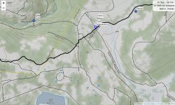
From East Park Reservoir to Hacking Lake there are almost zero opportunities. Side trips for water north dropping to Leona Spring from Manila Park is one option. The other is south to Center Creek in Lost Park.
 
When are you planning to go? How many miles per day are you planning?
 
There is also some "iffy" cow water in Summit Park.
 
When are you planning to go? How many miles per day are you planning?
Dates are not set yet but somewhere in the last week of July to Mid August. I did it last week of
August last year and that was nearly perfect.

I'd like to do it in 8 days, but probably 9, which is roughly 11-12 mile days.
 
Repeat offender Highliner! Nice man!
It's kinda been bugging me all year that I didn't really do the entire thing.
It's like saying I've run a marathon but I started at mile 9. So, I'm itching
to clear my mind.

I went to your site today seeing if you had any info on the eastern section,
didn't find any. If you have any on that section I'd greatly appreciate it.
Nope, never done that section, sorry. If you're looking to extend the Highline west of MLH though, give me a holler. Got a couple maps kicking around; gonna try hiking it this summer to see if it's doable.
 
I get wanting to do the "whole" thing. Definitely wouldn't talk you out of it and being able to hike it from highway to highway would be a great achievement. I'm thinking for myself though, that having once wanting to do the same thing and thinking about it some more, I think I'd be content to just do Leidy to Hayden myself when I get around to do it again. Then again, this coming from a guy who started it at Fox Lake via West Fork Whiterocks. Still, after all, that's when the "High" part of "Highline" really kicks in, and more so, as you've stated, water sources are fewer and further between, requiring you to not only carry a huge haul of food (unless you have a resupply set up along the way) and some big hauls of water on top of that. Not sure how comfortable I could get hiking with that kind of weight at that elevation, but still a bit tempting. Reading up on Chris's little write up on high Highline film page, it sounds like they relied on the same spring pointed out by @Perry. Hoping to get up there and at least revisit some section of it this summer.
 
@WasatchWill Thank you for being a voice of reason. @Perry thanks for your insights.

Are the spots I have marked not reliable?
E651F8C0-CDB1-463F-87FB-0E38447DC9C3.jpegB91841BC-20BB-49A7-ADFA-0BB0AA408504.jpeg
 
I would not rely on the dotted lines particularly as late in the season as you are planning to go.

On the first map image...

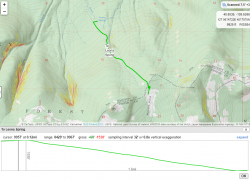
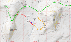
I don't recall seeing any water flowing in Big Brush Creek along the UHL trail. The upper end of Center Creek is likely going to be dry as well. I found the first water since East Park Reservoir in Center Creek but further south where the Forest Service road crosses it. It had a sufficient flow in 2016 last week of August, which was a dry year if I recall. Ended up camping in the adjacent meadow that night.

On the second map image...

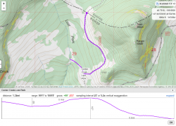
I have no intel on Deep Creep but that is quite a drop down to it from the Highline. I would think you might be better off heading down towards Long Park Reservoir instead. Further distance but not quite as much of a climb. The meadow east of the Carter Military Trail is Summit Park. This is where there is some water but was of poor quality due to all the cattle grazing there. I never ended up drinking any of it but I recall my brother saying it had an "earthy" taste :)
 
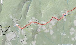
This is my route. I detoured off the UHL along the orange trace. Stayed by the creek that night. Made the mistake of taking the red trace route which put us going up a steep hillside with tons of deadfall to get back up to the main trail.

1590776767135.png
 
Back
Top