Water Sources in Lower Grand Gulch

LarryBoy

Hiker Trash
.
Joined
Jan 4, 2015
Messages
2,878
Hey folks, having a bit of trouble finding water information for lower Grand Gulch (Collins Spring TH-San Juan River). The best I could find is Kelsey stating that "The main canyon down from Collins Spring is bone dry". Couple questions
  • Does anyone know of any reliable/semi-reliable water sources in any side canyons? If so, how far from the main canyon are they?
  • Is the San Juan potable? Never been there so hard to determine its sediment load, or how much upstream industry there is.
Headed there this weekend to take advantage of a beautiful long weekend. Looking forward to it!
 
Hey folks, having a bit of trouble finding water information for lower Grand Gulch (Collins Spring TH-San Juan River). The best I could find is Kelsey stating that "The main canyon down from Collins Spring is bone dry". Couple questions
  • Does anyone know of any reliable/semi-reliable water sources in any side canyons? If so, how far from the main canyon are they?
  • Is the San Juan potable? Never been there so hard to determine its sediment load, or how much upstream industry there is.
Headed there this weekend to take advantage of a beautiful long weekend. Looking forward to it!
I walked the full enchilada some years back. We walked it with only two nights stay I think. Water was definitely an issue but we had enough near camps. The upper GG had water but the lower.... we stopped at a poor spring if memory serves. I vaguely remember it being a filter clogger too. We were then picked up by rafters we knew and they had water. Of course the San Juan is drinkable if you are thirsty and filter it. I use a magic wand and you don't have any clogging problem.
 
Welp we'll have to see. Weather shouldn't be too hot at this time of year, so water needs will definitely be less. Bringing 4 liters of capacity and planning to grin and bear the San Jan water. Who knows, potholes could be full as there's less evaporation in the winter. Not too much precip recently down there though...
 
I wish I could remember where that lower water source was. When are you going? Maybe I can ping my friends or my photo log about it...
 
Leaving tomorrow from work. Kelsey shows two springs in between the Government Trail and Collins Spring (i.e. farther upcanyon than I plan to be). He's got something labeled "SL" about 2/3 of the way between Collins and the San Juan, but I have no idea what it means as his legend doesn't explain it.
 
There's also a spot of narrows where people have had to do a little wading, so there must be water there at least occasionally. Only problem is it's only about 4 miles into the hike.
 
Leaving tomorrow !?!? Well I can't really help you much then. My memory doesn't help that well and I have no time to pull maps tonight. I do think we didn't have any dry camps. I remember one important spring we found it looks like it was half way through the second day that was important to stock up.
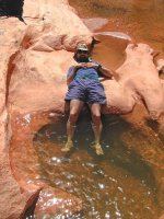
spring_13.jpg

Much of the rest of the canyon had plenty of water.
gulch_11.jpg

I do know that you are in for some real treats.
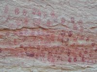
hands_12.jpg

My trip was 10 years ago sorry I couldn't come up with better advice at the last minute Larry. This was in my top 10 lifetime hikes for sure.
 
When you say "half way through the second day", I assume that you started at Bullet or Kane? That'd put you probably in between Bullet and the Government Trail. No worries at all man, I don't anticipate having too many water issues. 30-mile water carries aren't the end of the world. Thanks for the advice, and looking forward to great weather, great ruins, and a little peace and quiet!
 
We did the whole thing in three days. I just don't remember the location details. Vaya con suerte! and be safe...
 
  • Like
Reactions: Ben
Well after preparing for the worst, there was water the entire way! The bubbling little stream did make the experience rather cheery, even if I probably walked five extra miles trying to avoid wet feet. Great weather, zero people... all good. Thanks @langutah !
 
Well after preparing for the worst, there was water the entire way! The bubbling little stream did make the experience rather cheery, even if I probably walked five extra miles trying to avoid wet feet. Great weather, zero people... all good. Thanks @langutah !
You are welcome.Details? How many miles? Any pics? :)
 
You are welcome.Details? How many miles? Any pics? :)
I think it was about 36 miles officially, so call it 40+ with all the extra miles i zig-zagged. Weather was beyond perfect, sunny and 60's. Surprise windstorm on Sunday night, but that's what a tarp is for. I can honestly say that this is probably in the top three weekend backpacking trips I've ever been on. While there aren't hardly any ruins in the lower canyon, it's wilderness. Big Wilderness. I didn't see any footprints for most of the time - following animal trails and other paths of least resistance. The confluence at the San Juan is stunning, and peaceful all at once. Rewarding trip.

Pics - maybe, if I can figure out how to extract them from my ancient, crappy slide-phone. Trip Report if I feel motivated enough.
 
So you did an out and back? From what trailhead to the confluence and back? Isn't that rockslide/cliff/pourover just before the San Juan amazing ? Thanks, I was wondering how you did. I hiked in and around Bryce and the Pink Cliffs this weekend.
 
I'd love to see a report. I'm spending a few days in lower Grand Gulch in April and then camping at the confluence on a San Juan River trip in May.
 
So you did an out and back? From what trailhead to the confluence and back? Isn't that rockslide/cliff/pourover just before the San Juan amazing ? Thanks, I was wondering how you did. I hiked in and around Bryce and the Pink Cliffs this weekend.

How was that? Was it dayhiking, or backpacking opportunities there? Done (the parts that weren't closed to problem bear activity) the Under-The-Rim trail, but never been to the Pink Cliffs. My buddy was talking about going there in a couple months. This trip was an out-and-back from the Collins Spring TH. Would have liked to make it a loop, but I don't own a mountain bike, and all the lower canyon TH's are on dirt roads, so hitching is impossible.

There are a couple of cool pour-overs near the confluence. The one you're talking about is remarkable, and there's one just up-canyon where water spills over some hardened, swirly clay beds that's pretty cool too. There was one spot where the trail on the red flaky layer had washed out, and you had to jump over some pretty severe (20+ feet) exposure. Definitely a good idea to ditch the pack and come back for it.

I'd love to see a report. I'm spending a few days in lower Grand Gulch in April and then camping at the confluence on a San Juan River trip in May.

The confluence is amazing. The peace and quiet is amazing. Don't expect many Indian ruins (I saw just one, but I'm also a totally oblivious hiker), but the canyon is really cool, and very seldom traveled. Saw no footprints most of the way.
 
Same question, different time. Looking for information on current water sources in lower Grand Gulch, (between Water Canyon and the San Juan river). Also beta on the landslide crossing at the pour off near the river.
 

Don't like ads? Become a BCP Supporting Member and kiss them all goodbye. Click here for more info.

Back
Top