Water higher up in Virgin Springs Canyon?

regehr

Member
Joined
Mar 28, 2012
Messages
2,219
Has anyone been a ways up Virgin Springs Canyon lately? Am hoping to get up there in the next week or two, on the way up onto Sid's Mountain, and I'm wondering if we should load up a couple days' worth of water in the box canyon, or whether the springs up higher (near where the canyon divides into 2 major forks) are running? Also it looks on GE like there are some decent potholes in that same area. But would be a bummer to get up there and find it all dry and have to walk back down to the box. Thanks.
 
Just got back from this area. There didn't seem to be much water at all higher up in Virgin Springs Canyon, but we weren't looking very hard due to having loaded up at the pool at the end of the box canyon. Plenty of water in N Salt Wash and in the Saddle Horse Canyon. The area near the Kofford cabin is VERY cowed up and ugly, but the rest of this loop was super nice. Nobody else up there this weekend, and not a lot of footprints either.
 
Just got back from this area. There didn't seem to be much water at all higher up in Virgin Springs Canyon, but we weren't looking very hard due to having loaded up at the pool at the end of the box canyon. Plenty of water in N Salt Wash and in the Saddle Horse Canyon. The area near the Kofford cabin is VERY cowed up and ugly, but the rest of this loop was super nice. Nobody else up there this weekend, and not a lot of footprints either.
HI regehr,
By loop do you mean you went from Salt Wash back to Virgin Spring via the river? I am considering finally getting here in April. I was thinking avoiding the river with a figure 8 loop and around the W. Fk Virgin Spring/Cabin area being the cross point of the figure eight. That way I could do Cane/VSC/SaddleHorse canyons
Thanks,
John
 
Hi @John Morrow! We started at the N Salt Wash TH right near the mouth of Saddle Horse, walked down to the river, went to the box of Virgin Springs C and watered up, and then spent a night about halfway up that canyon. Next day, took a very classy exit mentioned in an Allen book that put us up near Swazy. Then up Swazy to take in the views, over to the cabin which we hadn't visited before, and then south to the rim of Saddle Horse where we spent another night. Then into Saddle Horse using a rubble slide that looked evil from above but was actually just fine, and then out to the mouth of Saddle Horse.

We spent a fair amount of time thrashing through the river and I agree this exact loop won't be a good idea during runoff. The other drawback was 2 dry camps, so we had heavy packs for a while, but both camps were spectacular so it was worth it.

I like the figure 8 idea but can't visualize it yet, can you give more detail? I would think there'll be more water available in spring so maybe you can avoid the dry camps.
 
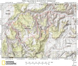
Something like this: Water and entry/exits need research. Depending on water distances the center area may actually not cross but parallel closely to form more of a peanut loop. Access conditions and/or water distances may determine which TH east or west.

VirginSprCaneSaddlehorseFigure8.JPG
 
Looks awesome.

Just purchased all three of Steve Allen's books. He put together some amazing books and wow! What a life.

Was just reading about your loop in his book.

Look forward to exploring where you were.
 
@John Morrow I like it! Have you worked out the direction of travel / water / camp sites?

I would definitely add a side trip to Swazy while you're passing nearby. I'm pretty sure we entered Saddle Horse up-canyon from where your route enters, and I would recommend that since there's a cool arch there and the camping on the rim was spectacular.
 
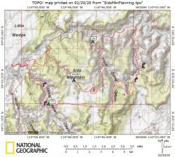
regehr, this looks like a potential trip with quite casual miles between camps leaving lots of time for rock art and other exploration. Potholes and springs I noted are wet in GE 4/2015 and 8/2019 aerial photo sets.

VirginSprCaneSaddlehorsePeanut.JPG

When I map it out I realize how short the overall distances really are.
My other thought is a Cottonwood/Spring/Nates type loop to the east. Anyone know much about this? Longer dry stretches for sure unless one can drive the 4WD to access from the top. My Subaru might require a Cottonwood mouth start.
 
It's a tiny detail but you don't have to approach Swazy from the west, you can pop out of VIrgin Springs Canyon, walk straight to Swazy, and then walk down the west side.
Also the LPH up there near the cabin is likely *very* cowed up, so be ready for that. We carried an extra day of water rather than taking from there (but didn't walk over to it, so it may be better than I fear).
We saw quite a lot of water in middle/lower Saddle Horse in October, so likely there's always good water there.

I have hiked lower parts of all of Cottonwood / Spring / Nates, but have not managed to do the bigger hikes in there yet. Looks great though.
 
Last edited:
I'm really enjoying being a fly on the wall in this conversation. I love that area and am gleefully rubbing my hands together as I mentally plan my next backpacking outing down there.
 
Thanks for the great info regehr. Did you investigate any of the exits of Spring Canyon or head of Nates? I'm torn between the two trip options, but i'm not feeling motivated or bold enough to locate the Spring/Sulphur/Nates exits this spring. I think Allen calls the broad canyon south of Spring "Sulphur".

Maybe I'm fooling myself on the relative mellowness of the canyon crossings around Sid's but with short distances and water, there's no risk to putting my tail between my legs and turning around or doing alternates. Not like a long dry retreat. Too bad about the cowed up canyon/potholes. It looks so nice on GE.
 
Last edited:
Thanks for the great info regehr. Did you investigate any of the exits of Spring Canyon or head of Nates? I'm torn between the two trip options, but i'm not feeling motivated or bold enough to locate the Spring/Sulphur/Nates exits this spring. I think Allen calls the broad canyon south of Spring "Sulphur".

Maybe I'm fooling myself on the relative mellowness of the canyon crossings around Sid's but with short distances and water, there's no risk to putting my tail between my legs and turning around or doing alternates. Not like a long dry retreat. Too bad about the cowed up canyon/potholes. It looks so nice on GE.
So Allen has two exits from upper Virgin Springs C, one quite close to Swazy (this is in the updated "Northern Swell" book) and then one a bit farther away in a different fork (in his Swell book from the 90s). We did not investigate the latter, and found the former exit to be quite mellow. Allen mentions a brief 4th class step but we thought he was being a bit conservative. There was little exposure and nothing there that I would hesitate to do on a solo trip, and I ain't a climber.

The Saddle Horse entrance/exit also changed between the older swell book and the 2013 northern swell book. Again, we did not investigate the older route and took the newer one and found it quite mellow, basically steep and loose but hardly even class 3. Again, I'd not hesitate to do this solo, especially if I had an emergency beacon as a hedge against a broken leg or whatever.

I have some potential space in April for a quick backpack or two and am strongly thinking about something in the Cottonwood / Spring / Nates area! Have not seen any of those exits, but the thing about Allen's info is you can trust it.

One way to find those E/Es in that country would be a long daytrip from a camp at Spring Canyon Spring: upcanyon and out Spring, over to Sulphur. If Sulphur feels comfortable then it just becomes an easy long wash walk back to camp. If Sulphur is a no go then you know your way back into Spring.

If I hit this area at the end of March I am leaning on Swazy/Sid country as there seems to be a higher abundance of rock art: BCS, Fremont, AP and both petro and picto.
 
If I hit this area at the end of March I am leaning on Swazy/Sid country as there seems to be a higher abundance of rock art: BCS, Fremont, AP and both petro and picto.

I found the rock art in Cottonwood Wash to be unexciting. The boulders near the mouth of Spring Canyon are a treat, though. Some of the stuff in N Salt Wash is very good. We didn't spend much time looking for stuff up on Sids Mtn but there's a panel or two not far ffrom the cabin.
 
My Kelsey San Rafael Swell arrived yesterday to my Post Office. He has a few other interesting things to add. One of note is an old trail from the flats of Cane Wash past a mine and up to Sids Mtn. He even calls it "Sids Mountain Trail" It is clearly visible on GE, with a mine road turning into a switchbacking trail. He calls your exit out of Saddle Horse, regehr, Keyhole Trail I believe, though his map is so small I may be looking farther upcanyon.
 
My Kelsey San Rafael Swell arrived yesterday to my Post Office. He has a few other interesting things to add. One of note is an old trail from the flats of Cane Wash past a mine and up to Sids Mtn. He even calls it "Sids Mountain Trail" It is clearly visible on GE, with a mine road turning into a switchbacking trail.

I believe Dennis has a trip report from that trail: http://udink.org/2019/07/02/sids-mountain-from-the-south/
 
My Kelsey San Rafael Swell arrived yesterday to my Post Office. He has a few other interesting things to add. One of note is an old trail from the flats of Cane Wash past a mine and up to Sids Mtn. He even calls it "Sids Mountain Trail" It is clearly visible on GE, with a mine road turning into a switchbacking trail. He calls your exit out of Saddle Horse, regehr, Keyhole Trail I believe, though his map is so small I may be looking farther upcanyon.
I don't have the book with my but my recollection is that our route (the one from the newer Allen book) is not the keyhole route. Yeah, Kelsey maps are not very good.
 
Similar threads
Thread starter Title Forum Replies Date
Janice Caching water? General Discussion 8
Bob 206 mile water trail Trip Planning 0
kwc Smoke on the water … fire in the sky … General Discussion 6
JBG Water Beta 2022 - Highline Trail Trip Planning 6
regehr potable water in Escalante town? Trip Planning 6
regehr water in lower muley twist? Trip Planning 0
Janice Water questions - Escalante area Trip Planning 38
Nethos Another water post(Bowdie/Midway) Trip Planning 10
H Access to Grand Gulch via Water Canyon Trip Planning 2
CodyL Winds- Big water slide Trip Planning 3
RyanP Sawyer Squeeze questions: how to pre-filter, and recommended dirty-water bag? Gear 30
Gretchen Millward Trachyte Creek conditions/water Trip Planning 0
B In Government Trail and out Water Canyon Trip Planning 3
Christo Water availability:Thorofare Yellowstone Trip Planning 6
RyanP road from Hite to Water Hole Flat Trip Planning 20
JBG Water on the Highline Trail - 2021 Trip Planning 2
garyhost Cedar Mesa Utah Trip. Conditions? Water? Trip Planning 8
RyanP Conditions (water/bugs) for Escalante/Death Hollow Trip Planning 27
J Grand Gulch (Kane to Bullet) Water Availability Trip Planning 9
E Water in the Needles early-May 2021 Trip Planning 3
S Packrafting Escalante - FiftyMile Creek and low water level Lake Powell Trip Planning 8
F Stevens Canyon/southern escalate water availability. Trip Planning 16
gnwatts Grand Gulch water Trip Planning 6
W 9 Days Solo Escalante Loop in October (water advice) - Stevens Canyon, Baker Route over Waterpocket fold, Halls Narrows to Moody Canyons Trip Planning 11
M Dark Canyon Complex Water Data Trip Planning 4
P Salt Creek water Backpacking 2
P Pitchstone Plateau water Backpacking 7
C Paria Canyon water source - August 2020 Trip Planning 2
OldBill Water treatment tablets and Cryptosporidium Gear 15
I Water in Frisky Creek south of Highway 12 in the Grand Staircase? Trip Planning 0
DrNed Water Sources McKee Draw to Leidy Peak Trip Planning 12
M Water containers Gear 28
fossana UT 2020 water outlook General Discussion 2
Rockskipper Maybe it was the BBQ sauce (guy survives 3 weeks w/ no food or water after getting lost) General Discussion 0
RyanP Water in Needles District in early April this year? Trip Planning 9
RyanP 3-day trip ideas (15-20 miles or so) for late May/early June with good water Trip Planning 9
M Water in Canyonlands Salt Creek early April? Trip Planning 11
Mikjik86 Desert Canyon/Water Shoes? Gear 9
Artemus 2018/2019 Snowpack and Water Year General Discussion 85
gnwatts Water Canyon on Cedar Mesa Backpacking 11
LarryBoy Water source information - Escalante/CRNP area Trip Planning 14
gnwatts Water Canyon (Cedar Mesa) top down General Discussion 11
O Green River/Stillwater Canyon question regarding water Trip Planning 3
blueeyes Black Canyon Water Trail On The Water 16
T Water availability next week in Cedar Mesa & Escalante areas Trip Planning 5
AKay09 5 day hike with lots of water and fishing? Trip Planning 13
KevinBoyer New Water Filter Needed...Suggestions?? Gear 48
Miya Water Resistant Down Sleeping Bags? Gear 36
D Water near EC3 Trip Planning 1
SKLund Water in Cedar Mesa in October Trip Planning 0

Similar threads

Back
Top