Yvonne
I lava it!!!
- Joined
- Jan 19, 2012
- Messages
- 4,177
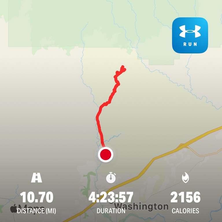
It was another day, another hike. Since we still need to practice social distancing and I wanted to avoid getting too close to people, I decided it was time again to head into the Red CliffsDesert Reserve wilderness. Solitude guaranteed and no people other than at the parking lot. I started pretty late around noon. It was a gloomy overcast day, perfect for hiking. This hike today also marked my 500th hiking mile for the year, and I was thrilled. I ended up hiking about 11 miles with a lot of side explorations.
I didn't bring a camera since my little lens died a few days ago, so cellphone pictures needed to do the job for now.
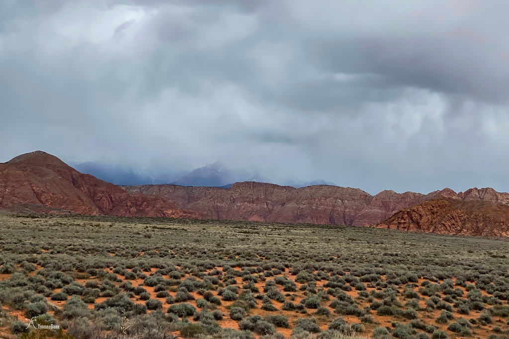
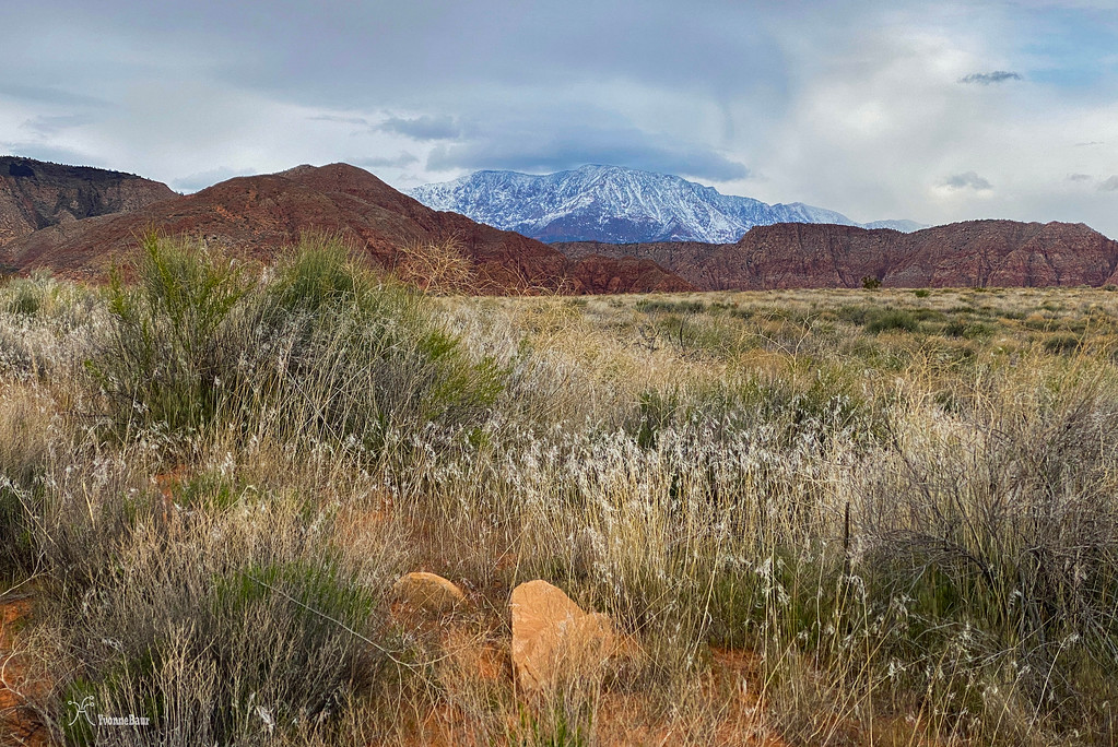
The trail started at the same trailhead as one of the more popular ones in the area, and since it was the weekend, there were tons of people out there. Luckily, after less than a quarter-mile, the trail split, and I had it all on my own. The first two miles I had to walk on an old service road, but these were pretty fast miles. And on the way to my target area, you'll get some excellent views of the Pine Valley Mountains in the distance. Not so much today, as they got dumped by snow.
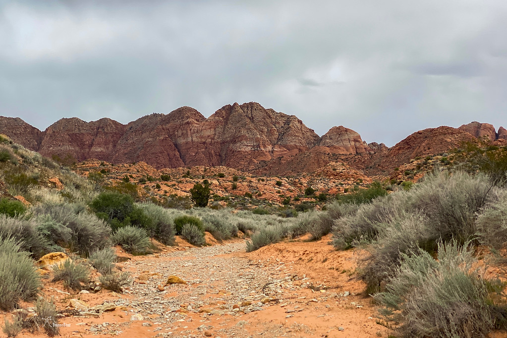
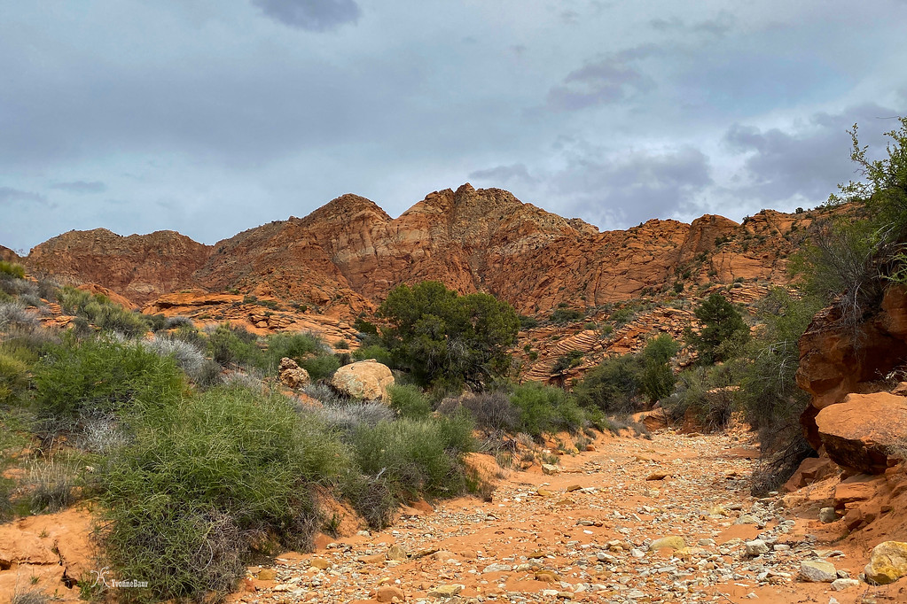
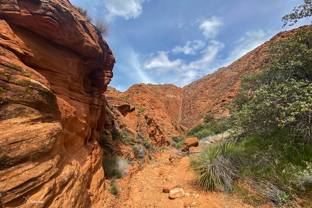
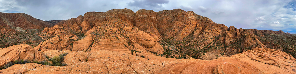
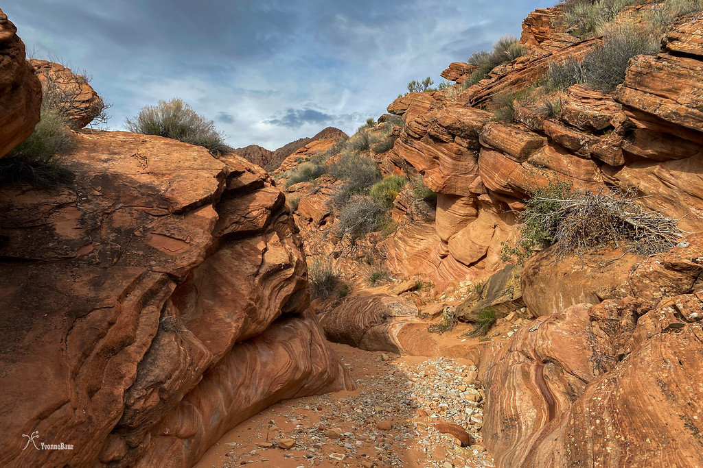
As soon as I dropped in the wash, the trail began to become interesting. Massive 2,000ft cliffs of Late Jurassic Navajo Sandstone were waiting to get explored.
I've been here a few times before, but the first view was always super exciting.
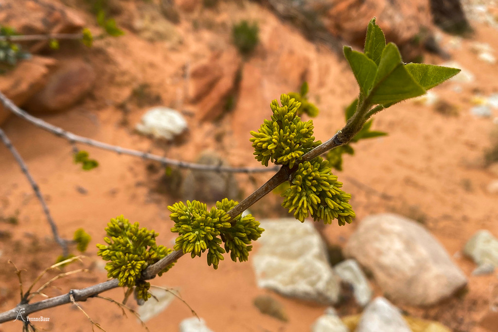
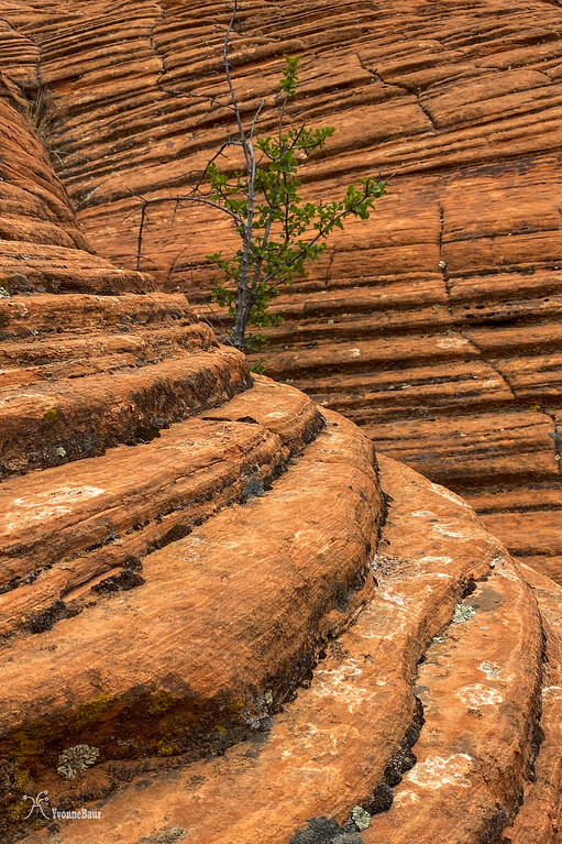
Spring has sprung, and many trees along the wash had pollen and fresh young leaves.
Soon I encountered the first cross-bedded outcrops of Navajo Sandstone. During the Lower Jurassic period, a massive erg (Sahara- sized dune desert) covered much of Southern Utah, and the remnants were visible in many places all over the area.
To me, this trip was again sort of a personal geology field trip. Since all classes are online now, no field trips were happening at all.
I decided to simply do my own, and hopefully, I already could recognize a lot of features.
Massive cliffs of Navajo Sandstone. The different colors were caused by iron oxide. When iron oxide leached out of the sandstone by groundwater, it created the white areas in the sandstone. Other color hues were created by the amount of iron still in place.
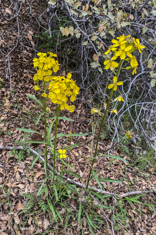
Western Wallflower
It was a weird year for wildflowers because all the winter rains came so late and just started in early March. Usually, during this time of the year, I would encounter tons of wildflowers. But not so much this year. Hopefully, they will pop up a bit later.
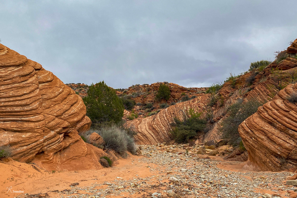
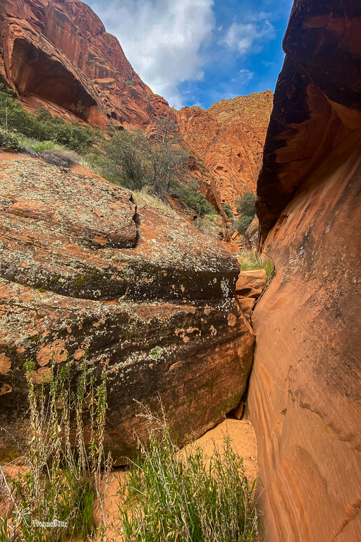
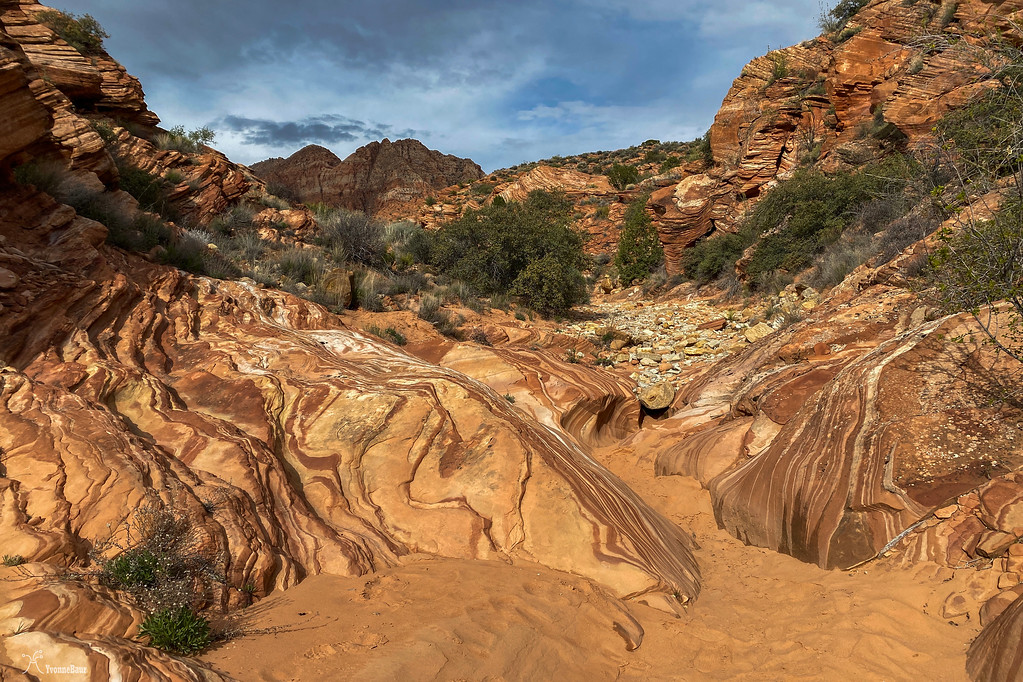
After about two additional miles, I entered a side canyon from the main wash and started to explore. Massive Sandstone cliffs with alluvium were coming down the steepest parts.
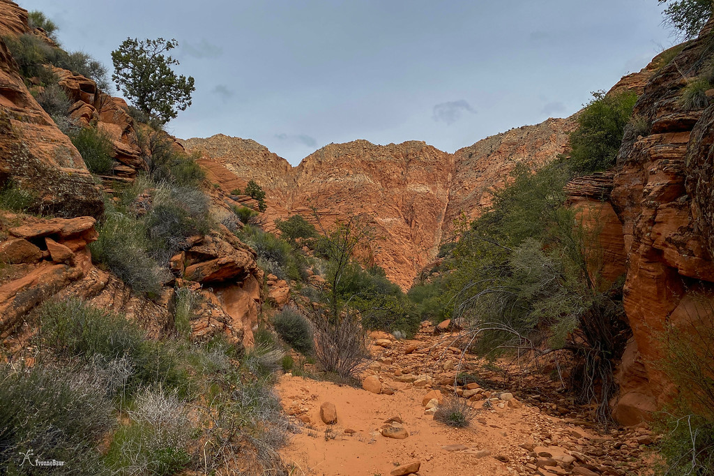
It didn't take long, and the side canyon started to become interesting.
Navajo Sandstone is a cliff builder.
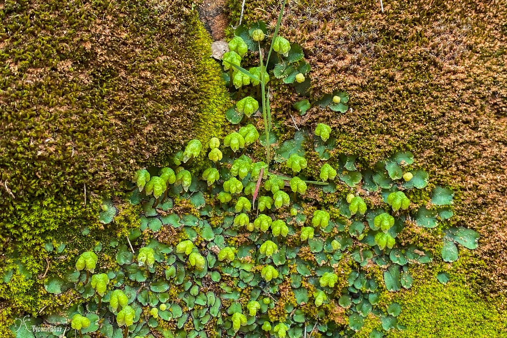
IN addition to all the sandstone cliffs, I found excellent patches of cryptobiotic soil. I enjoyed seeing these patches, as they consisted of whole communities of living organisms who prevented soil erosion. Despite the cyanobacteria that lived in the upper 1/8 inch of the crust and stained it black, there were lichens, mosses, and even fungi.
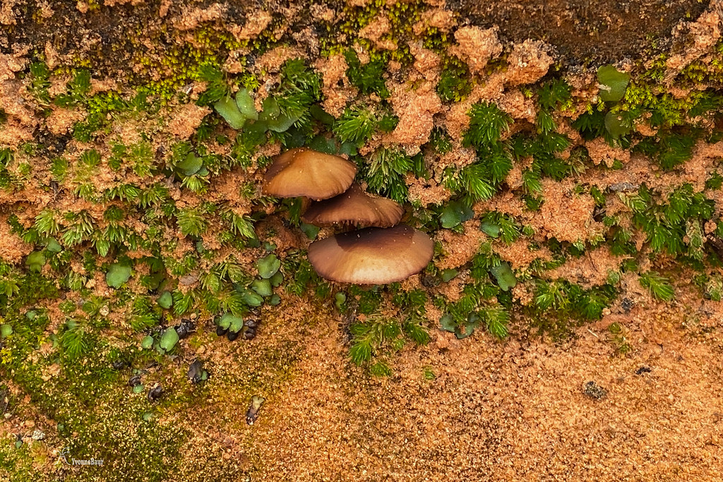
Life on a small scale: lichen, mosses and even fungi thrived here
I had to stop so many times; it was gorgeous down here.
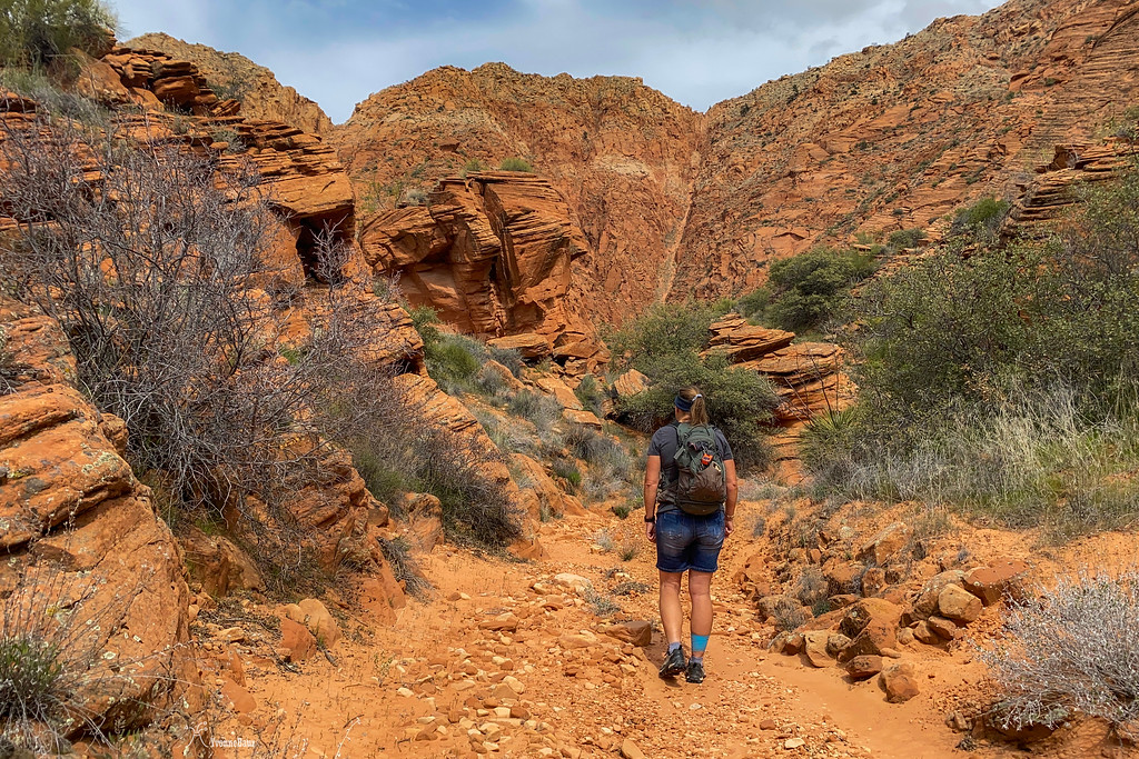
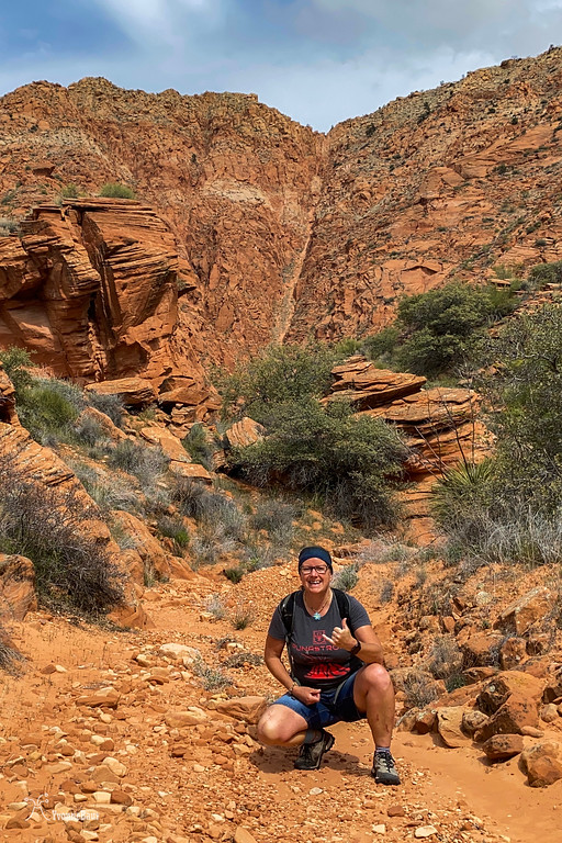
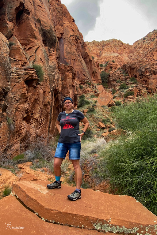
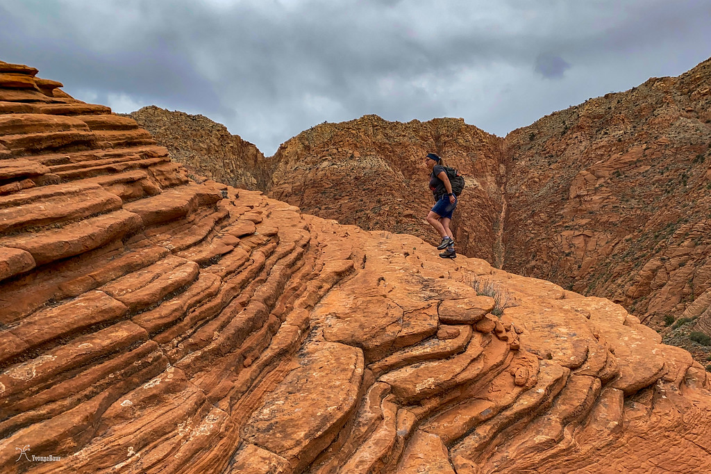
Once in a while, I stopped for a few selfies.
It was a perfect day for a hike: cloud cover and high 50s, not too hot, and no one else nearby. I couldn't ask for anything better.
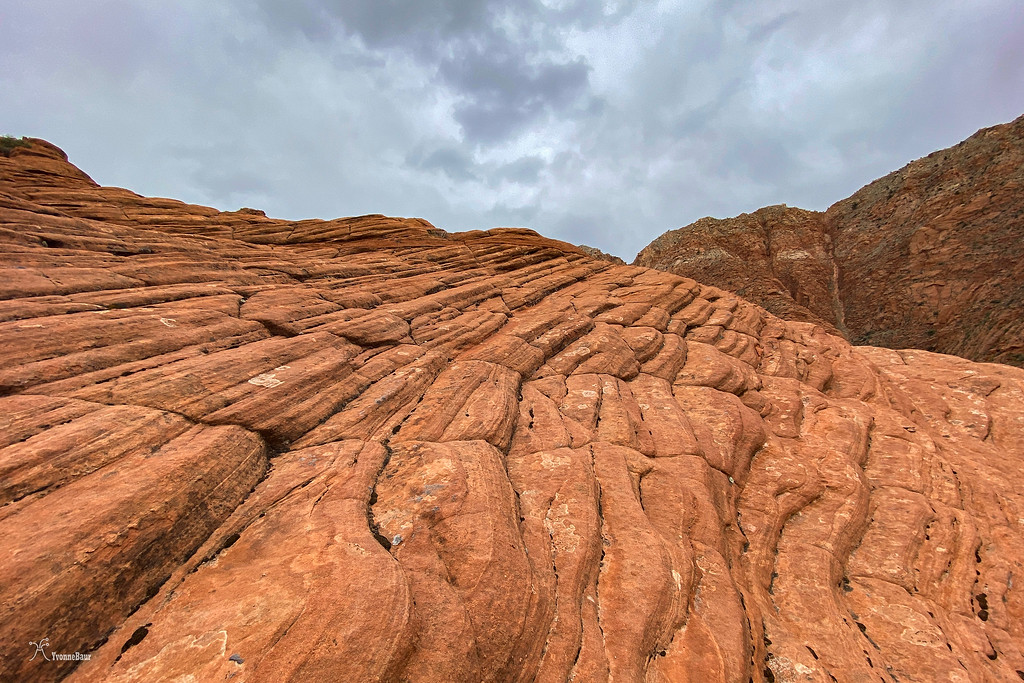
cross-bedded sandstone to the left was evidence of the former eolian environment
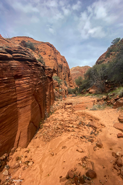
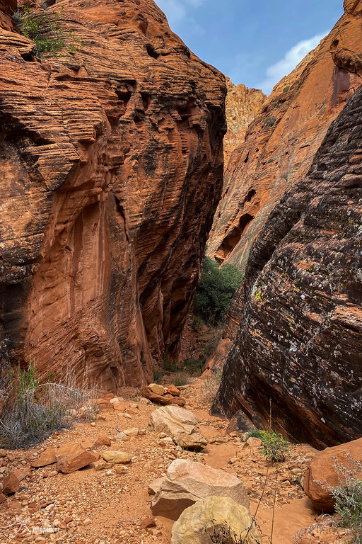
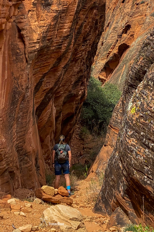
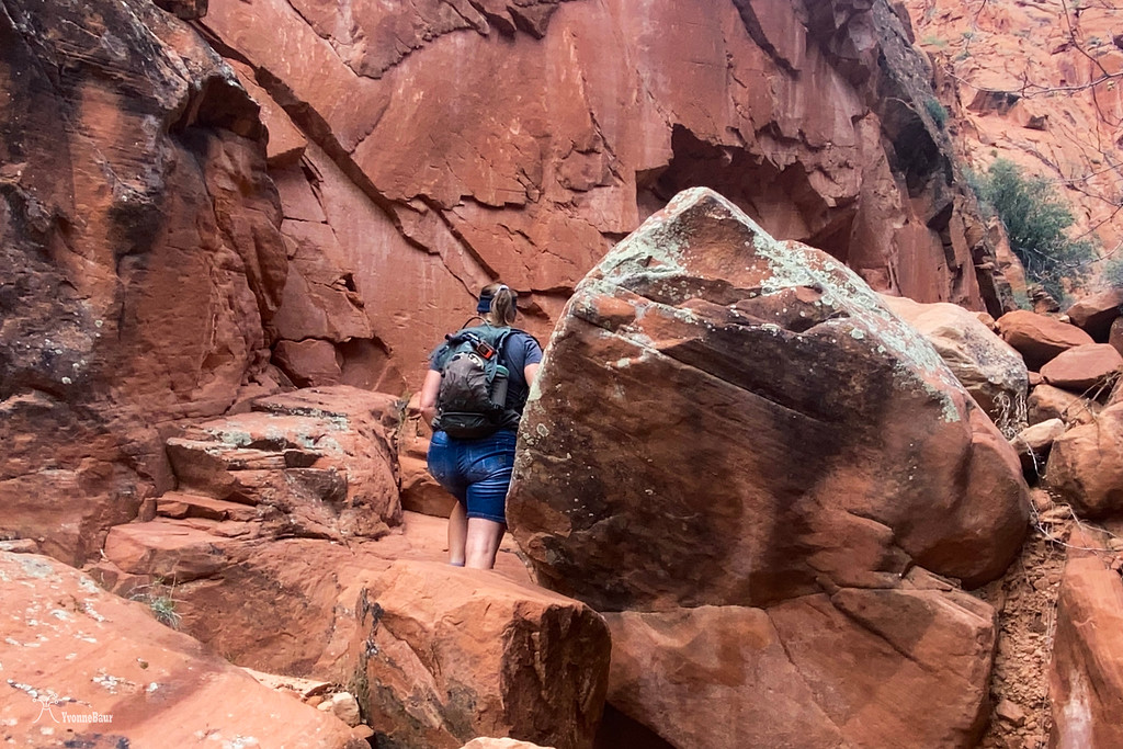
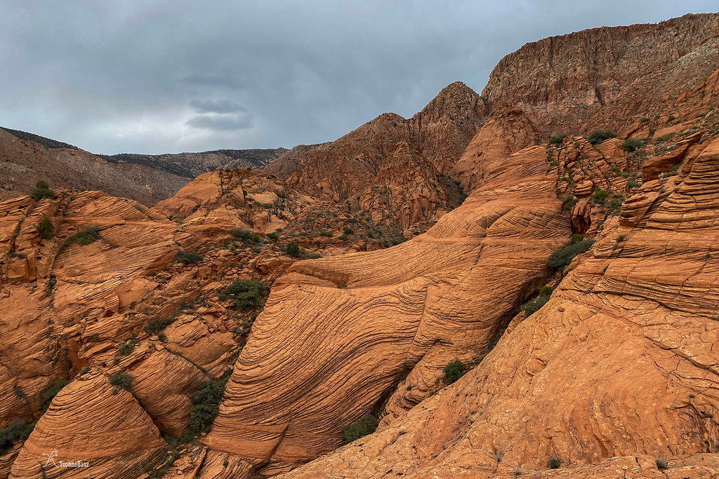
Pretty soon, the canyon started to get narrower, and Navajo Sandstone, a major cliff-builder, rose to both sides. Downcutting by water created the small slot canyon sections ahead of me.
let's see what's behind the corner
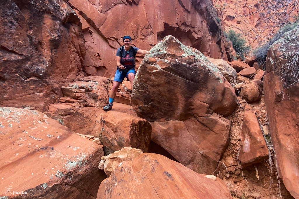
For a short time, the sun came out, and I continued exploring. The canyon narrowed gradually, and massive fall block boulders covered the place which I needed to negotiate around or climb up.
I encountered more massive boulder blocks that had eroded and fallen. Most of these massive fall block boulders are the result of groundwater and the widening of cracks and joints. At one point freeze and thaw cycles widen these cracks enough that gravity takes over
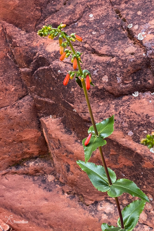
Penstemon almost ready to bloom
another Selfie
At one point, the boulders were too big to climb up anymore, so I turned around. I also didn't want to get more cuts on my legs as I was already battling a nasty leg infection. So I turned around and decided to climb up to one of the lithified dunes of Navajo Sandstone.
Nature always finds a way to grow.
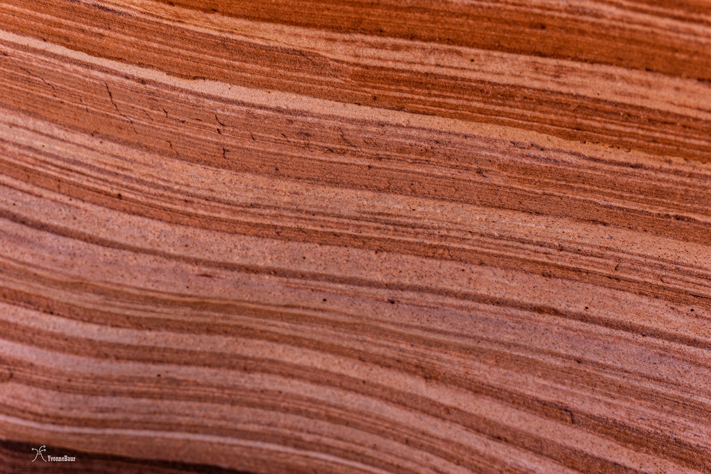
I found a pretty good access point to scramble up one of the dunes and made my way up. The cross-bedded strata definitely helped to find an easy way up.
working my way up
cross-bedded details
looking down to where I started
Closer to the top, it was a pretty steep scramble, but I finally made it to the top.
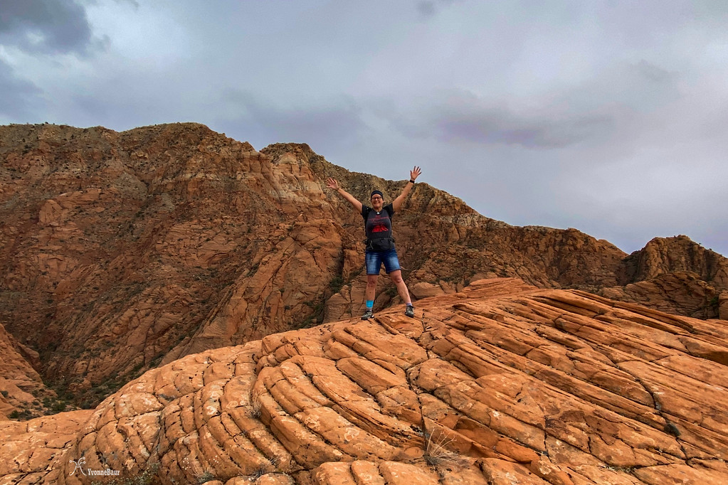
Finally, I'm at the top.
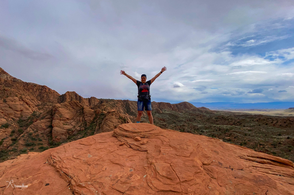
The view from up here was definitely worth the workout, and I enjoyed the massive cliffs next to me. These Navajo Sandston cliffs were almost as tall as the ones in Zion.
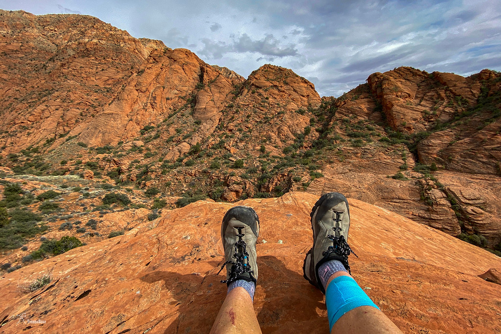
Siesta time
The way back down wasn't too bad, and from here, I headed back to the main wash and started to hike back to the trailhead. Once in a while, I got some patches of sunshine, but most of the time, it stayed overcast.
swirls of color created by water movement
nice strata of deposited sandstone layers
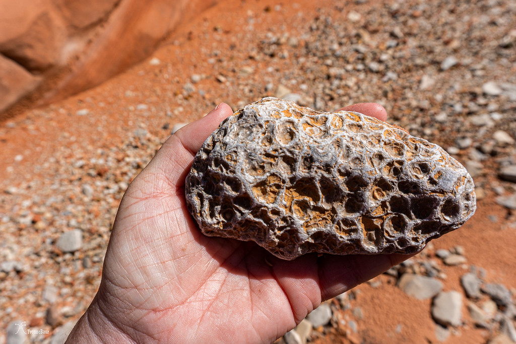
Wait - I found a rock!! I really liked this one with all the solution cavities.
The view of the Pine Valley Mountains, a massive laccolith, stayed with me while I hiked back to my car. It was a wonderful hike with no encounters with other humans. I was more than happy about it.
Roughly 11 miles later, I was back at my car and more than happy that I hit the 500-mile mark today.
I didn't bring a camera since my little lens died a few days ago, so cellphone pictures needed to do the job for now.
The trail started at the same trailhead as one of the more popular ones in the area, and since it was the weekend, there were tons of people out there. Luckily, after less than a quarter-mile, the trail split, and I had it all on my own. The first two miles I had to walk on an old service road, but these were pretty fast miles. And on the way to my target area, you'll get some excellent views of the Pine Valley Mountains in the distance. Not so much today, as they got dumped by snow.
As soon as I dropped in the wash, the trail began to become interesting. Massive 2,000ft cliffs of Late Jurassic Navajo Sandstone were waiting to get explored.
I've been here a few times before, but the first view was always super exciting.
Spring has sprung, and many trees along the wash had pollen and fresh young leaves.
Soon I encountered the first cross-bedded outcrops of Navajo Sandstone. During the Lower Jurassic period, a massive erg (Sahara- sized dune desert) covered much of Southern Utah, and the remnants were visible in many places all over the area.
To me, this trip was again sort of a personal geology field trip. Since all classes are online now, no field trips were happening at all.
I decided to simply do my own, and hopefully, I already could recognize a lot of features.
Massive cliffs of Navajo Sandstone. The different colors were caused by iron oxide. When iron oxide leached out of the sandstone by groundwater, it created the white areas in the sandstone. Other color hues were created by the amount of iron still in place.
Western Wallflower
It was a weird year for wildflowers because all the winter rains came so late and just started in early March. Usually, during this time of the year, I would encounter tons of wildflowers. But not so much this year. Hopefully, they will pop up a bit later.
After about two additional miles, I entered a side canyon from the main wash and started to explore. Massive Sandstone cliffs with alluvium were coming down the steepest parts.
It didn't take long, and the side canyon started to become interesting.
Navajo Sandstone is a cliff builder.
IN addition to all the sandstone cliffs, I found excellent patches of cryptobiotic soil. I enjoyed seeing these patches, as they consisted of whole communities of living organisms who prevented soil erosion. Despite the cyanobacteria that lived in the upper 1/8 inch of the crust and stained it black, there were lichens, mosses, and even fungi.
Life on a small scale: lichen, mosses and even fungi thrived here
I had to stop so many times; it was gorgeous down here.
Once in a while, I stopped for a few selfies.
It was a perfect day for a hike: cloud cover and high 50s, not too hot, and no one else nearby. I couldn't ask for anything better.
cross-bedded sandstone to the left was evidence of the former eolian environment
Pretty soon, the canyon started to get narrower, and Navajo Sandstone, a major cliff-builder, rose to both sides. Downcutting by water created the small slot canyon sections ahead of me.
let's see what's behind the corner
For a short time, the sun came out, and I continued exploring. The canyon narrowed gradually, and massive fall block boulders covered the place which I needed to negotiate around or climb up.
I encountered more massive boulder blocks that had eroded and fallen. Most of these massive fall block boulders are the result of groundwater and the widening of cracks and joints. At one point freeze and thaw cycles widen these cracks enough that gravity takes over
Penstemon almost ready to bloom
another Selfie
At one point, the boulders were too big to climb up anymore, so I turned around. I also didn't want to get more cuts on my legs as I was already battling a nasty leg infection. So I turned around and decided to climb up to one of the lithified dunes of Navajo Sandstone.
Nature always finds a way to grow.
I found a pretty good access point to scramble up one of the dunes and made my way up. The cross-bedded strata definitely helped to find an easy way up.
working my way up
cross-bedded details
looking down to where I started
Closer to the top, it was a pretty steep scramble, but I finally made it to the top.
Finally, I'm at the top.
The view from up here was definitely worth the workout, and I enjoyed the massive cliffs next to me. These Navajo Sandston cliffs were almost as tall as the ones in Zion.
Siesta time
The way back down wasn't too bad, and from here, I headed back to the main wash and started to hike back to the trailhead. Once in a while, I got some patches of sunshine, but most of the time, it stayed overcast.
swirls of color created by water movement
nice strata of deposited sandstone layers
Wait - I found a rock!! I really liked this one with all the solution cavities.
The view of the Pine Valley Mountains, a massive laccolith, stayed with me while I hiked back to my car. It was a wonderful hike with no encounters with other humans. I was more than happy about it.
Roughly 11 miles later, I was back at my car and more than happy that I hit the 500-mile mark today.
") . I'll have to add it to the to do list.
. I'll have to add it to the to do list.