- Joined
- Jul 8, 2015
- Messages
- 46
July 23-26th, 2015
Me and the family decided to head to the mountains for Pioneer Day weekend this year. Our destination was the Warner Lake Campground off the La Sal Loop road in the La Sal Mountains East of Moab. This would be my first trip to the La Sals, but I'm already looking forward to exploring them more in the future.
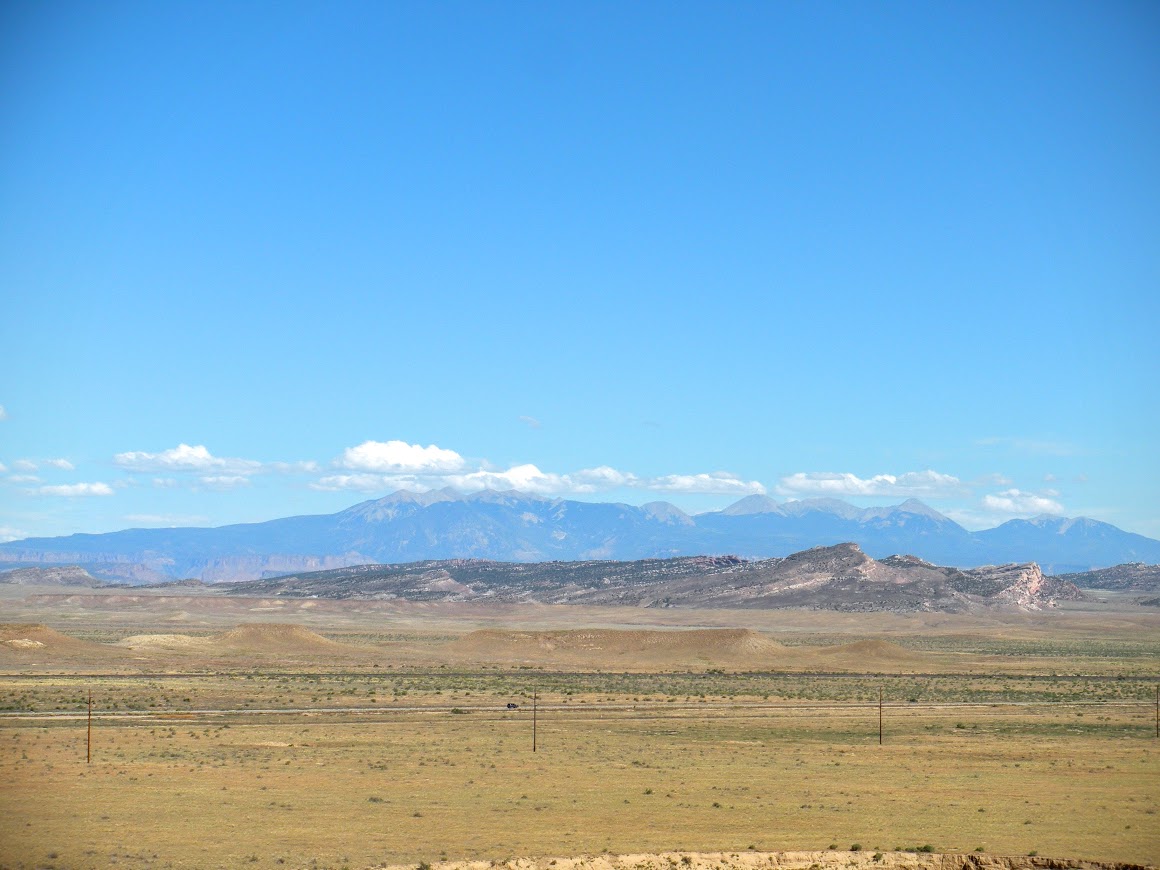
Day one was mostly loading gear and making the drive from Salt Lake to the campground. You could see the La Sal range approaching as we neared the Crescent Junction exit off I-70.
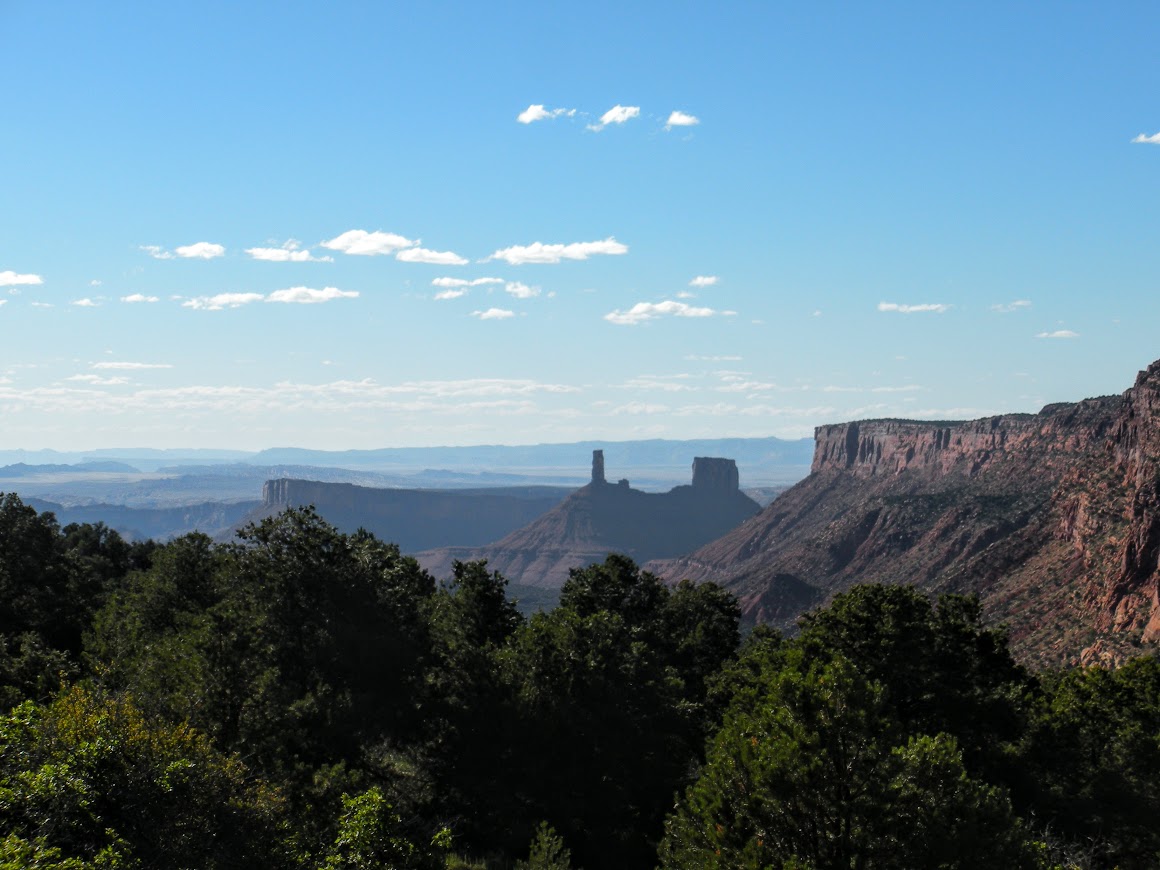
We continued on towards Moab and turned off at the River road (Utah 128) toward Castle Valley. After about 12 miles the River Road meets with the La Sal Loop road. We continued on the La Sal loop road and began to climb the foothills of the La Sals out of Castle Valley.
Looking out toward Castleton Tower from the La Sal loop road:
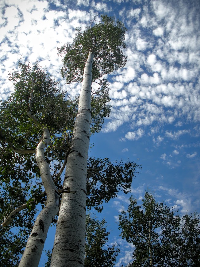
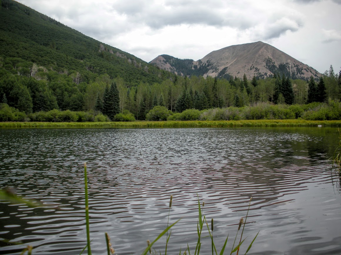
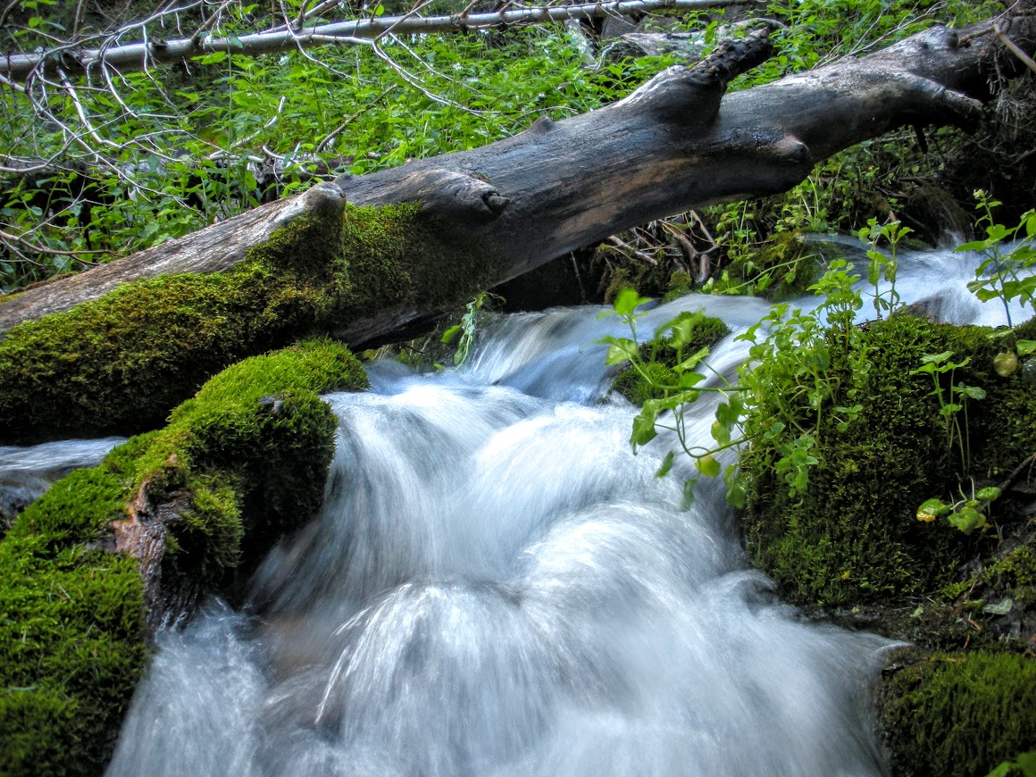
We arrived to Warner Lake campground in the early evening. The air at 9,200ft was cool and enjoyable compared to the heat of the red rock canyons below. Warner Lake Campground is situated in a beautiful aspen grove near the base of Haystack mountain. Created in 1933, it was originally a camp for the Civilian Conservation Corps. Warner Lake was created by the CCC by diverting and damming Mill Creek which is known for a popular swimming hole further down stream when it reaches the Sand Flat recreation area.
We spent the next day exploring the area surrounding the campground and tested the fishing in the lake.
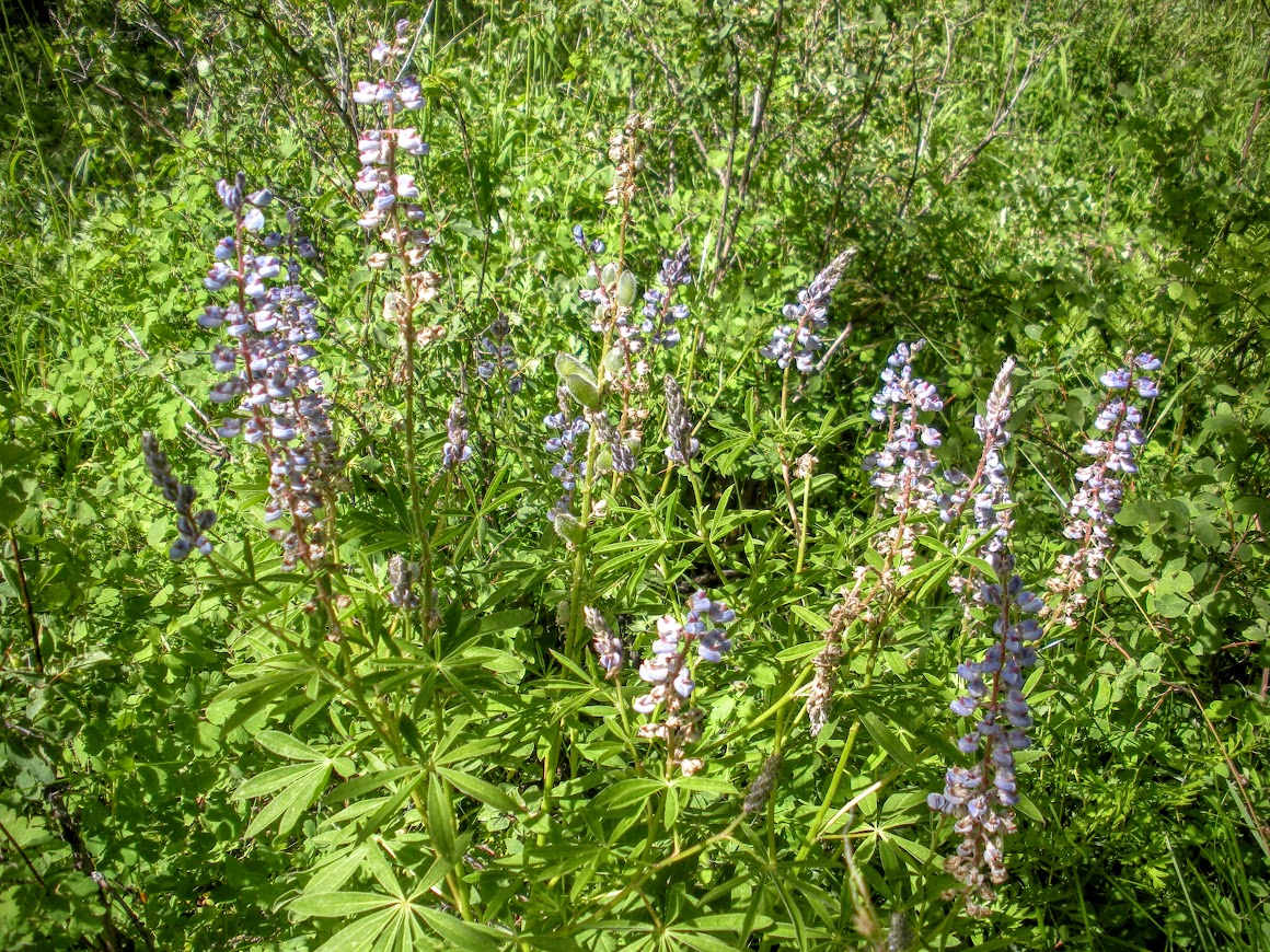
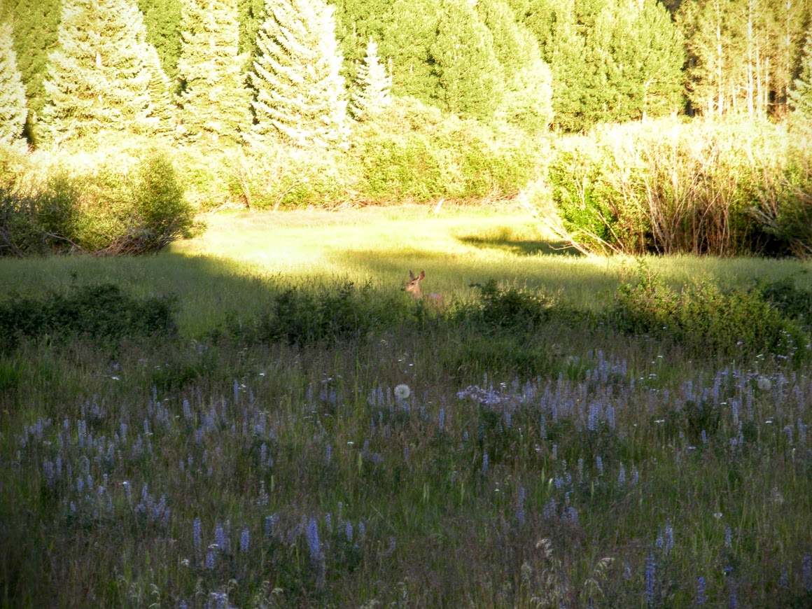
Lupine was thick around the campground:
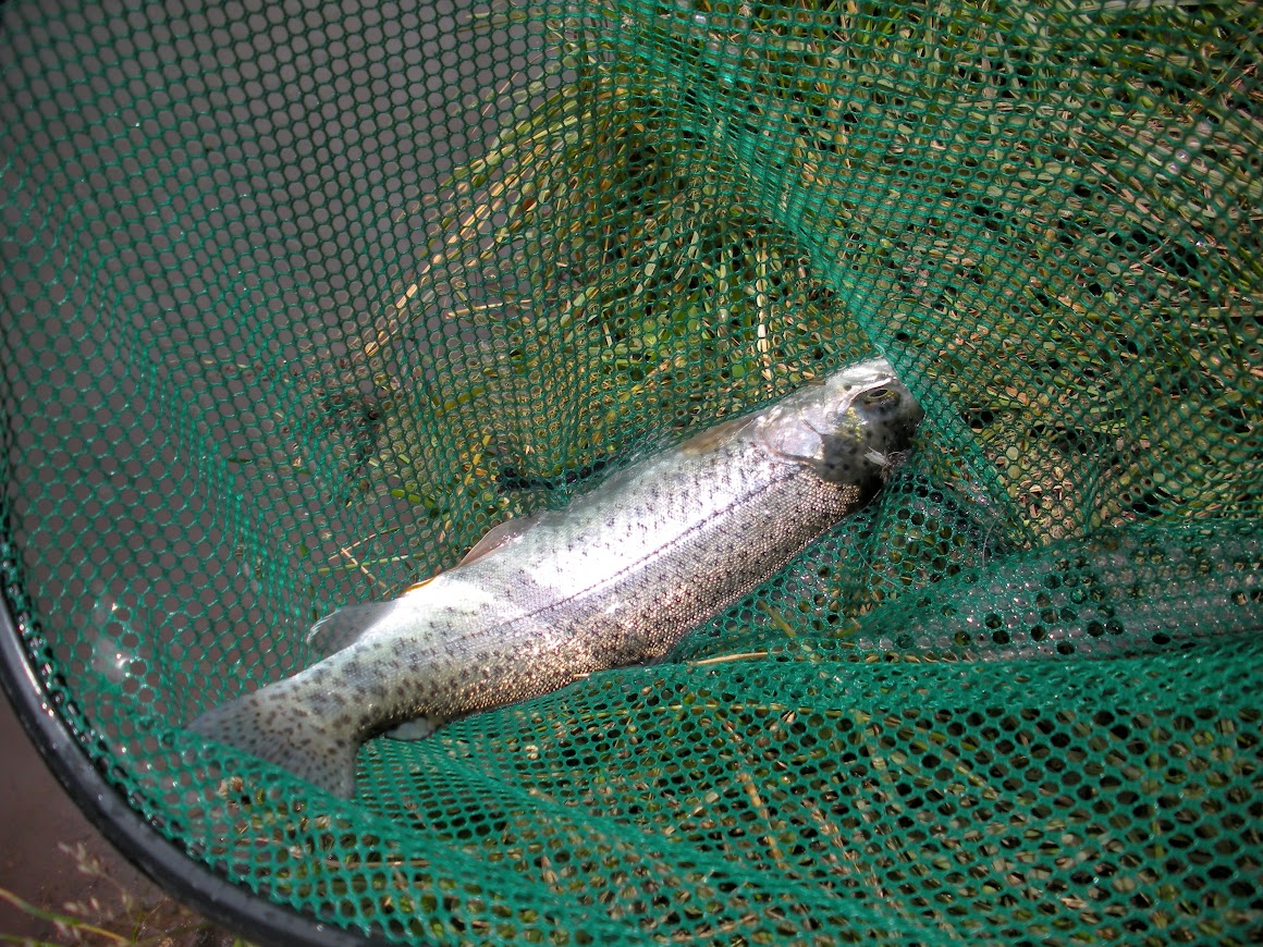
The lake was full of hungry planter rainbows, they bit my fly on every cast well into the afternoon.
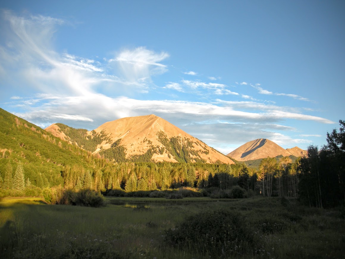
After fishing and letting the kids play in the water a bit we spent the rest of the evening relaxing at camp. I took some more pictures of the lake and Haystack mountain in the evening light.
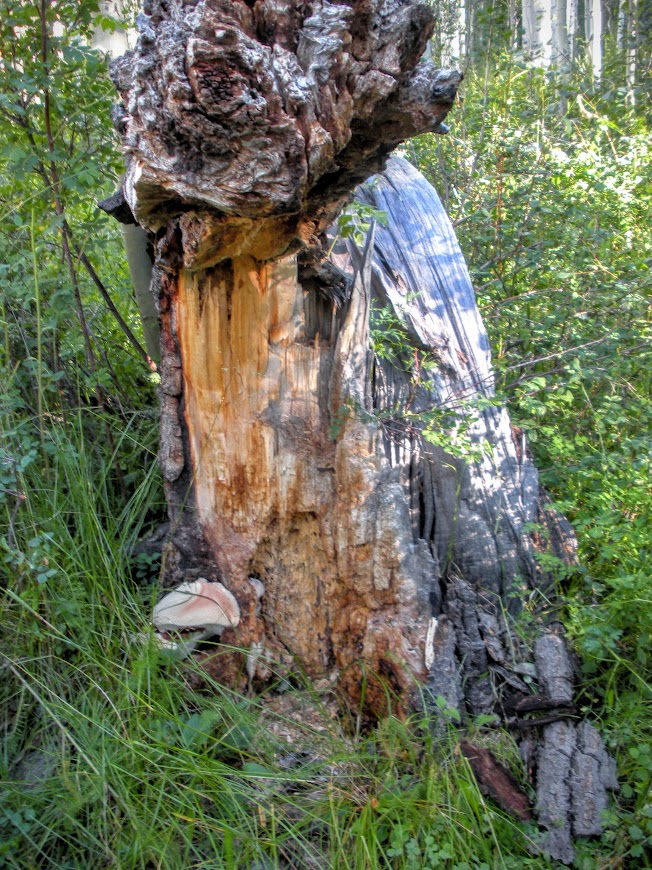
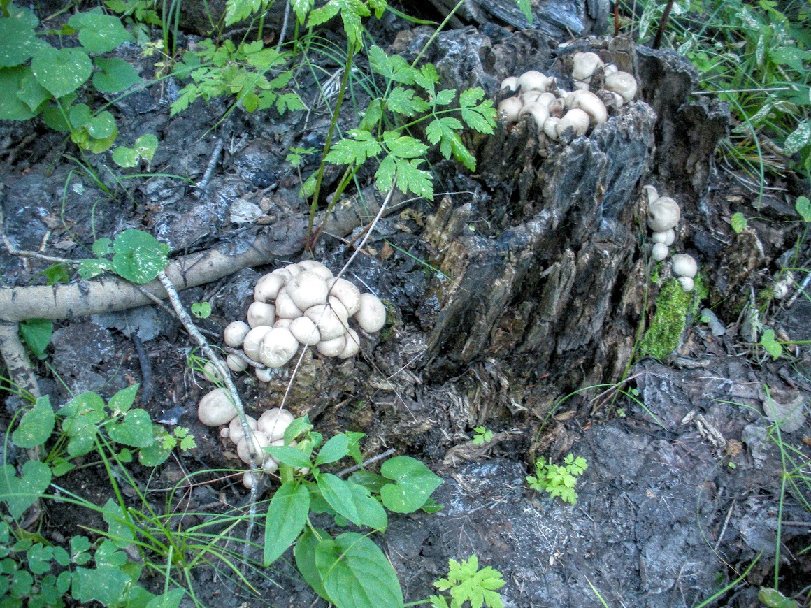
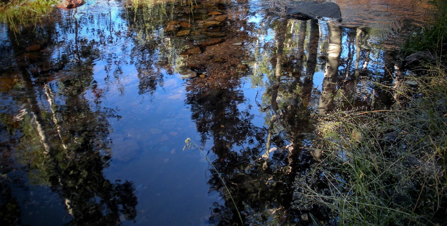
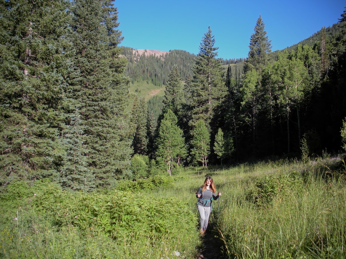
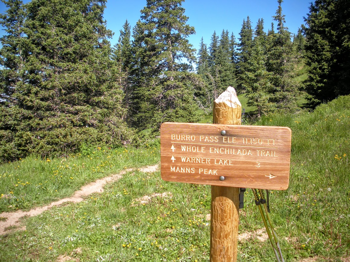
The next morning me and my wife took the trail from Warner Lake to Burro Pass. This was an amazing trail that followed Mill Creak to the top of Burrow Pass. The trail started in the aspens which gave way to big Douglas Firs as the elevation increased. We spotted many mushrooms and fungi along the trail in the aspen forests. A squirrel surprised us running across the trail with a 4" mushroom cap in its mouth.
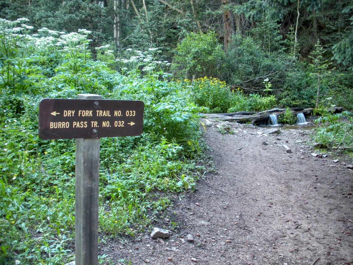
After about a mile we came to a sign marking the split between Wet Fork Mill Creek and Dry Fork Mill Creek. We continued up Wet Fork Mill Creek toward Burro Pass.
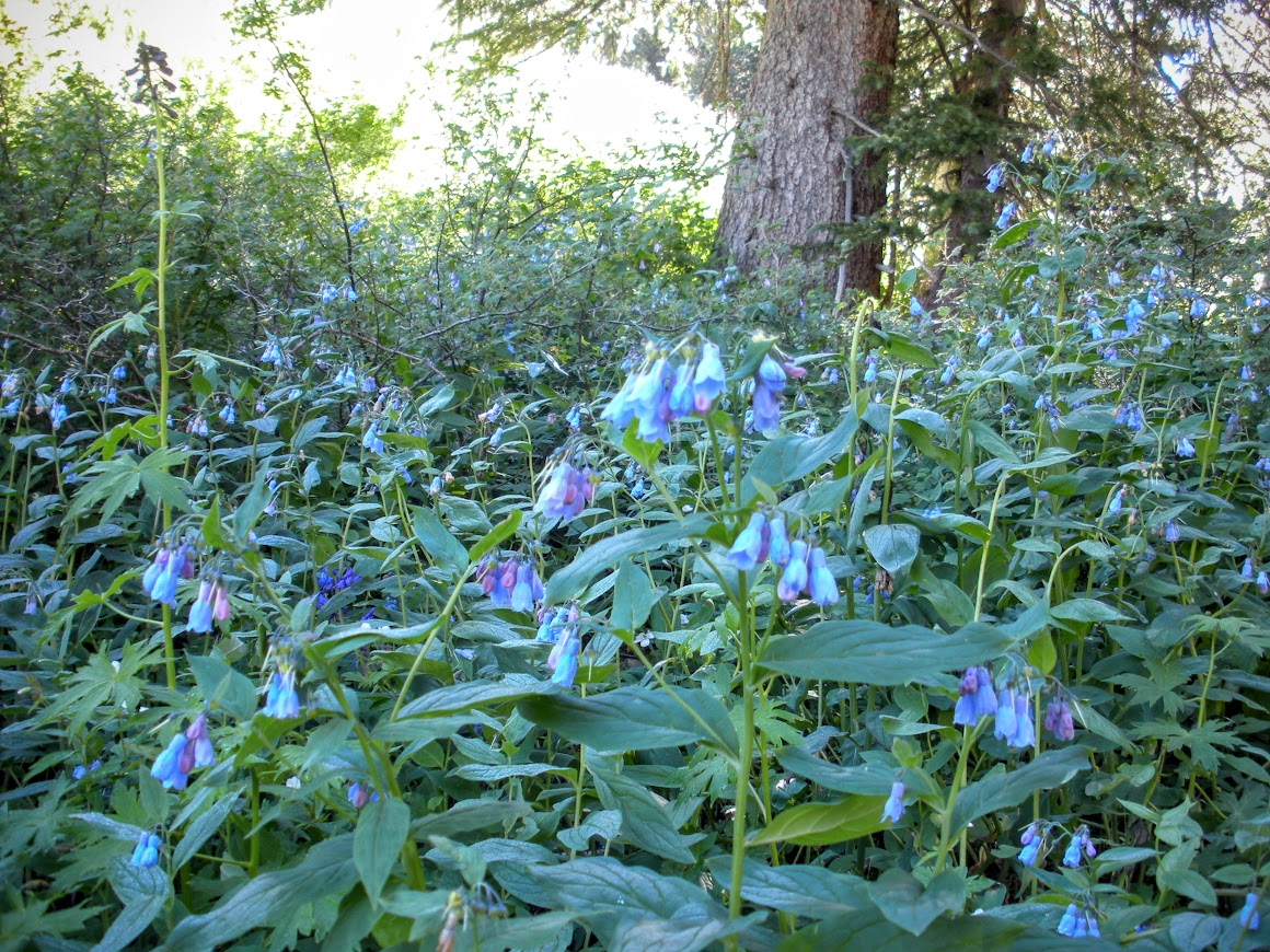
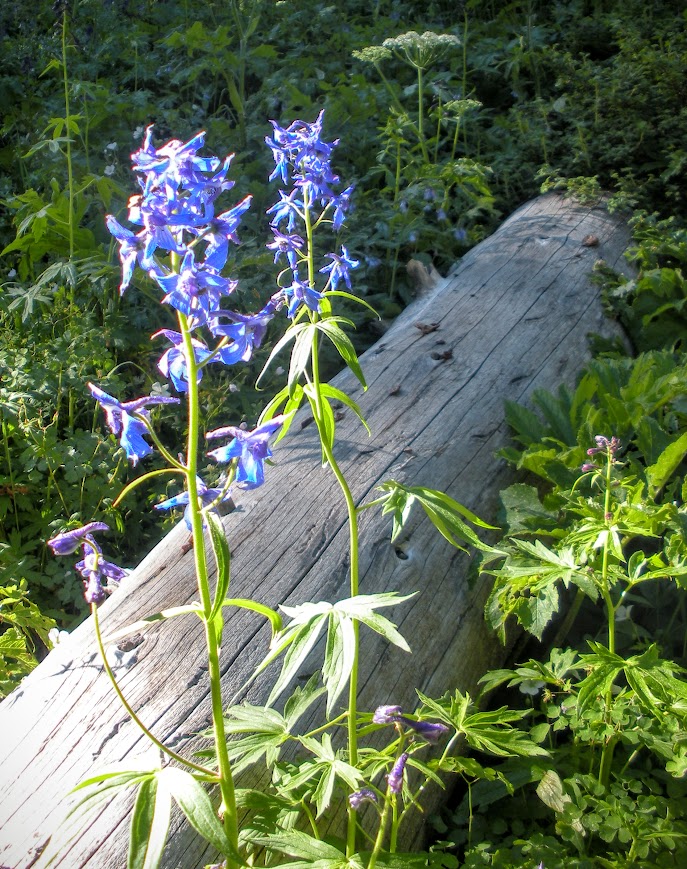
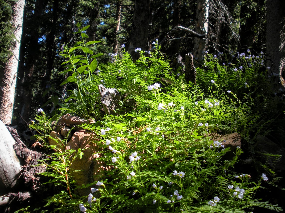
I thought I was going to be disappointed that I missed the Wasatch Wildflower Festival this same weekend, but the La Sals were in full bloom.
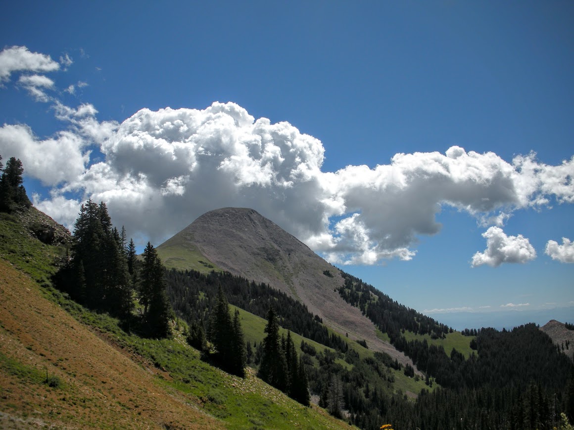
We reached Burro Pass 3 miles from Warner Lake. From here you can continue on another mile to Mann's Peak, 12,272ft. We rested on the pass for a while taking in the views of Mount Tomasaki towering above us.
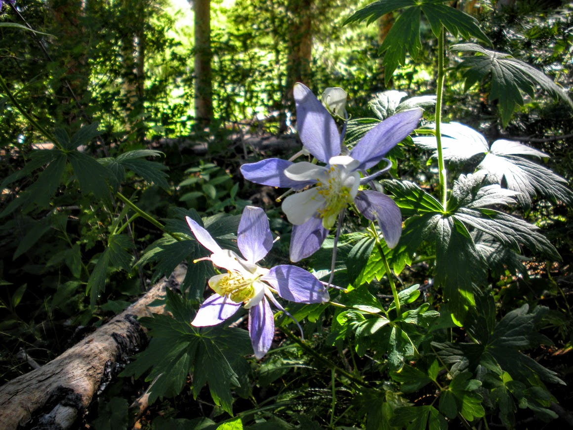
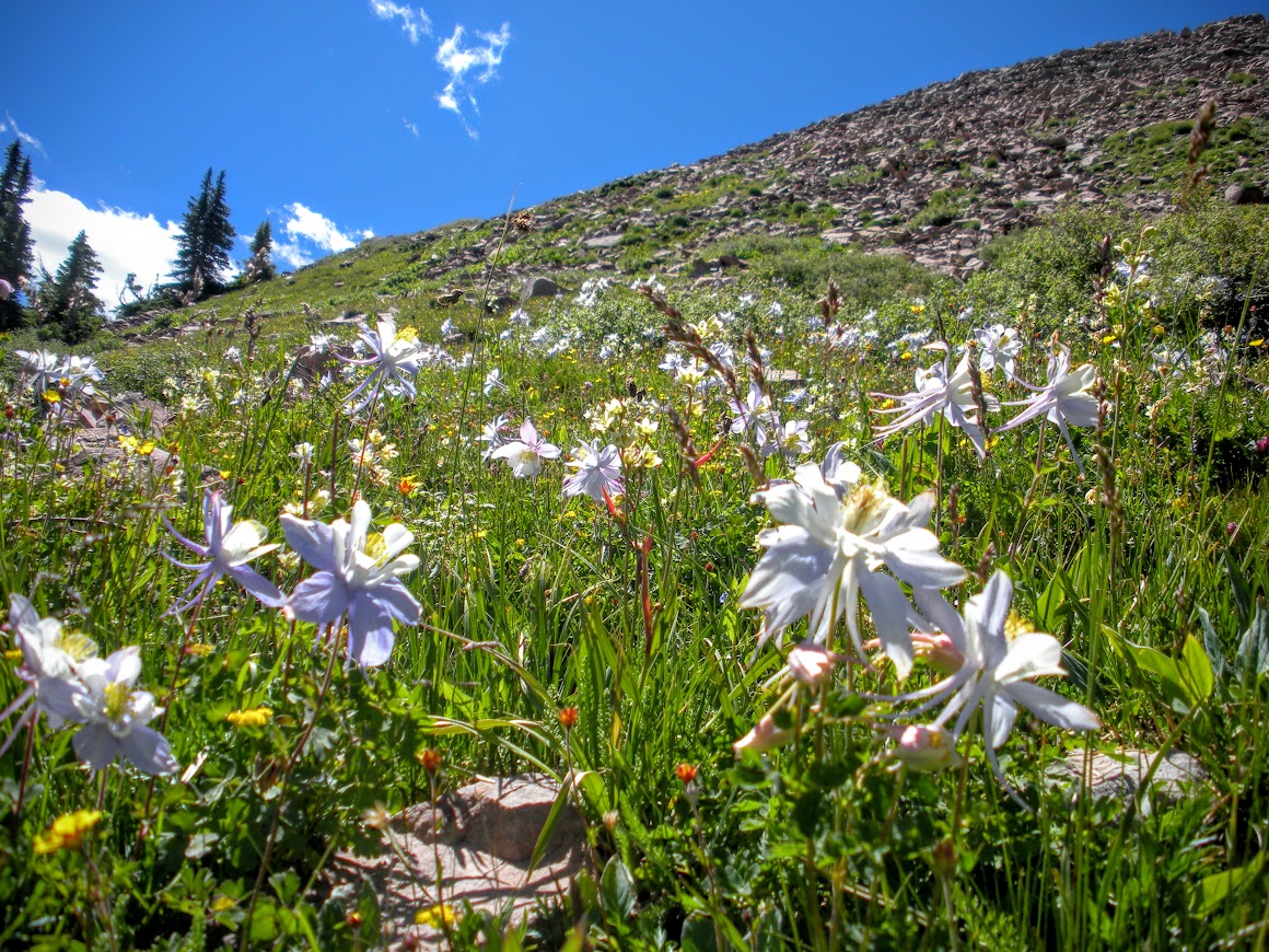
After a bit of a rest I climbed the ridge on the south side of Burro Pass which I've seen referred to as 'Burro Ridge'. On my way up I startled more than a few Pikas in the talus slope and came across the biggest patch of Colorado Columbine I have ever seen in the alpine tundra, about 11,400 ft.
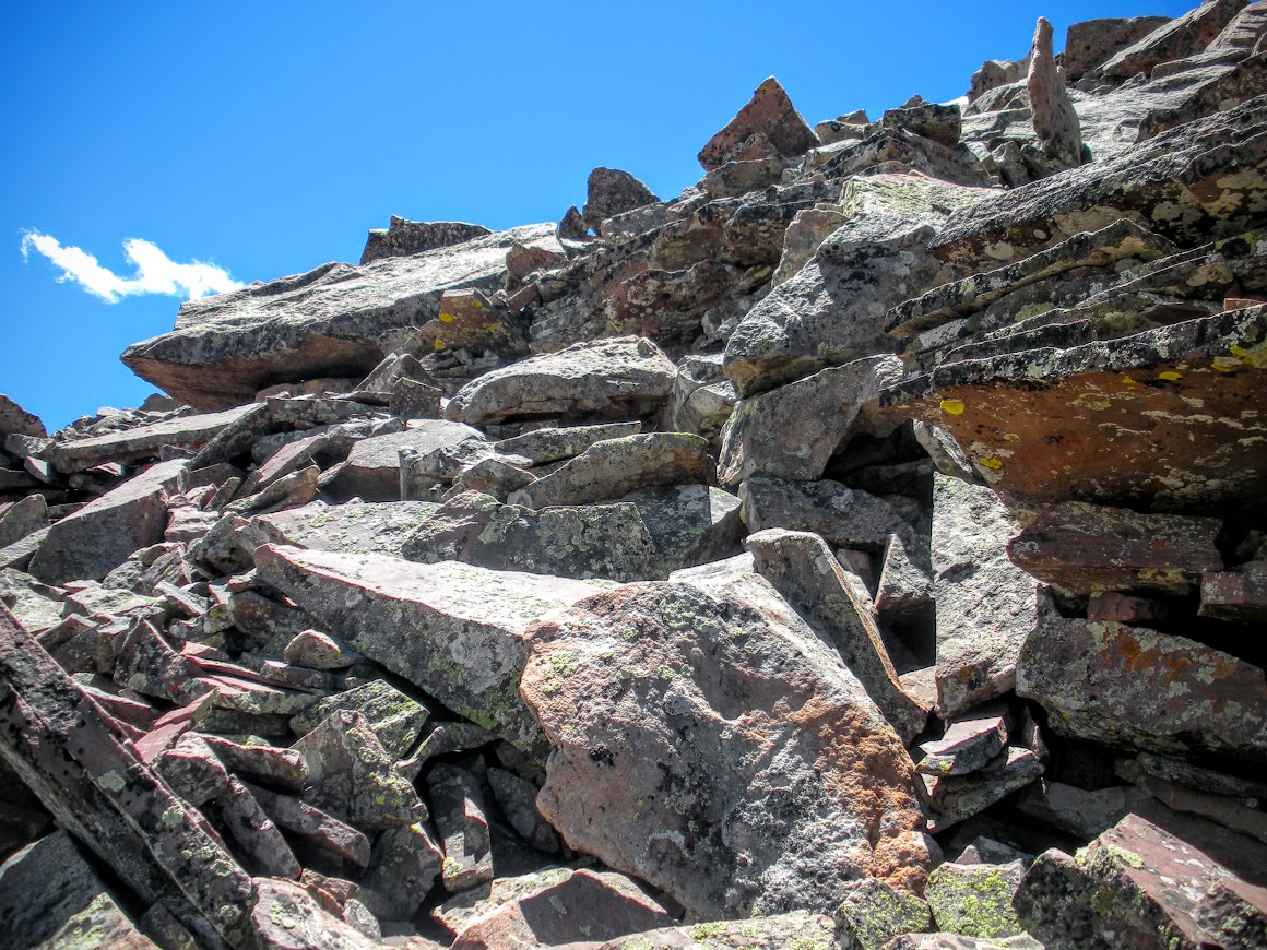
The grassy section I was traversing ran out and the angle of the slope increased greatly as I neared the last 200 feet to top out. It turned to a scramble over sometimes loose talus to gain the ridge.
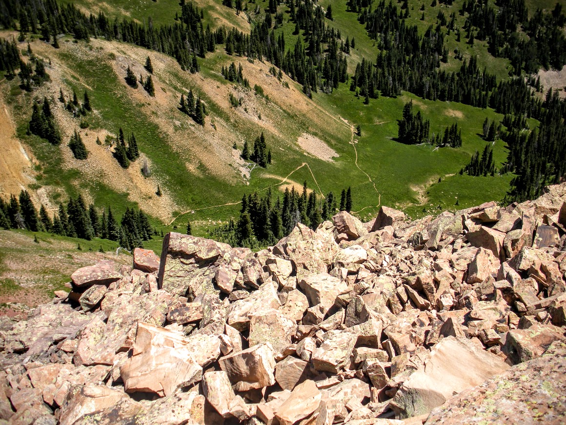
Looking down at the Burro Pass trail coming from Geyser Pass trailhead atop Burro Ridge.
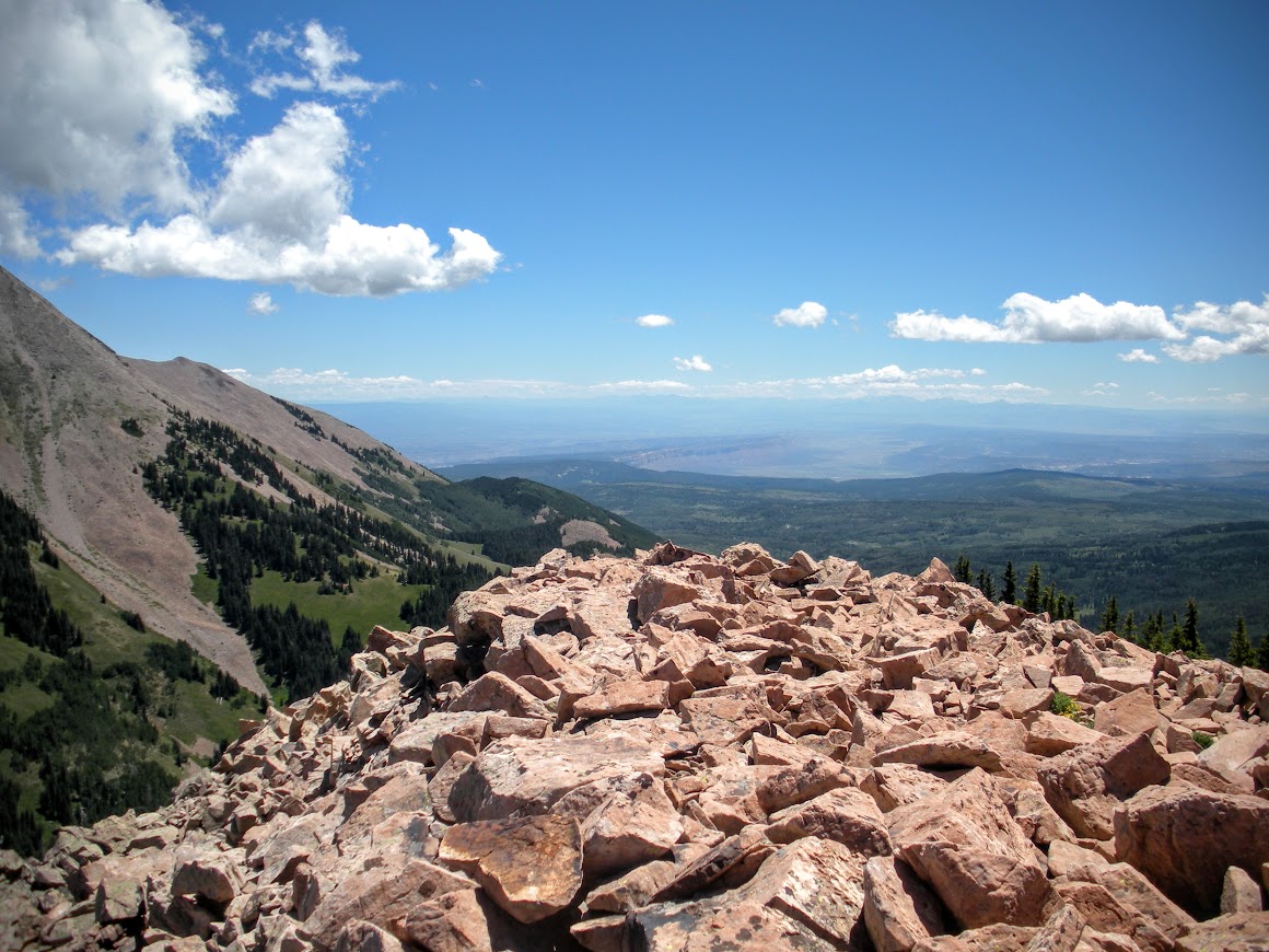
Once on top of Burro Ridge (11,641ft) I was rewarded with an incredible 360 degree view of the La Sals and the surrounding canyon country. You could see Moab and Canyonlands to the East and the San Juans to the West.
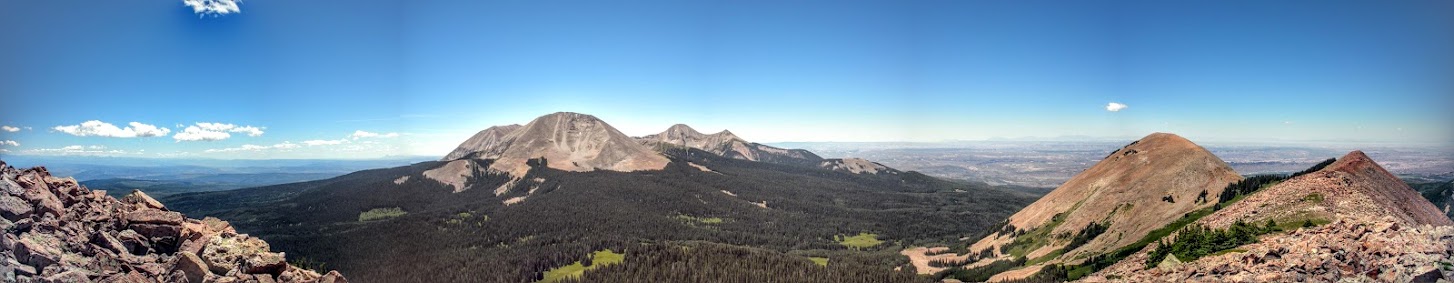
Looking south - Mount Mellenthin (center front), Mount Tukuhnikivatz and Tuk No (behind center right). Haystack Mountain and Burro Ridge far right.
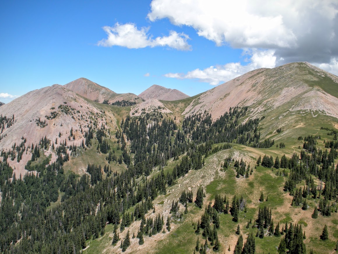
Mineral Mountain (left), Mount Waas (center) and Manns Peak (right) from Burro Ridge looking north.
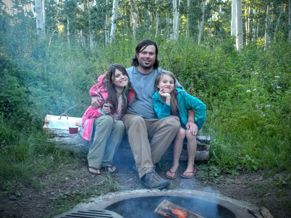
I was hoping to continue on Burro Ridge to Haystack peak, but it was getting late in the day and we needed to get back to camp. So we returned down the trail to Warner Lake for some rest and recuperation by the campfire.
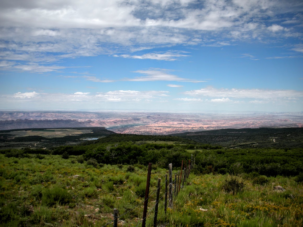
The next day it was time to pack up and head back to Salt Lake City. We continued south on the La Sal Loop road to exit near Moab. The views from the road down to Moab and the Canyonlands area were amazing.
This was a fun, quiet campground with great access to area trails, I can't wait to return. Next time, if I attempt to climb Haystack mountain I'll do it from the southern side as the slope on Haystack and Burro Ridge is more mellow than the north side. The trail to Manns Peak looks to stay moderate all the way to the top, so that's another hike I'll keep on my list for next time.
Me and the family decided to head to the mountains for Pioneer Day weekend this year. Our destination was the Warner Lake Campground off the La Sal Loop road in the La Sal Mountains East of Moab. This would be my first trip to the La Sals, but I'm already looking forward to exploring them more in the future.
Day one was mostly loading gear and making the drive from Salt Lake to the campground. You could see the La Sal range approaching as we neared the Crescent Junction exit off I-70.
We continued on towards Moab and turned off at the River road (Utah 128) toward Castle Valley. After about 12 miles the River Road meets with the La Sal Loop road. We continued on the La Sal loop road and began to climb the foothills of the La Sals out of Castle Valley.
Looking out toward Castleton Tower from the La Sal loop road:
We arrived to Warner Lake campground in the early evening. The air at 9,200ft was cool and enjoyable compared to the heat of the red rock canyons below. Warner Lake Campground is situated in a beautiful aspen grove near the base of Haystack mountain. Created in 1933, it was originally a camp for the Civilian Conservation Corps. Warner Lake was created by the CCC by diverting and damming Mill Creek which is known for a popular swimming hole further down stream when it reaches the Sand Flat recreation area.
We spent the next day exploring the area surrounding the campground and tested the fishing in the lake.
Lupine was thick around the campground:
The lake was full of hungry planter rainbows, they bit my fly on every cast well into the afternoon.
After fishing and letting the kids play in the water a bit we spent the rest of the evening relaxing at camp. I took some more pictures of the lake and Haystack mountain in the evening light.
The next morning me and my wife took the trail from Warner Lake to Burro Pass. This was an amazing trail that followed Mill Creak to the top of Burrow Pass. The trail started in the aspens which gave way to big Douglas Firs as the elevation increased. We spotted many mushrooms and fungi along the trail in the aspen forests. A squirrel surprised us running across the trail with a 4" mushroom cap in its mouth.
After about a mile we came to a sign marking the split between Wet Fork Mill Creek and Dry Fork Mill Creek. We continued up Wet Fork Mill Creek toward Burro Pass.
I thought I was going to be disappointed that I missed the Wasatch Wildflower Festival this same weekend, but the La Sals were in full bloom.
We reached Burro Pass 3 miles from Warner Lake. From here you can continue on another mile to Mann's Peak, 12,272ft. We rested on the pass for a while taking in the views of Mount Tomasaki towering above us.
After a bit of a rest I climbed the ridge on the south side of Burro Pass which I've seen referred to as 'Burro Ridge'. On my way up I startled more than a few Pikas in the talus slope and came across the biggest patch of Colorado Columbine I have ever seen in the alpine tundra, about 11,400 ft.
The grassy section I was traversing ran out and the angle of the slope increased greatly as I neared the last 200 feet to top out. It turned to a scramble over sometimes loose talus to gain the ridge.
Looking down at the Burro Pass trail coming from Geyser Pass trailhead atop Burro Ridge.
Once on top of Burro Ridge (11,641ft) I was rewarded with an incredible 360 degree view of the La Sals and the surrounding canyon country. You could see Moab and Canyonlands to the East and the San Juans to the West.
Looking south - Mount Mellenthin (center front), Mount Tukuhnikivatz and Tuk No (behind center right). Haystack Mountain and Burro Ridge far right.
Mineral Mountain (left), Mount Waas (center) and Manns Peak (right) from Burro Ridge looking north.
I was hoping to continue on Burro Ridge to Haystack peak, but it was getting late in the day and we needed to get back to camp. So we returned down the trail to Warner Lake for some rest and recuperation by the campfire.
The next day it was time to pack up and head back to Salt Lake City. We continued south on the La Sal Loop road to exit near Moab. The views from the road down to Moab and the Canyonlands area were amazing.
This was a fun, quiet campground with great access to area trails, I can't wait to return. Next time, if I attempt to climb Haystack mountain I'll do it from the southern side as the slope on Haystack and Burro Ridge is more mellow than the north side. The trail to Manns Peak looks to stay moderate all the way to the top, so that's another hike I'll keep on my list for next time.
Last edited: