ogdendude
Member
- Joined
- Apr 19, 2013
- Messages
- 86
I am sure nothing in this trip report is any new discovery, but I thought I'd tell you my experience March 27-29 compared to a trip I did in June about 6 years ago.
First off, the whole permitting thing is very different now as I am sure lots of other people already know. It was not online 6 years ago. Back then I walked into the Needles Visitors' Center and got one. Now it is all online for the whole Canyonlands park including backpacking and 4x4 roads (White Rim, Elephant Hill backcountry vehicle sites).
I think I got really lucky when I went online. I booked SC1 and SC3 only 10 days before the trip. Looking at the online system, it looked like every site was booked out for the entire park for weeks except for these two nights I got. So maybe there was a late cancellation and I just got dumb lucky to get these 2 sites on a popular weekend.
I also learned the bear container protocol is different. Now all backpackers must carry their own IGBC approved bear container rather than rely on the steel ammo boxes which are in the process of being removed. I did see that the ammo boxes are gone from SC1 and SC2 but they were still there for SC3. The Needles Visitors' Center people did say that if they are still there that they will be removed too. They told me that raccoons were figuring out how to open the ammo boxes. I actually have a different theory. I think they are making people carry their own bear container as a way to throw up another obstacle in trying to keep the numbers of visitors down in the canyon. Requiring people to carry their own bear containers is just a way to get some people to not go at all.
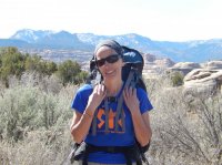
We (very attractive companion and I) left Ogden at 8:15am and arrived at REI at 9:00 am on Friday the 27th. We rented a bear container from REI and then set off for the Needles. Renting a bear container seemed to make a lot more sense than buying one unless you are going to use one a lot.
After some stops in Green River, Moab and Newspaper Rock, we arrived at the Cathedral Butte TH around 3:30pm.
The road to Cathedral Butte was in pretty much excellent shape. But a few words about that road. I have several different maps of that area and they all give different names to the same road. Beef Basin Road. Elk Ridge Road. Cottonwood Road. Bridger Jack Mesa Road. I mean, how difficult is it for whoever is in charge of these things to agree on what one road is named?
We did see a ton of rock climbers parked along Highway 211 as well as the Beef Basin Road. Seems as though this area is becoming somewhat of a climbing mecca.
At the TH there were 8 cars including mine. Last time I was here there was mine alone. So we knew that we would see a lot of people from the cars and also because we knew every campsite was booked every night.
I did see some snow still on the shaded north slope under the rim near the TH. So looks like the trail itself would have had snow on it a couple of weeks ago. Was now melting fast. Quite a lot of snow in the mountains immediately south of the TH.
The start:
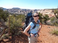
We set off around 3:45pm for our destination which was SC1. About 5 minutes down we ran into some "kids" who were on their way up and almost there. I asked where they started and they said SC4. So to me that is a hell of a long day going from SC4 to Cathedral Butte and hopefully seeing the sites along the way such as Big Ruin, etc.
So it made me start to think, people are doing itineraries based on what sites they can get given the limited availability rather than an itinerary which makes much sense for a good trip. Later on I ran into a group on their way from Cathedral Butte to SC4 in one day and it was 5:30pm at the time and I saw them at SC3, so they had an hour to go to get to SC4 and hopefully pitch their tent and make dinner while there was some light. Sure they could do that with headlamps, but not how you would plan your trip. They looked like they were racing to get to SC4. Didn't look like they were having much fun.
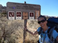
Getting from Cathedral Butte to SC1 was pretty uneventful. I did notice on this trip compared to my previous trip which was in a June, that this time everything was much more brown and not green. The marsh was brown. Most of the trees were brown with no leaves. No cactus flowers. So not as pretty. Less shade at the campsites as the trees were mostly bare.
Just after the marsh:
On this trip I did bring an empty 6 liter water container so that we could filter and fill up once at the spring and then take it to the campsite for all our needs rather than make a few trips. So water for dinner, breakfast, coffee, plus filling up both our drink containers (2 liters each) for the next day was about right. Last time I made several trips back and forth to the spring. Bringing one empty collapsable container was a good idea.
The gnats were more than zero but not as bad as my precious trip. No mosquitos. We did see a lot of bats right overhead.
There was a group in SC2 who were residents of Moab. They were there for 2 nights in the same campsite. Could hear almost every word they said as the canyon walls seemed to amplify their conservational voices.
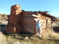
The next day we broke camp and were on our way by 8:45am. Visited all the sites I know of along the way. In all I counted 9 sets of ruins between SC1 and Upper Jump. (Not including anything I don't know about in Big Pocket or other double-secret side canyons.)
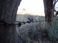
Kirk's Fence with 110 year old barbed wire:
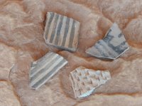
Seen at the first good ruins on the right:
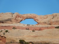
Not sure the name of this arch before Big Ruin:
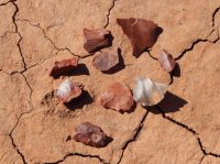
Seen next to the trail before Big Ruin:
Big Ruin from a distance with my little pocket camera telephoto:
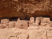
Seen at Big Ruin:
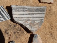
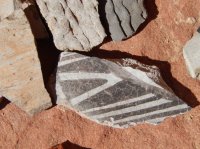
Arch near the trail on the right:
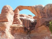
Another in the distance:
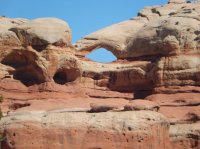
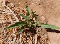
The Squash in Squash Ruins was barely started for the season. The previous time I was there in a June, the squash vines were spread all over the place. Notice all the brown from last season.
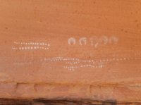
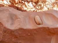
Along the trail we saw some canine track and tons of canine poop. Some looked minutes fresh. I assume it is all coyote. Saw a lot of jackrabbits. A few deer. Looked like a couple of elk tracks. Did not see any sign at all of bears.
Notice the snow in the background:
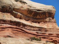
Crazy high ruins:
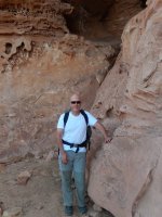
All American Man (actually I am cheating since I took this picture the next day on the way out when the light was better):
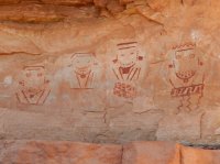
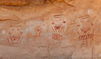
We went through the crack just past All American Man and then to Four Faces. I had never been here before and it is an amazing site. Great to just sit there and wonder what the 4 different faces, and their jewelry and their clothes and hats all mean. Easy to imagine that the could represent 4 important elders or chiefs or something. They all look important by their garb.
Then a quick jump over the Four Faces spring and then on to SC3. Set up camp and then walked out to Upper Jump. I didn't realize how close it is. On one map I have the location of SC3 is incorrect and places SC3 past Upper Jump and not before it.
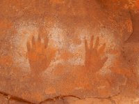
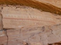
We also visited the pictographs in between SC3 and Upper Jump. Saw one shard of good size.
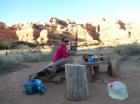
Dinner at SC3:
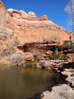
So on Sunday the 29th we knew we had to get from SC3 to Ogden. Sort of a long day for us (49 and almost 51 years old). We left camp at 9:00 and made it to Kirk's Spring by 11:45am. I thought that was reasonably good time. We took a good long enjoyable hour at the spring to rest, rejuvenate and refill our containers.
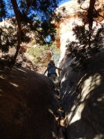
The crack:
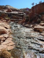
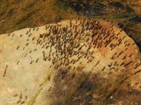
Zillions of baby guppies:
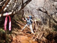
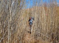
Marsh:
Going from the spring to the TH was slow. That climb in mid-afternoon for us out of shapers is a grind.
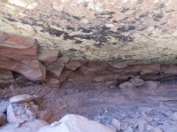
We did one stop along the way at an formerly-inhabited cave. Very blackened roof. Michael Kelsey does mention petroglyphs somewhere around here but I never found any.
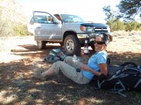
Made it to TH at 3:30pm.
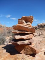
One crap of a big cairn by Kirk's Spring:
Featured image for home page:
First off, the whole permitting thing is very different now as I am sure lots of other people already know. It was not online 6 years ago. Back then I walked into the Needles Visitors' Center and got one. Now it is all online for the whole Canyonlands park including backpacking and 4x4 roads (White Rim, Elephant Hill backcountry vehicle sites).
I think I got really lucky when I went online. I booked SC1 and SC3 only 10 days before the trip. Looking at the online system, it looked like every site was booked out for the entire park for weeks except for these two nights I got. So maybe there was a late cancellation and I just got dumb lucky to get these 2 sites on a popular weekend.
I also learned the bear container protocol is different. Now all backpackers must carry their own IGBC approved bear container rather than rely on the steel ammo boxes which are in the process of being removed. I did see that the ammo boxes are gone from SC1 and SC2 but they were still there for SC3. The Needles Visitors' Center people did say that if they are still there that they will be removed too. They told me that raccoons were figuring out how to open the ammo boxes. I actually have a different theory. I think they are making people carry their own bear container as a way to throw up another obstacle in trying to keep the numbers of visitors down in the canyon. Requiring people to carry their own bear containers is just a way to get some people to not go at all.
We (very attractive companion and I) left Ogden at 8:15am and arrived at REI at 9:00 am on Friday the 27th. We rented a bear container from REI and then set off for the Needles. Renting a bear container seemed to make a lot more sense than buying one unless you are going to use one a lot.
After some stops in Green River, Moab and Newspaper Rock, we arrived at the Cathedral Butte TH around 3:30pm.
The road to Cathedral Butte was in pretty much excellent shape. But a few words about that road. I have several different maps of that area and they all give different names to the same road. Beef Basin Road. Elk Ridge Road. Cottonwood Road. Bridger Jack Mesa Road. I mean, how difficult is it for whoever is in charge of these things to agree on what one road is named?
We did see a ton of rock climbers parked along Highway 211 as well as the Beef Basin Road. Seems as though this area is becoming somewhat of a climbing mecca.
At the TH there were 8 cars including mine. Last time I was here there was mine alone. So we knew that we would see a lot of people from the cars and also because we knew every campsite was booked every night.
I did see some snow still on the shaded north slope under the rim near the TH. So looks like the trail itself would have had snow on it a couple of weeks ago. Was now melting fast. Quite a lot of snow in the mountains immediately south of the TH.
The start:

We set off around 3:45pm for our destination which was SC1. About 5 minutes down we ran into some "kids" who were on their way up and almost there. I asked where they started and they said SC4. So to me that is a hell of a long day going from SC4 to Cathedral Butte and hopefully seeing the sites along the way such as Big Ruin, etc.
So it made me start to think, people are doing itineraries based on what sites they can get given the limited availability rather than an itinerary which makes much sense for a good trip. Later on I ran into a group on their way from Cathedral Butte to SC4 in one day and it was 5:30pm at the time and I saw them at SC3, so they had an hour to go to get to SC4 and hopefully pitch their tent and make dinner while there was some light. Sure they could do that with headlamps, but not how you would plan your trip. They looked like they were racing to get to SC4. Didn't look like they were having much fun.

Getting from Cathedral Butte to SC1 was pretty uneventful. I did notice on this trip compared to my previous trip which was in a June, that this time everything was much more brown and not green. The marsh was brown. Most of the trees were brown with no leaves. No cactus flowers. So not as pretty. Less shade at the campsites as the trees were mostly bare.
Just after the marsh:

On this trip I did bring an empty 6 liter water container so that we could filter and fill up once at the spring and then take it to the campsite for all our needs rather than make a few trips. So water for dinner, breakfast, coffee, plus filling up both our drink containers (2 liters each) for the next day was about right. Last time I made several trips back and forth to the spring. Bringing one empty collapsable container was a good idea.

The gnats were more than zero but not as bad as my precious trip. No mosquitos. We did see a lot of bats right overhead.
There was a group in SC2 who were residents of Moab. They were there for 2 nights in the same campsite. Could hear almost every word they said as the canyon walls seemed to amplify their conservational voices.
The next day we broke camp and were on our way by 8:45am. Visited all the sites I know of along the way. In all I counted 9 sets of ruins between SC1 and Upper Jump. (Not including anything I don't know about in Big Pocket or other double-secret side canyons.)
Kirk's Fence with 110 year old barbed wire:

Seen at the first good ruins on the right:

Not sure the name of this arch before Big Ruin:

Seen next to the trail before Big Ruin:

Big Ruin from a distance with my little pocket camera telephoto:

Seen at Big Ruin:


Arch near the trail on the right:

Another in the distance:

The Squash in Squash Ruins was barely started for the season. The previous time I was there in a June, the squash vines were spread all over the place. Notice all the brown from last season.


Along the trail we saw some canine track and tons of canine poop. Some looked minutes fresh. I assume it is all coyote. Saw a lot of jackrabbits. A few deer. Looked like a couple of elk tracks. Did not see any sign at all of bears.
Notice the snow in the background:

Crazy high ruins:

All American Man (actually I am cheating since I took this picture the next day on the way out when the light was better):

We went through the crack just past All American Man and then to Four Faces. I had never been here before and it is an amazing site. Great to just sit there and wonder what the 4 different faces, and their jewelry and their clothes and hats all mean. Easy to imagine that the could represent 4 important elders or chiefs or something. They all look important by their garb.

Then a quick jump over the Four Faces spring and then on to SC3. Set up camp and then walked out to Upper Jump. I didn't realize how close it is. On one map I have the location of SC3 is incorrect and places SC3 past Upper Jump and not before it.

We also visited the pictographs in between SC3 and Upper Jump. Saw one shard of good size.

Dinner at SC3:

So on Sunday the 29th we knew we had to get from SC3 to Ogden. Sort of a long day for us (49 and almost 51 years old). We left camp at 9:00 and made it to Kirk's Spring by 11:45am. I thought that was reasonably good time. We took a good long enjoyable hour at the spring to rest, rejuvenate and refill our containers.
The crack:


Zillions of baby guppies:

Marsh:

Going from the spring to the TH was slow. That climb in mid-afternoon for us out of shapers is a grind.

We did one stop along the way at an formerly-inhabited cave. Very blackened roof. Michael Kelsey does mention petroglyphs somewhere around here but I never found any.

Made it to TH at 3:30pm.

One crap of a big cairn by Kirk's Spring:

Featured image for home page:

