- Joined
- Oct 30, 2016
- Messages
- 991
Some time back towards the first of the year, @Jackson had mentioned a desire to get a winter camping trip in. I'm all about winter, so I offered to head out with him if we could work out a location and time.
Work it out we did, with our sights set on Island in the Sky for a few days backpacking. After a quick stop at the visitor center to grab the backcountry permit, we met up at the Upheaval Canyon trailhead all bundled up and ready to face the worst that winter could send our way...
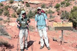
... which, as it turned out, would be a few days of 70ish highs and 40ish lows. Not bad for early March!
Our planned route was to drop down on the Syncline Loop and then head out in to Upheaval Canyon to make camp somewhere in the flats near the Green River. You can't camp in the loop, only in the shaded areas on the map below.
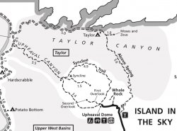
So as a first trip of the year for both of us, this would be a pretty good one. We chose to drop in on the west-facing portion of the loop, hauling about a gallon of water each to see us through the 7 miles to where we'd find a place to camp.
The trail starts out mellow for about half a mile and then sheds about 1200 feet of elevation over a rocky mile and a half, until settling in to a smoother descent for the remainder of the run out towards the river.
Here's @Jackson looking down in to the canyon. Our destination is through the gap and around the corner.
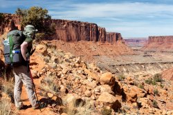
About half way down there's a short bit of steeper pitch that requires a bit of scrambling, but that was really about the crux of it.
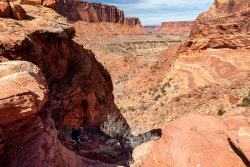
Walking the Syncline Trail was very easy. I don't see how it would be possible to get lost, but there is a constant string of cairns along the way to keep you on track and aid in cutting across some of the meandering curves that nature has carved out.
Interesting rock formations along the way.
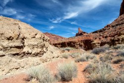
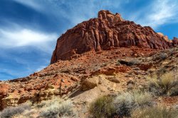
After a few miles we turned in to Upheaval. Shortly after the Syncline/Upheaval junction we came up on a seep. Just a slow drip, but apparently enough to keep some nearby willows alive and attract the local big horns..
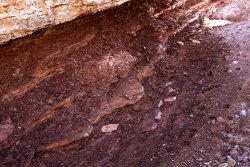
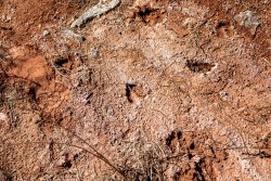
Soon enough the canyon walls tapered off and we popped out in the Upheaval Bottom area.
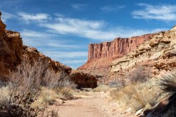
Looking back up in to the mouth of the canyon:
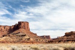
The sheer walls of Buck Mesa dominate the views to the east
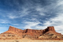
After setting up camp, we headed over to the river to refill our water supplies. The ranger suggested we'd be able to bushwack through all the growth along the banks but after wandering around for the better part of a mile trying to find anything that looked like it would be be possible to bust through, we cut back out to the White Rim Road (a narrow dirt scratch in the flats) and took the road to a wash that ran down to the river.
The Green River is one silty thing, and just dragging a water bag through it somehow managed to turn its cloudy color even cloudier. We managed to scoop our fill and head back to camp. @Jackson had brought some alum to help knock down the heavy alkaline flavor, but otherwise actually filtering the water wasn't an issue. My Katadyne bag had no problem dealing with a few liters of it, though after the water passed what was left in the bag did look pretty horrific.
Sundown came soon enough (last couple days before the time change), so after a quick bite it was time to enjoy the local show:

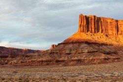
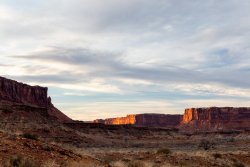
Our tents nestled in a fold of Big Horn Mesa
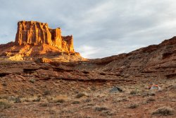
Early season camping. Sun down and temps dropping like a rock by 7pm - hit the sack! For a while anyway. By 2am I'd had enough of more tossing and turning than sleeping, so I thought I'd get up and see what my camera could make of a nearly full moon shining down on the landscape:
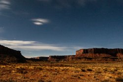
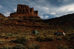
Back to bed. Felt like it got a bit colder than forecast, but soon enough the spotlight of the moon was replaced with the dull gray light of a mostly cloudy sky and it was time to rise and shine. For all the great low level clouds scattered around the sky, there was a thick enough batch obscuring the sun and keeping things from really firing up.
Still, the light dappling the canyon walls and changing every minute as clouds moved past the sun made for some pretty views.
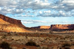
Despite seeing countless tracks and piles of scat (and the sheep related names of everything), we never did spot a big horn. I did turn around to find a @Jackson scurrying around on the cliffs though:
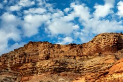
Time for breakfast. Time to see how well that alum worked.
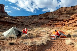
We got around to heading out around 10, with the sun already getting towards microwave intensity above us. Our initial plan was to find a new site to camp that would be much closer to water than our current site, and I'll just leave it at that. So off we went and headed back towards the Syncline.
Another interesting feature along the way
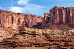
And eventually a good view of Upheaval Dome itself
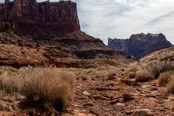
Lots of little lizards running around.
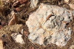
After a bit we were back on the Syncline and started making our way around the rest of the loop, coming up on the spur trail up towards the crater itself.
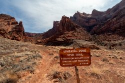
With only 4.6 miles back to the trailhead it seemed pointless to spend another night staring at rocks when we could just hike out and maybe head down towards Moab to (get food and beer) camp somewhere new. The 4.6mi turned out to be a lie and a half, but off we went.
At this point it's all uphill back to the trailhead. A short walk past the local designated camp site (also quite a ways from water), you get your first taste of the climb to come with a steep scramble up some rocks.
Here we are looking back down from whence we came:
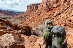
And a look forward to what we (or at least I) expected to be the big climb I'd read about:
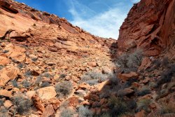
There's maybe 400 feet of a 2000 foot ascent in that picture so, no, a lot more climbing lay past that headwall looking bit at the top of the scree slope.
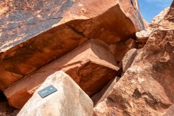
A little park service humor here? Not sure, but this is the 'trail' for a couple miles. Picking your way through, around, over and under boulders.
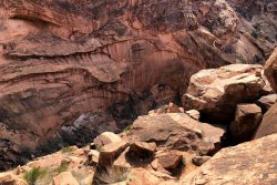
A couple spots of no-fall ledge walking with some pretty good exposure.
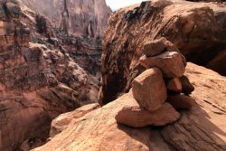
Almost kind of sort of the BCP logo along the way:
Once done with the miles of climbing through boulders, there's more miles of slipping and sliding through mud and ice, followed by a couple more miles of slogging along a red dirt trail surrounded by junipers and slabs of rock. All of which added up to far more than the 4.6 miles some ranger in the distant past calculated by laying a string on a map... Quite a bit more.
After about 5 hours of grinding it out, we looked to our left and the parking lot magically appeared. A quick change of clothes, guzzle of water, and off to Moab we went.
A great first outing of the year!
Work it out we did, with our sights set on Island in the Sky for a few days backpacking. After a quick stop at the visitor center to grab the backcountry permit, we met up at the Upheaval Canyon trailhead all bundled up and ready to face the worst that winter could send our way...

... which, as it turned out, would be a few days of 70ish highs and 40ish lows. Not bad for early March!
Our planned route was to drop down on the Syncline Loop and then head out in to Upheaval Canyon to make camp somewhere in the flats near the Green River. You can't camp in the loop, only in the shaded areas on the map below.

So as a first trip of the year for both of us, this would be a pretty good one. We chose to drop in on the west-facing portion of the loop, hauling about a gallon of water each to see us through the 7 miles to where we'd find a place to camp.
The trail starts out mellow for about half a mile and then sheds about 1200 feet of elevation over a rocky mile and a half, until settling in to a smoother descent for the remainder of the run out towards the river.
Here's @Jackson looking down in to the canyon. Our destination is through the gap and around the corner.

About half way down there's a short bit of steeper pitch that requires a bit of scrambling, but that was really about the crux of it.

Walking the Syncline Trail was very easy. I don't see how it would be possible to get lost, but there is a constant string of cairns along the way to keep you on track and aid in cutting across some of the meandering curves that nature has carved out.
Interesting rock formations along the way.


After a few miles we turned in to Upheaval. Shortly after the Syncline/Upheaval junction we came up on a seep. Just a slow drip, but apparently enough to keep some nearby willows alive and attract the local big horns..


Soon enough the canyon walls tapered off and we popped out in the Upheaval Bottom area.

Looking back up in to the mouth of the canyon:

The sheer walls of Buck Mesa dominate the views to the east

After setting up camp, we headed over to the river to refill our water supplies. The ranger suggested we'd be able to bushwack through all the growth along the banks but after wandering around for the better part of a mile trying to find anything that looked like it would be be possible to bust through, we cut back out to the White Rim Road (a narrow dirt scratch in the flats) and took the road to a wash that ran down to the river.
The Green River is one silty thing, and just dragging a water bag through it somehow managed to turn its cloudy color even cloudier. We managed to scoop our fill and head back to camp. @Jackson had brought some alum to help knock down the heavy alkaline flavor, but otherwise actually filtering the water wasn't an issue. My Katadyne bag had no problem dealing with a few liters of it, though after the water passed what was left in the bag did look pretty horrific.
Sundown came soon enough (last couple days before the time change), so after a quick bite it was time to enjoy the local show:


Our tents nestled in a fold of Big Horn Mesa

Early season camping. Sun down and temps dropping like a rock by 7pm - hit the sack! For a while anyway. By 2am I'd had enough of more tossing and turning than sleeping, so I thought I'd get up and see what my camera could make of a nearly full moon shining down on the landscape:


Back to bed. Felt like it got a bit colder than forecast, but soon enough the spotlight of the moon was replaced with the dull gray light of a mostly cloudy sky and it was time to rise and shine. For all the great low level clouds scattered around the sky, there was a thick enough batch obscuring the sun and keeping things from really firing up.
Still, the light dappling the canyon walls and changing every minute as clouds moved past the sun made for some pretty views.

Despite seeing countless tracks and piles of scat (and the sheep related names of everything), we never did spot a big horn. I did turn around to find a @Jackson scurrying around on the cliffs though:

Time for breakfast. Time to see how well that alum worked.

We got around to heading out around 10, with the sun already getting towards microwave intensity above us. Our initial plan was to find a new site to camp that would be much closer to water than our current site, and I'll just leave it at that. So off we went and headed back towards the Syncline.
Another interesting feature along the way

And eventually a good view of Upheaval Dome itself

Lots of little lizards running around.

After a bit we were back on the Syncline and started making our way around the rest of the loop, coming up on the spur trail up towards the crater itself.

With only 4.6 miles back to the trailhead it seemed pointless to spend another night staring at rocks when we could just hike out and maybe head down towards Moab to (get food and beer) camp somewhere new. The 4.6mi turned out to be a lie and a half, but off we went.
At this point it's all uphill back to the trailhead. A short walk past the local designated camp site (also quite a ways from water), you get your first taste of the climb to come with a steep scramble up some rocks.
Here we are looking back down from whence we came:

And a look forward to what we (or at least I) expected to be the big climb I'd read about:

There's maybe 400 feet of a 2000 foot ascent in that picture so, no, a lot more climbing lay past that headwall looking bit at the top of the scree slope.
A little park service humor here? Not sure, but this is the 'trail' for a couple miles. Picking your way through, around, over and under boulders.

A couple spots of no-fall ledge walking with some pretty good exposure.

Almost kind of sort of the BCP logo along the way:

Once done with the miles of climbing through boulders, there's more miles of slipping and sliding through mud and ice, followed by a couple more miles of slogging along a red dirt trail surrounded by junipers and slabs of rock. All of which added up to far more than the 4.6 miles some ranger in the distant past calculated by laying a string on a map... Quite a bit more.
After about 5 hours of grinding it out, we looked to our left and the parking lot magically appeared. A quick change of clothes, guzzle of water, and off to Moab we went.
A great first outing of the year!
Last edited:
