Ehouston24
Member
- Joined
- Jul 13, 2019
- Messages
- 6
Follow along with the video below to see how to install our site as a web app on your home screen.
Note: This feature may not be available in some browsers.
Thanks. The three of us are from PC/SLC/JH so we should be fine in that regard. Any thoughts on the Gunsight shortcut with backpacks? We would rather cut the miles but are a bit weary with heavy packs and not sure if there will still be snow up there on Aug 8th? Thanks in advance.Looks reasonable to me for a fit party especially if they are not coming from sea level to do it.
Any thoughts on the Gunsight shortcut with backpacks?
Ok thank you! Good info. Curses to that mountain goat.I am assuming that Gun sight is the scree field down into Henry's fork. I did nearly the same trip last year in Aug. We did that short cut with full packs after hiking up from Yellowstone basin and topping Kings peak. No one in my group was happy with my decision. It is steep and loose. Tired legs with packs was sketchy. Then to top it off a little dick of mountain goat tore across above us and knocked loose a bunch of rocks that rolled down on top of us. We had to scatter and shelter so not to get picked off. I watched several people come down the same way though out the day. Everyone appeared to make it.
I don't think I will do it again. Any kind of injury up there could be problematic. Hiking mostly down hill for a few extra miles to forgo that risk may be wise.
Jack.
I swear they have done that to me, more than once, in the Wasatch while climbing. And then a couple of charges... I am not that enamored with mountain goats anymore...Then to top it off a little dick of mountain goat tore across above us and knocked loose a bunch of rocks that rolled down on top of us.


I am assuming that Gun sight is the scree field down into Henry's fork.
Thanks, DrNed. So this would essentially cut off that corner, right? We were looking to camp at Yellowstone Creek. It looks like we would still hit that? It also looks like there is a lake in one of your pictures that might suffice if it’s not too exposed. Hopefully the weather will be good.If you're willing to do the Anderson to Gunsight shortcut, consider going off trail from Smith's Fork Pass to Anderson Pass.
If you're comfortable with off trail travel and reading a map, I highly recommend this. Once you get down from Smith's Fork
stay high and follow the most direct route until you hit the trail going up the south side of Anderson. All above tree line,
good views from the top of Yellowstone, save dropping down and coming back up and shorter.
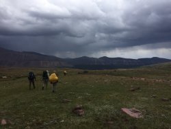
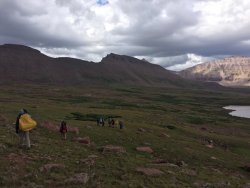
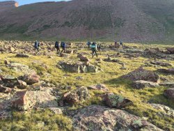
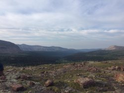
Here are a few of my images through that stretch:
View attachment 79943
View attachment 79944View attachment 79945
Looking down the Yellowstone Basin
View attachment 79946
Thanks Dave. Maybe we are still in for the short cut after all, in that case.I believe you might be confusing the Gunsight shortcut with the so-called toilet bowl. The Gunsight shortcut cuts the corner from Gunsight Pass to the base of Anderson Pass, saving the mileage and elevation loss of going down into Painter Basin on the official Highline Trail. The toilet bowl is the north facing scree chute just northeast of Anderson Pass that drops directly into Henrys Fork.
It would cut the corner and if memory serves there were a couple of unnamed ponds up there fed by streams.Thanks, DrNed. So this would essentially cut off that corner, right? We were looking to camp at Yellowstone Creek. It looks like we would still hit that? It also looks like there is a lake in one of your pictures that might suffice if it’s not too exposed. Hopefully the weather will be good.
Don't like ads? Become a BCP Supporting Member and kiss them all goodbye. Click here for more info.