- Joined
- Feb 15, 2020
- Messages
- 615
Way behind on my 2024 trip reports, but hoping to remedy that over the next few weeks (or months  ). Here's one from earlier in the season w/ @Nethos down in New Mexico. I posted in the "Meet Up" forum thinking I'd head up to the GYE, but w/ very little convincing @Nethos was able to lure me down to New Mexico. And I was not disappointed - to say the least!
It was a last-minute, short time-frame trip so our options were limited and we went in w/ a few different options flagged. As the trip went along, I'd say we settled on just about the right route for our constraints. I'd definitely like to get back out to the Pecos and try out a few of the other, longer options though - and it seems to be pretty perfect in the 'early season'.
All that said, our traverse of the Truchas Ridge was a lot of fun and highly rewarding.
Day 1: Santa Barbara TH to Truchas Lakes
Met up w/ @Nethos at the Santa Barbara trailhead to get an early-ish start on the day. Pretty tame start - just trying to get to Truchas Lakes and in good position for Day 2. Conditions were wonderful. Early sections of the trail were nothing particularly special - but the weather was great and the company was good. It was nice to be back in "summer conditions" after a long (if pretty mild) winter.
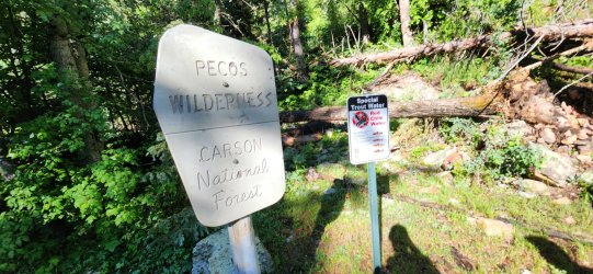
Beautiful views of the Rio Santa Barbara as we walked - along with pretty regular bovine companions for the first 6 or so miles.
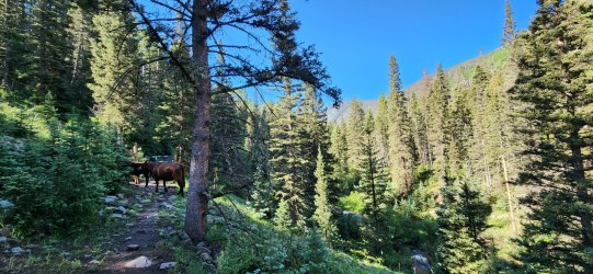
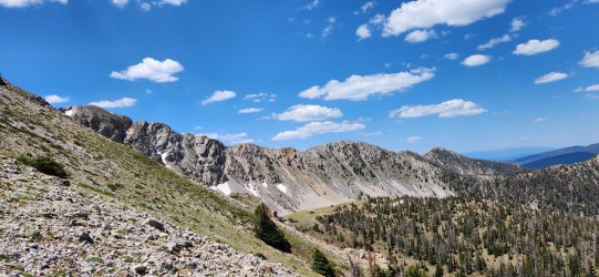
As the trees thinned our views improved as well. Lingering snowfields added an extra bit of beauty - we were a bit surprised how much snow actually remained.
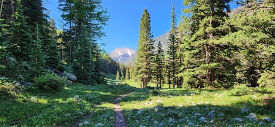
Closer look at Chimayosos Peak as we begin to climb a bit faster towards the pass that would take us to Truchas Lakes. I'd love to follow the path up to Chimayosos and the ridge beyond on a future trip.
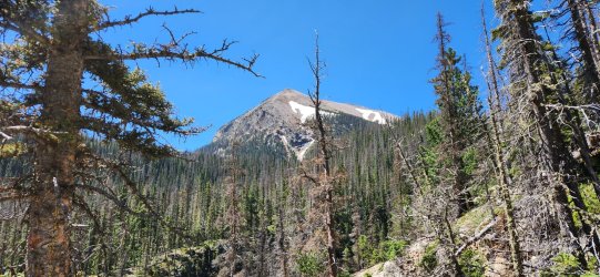
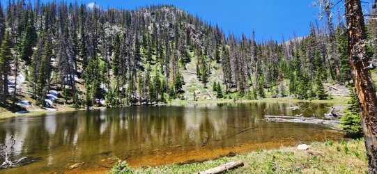
Took a short lunch break at the unassuming No Fish Lake.
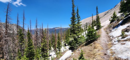
Grew a bit warm as we ascended above treeline for the first time. Occasional snowfields made the trail awkward to follow in a few spots - but not for more than a few steps at a time.
Looking towards North Truchas Peak - which would mark the end of our 'Truchas Traverse' on Day 2.
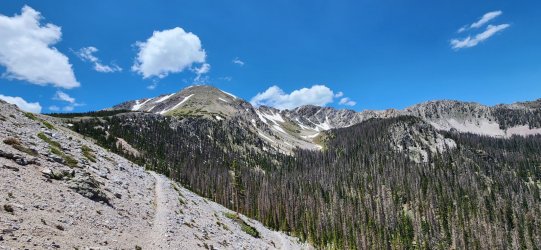
360° from the pass between North Truchas Peak and Chimayosos Peak.
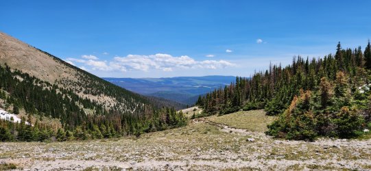
Pretty chill descent down to Truchas Lakes. Very large burn scar dominating the view south.
Truchas Lakes was a really nice spot, but it took a bit of time to find a good campsite that was "in spec".
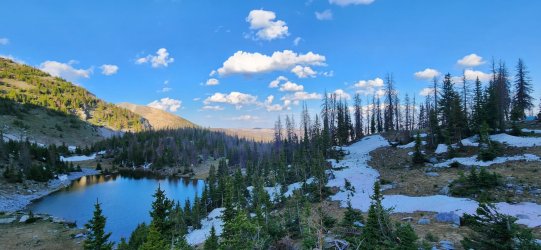
Day 2: Truchas Lakes to West Fork Rio Santa Barbara (via Truchas Ridge)
This was a really spectacular day in the mountains. A pretty grand adventure given how easy it was to access. Our plan was to continue along the trail south of Truchas Peak (also known as "South Truchas Peak") and traverse the ridge up to North Truchas Peak. Truchas Peak itself is the second highest peak in New Mexico and just ~60' shorter than Wheeler Peak to the north - North Truchas Peak doesn't have the requisite prominence to make most lists, but is also one of the very few spots in New Mexico to top out above 13k'. I really enjoyed getting to know a new wilderness area and was happily learning more as we went along.
During breakfast (and dinner the previous night) we could occasionally hear bighorns moving around the ridge and talus fields above. We would get a better look as the day progressed.
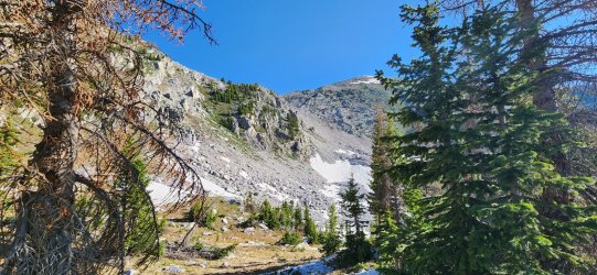
A number of "lakes" we passed weren't marked as much more than a damp spot on topo maps - a sign of how early and quickly the area can dry out once the snow melts completely. I'm sure this route would be wonderful in October - or even November, but I do wonder what water availability would be like at that time.
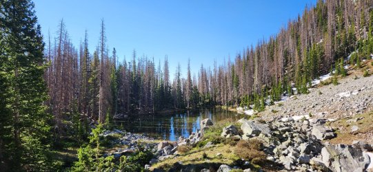
Looking south towards the Trailriders Wall and the path to Pecos Baldy. It looks like some wonderful walking and its another spot I hope to return and explore further.
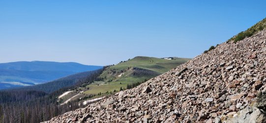
But today we would be turning back to the north for our primary objective - first up, South Truchas Peak.
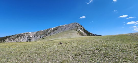
Pecos Baldy to the south.
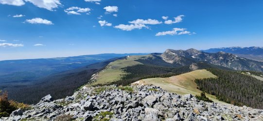
Ridge looking towards our first 'high point' of the day (South) Truchas Peak - and North Truchas Peak in the distance.
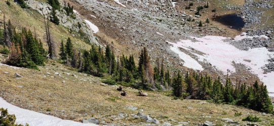
A few bighorn rams sharing the ridges with us.
Jose Vigil Lake
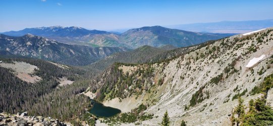
360° from (South) Truchas Peak @ 13,108'.
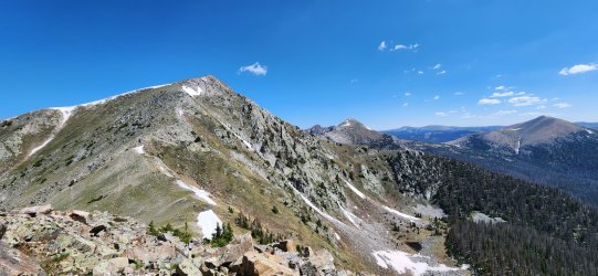
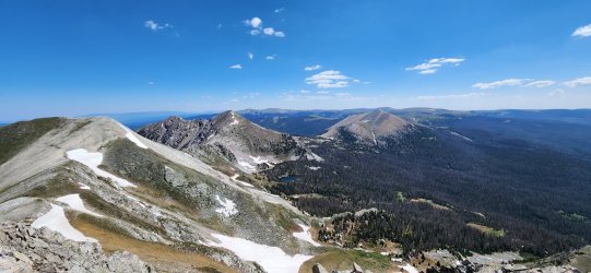
Pretty good look at the remaining route for the day. The section to the high point 'Medio Truchas Peak' that branches off towards Middle Truchas Peak was fairly innocuous, but it would get a bit more interesting from there until North Truchas Peak.
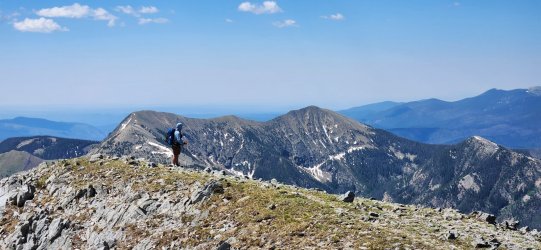
@Nethos taking in the ample scenery.
Continuing north towards North Truchas and the 'playground' in between. There were a few sections here of Class 3 scrambling - varying from mildly to very exposed depending on the specific route. Going slow and steady it could stay a fun Class 3 scramble the whole way, but easy to make it a bit 'spicier' if you want to stay on the upper ridge.
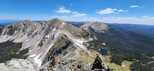
We would stop near the pass south of North Truchas Peak for lunch. From a distance, this section looked like it might "cliff out" and - despite reasonable beta that the route would 'go' - I think we were both a little nervous. But as we got closer, it was evident there were a couple good cracks that would go fairly easily.
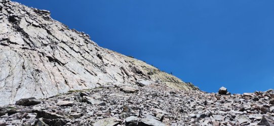
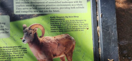
As we enjoyed our lunch, we were treated to a bit of a show. A sizeable bighorn 'nursery herd' was gathered below us - and seemed to increase in number each time we counted. It was a joy to watch the young ones play - and the mothers join in occasionally as well.
The final climb...
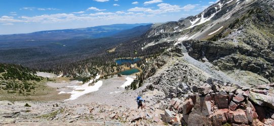
West towards the Trampas Lakes Basin (just over the ridge). Another area ripe for future exploration.
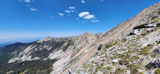
360° from North Truchas Peak @ 13,025'.
We weighed a few options for descending North Truchas Peak, but my desire to make a predictable and early exit on Day 3 pushed us towards dropping back to the pass from Day 1 and heading back out the way we entered.
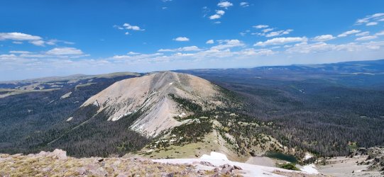
I'd like to travel this ridge one of these days - it looks similar in character to the section between Medio Truchas Peak and North Truchas Peak, but maybe a bit more prolonged. (If anyone has done it, give me a shout - I only know of one person to have done it, but I'm sure more have and it'd be great to get more beta.)
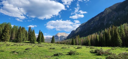
Back below treeline for a wonderful night's rest. The weather never disappointed - though I'm sure it'd be quite warm in just a few short weeks.
Day 3: West Fork Rio Santa Barbara to Santa Barbara TH
The last day was just a quick jaunt back to the Santa Barbara trailhead and the drive home. Well worth the trip to explore a new (to me) area and meet back up w/ @Nethos closer to his 'home turf'.
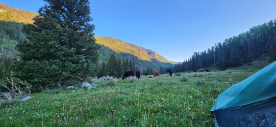
Woke up to a few of our bovine companions in the AM. They paid us little mind - maybe too little, as they made me a bit nervous while I packed up.
Really enjoyed our encounters with these folks. Some of the best viewing of their kind I've ever enjoyed.
Thanks again to @Nethos for joining me and turning me on to yet another beautiful wilderness area!
As I type this on the eve of Thanksgiving Day, I'd be remiss to not say how thankful to everyone on BCP I am. I haven't been around much the last few months, but it has been a pleasure sharing our collective love of the outdoors with all of you. Looking forward to many more years of the same to come! (And I'll try to roll out a few more trip reports soon - for my benefit, if nothing else. )
)
It was a last-minute, short time-frame trip so our options were limited and we went in w/ a few different options flagged. As the trip went along, I'd say we settled on just about the right route for our constraints. I'd definitely like to get back out to the Pecos and try out a few of the other, longer options though - and it seems to be pretty perfect in the 'early season'.
All that said, our traverse of the Truchas Ridge was a lot of fun and highly rewarding.
Day 1: Santa Barbara TH to Truchas Lakes
Met up w/ @Nethos at the Santa Barbara trailhead to get an early-ish start on the day. Pretty tame start - just trying to get to Truchas Lakes and in good position for Day 2. Conditions were wonderful. Early sections of the trail were nothing particularly special - but the weather was great and the company was good. It was nice to be back in "summer conditions" after a long (if pretty mild) winter.

Beautiful views of the Rio Santa Barbara as we walked - along with pretty regular bovine companions for the first 6 or so miles.

As the trees thinned our views improved as well. Lingering snowfields added an extra bit of beauty - we were a bit surprised how much snow actually remained.

Closer look at Chimayosos Peak as we begin to climb a bit faster towards the pass that would take us to Truchas Lakes. I'd love to follow the path up to Chimayosos and the ridge beyond on a future trip.

Took a short lunch break at the unassuming No Fish Lake.

Grew a bit warm as we ascended above treeline for the first time. Occasional snowfields made the trail awkward to follow in a few spots - but not for more than a few steps at a time.

Looking towards North Truchas Peak - which would mark the end of our 'Truchas Traverse' on Day 2.

360° from the pass between North Truchas Peak and Chimayosos Peak.
Pretty chill descent down to Truchas Lakes. Very large burn scar dominating the view south.

Truchas Lakes was a really nice spot, but it took a bit of time to find a good campsite that was "in spec".

Day 2: Truchas Lakes to West Fork Rio Santa Barbara (via Truchas Ridge)
This was a really spectacular day in the mountains. A pretty grand adventure given how easy it was to access. Our plan was to continue along the trail south of Truchas Peak (also known as "South Truchas Peak") and traverse the ridge up to North Truchas Peak. Truchas Peak itself is the second highest peak in New Mexico and just ~60' shorter than Wheeler Peak to the north - North Truchas Peak doesn't have the requisite prominence to make most lists, but is also one of the very few spots in New Mexico to top out above 13k'. I really enjoyed getting to know a new wilderness area and was happily learning more as we went along.
During breakfast (and dinner the previous night) we could occasionally hear bighorns moving around the ridge and talus fields above. We would get a better look as the day progressed.

A number of "lakes" we passed weren't marked as much more than a damp spot on topo maps - a sign of how early and quickly the area can dry out once the snow melts completely. I'm sure this route would be wonderful in October - or even November, but I do wonder what water availability would be like at that time.

Looking south towards the Trailriders Wall and the path to Pecos Baldy. It looks like some wonderful walking and its another spot I hope to return and explore further.

But today we would be turning back to the north for our primary objective - first up, South Truchas Peak.

Pecos Baldy to the south.

Ridge looking towards our first 'high point' of the day (South) Truchas Peak - and North Truchas Peak in the distance.

A few bighorn rams sharing the ridges with us.

Jose Vigil Lake

360° from (South) Truchas Peak @ 13,108'.
Pretty good look at the remaining route for the day. The section to the high point 'Medio Truchas Peak' that branches off towards Middle Truchas Peak was fairly innocuous, but it would get a bit more interesting from there until North Truchas Peak.

@Nethos taking in the ample scenery.

Continuing north towards North Truchas and the 'playground' in between. There were a few sections here of Class 3 scrambling - varying from mildly to very exposed depending on the specific route. Going slow and steady it could stay a fun Class 3 scramble the whole way, but easy to make it a bit 'spicier' if you want to stay on the upper ridge.

We would stop near the pass south of North Truchas Peak for lunch. From a distance, this section looked like it might "cliff out" and - despite reasonable beta that the route would 'go' - I think we were both a little nervous. But as we got closer, it was evident there were a couple good cracks that would go fairly easily.

As we enjoyed our lunch, we were treated to a bit of a show. A sizeable bighorn 'nursery herd' was gathered below us - and seemed to increase in number each time we counted. It was a joy to watch the young ones play - and the mothers join in occasionally as well.
The final climb...

West towards the Trampas Lakes Basin (just over the ridge). Another area ripe for future exploration.

360° from North Truchas Peak @ 13,025'.
We weighed a few options for descending North Truchas Peak, but my desire to make a predictable and early exit on Day 3 pushed us towards dropping back to the pass from Day 1 and heading back out the way we entered.

I'd like to travel this ridge one of these days - it looks similar in character to the section between Medio Truchas Peak and North Truchas Peak, but maybe a bit more prolonged. (If anyone has done it, give me a shout - I only know of one person to have done it, but I'm sure more have and it'd be great to get more beta.)

Back below treeline for a wonderful night's rest. The weather never disappointed - though I'm sure it'd be quite warm in just a few short weeks.

Day 3: West Fork Rio Santa Barbara to Santa Barbara TH
The last day was just a quick jaunt back to the Santa Barbara trailhead and the drive home. Well worth the trip to explore a new (to me) area and meet back up w/ @Nethos closer to his 'home turf'.
Woke up to a few of our bovine companions in the AM. They paid us little mind - maybe too little, as they made me a bit nervous while I packed up.

Really enjoyed our encounters with these folks. Some of the best viewing of their kind I've ever enjoyed.

Thanks again to @Nethos for joining me and turning me on to yet another beautiful wilderness area!
As I type this on the eve of Thanksgiving Day, I'd be remiss to not say how thankful to everyone on BCP I am. I haven't been around much the last few months, but it has been a pleasure sharing our collective love of the outdoors with all of you. Looking forward to many more years of the same to come! (And I'll try to roll out a few more trip reports soon - for my benefit, if nothing else.
Last edited:
