McKee80
Member
- Joined
- Feb 9, 2017
- Messages
- 236
Hi, and thanks to everyone that provided information to make this trip possible for me. I get about a week a year to do a backpacking trip out west. We've only been at this a short time and we wanted to try some cross country travel, but nothing too nasty. And to get better at finding campsites. After considering a bunch of options, we decided to explore the Bear Lakes Basin outside of Bishop, CA. As usual, I mapped out a route that is beyond my capabilities, asked for advice, and throttled it down to something reasonable. For reference (if I say something was easy or hard), I'm 6'1", 240 lbs, work at a desk all day, and exercise about once a week. So we flew from Pittsburgh to Vegas, drove up and got our permit and bear cans. We were planning on starting that day, but switched to a walkup from Pine Creek the next day. We got all of our gear sorted out and camped along the creek near the trailhead. I decided to try trailrunners instead of boots and I had a new quilt to replace my sleeping bag.
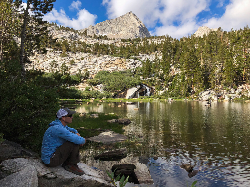
Day 1 (9-5): Pine Creek Trailhead to Pine Lakes
Well, my sleeping pad deflated twice during the night. I had a patch kit and considered fixing it the first lake we got to, but I ended up getting nervous about it and we drove back to Bishop for a backup. I ended up buying a foam pad in case I couldn't fix it, and we were back on our way. The hike up to Pine Lake wasn't too bad. It was cool and rained most of the time. Everyone we met coming out said the weather had been bad the last couple days. We figured we would have lots of lakeside camp spots this trip, so we went looking for a site between Pine and Upper Pine that I had heard people talk about. We never did find it, but we did find a cool spot under this multi colored mountain. The bugs were out, but the wind kept them mostly away. The only other eventful thing that happened was I almost flung myself off a cliff swinging my full backpack on after a water stop.
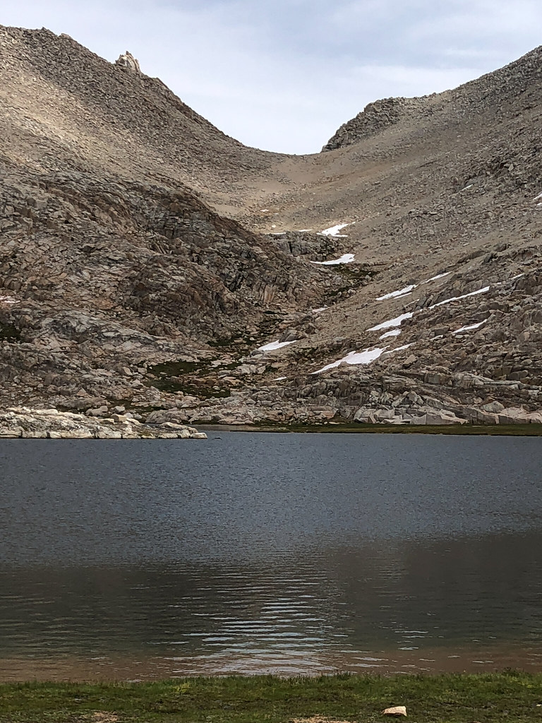
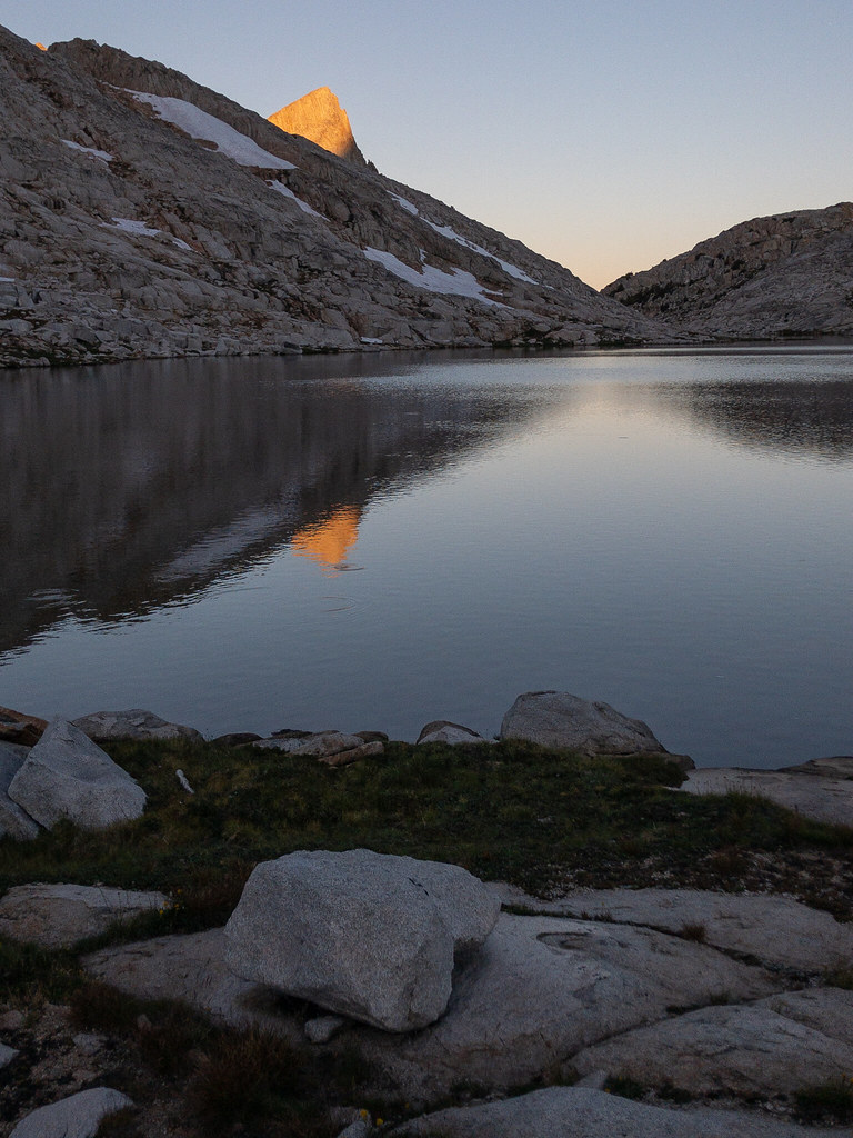
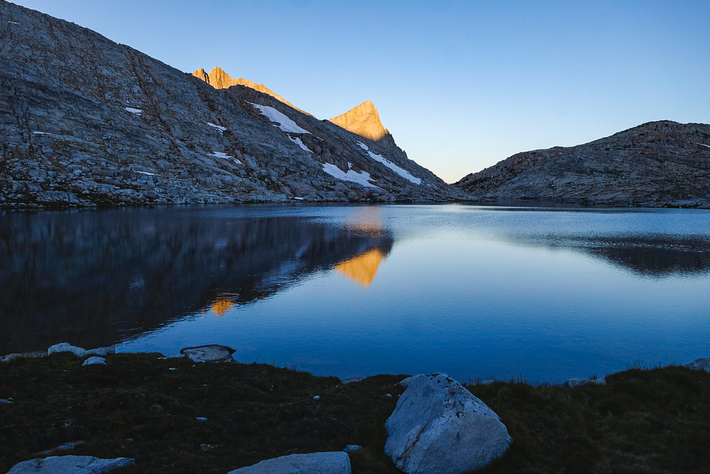
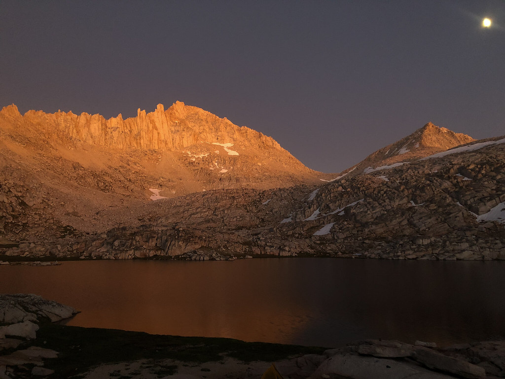
Pine Lake was a pretty harbinger of what was to come
Pine Lake getting sprinkled with rain
Pine Creek between the lakes. The water never would allow me to get the peak lined up right.

Sometimes I play around with portrait mode on my phone. Never quite pulls off real camera DOF. Pine Creek canyon in the background.
Day 2 (9-6): Pine Lakes to Granite Park
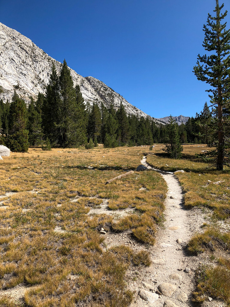
I woke up to a full sleeping pad. The valve is a little quirky and I finally got it figured out. I spend the rest of the trip sleeping on two pads, which was awesome. I was up early and following the creek, trying to get a picture where the creek leads into a mountain. I eventually got to a beautiful meadow around sunrise that floored me. I felt like I had just discovered something amazing that no one had ever seen. I took many pictures trying to capture the feeling I had, to no avail. I'm sure many people have been there, but if you are one of them, I don't want to know") .
.
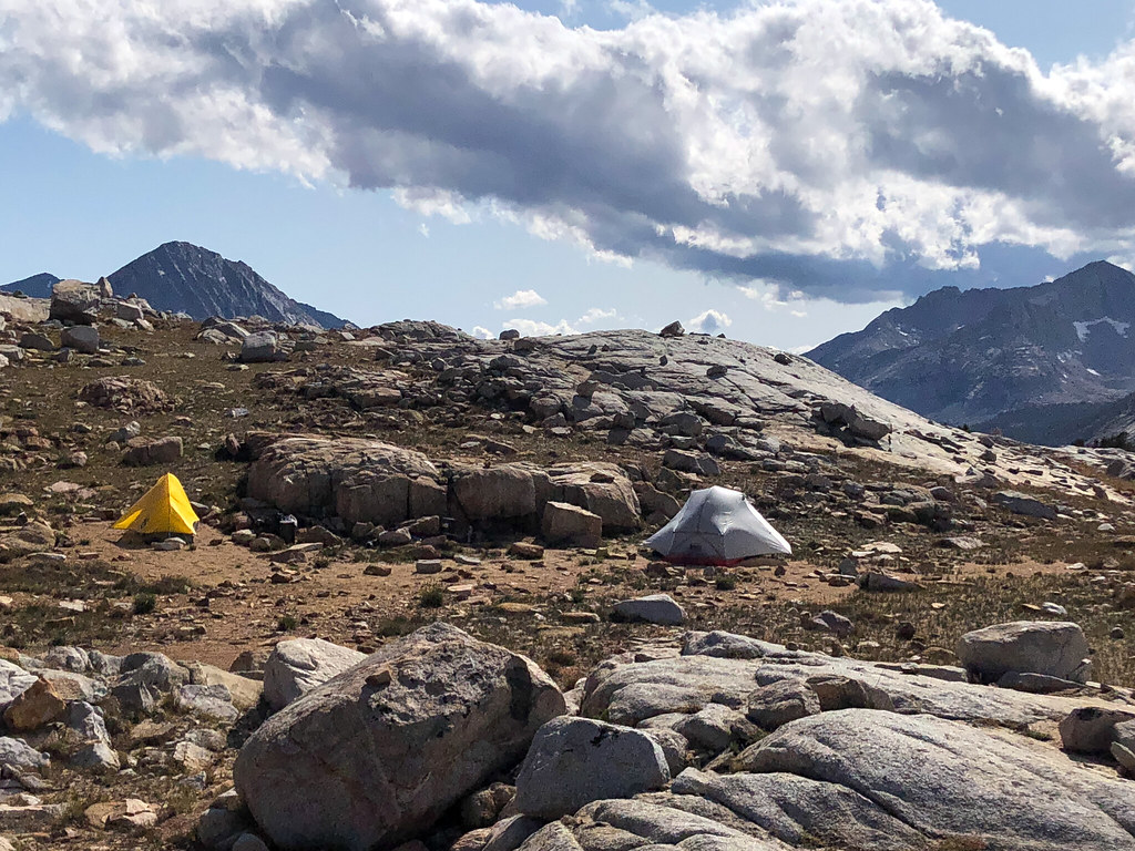
Our campsite beneath the mountain.
The secret meadow. I actually went back to camp and dragged my buddy up there, but it didn't have the same effect on him.
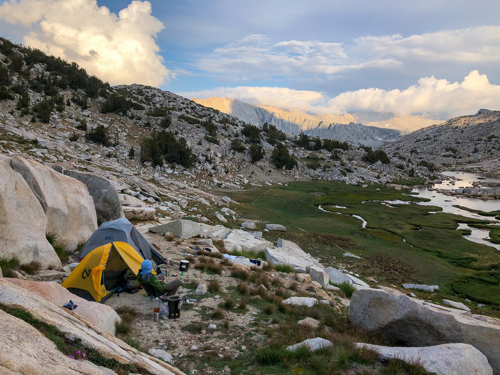
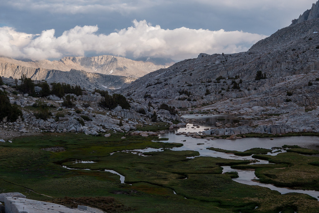
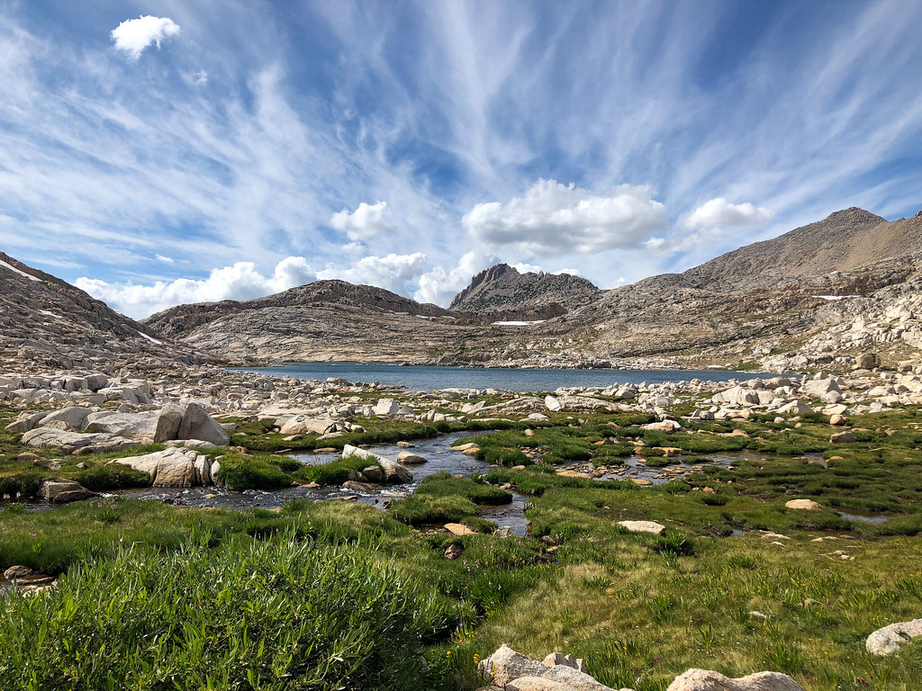
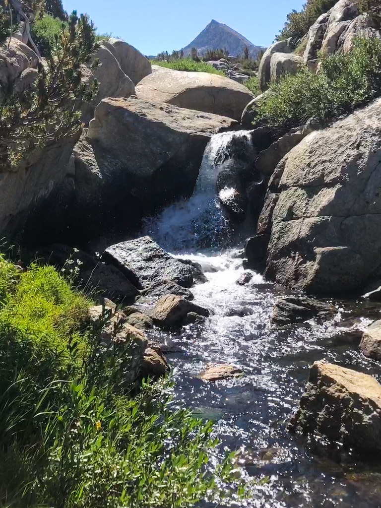
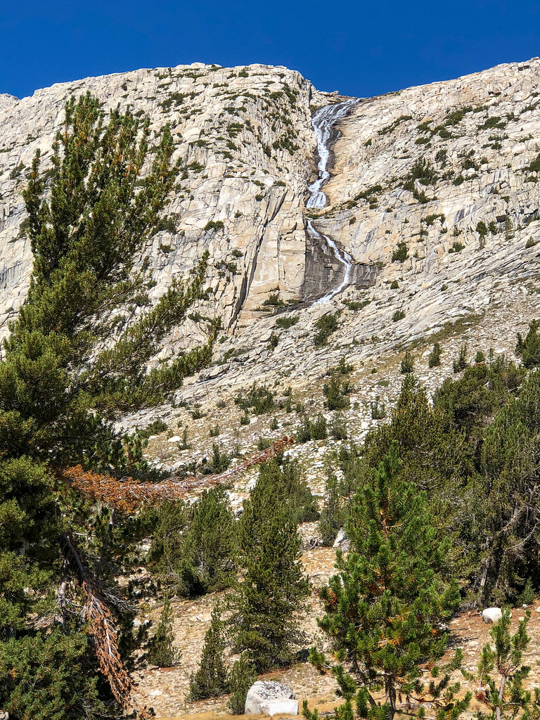
We got a late start due to my "discovery" and headed towards Granite Park. Coming into Granite Park was awesome. Lots of trees and grass and streams and waterfalls. I was surprised how green it was through the whole trip. We loved the "u" shaped lake and found a great spot up on the ledges at the far end near the waterfall. We got set up and spent about 45 minutes in the tents while it rained. We made a short scramble up to the ridge and checked out the Chalfant Lakes, took a swim, and watched the sunset and had some whiskey. We saw some headlamps as another group came in after dark on the other side of the lake. It was a little cold, but not too bad. It would get gradually colder as the trip went on.
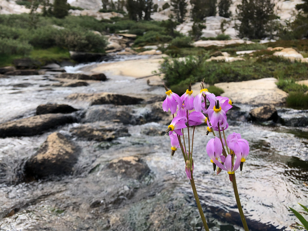
I really liked Upper Pine Lake. There were a lot of cool marshy areas.
Looking back on Upper Pine Lake.
Taking a break at Honeymoon Lake.
Granite Park was so cool. Trees, flowers, streams, mountains, and little waterfalls.
Yours truly and some granite.
Random pictures near camp.
Chalfant Lakes.
Camp in Granite Park.
Camp view.
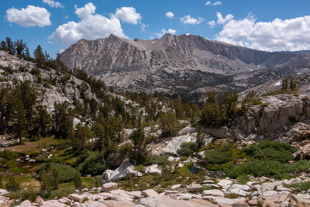
Day 3 (9-7): Granite Park to Vee Lake
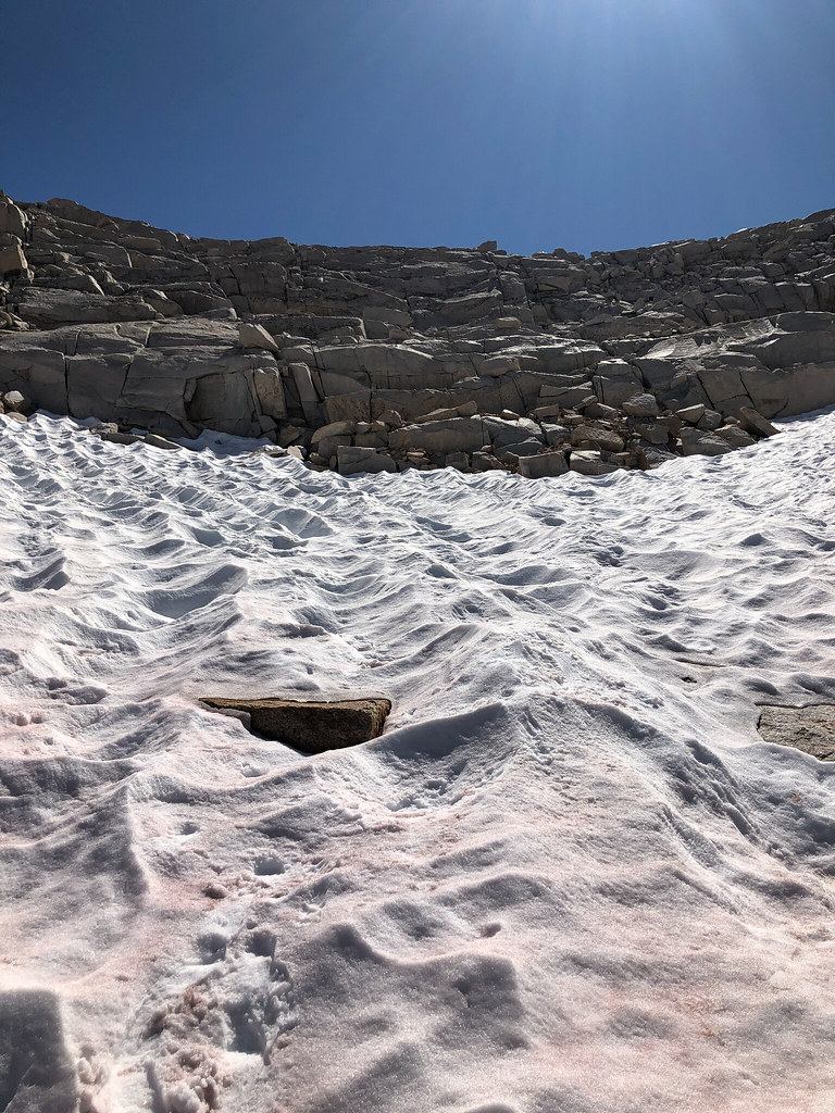
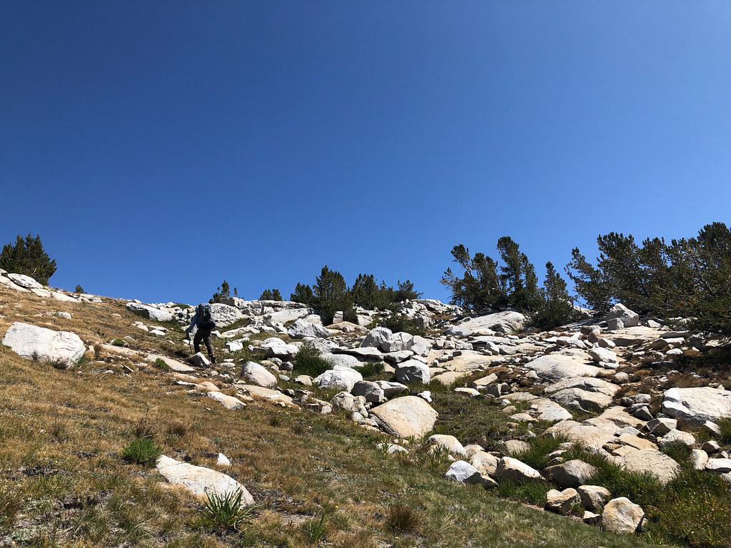
We woke up to clear skies. It would mostly stay that way the rest of the trip. Got our first cross country pass under our belts with Italy Pass (although it is mostly a trail up there from that side) and made our way to Dancing Bear Pass. I had seen that the best way is to not drop too much elevation. But as we looked at it, we picked a slightly lower route to avoid one long snowfield and just climb back up. Before the trip, I had downloaded some other people's tracks through certain areas as a guide. We didn't follow them all the time because we were trying to learn how to navigate, but they were useful as a general sanity check. Anyway, we decided to cross a low angle snowfield climbing up to Dancing Bear Pass and that (and subsequent snowfields) were the only time I regretted the trailrunners. We crossed the now dry lake on Dancing Bear Pass and the view of White Bear and Black Bear lakes made my jaw drop. It was so cool.
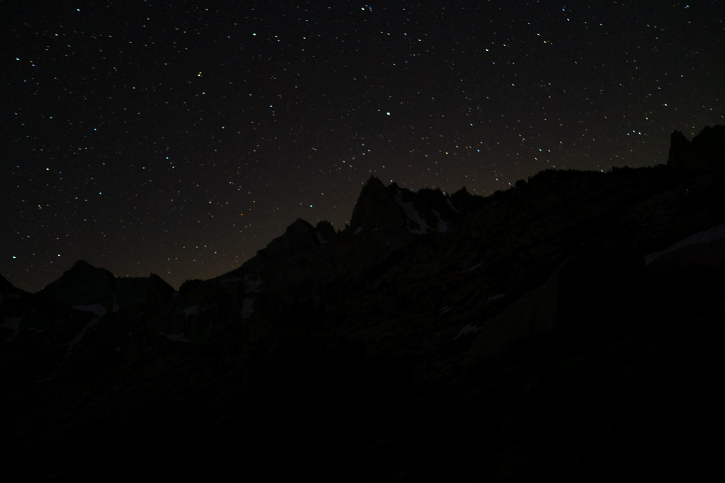
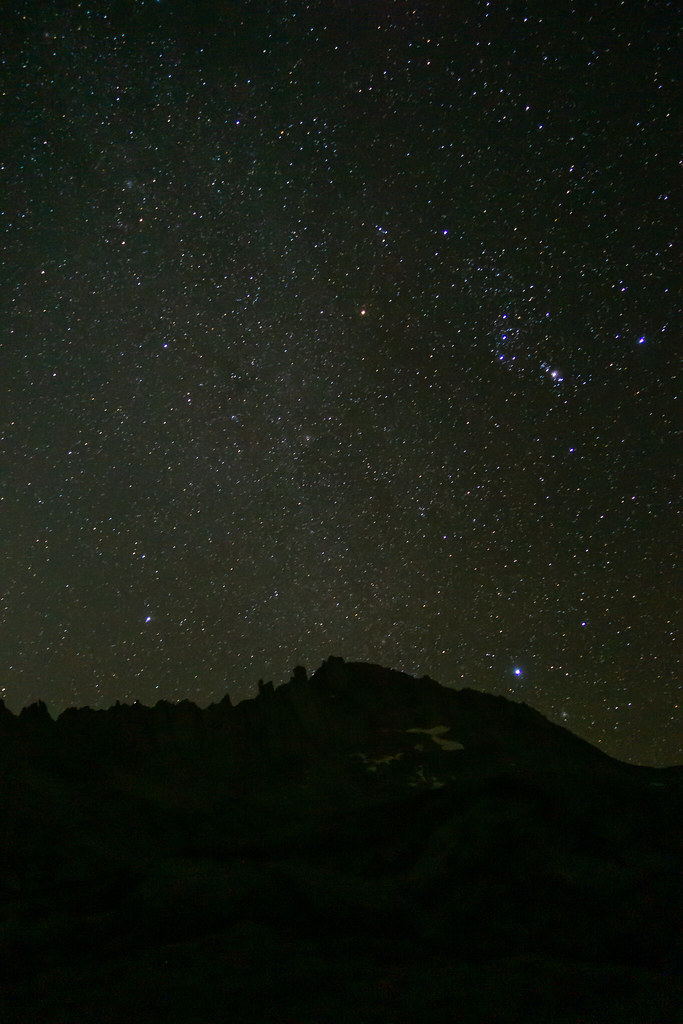
My star picture game is not strong. Every trip, I have big plans to get up and set up my tripod in the middle of the night and it never happens. So I get these using a mini tripod with one arm sticking out of my sleeping bag. Anyway, there were stars out, you get the idea.
Goodbye to our home for the past 16 hours.
This was the next lake after the one we camped at. No wind for a change.
Granite Bear Pass ... nope.
On the way to Italy Pass. FYI - there are some rocks in this area.
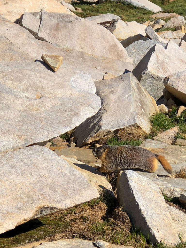
This guy wasn't too excited to see us. We weren't feeling it, either. We mutually agreed to go our separate ways. No hard feelings.

Looking back from Italy Pass.
Dancing Bear Pass. We rock hopped the first one, skirted to the right of the second, and went straight up the third.
White Bear Lake.
Black Bear Lake (I think).
BeaRoyce Pass?
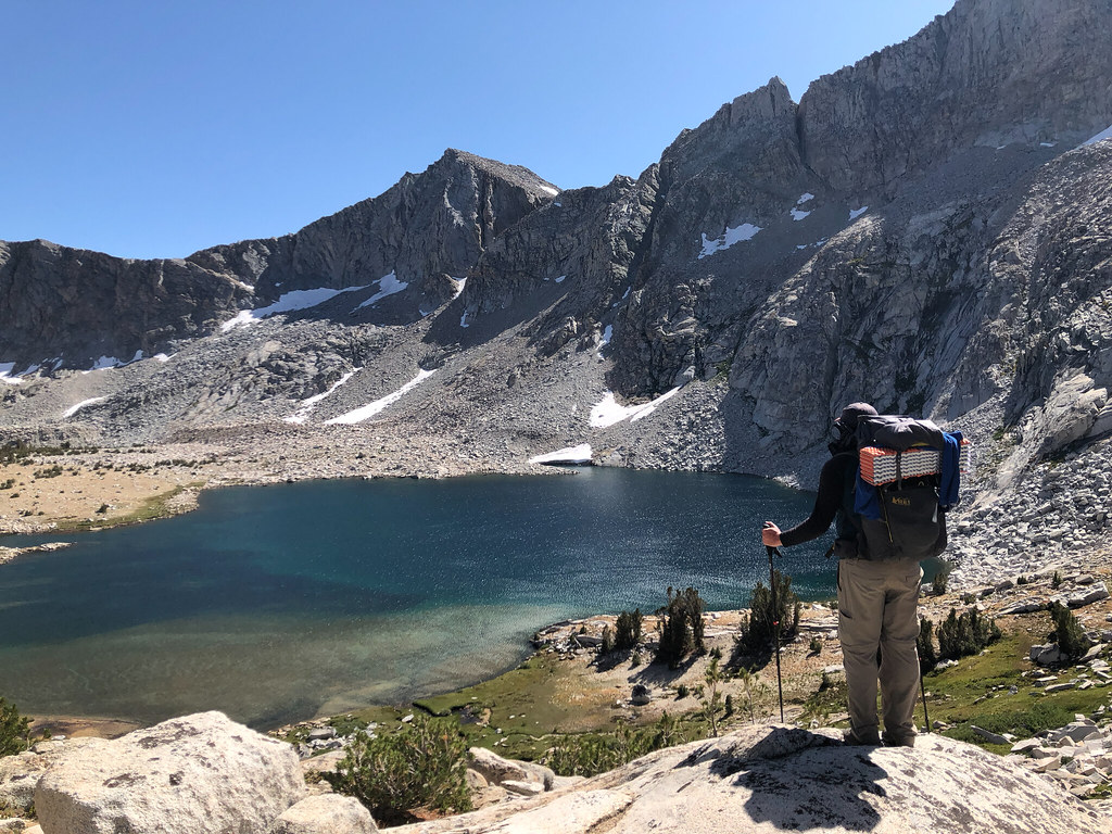
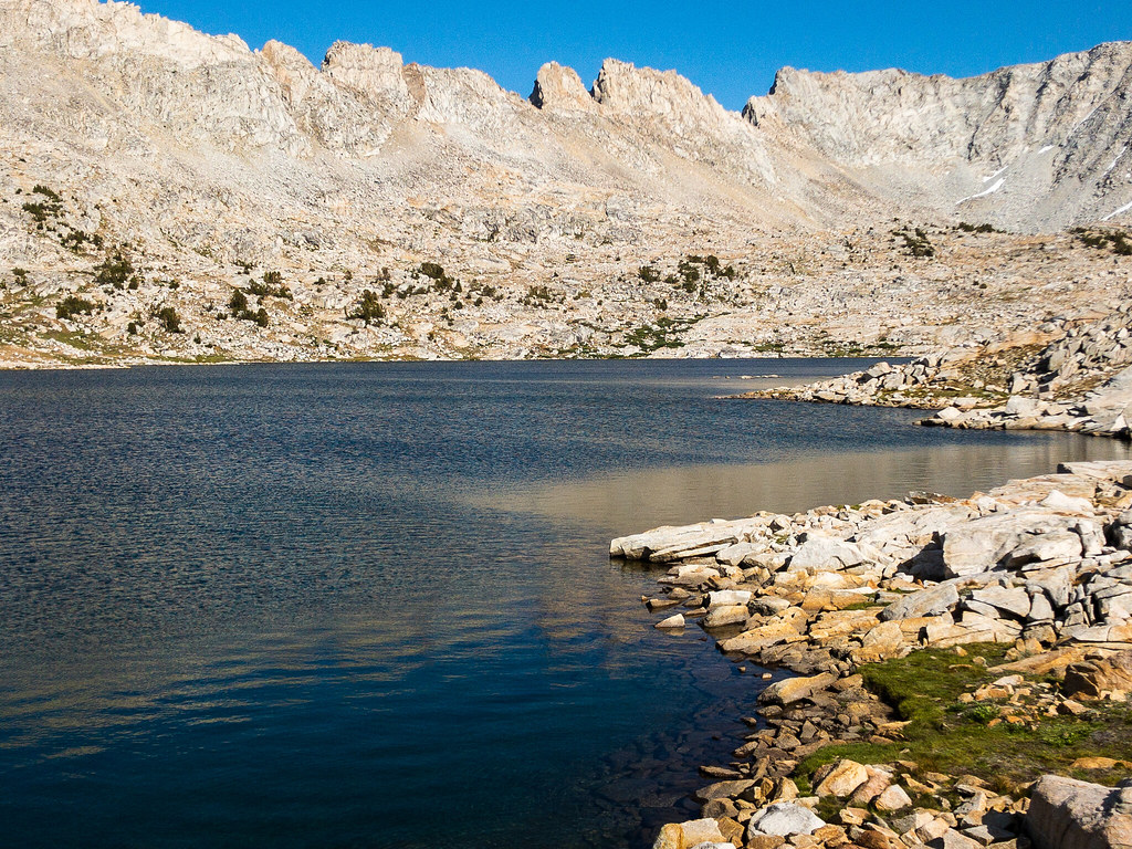
We made our way down to Big Bear Lake, made some navigation errors getting up to Ursa Lake (we ended up at the Big Bear Lake inlet waterfall, what a bummer), and took a break. We were feeling pretty good, so we decided to try hopping over a saddle to Vee Lake. There were some small snowfields and talus climbing, but nothing technical at all, just tiring. We got to the other side and wow. Vee Lake was way, way, WAY down there! Probably should have been able to pick that up from all the lines on the map. So, we got going and ended up at the big peninsula. We made our way around to the inlet, which is a really cool area. Loads of tiny streams and waterfalls and some flowers (still). I made sure we picked a spot where we could see Seven Gables and I was all proud of myself.
Vee Lake from the inlet area.
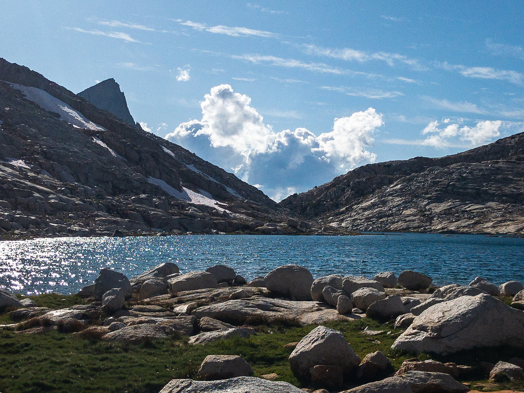
Vee Lake with Seven Gables.
Sunset at our campsite.
I don't know if it was the exertion or altitude or what, but my body really felt that day. I'd read that off trail travel you should account for half the distance compared to trail. But some part of me was like "yeah, that's probably conservative, etc". Turned out to be true in my case. Our original plan was to stay here two nights and spend the next day going down to the PCT via East Fork Bear Creek. After the day we had, though, I thought it would be better to make some distance towards Feather Pass, rather than try to get to Merriam Lake from Vee Lake. I wasn't sure I had it in me, and the route around Den Lake was not something I was confident in at all. Plus, I was a little cranky. So, we decided to drop our packs at Vee Lake near the way to Little Bear Lakes and take a couple hours poking about the East Fork of Bear Creek the next day.
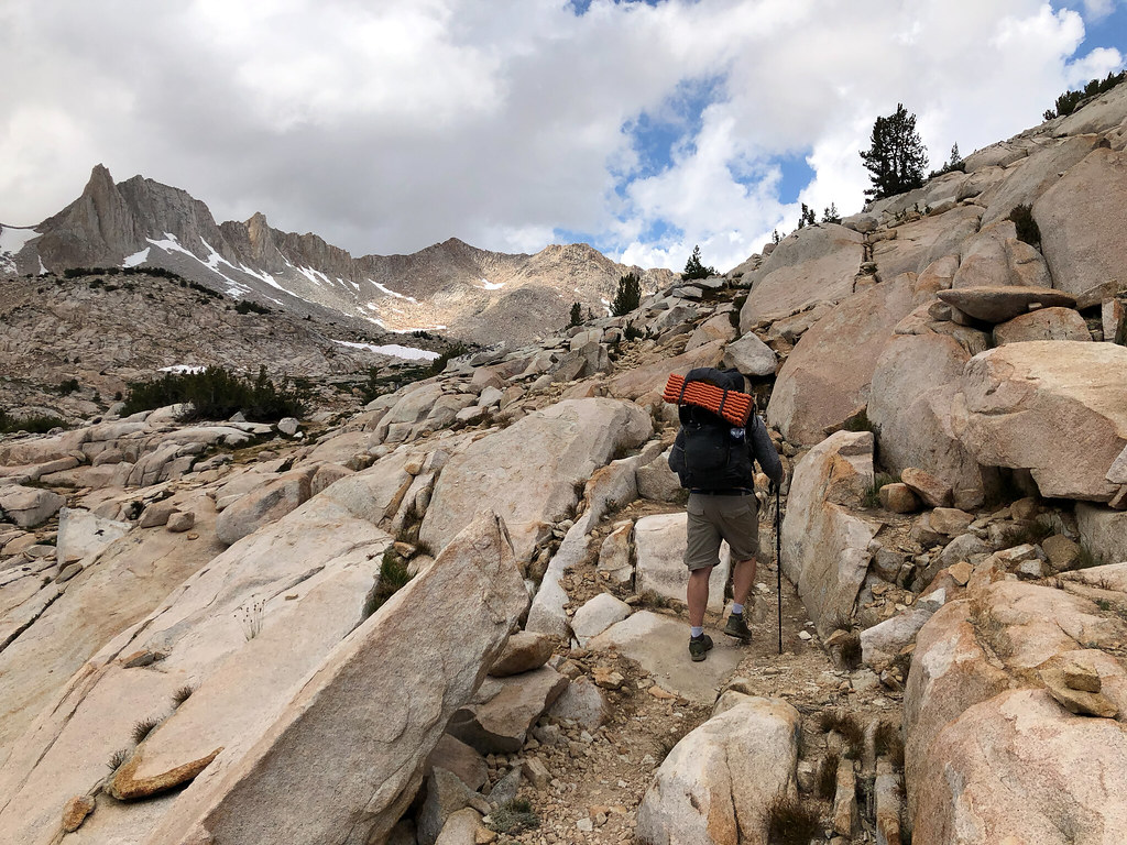
Day 4 (9-8): Vee Lake to Bearpaw Lake
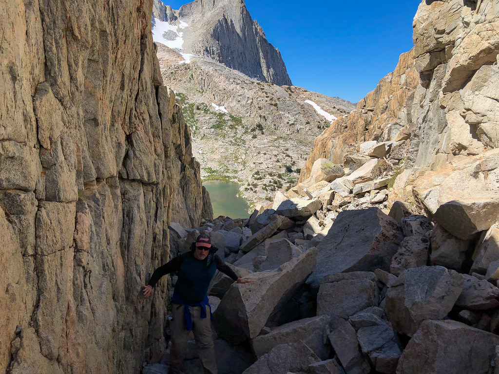
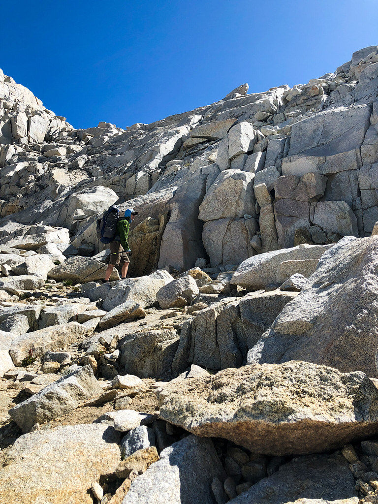
So, that is what we did. Oh, and on the way over there, I realized that I hadn't been looking at and taking pictures of Seven Gables, but the peak to the north of it. Still a cool peak, though! I knew there was a ducked route up high along the creek until you got to the boot shaped lake, but we missed them. Maybe they were before the notch to the lake below? In any event, we had a beautiful walk along the creek until we got squeezed out right after the stream that goes up to Little Bear Lakes. I think we could have crossed the creek and continued, but we were running short on our alloted time. When we came back up the notch, we took a much better route. We stayed along the wall on climbers right. What a fun scrambling adventure that notch is, though. Nothing hard, just lots of fun climbing on rocks.
Still thinking that is Seven Gables.
What in the world is that ... oooohhhh.
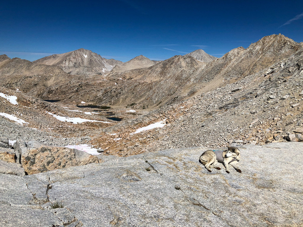
We picked up our packs and headed up to Little Bear Lakes. We were at lake level when we got to Big Bear Lake. We had been mostly successful in our off trail travels, and feeling pretty cocky. So we decided to take a shortcut over the ridge to Ursa Lake. We climbed and climbed until we were eventually confronted by a cliff and a steep snowfield. We took a look around, didn't like it, and headed back down to where we started. We made our way around and up to Ursa Lake, where we met Walter and his rescue sled dog, Sight. Super nice guy, he was setting up at Ursa, so we continued to Bearpaw.
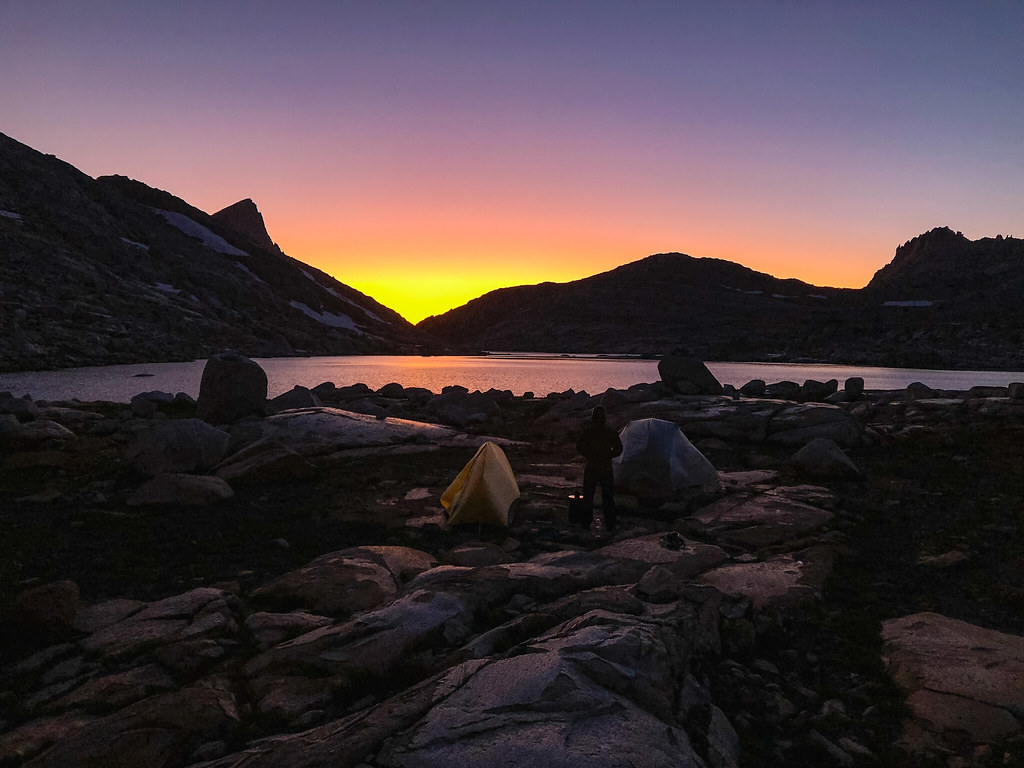
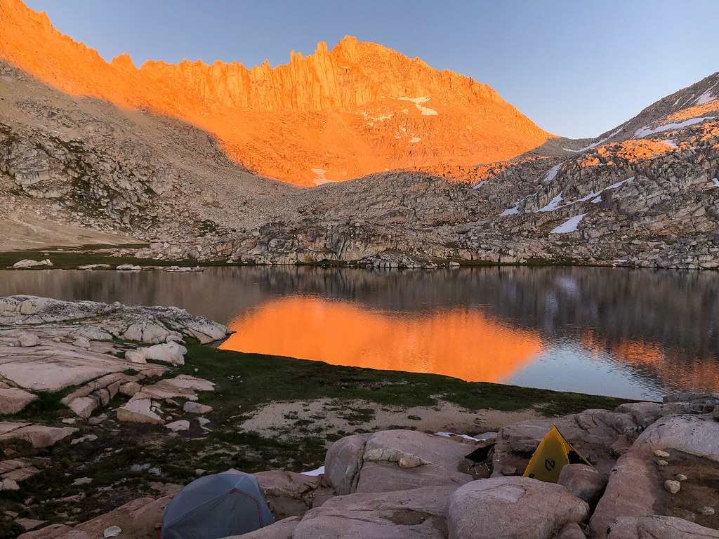
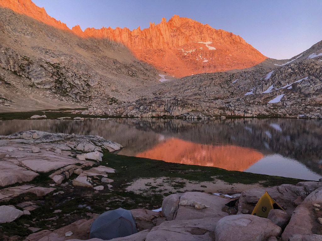
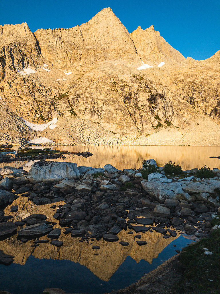
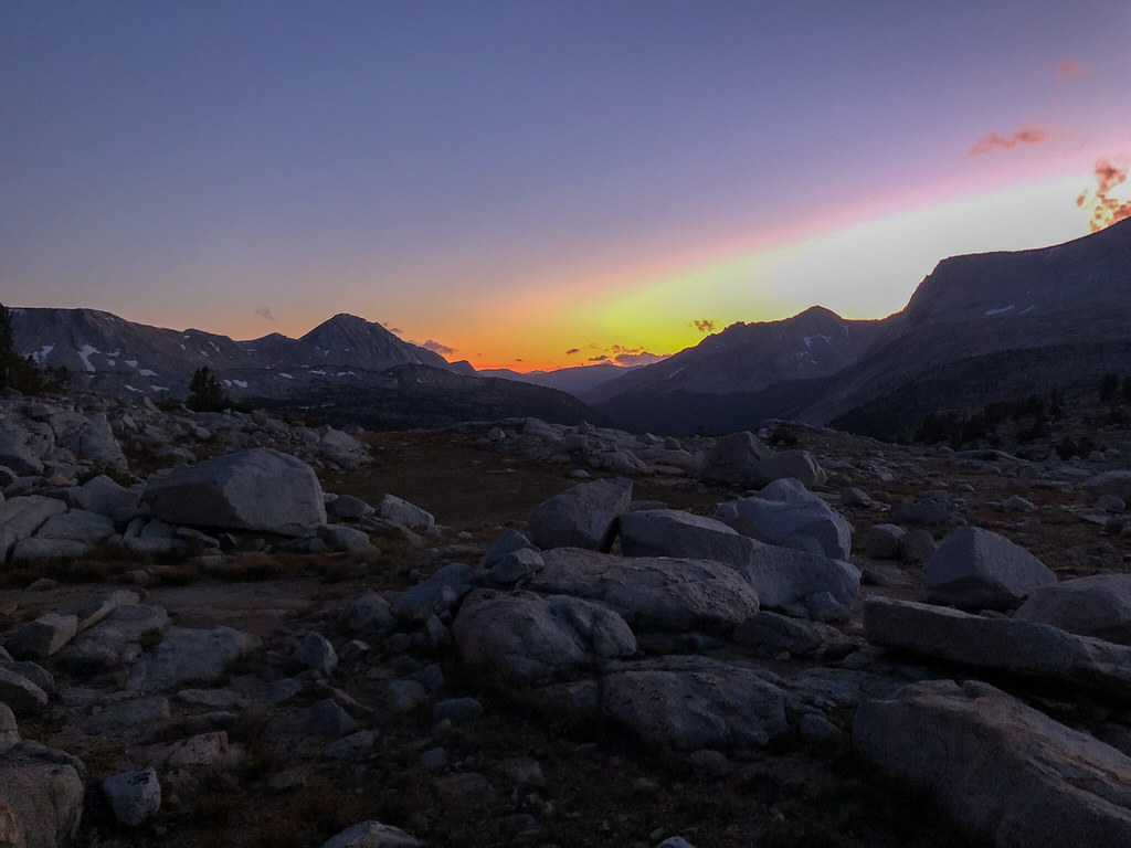
It was becoming part of the routine to drop our packs and wander around looking for cool campsites. And after the wind at Vee Lake, we wanted something sheltered a little. We found an apartment complex of campsites on the big granite mound overlooking the lake. There were at least three or four small level places, about 5-10 feet apart in elevation. It was super cool. We relaxed for a while. My buddy tried fishing. There was a fish that was jumping right near us every couple minutes, mocking him. Unfortunately, our fishing setup was lacking, to say the least. At the last minute, we picked up some line, a couple lures, and some sinkers, thinking we could use our hiking poles as rods. We're not good fishermen with a legit setup, so that kind of went as we expected it to. But he had fun and I had fun sipping whiskey and watching him try to cast. Sunset was awesome as the sun, then the moon after it lit up Feather Peak with changing colors.
Time for dinner, whiskey and a light show.
The last thing we expected was to come across and old guy with super hot moves dancing in the twilight. But we got ... lucky?
Day 5 (9-9): Bearpaw Lake to Merriam Lake
When planning the trip, Feather Pass was the part I had the most trepidation about. But it ended up not being that big a deal, at least on the way up. We ran into Walter and Sight again and they took a break before the last stretch to talk about the route up the final part. He had done it many times, and they went first so we could watch them. I put on micro spikes for the snowfield and it was amazing how easy they made it (it was still morning). There was only one part we had to use our knees to get up on the next ledge. We hung out for a while and life was good.
There were stars on this night as well.
No way that guy is making it up there, now matter how slow he goes.
Final snowfield and climb.
So close.
Sight at the top of the pass, with Bearpaw, etc in the background.
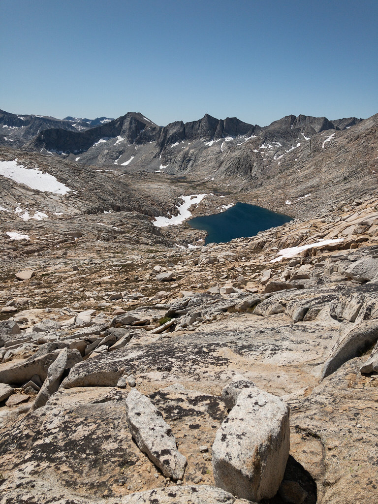
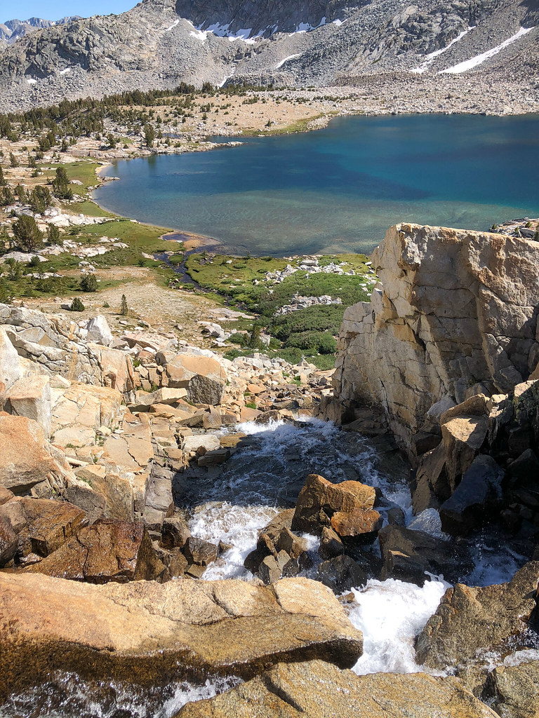
Walter and Sight took off down the pass and we followed a little bit later. Walter had said "just a relaxing walk in the park from here". That was true for a while. Just above LaSalle Lake, we came to a part that was pretty steep. In retrospect, it wouldn't have been bad if we would have handed our packs down. But we saw that if we cut right around a big boulder, we would be able to get down a much lower angle rock field. So, that's what we did. It wasn't until we were deep in it that we realized ALL of the rocks moved. It was like walking on a 10 foot high stack of unstable watermellon sized rocks. Actually, that is exacly what it was. I dislodged a rock with one foot that caused it to crash into my other ankle. Just a scrape, but it freaked me out enough to crab walk for a while. It got a little better towards the bottom because there were big, stable rocks you could stay on. Once at the bottom (it took us almost 90 minutes), we got our wits together. It was, as my buddy said, "traumatic". By the time we cleared LaSalle Lake, we were back in the swing of things. We passed all the pretty lakes and were punched in the face by the waterfalls and views of Merriam Lake. We made our way down to the outlet and found another nice camp spot in some trees.
I had no idea how much I was going to hate this lake by the time I got down there. Not fair, I know, very pretty lake, but ugly inside.
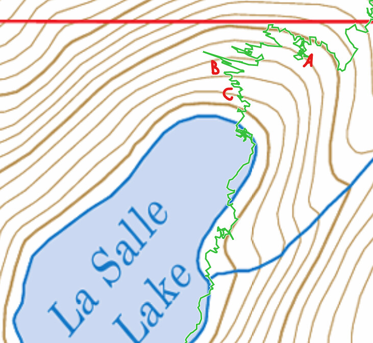
(A) where we should have gone (B) where we went (C) where I quit backpacking for good (temporarily)
Once again, the interwebs were correct. What a cool lake!
Me, having aged 25 years, with clothes hanging out of my pack and a sleeping pad I didn't need.
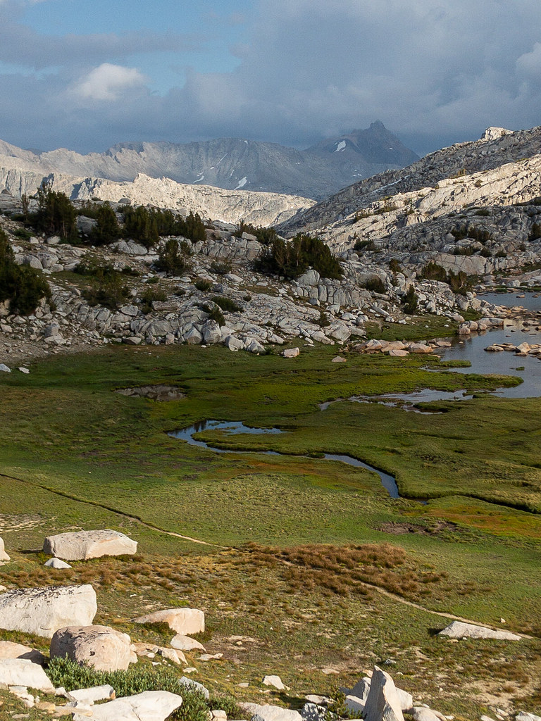
Day 6 (9-10): Merriam Lake to French Lake
The lake was too windy in the morning to get the reflection pictures that I like, but the outlet was calm, so I used that for a couple pictures. We headed down off trail to one of the prettiest places on the whole trip. The meadows below Merriam were like something out of a movie. We wandered slowly across the meadows, probably crossed a dozen tiny streams. This place actually made us slow down and appreciate it.
One of my favorite parts. So peaceful and easy.
After the meadows, we followed the creek down to the French Canyon trail. There is a trail on the USGS map on the east side of the creek, but I have read that several people had not found it. We did unintentionally find it and it felt sooooo good to have a path to go on and not to have to worry about the best way to traverse the next 15 feet. I really enjoyed being off trail, but being on trail (well, not a trail, but an intermittent path) was a nice break. We descended though wonderful forest and sporadic waterfalls down to the trail. Our original plan was to loop up to Royce Lakes, but we were craving distant mountain views for our last night. We decided to go to French Lake instead. We motored up the pretty French Canyon trail. Just as we headed past the trail to Elba Lake, we ran into Walter again. He hiked ahead of us and waited by a creek. He gave us a general direction of the best way off trail to French Lake. That guy was always in the right place at the right time for us. He was camped near one of the other glacial divide lakes and was heading to Honeymoon Lake for a re-supply.
Down, down, down.
French Canyon Trail.
Royce Falls. We could only see the bottom at first, but figured if we kept hiking up the trail, we'd be able to see the top. Which we could, but then we couldn't see the bottom anymore.
Up to French Lake.
French Lake.
Last campsite.
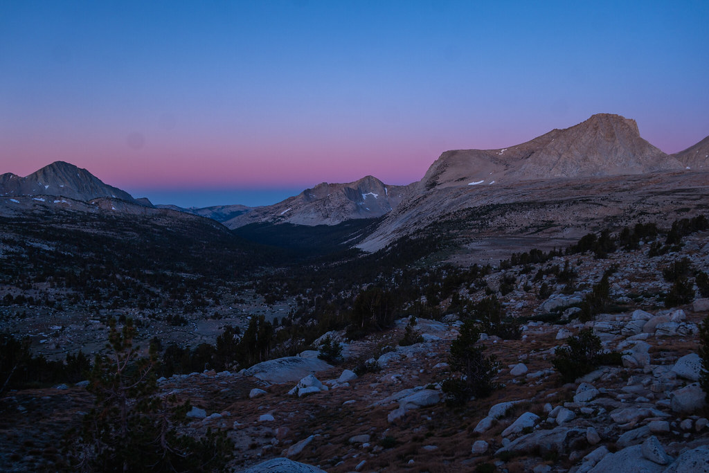
I didn't really understand that cross country travel was not all the same. Cross country to French Lake was pretty easy, much easier than some of the travel in the Bear Lakes Basin. We did our thing, found a cool spot, found an overlook for sunset, and got set up. We also found a high area that let us see almost our whole route! The wind was fierce. It was getting colder every day. This was the first day that I actually went into my tent to escape the wind. In fact, I fell asleep and almost missed sunset.
Day 7 (9-11): French Lake to Pine Creek trailhead
We got up earlier than usual since we had a long day. The cross country to Pine Creek Pass was a piece of cake. Several more hours and 4000 feet of drop later, we were at the car having a celebratory beer. We had some lunch and got a cheap Priceline room at Circus Circus in Vegas. We saw a handful of people in a week, then stayed in a Vegas hotel. Serious culture shock.
Just before dawn, French Canyon.
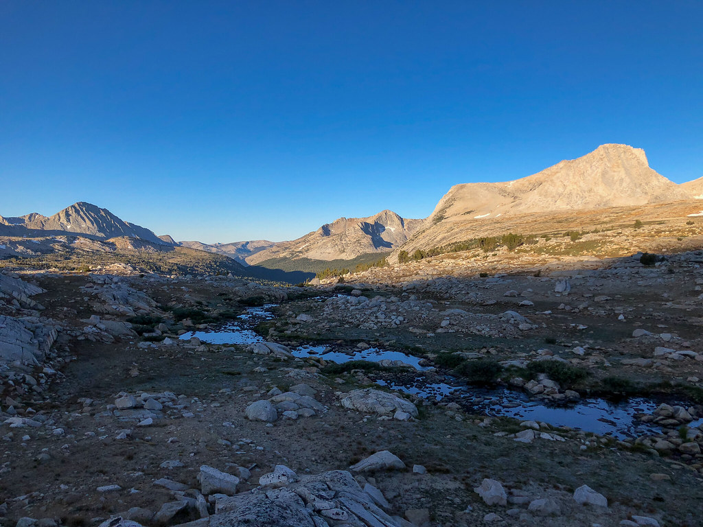
A little later in the morning.
Upper Pine Lake.
Epilogue:
What a great trip. It was definitely a step up for us, adventure-wise. Throughout the whole trip, I was overcome with a sense of gratitude. Not just for the trip and the places, but for everything and everyone in my life. These trips really bring things into perspective for me. The quilt is a keeper, for sure. I didn't use the straps and still didn't have problems flipping around or letting cold air in. I did wear a down hood when I slept. And having two sleeping pads was kind of cheating. Other than the snowfields, the trailrunners worked great. I mean, they were OK, but I definitely slipped more than my buddy, who had boots. Saved me a pound on the feet, and when they did get wet, they dried out quickly.
Day 1 (9-5): Pine Creek Trailhead to Pine Lakes
Well, my sleeping pad deflated twice during the night. I had a patch kit and considered fixing it the first lake we got to, but I ended up getting nervous about it and we drove back to Bishop for a backup. I ended up buying a foam pad in case I couldn't fix it, and we were back on our way. The hike up to Pine Lake wasn't too bad. It was cool and rained most of the time. Everyone we met coming out said the weather had been bad the last couple days. We figured we would have lots of lakeside camp spots this trip, so we went looking for a site between Pine and Upper Pine that I had heard people talk about. We never did find it, but we did find a cool spot under this multi colored mountain. The bugs were out, but the wind kept them mostly away. The only other eventful thing that happened was I almost flung myself off a cliff swinging my full backpack on after a water stop.
Pine Lake was a pretty harbinger of what was to come
Pine Lake getting sprinkled with rain
Pine Creek between the lakes. The water never would allow me to get the peak lined up right.
Sometimes I play around with portrait mode on my phone. Never quite pulls off real camera DOF. Pine Creek canyon in the background.
Day 2 (9-6): Pine Lakes to Granite Park
I woke up to a full sleeping pad. The valve is a little quirky and I finally got it figured out. I spend the rest of the trip sleeping on two pads, which was awesome. I was up early and following the creek, trying to get a picture where the creek leads into a mountain. I eventually got to a beautiful meadow around sunrise that floored me. I felt like I had just discovered something amazing that no one had ever seen. I took many pictures trying to capture the feeling I had, to no avail. I'm sure many people have been there, but if you are one of them, I don't want to know
. Our campsite beneath the mountain.
The secret meadow. I actually went back to camp and dragged my buddy up there, but it didn't have the same effect on him.
We got a late start due to my "discovery" and headed towards Granite Park. Coming into Granite Park was awesome. Lots of trees and grass and streams and waterfalls. I was surprised how green it was through the whole trip. We loved the "u" shaped lake and found a great spot up on the ledges at the far end near the waterfall. We got set up and spent about 45 minutes in the tents while it rained. We made a short scramble up to the ridge and checked out the Chalfant Lakes, took a swim, and watched the sunset and had some whiskey. We saw some headlamps as another group came in after dark on the other side of the lake. It was a little cold, but not too bad. It would get gradually colder as the trip went on.
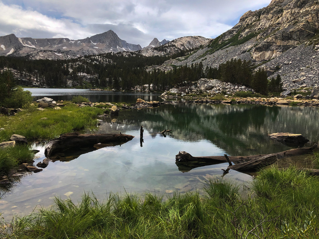
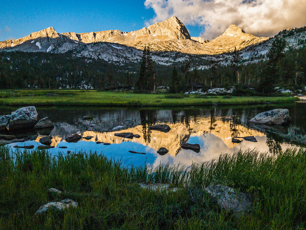
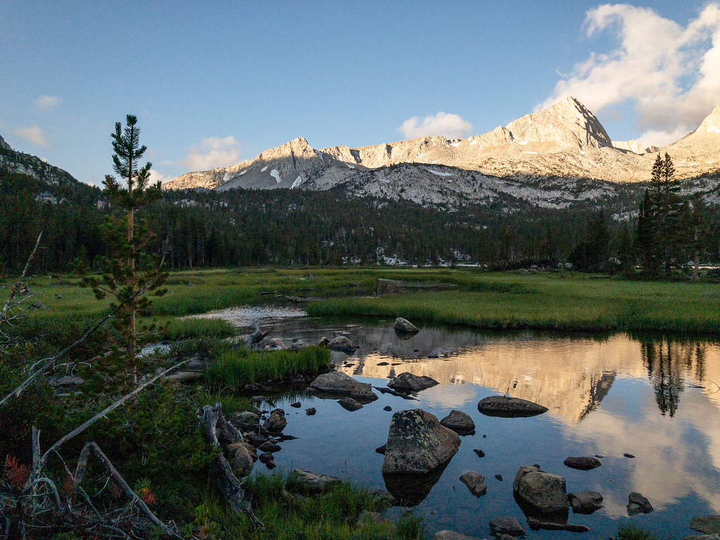
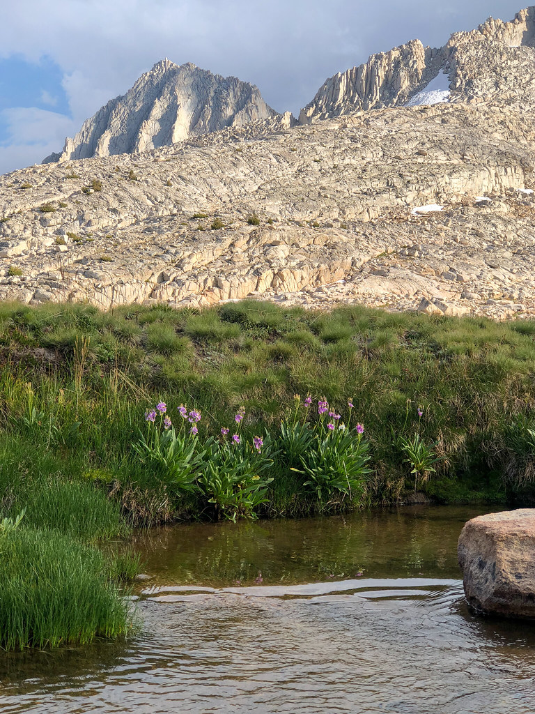
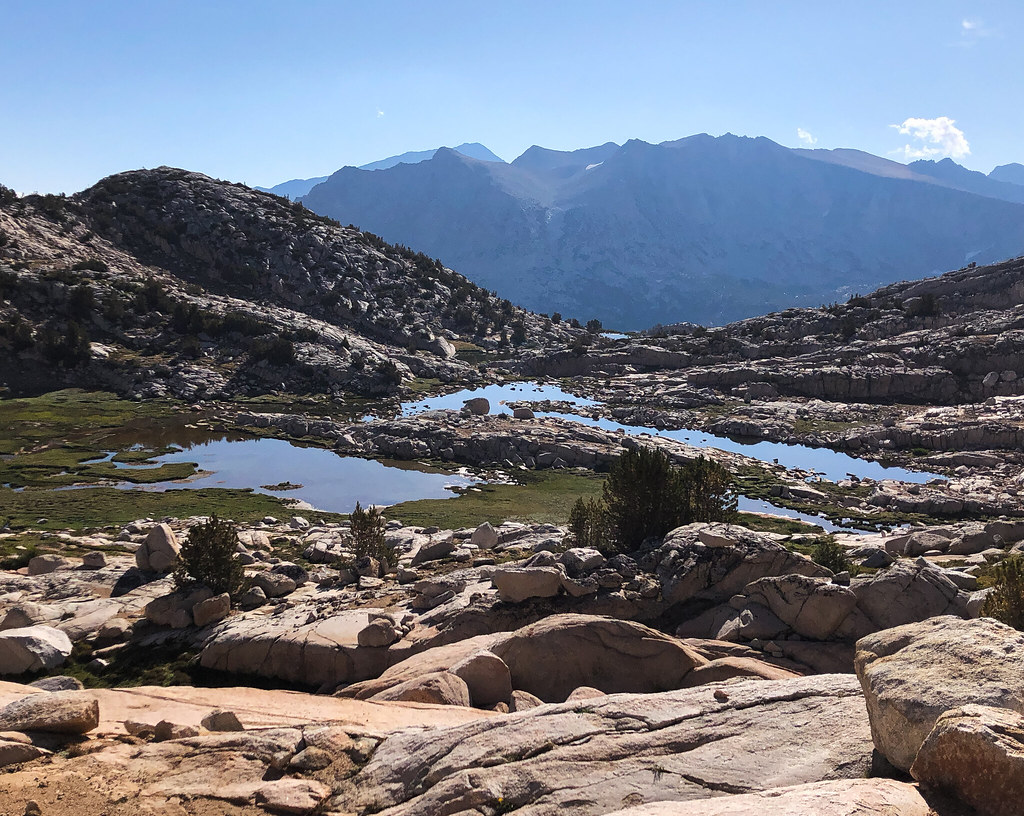
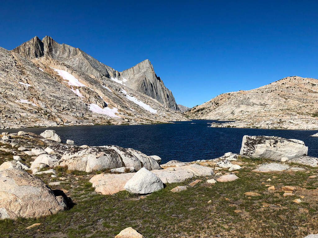
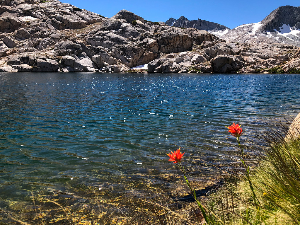
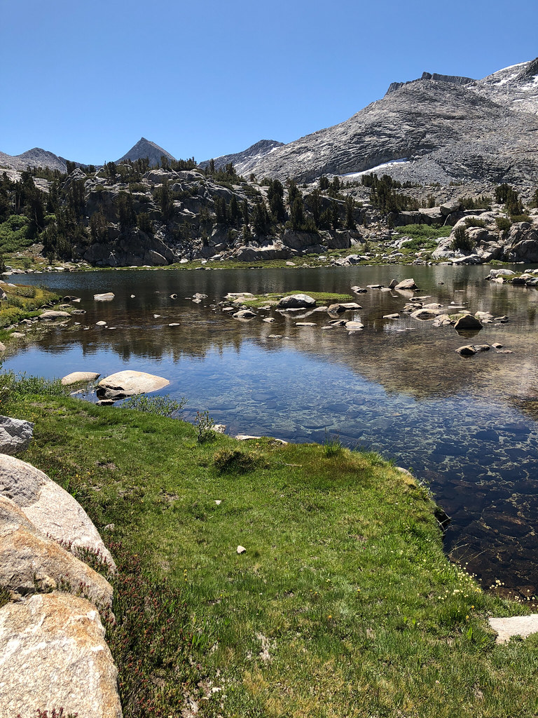
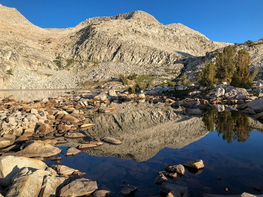
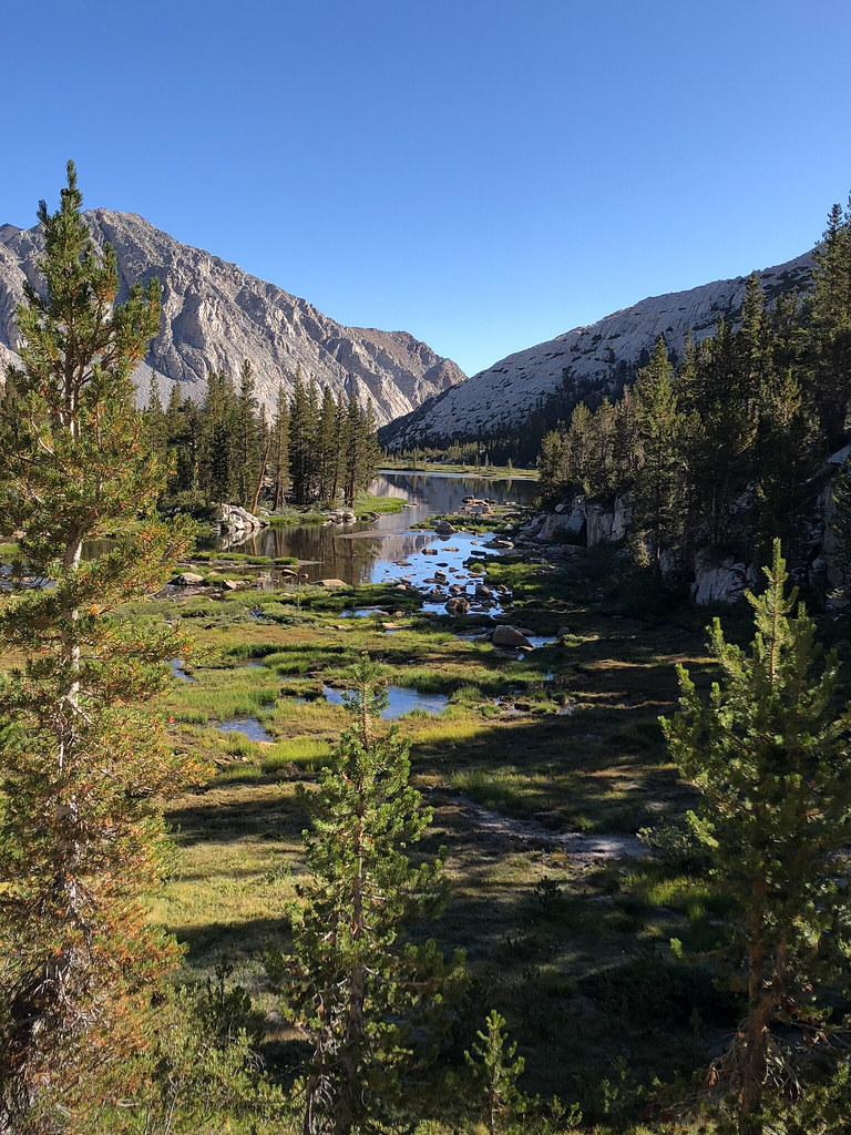
I really liked Upper Pine Lake. There were a lot of cool marshy areas.
Looking back on Upper Pine Lake.
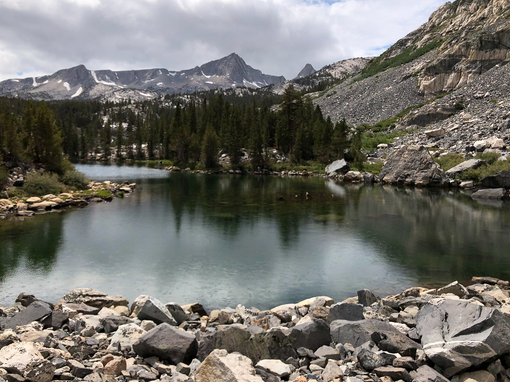
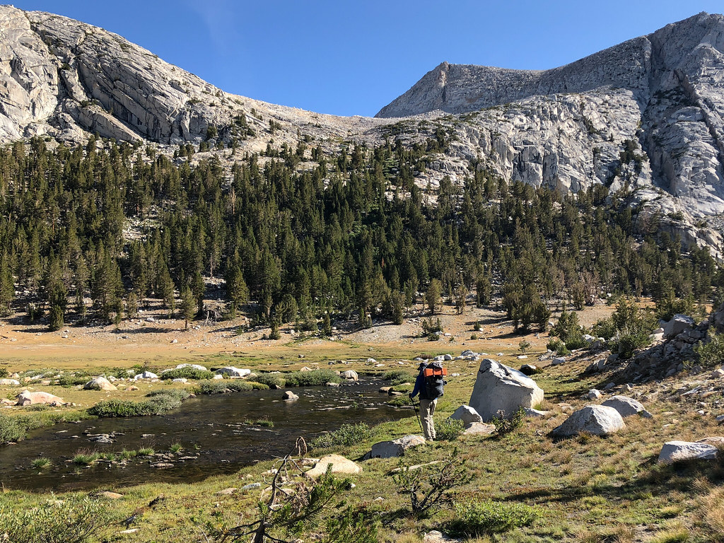
Taking a break at Honeymoon Lake.
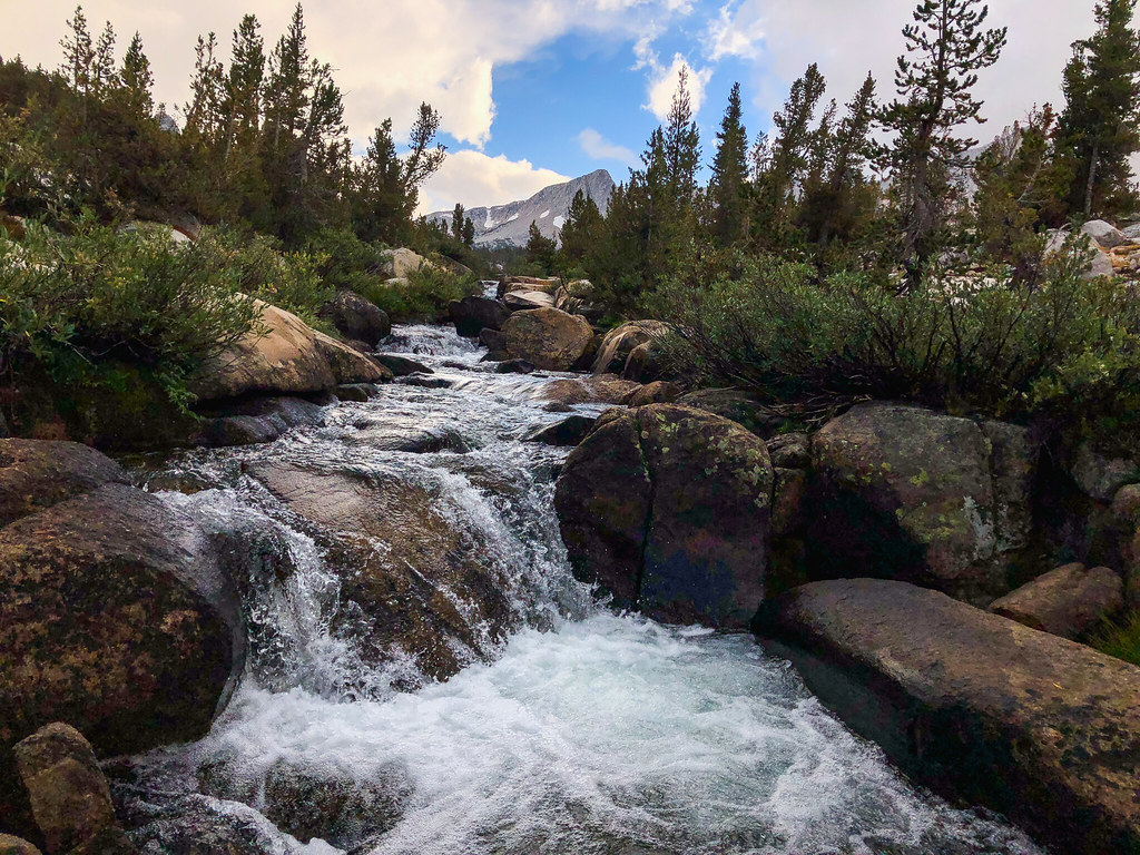
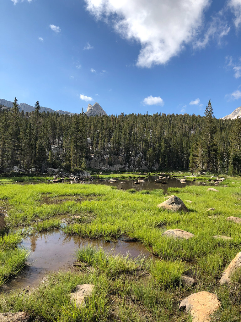
Granite Park was so cool. Trees, flowers, streams, mountains, and little waterfalls.
Yours truly and some granite.
Random pictures near camp.
Chalfant Lakes.
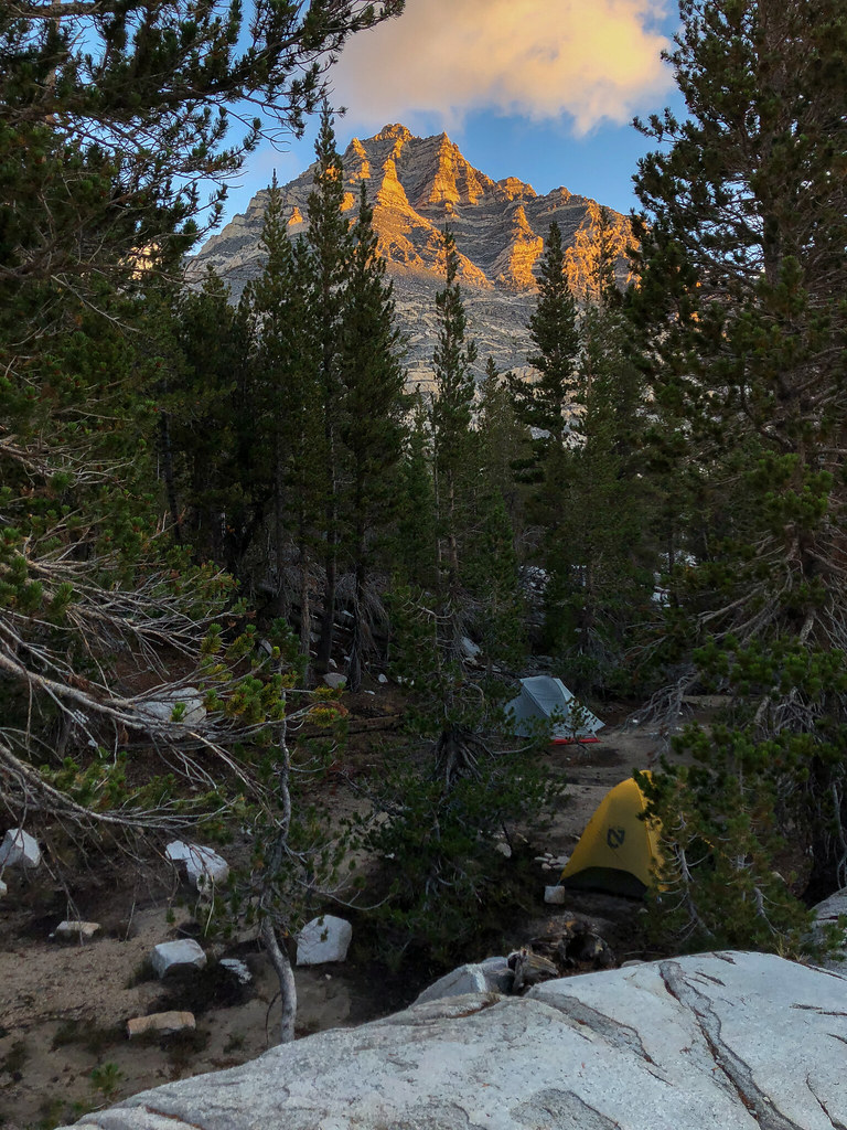
Camp in Granite Park.
Camp view.
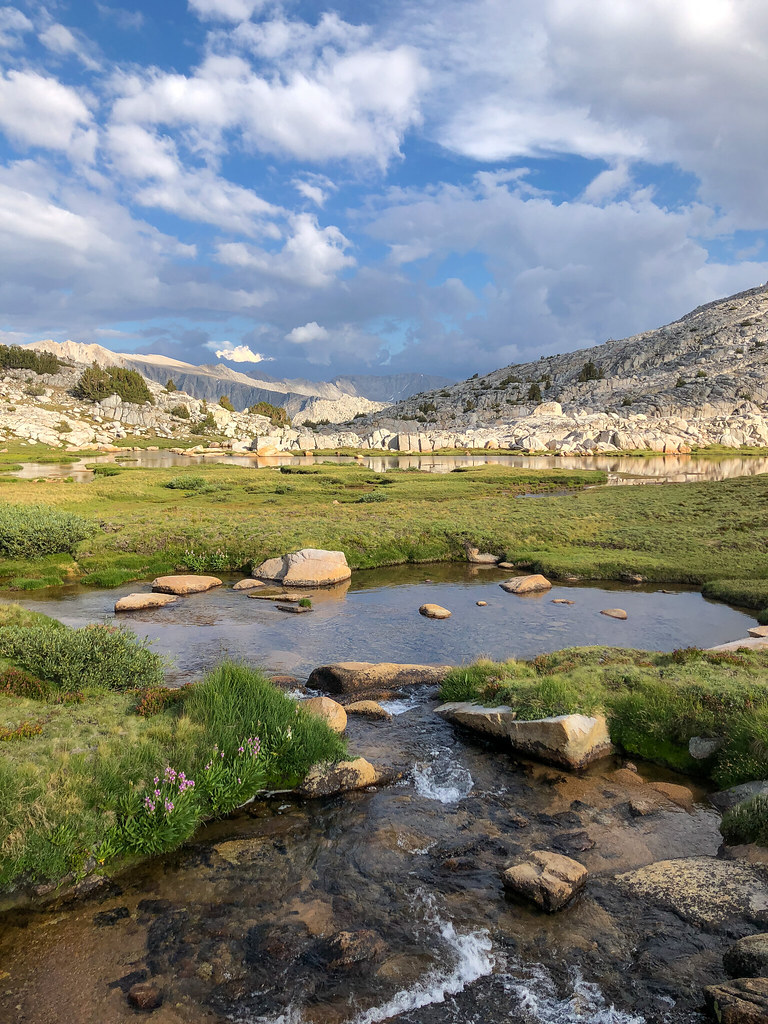
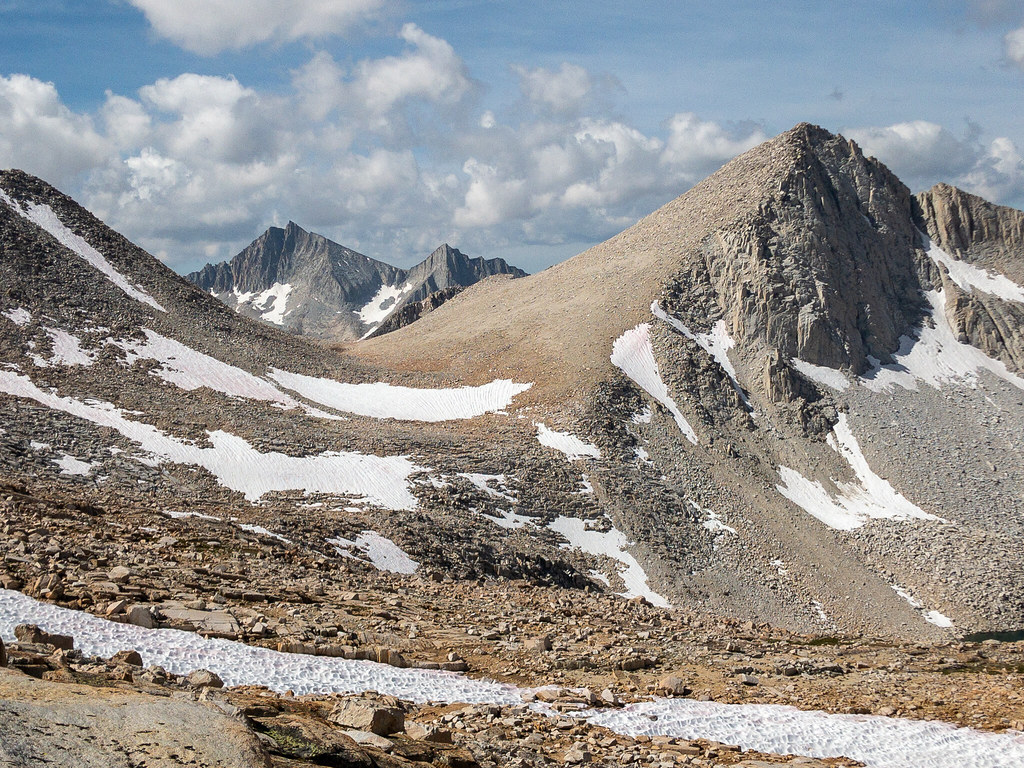
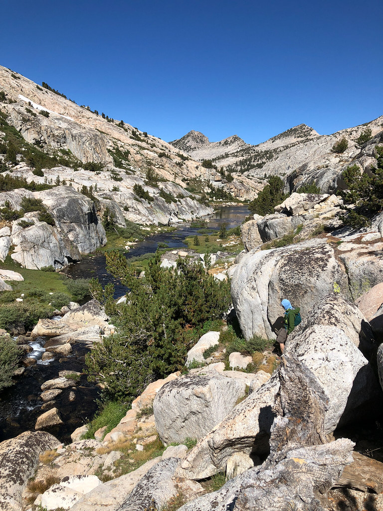
Day 3 (9-7): Granite Park to Vee Lake
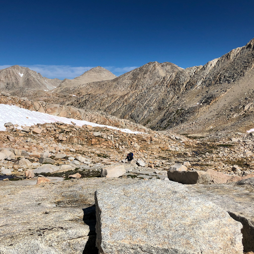
We woke up to clear skies. It would mostly stay that way the rest of the trip. Got our first cross country pass under our belts with Italy Pass (although it is mostly a trail up there from that side) and made our way to Dancing Bear Pass. I had seen that the best way is to not drop too much elevation. But as we looked at it, we picked a slightly lower route to avoid one long snowfield and just climb back up. Before the trip, I had downloaded some other people's tracks through certain areas as a guide. We didn't follow them all the time because we were trying to learn how to navigate, but they were useful as a general sanity check. Anyway, we decided to cross a low angle snowfield climbing up to Dancing Bear Pass and that (and subsequent snowfields) were the only time I regretted the trailrunners. We crossed the now dry lake on Dancing Bear Pass and the view of White Bear and Black Bear lakes made my jaw drop. It was so cool.
My star picture game is not strong. Every trip, I have big plans to get up and set up my tripod in the middle of the night and it never happens. So I get these using a mini tripod with one arm sticking out of my sleeping bag. Anyway, there were stars out, you get the idea.
Goodbye to our home for the past 16 hours.
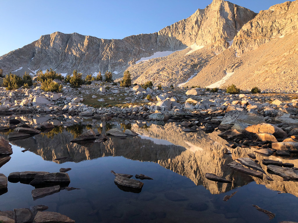
This was the next lake after the one we camped at. No wind for a change.
Granite Bear Pass ... nope.
On the way to Italy Pass. FYI - there are some rocks in this area.
This guy wasn't too excited to see us. We weren't feeling it, either. We mutually agreed to go our separate ways. No hard feelings.
Looking back from Italy Pass.
Dancing Bear Pass. We rock hopped the first one, skirted to the right of the second, and went straight up the third.
White Bear Lake.
Black Bear Lake (I think).
BeaRoyce Pass?
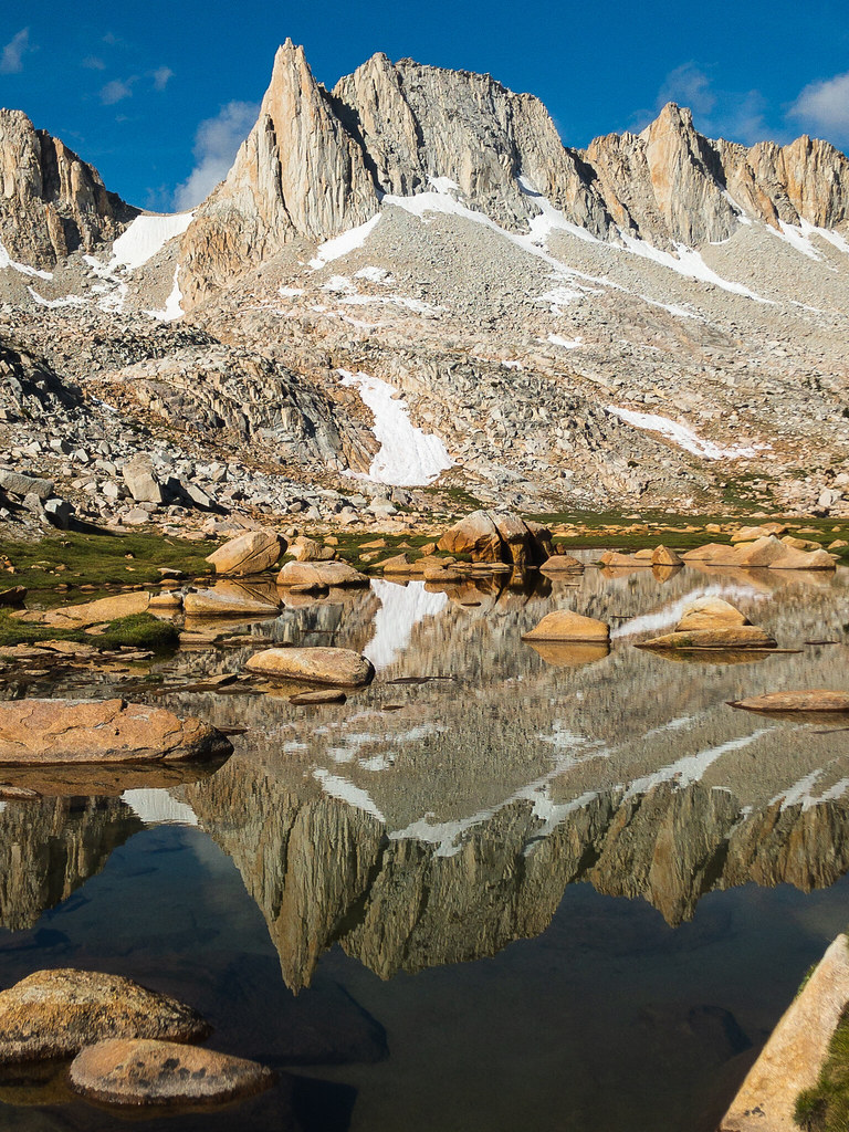
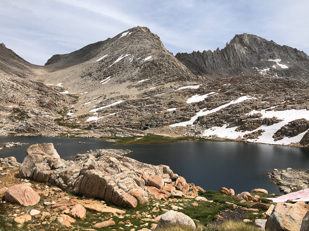
We made our way down to Big Bear Lake, made some navigation errors getting up to Ursa Lake (we ended up at the Big Bear Lake inlet waterfall, what a bummer), and took a break. We were feeling pretty good, so we decided to try hopping over a saddle to Vee Lake. There were some small snowfields and talus climbing, but nothing technical at all, just tiring. We got to the other side and wow. Vee Lake was way, way, WAY down there! Probably should have been able to pick that up from all the lines on the map. So, we got going and ended up at the big peninsula. We made our way around to the inlet, which is a really cool area. Loads of tiny streams and waterfalls and some flowers (still). I made sure we picked a spot where we could see Seven Gables and I was all proud of myself.
Vee Lake from the inlet area.
Vee Lake with Seven Gables
.Sunset at our campsite.
I don't know if it was the exertion or altitude or what, but my body really felt that day. I'd read that off trail travel you should account for half the distance compared to trail. But some part of me was like "yeah, that's probably conservative, etc". Turned out to be true in my case. Our original plan was to stay here two nights and spend the next day going down to the PCT via East Fork Bear Creek. After the day we had, though, I thought it would be better to make some distance towards Feather Pass, rather than try to get to Merriam Lake from Vee Lake. I wasn't sure I had it in me, and the route around Den Lake was not something I was confident in at all. Plus, I was a little cranky. So, we decided to drop our packs at Vee Lake near the way to Little Bear Lakes and take a couple hours poking about the East Fork of Bear Creek the next day.
Day 4 (9-8): Vee Lake to Bearpaw Lake
So, that is what we did. Oh, and on the way over there, I realized that I hadn't been looking at and taking pictures of Seven Gables, but the peak to the north of it. Still a cool peak, though! I knew there was a ducked route up high along the creek until you got to the boot shaped lake, but we missed them. Maybe they were before the notch to the lake below? In any event, we had a beautiful walk along the creek until we got squeezed out right after the stream that goes up to Little Bear Lakes. I think we could have crossed the creek and continued, but we were running short on our alloted time. When we came back up the notch, we took a much better route. We stayed along the wall on climbers right. What a fun scrambling adventure that notch is, though. Nothing hard, just lots of fun climbing on rocks.
Still thinking that is Seven Gables.
What in the world is that ... oooohhhh.
We picked up our packs and headed up to Little Bear Lakes. We were at lake level when we got to Big Bear Lake. We had been mostly successful in our off trail travels, and feeling pretty cocky. So we decided to take a shortcut over the ridge to Ursa Lake. We climbed and climbed until we were eventually confronted by a cliff and a steep snowfield. We took a look around, didn't like it, and headed back down to where we started. We made our way around and up to Ursa Lake, where we met Walter and his rescue sled dog, Sight. Super nice guy, he was setting up at Ursa, so we continued to Bearpaw.
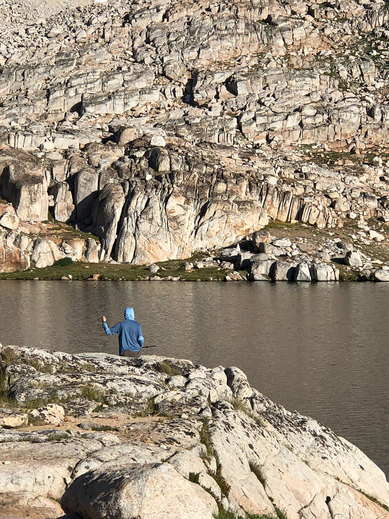
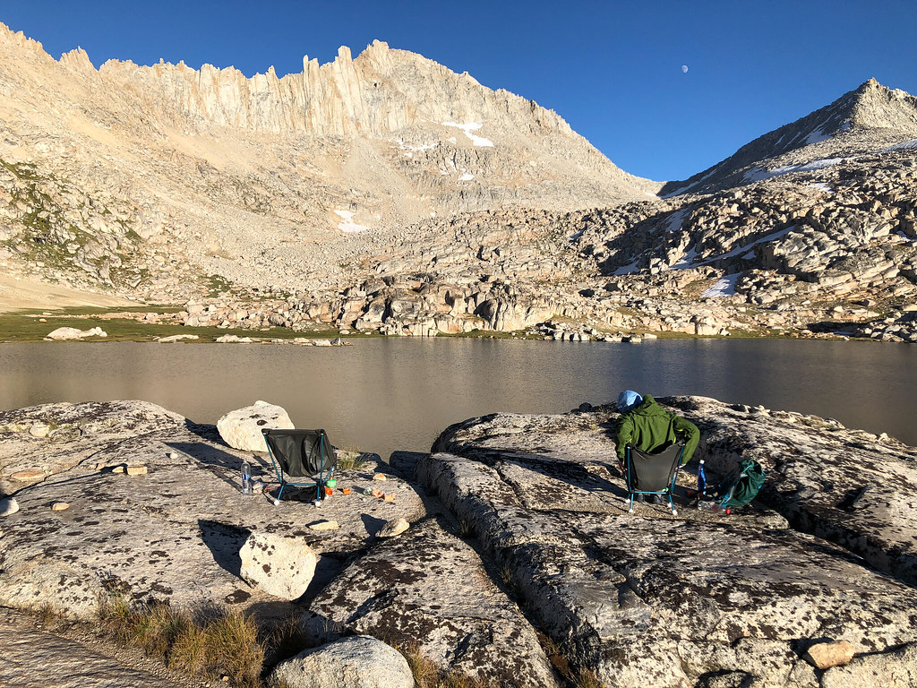
It was becoming part of the routine to drop our packs and wander around looking for cool campsites. And after the wind at Vee Lake, we wanted something sheltered a little. We found an apartment complex of campsites on the big granite mound overlooking the lake. There were at least three or four small level places, about 5-10 feet apart in elevation. It was super cool. We relaxed for a while. My buddy tried fishing. There was a fish that was jumping right near us every couple minutes, mocking him. Unfortunately, our fishing setup was lacking, to say the least. At the last minute, we picked up some line, a couple lures, and some sinkers, thinking we could use our hiking poles as rods. We're not good fishermen with a legit setup, so that kind of went as we expected it to. But he had fun and I had fun sipping whiskey and watching him try to cast. Sunset was awesome as the sun, then the moon after it lit up Feather Peak with changing colors.
Time for dinner, whiskey and a light show.
The last thing we expected was to come across and old guy with super hot moves dancing in the twilight. But we got ... lucky?
Day 5 (9-9): Bearpaw Lake to Merriam Lake
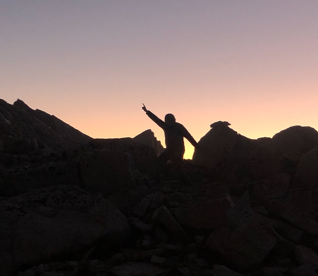
When planning the trip, Feather Pass was the part I had the most trepidation about. But it ended up not being that big a deal, at least on the way up. We ran into Walter and Sight again and they took a break before the last stretch to talk about the route up the final part. He had done it many times, and they went first so we could watch them. I put on micro spikes for the snowfield and it was amazing how easy they made it (it was still morning). There was only one part we had to use our knees to get up on the next ledge. We hung out for a while and life was good.
There were stars on this night as well.
No way that guy is making it up there, now matter how slow he goes.
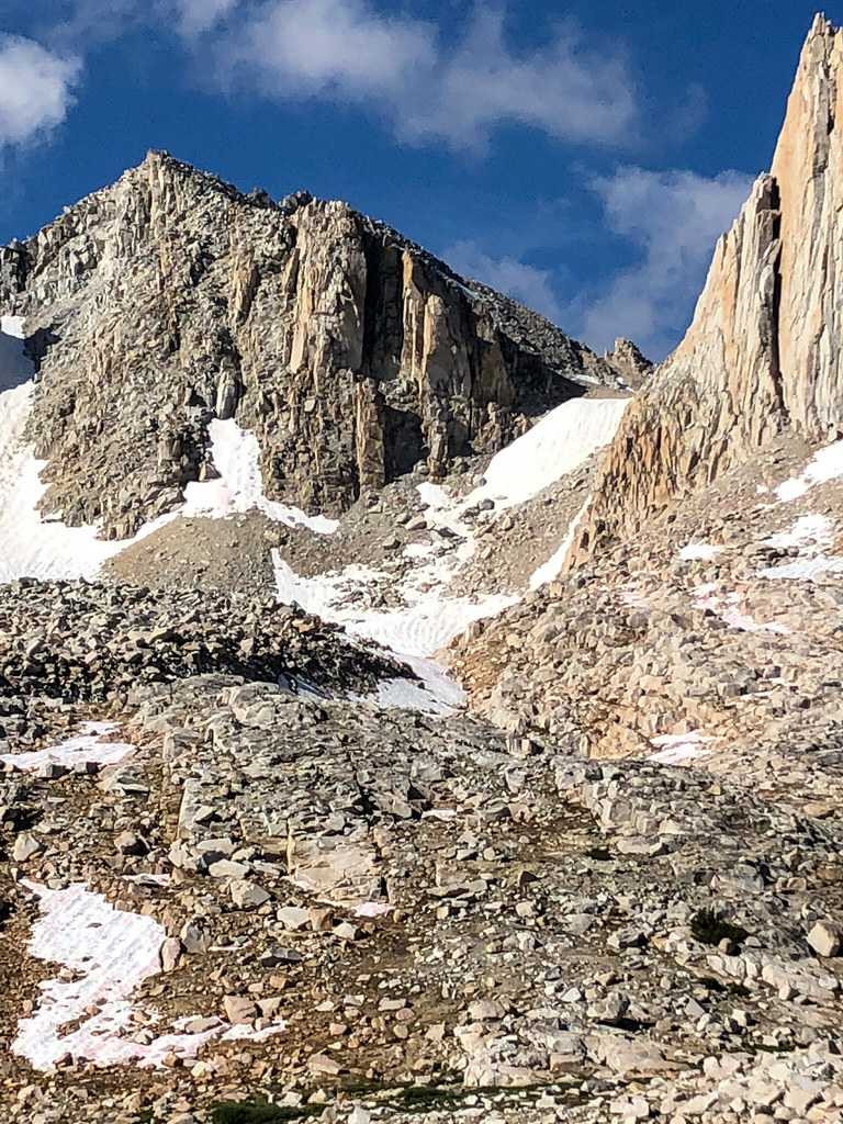
Final snowfield and climb.
So close.
Sight at the top of the pass, with Bearpaw, etc in the background.
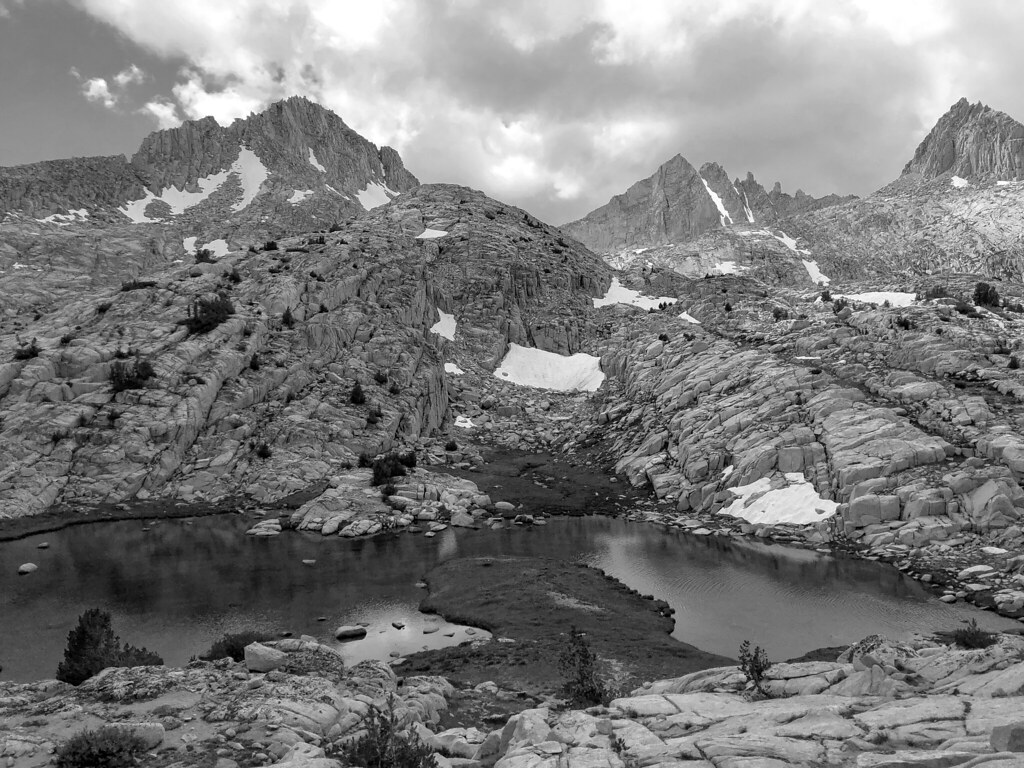
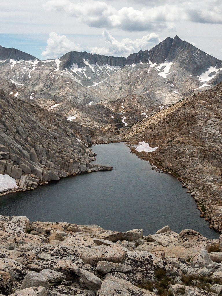
Walter and Sight took off down the pass and we followed a little bit later. Walter had said "just a relaxing walk in the park from here". That was true for a while. Just above LaSalle Lake, we came to a part that was pretty steep. In retrospect, it wouldn't have been bad if we would have handed our packs down. But we saw that if we cut right around a big boulder, we would be able to get down a much lower angle rock field. So, that's what we did. It wasn't until we were deep in it that we realized ALL of the rocks moved. It was like walking on a 10 foot high stack of unstable watermellon sized rocks. Actually, that is exacly what it was. I dislodged a rock with one foot that caused it to crash into my other ankle. Just a scrape, but it freaked me out enough to crab walk for a while. It got a little better towards the bottom because there were big, stable rocks you could stay on. Once at the bottom (it took us almost 90 minutes), we got our wits together. It was, as my buddy said, "traumatic". By the time we cleared LaSalle Lake, we were back in the swing of things. We passed all the pretty lakes and were punched in the face by the waterfalls and views of Merriam Lake. We made our way down to the outlet and found another nice camp spot in some trees.
I had no idea how much I was going to hate this lake by the time I got down there. Not fair, I know, very pretty lake, but ugly inside.
(A) where we should have gone (B) where we went (C) where I quit backpacking for good (temporarily)
Once again, the interwebs were correct. What a cool lake!
Me, having aged 25 years, with clothes hanging out of my pack and a sleeping pad I didn't need.
Day 6 (9-10): Merriam Lake to French Lake
The lake was too windy in the morning to get the reflection pictures that I like, but the outlet was calm, so I used that for a couple pictures. We headed down off trail to one of the prettiest places on the whole trip. The meadows below Merriam were like something out of a movie. We wandered slowly across the meadows, probably crossed a dozen tiny streams. This place actually made us slow down and appreciate it.
One of my favorite parts. So peaceful and easy.
After the meadows, we followed the creek down to the French Canyon trail. There is a trail on the USGS map on the east side of the creek, but I have read that several people had not found it. We did unintentionally find it and it felt sooooo good to have a path to go on and not to have to worry about the best way to traverse the next 15 feet. I really enjoyed being off trail, but being on trail (well, not a trail, but an intermittent path) was a nice break. We descended though wonderful forest and sporadic waterfalls down to the trail. Our original plan was to loop up to Royce Lakes, but we were craving distant mountain views for our last night. We decided to go to French Lake instead. We motored up the pretty French Canyon trail. Just as we headed past the trail to Elba Lake, we ran into Walter again. He hiked ahead of us and waited by a creek. He gave us a general direction of the best way off trail to French Lake. That guy was always in the right place at the right time for us. He was camped near one of the other glacial divide lakes and was heading to Honeymoon Lake for a re-supply.
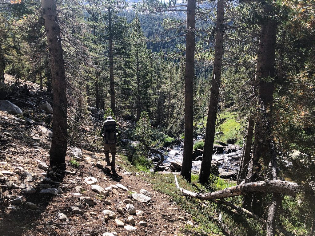
Down, down, down.
French Canyon Trail.
Royce Falls. We could only see the bottom at first, but figured if we kept hiking up the trail, we'd be able to see the top. Which we could, but then we couldn't see the bottom anymore.
Up to French Lake.
French Lake.
Last campsite.
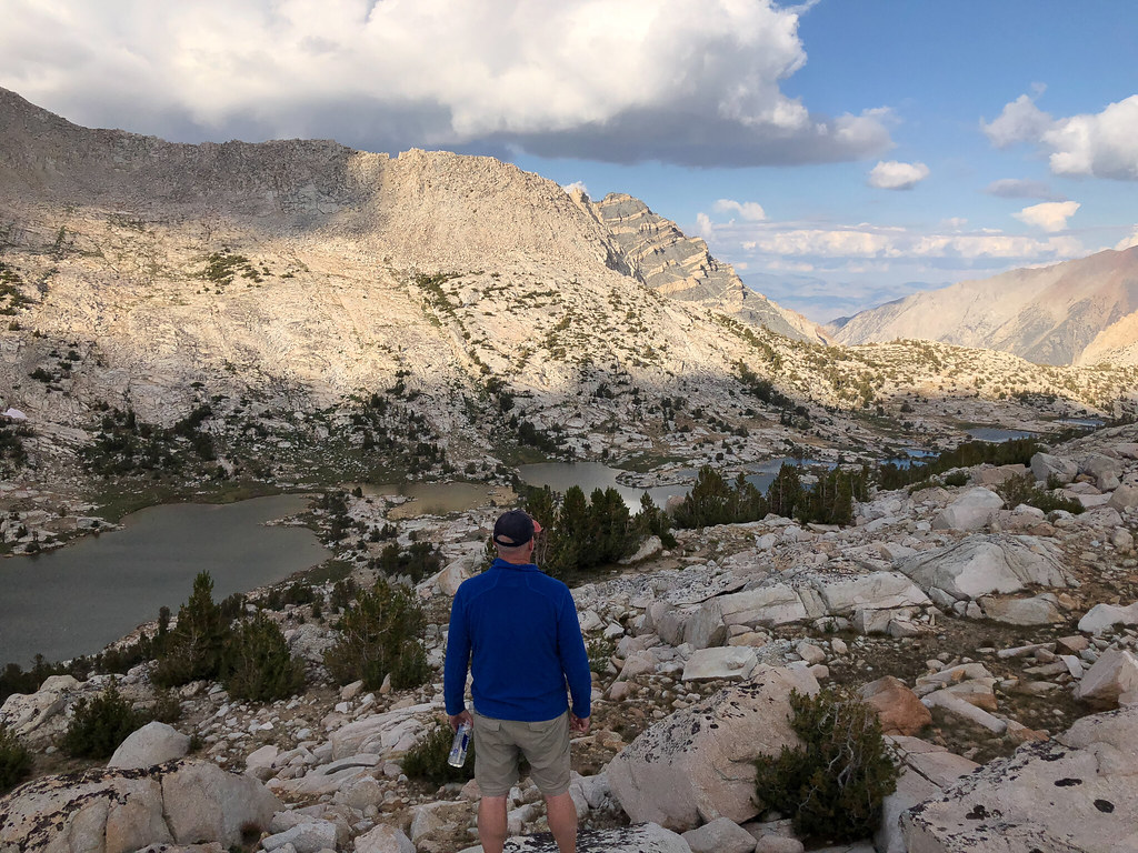
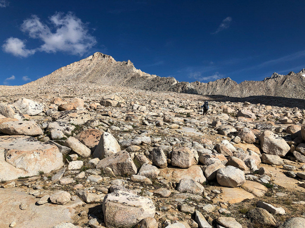
I didn't really understand that cross country travel was not all the same. Cross country to French Lake was pretty easy, much easier than some of the travel in the Bear Lakes Basin. We did our thing, found a cool spot, found an overlook for sunset, and got set up. We also found a high area that let us see almost our whole route! The wind was fierce. It was getting colder every day. This was the first day that I actually went into my tent to escape the wind. In fact, I fell asleep and almost missed sunset.
Day 7 (9-11): French Lake to Pine Creek trailhead
We got up earlier than usual since we had a long day. The cross country to Pine Creek Pass was a piece of cake. Several more hours and 4000 feet of drop later, we were at the car having a celebratory beer. We had some lunch and got a cheap Priceline room at Circus Circus in Vegas. We saw a handful of people in a week, then stayed in a Vegas hotel. Serious culture shock.
Just before dawn, French Canyon.
A little later in the morning.
Upper Pine Lake.
Epilogue:
What a great trip. It was definitely a step up for us, adventure-wise. Throughout the whole trip, I was overcome with a sense of gratitude. Not just for the trip and the places, but for everything and everyone in my life. These trips really bring things into perspective for me. The quilt is a keeper, for sure. I didn't use the straps and still didn't have problems flipping around or letting cold air in. I did wear a down hood when I slept. And having two sleeping pads was kind of cheating. Other than the snowfields, the trailrunners worked great. I mean, they were OK, but I definitely slipped more than my buddy, who had boots. Saved me a pound on the feet, and when they did get wet, they dried out quickly.