IntrepidXJ
ADVENTR
- Joined
- Jan 17, 2012
- Messages
- 3,493
Saturday, December 6, 2014
In a recent conversation with a Facebook friend, he mentioned to me that there might be some rock art located along the Little Dolores River between two parcels of private property. After doing some research on the property boundaries and finding that access would probably be possible by hiking down Toms Canyon, I mapped a possible route on Google Earth that avoided all private property and stayed on BLM land to the area. The only concern I had left was finding an access point down into Toms Canyon from the rim. I had found a spot on Google Earth that looked good, but would not know for sure until I was there and checked it out for myself. On Saturday morning I decided to head up and give this hike a shot. After stopping at the Visitor Center in the Colorado National Monument to pick up a calendar that features one of my photos, I continued up through Glade Park to the Little Dolores Road and took it almost to it's end at the private property. I turned off on a side road that lead to a campsite and started hiking from there. First, I had to climb to a short pass on a faint trail that gave me a nice view down into Toms Canyon. The faint trail I followed up to the pass pretty much ended there and I had to bushwhack through the steep and rocky wash on the way down into Toms Canyon. There was one rocky ledge that I thought was going to stop me and prevent me from going further, but after a little searching I managed to find a way down. It turns out that the route I had planned in Google Earth worked out perfectly. Once I was down in Toms Canyon the hiking was much easier and I followed some well-used cow trails.
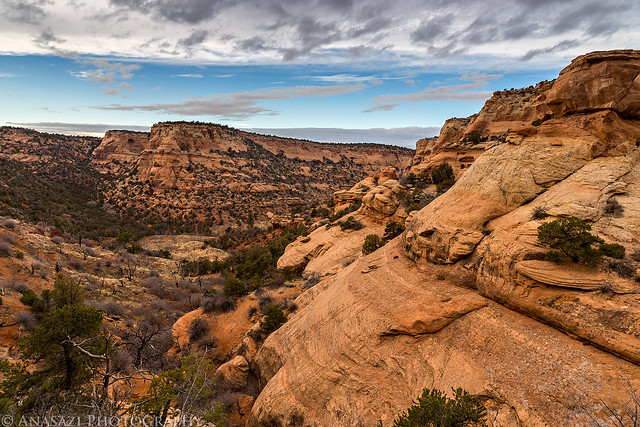
Sandstone scenery as I climbed up to the short pass while searching for a route into Toms Canyon.
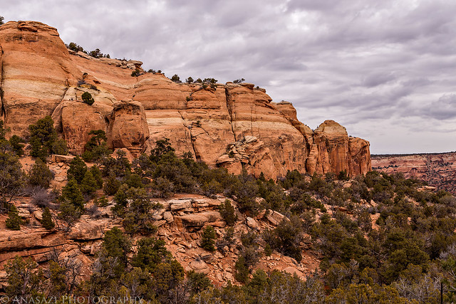
Sandstone Under Clouds by IntrepidXJ, on Flickr
After hiking down Toms Canyon for a little bit, I eventually reached the confluence with the Little Dolores River. I followed another game trail down the steep cut bank and crossed the shallow water to reach the canyon wall on the other side. I hiked along the sheer cliff from one property boundary to the other keeping an eye out for any signs of rock art. It was a little difficult in spots where small washes prevented me from following the wall and I had to find ways around, which included following very steep game trails down to the river again and bushwhacking my way to the other side where I would have to climb up the steep bank again. I ended up doing a lot of climbing on this hike.
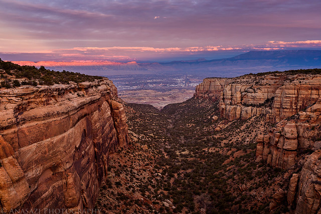
View towards the mouth of Toms Canyon over the Little Dolores River.
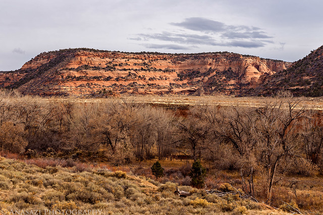
Little Dolores View by IntrepidXJ, on Flickr
At one point, as I was hiking along the canyon wall, I heard a sound below me and saw a group of four large bull elk. I quickly took this photo of three of them right before they took off.

Bull Elk by IntrepidXJ, on Flickr
I feel that I thoroughly searched the canyon walls for rock art between the parcels of private property, but unfortunately I came up empty handed this time. Even though I didn't find what I was looking for, it was still a very nice hike in an area not many people venture to, and I didn't see another person all day. With all the route-finding, my GPS recorded the entire hike as about 9.5 miles round trip.
Sandstone formation along the canyon wall I was searching.
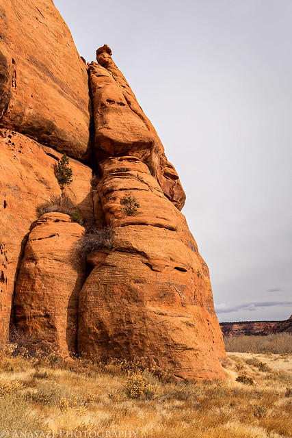
Little Dolores Sandstone by IntrepidXJ, on Flickr
Avoiding private property...
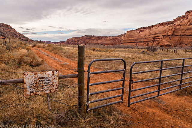
Avoiding Private Property by IntrepidXJ, on Flickr
Following the cow trail back up Toms Canyon.
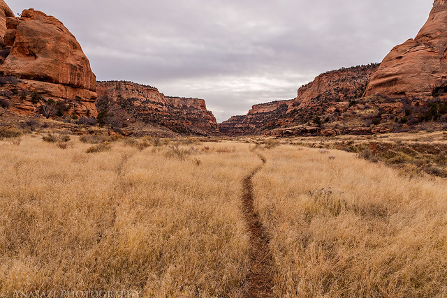
Lower Toms Canyon by IntrepidXJ, on Flickr
As I climbed back out of Toms Canyon to the pass, I took this photo looking down on the route I had used. The overcast skies also were finally starting to clear a little.
Toms Canyon Descent by IntrepidXJ, on Flickr
As I was driving back home after the hike, the sky continued to clear a little in the west and I could tell there might be a nice sunset this evening. I stopped for a few quick photos as I drove back across Glade Park.
When I returned to Ds Road, I stopped for a quick photo of Frying Pan Arch that is visible from the road.
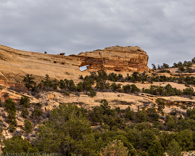
Frying Pan Arch by IntrepidXJ, on Flickr
I spotted this lone tree in a shallow alcove just as the evening sun came out.
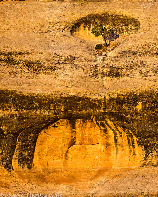
Lonely Tree by IntrepidXJ, on Flickr
Ds Road on Glade Park.
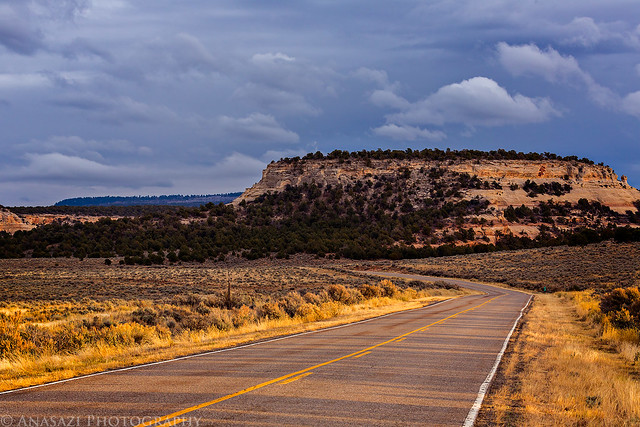
Ds Road by IntrepidXJ, on Flickr
Nice light on the sandstone around me as the clouds cleared.
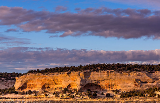
Alcove Light by IntrepidXJ, on Flickr
With the possibility of a nice sunset, I hurried back to the Colorado National Monument so I could try and get some photos. I managed to get a few shots off over Columbus Canyon and Red Canyon before the light was gone. It was a pretty spectacular sunset with nice light and a great way to end the day!
Entering the Colorado National Monument with the Book Cliffs lit up in front of me.

Book Cliffs Road by IntrepidXJ, on Flickr
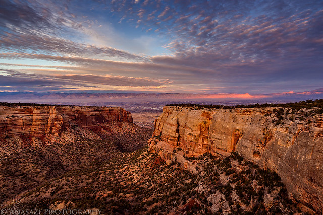
Beautiful clouds over Columbus Canyon with nice light on the Book Cliffs in the distance.
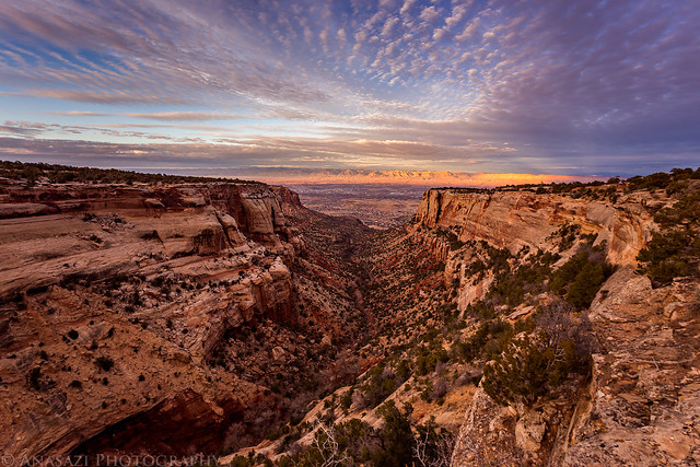
Columbus Canyon Sunset by IntrepidXJ, on Flickr
Columbus Clouds by IntrepidXJ, on Flickr
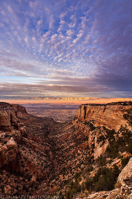
A few shots over Red Canyon before the light was gone and I was on my way back home again.
Red Canyon Clouds by IntrepidXJ, on Flickr
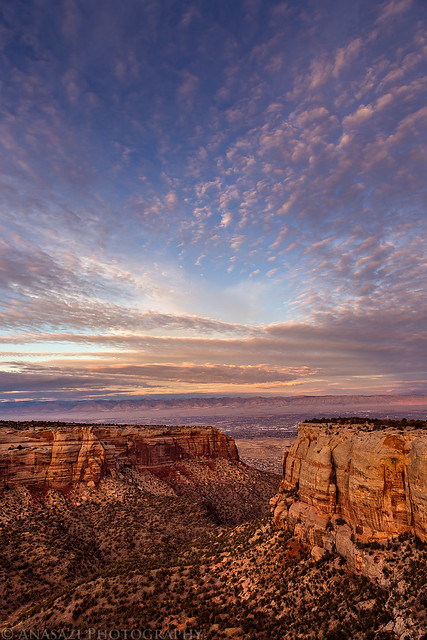
Red Canyon Sky by IntrepidXJ, on Flickr
Red Canyon by IntrepidXJ, on Flickr
>> Toms Canyon to the Little Dolores
>> The Original Trip Report on ADVENTR.CO
Featured images for home page:

In a recent conversation with a Facebook friend, he mentioned to me that there might be some rock art located along the Little Dolores River between two parcels of private property. After doing some research on the property boundaries and finding that access would probably be possible by hiking down Toms Canyon, I mapped a possible route on Google Earth that avoided all private property and stayed on BLM land to the area. The only concern I had left was finding an access point down into Toms Canyon from the rim. I had found a spot on Google Earth that looked good, but would not know for sure until I was there and checked it out for myself. On Saturday morning I decided to head up and give this hike a shot. After stopping at the Visitor Center in the Colorado National Monument to pick up a calendar that features one of my photos, I continued up through Glade Park to the Little Dolores Road and took it almost to it's end at the private property. I turned off on a side road that lead to a campsite and started hiking from there. First, I had to climb to a short pass on a faint trail that gave me a nice view down into Toms Canyon. The faint trail I followed up to the pass pretty much ended there and I had to bushwhack through the steep and rocky wash on the way down into Toms Canyon. There was one rocky ledge that I thought was going to stop me and prevent me from going further, but after a little searching I managed to find a way down. It turns out that the route I had planned in Google Earth worked out perfectly. Once I was down in Toms Canyon the hiking was much easier and I followed some well-used cow trails.
Sandstone scenery as I climbed up to the short pass while searching for a route into Toms Canyon.
Sandstone Under Clouds by IntrepidXJ, on Flickr
After hiking down Toms Canyon for a little bit, I eventually reached the confluence with the Little Dolores River. I followed another game trail down the steep cut bank and crossed the shallow water to reach the canyon wall on the other side. I hiked along the sheer cliff from one property boundary to the other keeping an eye out for any signs of rock art. It was a little difficult in spots where small washes prevented me from following the wall and I had to find ways around, which included following very steep game trails down to the river again and bushwhacking my way to the other side where I would have to climb up the steep bank again. I ended up doing a lot of climbing on this hike.
View towards the mouth of Toms Canyon over the Little Dolores River.
Little Dolores View by IntrepidXJ, on Flickr
At one point, as I was hiking along the canyon wall, I heard a sound below me and saw a group of four large bull elk. I quickly took this photo of three of them right before they took off.
Bull Elk by IntrepidXJ, on Flickr
I feel that I thoroughly searched the canyon walls for rock art between the parcels of private property, but unfortunately I came up empty handed this time. Even though I didn't find what I was looking for, it was still a very nice hike in an area not many people venture to, and I didn't see another person all day. With all the route-finding, my GPS recorded the entire hike as about 9.5 miles round trip.
Sandstone formation along the canyon wall I was searching.
Little Dolores Sandstone by IntrepidXJ, on Flickr
Avoiding private property...
Avoiding Private Property by IntrepidXJ, on Flickr
Following the cow trail back up Toms Canyon.
Lower Toms Canyon by IntrepidXJ, on Flickr
As I climbed back out of Toms Canyon to the pass, I took this photo looking down on the route I had used. The overcast skies also were finally starting to clear a little.
Toms Canyon Descent by IntrepidXJ, on Flickr
As I was driving back home after the hike, the sky continued to clear a little in the west and I could tell there might be a nice sunset this evening. I stopped for a few quick photos as I drove back across Glade Park.
When I returned to Ds Road, I stopped for a quick photo of Frying Pan Arch that is visible from the road.
Frying Pan Arch by IntrepidXJ, on Flickr
I spotted this lone tree in a shallow alcove just as the evening sun came out.
Lonely Tree by IntrepidXJ, on Flickr
Ds Road on Glade Park.
Ds Road by IntrepidXJ, on Flickr
Nice light on the sandstone around me as the clouds cleared.
Alcove Light by IntrepidXJ, on Flickr
With the possibility of a nice sunset, I hurried back to the Colorado National Monument so I could try and get some photos. I managed to get a few shots off over Columbus Canyon and Red Canyon before the light was gone. It was a pretty spectacular sunset with nice light and a great way to end the day!
Entering the Colorado National Monument with the Book Cliffs lit up in front of me.
Book Cliffs Road by IntrepidXJ, on Flickr
Beautiful clouds over Columbus Canyon with nice light on the Book Cliffs in the distance.
Columbus Canyon Sunset by IntrepidXJ, on Flickr
Columbus Clouds by IntrepidXJ, on Flickr
A few shots over Red Canyon before the light was gone and I was on my way back home again.
Red Canyon Clouds by IntrepidXJ, on Flickr
Red Canyon Sky by IntrepidXJ, on Flickr
Red Canyon by IntrepidXJ, on Flickr
>> Toms Canyon to the Little Dolores
>> The Original Trip Report on ADVENTR.CO
Featured images for home page:

