Ticaboo Creek, May 2024

Joined
Oct 6, 2021
Messages
22
Hi folks, this report is for my solo trip to Ticaboo Creek via the South Fork trailhead, May 23–27, 2024. It was indeed a bit late in the season, but I got lucky and temperatures were reasonable; highs in the upper 80s. A week later the forecast highs were well over 100.

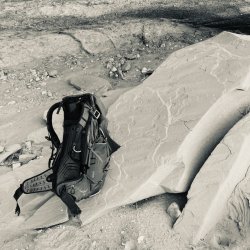
Photography this time was my phone, because it was easy. I already had the phone on for maps (CalTopo), also a first. I think it turned out okay and I plan to lean in on this for the time being because it’s just so much easier than a separate camera.

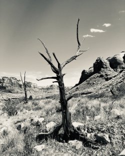
It was a five-day trip and I’ll do each day in a separate post in this thread.

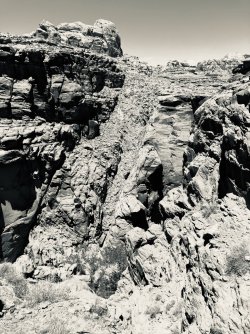
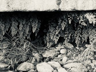
However, I’ll start with something that I want to be location-vague about. I came across a large mudstone (?) inclusion in one of the sandstones, which in itself was very cool, but while crossing the area, I looked down and at my feet was something that sure as hell looked like the cast of a dinosaur track! The rock was the right age, but I didn’t see other fossils anywhere in that layer. It could 100% be just a coincidentally shaped rock.

dino - 2.jpeg
“Dino track” side A.

dino - 3.jpeg
“Dino track” side B.

dino - 1.jpeg
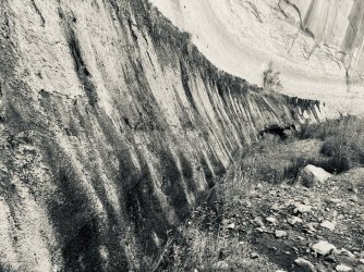
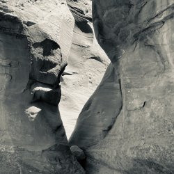
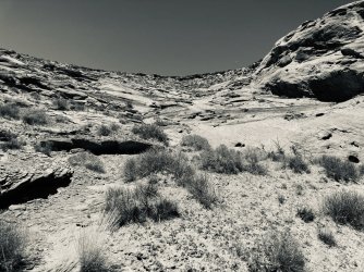
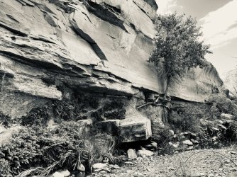
Some of the surrounding rocks.

dino - 4.jpeg
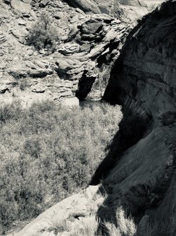
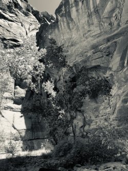
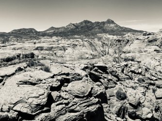
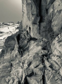
More surrounding rocks.
 

Day 1

I had stayed overnight at Recapture Lodge in Bluff and got up bright and early at ... we’ll just skip that part.

IMG_5339.jpeg
Weigh-in on the Recapture patio. Note units — kilograms.

IMG_5338.jpeg
Part of the problem might be that I brought four (4) books.

It took just under four hours to drive from Bluff to the trailhead, including 45 minutes on a pretty rough dirt road. There were lots of roads not on the map and it would have been rough (ha!) without my GPS. It’s a windswept, not particularly pleasant trailhead.

On-trail finally at 1345. The plan was to hike downstream to what Kelsey calls Wall Spring just after the confluence with North Fork, or perhaps the mouth of Peshliki Fork a little further.

IMG_5342.jpeg
No views at the trailhead either. Mt Ellsworth.

IMG_5343.jpeg
Me looking prepared, or something. Mt Holmes in the background.

The trail is somewhat easy to follow down to the South Fork Ticaboo wash. It is not in good shape though. If you get off-trail, there are lots of cairns to choose from.

IMG_5346.jpeg
Looking up-canyon from where the trail meets the wash.

While looking for a late lunch spot, there was a sudden explosion of flapping bird wings. I thought quickly, realized it was a mama quail trying to distract me, and turned around just in time to see a couple of chicks scurry under the brush.

IMG_5349.jpeg
Somewhere in the South Fork of Ticaboo Creek.

IMG_5351.jpeg
One of several short, crack-style side canyons. I understand these get rather spectacular upstream from the access trail.

IMG_5354.jpeg
Desert varnish on river left.

IMG_5355.jpeg
One of several dry meadows as the wash enters the Kayenta.

IMG_5357.jpeg
Entering the Wingate Sandstone.

While it was only a three-hour hike to camp, and my pack wasn’t that unreasonable, it was remarkably difficult. I couldn’t figure out why other than I must be less fit than usual. It’s also plausible I was a bit dehydrated — it was in the 80s but not super hot.

I’d planned to check out both Wall Spring and Peshliki before selecting a campsite, but skipped the latter and found some nice cottonwoods in front of an alcove near Wall Spring. “Bat Camp” had running water, afternoon shade by 1700, and morning shade until 1000. (I later saw no good campsites near Peshliki, so that would have been a waste of effort anyway.)

IMG_5359.jpeg
First item of business once in camp was to recline for an extended period.

IMG_5364.jpeg
Looking upstream from my kitchen area.

Dinner was macaroni and cheese, which was both easy and delicious.

IMG_5363.jpeg
Sunset on Day 1.

Two remarkable events happened before I turned in.

First, I learned that I should call it Bat Camp because the place was absolutely swarming with bats. I even had one fly between me and my food.

Second, there were also lots of curious toads around. One even hopped up right next to me and let me pet her. (I’m pretty sure it was a her because later in the trip there was some toad humping and the ones with those markings were on the bottom.)
 
These trip reports, well, all I can say is I wish you'd find some decent scenery once in awhile. And where's the rest of the illustrious group?
 
You need to get out of that dang God-forsaken desert. Ever been to Miami Beach or maybe even Myrtle Beach? Think of all the people you could meet on a five-day trip! You wouldn't have to sit around reading boring books and taking photos of your knees.
 
Last edited:

Day 2

The goal today was to (1) visit the pool at the foot of Peshliki Fork and (2) reverse the up-and-over traverse between North and Peshliki Forks described by Bill Priedhorsky in 2009, and possibly (3) visit the spring a few miles up Ticaboo’s North Fork.

(Geography note: Ticaboo has four named forks and quite a few unnamed ones. The North, Middle, and South Forks drain from Mount Ellsworth on the west side of the system. The Peshliki Fork drains a mesa to the north.)

IMG_5366.jpeg
Morning sun on the cottonwoods outside camp.

I was awake at 0700 and out of the tent promptly at 0800. Camp departure was 1030.

IMG_5371.jpeg
This large-ish lizard was a daily visitor each morning as soon as this log became illuminated.

IMG_5384.jpeg
Large spring not far below camp. This may be what Kelsey calls “Wall Spring”. It’s a few feet below the high water mark.

IMG_5381.jpeg
Sacred Datura flower.

Lake Powell’s high water mark at 3,700 feet elevation is subtle. There are a few benches with dead tamerisk and occasional clam shells, but those are the only unpleasant parts of the area. Other than that, it looks like a normal canyon now.

IMG_5388.jpeg
Indian Paintbrush, possibly?

IMG_5389.jpeg
Peshliki pool. While other trip reports show this large pool as quite pleasant (e.g. the 2009 Priedhorsky report), when I visited, the shore was heavily overgrown with essentially no beach or other hangout places near the water. There was also a fair amount of leaves and other crud floating on the surface.

The fall above Peshliki pool can be bypassed via the scree slope on river right, and possibly also the Wingate slickrock slope on river left.

IMG_5396.jpeg
Dry Peshliki Fork above the first fall.

IMG_5400.jpeg
Minor second fall.

IMG_5399.jpeg
Taking a break under the second fall. I’ve discover that my frame pack works plenty well as a day pack, saving an item to bring.

IMG_5401.jpeg
Large third fall a couple of miles up Peshliki, at the top of the Wingate. I didn’t find any name for it, so I’ll refer to it as “Never Falls”.

IMG_5405.jpeg
Lip of Never Falls from below.

IMG_5407.jpeg
Never Falls is bypassed on river left by ascending the rubble of a huge fault. This photo is looking down the slope from partway up, with the fault continuing on the other side of the canyon.

IMG_5409.jpeg
I decided to attempt crossing over to North Fork a little south of where Priedhorsky had, by continuing to follow the fault.

IMG_5415.jpeg
Mt Ellsworth from the ridge summit between Peshliki and North Forks, which I called “Mt Gonna”.


Descent into the side canyon leading to North Fork was a little complicated, but not a problem. From near the mouth of the side canyon, I cut across a bench and headed upstream a little bit to “College Spring”, where Kelsey describes meeting a group of college students in spring 2001 (?). There’s quite a good flow in the area, and a large, well-established but very sunny campsite.

IMG_5418.jpeg
Prickly pear blossom near College Camp. I only ever saw these in the afternoon, so maybe they are single-day afternoon flowers?

IMG_5422.jpeg
Part of College Spring. It was undercut enough to have the earthy, damp smell of a cave.

IMG_5420.jpeg
Filling my water bottles at College Spring. It took 14 seconds for one bottle, i.e. about 4 liters per minute flow rate.

IMG_5424.jpeg
More bad scenery at College Spring.

IMG_5427.jpeg
Dead junipers captured well the mood of the long, hot hike downstream back to camp.

IMG_5435.jpeg
One of the white flowers ubiquitous in camp.

Arrival back in camp was 1730, i.e. a 7-hour hike including the generous breaks. Dinner was my famous enchiladas. Good day, but tiring.
 

Attachments

  • IMG_5405.jpeg
    IMG_5405.jpeg
    471.5 KB · Views: 0
  • IMG_5366.jpeg
    IMG_5366.jpeg
    760.7 KB · Views: 0
  • IMG_5371.jpeg
    IMG_5371.jpeg
    352.1 KB · Views: 0
  • IMG_5381.jpeg
    IMG_5381.jpeg
    210.9 KB · Views: 0
  • IMG_5384.jpeg
    IMG_5384.jpeg
    779.4 KB · Views: 0
  • IMG_5388.jpeg
    IMG_5388.jpeg
    225.1 KB · Views: 0
  • IMG_5389.jpeg
    IMG_5389.jpeg
    628.5 KB · Views: 1
  • IMG_5399.jpeg
    IMG_5399.jpeg
    526.5 KB · Views: 1
  • IMG_5400.jpeg
    IMG_5400.jpeg
    424.2 KB · Views: 1
  • IMG_5401.jpeg
    IMG_5401.jpeg
    579.3 KB · Views: 1
  • IMG_5396.jpeg
    IMG_5396.jpeg
    472.4 KB · Views: 1
  • IMG_5407.jpeg
    IMG_5407.jpeg
    686.5 KB · Views: 1
  • IMG_5409.jpeg
    IMG_5409.jpeg
    662.1 KB · Views: 1
  • IMG_5415.jpeg
    IMG_5415.jpeg
    564.6 KB · Views: 1
  • IMG_5418.jpeg
    IMG_5418.jpeg
    452.2 KB · Views: 1
  • IMG_5420.jpeg
    IMG_5420.jpeg
    357.2 KB · Views: 0
  • IMG_5422.jpeg
    IMG_5422.jpeg
    395.4 KB · Views: 0
  • IMG_5424.jpeg
    IMG_5424.jpeg
    644.8 KB · Views: 0
  • IMG_5427.jpeg
    IMG_5427.jpeg
    560.2 KB · Views: 0
  • IMG_5435.jpeg
    IMG_5435.jpeg
    250 KB · Views: 0
One of the white flowers ubiquitous in camp.
Looks like evening primrose to me.

My new nickname for Mt. Ellsworth is Not Gonna (too many rattlers). The photo of the sun on the cottonwoods looks like some kind of spring flowering tree, like a white crabapple or something. Really beautiful. That next to last photo of the tree is very evocative. If I were in a place like that you'd have to drag me out with a rope.
 
Back
Top