regehr
Member
- Joined
- Mar 28, 2012
- Messages
- 2,482
The American Fork Twins, along with Red Top (to the west, un-named on the map) and Peak 11391 (a bit to the south of the east twin) might as well be regarded as a quadruple peak since the other two have very little prominence.

I've lived in SLC for 17 years and somehow had never visited any of these, and decided to fix that today since my kids needed dropping off and picking up at Snowbird for a summer camp. The tram base at Snowbird had a couple hundred people walking around in camo, carrying compound bows, it turned out they were hiking the trails and shooting at enormous numbers of fake deer (and fish, dinosaurs, and more) cunningly placed near these trails. They made me nervous but I ended up leaving them behind within minutes and didn't see anyone until I got to the tram top a few hours later. It was a nice morning:

But it didn't take me long to remember why I'd been avoiding this area -- ski stuff in summer is just not very pretty.

Yuck.

There were a few flowers out but it wasn't wall-to-wall like you sometimes see.


The route starts at 8100', follows service roads for a while, then ski slopes, ending up at the Gad 2 lift at about 10,000'. Super easy walking up to this point! Then a short, steep climb up some talus and grassy slopes to the ridge overlooking White Pine.

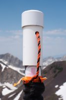
I couldn't figure out what this is for.

This ridge climbs directly to Red Top. It is listed as class 3 in books such as "Wasatch Eleveners" which seems maybe a bit of an exaggeration, it's maybe class 3- or class 2+ if you go for that sort of rating. Mostly it's an easy walk with just a few steep rocky sections, and little or no exposure. Here I'm just below the summit of Red Top looking over at the twins.
Past Red Top, the (higher) west twin is still just a bit of a slog. This is the highest point in Salt Lake County and the highest point in this part of the Wasatch Range -- comfortably higher than its neighbors like the Broads Fork Twins, Pfeifferhorn, Lone Peak, etc.

Looking back at Red Top we can see it hardly rates as a summit of its own.

Happily there was a nice snowbank right atop the west twin so my summit beer was well chilled. I let the beer cool and deliberately dropped my pack before trekking over to the east twin so that I wouldn't be tempted to try the knife edge ridge to Hidden Peak. I don't like doing exposed class 4 by myself.

A half dozen of these contraptions littered the ridge between the twins.

One of them had some gear on top and a sticker indicating Whistler Ski Patrol. It wasn't clear to me what this contraption would accomplish but whatever.
Some nice flowers near the saddle:

Looking south at Peak 11391 which I did not take time to visit:

So many good mountains I can't stand it. I climbed Red Baldy on June 8 and was on snow almost the entire time, hiking it would be very different now.

Looking down from the east twin at the knife edged ridge leading to Hidden Peak:

At this point I noticed the service roads on both sides of the ridge and decided to hike out to the tram and bail to one of the roads if I didn't like the knife edge. So I had to go back to the west twin, drink my (now ice old) beer, grab my pack, and come back to the east twin. The scramble down to where the rock changes from very dark to very light was super fun! Solid rock and little exposure, perfect class 3. Somewhere near the low point, near where the rock transitions from dark to light I bailed to the south (right) and this was very much not a fun couple hundred vertical feet, it was possibly more difficult than just staying on the ridge would have been. But anyhow I ended up on the road at which point is was a quick and easy walk to the tram. Looking back at the east twin from the road you can maybe appreciate that bailing off this ridge to the south sort of sucks:

Nice view of Devil's Castle along with developing clouds, one of the reasons I felt like bailing to the tram instead of retracing my steps past Gad 2 to Snowbird base.

Summary of the descent from the east twin (at left of photo). The top part (light rock) is steepish and somewhat loose, but an easy walk. The dark rock is a real scramble but easy and fun. The light-colored knife edge ridge is supposed to be tricky and I didn't want to do it. There are service roads on both sides not too far below the ridge. Perhaps the one to the north is easier to get to than the one to the south.

The tram took me back to the Snowbird base about 5 hours after I had left.
I've lived in SLC for 17 years and somehow had never visited any of these, and decided to fix that today since my kids needed dropping off and picking up at Snowbird for a summer camp. The tram base at Snowbird had a couple hundred people walking around in camo, carrying compound bows, it turned out they were hiking the trails and shooting at enormous numbers of fake deer (and fish, dinosaurs, and more) cunningly placed near these trails. They made me nervous but I ended up leaving them behind within minutes and didn't see anyone until I got to the tram top a few hours later. It was a nice morning:
But it didn't take me long to remember why I'd been avoiding this area -- ski stuff in summer is just not very pretty.
Yuck.
There were a few flowers out but it wasn't wall-to-wall like you sometimes see.
The route starts at 8100', follows service roads for a while, then ski slopes, ending up at the Gad 2 lift at about 10,000'. Super easy walking up to this point! Then a short, steep climb up some talus and grassy slopes to the ridge overlooking White Pine.
I couldn't figure out what this is for.
This ridge climbs directly to Red Top. It is listed as class 3 in books such as "Wasatch Eleveners" which seems maybe a bit of an exaggeration, it's maybe class 3- or class 2+ if you go for that sort of rating. Mostly it's an easy walk with just a few steep rocky sections, and little or no exposure. Here I'm just below the summit of Red Top looking over at the twins.
Past Red Top, the (higher) west twin is still just a bit of a slog. This is the highest point in Salt Lake County and the highest point in this part of the Wasatch Range -- comfortably higher than its neighbors like the Broads Fork Twins, Pfeifferhorn, Lone Peak, etc.
Looking back at Red Top we can see it hardly rates as a summit of its own.
Happily there was a nice snowbank right atop the west twin so my summit beer was well chilled. I let the beer cool and deliberately dropped my pack before trekking over to the east twin so that I wouldn't be tempted to try the knife edge ridge to Hidden Peak. I don't like doing exposed class 4 by myself.
A half dozen of these contraptions littered the ridge between the twins.
One of them had some gear on top and a sticker indicating Whistler Ski Patrol. It wasn't clear to me what this contraption would accomplish but whatever.
Some nice flowers near the saddle:
Looking south at Peak 11391 which I did not take time to visit:
So many good mountains I can't stand it. I climbed Red Baldy on June 8 and was on snow almost the entire time, hiking it would be very different now.
Looking down from the east twin at the knife edged ridge leading to Hidden Peak:
At this point I noticed the service roads on both sides of the ridge and decided to hike out to the tram and bail to one of the roads if I didn't like the knife edge. So I had to go back to the west twin, drink my (now ice old) beer, grab my pack, and come back to the east twin. The scramble down to where the rock changes from very dark to very light was super fun! Solid rock and little exposure, perfect class 3. Somewhere near the low point, near where the rock transitions from dark to light I bailed to the south (right) and this was very much not a fun couple hundred vertical feet, it was possibly more difficult than just staying on the ridge would have been. But anyhow I ended up on the road at which point is was a quick and easy walk to the tram. Looking back at the east twin from the road you can maybe appreciate that bailing off this ridge to the south sort of sucks:
Nice view of Devil's Castle along with developing clouds, one of the reasons I felt like bailing to the tram instead of retracing my steps past Gad 2 to Snowbird base.
Summary of the descent from the east twin (at left of photo). The top part (light rock) is steepish and somewhat loose, but an easy walk. The dark rock is a real scramble but easy and fun. The light-colored knife edge ridge is supposed to be tricky and I didn't want to do it. There are service roads on both sides not too far below the ridge. Perhaps the one to the north is easier to get to than the one to the south.
The tram took me back to the Snowbird base about 5 hours after I had left.
Attachments
Last edited: