McKee80
Member
- Joined
- Feb 9, 2017
- Messages
- 236
Preface:
I just started backpacking this year with a goal of backpacking in the Sierras someday. I spent the spring and summer backpacking around PA and WV. Probably a half dozen trips, one two nighter, and a couple solo. My fiancee and kids liked me to be able to check in, so I got an inReach. About a month ago, I realized that there were really cheap flights to Vegas, and Vegas was a 4 hour drive from the Eastern Sierras. My buddy couldn't go, so I started planning for a solo trip. I really wanted to go to the TM part of Yosemite, so I planned a trip out of Murphy Creek, including Mt Hoffman, Cloud's Rest and Sunrise and Cathedral Lakes. My backup plan was a trip out of Agnew Meadows.
Day 0: "Man plans, God laughs"
By the time I got to Bishop to pick up my bear can, I had decided to go with my backup plan (suggested by people on the board). I didn't want to get to Mt Hoffman and Cloud's Rest and not be able to see any views. As infrequently as I am likely to get out there, I decided to save them for another trip. My backup plan I had made out was to hike to Ediza Lake, go x-country to Nydiver Lakes to the west side of Garnet, over the western pass to Thousand Island Lakes, and out. It was 3:00 by the time I got to Bishop and decided to take an acclimitization day. I picked up my walk in permit for the River Trail, then I went up to North Lake and Sabrina lake and walked around a bit and saw a cool rainbow on the death alley known as the road to North Lake.
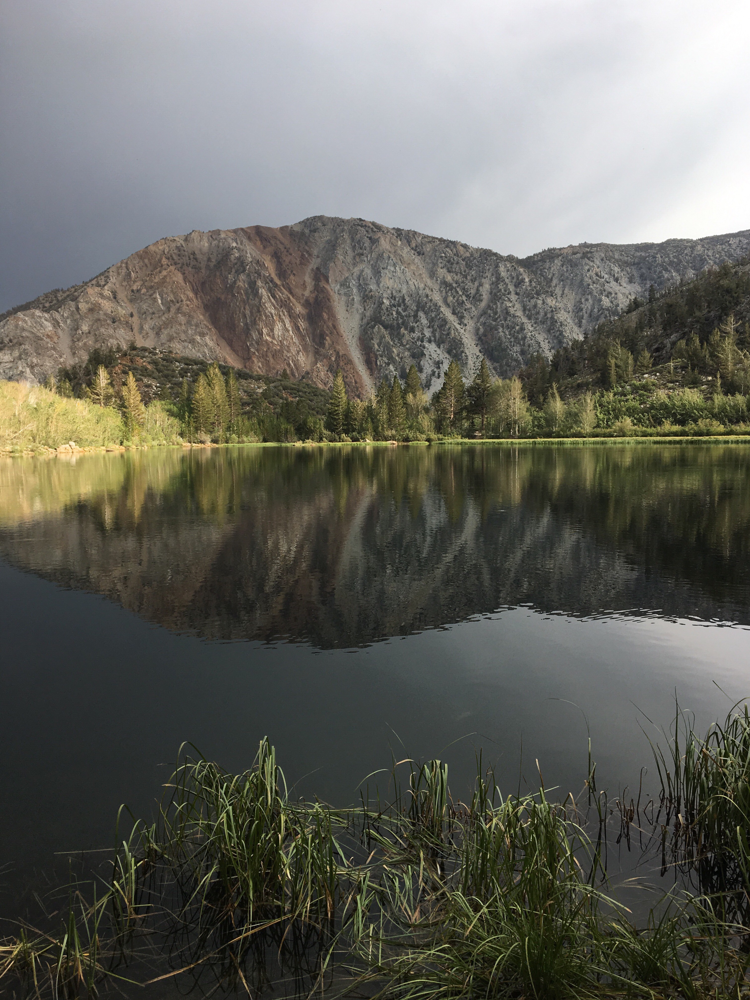
North Lake

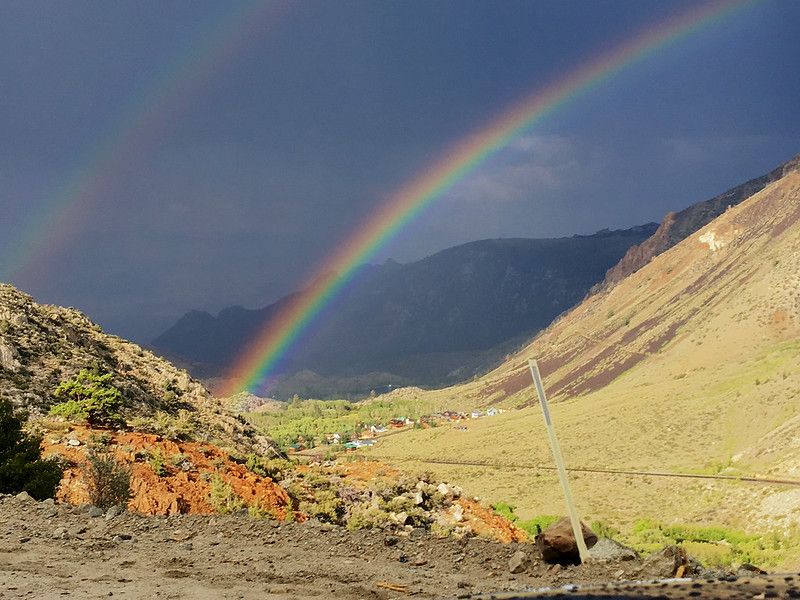
Rainbow on road to North Lake
I noticed checking into the hotel that Bishop is at 4150 ft, so much for acclimitization.
Day 1: "Everyone has a plan until they get punched in the face"
After watching the beautiful sunset on the way up to Mammoth, I arrived at the trailhead at 7:00 AM. I was off on my adventure.
Agnew Meadow
 [/url][/IMG]
Olaine Lake
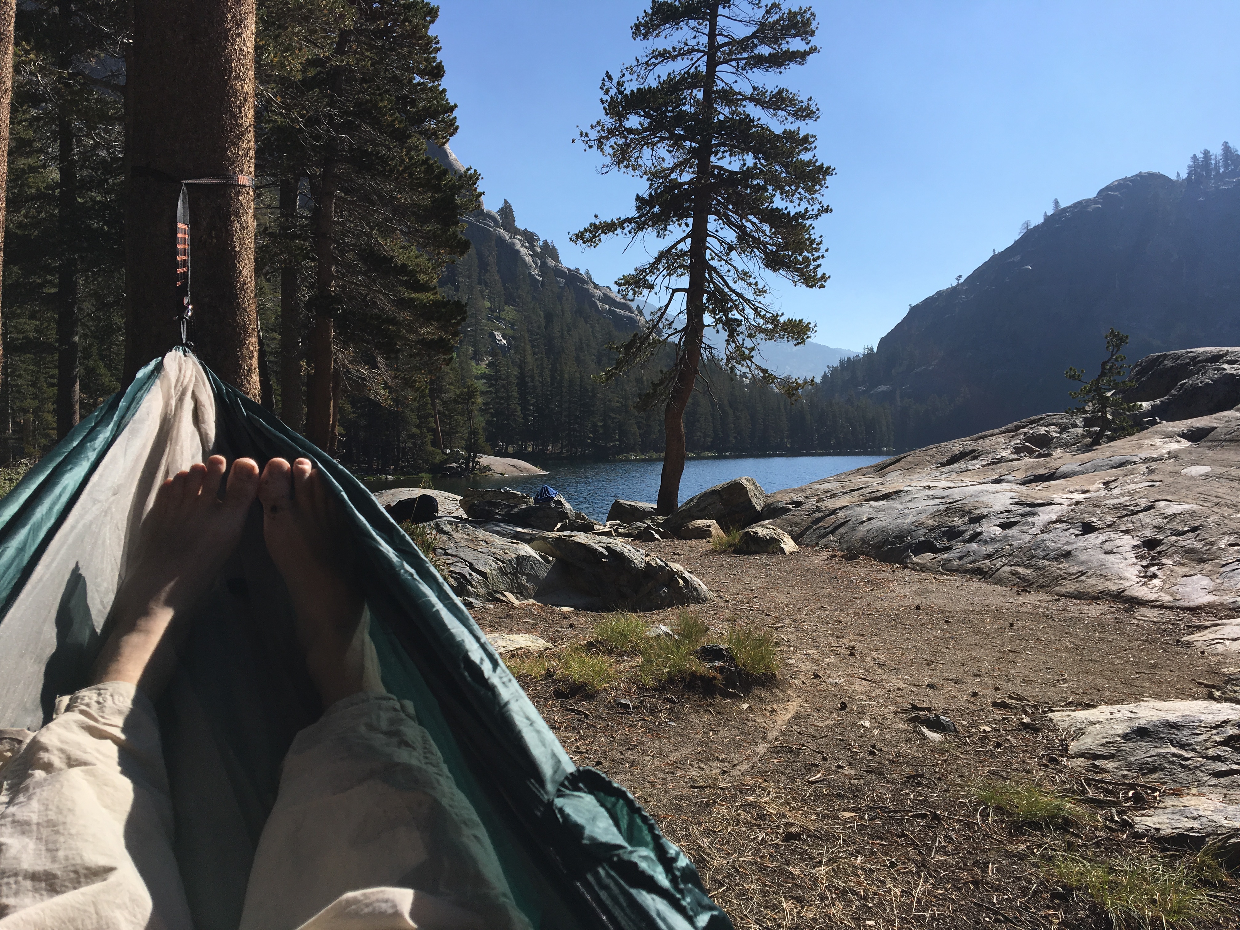
I hiked slow and was stopping constantly to look around. It was amazing. When I reached Shadow Lake for a break, I hung the hammock and took a snooze. I had an early lunch and took a swim. I was there for two hours without even realizing it.
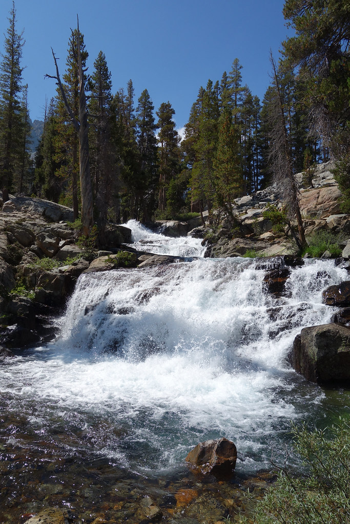
I geared back up and headed back on the trail. It was about 5 minutes before I saw a huge waterfall coming into Shadow Lake. So, I had to go down there and check it out.
After another long break, it was back on the trail to Ediza Lake. I reached the log crossing of the Ediza Lake outlet and realized that it didn't look like it did in the pictures.
No crossing here!
I actually enjoy water crossings. It was pretty easy to do about a hundred yards downstream. But, for whatever reason, I made an error in judgement. Maybe I over-estimated my skills, didn't want to backtrack, I'm not sure. I saw a use trail heading up the north side of the outlet and decided to take it. I assumed there must be a way to cross up there. I headed up the use trail and it got increasingly sketchy. At one point, I attempted to transfer my balance forward onto a rock. I didn't get there. I didn't fully account for the 40 lbs on my back, I guess. I ended up like a turtle on my back between some rocks. Some dayhikers were behind me and helped me up. They looked ahead and decided to turn back. I took stock of my situation. Some flesh wounds on my forearm and shin and a bent pole, but I was pretty lucky. I was a couple feet from the raging outlet. Then I realized my inReach was gone. It had been in an unzipped side pocket of my pack. I searched for about 20 minutes, but I knew it went between the rocks and down the creek.
I got back down to the formerly legit crossing and saw the day hikers again. They were kind enough to take my fiancee's number and agreed to text her when they got back. I was a little shaken up and unsure of my next step. I ended up hiking back to the JMT junction to regroup. When I got there, I met a guy with his son, brother and dad (who was 79!). They were done hiking for the day and were going to head up the pass to Garnet for a ways and set up camp. They asked if I wanted to join them. I thanked them and told them I might and they headed off. I followed a short time later. I saw them getting set up in a spot off the trail. There was enough room for several tents and a JMT hiker I had met earlier had joined them. They asked again if I needed a spot and I gladly accepted. I got my tent set up, but I kept wondering if the dayhikers would remember to text. I left my tent and hiked back to the Shadow Lake outlet, where I last had reception. I called my fiancee, she had gotten the text from the dayhikers and we shared a laugh about how my inReach didn't last a day (I had previously broken cell phones in the Smokey Mountains and Lake Tahoe). She had let my mom and my sons know what was going on (they were also unsurprised). I told her I could come out the next day, but she encouraged me to stay and asked me to try to get in touch when I could. I hiked back to camp, exhausted, sore, nauseous, and discouraged. I wasn't sure what I was going to do in the morning. I felt humbled, shaken up, embarrassed and stupid, and was wondering what the hell I was doing out here in the first place. I cleaned up my wounds, choked down a dry tortilla, and went to bed.
Day 2: "A man's got to know his limitations"
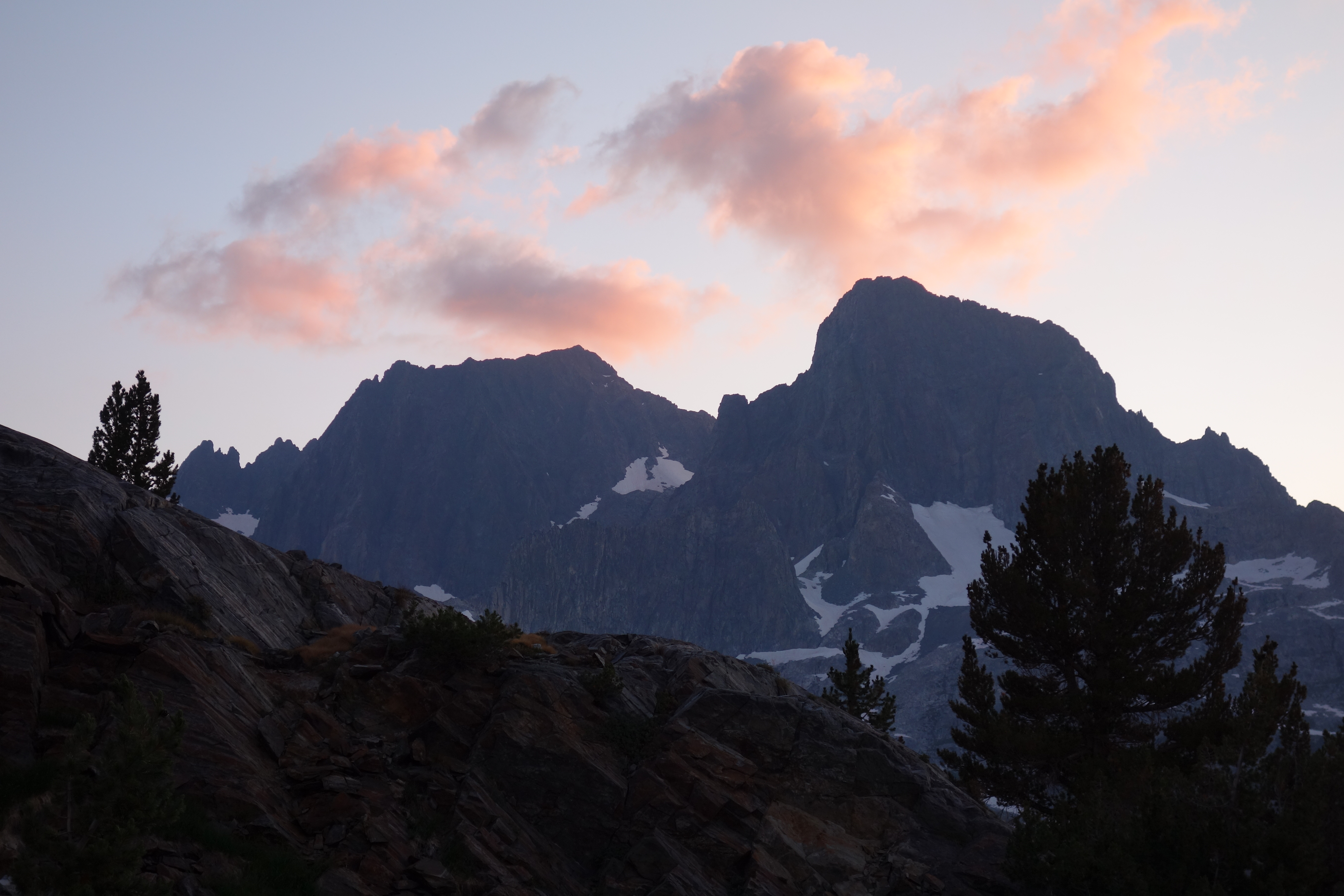
I woke up to a glorious sunrise over the Minarets. True, I was alone, relatively inexperienced, and without a way to contact anyone if I ran into trouble. But I was also in a beautiful place that made me feel good, had good maps and a gps, with uncommonly kind people crossing my path every thirty minutes or so. And I was always within half a days walk of the trailhead. And my bent pole was a constant reminder to stay in my comfort zone.
I decided to leave camp set up and give Ediza Lake another crack. I packed up a daypack and headed out.
 [/url][/IMG]
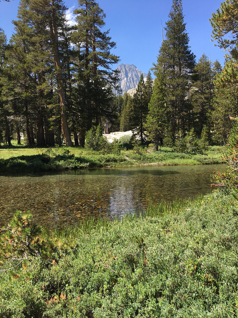
 DSC00035[/url] by Sean McKee, on Flickr[/IMG]
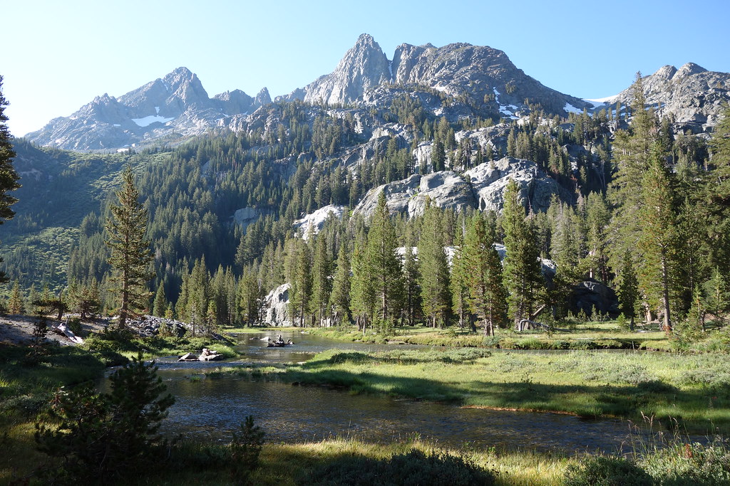
I waited at the safer crossing until there was a group coming the other way and checked out their path through the water. I duplicated it without problem and was soon at Ediza Lake.
 [/url]
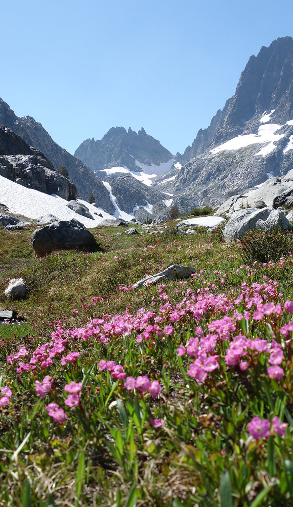
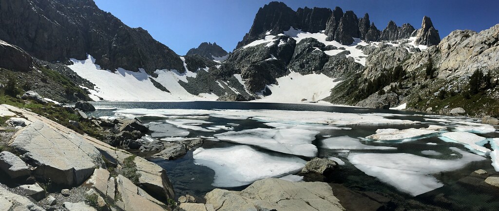
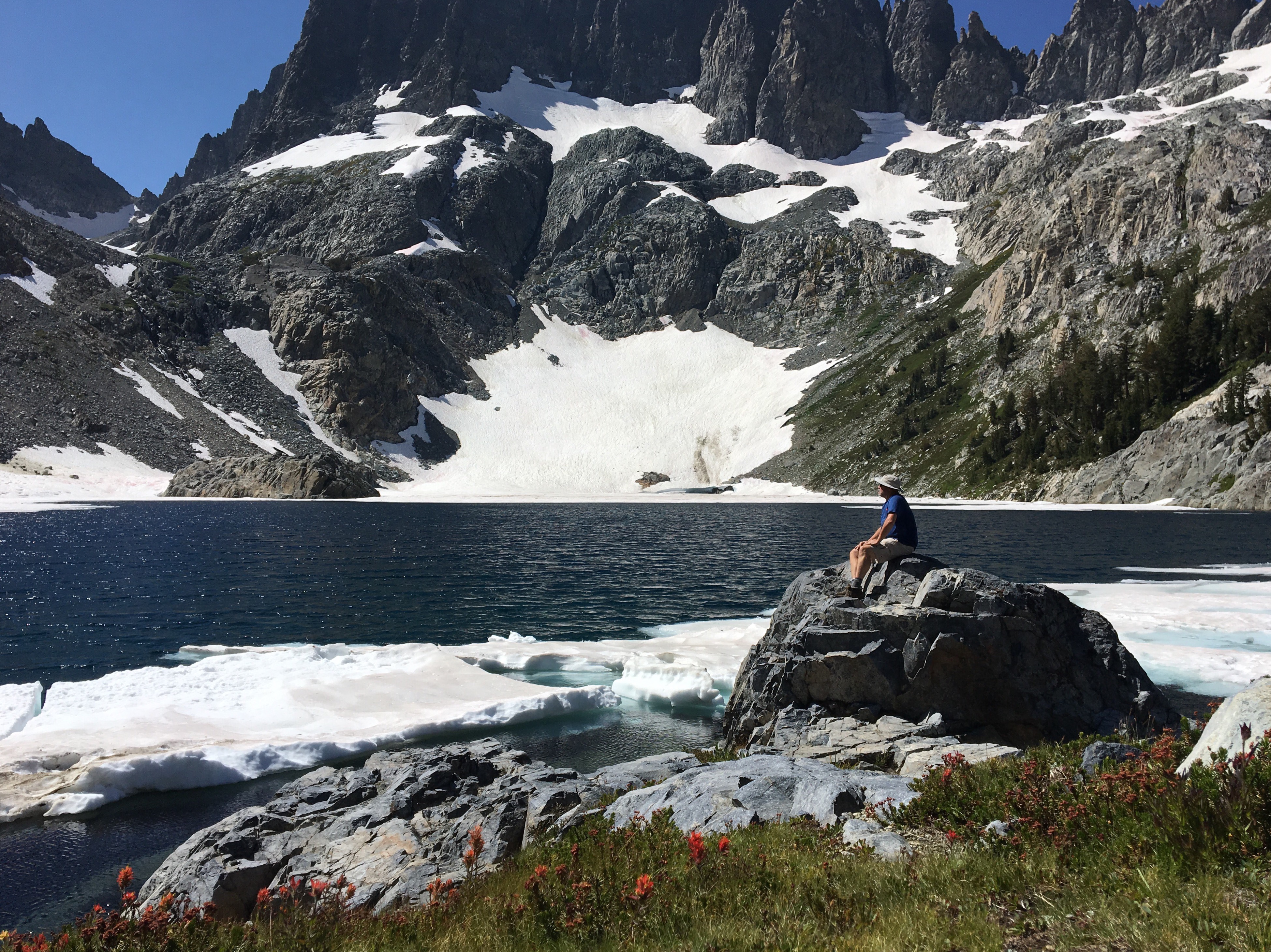
I talked to a group camped there and they recommeded the Iceberg Lake Trail, so I went up there and I was glad I did. The first half is a climb with aweseome views of Ediza, the second half is a beautiful trail through a meadow heading up to the lake.
 DSC00042[/url] by Sean McKee, on Flickr[/IMG]
 DSC00046[/url] by Sean McKee, on Flickr[/IMG]

 DSC00047[/url] by Sean McKee, on Flickr[/IMG]
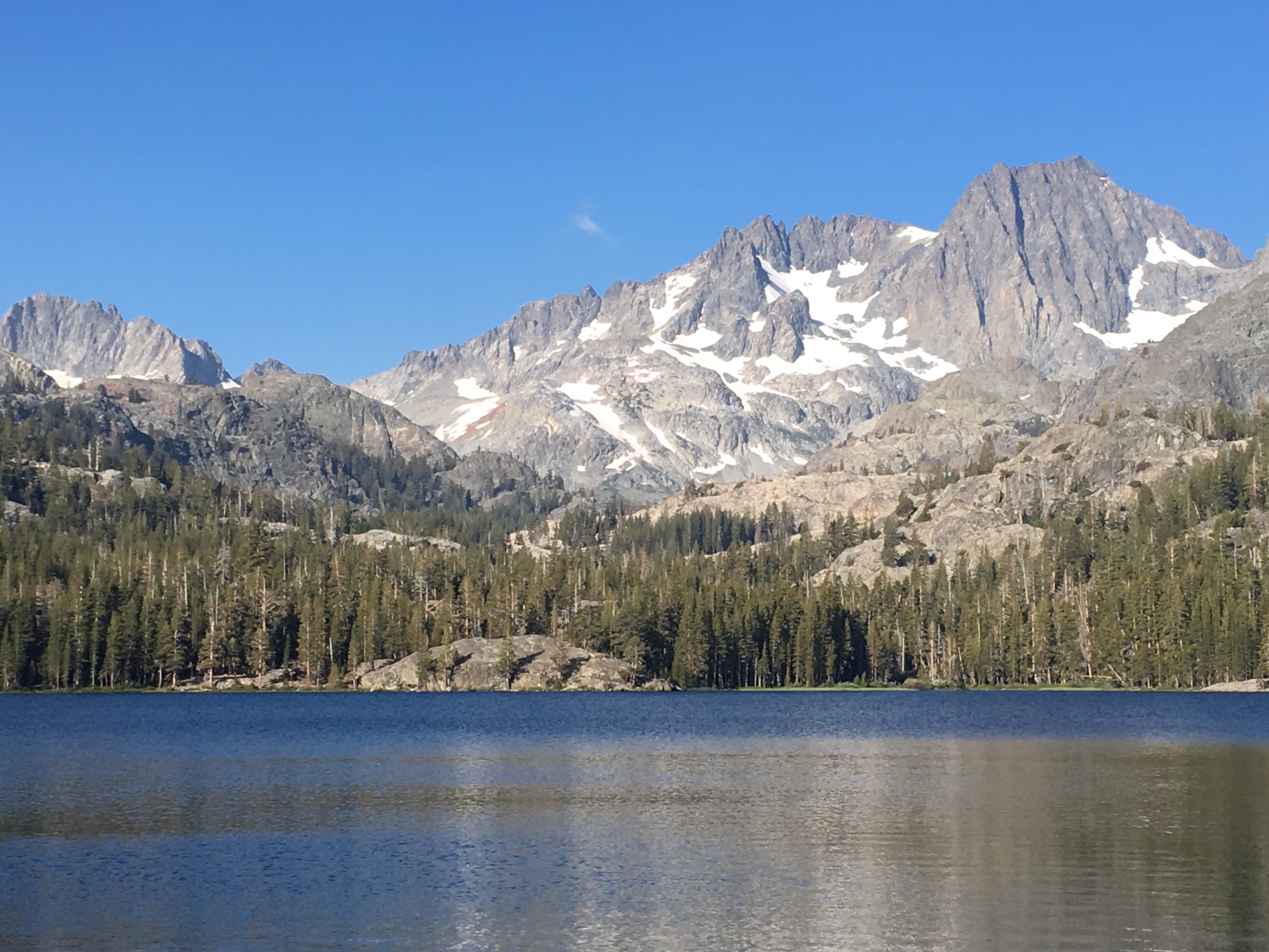
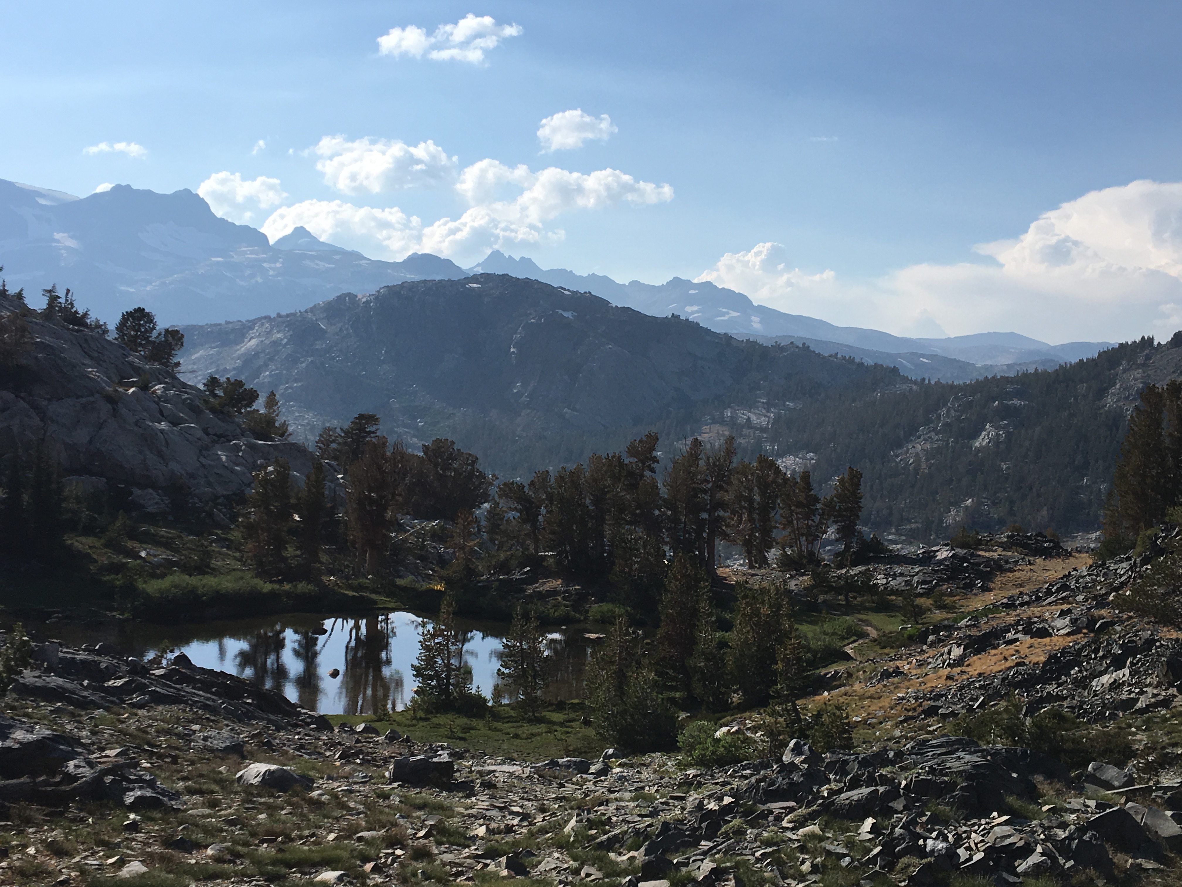
I made it back to camp and had a decision to make. I was just playing it by ear at this point. I felt pretty good and the weather was clear, so I headed up over the pass to Garnet Lake. I had some minor elevation stuff going on, I think. I felt some pressure in my head (which wasn't surprising, I can't dive too deep snorkeling, either) and I had to take some breaks to catch my breath on the climb. It was a really cool trail near the top, leading to a little tarn. Then I was rewarded with incredible views of Garnet Lake.

Looking back the way I came
 IMG_4377[/url] by Sean McKee, on Flickr[/IMG]
 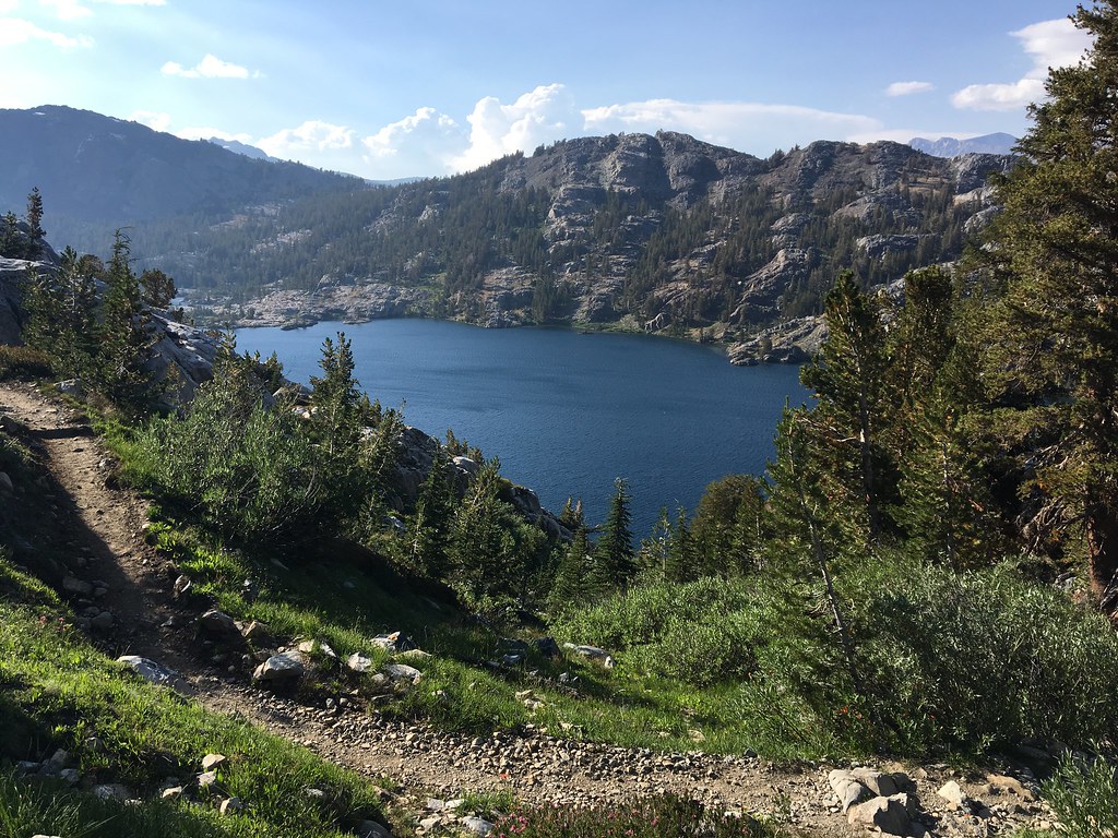 IMG_4377 by Sean McKee, on Flickr
I hiked along the south side of the lake and found a spot. It was somewhat exposed, but I was tired and didn't feel like bushwacking around looking for something better. It had a good view of the lake.
 DSC00059[/url] by Sean McKee, on Flickrg[/IMG]
 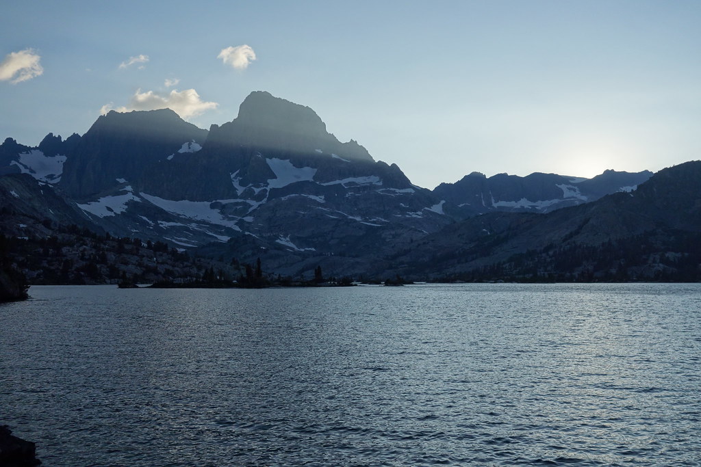 DSC00059 by Sean McKee, on Flickr
Day 3:
It was cool being on east coast time, because I was always up by sunrise. I think that was my favorite part of the days. Everything was so still and quiet. I took some pictures and headed on to Thousand Island Lake. Again, I took a break 15 minutes into my trip, as I was mesmerized by the view at the Garnet Lake outlet. I just sat on the bridge for a while. As I did, a PCT hiker came by. I saw he had an inReach and he graciously allowed me to send a message to my family.
 DSC00083[/url] by Sean McKee, on Flickr[/IMG]
 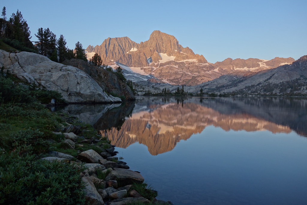 DSC00083 by Sean McKee, on Flickr
 DSC00080[/url] by Sean McKee, on Flickr[/IMG]
 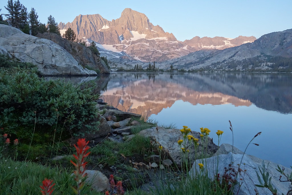 DSC00080 by Sean McKee, on Flickr
It was a nice little hike to Thousand Island Lake. I stopped at Ruby Lake and spent a half an hour helping a guy look for his dog. As it turned out, the dog had headed back up the switchbacks towards Garnet. It was spotted by some hikers coming down, who happened to be the dad and son from the family that I camped with the first night. It was really cool to see them again.
 DSC00095[/url] by Sean McKee, on Flickr[/IMG]
  DSC00095 by Sean McKee, on Flickr
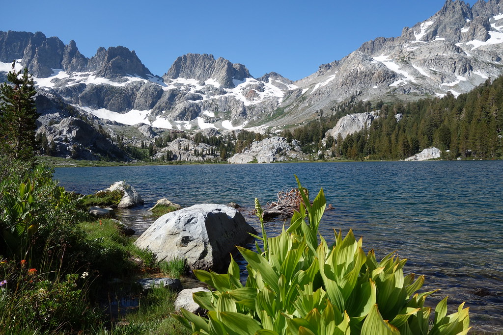
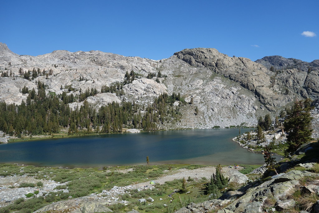
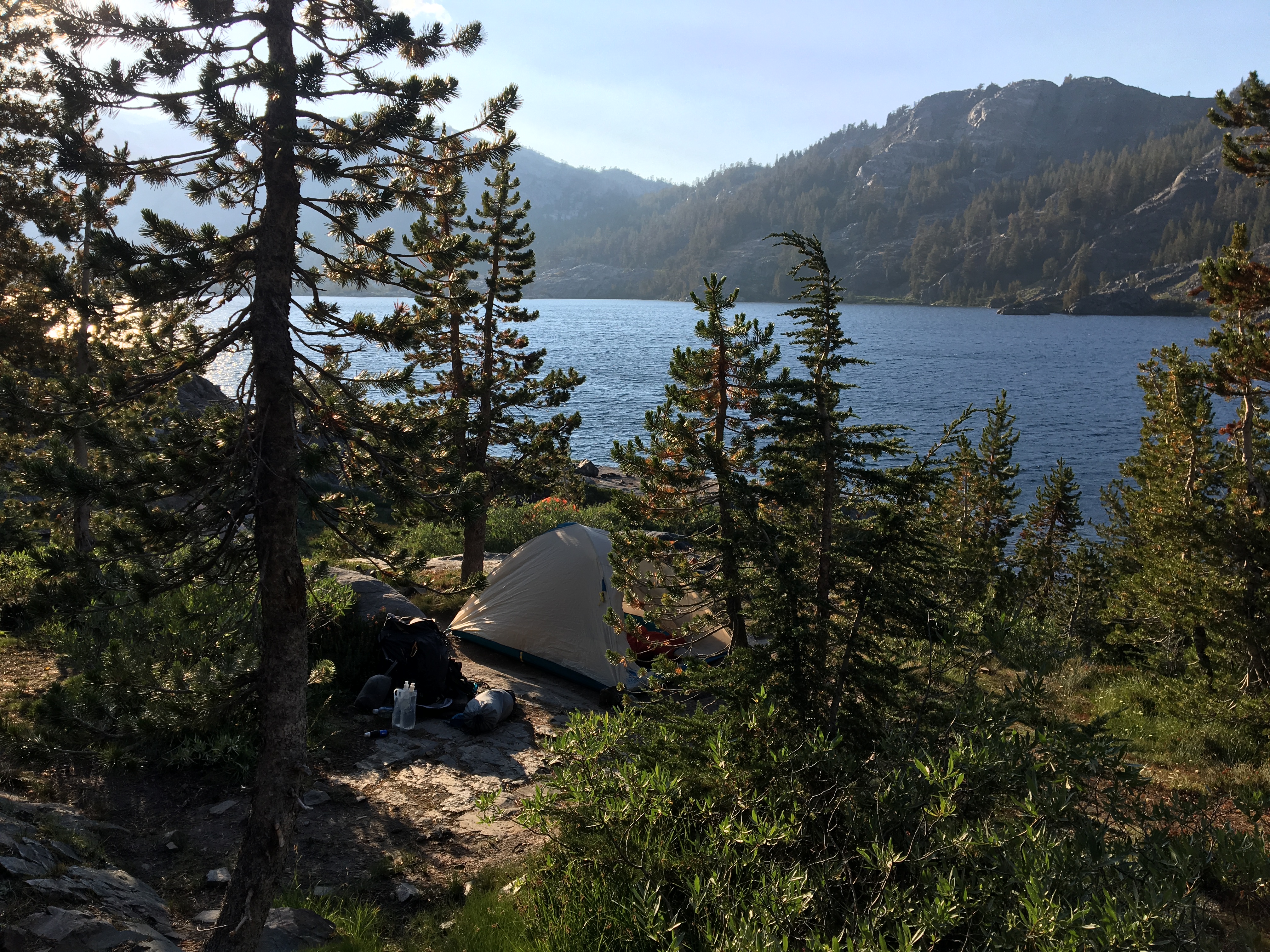
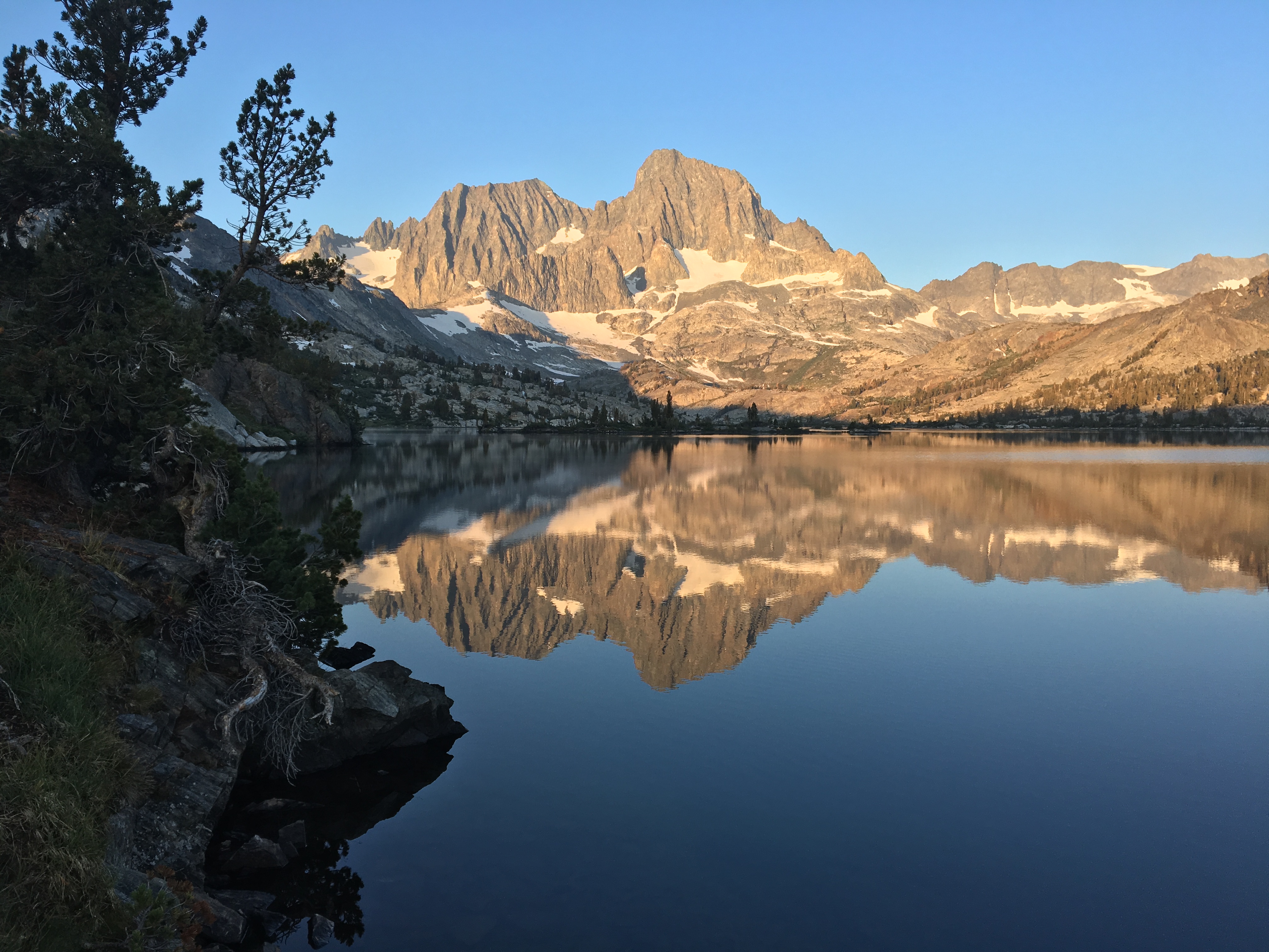
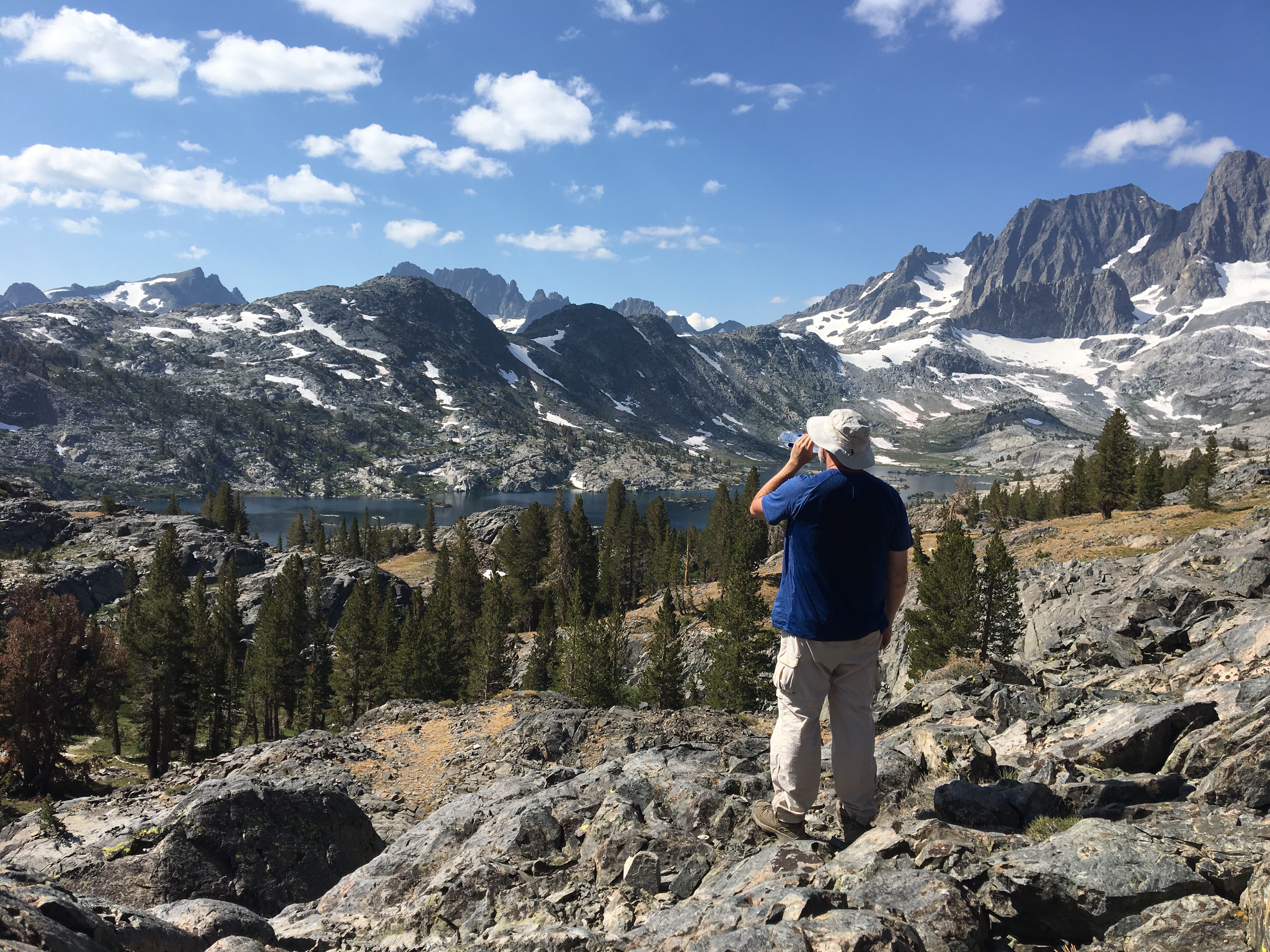
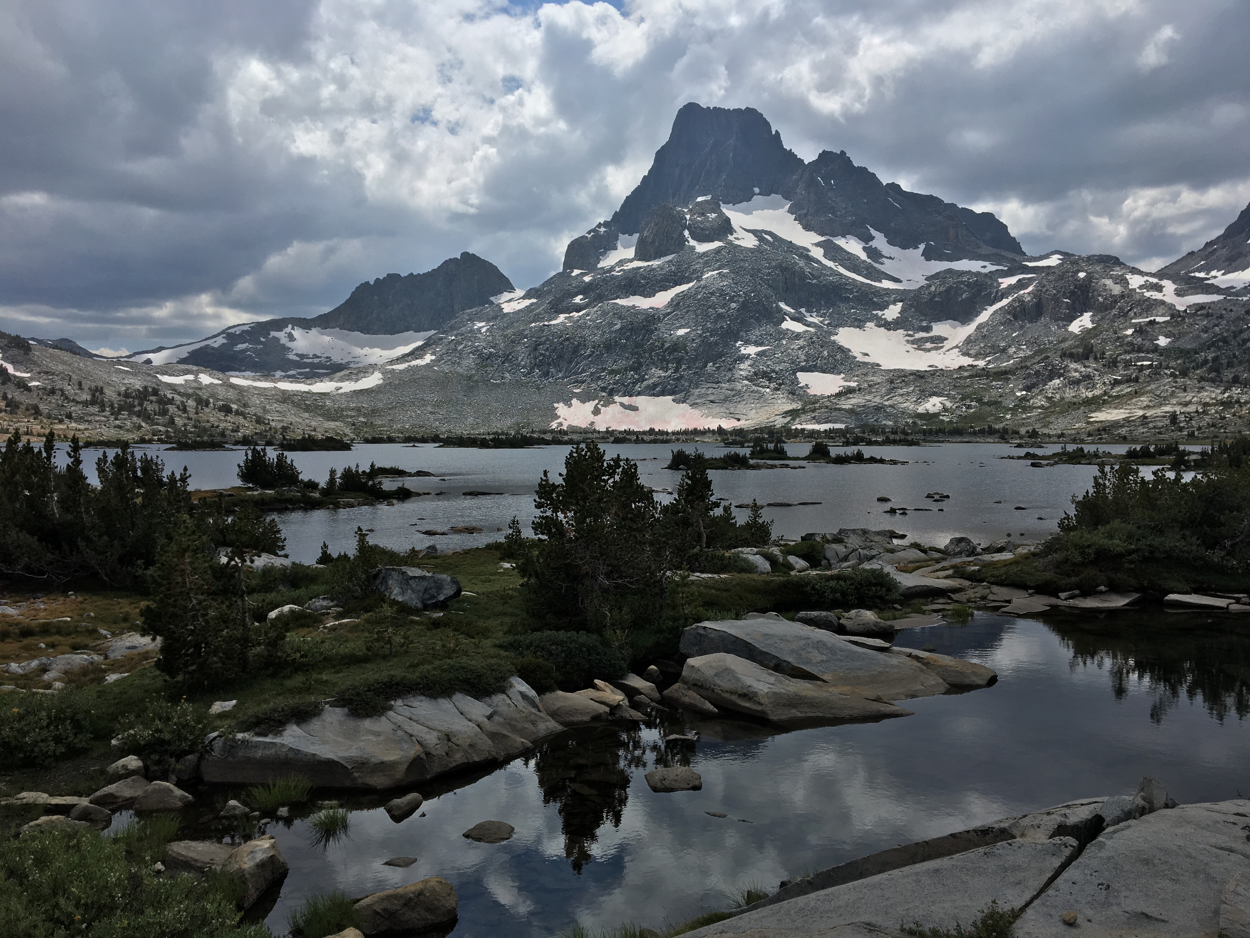
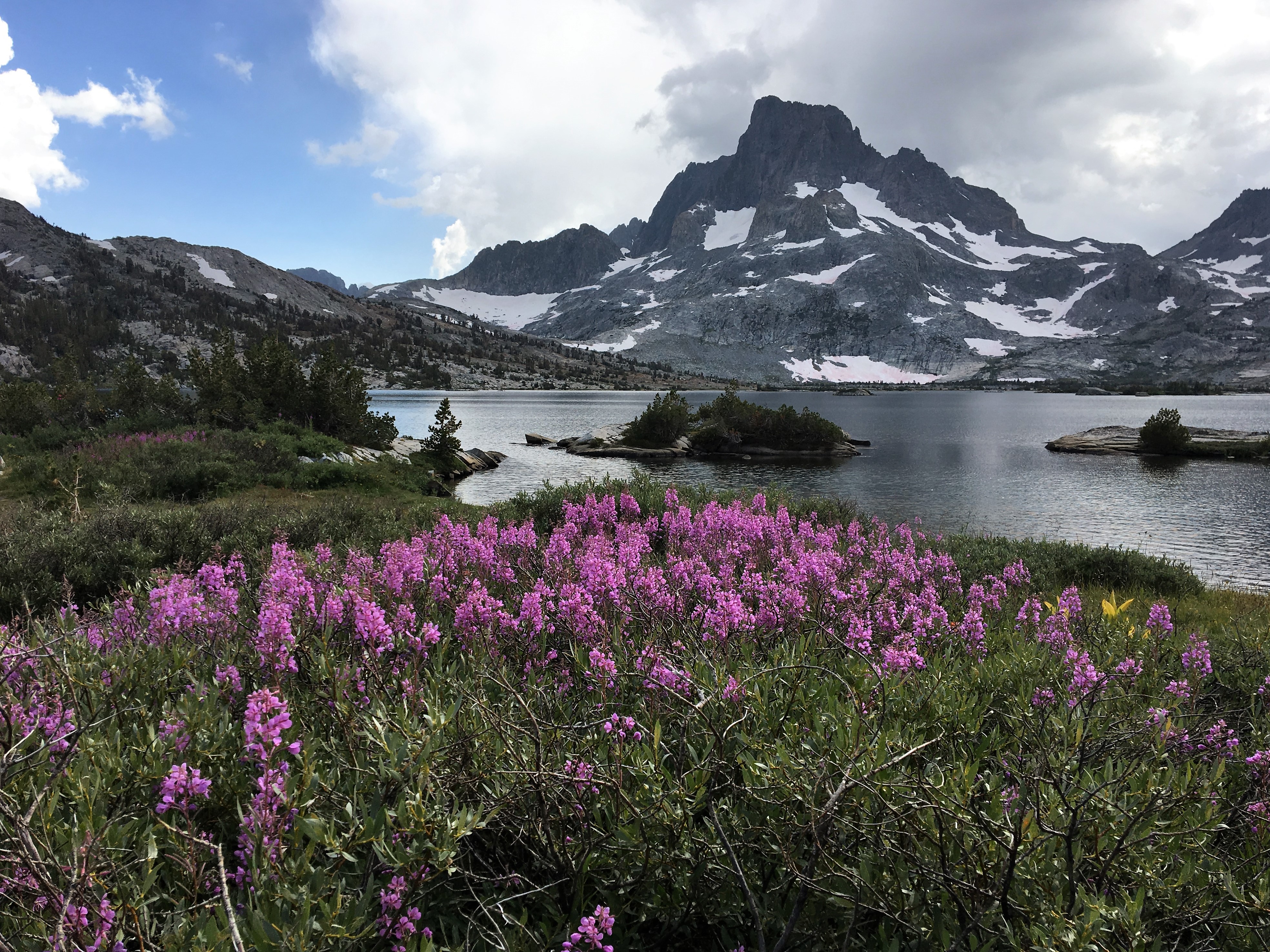
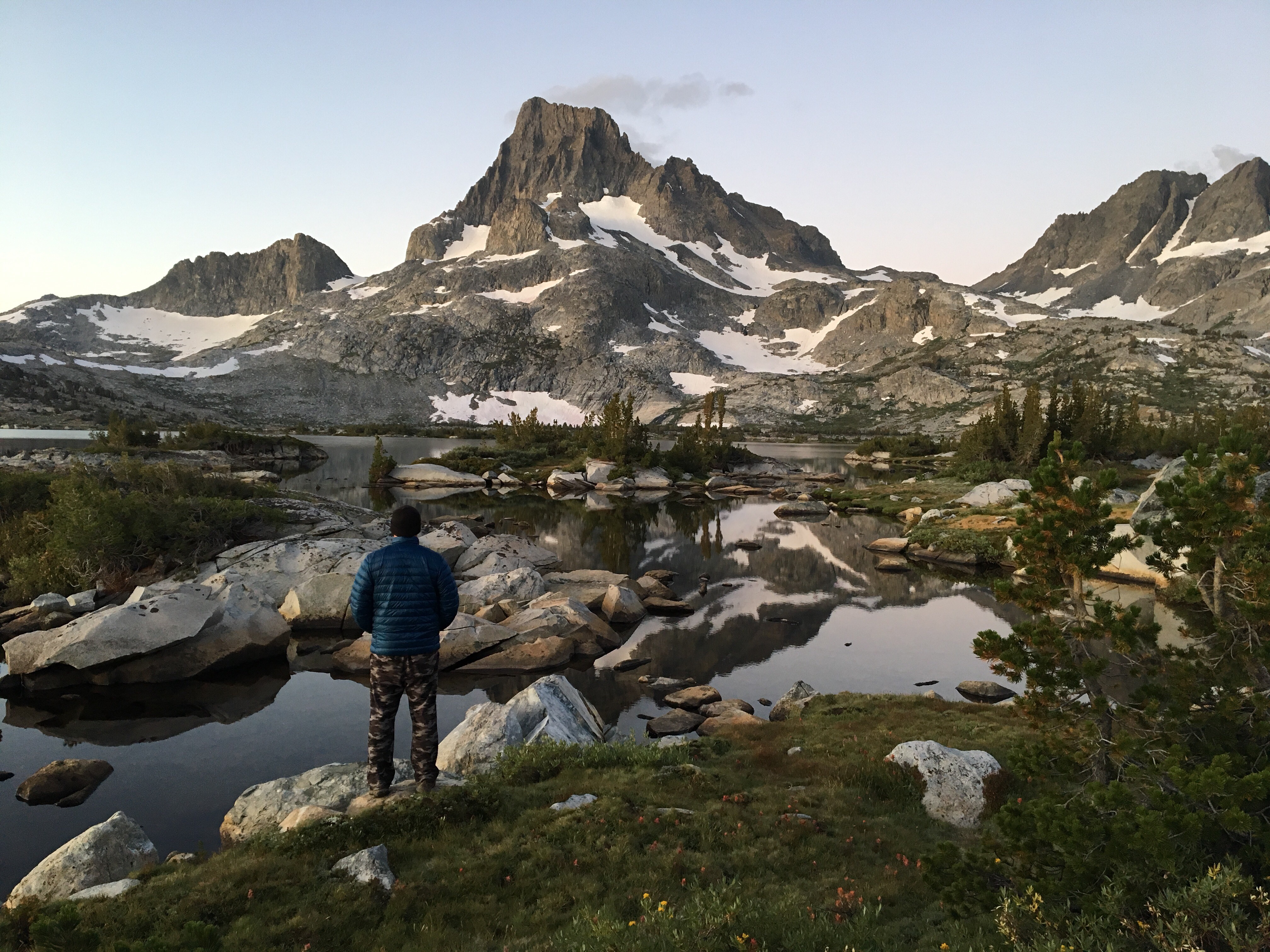
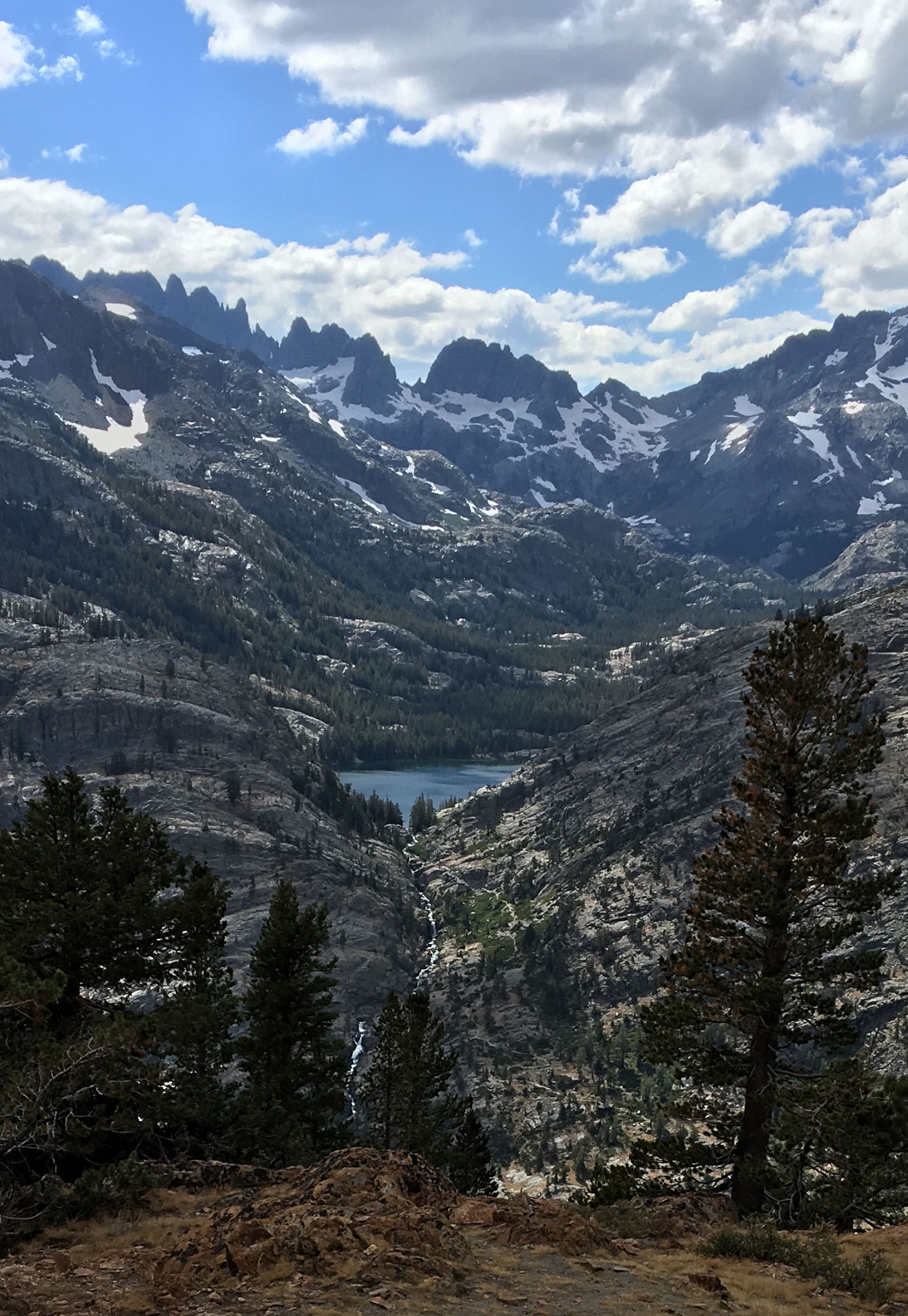
Once I got to Thousand Island Lake, I kept going west. As advertised, the further I went, the less people I saw. There were some cool sites, but I headed back to a site I saw earlier on. I think I wanted to hear the occasional voice. I was getting my campsite set up when I saw and smelled some bear poop in the site. I was trying to figure out if I should move. It was one thing to know that there are bears around, but for me, it was another to know that there was a bear literally right there recently. As I was pondering, a JMT hiker struck up a conversation with me. He had just passed up a really nice site in the trees because he wanted to be further west. He offered to backtrack and take me up there to show me. It was awesome and I never would have found it myself. It had a great view of Banner Peak and was completely sheltered in the trees.
I spent the rest of the day eating by the water, swimming, and taking pictures. I had considered going 8 miles round trip to Davis Lakes, but I decided to save that for another time.
 DSC00117[/url] by Sean McKee, on Flickr[/IMG]
 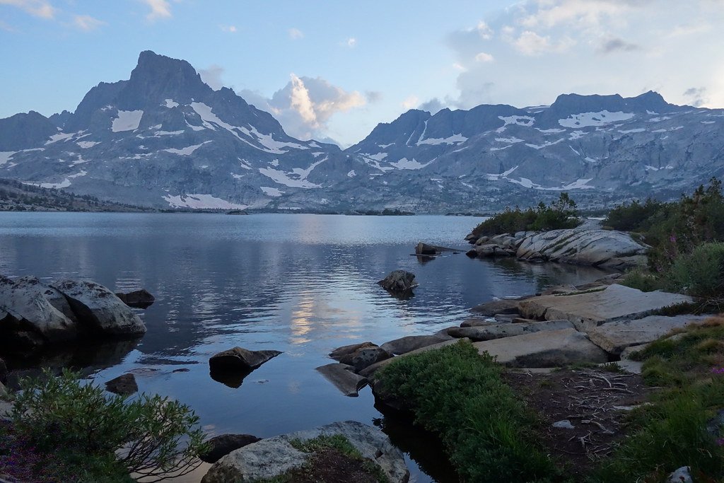 DSC00117 by Sean McKee, on Flickr
Day 4:
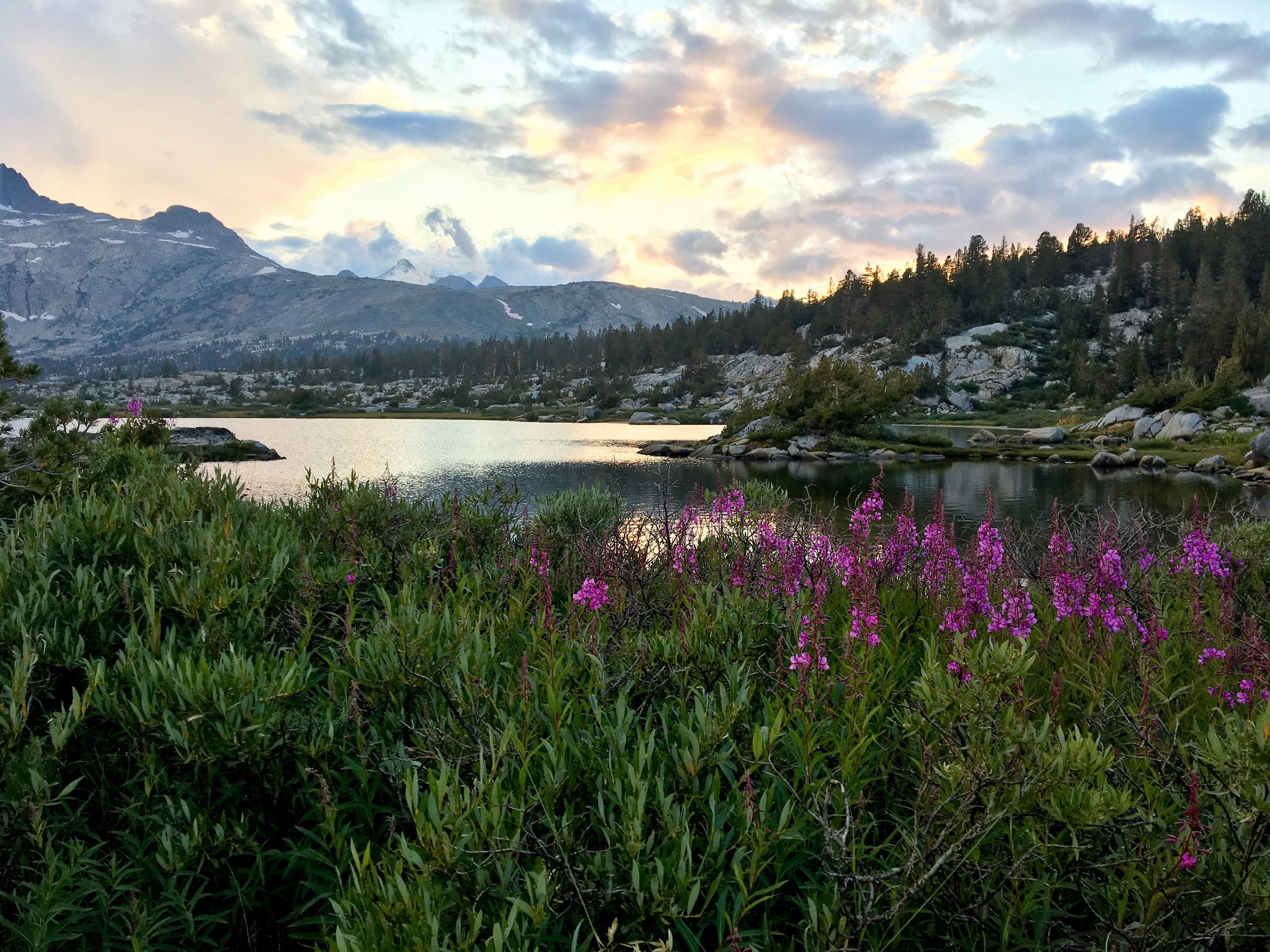
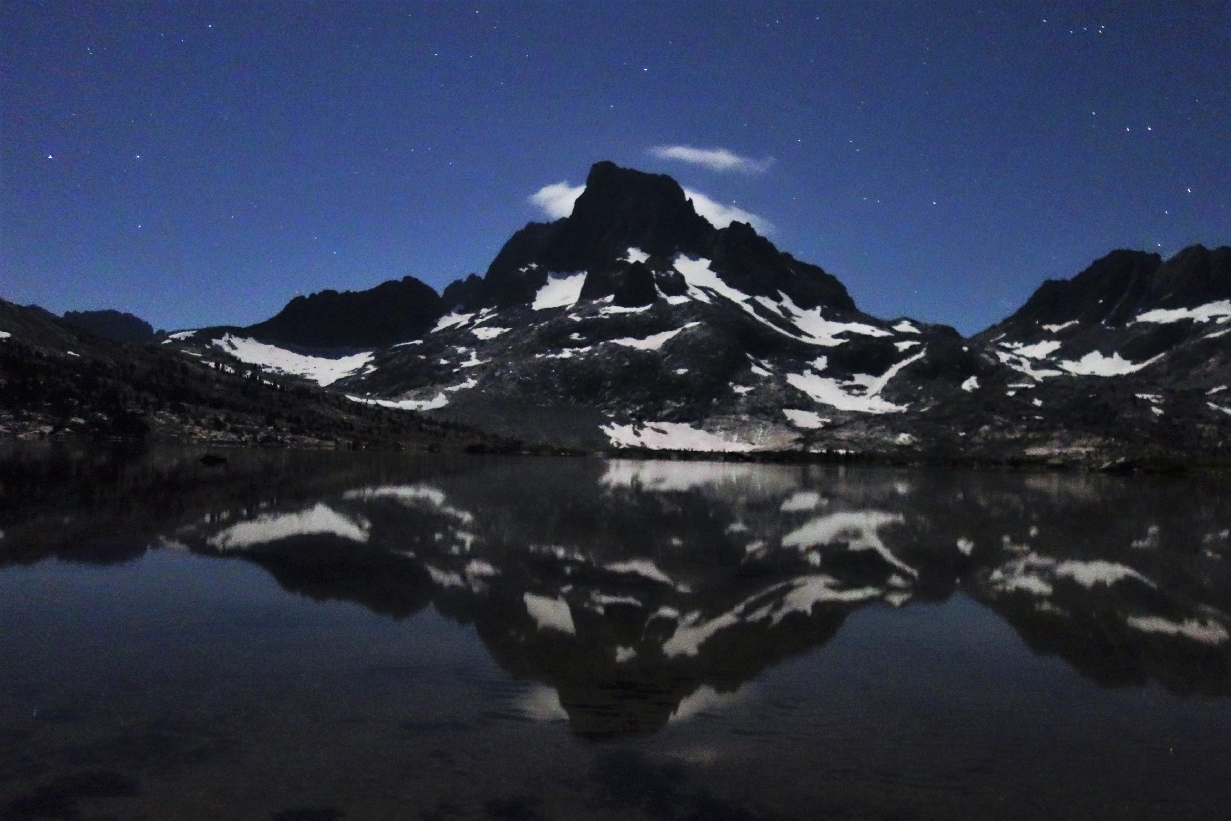
I got up around 3:30 to try to take some pictures of the stars. It was close to a full moon, so I knew I wasn't going to get anything great. But I wanted to try it out. It worked out pretty well, unfortunately the moon was over by Banner Peak, so the light washed out the stars over there. I was able to get some star pictures on the other side of the sky, though. It was a good start, I had never taken star pictures before.
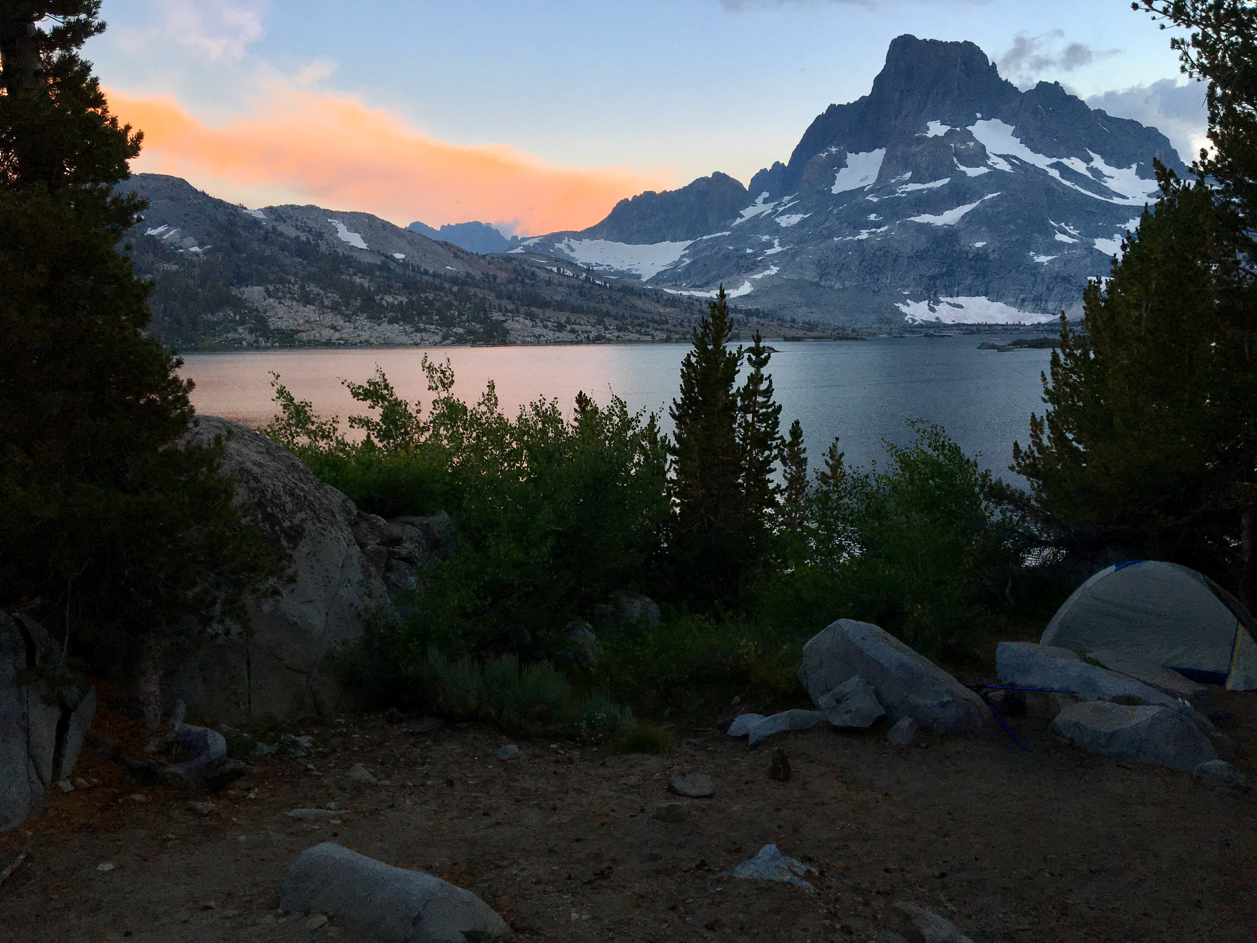
When I got back to the tent, I took off the rainfly and dozed looking up at the starts until just before sunrise. I threw on my puffy and my hat and walked down towards where I was the day before on the western side of the lake. This is where I got my favorite pics of the trip. I just kept being drawn further and further west. I only stopped when I realized I was on that peninsula and would have a long walk around in my sleeping clothes. I met a couple that were headed out for Banner Peak. That is a really cool area, though.
 DSC00184[/url] by Sean McKee, on Flickr[/IMG]
 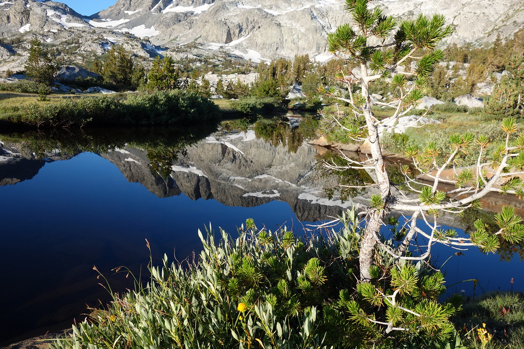 DSC00184 by Sean McKee, on Flickr
 DSC00181 (2)[/url] by Sean McKee, on Flickr[/IMG]
 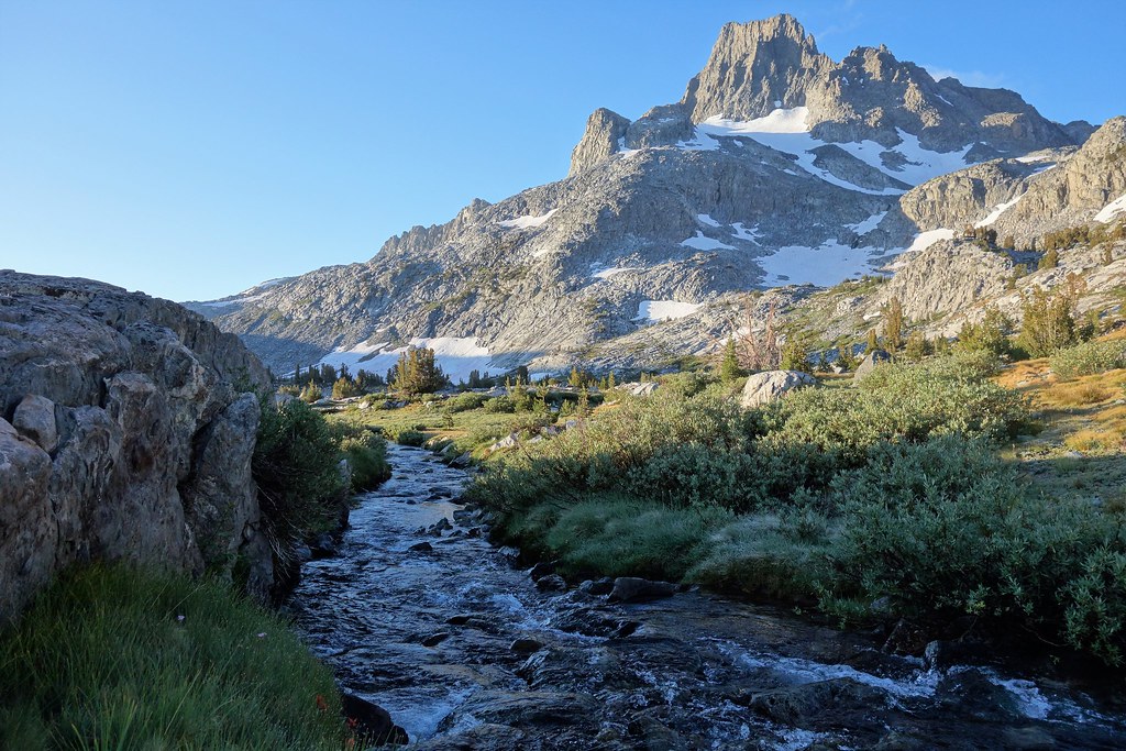 DSC00181 (2) by Sean McKee, on Flickr
 DSC00178[/url] by Sean McKee, on Flickr[/IMG]
 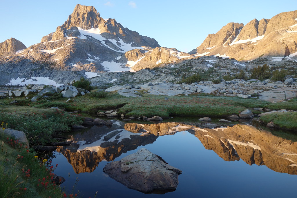 DSC00178 by Sean McKee, on Flickr
 DSC00175[/url] by Sean McKee, on Flickr[/IMG]
 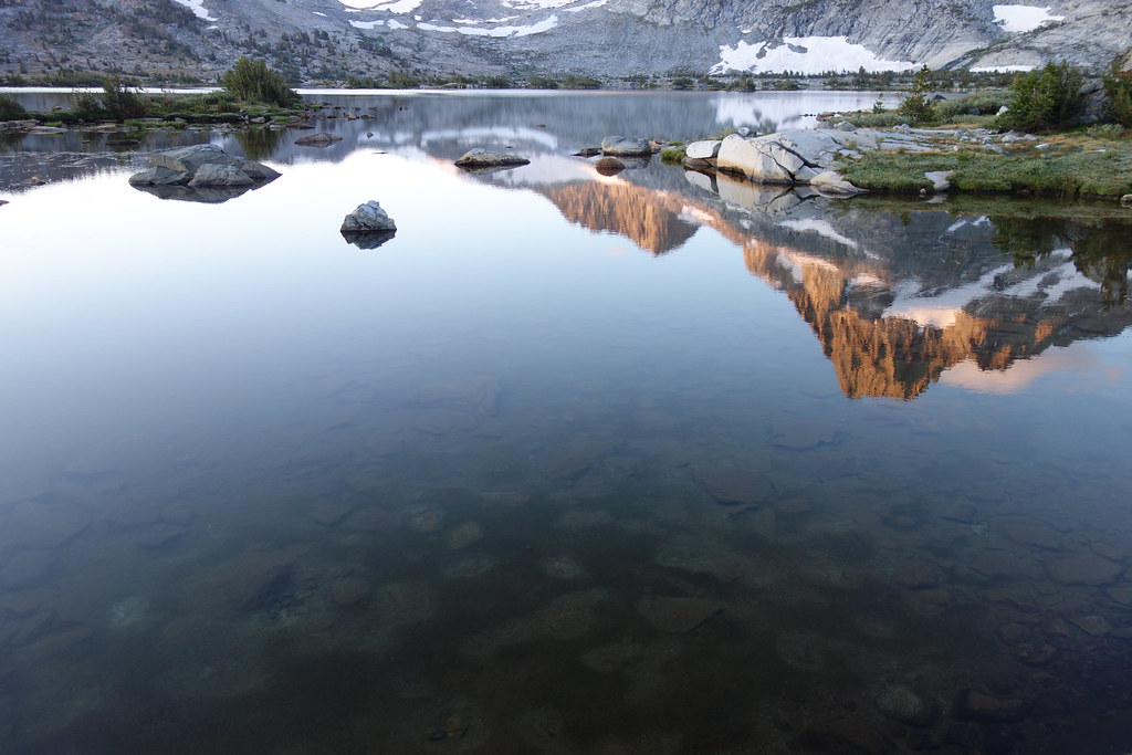 DSC00175 by Sean McKee, on Flickr
 DSC00174[/url] by Sean McKee, on Flickr[/IMG]
 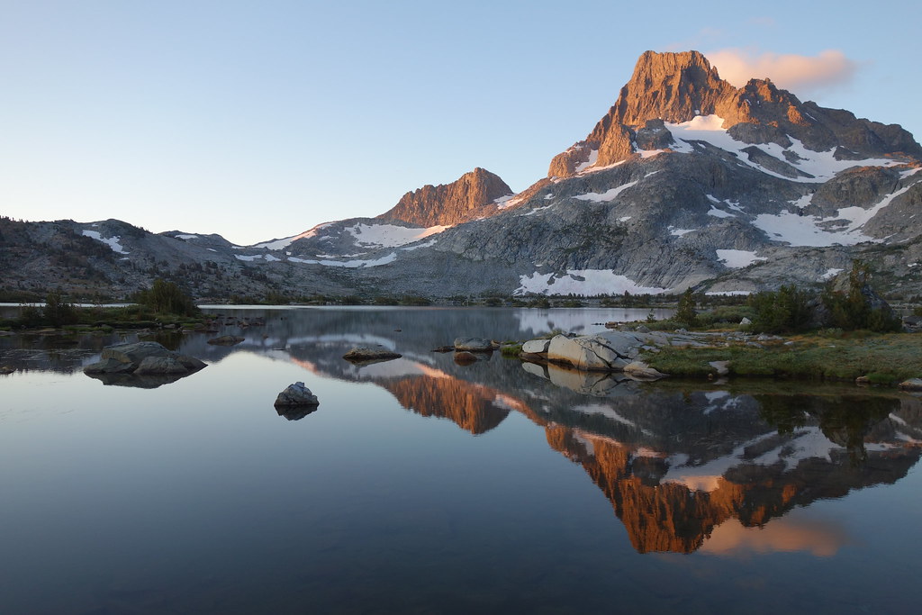 DSC00174 by Sean McKee, on Flickr
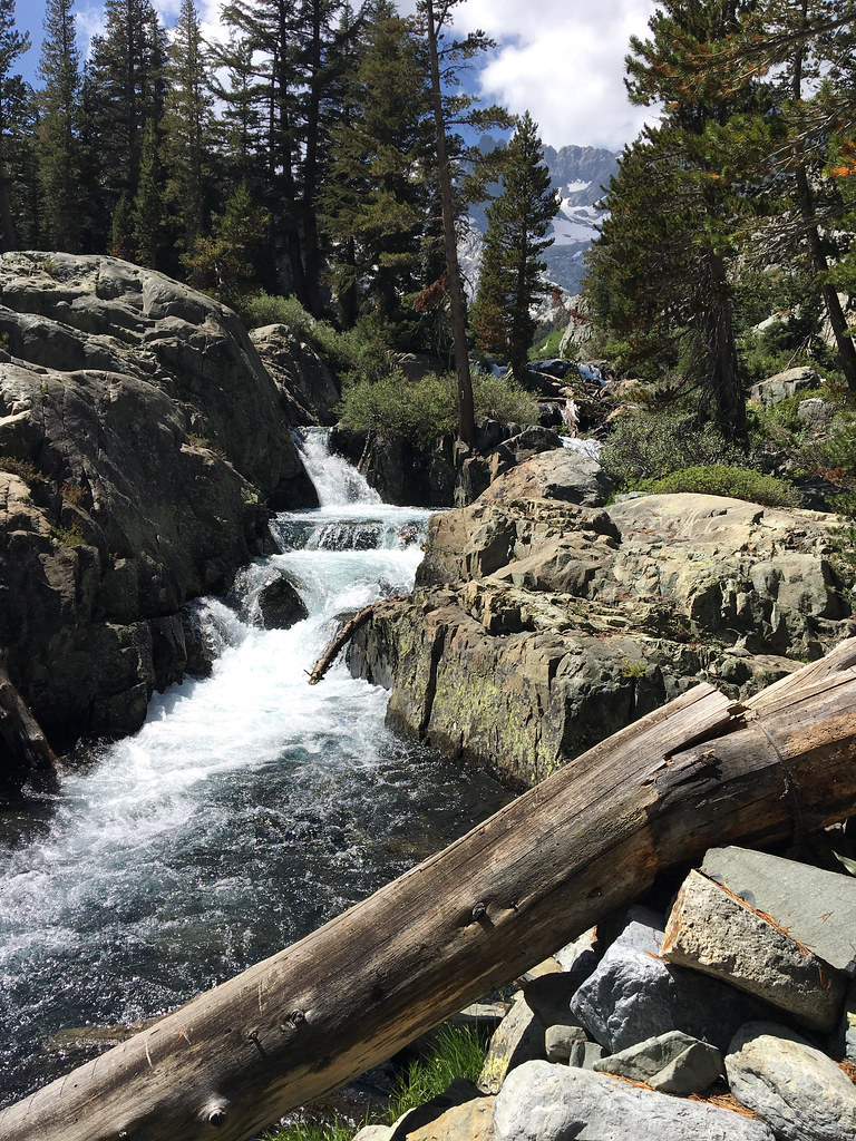
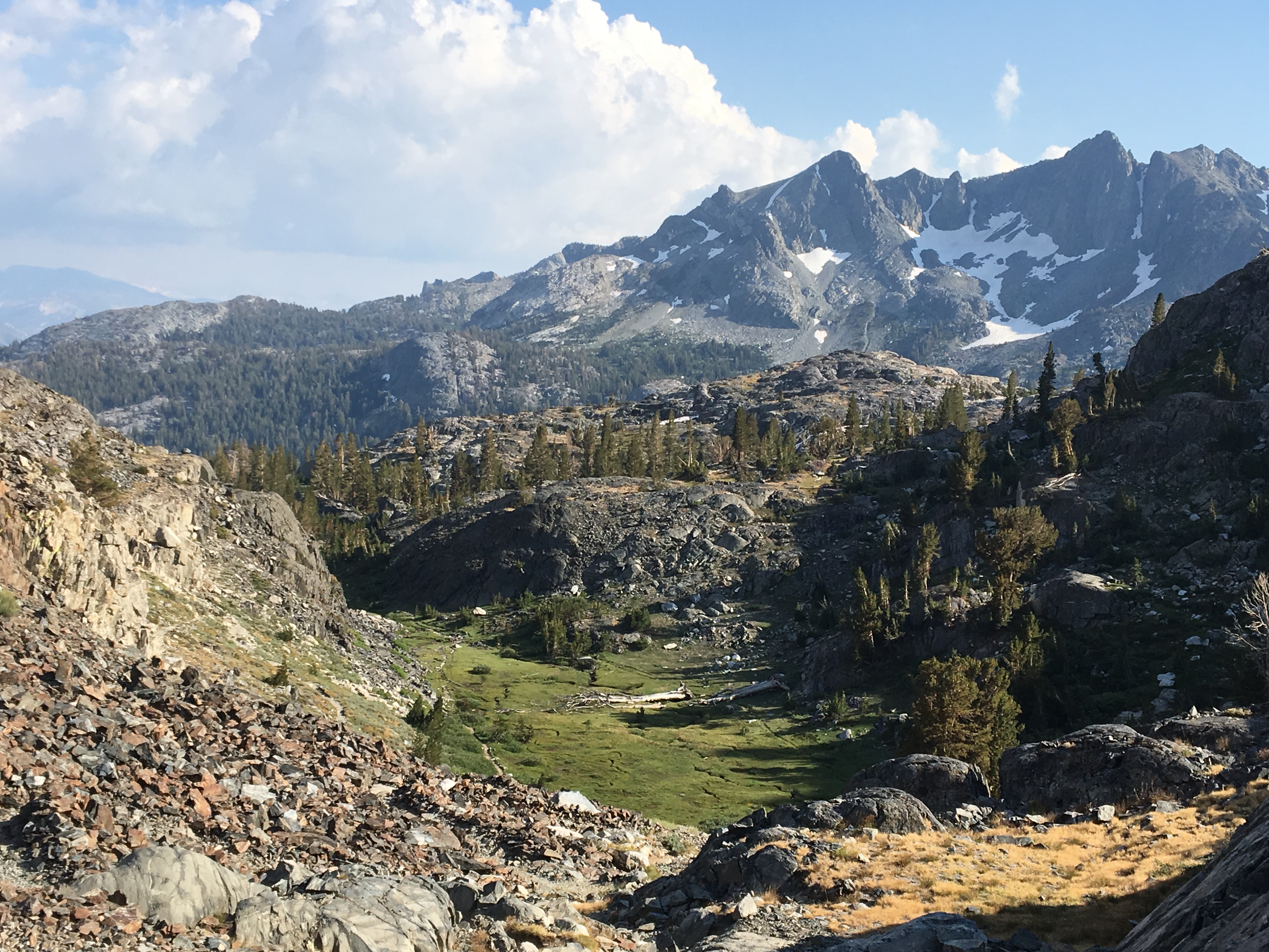
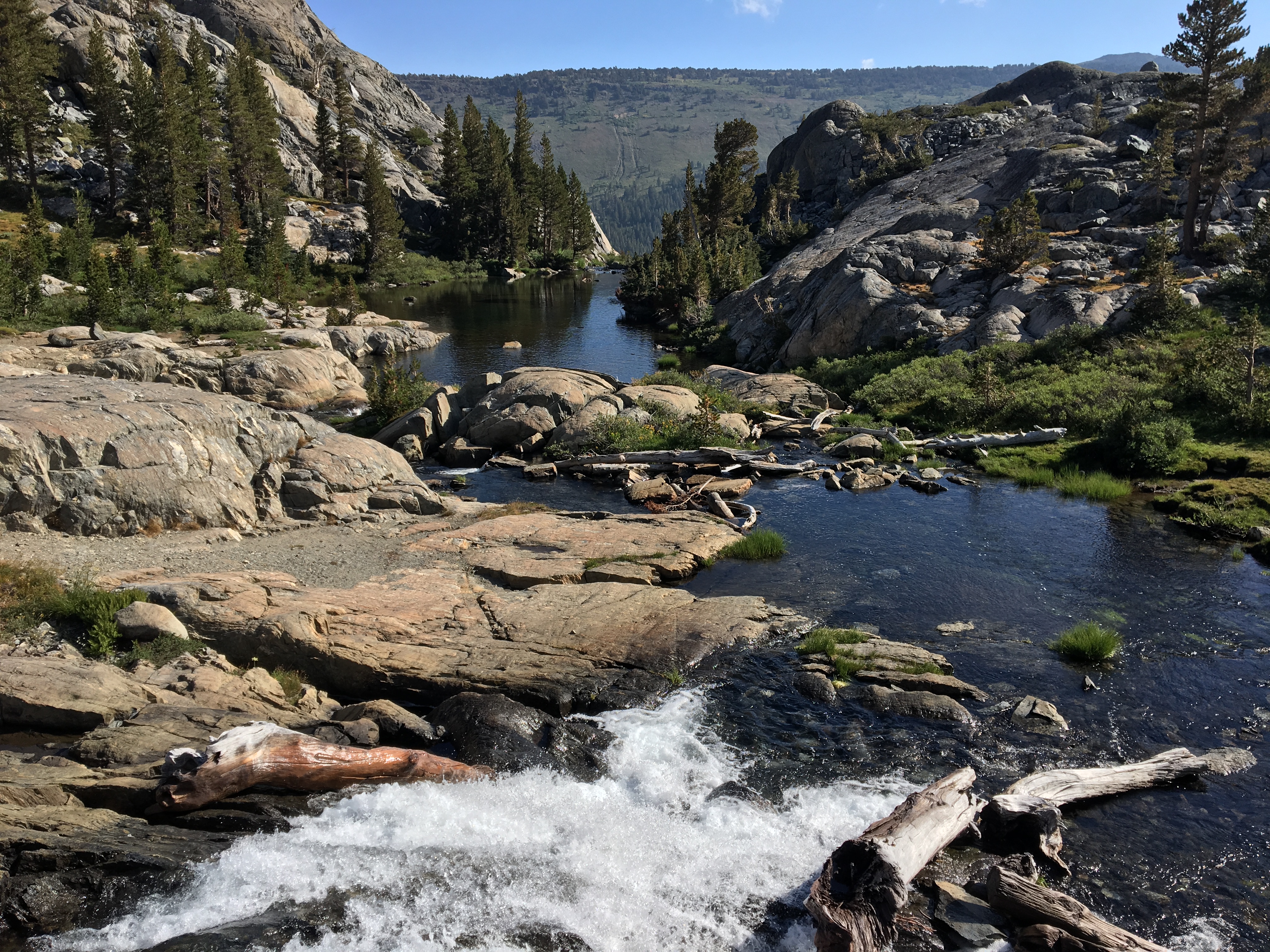
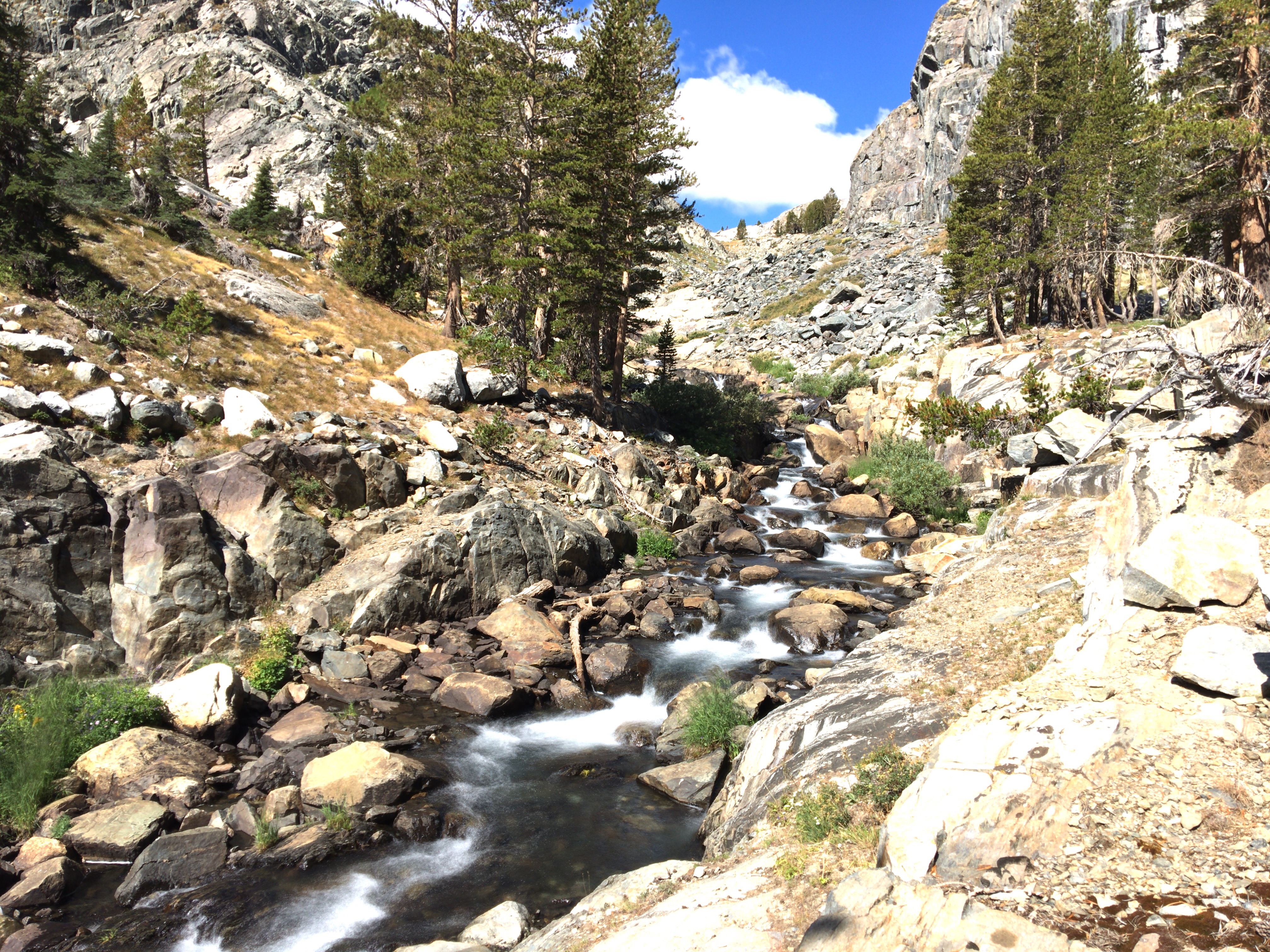
I had one more day, potentially, but I decided I didn't want to hike out then drive the 5.5 hours back to Vegas in the same day. So, it was time to pack up camp and head out on the high trail. Three different people told me the high trail was "all downhill" to the trailhead. That turned out not to be true at all! The second half of it, yeah, but not the first half. It is a varied and scenic trail, and it had a lot of water on it. I stopped for a break at an amazing campsite overlooking a huge long waterfall. I also took a detour to Badger Lakes (I took a brief swim in it, but it has a quicksand/mud bottom). Seems curiousity always gets the better or me when I see a little trail or cairn. Which is how I ended up having lunch at a site overlooking Shadow Lake, where it all started. I finished up by descending the never ending switchbacks to Agnew Meadows.
 IMG_4445[/url] by Sean McKee, on Flickr[/IMG]
 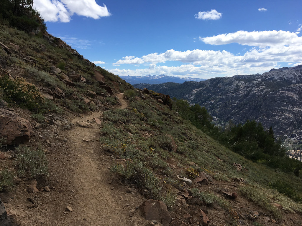 IMG_4445 by Sean McKee, on Flickr
 DSC00191[/url] by Sean McKee, on Flickr[/IMG]
  DSC00191 by Sean McKee, on Flickr
 DSC00192[/url] by Sean McKee, on Flickr[/IMG]
 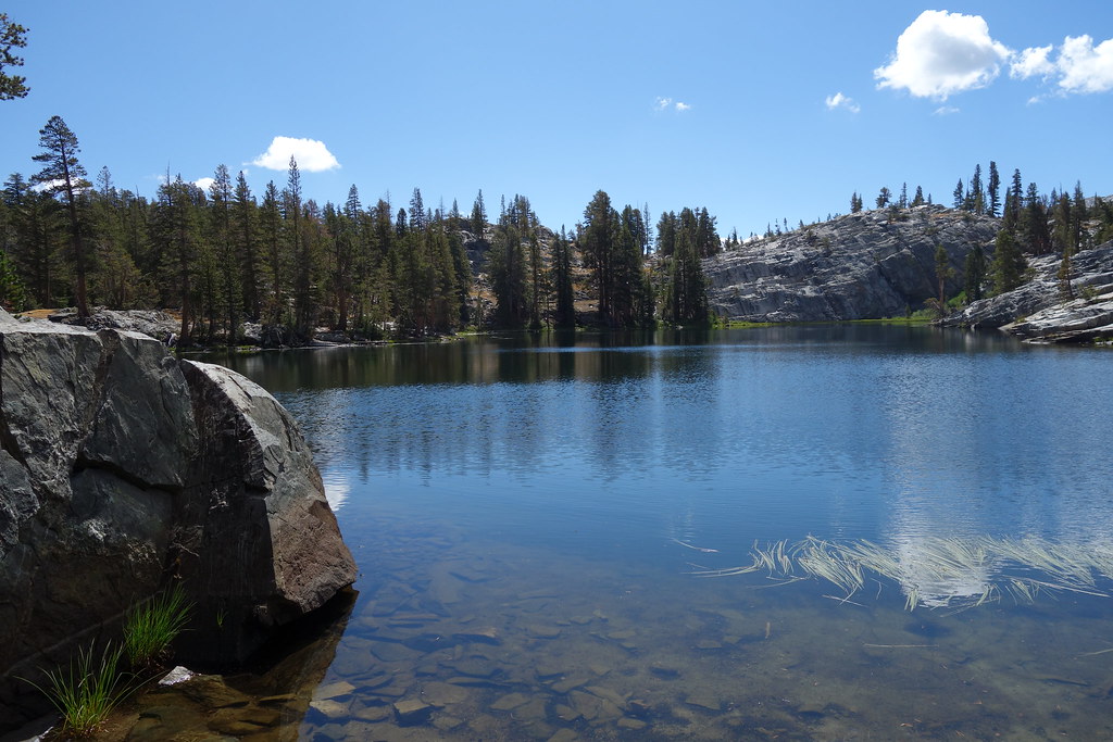 DSC00192 by Sean McKee, on Flickr
 DSC00212[/url] by Sean McKee, on Flickr[/IMG]
 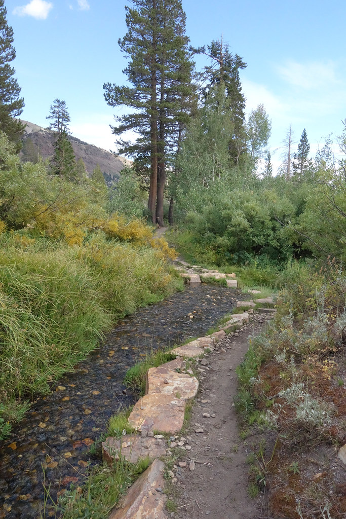 DSC00212 by Sean McKee, on Flickr
Back to the start!
Day 5:
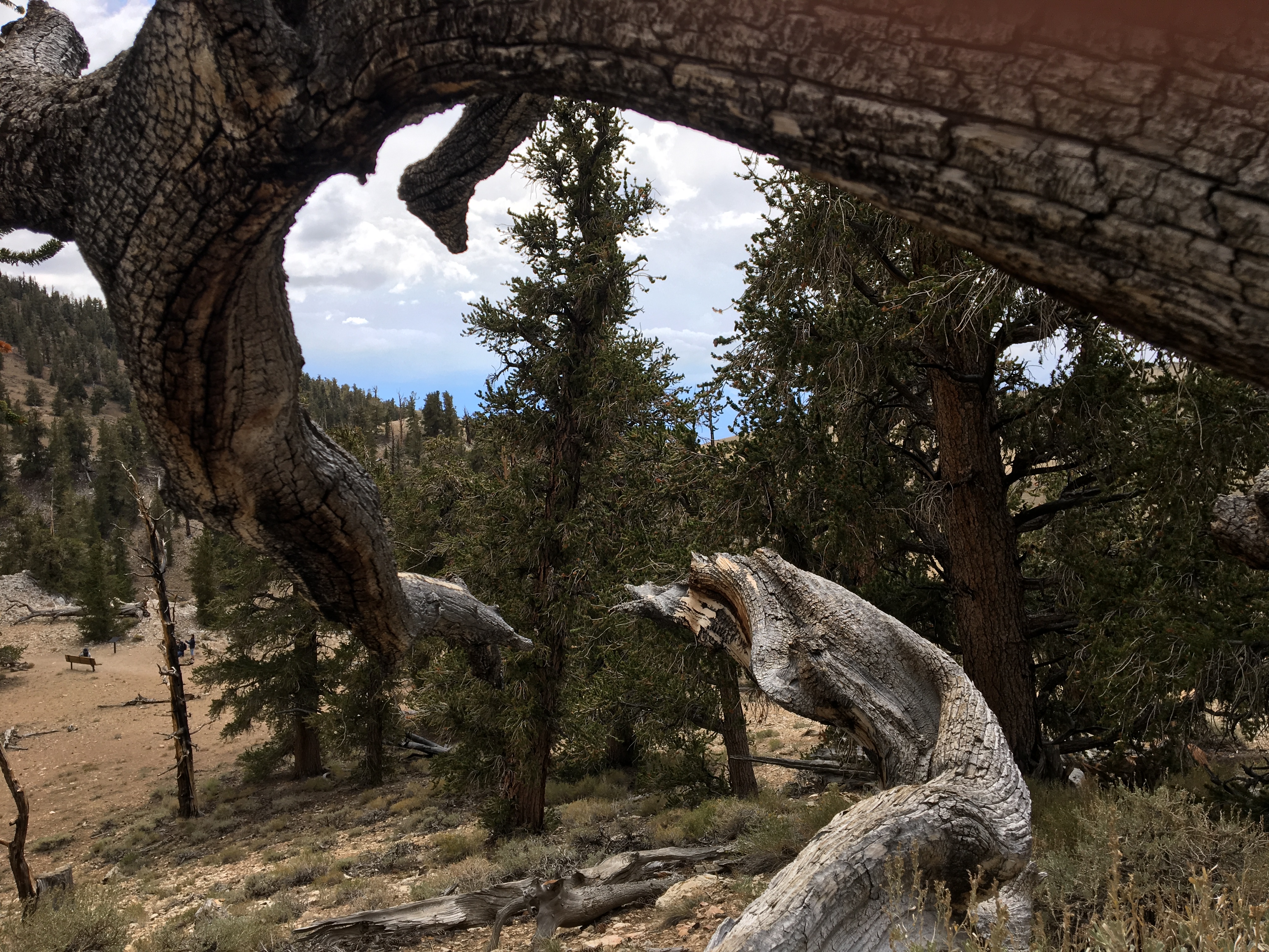
I had a leisurely drive back to Vegas, so I had my last zip lock bag lunch on a rock at South Lake. I took some pictures for some folks heading out on the South Lake-North Lake loop and wished I was going with them. I then took another detour to the Ancient Bristlecone Pine Forest at 10,000+ feet. That place was pretty cool, too.


Epilouge:
This trip ended up being perfect for my first solo multi night trip. The weather was perfect. I never had a problem finding solitude or the comfort of having people around. Thank you to all the people posting on these boards for inspiring me to make the trip. And thank you to the random people showing kindness to strangers in the backcountry. I learned a lot of stuff about backpacking, that's for sure. And that will come in handy, because I am certainly going back there.
I just started backpacking this year with a goal of backpacking in the Sierras someday. I spent the spring and summer backpacking around PA and WV. Probably a half dozen trips, one two nighter, and a couple solo. My fiancee and kids liked me to be able to check in, so I got an inReach. About a month ago, I realized that there were really cheap flights to Vegas, and Vegas was a 4 hour drive from the Eastern Sierras. My buddy couldn't go, so I started planning for a solo trip. I really wanted to go to the TM part of Yosemite, so I planned a trip out of Murphy Creek, including Mt Hoffman, Cloud's Rest and Sunrise and Cathedral Lakes. My backup plan was a trip out of Agnew Meadows.
Day 0: "Man plans, God laughs"
By the time I got to Bishop to pick up my bear can, I had decided to go with my backup plan (suggested by people on the board). I didn't want to get to Mt Hoffman and Cloud's Rest and not be able to see any views. As infrequently as I am likely to get out there, I decided to save them for another trip. My backup plan I had made out was to hike to Ediza Lake, go x-country to Nydiver Lakes to the west side of Garnet, over the western pass to Thousand Island Lakes, and out. It was 3:00 by the time I got to Bishop and decided to take an acclimitization day. I picked up my walk in permit for the River Trail, then I went up to North Lake and Sabrina lake and walked around a bit and saw a cool rainbow on the death alley known as the road to North Lake.
North Lake
Rainbow on road to North Lake
I noticed checking into the hotel that Bishop is at 4150 ft, so much for acclimitization.
Day 1: "Everyone has a plan until they get punched in the face"
After watching the beautiful sunset on the way up to Mammoth, I arrived at the trailhead at 7:00 AM. I was off on my adventure.
Agnew Meadow
Olaine Lake
I hiked slow and was stopping constantly to look around. It was amazing. When I reached Shadow Lake for a break, I hung the hammock and took a snooze. I had an early lunch and took a swim. I was there for two hours without even realizing it.
I geared back up and headed back on the trail. It was about 5 minutes before I saw a huge waterfall coming into Shadow Lake. So, I had to go down there and check it out.
After another long break, it was back on the trail to Ediza Lake. I reached the log crossing of the Ediza Lake outlet and realized that it didn't look like it did in the pictures.
No crossing here!
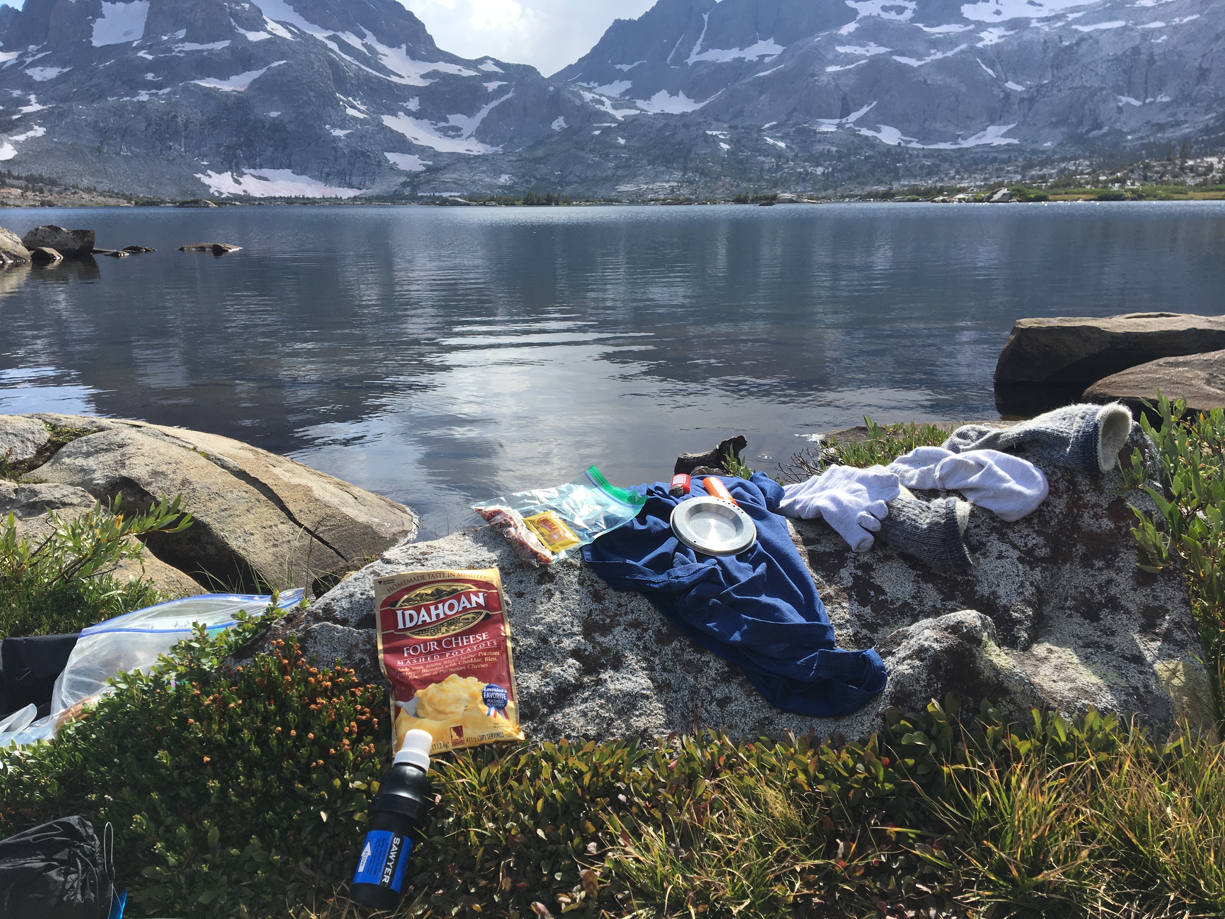
I actually enjoy water crossings. It was pretty easy to do about a hundred yards downstream. But, for whatever reason, I made an error in judgement. Maybe I over-estimated my skills, didn't want to backtrack, I'm not sure. I saw a use trail heading up the north side of the outlet and decided to take it. I assumed there must be a way to cross up there. I headed up the use trail and it got increasingly sketchy. At one point, I attempted to transfer my balance forward onto a rock. I didn't get there. I didn't fully account for the 40 lbs on my back, I guess. I ended up like a turtle on my back between some rocks. Some dayhikers were behind me and helped me up. They looked ahead and decided to turn back. I took stock of my situation. Some flesh wounds on my forearm and shin and a bent pole, but I was pretty lucky. I was a couple feet from the raging outlet. Then I realized my inReach was gone. It had been in an unzipped side pocket of my pack. I searched for about 20 minutes, but I knew it went between the rocks and down the creek.
I got back down to the formerly legit crossing and saw the day hikers again. They were kind enough to take my fiancee's number and agreed to text her when they got back. I was a little shaken up and unsure of my next step. I ended up hiking back to the JMT junction to regroup. When I got there, I met a guy with his son, brother and dad (who was 79!). They were done hiking for the day and were going to head up the pass to Garnet for a ways and set up camp. They asked if I wanted to join them. I thanked them and told them I might and they headed off. I followed a short time later. I saw them getting set up in a spot off the trail. There was enough room for several tents and a JMT hiker I had met earlier had joined them. They asked again if I needed a spot and I gladly accepted. I got my tent set up, but I kept wondering if the dayhikers would remember to text. I left my tent and hiked back to the Shadow Lake outlet, where I last had reception. I called my fiancee, she had gotten the text from the dayhikers and we shared a laugh about how my inReach didn't last a day (I had previously broken cell phones in the Smokey Mountains and Lake Tahoe). She had let my mom and my sons know what was going on (they were also unsurprised). I told her I could come out the next day, but she encouraged me to stay and asked me to try to get in touch when I could. I hiked back to camp, exhausted, sore, nauseous, and discouraged. I wasn't sure what I was going to do in the morning. I felt humbled, shaken up, embarrassed and stupid, and was wondering what the hell I was doing out here in the first place. I cleaned up my wounds, choked down a dry tortilla, and went to bed.
Day 2: "A man's got to know his limitations"
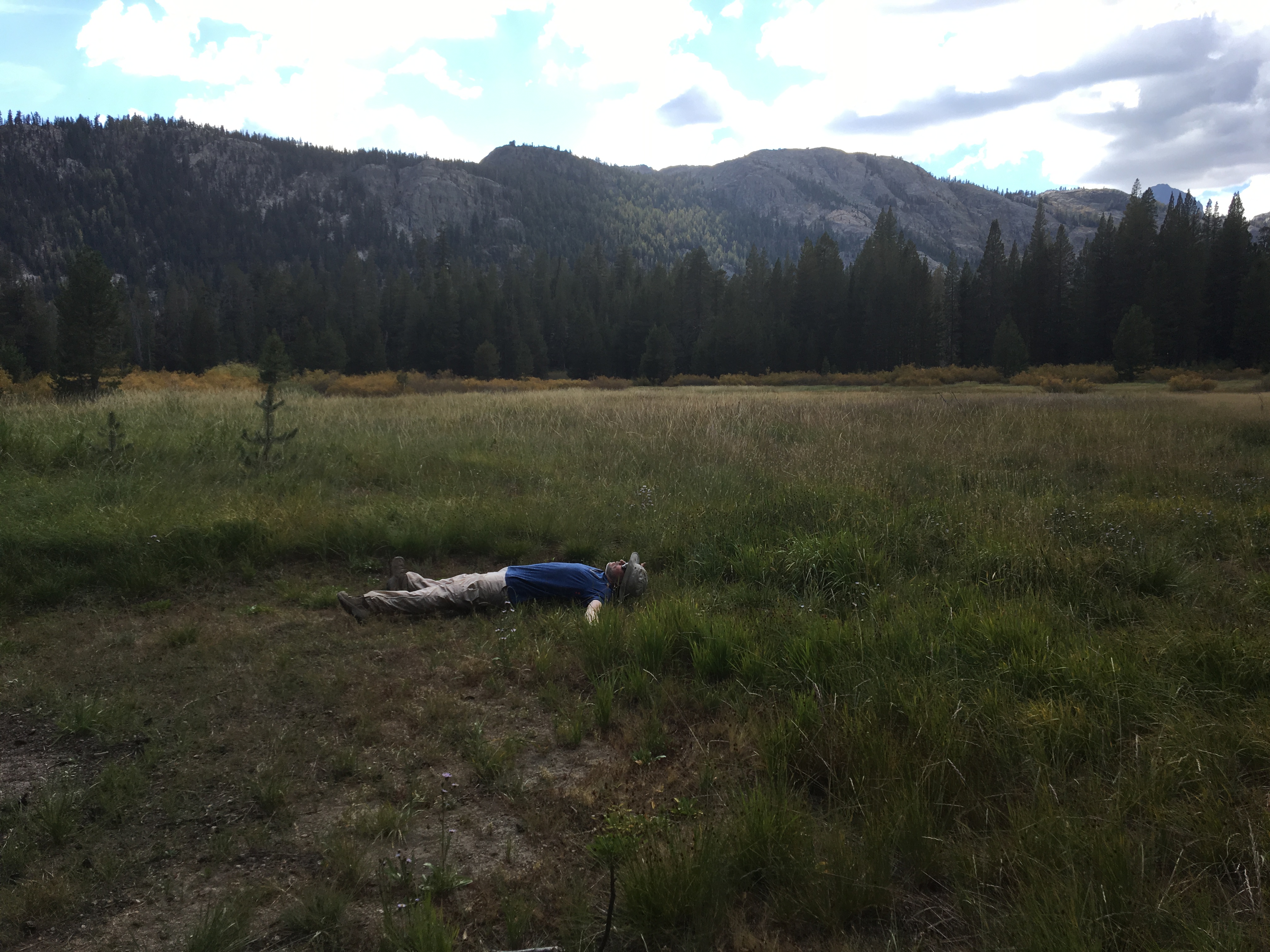
I woke up to a glorious sunrise over the Minarets. True, I was alone, relatively inexperienced, and without a way to contact anyone if I ran into trouble. But I was also in a beautiful place that made me feel good, had good maps and a gps, with uncommonly kind people crossing my path every thirty minutes or so. And I was always within half a days walk of the trailhead. And my bent pole was a constant reminder to stay in my comfort zone.
I decided to leave camp set up and give Ediza Lake another crack. I packed up a daypack and headed out.
I waited at the safer crossing until there was a group coming the other way and checked out their path through the water. I duplicated it without problem and was soon at Ediza Lake.
I talked to a group camped there and they recommeded the Iceberg Lake Trail, so I went up there and I was glad I did. The first half is a climb with aweseome views of Ediza, the second half is a beautiful trail through a meadow heading up to the lake.
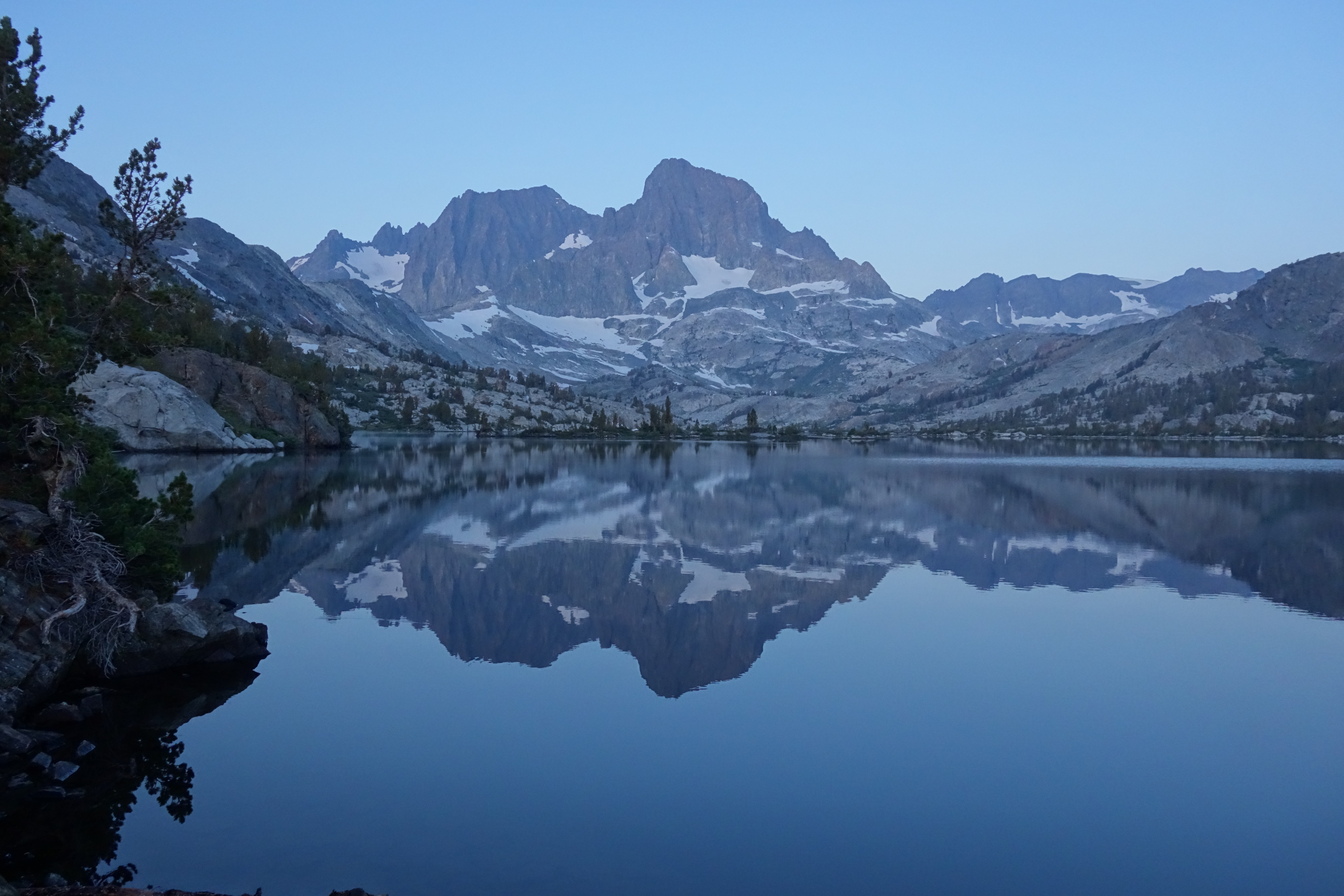
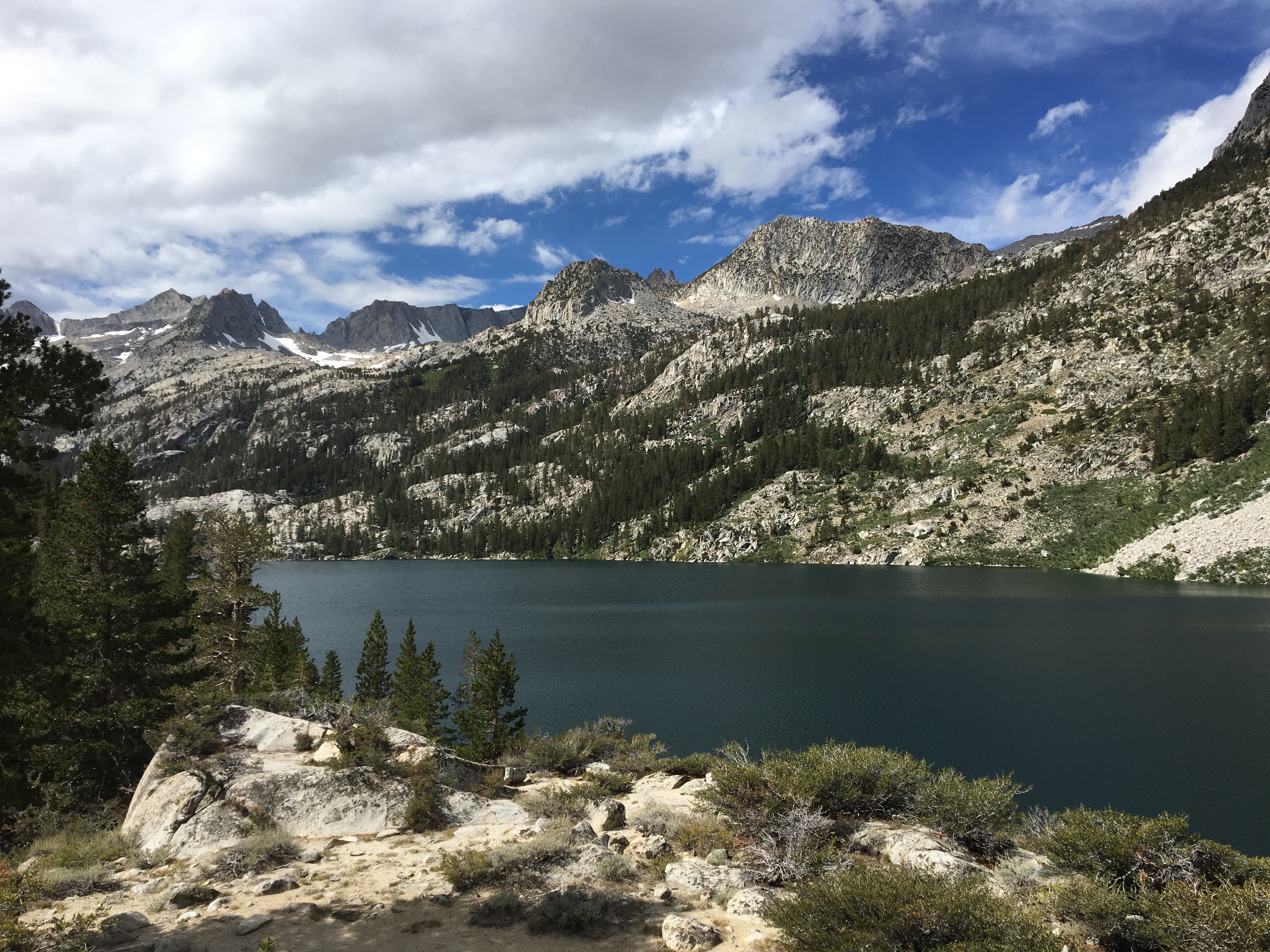
I made it back to camp and had a decision to make. I was just playing it by ear at this point. I felt pretty good and the weather was clear, so I headed up over the pass to Garnet Lake. I had some minor elevation stuff going on, I think. I felt some pressure in my head (which wasn't surprising, I can't dive too deep snorkeling, either) and I had to take some breaks to catch my breath on the climb. It was a really cool trail near the top, leading to a little tarn. Then I was rewarded with incredible views of Garnet Lake.
Looking back the way I came
IMG_4377 by Sean McKee, on FlickrI hiked along the south side of the lake and found a spot. It was somewhat exposed, but I was tired and didn't feel like bushwacking around looking for something better. It had a good view of the lake.
DSC00059 by Sean McKee, on FlickrDay 3:
It was cool being on east coast time, because I was always up by sunrise. I think that was my favorite part of the days. Everything was so still and quiet. I took some pictures and headed on to Thousand Island Lake. Again, I took a break 15 minutes into my trip, as I was mesmerized by the view at the Garnet Lake outlet. I just sat on the bridge for a while. As I did, a PCT hiker came by. I saw he had an inReach and he graciously allowed me to send a message to my family.
DSC00083 by Sean McKee, on Flickr
DSC00080 by Sean McKee, on FlickrIt was a nice little hike to Thousand Island Lake. I stopped at Ruby Lake and spent a half an hour helping a guy look for his dog. As it turned out, the dog had headed back up the switchbacks towards Garnet. It was spotted by some hikers coming down, who happened to be the dad and son from the family that I camped with the first night. It was really cool to see them again.
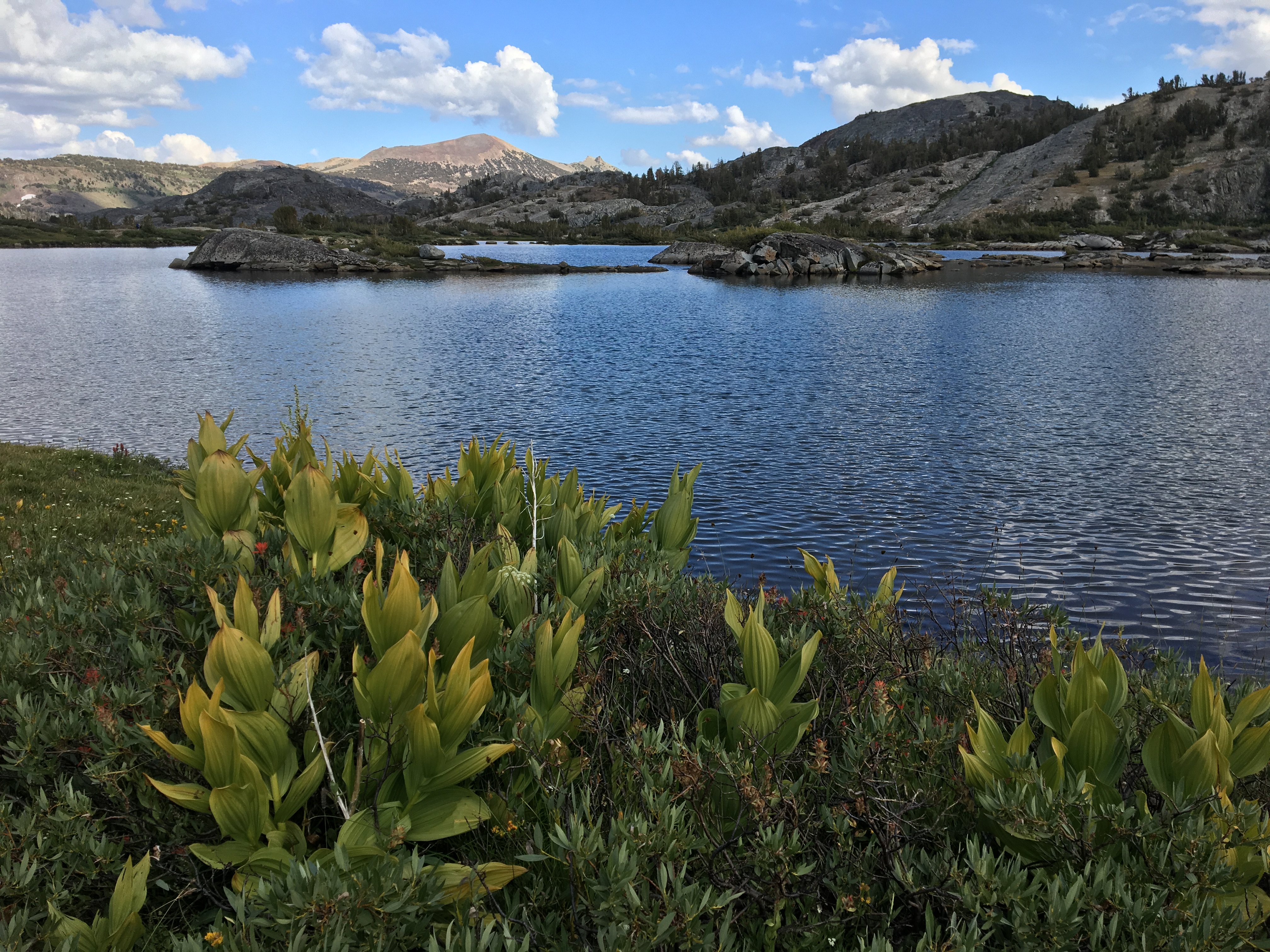
DSC00095 by Sean McKee, on FlickrOnce I got to Thousand Island Lake, I kept going west. As advertised, the further I went, the less people I saw. There were some cool sites, but I headed back to a site I saw earlier on. I think I wanted to hear the occasional voice. I was getting my campsite set up when I saw and smelled some bear poop in the site. I was trying to figure out if I should move. It was one thing to know that there are bears around, but for me, it was another to know that there was a bear literally right there recently. As I was pondering, a JMT hiker struck up a conversation with me. He had just passed up a really nice site in the trees because he wanted to be further west. He offered to backtrack and take me up there to show me. It was awesome and I never would have found it myself. It had a great view of Banner Peak and was completely sheltered in the trees.
I spent the rest of the day eating by the water, swimming, and taking pictures. I had considered going 8 miles round trip to Davis Lakes, but I decided to save that for another time.
DSC00117 by Sean McKee, on FlickrDay 4:
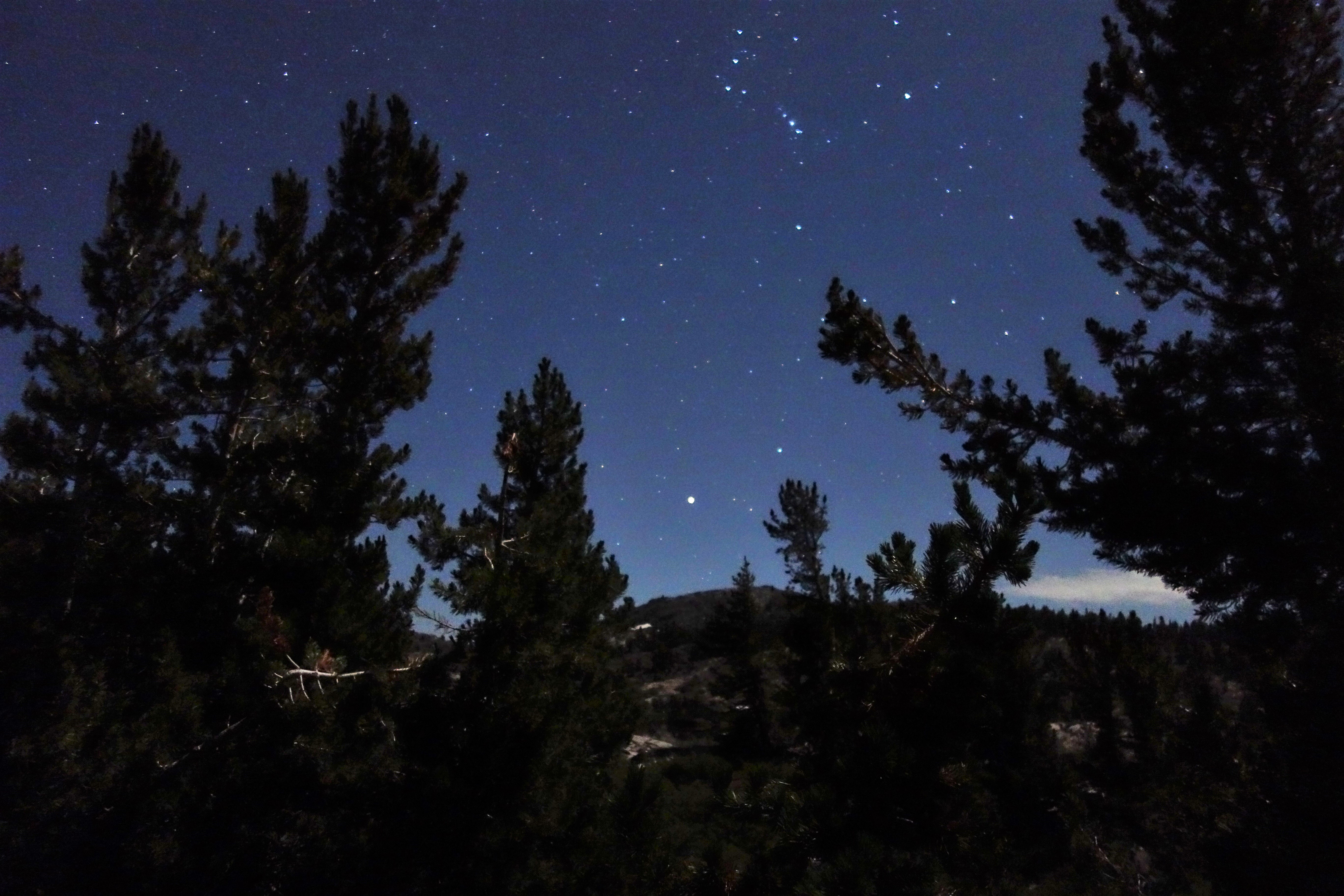
I got up around 3:30 to try to take some pictures of the stars. It was close to a full moon, so I knew I wasn't going to get anything great. But I wanted to try it out. It worked out pretty well, unfortunately the moon was over by Banner Peak, so the light washed out the stars over there. I was able to get some star pictures on the other side of the sky, though. It was a good start, I had never taken star pictures before.
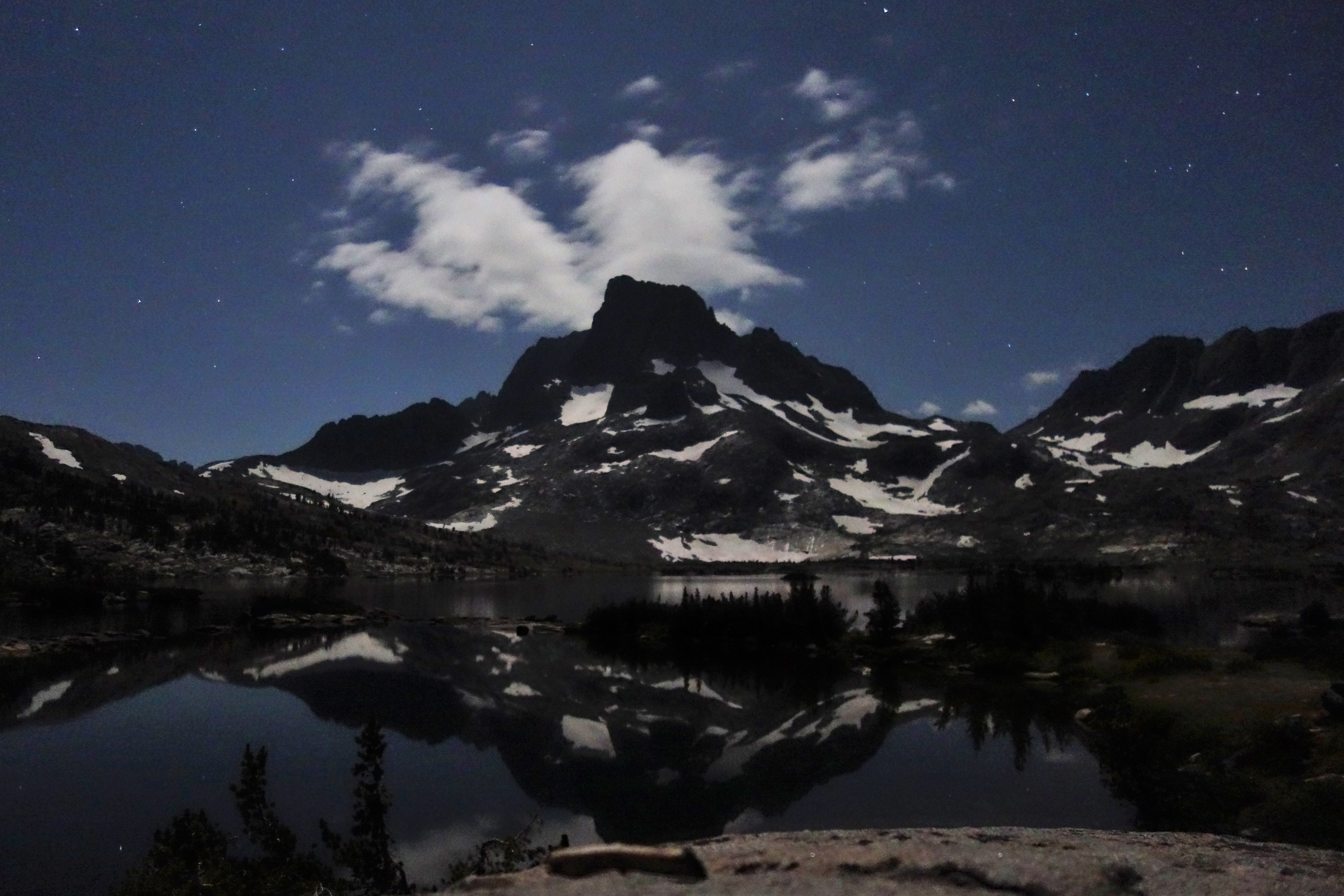
When I got back to the tent, I took off the rainfly and dozed looking up at the starts until just before sunrise. I threw on my puffy and my hat and walked down towards where I was the day before on the western side of the lake. This is where I got my favorite pics of the trip. I just kept being drawn further and further west. I only stopped when I realized I was on that peninsula and would have a long walk around in my sleeping clothes. I met a couple that were headed out for Banner Peak. That is a really cool area, though.
DSC00184 by Sean McKee, on Flickr
DSC00181 (2) by Sean McKee, on Flickr
DSC00178 by Sean McKee, on Flickr
DSC00175 by Sean McKee, on Flickr
DSC00174 by Sean McKee, on FlickrI had one more day, potentially, but I decided I didn't want to hike out then drive the 5.5 hours back to Vegas in the same day. So, it was time to pack up camp and head out on the high trail. Three different people told me the high trail was "all downhill" to the trailhead. That turned out not to be true at all! The second half of it, yeah, but not the first half. It is a varied and scenic trail, and it had a lot of water on it. I stopped for a break at an amazing campsite overlooking a huge long waterfall. I also took a detour to Badger Lakes (I took a brief swim in it, but it has a quicksand/mud bottom). Seems curiousity always gets the better or me when I see a little trail or cairn. Which is how I ended up having lunch at a site overlooking Shadow Lake, where it all started. I finished up by descending the never ending switchbacks to Agnew Meadows.
IMG_4445 by Sean McKee, on Flickr
DSC00191 by Sean McKee, on Flickr
DSC00192 by Sean McKee, on Flickr
DSC00212 by Sean McKee, on FlickrBack to the start!
Day 5:
I had a leisurely drive back to Vegas, so I had my last zip lock bag lunch on a rock at South Lake. I took some pictures for some folks heading out on the South Lake-North Lake loop and wished I was going with them. I then took another detour to the Ancient Bristlecone Pine Forest at 10,000+ feet. That place was pretty cool, too.
Epilouge:
This trip ended up being perfect for my first solo multi night trip. The weather was perfect. I never had a problem finding solitude or the comfort of having people around. Thank you to all the people posting on these boards for inspiring me to make the trip. And thank you to the random people showing kindness to strangers in the backcountry. I learned a lot of stuff about backpacking, that's for sure. And that will come in handy, because I am certainly going back there.
Last edited:
 . Time to do some research.