Udink
Still right here.
- Joined
- Jan 17, 2012
- Messages
- 1,742
I was feeling lethargic this past weekend and on Saturday, after doing very little all day, I half-heartedly made plans to drive to the end of the Spur the following day. The Spur is a long, narrow strip of land bordered by Horseshoe Canyon on the west and the Green River and Millard Canyon on the east. These deep canyon drainages converge at the north end of the Spur and create a formidable barrier that is only penetrated by a single road from the south. I didn't even set my alarm clock. I figured that if the trip was meant to happen I would be awake in time on Sunday morning to prepare and leave town. At 6:37AM I was wide awake and ready to make it happen.
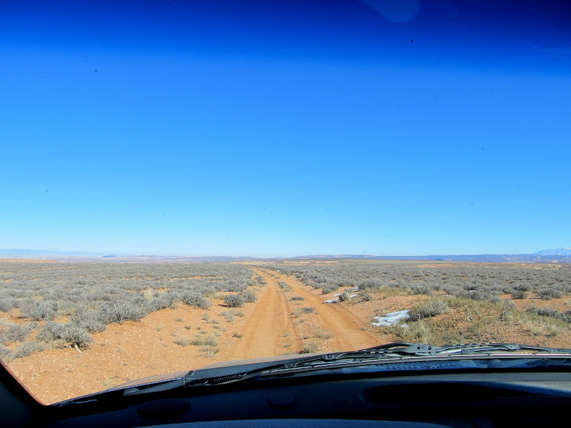
After eating breakfast, drinking coffee, readying my camera and GPS, packing food and drink for me and the dogs, and fueling up the Jeep, I was on the road by 8:00. I topped off the fuel in Green River and reset the odometer when I hit the gravel road leading south toward Hans Flat. I had been on the San Rafael Desert road many times, but only twice have I been past the Hans Flat ranger station: once on the way to the Maze in 2012 and again later that same year on the way to descend the High Spur slot canyon. This time I had two dogs in the Jeep and I wasn't inclined to stop at the ranger station and potentially be denied access to the BLM land just beyond the Glen Canyon National Recreation Area land. It looked like nobody was home when I rolled past the ranger station, and a short distance beyond it became clear that nobody had been down the Spur road since before the last snow storm sometime late last year.
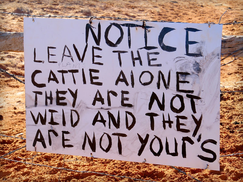
Humorous sign on the way to Hans Flat
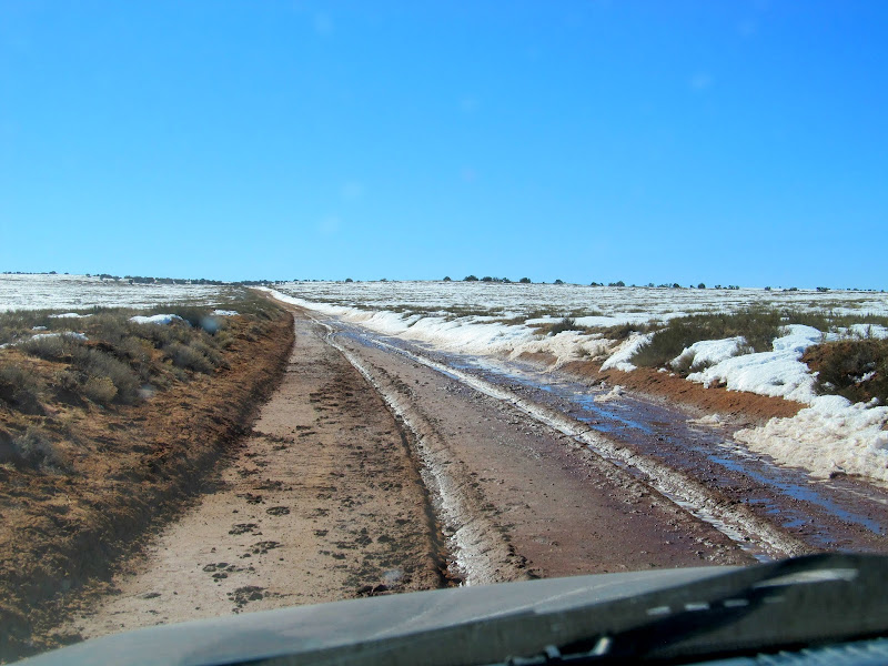
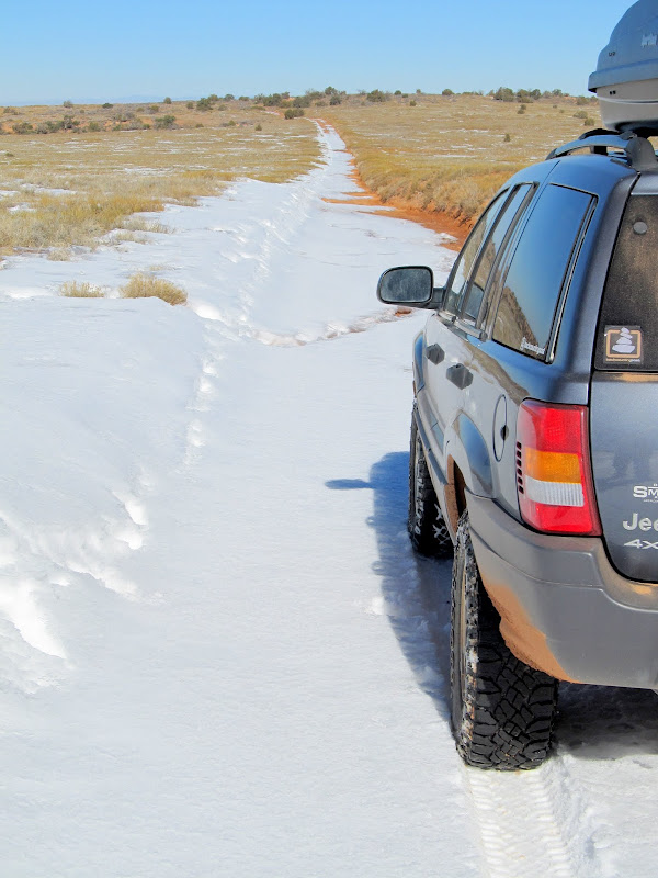
Sloppy road that was frozen during the drive in
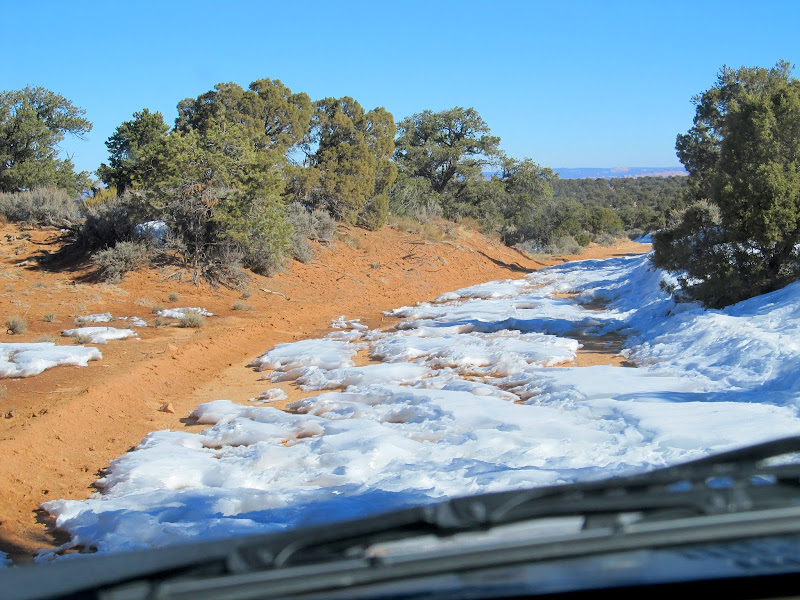
Breaking trail through the snow just north of Hans Flat ranger station
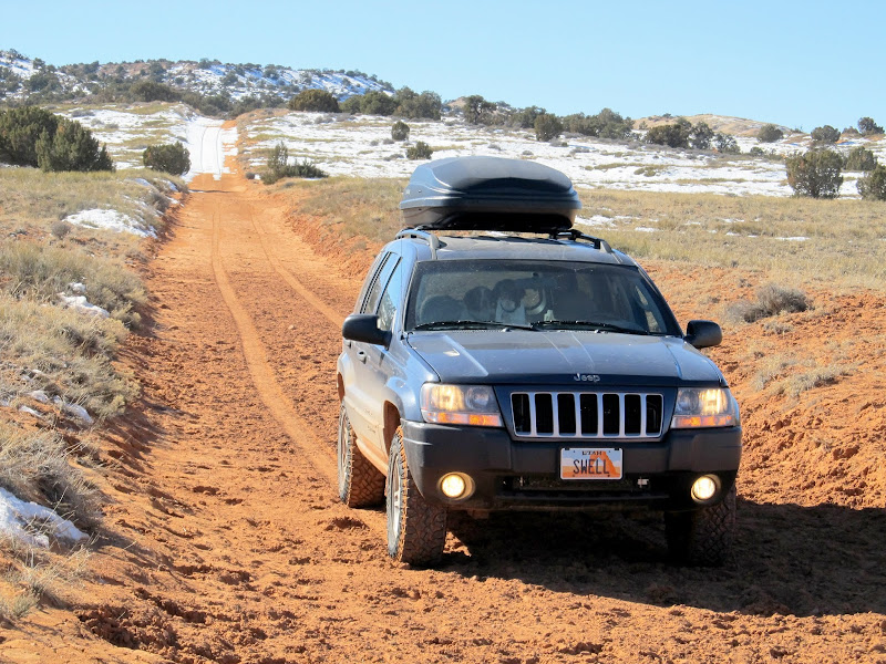
Descending from Hans Flat onto the Spur
I actually had a hike planned out, but when I got to the starting point it was evident that I didn't have enough time to hike, let alone get back to Green River before dark. I stopped briefly several times to take photos and took quite a few from the Jeep. Once I passed the boundary from GCNRA to BLM land, I stopped to let the dogs run around a bit.
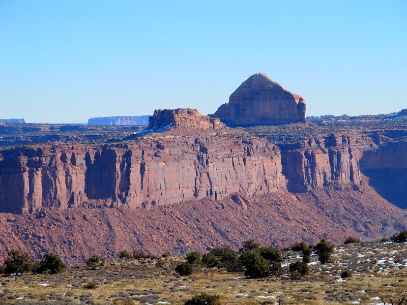
Cleopatra's Chair across Millard Canyon
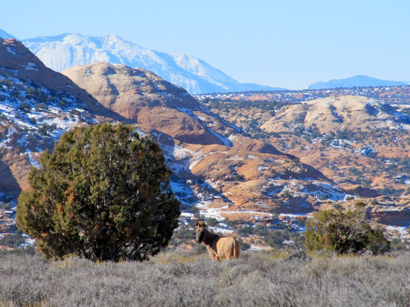
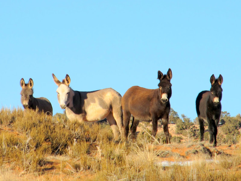
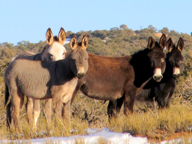
Wild burro
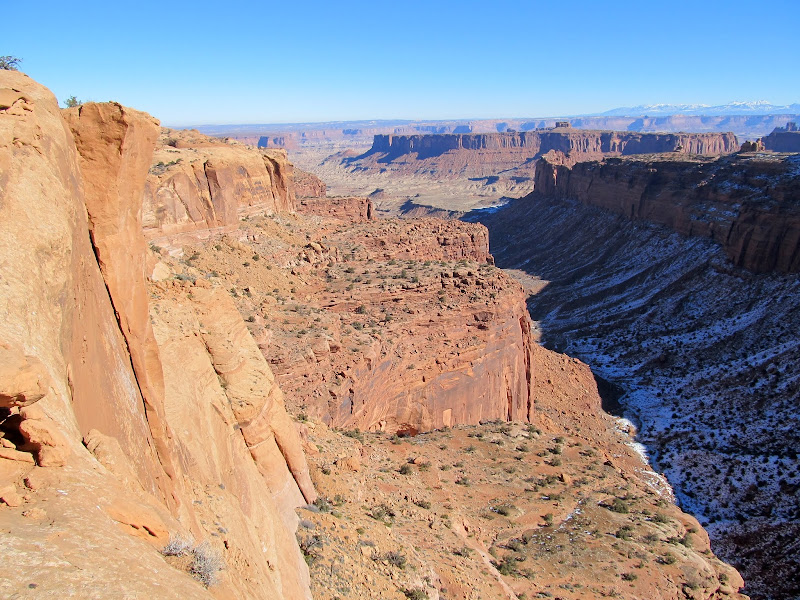
Millard Canyon
Lower Millard Canyon
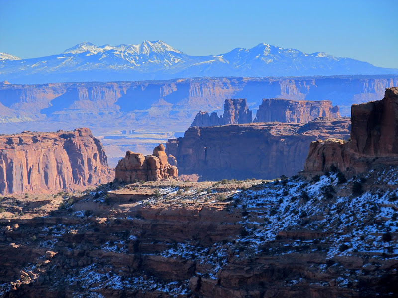
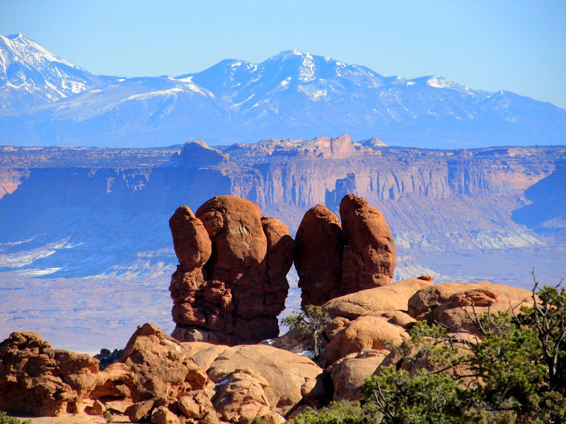
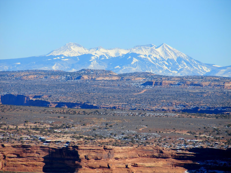
The La Sal Mountains over canyon country
The road across High Spur
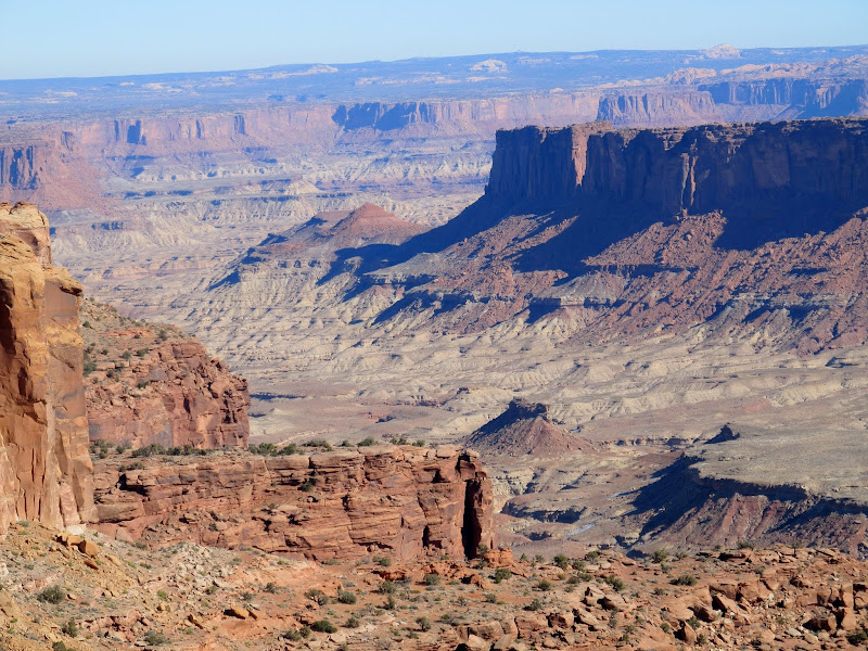
Formations on the rim of Millard Canyon
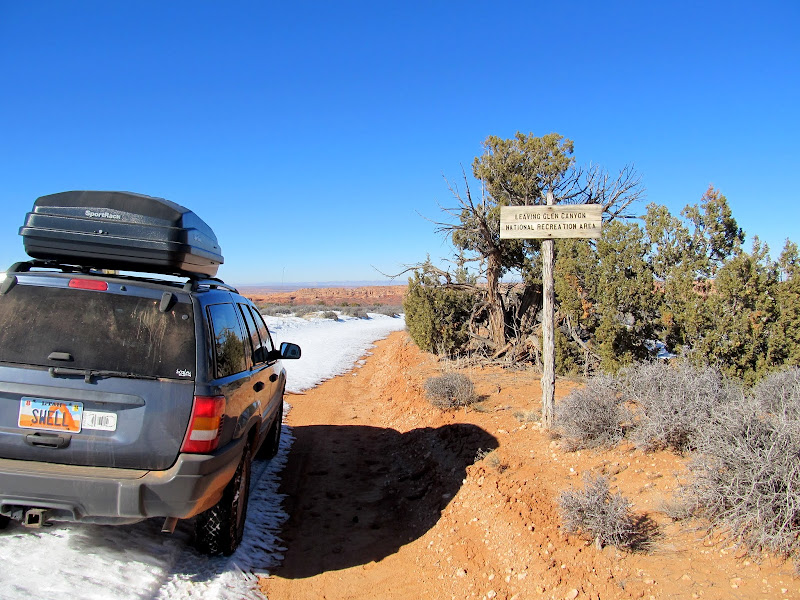
Glen Canyon National Recreation Area boundary
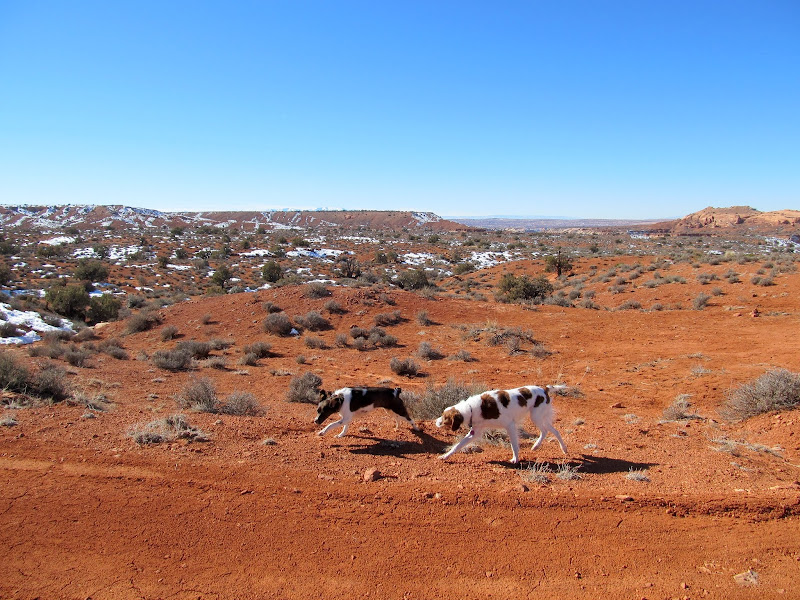
Letting the puppies run now that we're back on BLM land
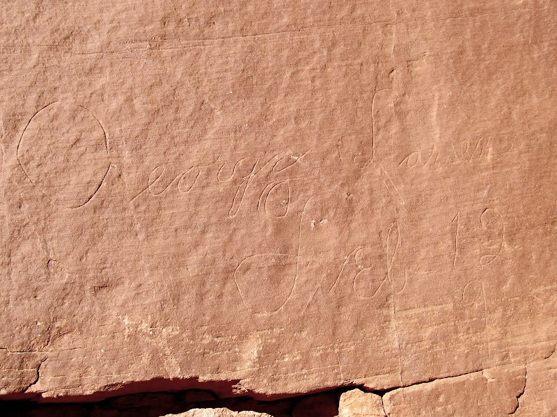
I'd seen a few distant rock outcroppings that looked like they would have attracted cowboys or sheepherders to scratch their names into the cliffs, but eventually the road passed right by one such outcropping and I stopped to examine the rocks. I found that George Larsen had apparently been there many times and left several nice cursive inscriptions. Antonio Romero was also there in 1926 (though my photos of his name didn't turn out well).
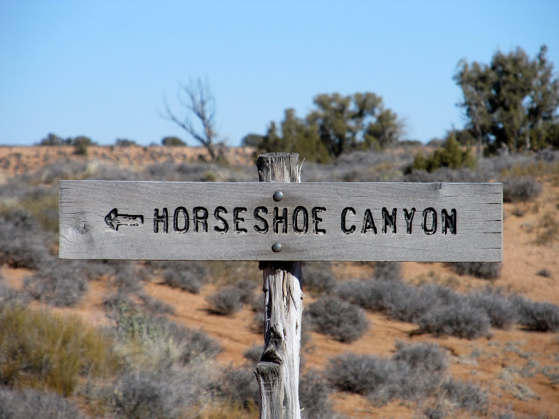
Sign pointing to Horseshoe Canyon road and Tidwell Ranch
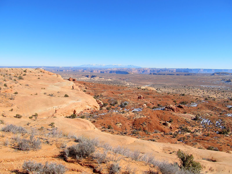
View over Low Spur
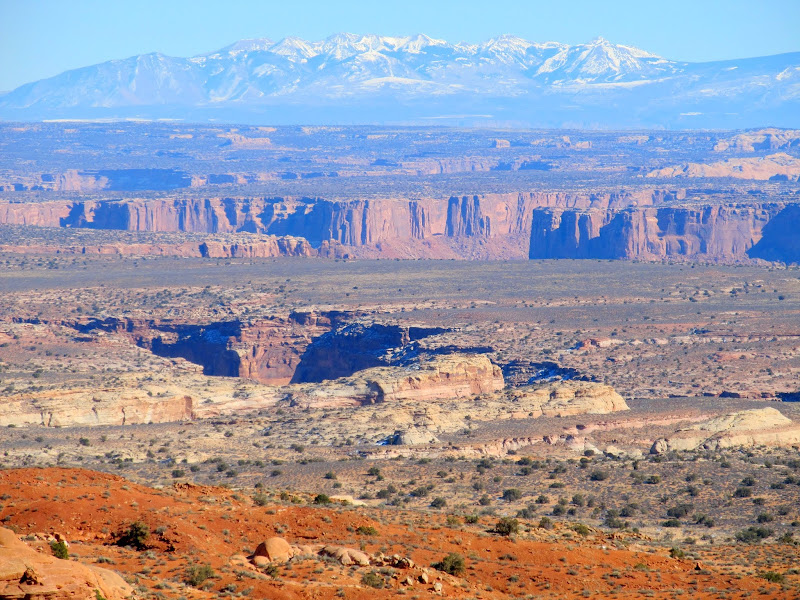
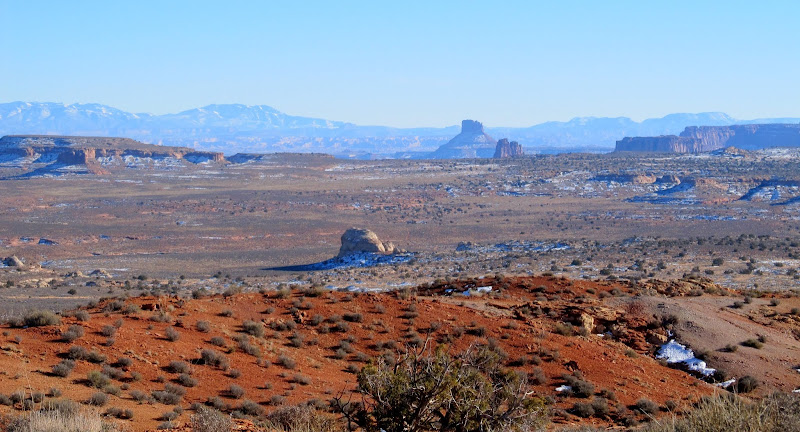
Low Spur, Horsethief Canyon, Labyrinth Canyon, and the La Sal Mountains
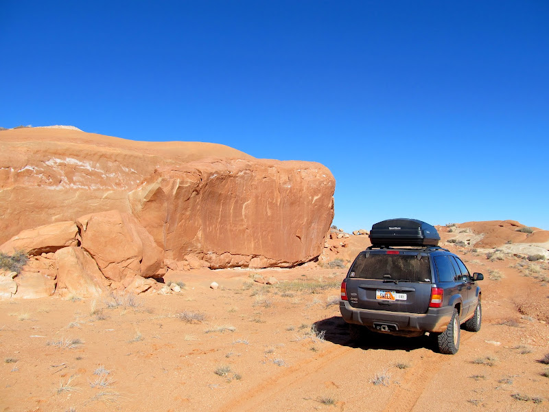
Irresistable rock outcropping that I had to examine
George Larsen, Feb 12, 9
The road got rougher the farther along I got, but I made it to the end in 2WD. There was a lonely geocache at the end of the road which I found easily, then I took a few photos and began the return trip. In this case it really was more about the journey than the destination!
Flat terrain near the end of the Spur
The final stretch of road before reaching the end of the Spur
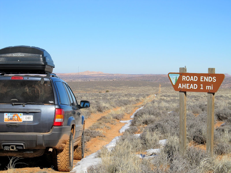
Road ends ahead 1 mi
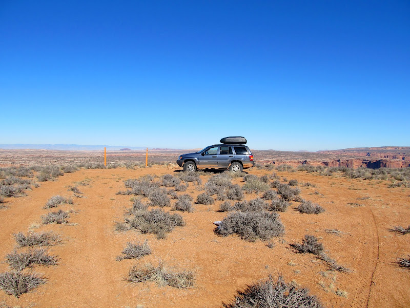
End of the road on the Spur
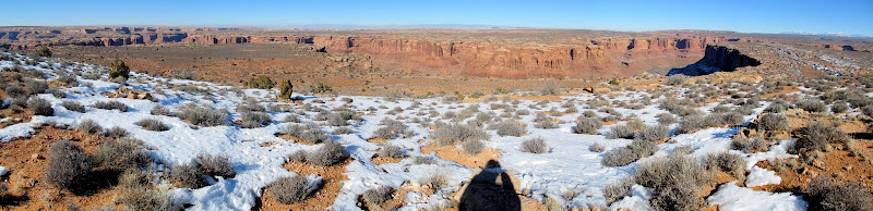
Panorama from the end of the road
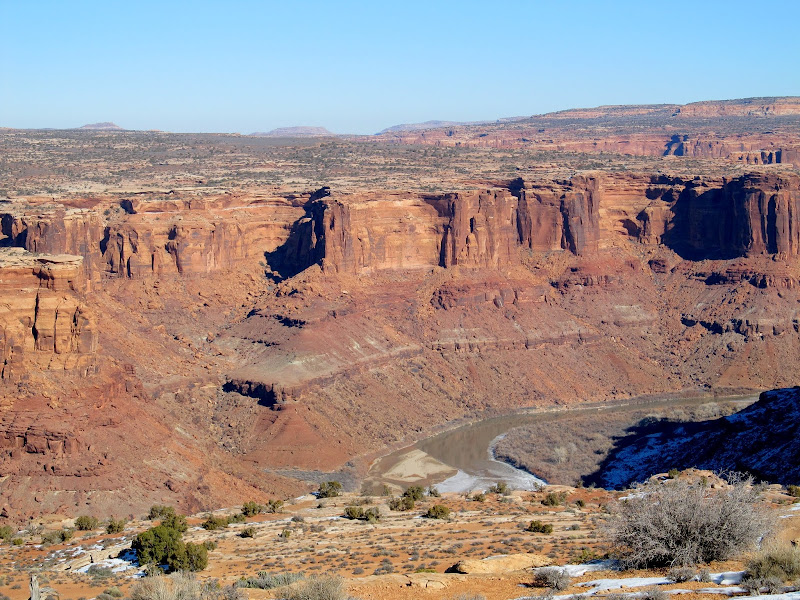
Green River at Cottonwood Bottom
The La Sals over Mineral Point
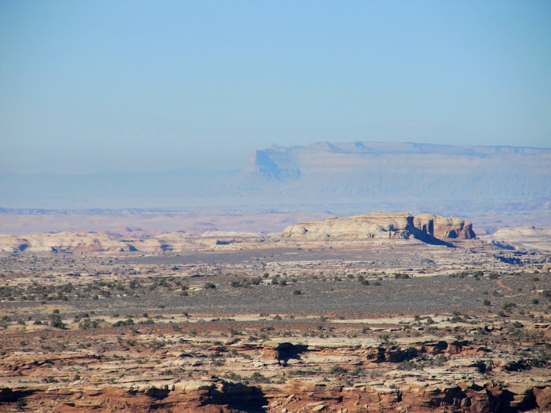
The Book Cliffs through the haze
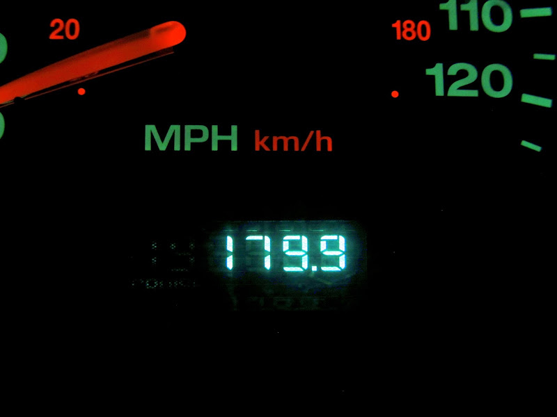
During the drive out I had to shift into 4WD for one very short uphill section of snow-covered road. I'd seen a solo wild burro while driving in, and on the way out I saw several more. I passed the ranger station and this time there was a Park Service Jeep there but, not being obliged to stop, I blew on past again. The sun slipped behind the horizon before I got back to the San Rafael Desert road and it was fully dark when I got back to the pavement near Green River. I'd spent nine hours and 179.9 miles on dirt roads. It was a decent sightseeing trip, but not something I would do again without spending at least a couple of nights and exploring more of the area on foot.
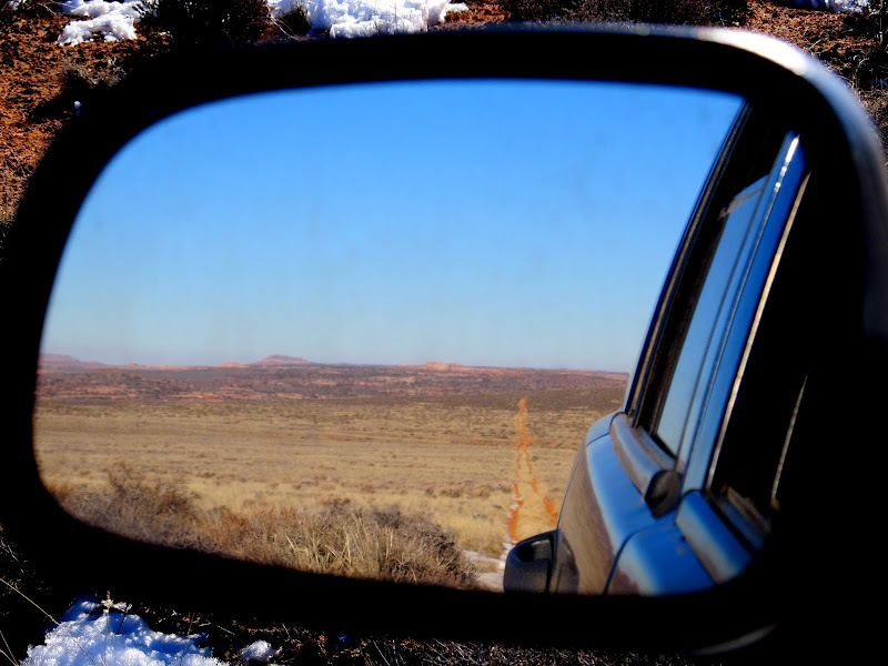
Rear-view of the Spur road
Henry Mountains
View across Low Spur
Wild burros
Wild burros
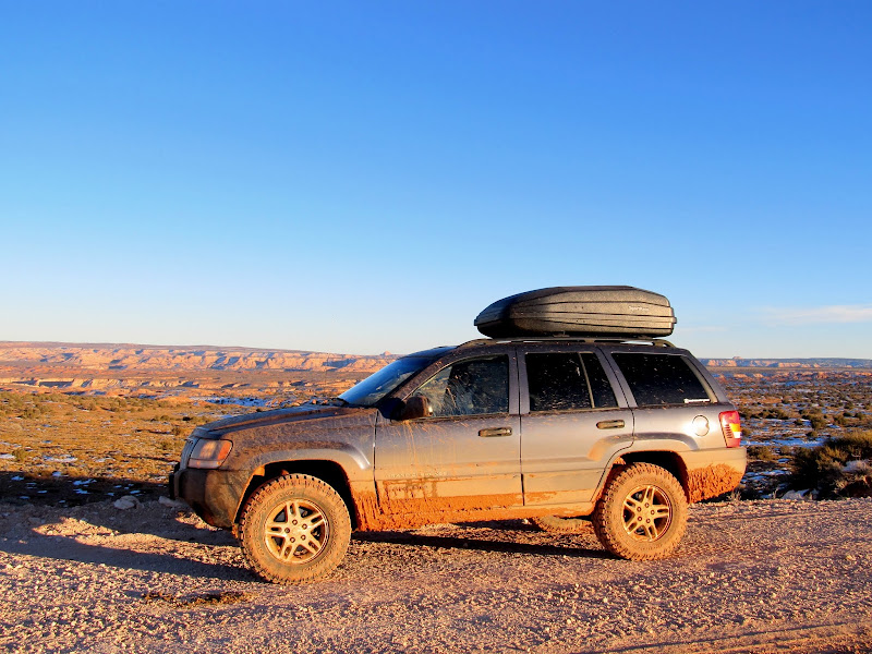
I laughed at my wife when she washed the Jeep last week. Now she knows why.
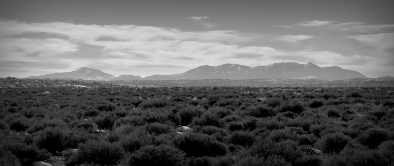
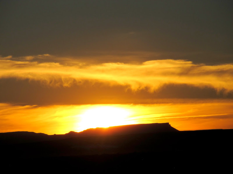
Sunset over the Flat Tops
179.9 miles on the trip odometer, all on dirt roads
Full photo gallery:
https://picasaweb.google.com/Dennis.Udink/TheSpur
[parsehtml]<iframe width="800" height="600" frameborder="0" scrolling="no" marginheight="0" marginwidth="0" src="https://maps.google.com/maps?q=http:%2F%2Fudink.org%2Fgeo%2FTheSpur.kmz&hl=en&sspn=0.082137,0.169086&t=h&ie=UTF8&ll=38.404101,-110.151672&spn=0.322853,0.54863&z=11&output=embed"></iframe><br /><small><a href="https://maps.google.com/maps?q=http:%2F%2Fudink.org%2Fgeo%2FTheSpur.kmz&hl=en&sspn=0.082137,0.169086&t=h&ie=UTF8&ll=38.404101,-110.151672&spn=0.322853,0.54863&z=11&source=embed" style="color:#0000FF;text-align:left">View Larger Map</a></small>[/parsehtml]http://udink.org/geo/TheSpur.kmz
Featured image for home page:

After eating breakfast, drinking coffee, readying my camera and GPS, packing food and drink for me and the dogs, and fueling up the Jeep, I was on the road by 8:00. I topped off the fuel in Green River and reset the odometer when I hit the gravel road leading south toward Hans Flat. I had been on the San Rafael Desert road many times, but only twice have I been past the Hans Flat ranger station: once on the way to the Maze in 2012 and again later that same year on the way to descend the High Spur slot canyon. This time I had two dogs in the Jeep and I wasn't inclined to stop at the ranger station and potentially be denied access to the BLM land just beyond the Glen Canyon National Recreation Area land. It looked like nobody was home when I rolled past the ranger station, and a short distance beyond it became clear that nobody had been down the Spur road since before the last snow storm sometime late last year.
Humorous sign on the way to Hans Flat
Sloppy road that was frozen during the drive in
Breaking trail through the snow just north of Hans Flat ranger station
Descending from Hans Flat onto the Spur
I actually had a hike planned out, but when I got to the starting point it was evident that I didn't have enough time to hike, let alone get back to Green River before dark. I stopped briefly several times to take photos and took quite a few from the Jeep. Once I passed the boundary from GCNRA to BLM land, I stopped to let the dogs run around a bit.
Cleopatra's Chair across Millard Canyon
Wild burro
Millard Canyon
Lower Millard Canyon
The La Sal Mountains over canyon country
The road across High Spur
Formations on the rim of Millard Canyon
Glen Canyon National Recreation Area boundary
Letting the puppies run now that we're back on BLM land
I'd seen a few distant rock outcroppings that looked like they would have attracted cowboys or sheepherders to scratch their names into the cliffs, but eventually the road passed right by one such outcropping and I stopped to examine the rocks. I found that George Larsen had apparently been there many times and left several nice cursive inscriptions. Antonio Romero was also there in 1926 (though my photos of his name didn't turn out well).
Sign pointing to Horseshoe Canyon road and Tidwell Ranch
View over Low Spur
Low Spur, Horsethief Canyon, Labyrinth Canyon, and the La Sal Mountains
Irresistable rock outcropping that I had to examine
George Larsen, Feb 12, 9
The road got rougher the farther along I got, but I made it to the end in 2WD. There was a lonely geocache at the end of the road which I found easily, then I took a few photos and began the return trip. In this case it really was more about the journey than the destination!
Flat terrain near the end of the Spur
The final stretch of road before reaching the end of the Spur
Road ends ahead 1 mi
End of the road on the Spur
Panorama from the end of the road
Green River at Cottonwood Bottom
The La Sals over Mineral Point
The Book Cliffs through the haze
During the drive out I had to shift into 4WD for one very short uphill section of snow-covered road. I'd seen a solo wild burro while driving in, and on the way out I saw several more. I passed the ranger station and this time there was a Park Service Jeep there but, not being obliged to stop, I blew on past again. The sun slipped behind the horizon before I got back to the San Rafael Desert road and it was fully dark when I got back to the pavement near Green River. I'd spent nine hours and 179.9 miles on dirt roads. It was a decent sightseeing trip, but not something I would do again without spending at least a couple of nights and exploring more of the area on foot.
Rear-view of the Spur road
Henry Mountains
View across Low Spur
Wild burros
Wild burros
I laughed at my wife when she washed the Jeep last week. Now she knows why.
Sunset over the Flat Tops
179.9 miles on the trip odometer, all on dirt roads
Full photo gallery:
https://picasaweb.google.com/Dennis.Udink/TheSpur
[parsehtml]<iframe width="800" height="600" frameborder="0" scrolling="no" marginheight="0" marginwidth="0" src="https://maps.google.com/maps?q=http:%2F%2Fudink.org%2Fgeo%2FTheSpur.kmz&hl=en&sspn=0.082137,0.169086&t=h&ie=UTF8&ll=38.404101,-110.151672&spn=0.322853,0.54863&z=11&output=embed"></iframe><br /><small><a href="https://maps.google.com/maps?q=http:%2F%2Fudink.org%2Fgeo%2FTheSpur.kmz&hl=en&sspn=0.082137,0.169086&t=h&ie=UTF8&ll=38.404101,-110.151672&spn=0.322853,0.54863&z=11&source=embed" style="color:#0000FF;text-align:left">View Larger Map</a></small>[/parsehtml]http://udink.org/geo/TheSpur.kmz
Featured image for home page:
Last edited by a moderator:
")