Navigation
Install the app
How to install the app on iOS
Follow along with the video below to see how to install our site as a web app on your home screen.
Note: This feature may not be available in some browsers.
More options
Style variation
You are using an out of date browser. It may not display this or other websites correctly.
You should upgrade or use an alternative browser.
You should upgrade or use an alternative browser.
Album The members of backcountrypost.com
- Thread starter Backcountry Post
- Start date
OldBill
Member
- Joined
- Aug 18, 2015
- Messages
- 591
Thought I'd make my subpar addition to this collection of BCP member photographic stories. My most scenic hikes are in the Winds which are usually solo & I can't take selfies. Recently visited NM with my girlfriend. Posted the Pecos backpack. She also wanted to climb Wheeler (tallest pt in NM at 13,167'). I'm not big into peak bagging, but wanted to test my torn hip further to make sure I survive my Winds trip with @Bob this year.
We took the Williams L trail from the Taos Ski Resort so about 2900' gain. One reason I'm not keen on just climbing peaks is that the view is usually less than optimal by the time you get there. Reality doesn't equal the advertising. We had smoke from fires and storms building in, but went for it just for the exercise if nothing else.
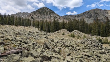
Decent views after the first few miles
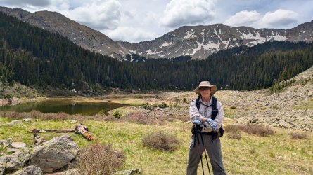
My best @scatman expression.
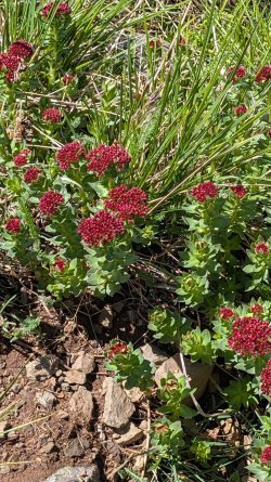
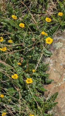
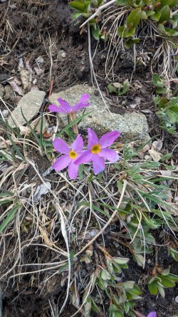
Early June, so lots of flowers
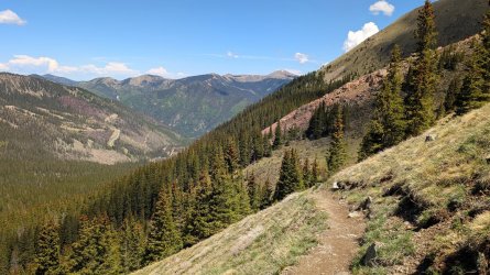
Views back towards the ski resort
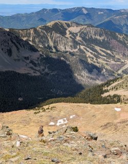
This marmot seemed amused by the humans on the trail (appearing only as specks below) though he's keeping one eye on me.
Nearing the peak
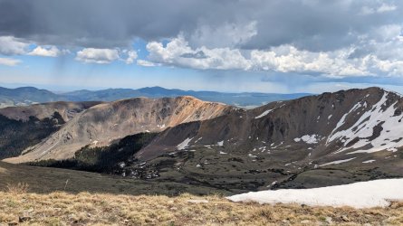
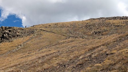
It was hazy and the clouds were building by the time we got to the top, but 360 views were still good. Had to smile for the summit shot.
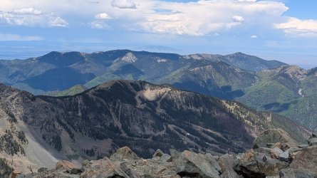
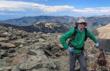
The hardest part for me was the return downhill- the damaged hip does not like that extra impact. Took my time and a few anti-inflammatories later had no major problems. Progress from not being able to walk 50' in January.
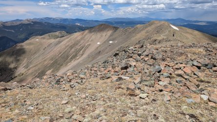
We took the Williams L trail from the Taos Ski Resort so about 2900' gain. One reason I'm not keen on just climbing peaks is that the view is usually less than optimal by the time you get there. Reality doesn't equal the advertising. We had smoke from fires and storms building in, but went for it just for the exercise if nothing else.
Decent views after the first few miles

My best @scatman expression.

Early June, so lots of flowers


Views back towards the ski resort

This marmot seemed amused by the humans on the trail (appearing only as specks below) though he's keeping one eye on me.

Nearing the peak


It was hazy and the clouds were building by the time we got to the top, but 360 views were still good. Had to smile for the summit shot.


The hardest part for me was the return downhill- the damaged hip does not like that extra impact. Took my time and a few anti-inflammatories later had no major problems. Progress from not being able to walk 50' in January.

- Joined
- Dec 23, 2013
- Messages
- 4,347
Thought I'd make my subpar addition to this collection of BCP member photographic stories. My most scenic hikes are in the Winds which are usually solo & I can't take selfies. Recently visited NM with my girlfriend. Posted the Pecos backpack. She also wanted to climb Wheeler (tallest pt in NM at 13,167'). I'm not big into peak bagging, but wanted to test my torn hip further to make sure I survive my Winds trip with @Bob this year.
We took the Williams L trail from the Taos Ski Resort so about 2900' gain. One reason I'm not keen on just climbing peaks is that the view is usually less than optimal by the time you get there. Reality doesn't equal the advertising. We had smoke from fires and storms building in, but went for it just for the exercise if nothing else.
Decent views after the first few miles
View attachment 142381
My best @scatman expression.
View attachment 142380
Early June, so lots of flowers
View attachment 142382
View attachment 142383
View attachment 142384
Views back towards the ski resort
View attachment 142387
This marmot seemed amused by the humans on the trail (appearing only as specks below) though he's keeping one eye on me.
View attachment 142388
Nearing the peak
View attachment 142389
View attachment 142390
It was hazy and the clouds were building by the time we got to the top, but 360 views were still good. Had to smile for the summit shot.
View attachment 142391
View attachment 142392
The hardest part for me was the return downhill- the damaged hip does not like that extra impact. Took my time and a few anti-inflammatories later had no major problems. Progress from not being able to walk 50' in January.
View attachment 142393
Nice shots @OldBill. It must have taken years of practice to get that Scatman smile down. @Rockskipper hasn't been teaching you the ways of Scat has she?
- Joined
- Jun 11, 2017
- Messages
- 4,612
You may not survive regardless, from the stories I've heard...but then, they're all from @scatman, so who knows?to make sure I survive my Winds trip with @Bob this year.
- Joined
- Dec 23, 2013
- Messages
- 4,347
- Joined
- Dec 23, 2013
- Messages
- 4,347
My wife works at the Salt Lake Clinic here in town, and one day an older patient came in and told her that he lived in the Avenues, which is where our family lives. He said that when he was a kid, he would play at the Lindsey Gardens (park nearby), down in Memory Grove, and the caves on Ensign Peak. Sheila told them that we'd been up Ensign probably a hundred times over the years and that we'd never seen any caves. He said that they were located on the west side of the peak. So this morning, Sheila, Katie and I headed out to see if we could find these caves on Ensign Peak.
Now in order to get to the west side of Ensign, you have to use the original trail that goes straight up to the top. I hiked this original trail the first time I did Ensign, which was about 44 years ago? Ever since, I have just taken the newer trail up, since access to the old trail is fenced off now. Shades of Hayden Valley to come @TractorDoc . Anyway, once you're about halfway up, you need to cut across the slope on an old game/social trail heading west until you reach the conglomerate cliffs, then you can follow the base of the cliff until you reach the cave. We found only one small cave, so I didn't think that the term caves really applied.
Here some shots of our exploration:
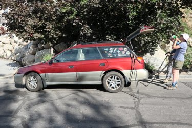
One last drink before we leave the car.
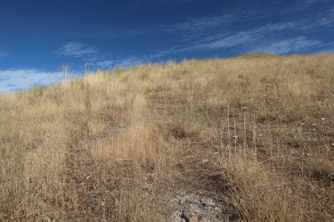
You can see the little hump above which is Ensign Peak. Can you make out the old trail? I'm in stealth mode at this point.
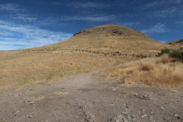
Once you get over the first rise Ensign comes into full view. The rocks on the left hand side of the hill is where we will be heading.
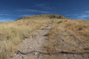
Ah, the old trail. It's a steep bugger.
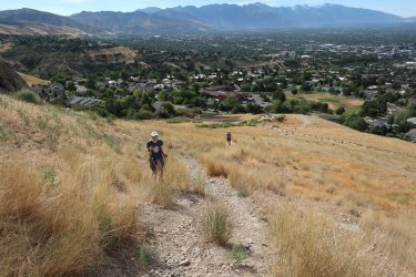
We made our way through the fence and are headed up.
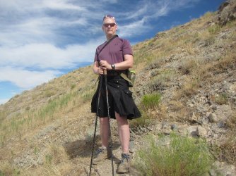
I'm at about the halfway up mark and though it is hard to see in this shot, there is a faint trail heading west.
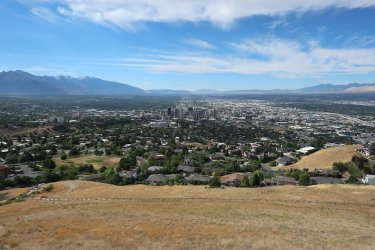
Nice view of the city from the halfway point
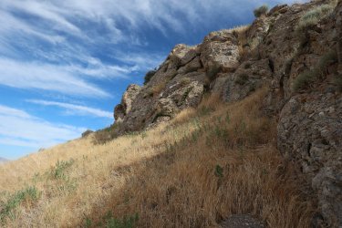
We've made it to the cliff band
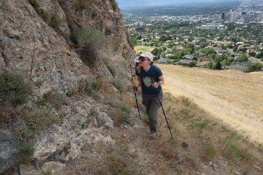
Now just following the base of the cliff
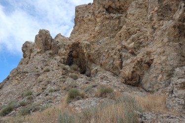
I thought this might be what we were looking for, but I'm not sure I'd call it a cave, though I did scramble up to take a look
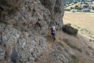
Waiting for me to come back down
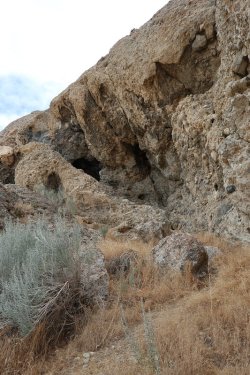
Now this looks a little more promising
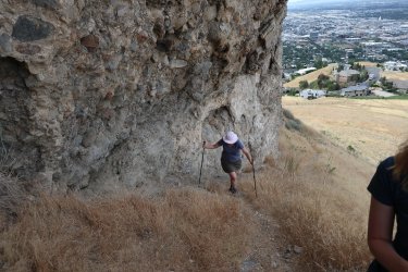
Steep ascent to the next potential cave site
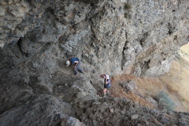
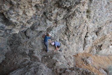
Some light scrambling required to reach the opening
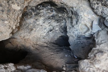
And voila, there it is. It didn't go back very far, and there was a side cavern that Sheila and Katie went into. Someone had had a
beer party up here at some point - a Pabst Blue Ribbon one.
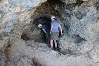
Contemplating heading into the side cavern
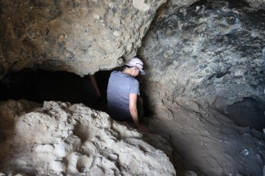
Heading in
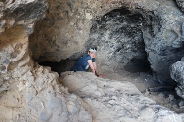
And coming back out
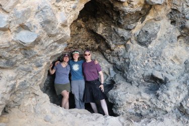
Cave shot.
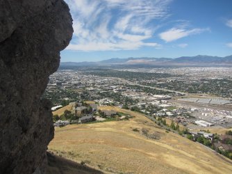
View from the cave
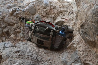
The maiden voyage for my new fanny pack, which I think I like.
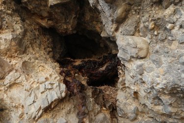
An opening above the cave that looks like it might be occupied
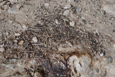
We may have some bat guano here.
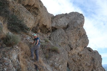
We went further around Ensign to see if we could find anything else. Katie is scrambling up in this shot to check on an opening
beyond the shrub just in front of her.
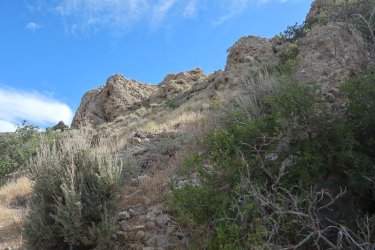
And up a little further to check out another rock formation
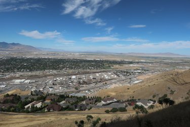
Oil refineries below, along with the Union Pacific Railyard, the west end of the Oquirrh Mountains across the valley, and Antelope
Island to the north in the distance.
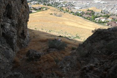
Came back to the cave and had a snack just in front of the mouth
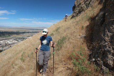
Now we are heading back to the original trail and plan to take it to the summit of Ensign
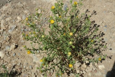
Gumweed is in bloom on the slopes
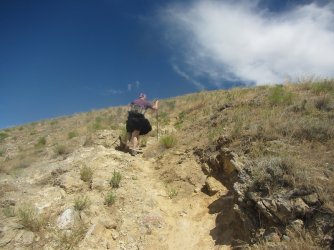
Digging in to get to the top
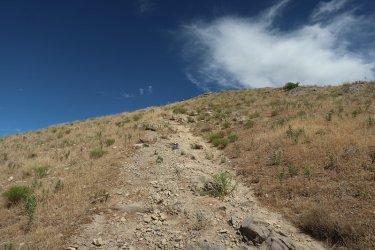
The original Ensign Peak Trail
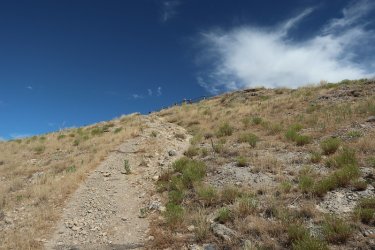
Can just make out the fence and the monument on the summit
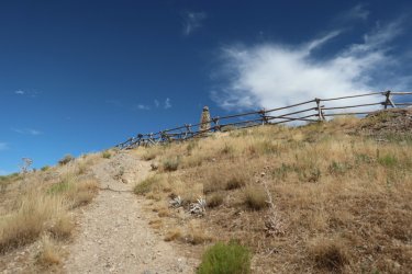
Just have to find a way through the fence
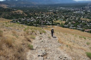
The ladies are still making their way up
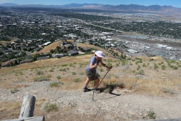
Arriving at the fence
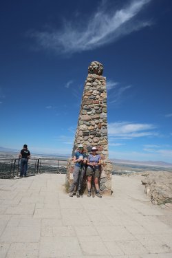
Made it.
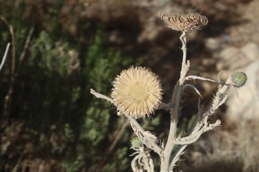
Old thistle just off the summit
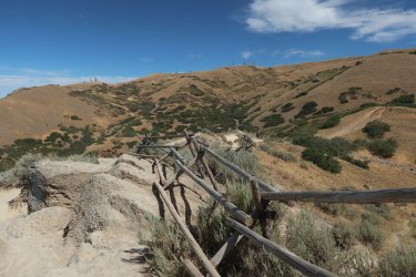
Taking the normal way down on our return
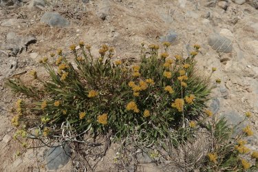
Some rock goldenrod
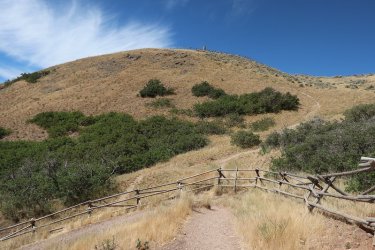
A look back at Ensign
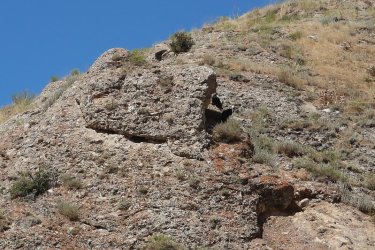
We saw these two vultures flying around when we were at the cave. One of them was taking a rest in the shade of the big rock
above.
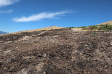
Looks like the had a recent burn near the base of Ensign.
When we got back to our car it was already 88 degrees, and we were glad that we hadn't gotten a later start. All in all a fun little exploratory hike.
Now in order to get to the west side of Ensign, you have to use the original trail that goes straight up to the top. I hiked this original trail the first time I did Ensign, which was about 44 years ago? Ever since, I have just taken the newer trail up, since access to the old trail is fenced off now. Shades of Hayden Valley to come @TractorDoc . Anyway, once you're about halfway up, you need to cut across the slope on an old game/social trail heading west until you reach the conglomerate cliffs, then you can follow the base of the cliff until you reach the cave. We found only one small cave, so I didn't think that the term caves really applied.
Here some shots of our exploration:

One last drink before we leave the car.

You can see the little hump above which is Ensign Peak. Can you make out the old trail? I'm in stealth mode at this point.

Once you get over the first rise Ensign comes into full view. The rocks on the left hand side of the hill is where we will be heading.

Ah, the old trail. It's a steep bugger.

We made our way through the fence and are headed up.

I'm at about the halfway up mark and though it is hard to see in this shot, there is a faint trail heading west.

Nice view of the city from the halfway point

We've made it to the cliff band

Now just following the base of the cliff

I thought this might be what we were looking for, but I'm not sure I'd call it a cave, though I did scramble up to take a look

Waiting for me to come back down

Now this looks a little more promising

Steep ascent to the next potential cave site


Some light scrambling required to reach the opening

And voila, there it is. It didn't go back very far, and there was a side cavern that Sheila and Katie went into. Someone had had a
beer party up here at some point - a Pabst Blue Ribbon one.

Contemplating heading into the side cavern

Heading in

And coming back out

Cave shot.

View from the cave

The maiden voyage for my new fanny pack, which I think I like.

An opening above the cave that looks like it might be occupied

We may have some bat guano here.

We went further around Ensign to see if we could find anything else. Katie is scrambling up in this shot to check on an opening
beyond the shrub just in front of her.

And up a little further to check out another rock formation

Oil refineries below, along with the Union Pacific Railyard, the west end of the Oquirrh Mountains across the valley, and Antelope
Island to the north in the distance.

Came back to the cave and had a snack just in front of the mouth

Now we are heading back to the original trail and plan to take it to the summit of Ensign

Gumweed is in bloom on the slopes

Digging in to get to the top

The original Ensign Peak Trail

Can just make out the fence and the monument on the summit

Just have to find a way through the fence

The ladies are still making their way up

Arriving at the fence

Made it.

Old thistle just off the summit

Taking the normal way down on our return

Some rock goldenrod

A look back at Ensign

We saw these two vultures flying around when we were at the cave. One of them was taking a rest in the shade of the big rock
above.

Looks like the had a recent burn near the base of Ensign.
When we got back to our car it was already 88 degrees, and we were glad that we hadn't gotten a later start. All in all a fun little exploratory hike.
- Joined
- Aug 21, 2018
- Messages
- 748
I could have used some shade today. It was hot!Shades of Hayden Valley to come @TractorDoc
No snappers, rattlers, or grizzlies today, so members of BCP it is.
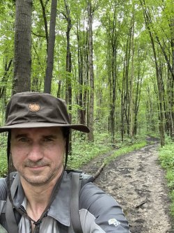
I hiked an 8.3 mile loop in Cuyahoga Valley with the weighted pack. . . part of which involved bushwacking. You'll have to wait for the video on my YouTube channel if you want to see what was involved, but here is a white legged picture of the aftermath.
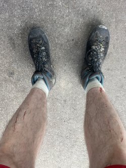
Legs feel a bit sore if I sit too long, but its one of those good feelings that make you think you accomplished something.
- Joined
- Dec 23, 2013
- Messages
- 4,347
Scat...... Perfect trail to practice for the Gallatin High line. ...up and down a few days and you will be ready......
It's not the up and down that I'm worried about, it's the water.
- Joined
- Jun 11, 2017
- Messages
- 4,612
High altitude spelunking looks like fun.
Reminds me of when I was a wee lass and my two older sisters decided to have some fun at my expense and convinced me there were ice cream bars hanging from the roof of a small cave in the rocks up above our ranch which I'd been too scared to go in, fearing rattlers (I was about 5). I discovered that I'd do most anything for ice cream - at the same time that I learned the meaning of the word gullible.
But no rattlers?
- Joined
- Dec 23, 2013
- Messages
- 4,347
High altitude spelunking looks like fun.
Reminds me of when I was a wee lass and my two older sisters decided to have some fun at my expense and convinced me there were ice cream bars hanging from the roof of a small cave in the rocks up above our ranch which I'd been too scared to go in, fearing rattlers (I was about 5). I discovered that I'd do most anything for ice cream - at the same time that I learned the meaning of the word gullible.
But no rattlers?
What flavor ice cream bars were your sisters conjuring up?
I thought that there might be a decent chance of seeing a rattler on the west side of Ensign, but all we saw were lizards and buzzards.
- Joined
- Jun 11, 2017
- Messages
- 4,612
Probably vanilla since we were a pretty sophisticated bunch. Kind of surprised you didn’t see even one rattler.What flavor ice cream bars were your sisters conjuring up?
- Joined
- Aug 21, 2018
- Messages
- 748
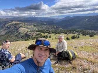
A little Gallatin preview of @Bob @scatman and @TractorDoc while I wait for my plane at the Bozeman airport.
A great trip with no major physical injuries. . . perhaps just a little mental scarring.
A great trip with no major physical injuries. . . perhaps just a little mental scarring.

Last edited:
- Joined
- Apr 20, 2013
- Messages
- 1,510
Sorry, had to do it. Somewhere in the vast wilderness of Yellowstone? Maybe near Specimen Creek? Maybe not?
How was the flavor?
Partial berries or just grass or just...
- Joined
- Jun 11, 2017
- Messages
- 4,612
Beary delight
- Joined
- Dec 23, 2013
- Messages
- 4,347
How was the flavor?
Partial berries or just grass or just...
The flavor was beary delicious!
Beary delight
I'm working on how I can incorporate you and a busker into my next trip report @Rockskipper.
- Joined
- Jun 11, 2017
- Messages
- 4,612
I would happily play my harmonica for jelly bellies.The flavor was beary delicious!Fewer berries than I would have liked.
I'm working on how I can incorporate you and a busker into my next trip report @Rockskipper.Oh, and the "Safe" words.

- Joined
- Aug 21, 2018
- Messages
- 748
Don't like ads? Become a BCP Supporting Member and kiss them all goodbye. Click here for more info.


