NateGeesaman
Donkey
- Joined
- Jan 20, 2012
- Messages
- 272
To start where part 1 ended, a beautiful sunrise from our camp in Water Canyon.
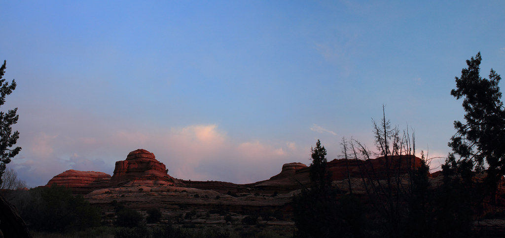
Water Canyon Sunrise by NateGeesaman, on Flickr
We got moving early to take advantage of the cool morning.
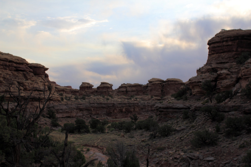
Morning through Water Canyon by NateGeesaman, on Flickr
The early morning light was great as we made our way along the pass to Shot Canyon.
over to shot trail by NateGeesaman, on Flickr
Shot Morning Pano 2 by NateGeesaman, on Flickr
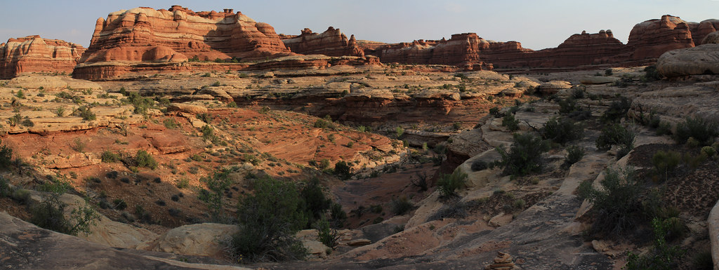
Shot Morning Pano by NateGeesaman, on Flickr
Water Shot Pass Pano by NateGeesaman, on Flickr
water shot pass pano re-crop by NateGeesaman, on Flickr
WATER SHOT PANO 2 by NateGeesaman, on Flickr
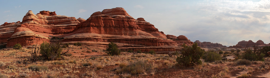
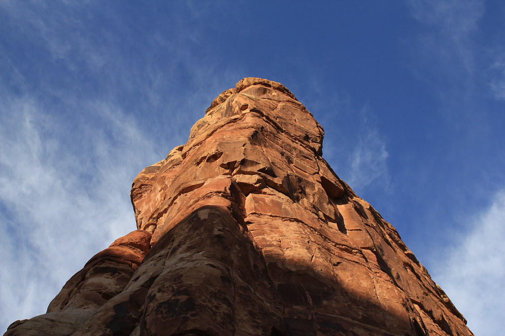
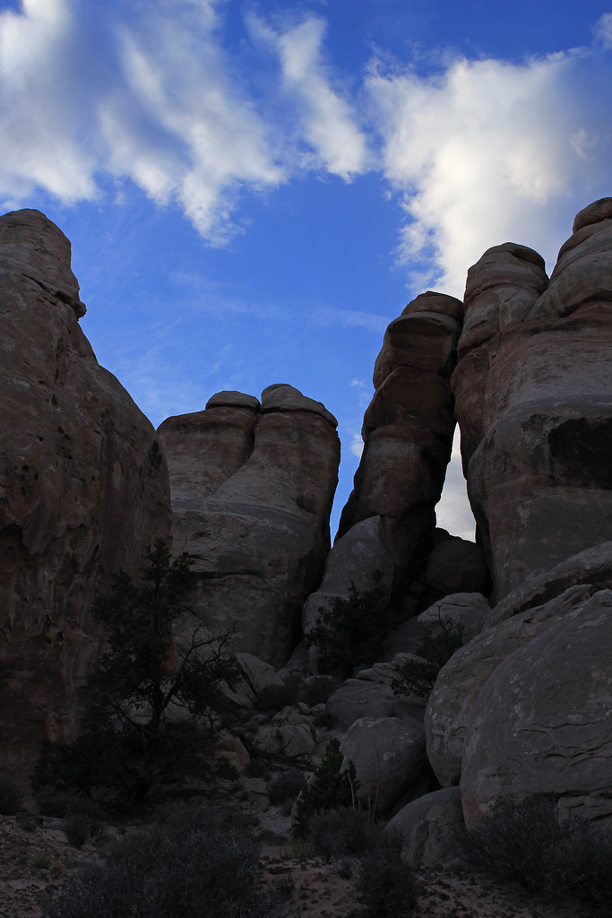
The air was cool and we were making great time as we made our way to the climb out of Shot Canyon towards Chimney Rock. This climb in particular was interesting because of all the work that must have gone into putting the stones in place to make the climb more manageable for cattle.
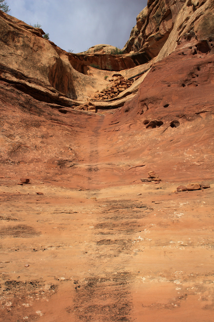
Shot canyon climb out by NateGeesaman, on Flickr
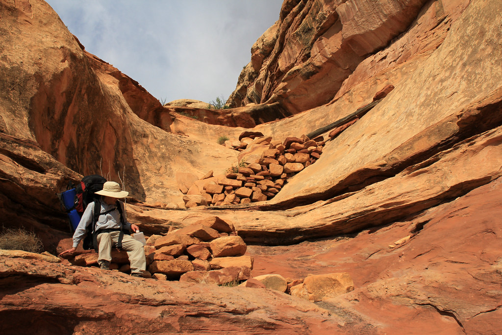
Shot Canyon Exit` by NateGeesaman, on Flickr
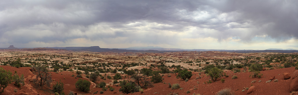
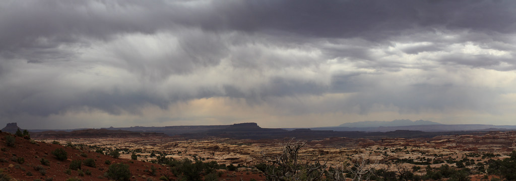
As we made our way to the top of Shot Canyon dark clouds started to form on the horizon ahead of us.
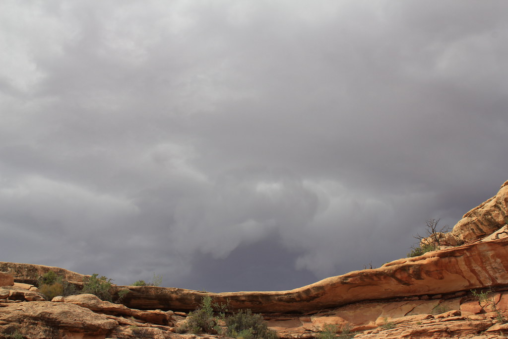
Dun Dun Duuuunnn by NateGeesaman, on Flickr
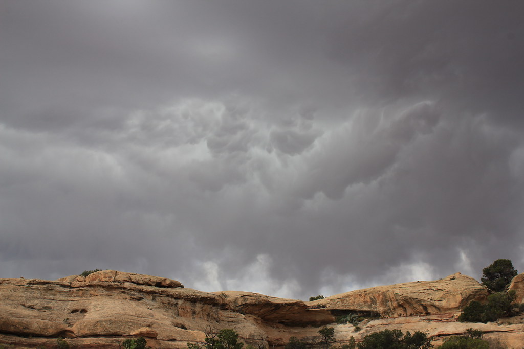
Do you think it might rain? by NateGeesaman, on Flickr
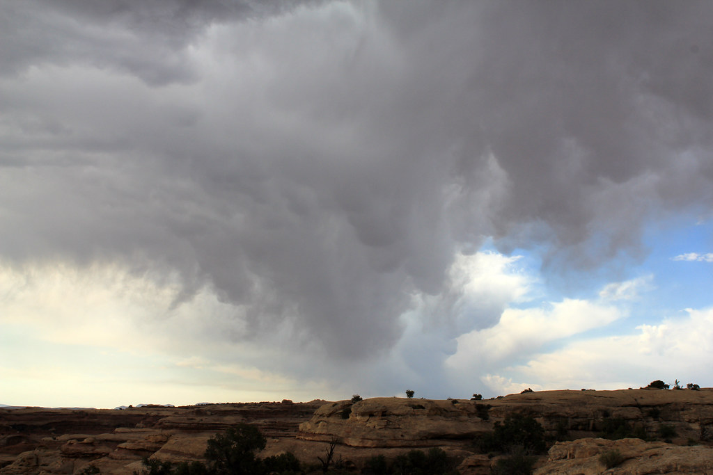
Maze Cloud by NateGeesaman, on Flickr
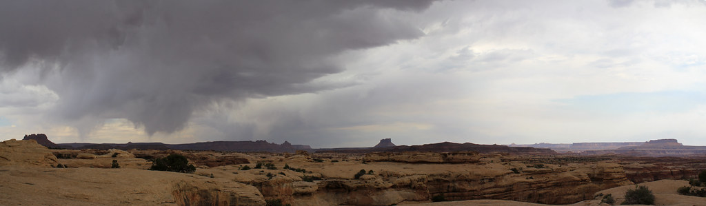
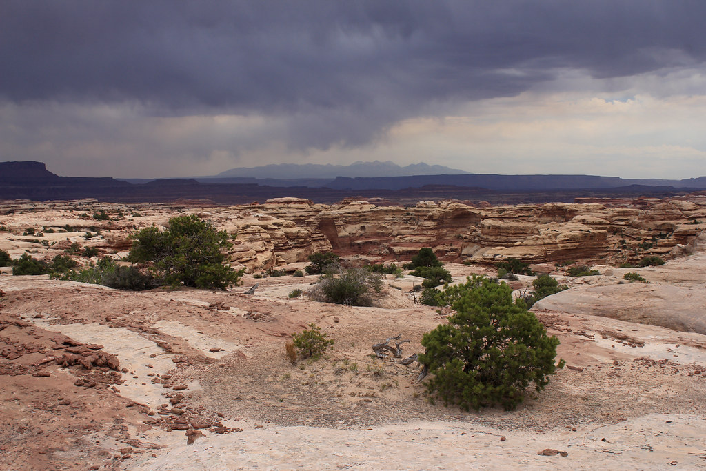
As we were making our way towards Chimney Rock we were forced to converse over what we should do if we had to wait out a storm. We were high on a ridge and lightning was a real danger, but thankfully the cloudbursts seemed to be happening on either side of us while the skies overhead threatened, but never produced much moisture.
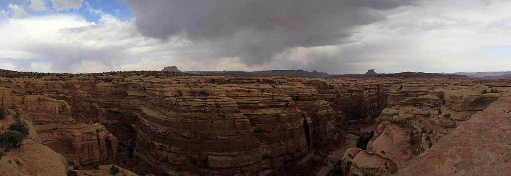
Cloudburst Pano by NateGeesaman, on Flickr
Pete's Mesa Pano 5 by NateGeesaman, on Flickr
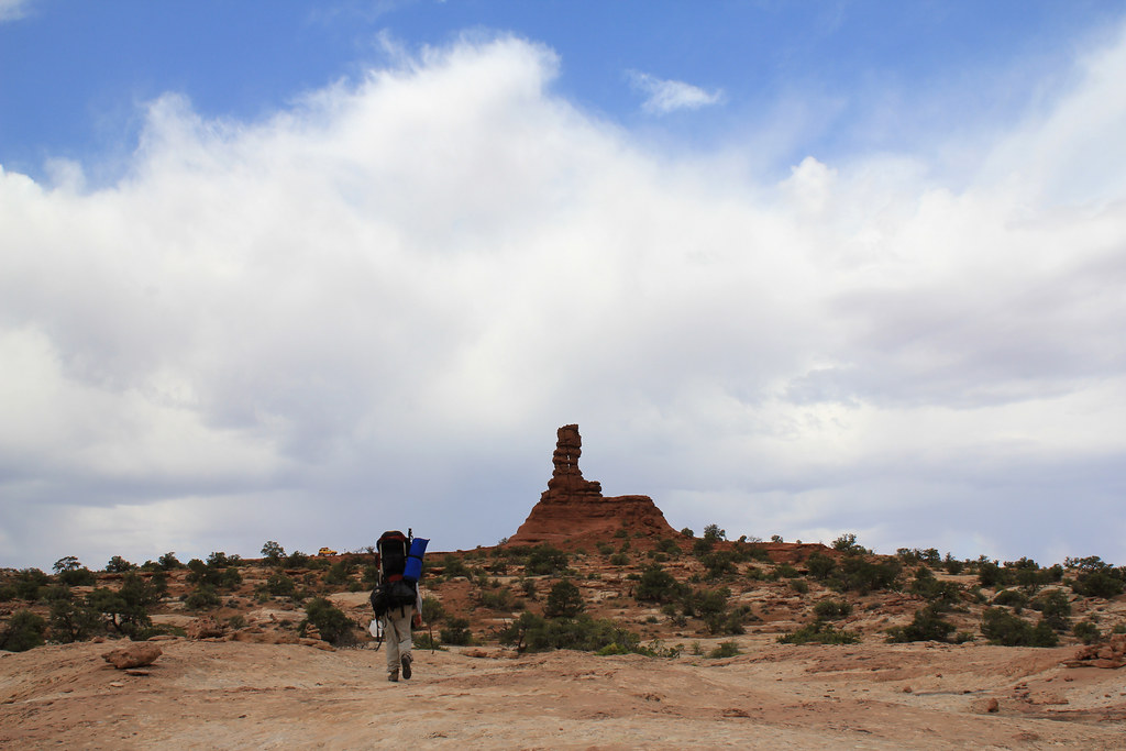
Adam and Chimney by NateGeesaman, on Flickr
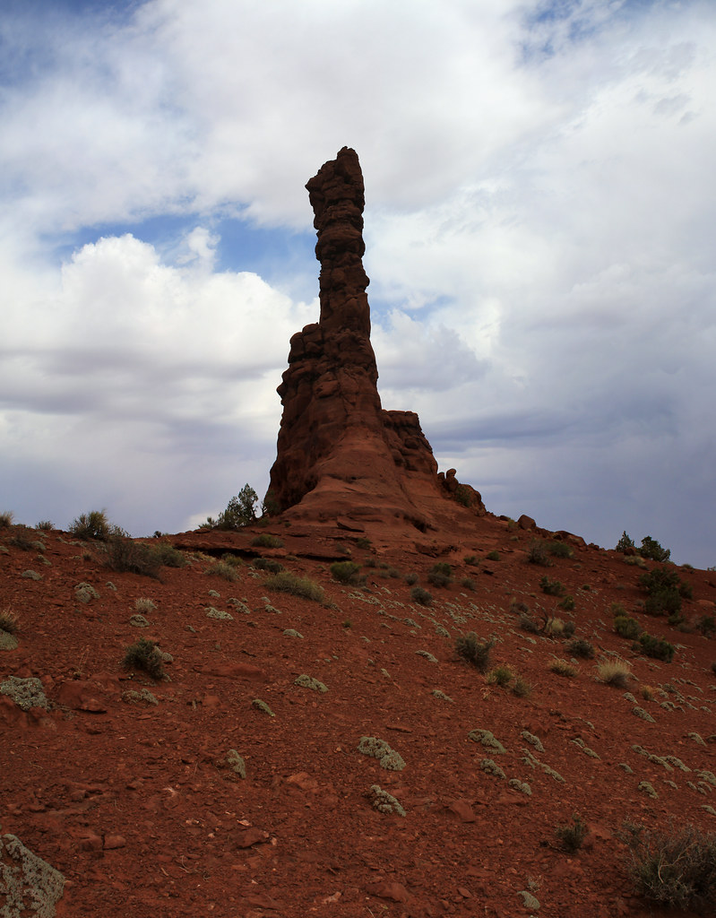
Chimney Rock Verto by NateGeesaman, on Flickr
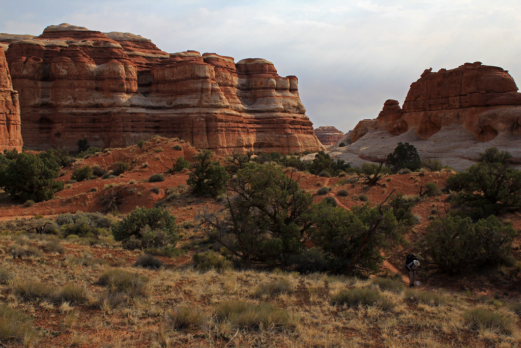
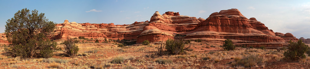
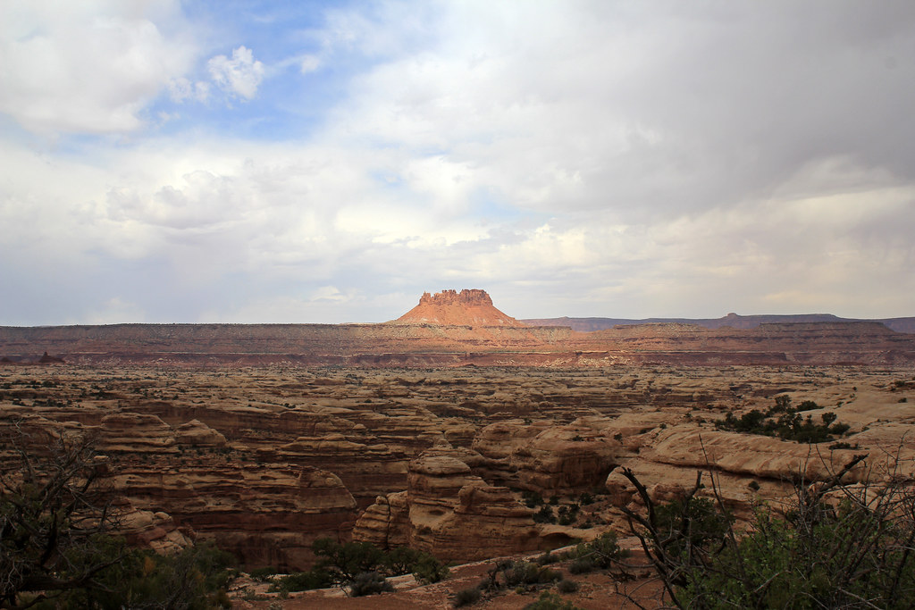
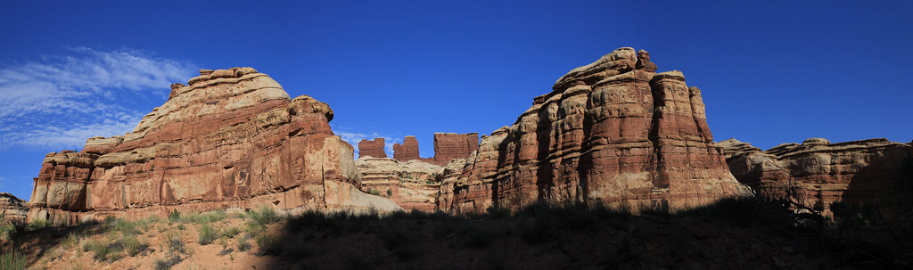
We took a long break to eat at Chimney Rock and I went exploring looking for a good pano of Upper Water Canyon. This is what I came up with:
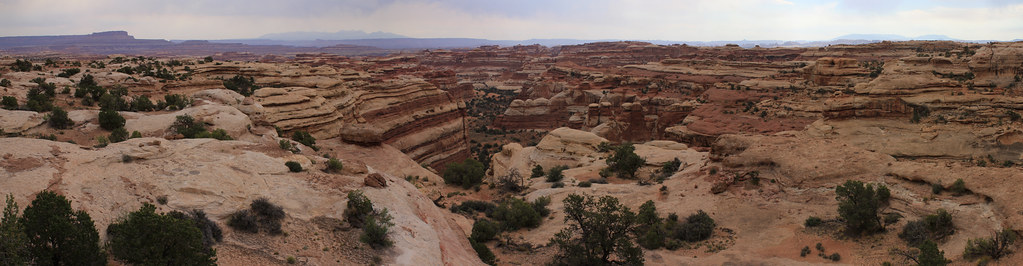
Upper Water Canyon 2 by NateGeesaman, on Flickr
I was really sucked in by the view from Chimney Rock of this beautiful canyon. I was hypnotized by the red and white striped walls and spires. Drawn in looking for the best vantage point. I had better luck on my next visit.
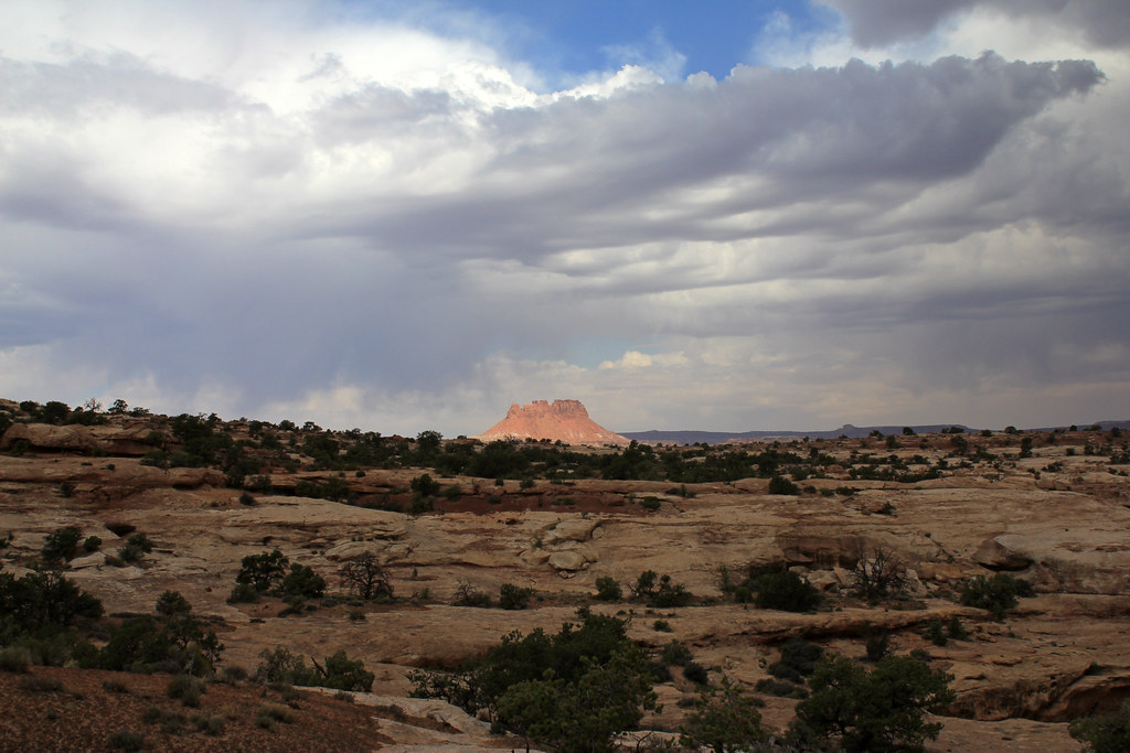
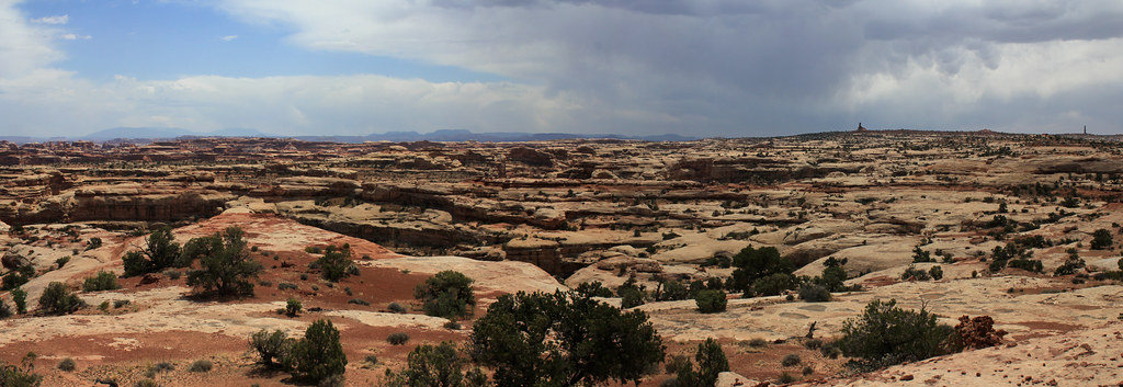
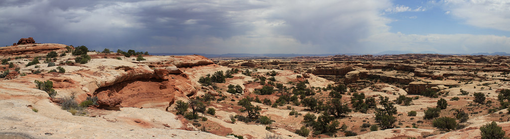
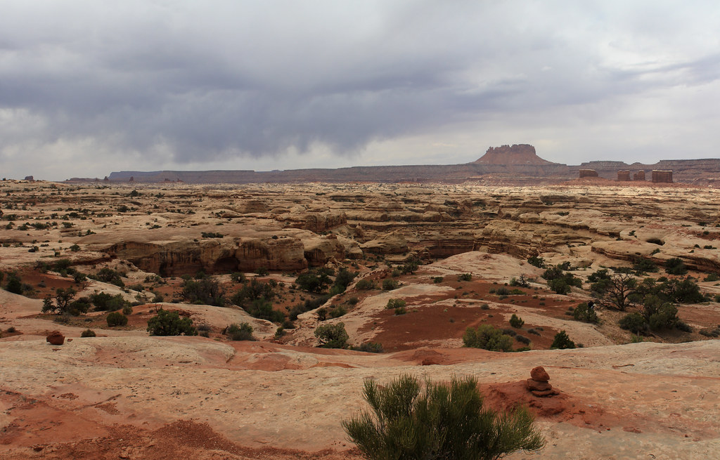
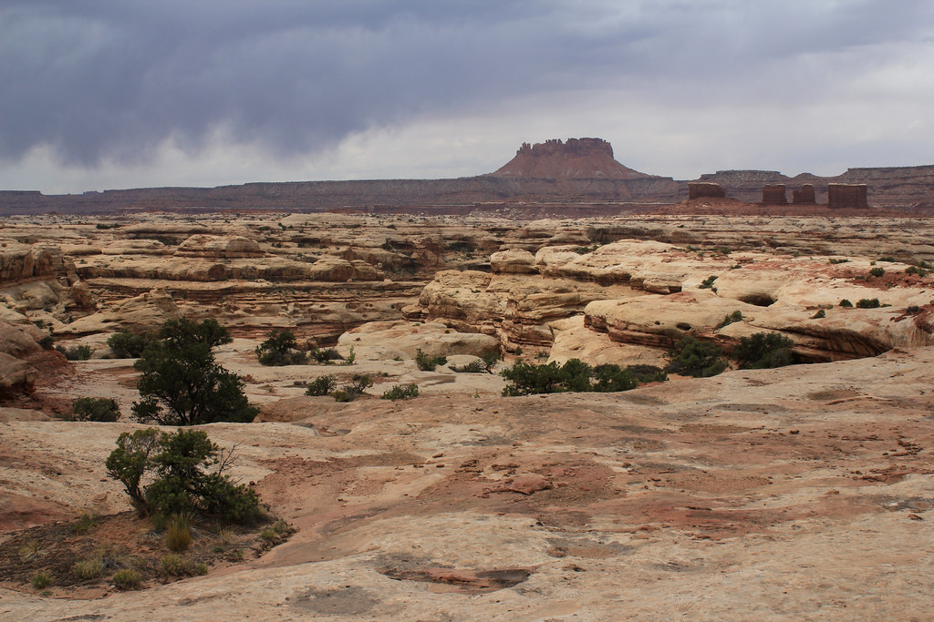
So we began the journey from Chimney Rock along the Pete's Mesa Trail North. Great skies and 360 degrees of beautiful expansive views of The Maze made for a real walk to remember. Pete's Mesa is up there with my favorite walks I have ever taken.
The clouds made for extremely pleasant temperatures which should have helped our pace, but I had a hard time walking 10 steps without taking photos up there.
Elaterite Lit 2 by NateGeesaman, on Flickr
Pete's Mesa Trail Pano 4 by NateGeesaman, on Flickr
Re cropped this one to get a better look at the golden light poking through the clouds:
Pete's Mesa Pano 8 by NateGeesaman, on Flickr
Lit Elaterite by NateGeesaman, on Flickr
Pete's Mesa Pano 2 by NateGeesaman, on Flickr
The views would not stop. Beautiful blue La Sals, Towering glowing buttes, bursting clouds, dark gloomy canyons, and all the beautiful enduring plants peppered graciously across the landscape eagerly awaiting a drink.
Pete's Mesa Yin Yang by NateGeesaman, on Flickr
Pete's Mesa Cacti by NateGeesaman, on Flickr
Pete's Mesa Pano 6 by NateGeesaman, on Flickr
Pete's Mesa Pano 7 by NateGeesaman, on Flickr
Pete's Mesa provided an excellent view into Jasper Canyon. A special place that has been closed off to humans for a while and cattle have never grazed there, so the fauna is a great selection of native plants.
Pete's Mesa Pano 3 by NateGeesaman, on Flickr
Pete's Mesa Trail by NateGeesaman, on Flickr
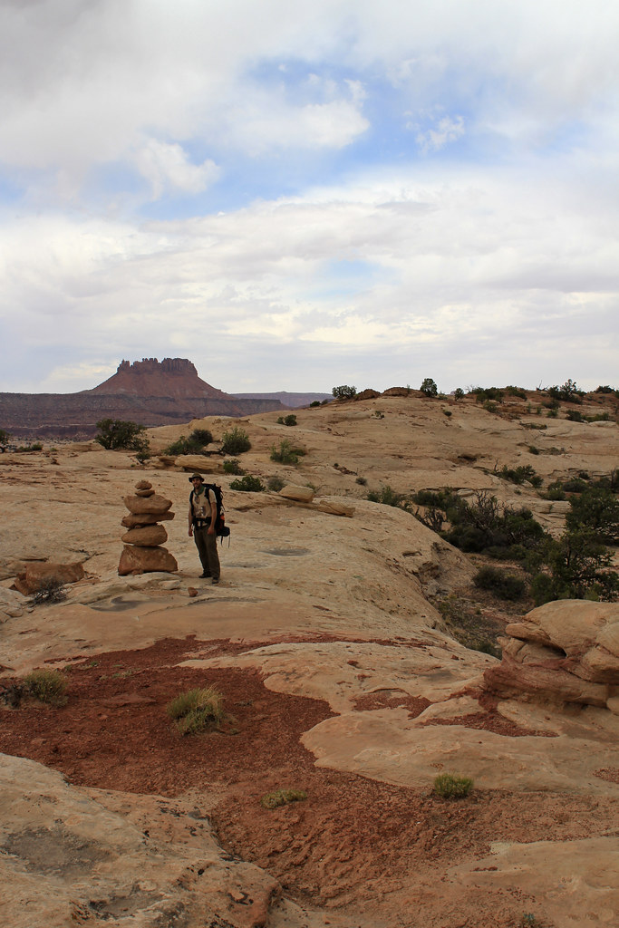
ME AND MONSTROUS CAIRN by NateGeesaman, on Flickr
Chocolate Rain by NateGeesaman, on Flickr
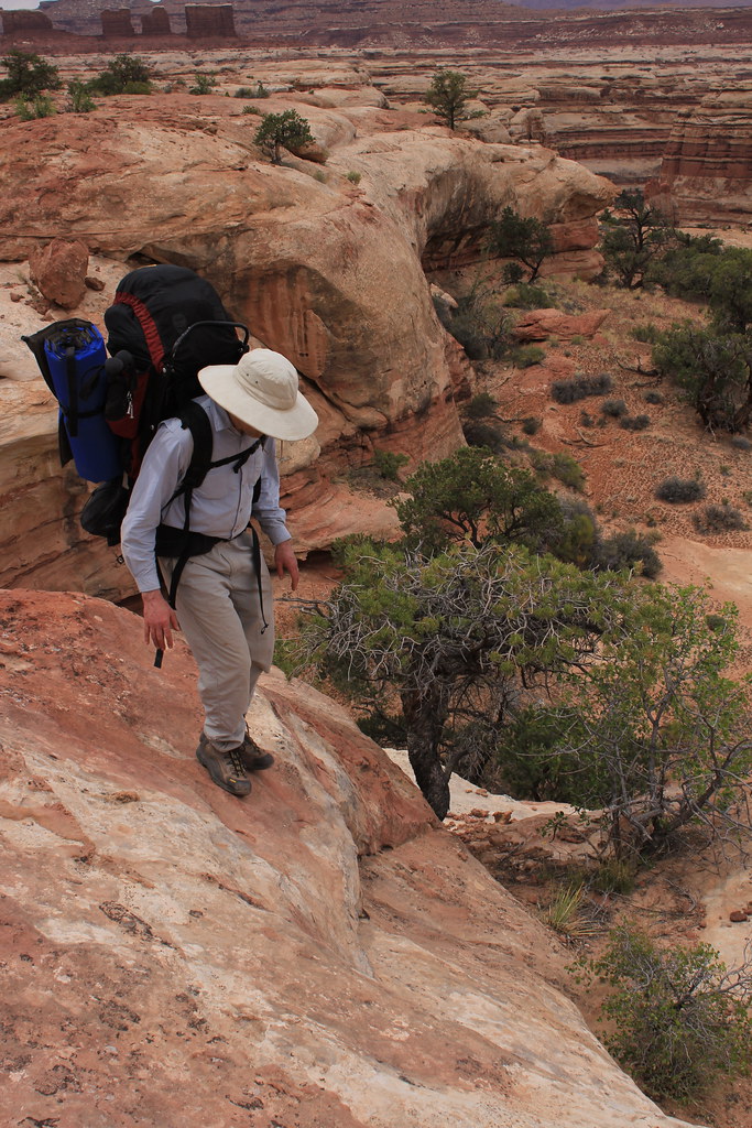
The climb down to Pictograph Fork from Pete's Mesa was steep and we had to use the rope a few times to lower the packs down.
IMG_5627 by NateGeesaman, on Flickr
In good time we arrived at Pictograph Fork where we intended to camp and found a fine spot close to the water.
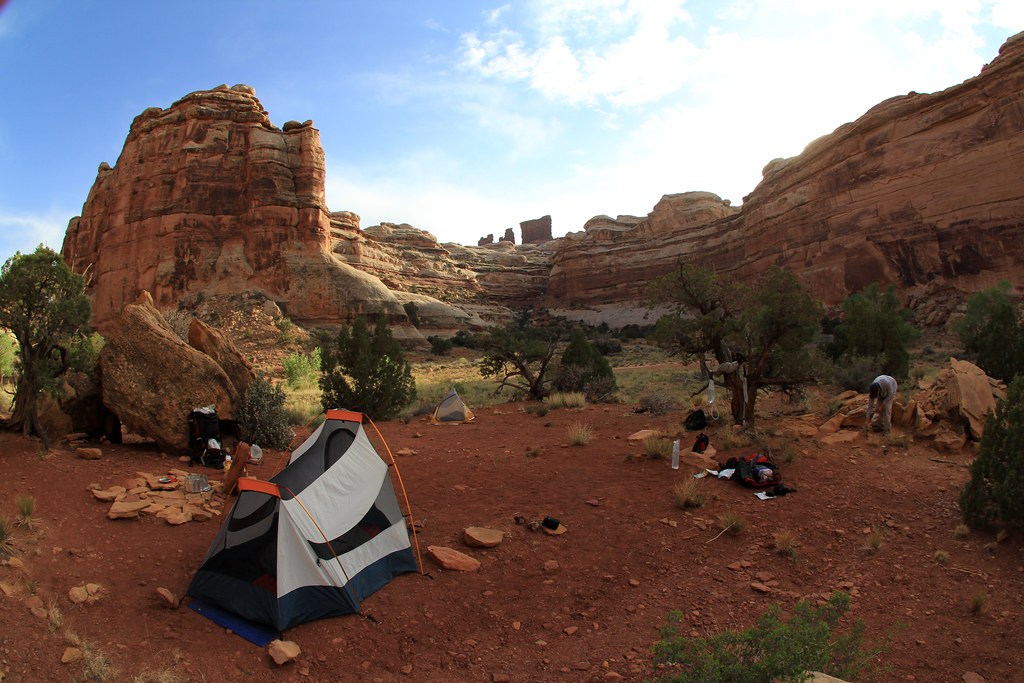
Maze Camp 3 by NateGeesaman, on Flickr
You can see a bunch of rocks put out on the floor and one big rock jutting out for back support in what was an awesome place to sit back and enjoy. Looking up from this seat gave you a great view up at the massive sandstone spire that we were stationed next to.
IMG_5802 by NateGeesaman, on Flickr
After making dinner at camp we decided to make the short jaunt over to The Maze Overlook climb to look for the spring and perhaps climb up to the overlook. I know in retrospect that we stopped looking for the spring just short of its location. Adam headed back to camp, and I tried to get as close to The Maze Overlook as I could. I saw last light on The Chocolate Drops along the way.
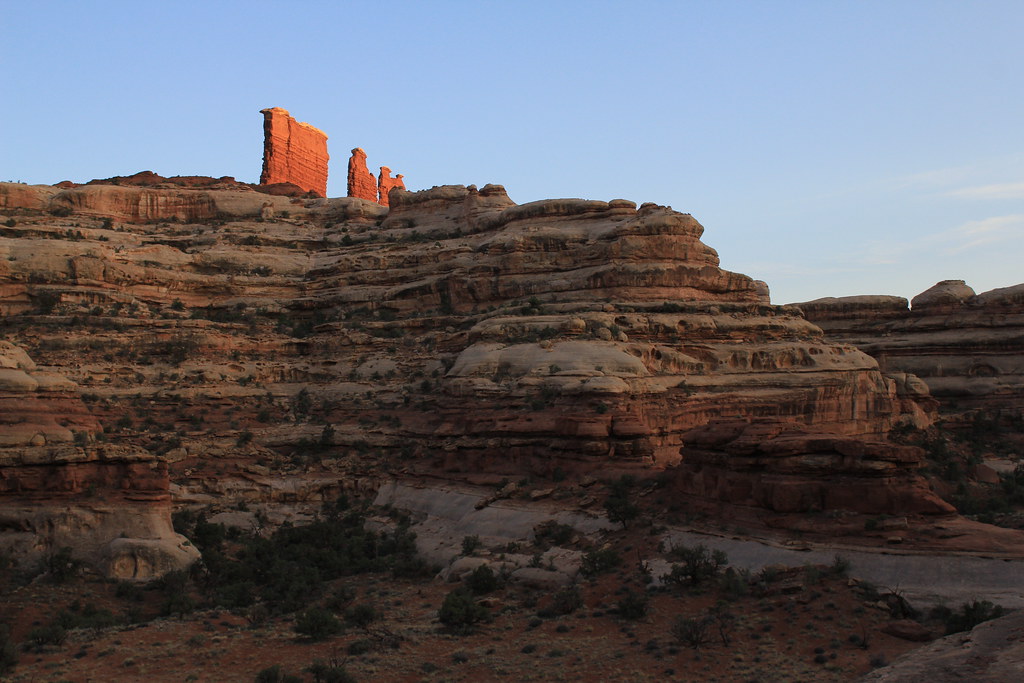
Last Light on The Chocolate Drops by NateGeesaman, on Flickr
Some of the climbing along this trail was too much for me to think about doing the other way in the dark, so as the light faded I stopped, took some selfles, and turned around.
Climbing up to The Maze Overlook by NateGeesaman, on Flickr
I met Adam back at camp and drank some whiskey soaking in the beautiful views around our great camp spot. It was mostly cloudy that night and this was the best star trail I could get in those conditions.
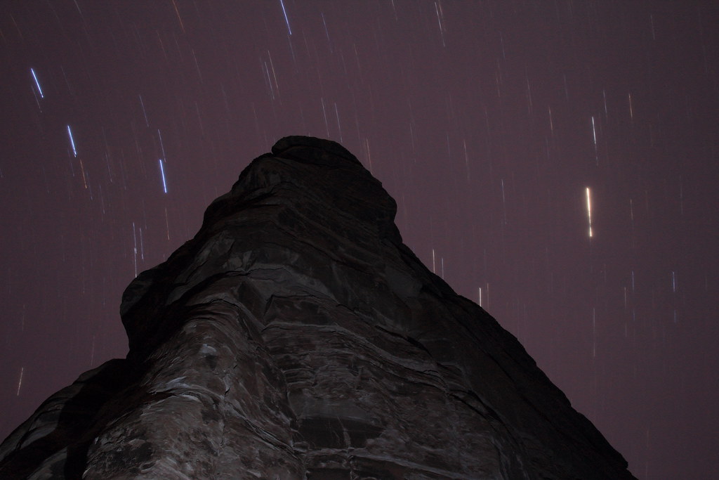
Maze Camp 3 trails by NateGeesaman, on Flickr
The next day we made our way towards The Dollhouse with our packs full of water and our legs sore from the previous 3 days hiking. So we said our goodbyes to the spring and The Chocolate Drops.
Chocolate Pano by NateGeesaman, on Flickr
I was moving slowly along trying to conserve my energy for the last hot miles we were going to encounter that day. A welcome break in the shade came at The Harvest Scene Petroglyph Panel.
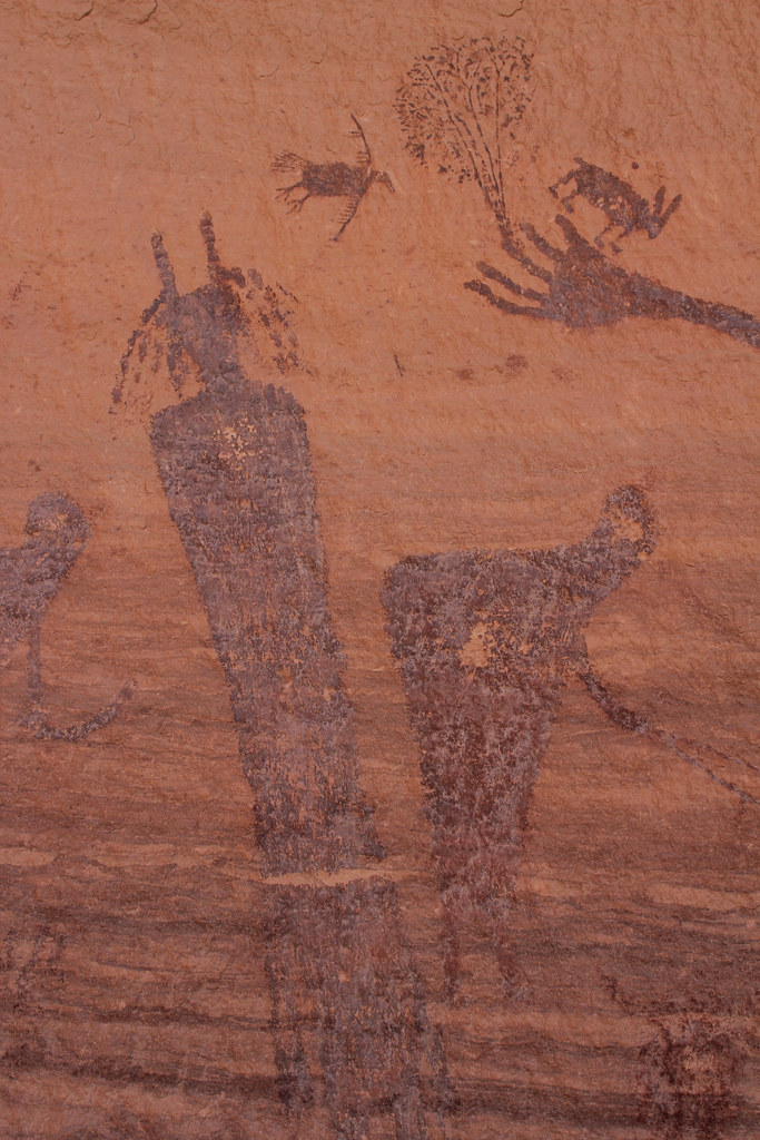
Harvest Chunk by NateGeesaman, on Flickr
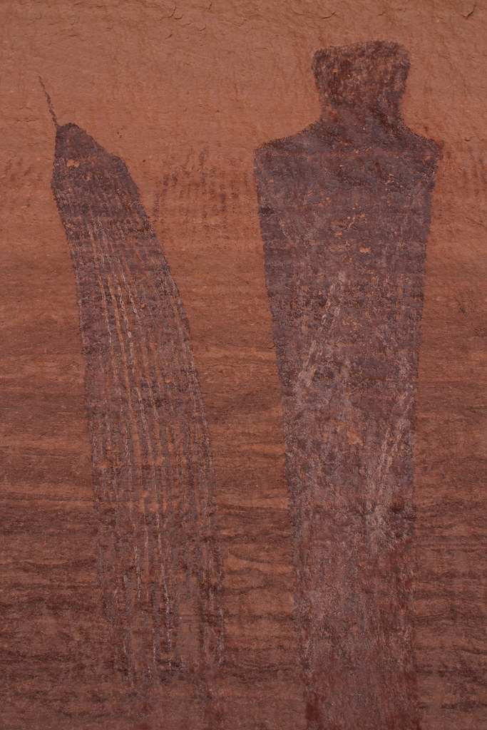
Harvest Chunk 2 by NateGeesaman, on Flickr
Harvest Chunk C by NateGeesaman, on Flickr
Harvest Chunk D by NateGeesaman, on Flickr
Harvest E by NateGeesaman, on Flickr
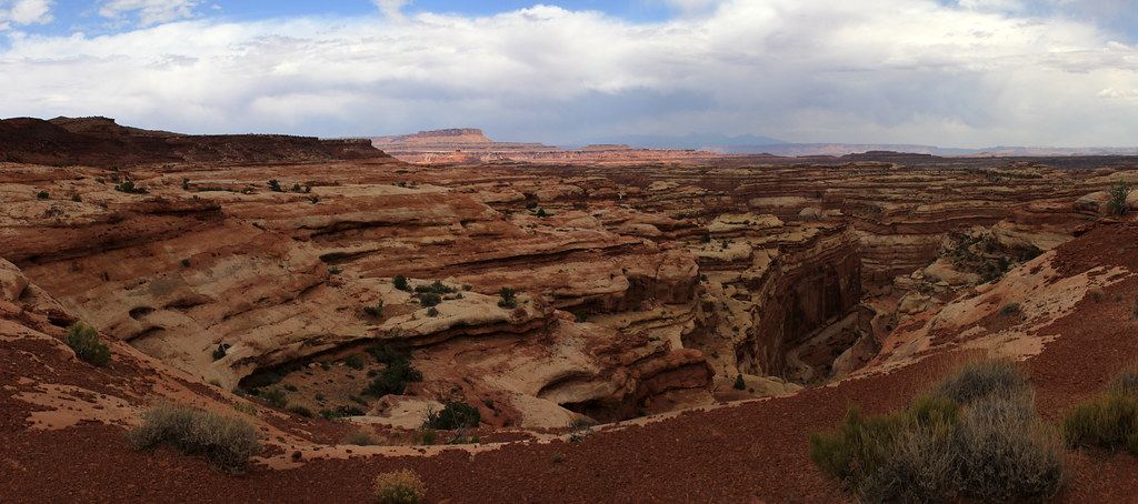
The walk through the bottom of The Maze was great. The winding striped walls and all the great growth down there in the bottom made for a great trail experience. Eventually, we made it to the climb out from Pictograph Canyon.
Picto Canyon Exit by NateGeesaman, on Flickr
I saw this great cairn along the climb out.
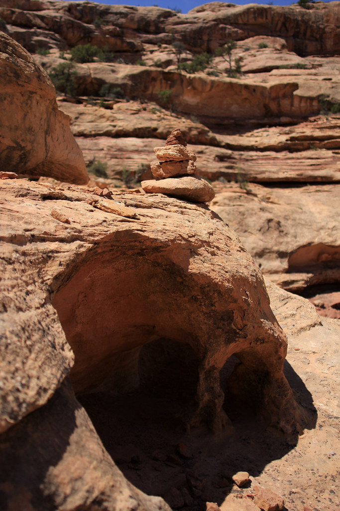
Awesome Trail by NateGeesaman, on Flickr
I also saw the beautiful dry trail of a waterfall, but the lighting was really harsh. These are the best I could manage.
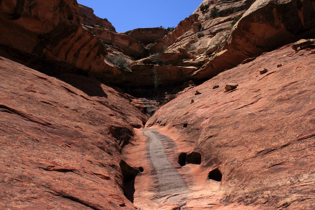
Picto Canyon Exit by NateGeesaman, on Flickr
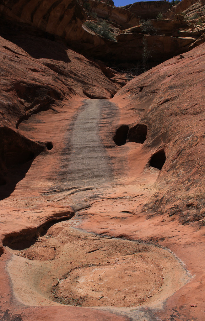
Picto exit slide by NateGeesaman, on Flickr
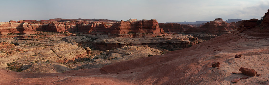
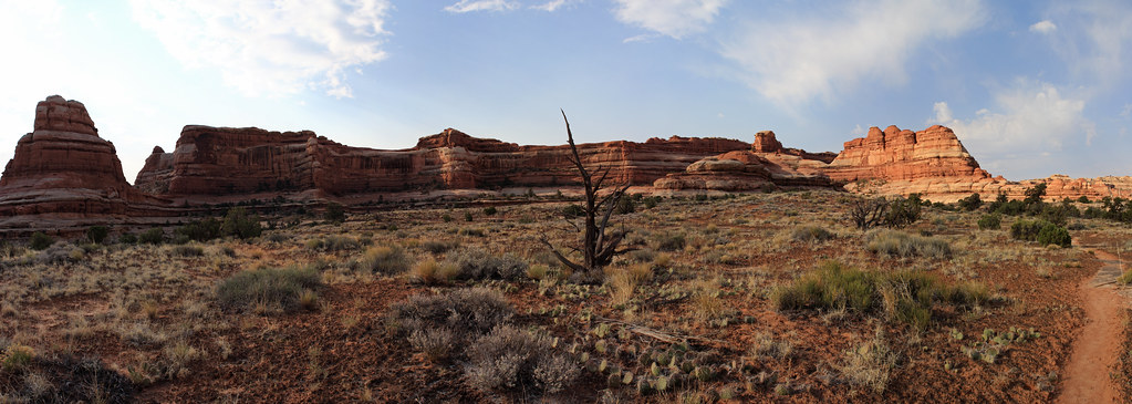
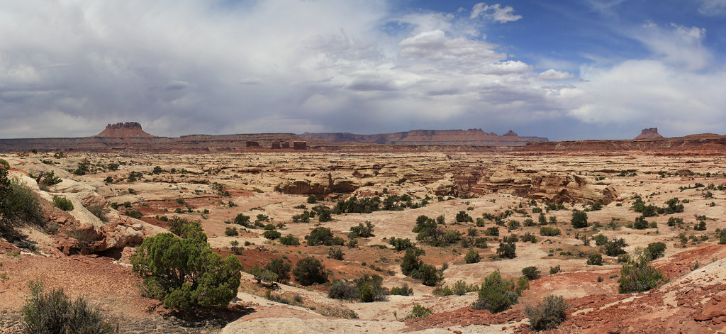
This next shot is a 4 shot stitch of the upper reaches of Water Canyon in the Maze District of Canyonlands shot on 5-17-12 as we made our way back towards the Colorado River to be picked up. We took a break at Chimney Rock and took the packs off. I was drawn in by the view into this magnificently colored canyon and had to take the opportunity to use the break in our travels to hike down to the ridge between Water and Shot Canyons and get some good panos of the area. Only after looking at a map did I realize I had been seduced by the beauty of this canyon into adding about 4 extra miles to my hiking that day. I left my companion resting in the shade by Chimney Rock for longer than I thought and I was thankful for his understanding that I was hypnotized by the views. This may well be my favorite shot I got out there.
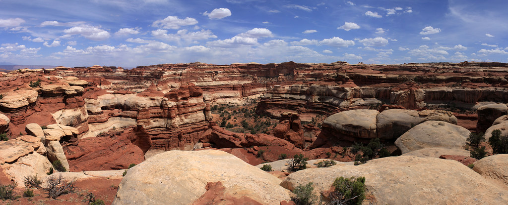
Upper Water Canyon Pano by NateGeesaman, on Flickr
Then we made our way back towards the Dollhouse and set up camp along the start of Beehive Arch Trail. We rested a bit after the long hot slog we had just completed. We ate some grub and got going along The Dollhouse Loop Trail hoping to catch a sunset.
Dollhouse Afternoon by NateGeesaman, on Flickr
Dollhouse Dusk by NateGeesaman, on Flickr
IMG_6296 by NateGeesaman, on Flickr
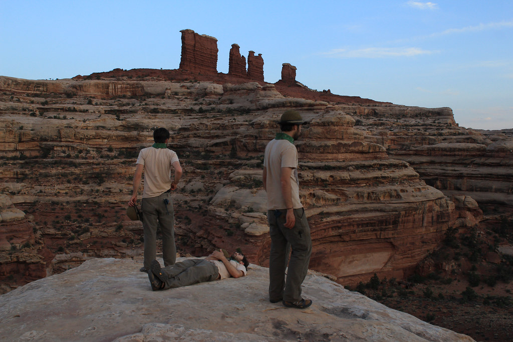
And we went to the Surprise Valley Overlook to enjoy the blues of the desert
Suprise Valley Sunset by NateGeesaman, on Flickr
Then it was a decent walk in the dark back to camp and I passed out exhausted from a long days journey.
We wanted to make our way back to The Dollhouse early so I could get some sunrise shots and we would be assured of having plenty of time to meet Tex's down in Spanish Bottom for a ride back to Moab.
Here is my favorite shot I got that sunrise of Adam doing his morning prayer.
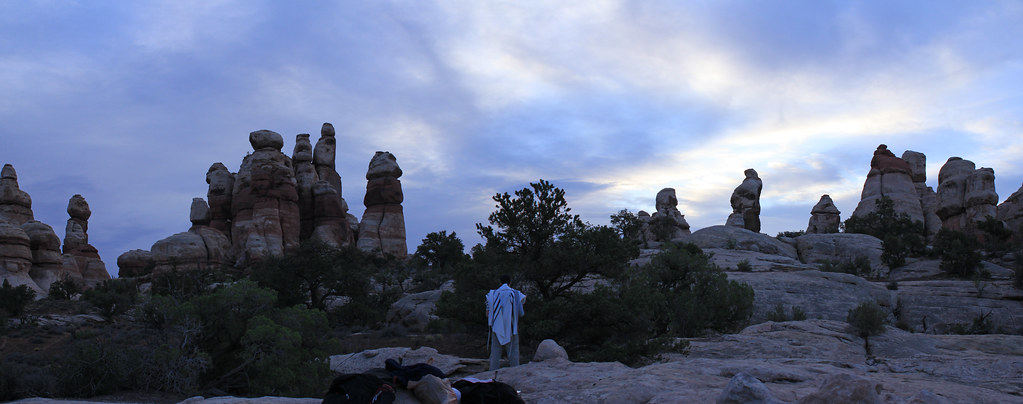
Adam Prayer by NateGeesaman, on Flickr
Dollhouse Sunrise 2 by NateGeesaman, on Flickr
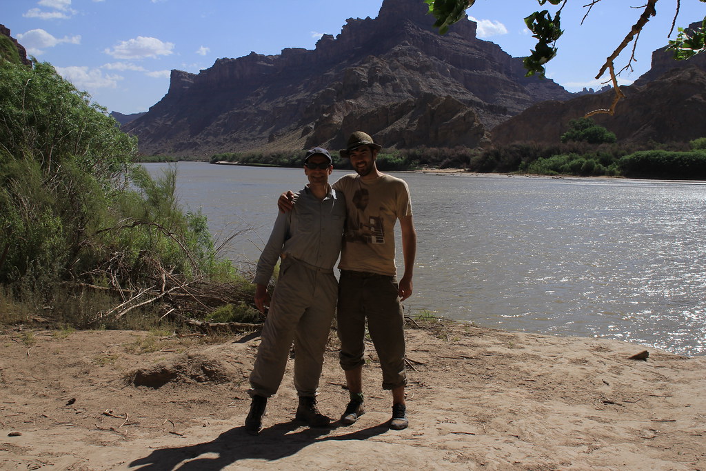
Then came the long decent to Spanish Bottom where a character of a guide named Johnny of Tag-a-long was enjoying some time off and hanging out at what he called "The Bus Stop." He was fun to talk with and know a lot about Moab and the surrounding areas. He made the wait for the boat a pleasant time. He shot this photo for us. Look Ma! I made a new friend.
IMG_6377 by NateGeesaman, on Flickr
I enjoyed the boat ride home very much because it was windy difficult conditions that out boat driver described as one of the most difficult things he has ever done. It was good to taste beer again thanks to a generous river runner. I looked forward to talking to my girlfriend for the first time in 5 days, and seeing her shortly.
I looked for a hotel room so that my girlfriend and another close friend could come down and have a bed to crash in, but after checking 2 hotels that were all booked I got discouraged and decided to shower at a camp ground and look for something nice on BLM land.
SUCCESS!
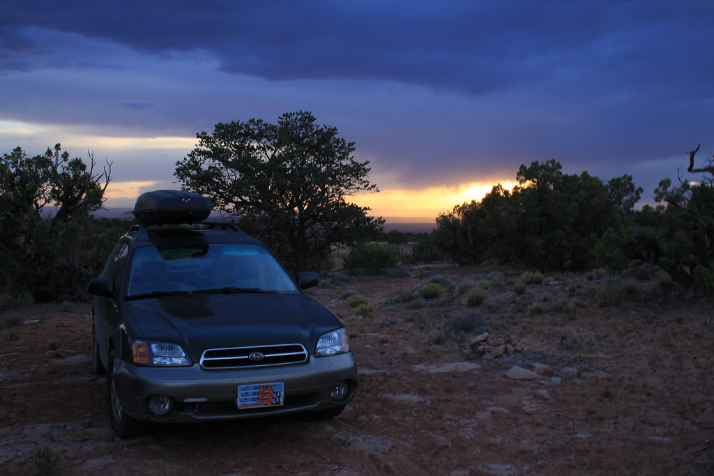
BLM Spot by NateGeesaman, on Flickr
It was great to listen to music for the first time in 5 days and have a fire to keep me company while I awaited my friends. To try and manage the length of this report a little bit, I am just going to tell you that the next day we hiked Tower Arch early in the morning and it was extremely beautiful. We camped at BLM spot again the next night and I got some good stars I have to include in the report.
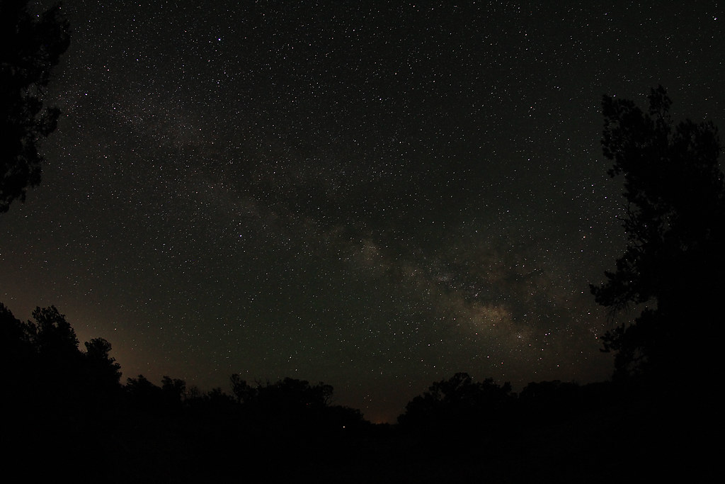
Milky Way Outside Canyonlands by NateGeesaman, on Flickr
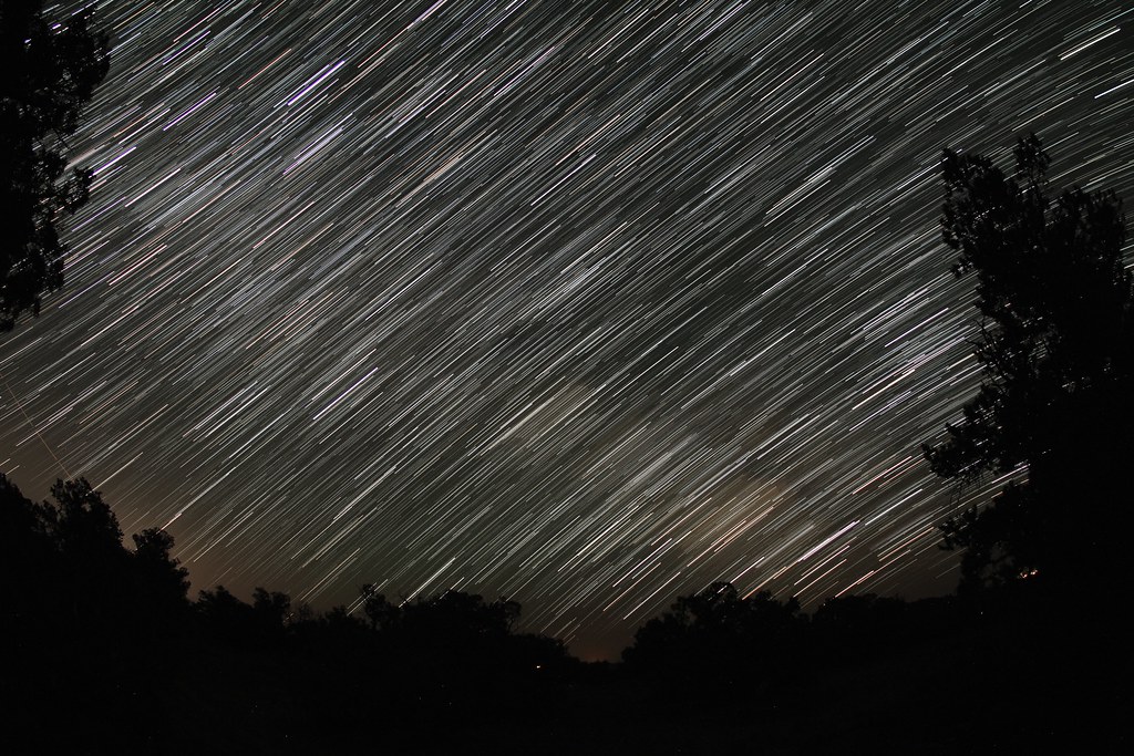
Milky Trails by NateGeesaman, on Flickr
The next day we explored the Behind the Rocks area and went swimming at left hand. Then we watched the eclipse in Arches at Panorama Point where they were having an event. Ariel and I celebrated our time together (4 years) with a nice meal in town before heading back to SLC. Here is Ariel at Left Hand:

IMG_7119 by NateGeesaman, on Flickr

IMG_7107 by NateGeesaman, on Flickr
I consider myself extremely lucky to have shared a chunk of my life with Ariel and I would rather have spent the last 4 years with no one else. I hope we can continue to be a good presences each others lives.
Featured image for home page:

Water Canyon Sunrise by NateGeesaman, on Flickr
We got moving early to take advantage of the cool morning.
Morning through Water Canyon by NateGeesaman, on Flickr
The early morning light was great as we made our way along the pass to Shot Canyon.
over to shot trail by NateGeesaman, on Flickr
Shot Morning Pano 2 by NateGeesaman, on Flickr
Shot Morning Pano by NateGeesaman, on Flickr
Water Shot Pass Pano by NateGeesaman, on Flickr
water shot pass pano re-crop by NateGeesaman, on Flickr
WATER SHOT PANO 2 by NateGeesaman, on Flickr
The air was cool and we were making great time as we made our way to the climb out of Shot Canyon towards Chimney Rock. This climb in particular was interesting because of all the work that must have gone into putting the stones in place to make the climb more manageable for cattle.
Shot canyon climb out by NateGeesaman, on Flickr
Shot Canyon Exit` by NateGeesaman, on Flickr
As we made our way to the top of Shot Canyon dark clouds started to form on the horizon ahead of us.
Dun Dun Duuuunnn by NateGeesaman, on Flickr
Do you think it might rain? by NateGeesaman, on Flickr
Maze Cloud by NateGeesaman, on Flickr
As we were making our way towards Chimney Rock we were forced to converse over what we should do if we had to wait out a storm. We were high on a ridge and lightning was a real danger, but thankfully the cloudbursts seemed to be happening on either side of us while the skies overhead threatened, but never produced much moisture.
Cloudburst Pano by NateGeesaman, on Flickr
Pete's Mesa Pano 5 by NateGeesaman, on Flickr
Adam and Chimney by NateGeesaman, on Flickr
Chimney Rock Verto by NateGeesaman, on Flickr
We took a long break to eat at Chimney Rock and I went exploring looking for a good pano of Upper Water Canyon. This is what I came up with:
Upper Water Canyon 2 by NateGeesaman, on Flickr
I was really sucked in by the view from Chimney Rock of this beautiful canyon. I was hypnotized by the red and white striped walls and spires. Drawn in looking for the best vantage point. I had better luck on my next visit.
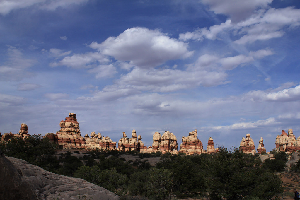
So we began the journey from Chimney Rock along the Pete's Mesa Trail North. Great skies and 360 degrees of beautiful expansive views of The Maze made for a real walk to remember. Pete's Mesa is up there with my favorite walks I have ever taken.
The clouds made for extremely pleasant temperatures which should have helped our pace, but I had a hard time walking 10 steps without taking photos up there.
Elaterite Lit 2 by NateGeesaman, on Flickr
Pete's Mesa Trail Pano 4 by NateGeesaman, on Flickr
Re cropped this one to get a better look at the golden light poking through the clouds:
Pete's Mesa Pano 8 by NateGeesaman, on Flickr
Lit Elaterite by NateGeesaman, on Flickr
Pete's Mesa Pano 2 by NateGeesaman, on Flickr
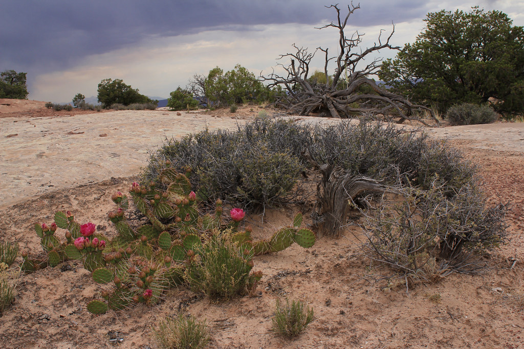
The views would not stop. Beautiful blue La Sals, Towering glowing buttes, bursting clouds, dark gloomy canyons, and all the beautiful enduring plants peppered graciously across the landscape eagerly awaiting a drink.
Pete's Mesa Yin Yang by NateGeesaman, on Flickr
Pete's Mesa Cacti by NateGeesaman, on Flickr
Pete's Mesa Pano 6 by NateGeesaman, on Flickr
Pete's Mesa Pano 7 by NateGeesaman, on Flickr
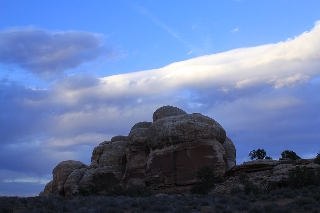
Pete's Mesa provided an excellent view into Jasper Canyon. A special place that has been closed off to humans for a while and cattle have never grazed there, so the fauna is a great selection of native plants.
Pete's Mesa Pano 3 by NateGeesaman, on Flickr
Pete's Mesa Trail by NateGeesaman, on Flickr
ME AND MONSTROUS CAIRN by NateGeesaman, on Flickr
Chocolate Rain by NateGeesaman, on Flickr
The climb down to Pictograph Fork from Pete's Mesa was steep and we had to use the rope a few times to lower the packs down.
IMG_5627 by NateGeesaman, on Flickr
In good time we arrived at Pictograph Fork where we intended to camp and found a fine spot close to the water.
Maze Camp 3 by NateGeesaman, on Flickr
You can see a bunch of rocks put out on the floor and one big rock jutting out for back support in what was an awesome place to sit back and enjoy. Looking up from this seat gave you a great view up at the massive sandstone spire that we were stationed next to.
IMG_5802 by NateGeesaman, on Flickr
After making dinner at camp we decided to make the short jaunt over to The Maze Overlook climb to look for the spring and perhaps climb up to the overlook. I know in retrospect that we stopped looking for the spring just short of its location. Adam headed back to camp, and I tried to get as close to The Maze Overlook as I could. I saw last light on The Chocolate Drops along the way.
Last Light on The Chocolate Drops by NateGeesaman, on Flickr
Some of the climbing along this trail was too much for me to think about doing the other way in the dark, so as the light faded I stopped, took some selfles, and turned around.
Climbing up to The Maze Overlook by NateGeesaman, on Flickr
I met Adam back at camp and drank some whiskey soaking in the beautiful views around our great camp spot. It was mostly cloudy that night and this was the best star trail I could get in those conditions.
Maze Camp 3 trails by NateGeesaman, on Flickr
The next day we made our way towards The Dollhouse with our packs full of water and our legs sore from the previous 3 days hiking. So we said our goodbyes to the spring and The Chocolate Drops.
Chocolate Pano by NateGeesaman, on Flickr
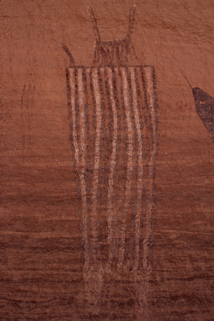
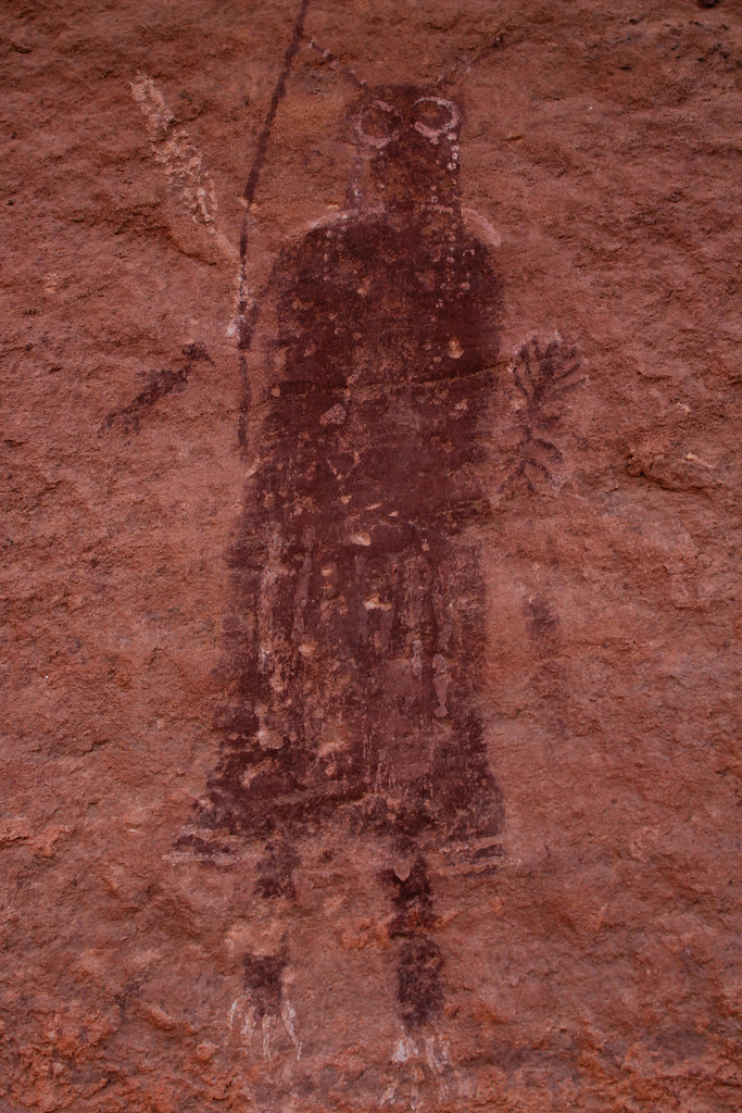
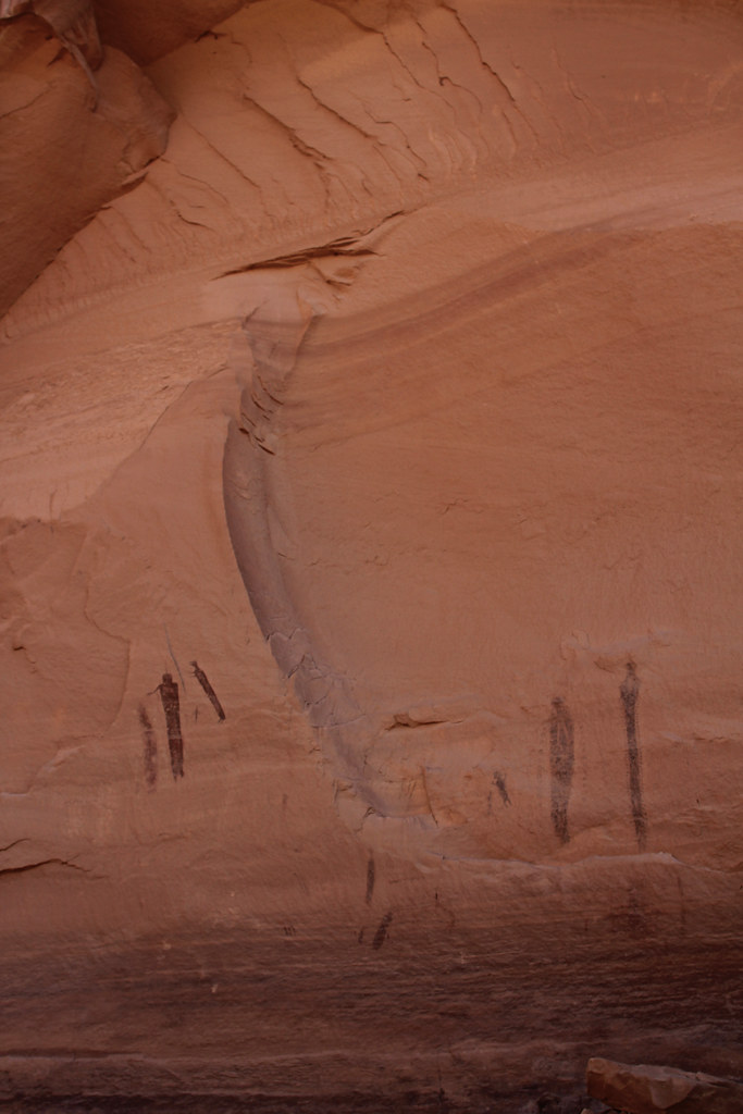
I was moving slowly along trying to conserve my energy for the last hot miles we were going to encounter that day. A welcome break in the shade came at The Harvest Scene Petroglyph Panel.
Harvest Chunk by NateGeesaman, on Flickr
Harvest Chunk 2 by NateGeesaman, on Flickr
Harvest Chunk C by NateGeesaman, on Flickr
Harvest Chunk D by NateGeesaman, on Flickr
Harvest E by NateGeesaman, on Flickr
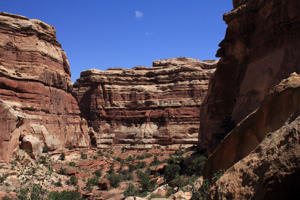
The walk through the bottom of The Maze was great. The winding striped walls and all the great growth down there in the bottom made for a great trail experience. Eventually, we made it to the climb out from Pictograph Canyon.
Picto Canyon Exit by NateGeesaman, on Flickr
I saw this great cairn along the climb out.
Awesome Trail by NateGeesaman, on Flickr
I also saw the beautiful dry trail of a waterfall, but the lighting was really harsh. These are the best I could manage.
Picto Canyon Exit by NateGeesaman, on Flickr
Picto exit slide by NateGeesaman, on Flickr
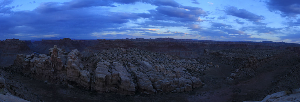
This next shot is a 4 shot stitch of the upper reaches of Water Canyon in the Maze District of Canyonlands shot on 5-17-12 as we made our way back towards the Colorado River to be picked up. We took a break at Chimney Rock and took the packs off. I was drawn in by the view into this magnificently colored canyon and had to take the opportunity to use the break in our travels to hike down to the ridge between Water and Shot Canyons and get some good panos of the area. Only after looking at a map did I realize I had been seduced by the beauty of this canyon into adding about 4 extra miles to my hiking that day. I left my companion resting in the shade by Chimney Rock for longer than I thought and I was thankful for his understanding that I was hypnotized by the views. This may well be my favorite shot I got out there.
Upper Water Canyon Pano by NateGeesaman, on Flickr
Then we made our way back towards the Dollhouse and set up camp along the start of Beehive Arch Trail. We rested a bit after the long hot slog we had just completed. We ate some grub and got going along The Dollhouse Loop Trail hoping to catch a sunset.
Dollhouse Afternoon by NateGeesaman, on Flickr
Dollhouse Dusk by NateGeesaman, on Flickr
IMG_6296 by NateGeesaman, on Flickr
And we went to the Surprise Valley Overlook to enjoy the blues of the desert
Suprise Valley Sunset by NateGeesaman, on Flickr
Then it was a decent walk in the dark back to camp and I passed out exhausted from a long days journey.
We wanted to make our way back to The Dollhouse early so I could get some sunrise shots and we would be assured of having plenty of time to meet Tex's down in Spanish Bottom for a ride back to Moab.
Here is my favorite shot I got that sunrise of Adam doing his morning prayer.
Adam Prayer by NateGeesaman, on Flickr
Dollhouse Sunrise 2 by NateGeesaman, on Flickr
Then came the long decent to Spanish Bottom where a character of a guide named Johnny of Tag-a-long was enjoying some time off and hanging out at what he called "The Bus Stop." He was fun to talk with and know a lot about Moab and the surrounding areas. He made the wait for the boat a pleasant time. He shot this photo for us. Look Ma! I made a new friend.
IMG_6377 by NateGeesaman, on Flickr
I enjoyed the boat ride home very much because it was windy difficult conditions that out boat driver described as one of the most difficult things he has ever done. It was good to taste beer again thanks to a generous river runner. I looked forward to talking to my girlfriend for the first time in 5 days, and seeing her shortly.
I looked for a hotel room so that my girlfriend and another close friend could come down and have a bed to crash in, but after checking 2 hotels that were all booked I got discouraged and decided to shower at a camp ground and look for something nice on BLM land.
SUCCESS!
BLM Spot by NateGeesaman, on Flickr
It was great to listen to music for the first time in 5 days and have a fire to keep me company while I awaited my friends. To try and manage the length of this report a little bit, I am just going to tell you that the next day we hiked Tower Arch early in the morning and it was extremely beautiful. We camped at BLM spot again the next night and I got some good stars I have to include in the report.
Milky Way Outside Canyonlands by NateGeesaman, on Flickr
Milky Trails by NateGeesaman, on Flickr
The next day we explored the Behind the Rocks area and went swimming at left hand. Then we watched the eclipse in Arches at Panorama Point where they were having an event. Ariel and I celebrated our time together (4 years) with a nice meal in town before heading back to SLC. Here is Ariel at Left Hand:
IMG_7119 by NateGeesaman, on Flickr
IMG_7107 by NateGeesaman, on Flickr
I consider myself extremely lucky to have shared a chunk of my life with Ariel and I would rather have spent the last 4 years with no one else. I hope we can continue to be a good presences each others lives.
Featured image for home page:
")