- Joined
- Jul 23, 2013
- Messages
- 1,666
4 Basins. 4 Passes. 4 Days.
This roughly 37 mile trip within the High Uintas Wilderness had been brewing up for about a year.
You see, one of my favorite ways to approach many of my backpacking trips now is to create some sort of unique route for the trip. These routes typically include some combination of well-worn, developed and established trails but also lesser used trails, and of course some off-trail cross country traverses. Even if it's to consist entirely of established trails, I like to mix them up into unique loops or little thru-hikes that likely few others, if any, have done in the same fashion. For just a couple examples from the past, see this little overnight trip I once made happen in Capitol Reef National Park or this ambitious 65 mile route I assembled to lead my wife and I from her childhood home just outside Park City to our home in Provo. I'm not sure why I get such a kick of out it, but I do. I think it just adds a bit more of an adventurous feel and allows me to feel a little bit innovative, a little bit creative, and be a little bit of a pioneer. Rather than always recreate the adventures of others, I like to uniquely create my own personal adventure. I would also liken it to playing connect the dots on a map and seeing what kind of picture I can come up with.
So...what inspired this High Uinta 4-4-4 route? Well, ever since my first trip up to Allsop Lake a few years back with a group of friends including fellow BCP members @Parma @Jackson & @Blake Merrell, I had longed to return and get back onto the ridge that separates Allsop from the basin Priord Lake sits in. Only this time, rather than going back down to a base camp at Allsop as most of our group had done before, I wanted to head down the other side of the ridge and see Priord for the first time. When I got a free weekend to do so, I had hoped to thread the two lakes together in a lollipop loop fashion. But after reviewing maps and putting my creative hat on, I saw that I could expand the loop in a significant way by stretching it out into the Rock Creek basin and the West Fork Blacks Fork basin (aka Dead Horse). And while an avid ultra-runner could certainly complete this route in a day (weather permitting), and a fast-pacing ultralight backpacker could very well still finish it in two days, my objectives for said route would require I allow myself a bit more than a short traditional weekend.
Enter 2020. As with earlier in July, another week opened up in early August allowing me to take some more vacation time and sandwich yet another backpacking trip within another stay with my family at the cabin. For this week, I was able to budget four days to make this trip within another trip happen. I reached out to a friend or two and neither could join up. So this would have to be another solo adventure.
Monday - August 3, 2020
Day 1: Trailhead to Allsop
Miles hiked: 9, Elevation gained: 1850 ft
After spending the morning with my family at the cabin and assembling my gear, I jumped in my car and made the short drive down the road and up to the trailhead for the East Fork Bear River.
It was early afternoon and I now had to hike almost 9 miles to place me at my destination for the night: Allsop Lake. Because there was no stretch of the route I'd be hiking this day that I had not previously covered, I did not feel I'd be missing out on anything by hiking at a bit more of a hurried pace.
The trail starts off with a short bit through a lush little aspen grove before following a series of boardwalks through an old burn scar, the result of a 10,000 acre fire that erupted in 2002 caused by an unfortunate incident at the nearby Boy Scout Camp. While such fires are certainly unfortunate, especially when they are human caused given how long it takes for such areas to recover from, the silver lining is that with all the dead trees left in the wake, the views can really open up through sections such as this. It can also be a healthy thing for the local eco-system, especially when the trees are already ravaged by beetle infestations, as what has plagued so many parts of the Uintas over the past few decades.
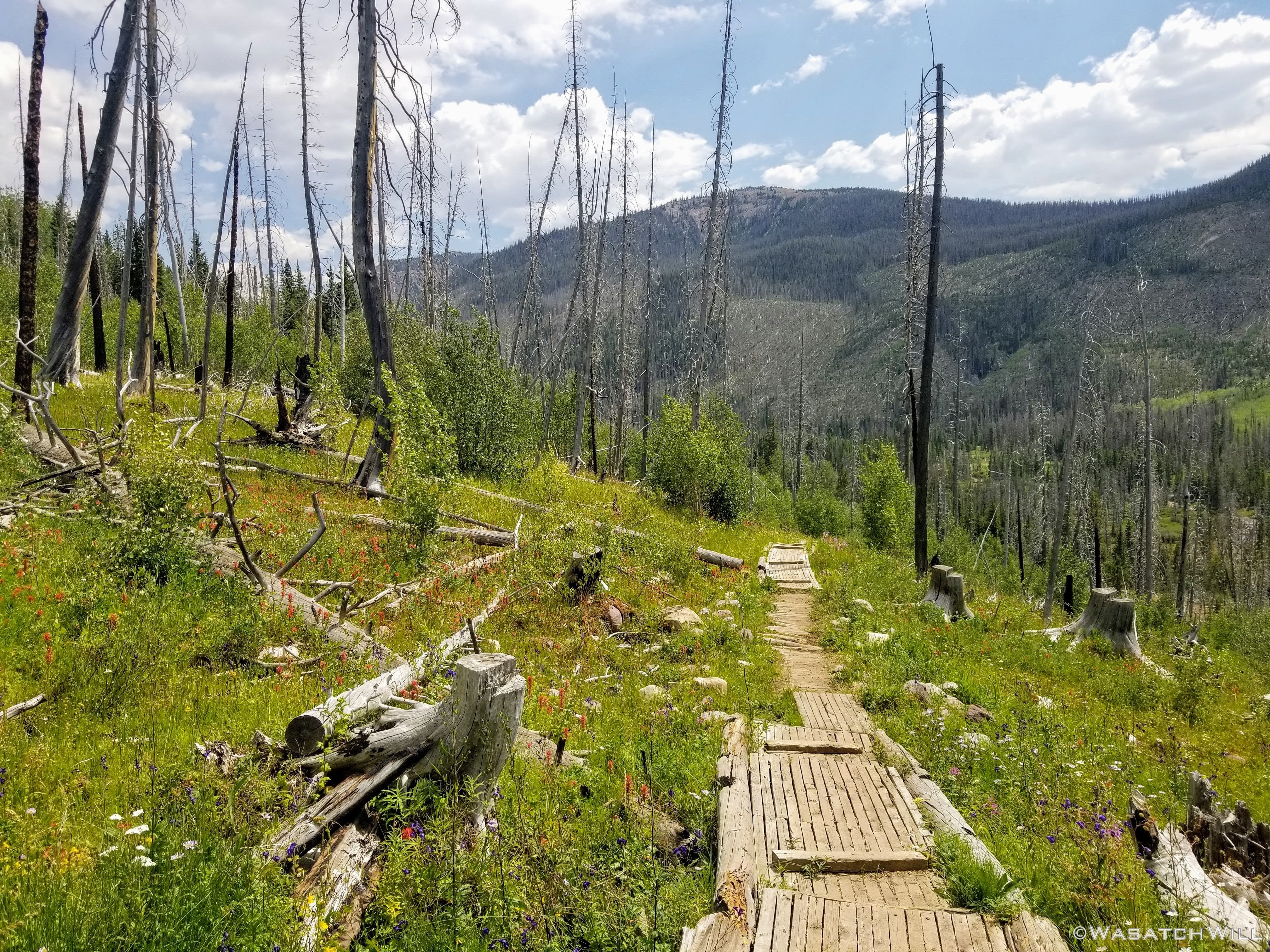
Boardwalks early on along East Fork Bear River Trail
The views don't last long though because after the boardwalks, the trail enters into a dense section of surviving trees.
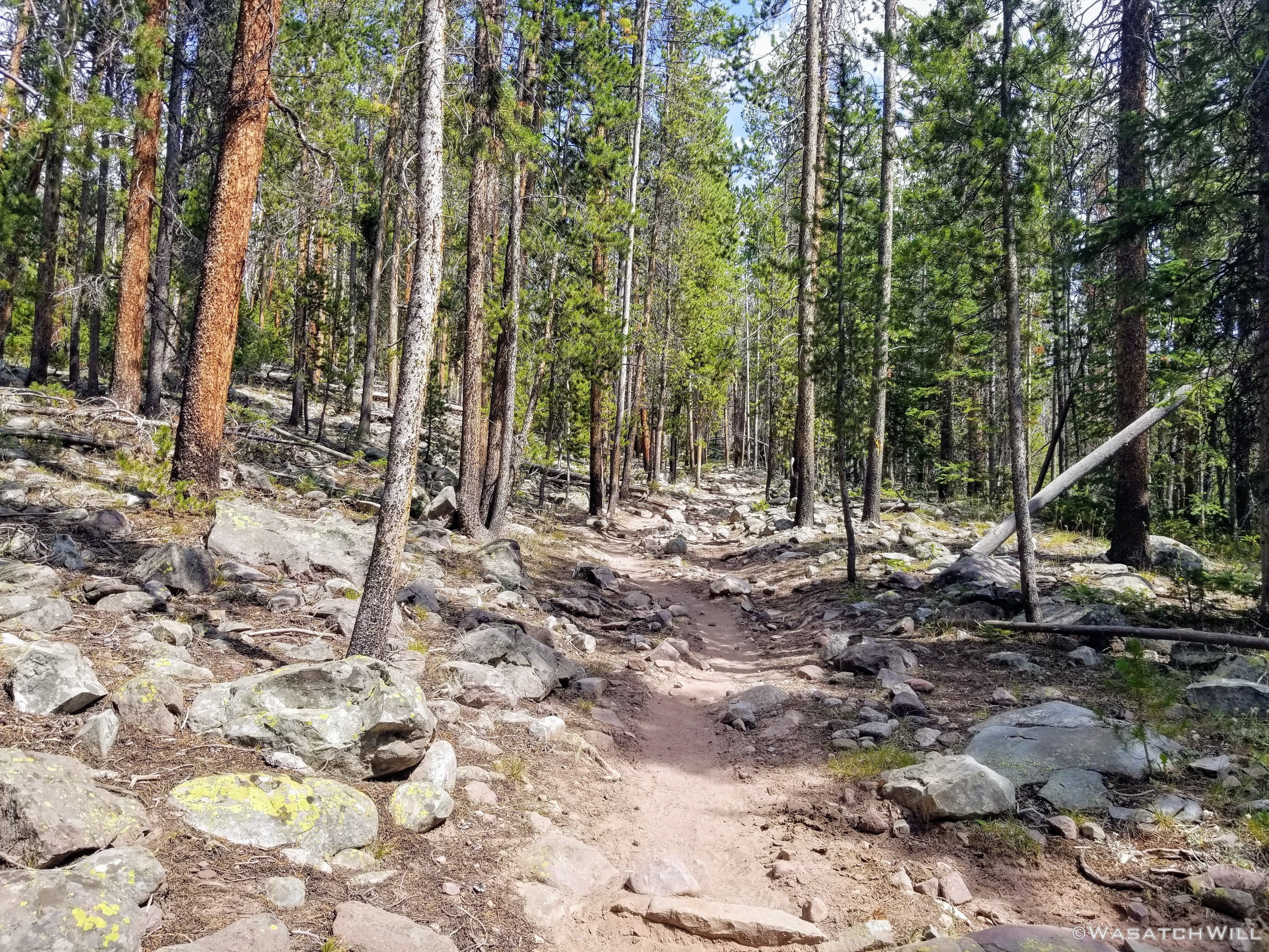
Into some live trees
Of course, the resident cattle herd was there to greet me part way up the trail. Same place they were hanging out last time.

The resident cattle

Old tie-hacker cabin remnants
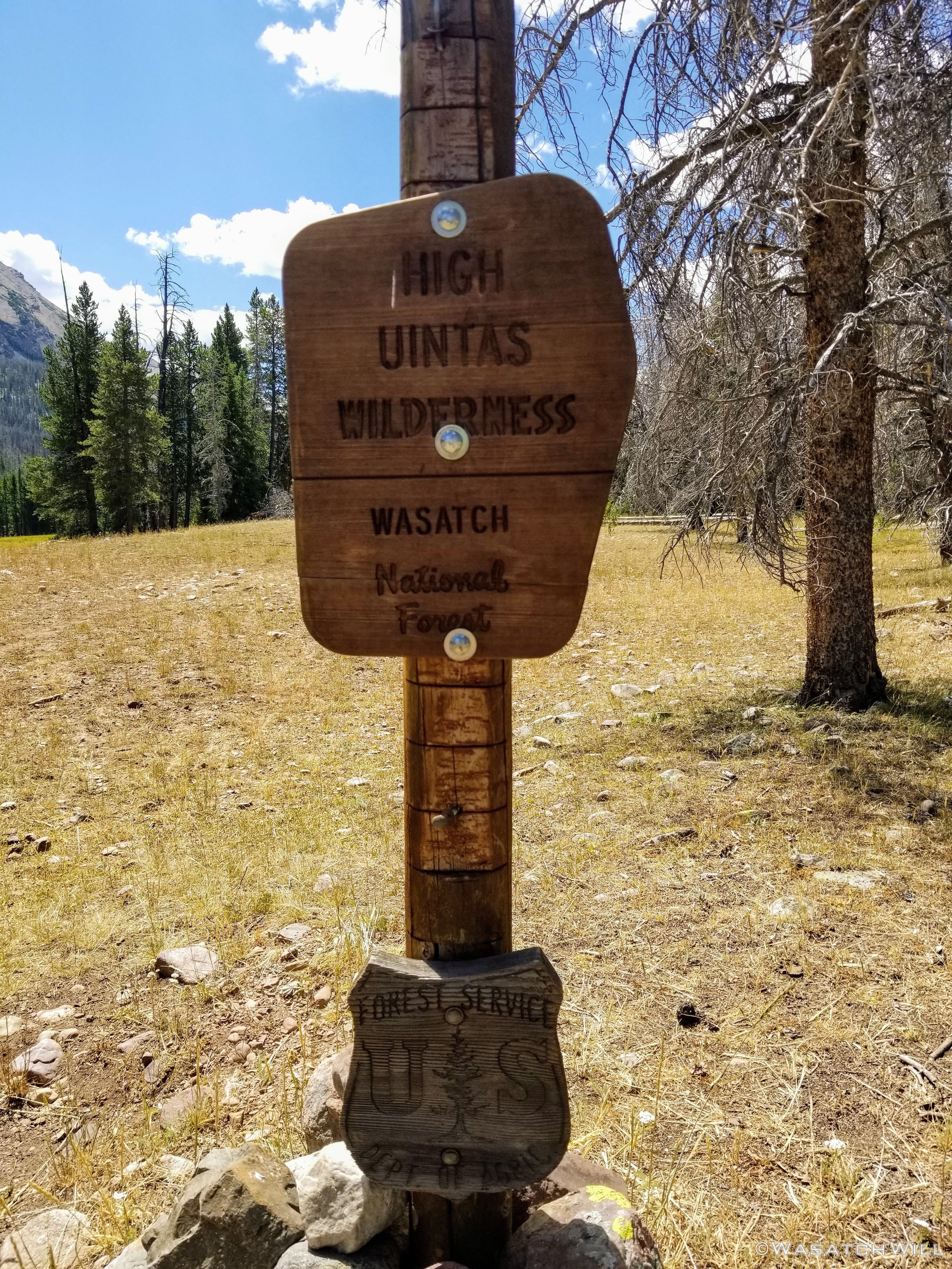
Not long after that, I was officially inside the designated wilderness area.

High Uintas Wilderness boundary marker
Then came the fork with the trail to Priord Lake. Most folks, certainly the more sane ones, opt to turn here if Priord is on their agenda. But of course, that wasn't going to be me this day or the next. Instead, I would opt for a much more strenuous, albeit a much more scenic high route over to Priord the following morning. Bring it on!

Staying true to the left

Waterfall and view up Right Hand Fork
Above the falls
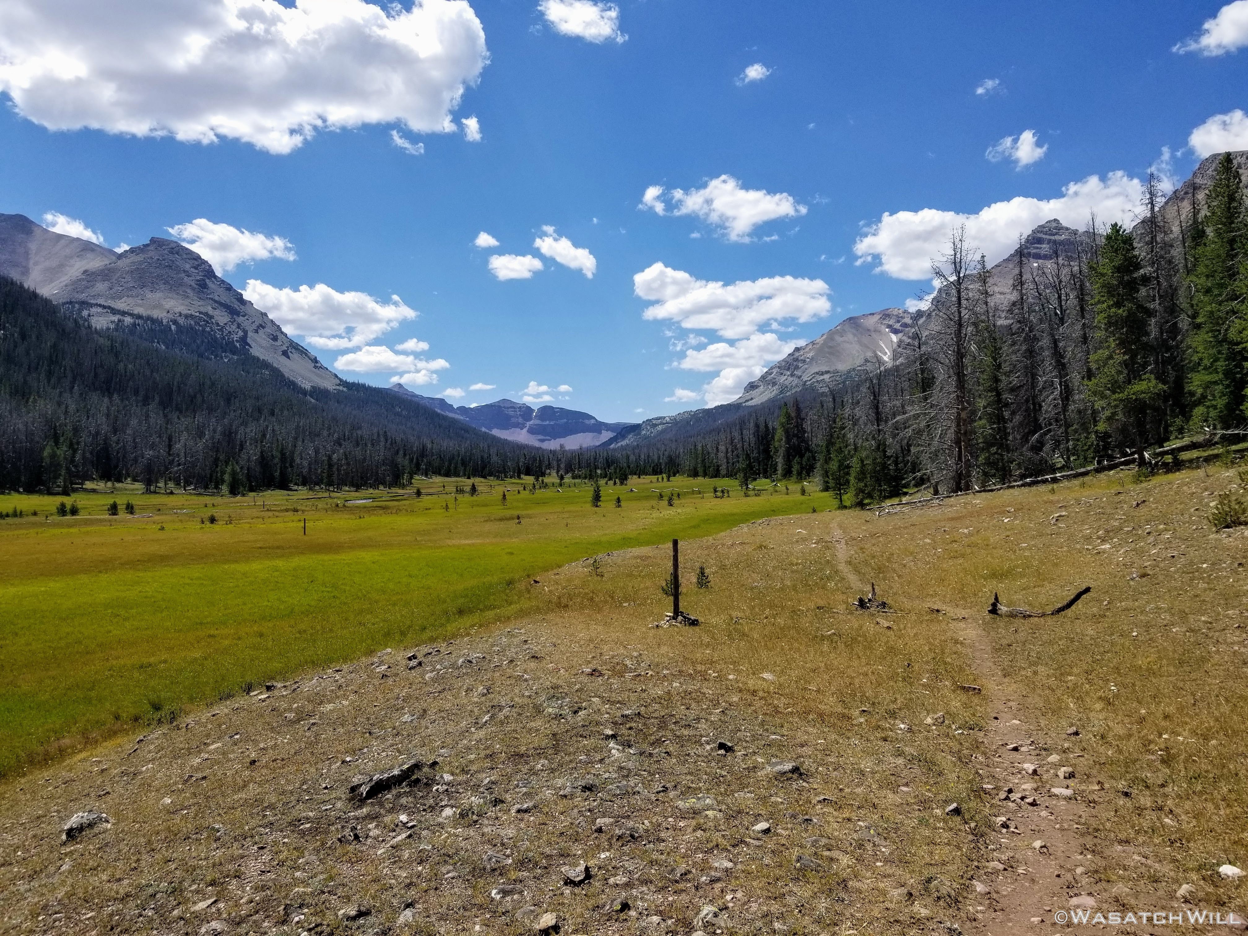
After gaining a rise just after the fork and passing by the nearby waterfall, the trail would continue to weave its way through stands of trees and bigger wide open meadows. These large meadows, stretching between Mount Beulah to the east and The Cathedral on the west serve as my favorite stretches of this particular trail.

Big meadows

Into the Great Wide Open

Looking back up on Mount Beulah
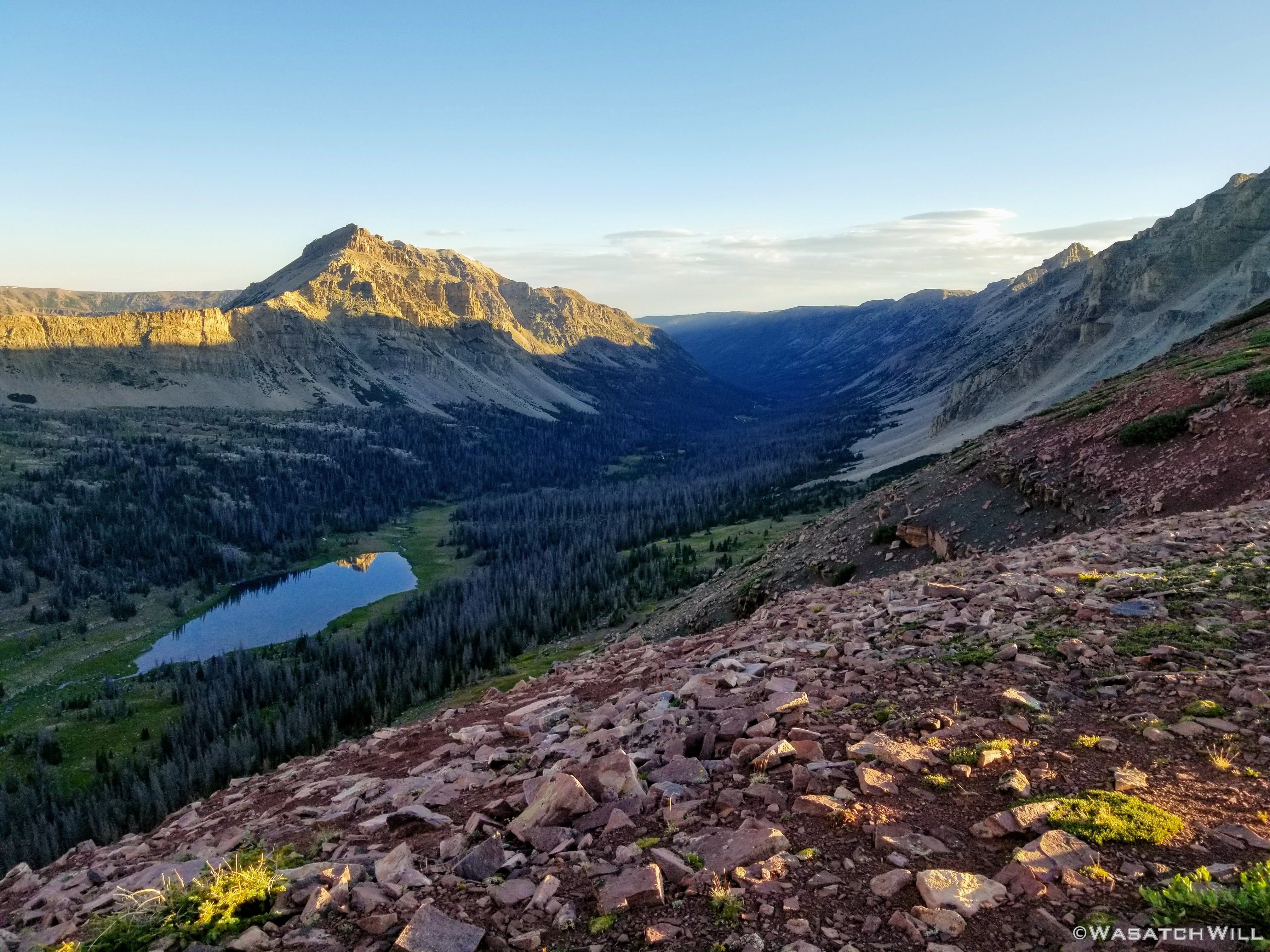
In due time, I finally had Lake Allsop within view, cradled beneath Yard Peak. It has a mesmerizing way of looking like a mirage when you first spot it. There had been at least one other party signed into the register back at the trailhead that looked like they had planned to be at Allsop as well on this night. However, I never saw a trace of anyone around the lake, nor had I since I had left the trailhead. It was looking like I would have the whole lake to myself for the night, a stark contrast to the swarming covid camper crowds huddled all along the Mirror Lake Highway not far away.

Allsop comes into view with Yard Peak above

The waters of Allsop Lake
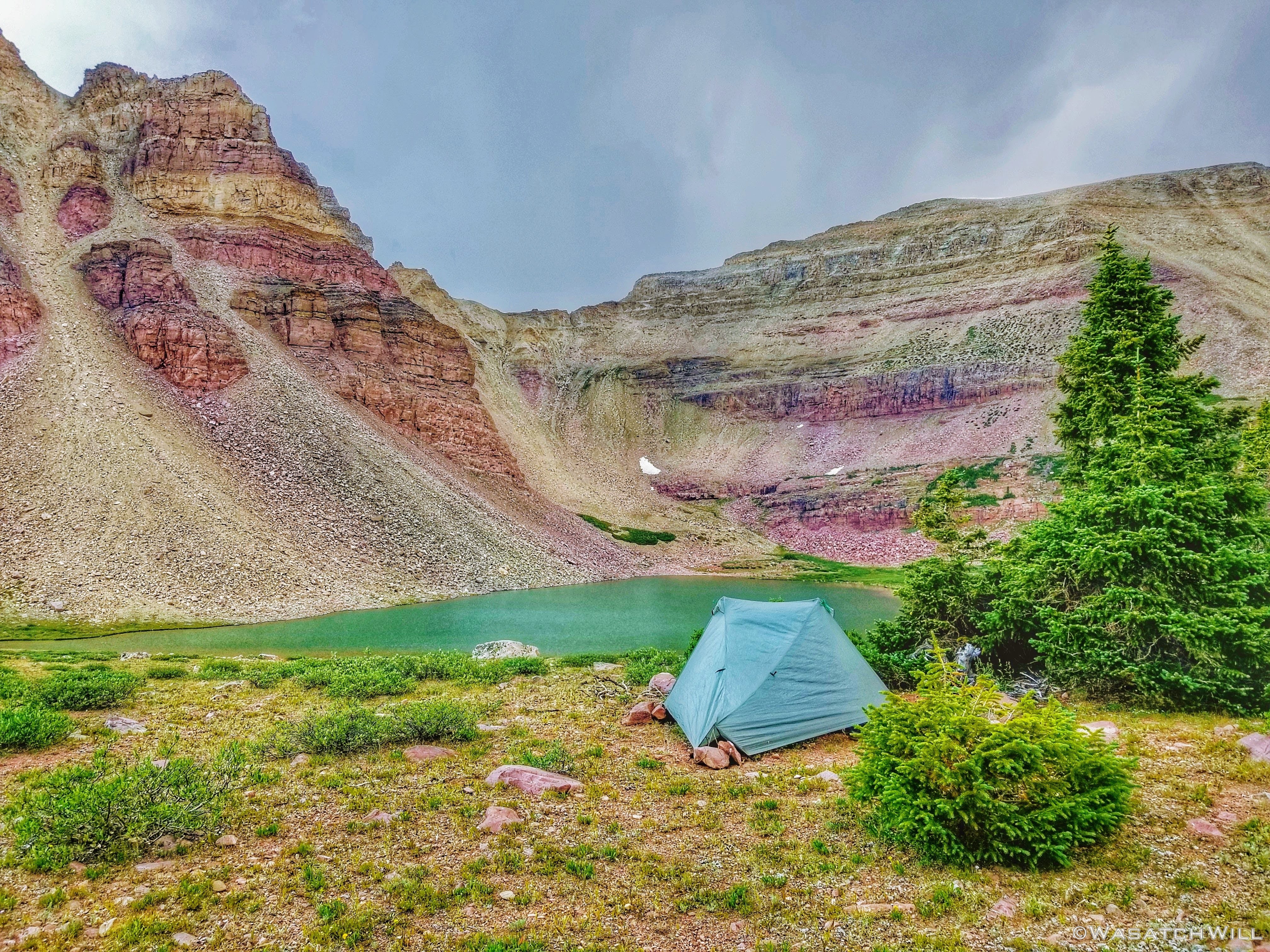
I pushed past the site where I had camped with my group the last time I had been here, and moved on to a clear bench not far from the lake's inlet. There I would stake out my tent for the first night of what would become my most adventurous solo trip yet. Or so I thought. When I went to put up my tent, I could not find my stakes anywhere in my pack.
"Oops...They must have fallen out of my pack's side pocket while laying down in the back of my car on the bumpy dirt road up to the trailhead," I thought to myself, among other things. After all, I usually store my stakes in a little vinyl black envelope originally made to hold a pair of sunglasses which would have camouflaged really well with the protective mat that lines the back of my 4Runner, thus making it easy to miss when I was ensuring I had my pack all set to go.
Trying not to get too upset with myself, I scavenged around for some sturdy little sticks. In that landscape, it proved to be a little bit more difficult than I would have thought because most of the promising looking sticks were too aged and brittle with no strength left in them.
I managed to find some that would get the job done and got out my Mora knife to whittle them down to shape for easier penetration into the tough tundra. I've carried the knife on most trips since I got it a number of years ago but almost never use it, so for the last few trips I'd been contemplating leaving it behind unless I knew for sure I'd be putting it to use such as for batoning wood for a fire which I rarely do in the backcountry now days. I was sure glad I kept it on my pack again for this trip though. I also made sure to pack those newly minted wooden stakes for the remainder of the trip.
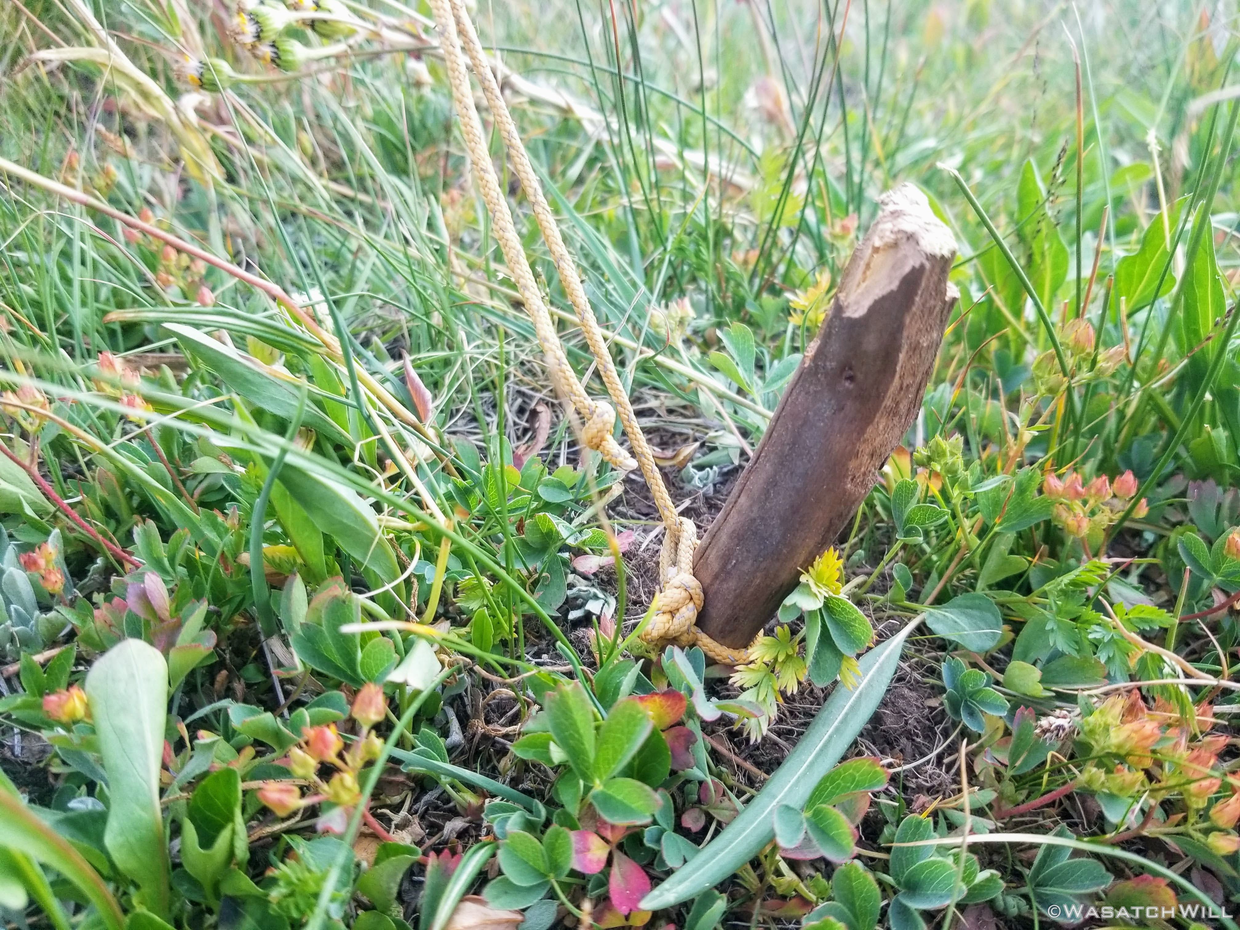
Handcrafted stake

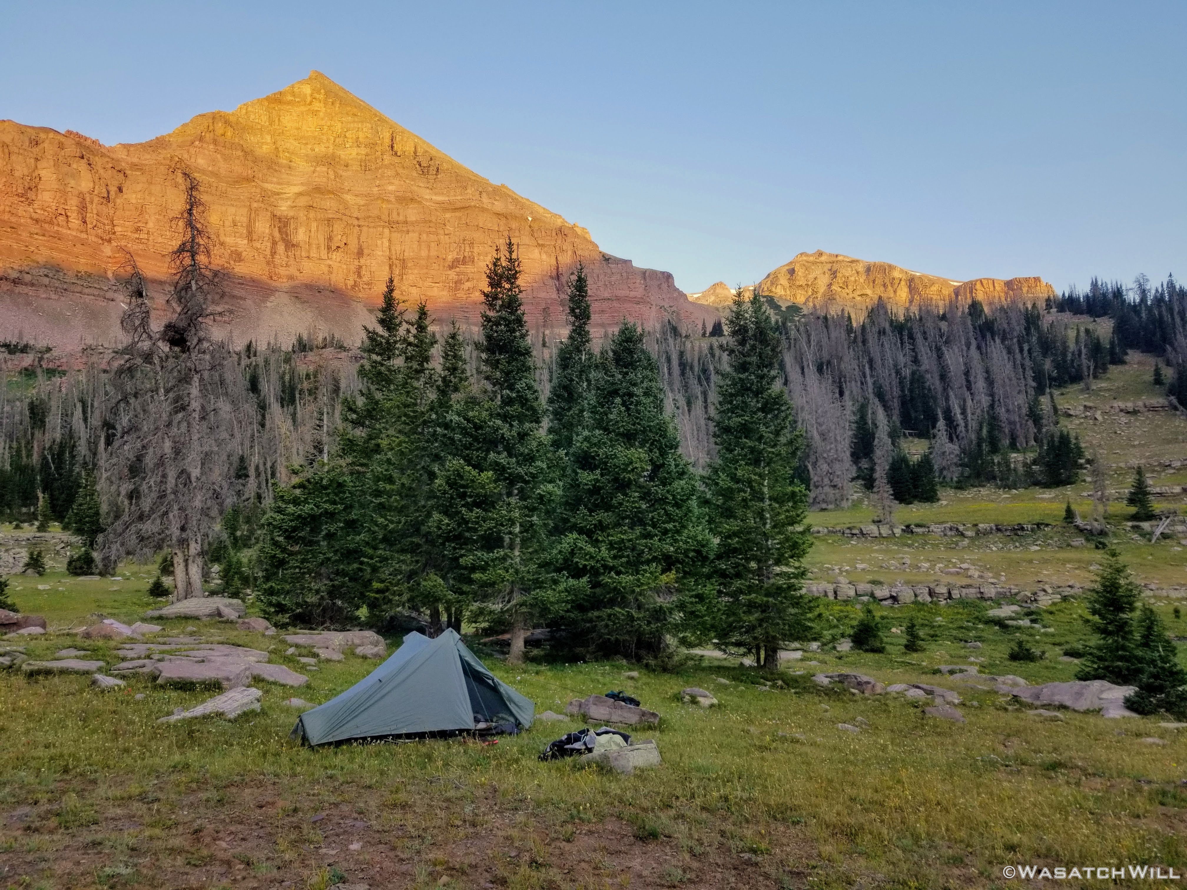
My Tarptent Notch with Mt. Beulah beyond
By the time I finally had my tent up and ate some dinner, there was precious little day light left to attempt some fishing. I went down and tried a few casts, got a couple little hits, but couldn't get anything more than a really small fish to stick.
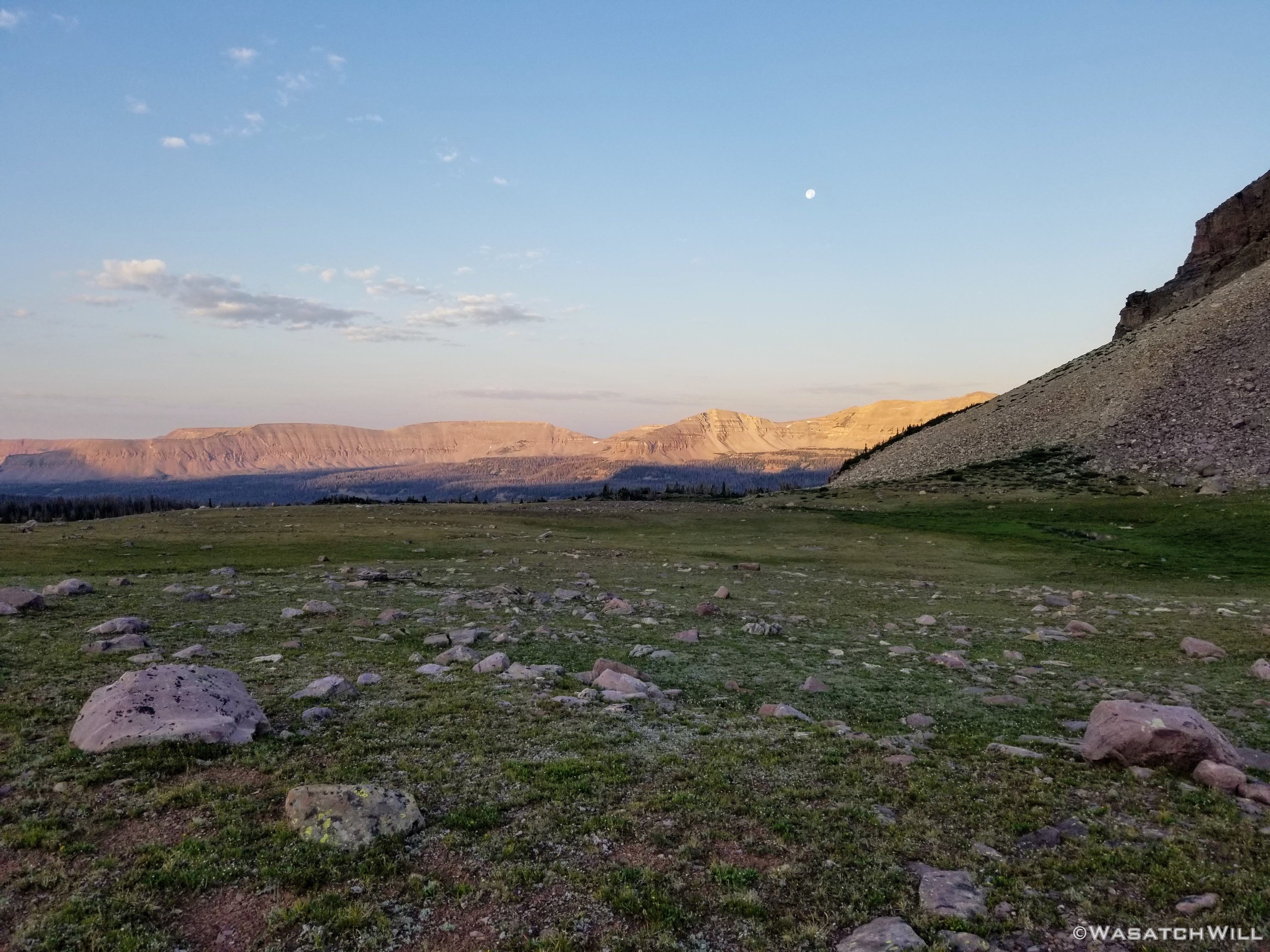
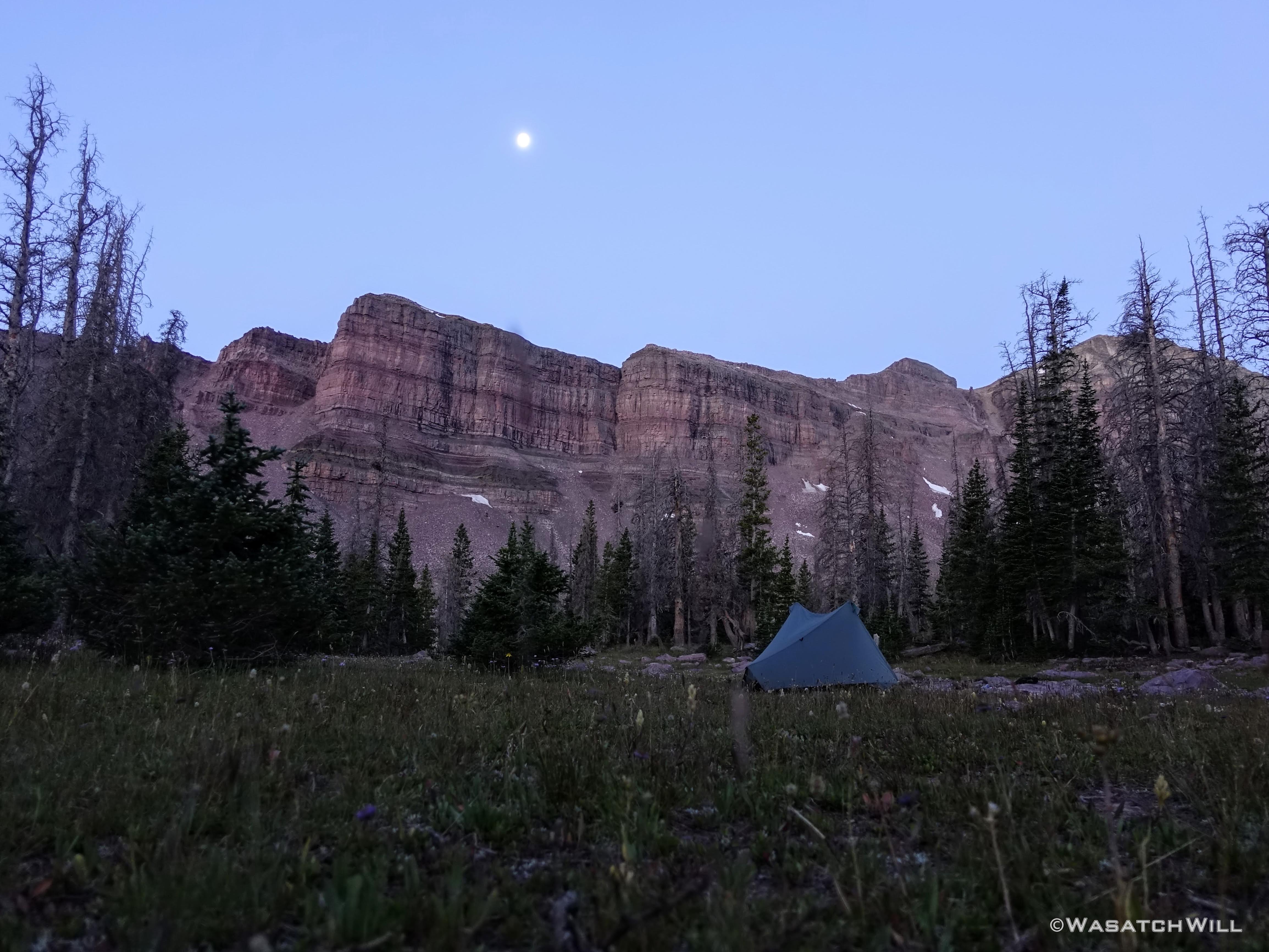
Back at my tent, I retired for the night for an early sleep in anticipation of a big two-pass day to follow. I was awoken to a full moon that had risen up over my tent some time later in the night. I set my camera out on its mini tripod to get a shot of the view from my vestibule looking out toward the Cathedral and then slept the rest of the night away.

Cathedral aglow under full moon
Tuesday - August 4, 2020
Day 2: Allsop to Rock Creek
Miles hiked: 6, Elevation gained: 2600 ft
Morning greeted me with the crisp, cool air and blue bird skies so typical of mountain mornings in the summer. With two passes on the day's itinerary, I didn't mess around much in the morning. I tried fishing for a half hour with no action at all, then committed to packing up and getting on my way. I wanted to be over both passes if at all possible before any serious afternoon thunderstorms could materialize.
From Allsop Lake, there'd be no real trail for a while. In other words, some cross country, off-trail travel and some good ol' fashion boulder-hopping up and down a bunch of talus was now the flavor of the day.
Morning alpenglow on Yard Peak above camp
The Cathedral reflects in Allsop Lake

Yard Peak reflected in Allsop Lake
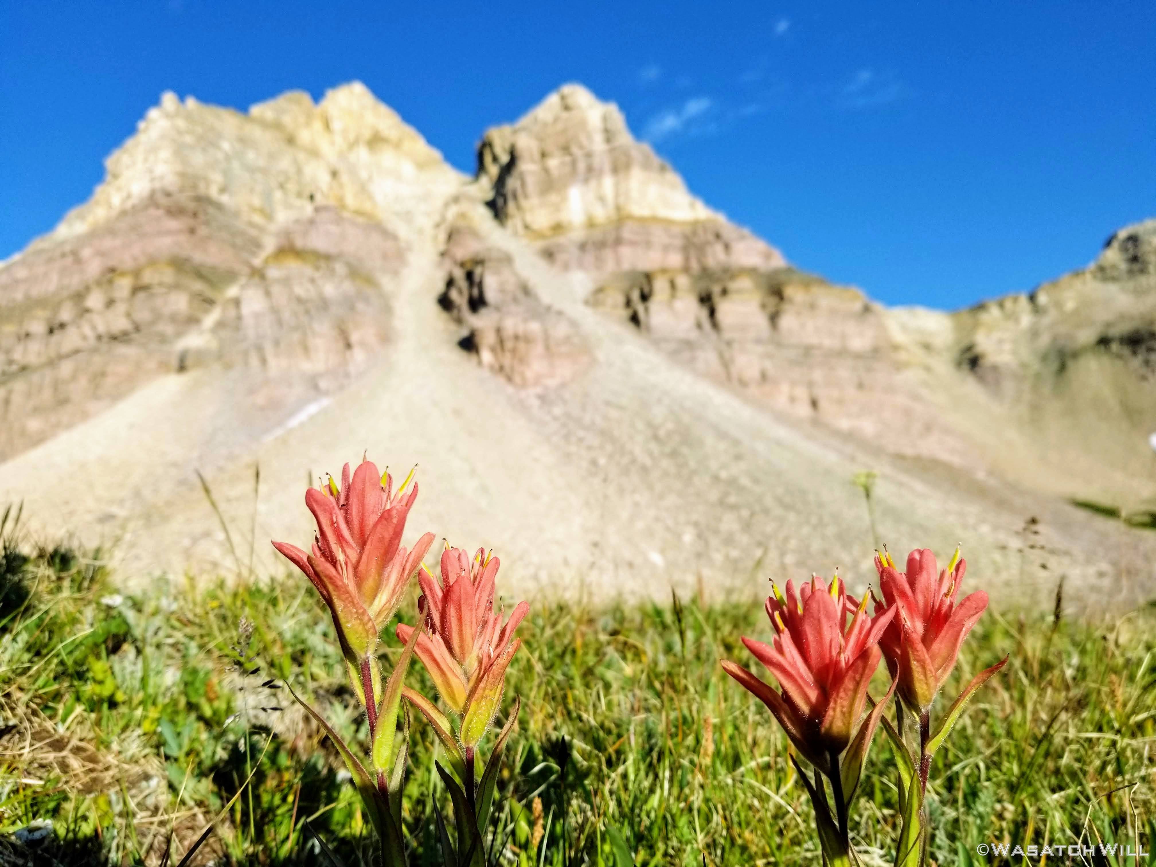
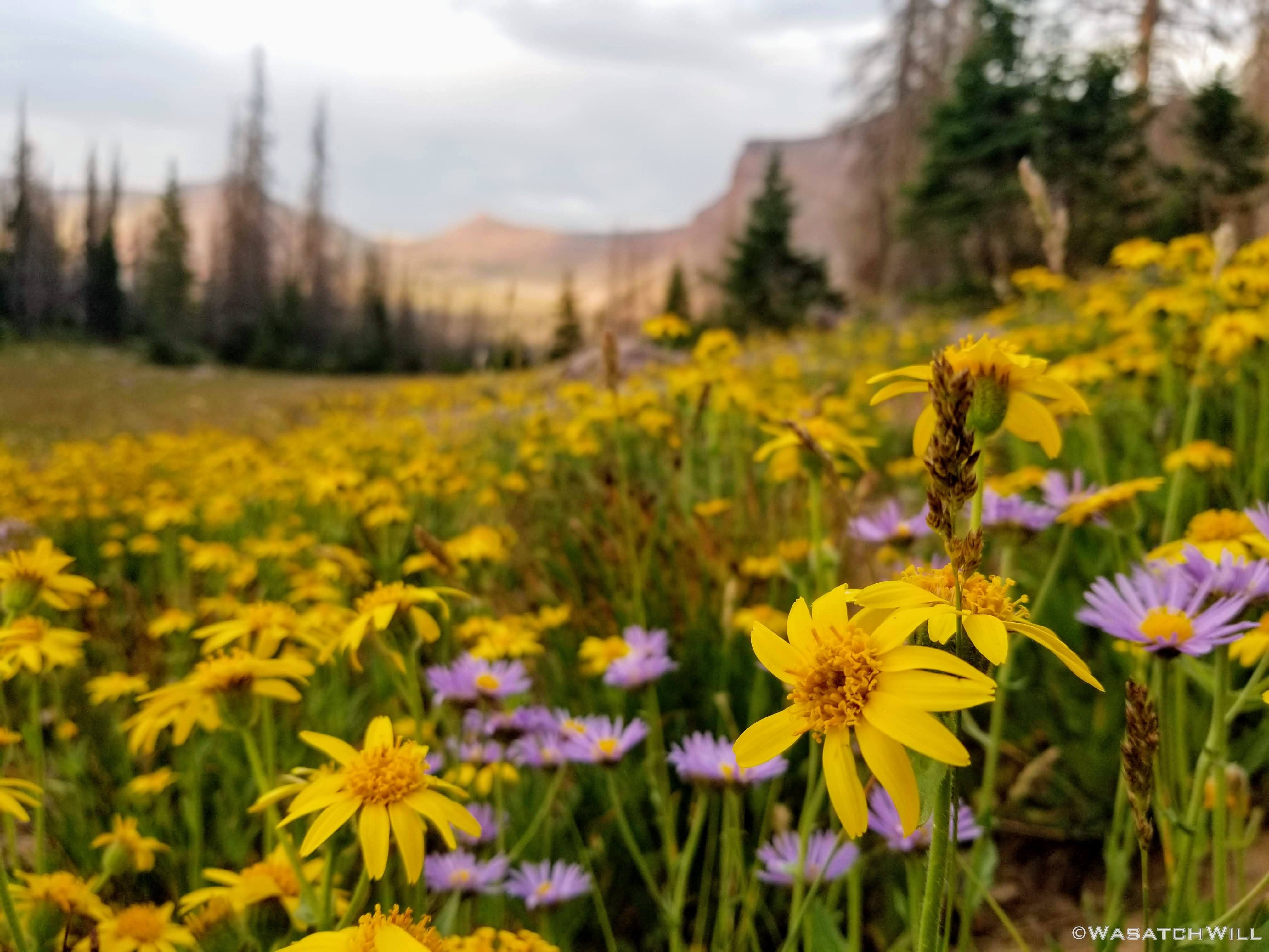
Various wildflowers with Yard Peak above

Paintbrush and Yard Peak
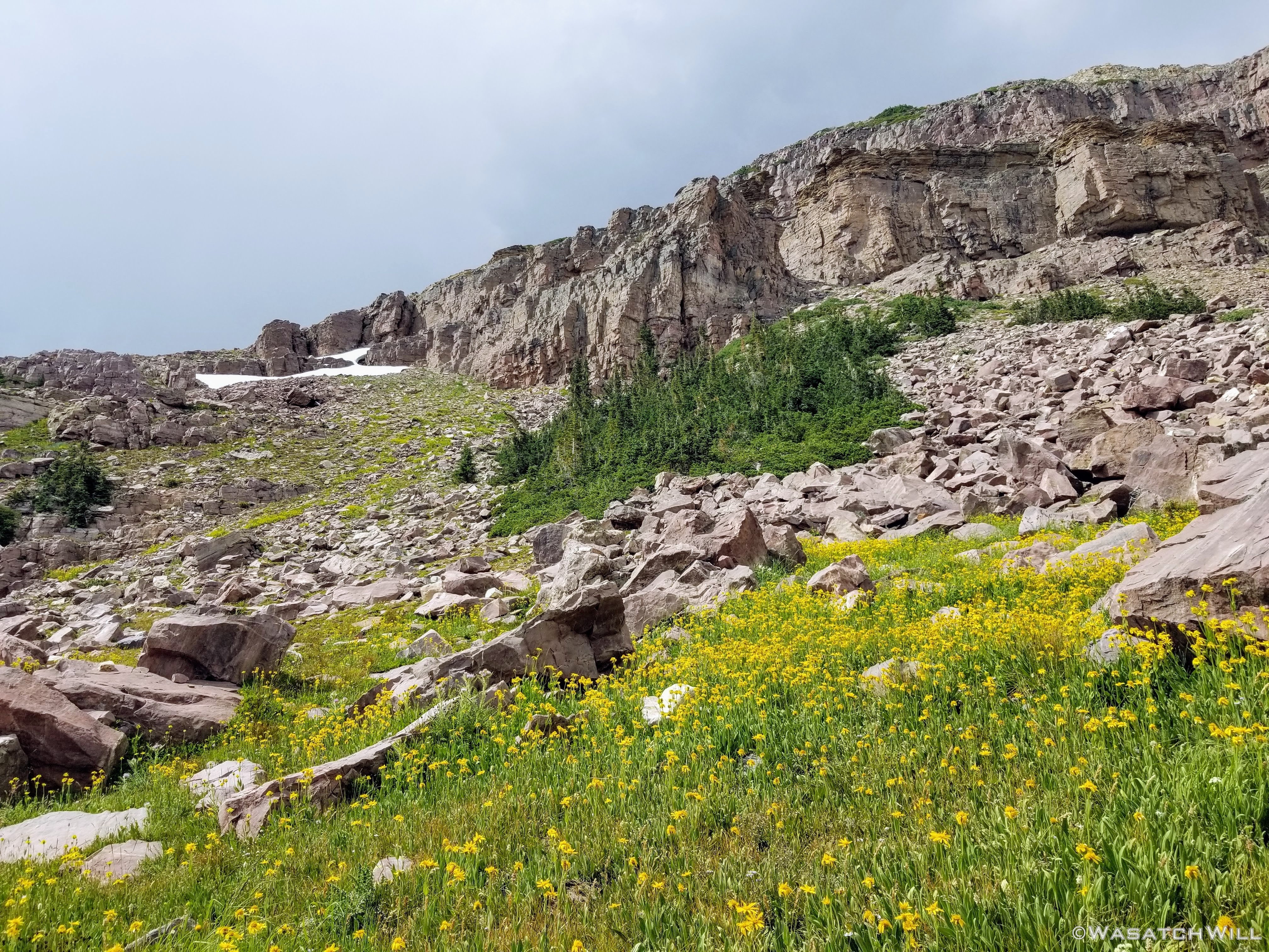
Upon arriving at the base of pass #1, or 'Yard Pass' as it may be called, I sat down on a rock for a little rest and to charge up with some breakfast in the form of an oatmeal bar. It had already been a quick rise in elevation just to get there from the lake.
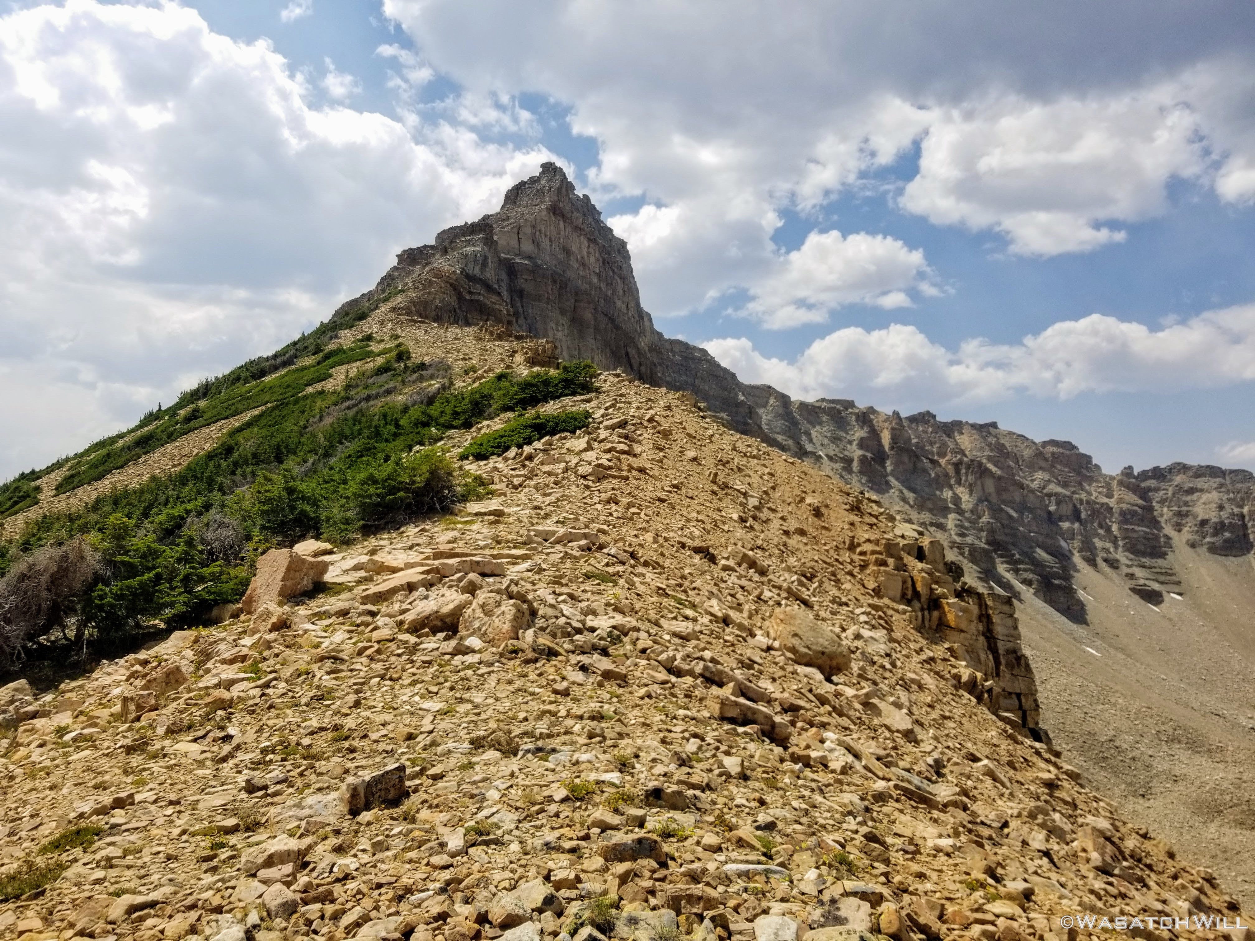
Now would come the first taste of a bit of type 2 fun for this trip. A scramble up a steep scree and talus covered slope. There would be no mistaking which notch in the ridge to shoot for this time up. That had all been done my previous time up here.
'Yard Pass'
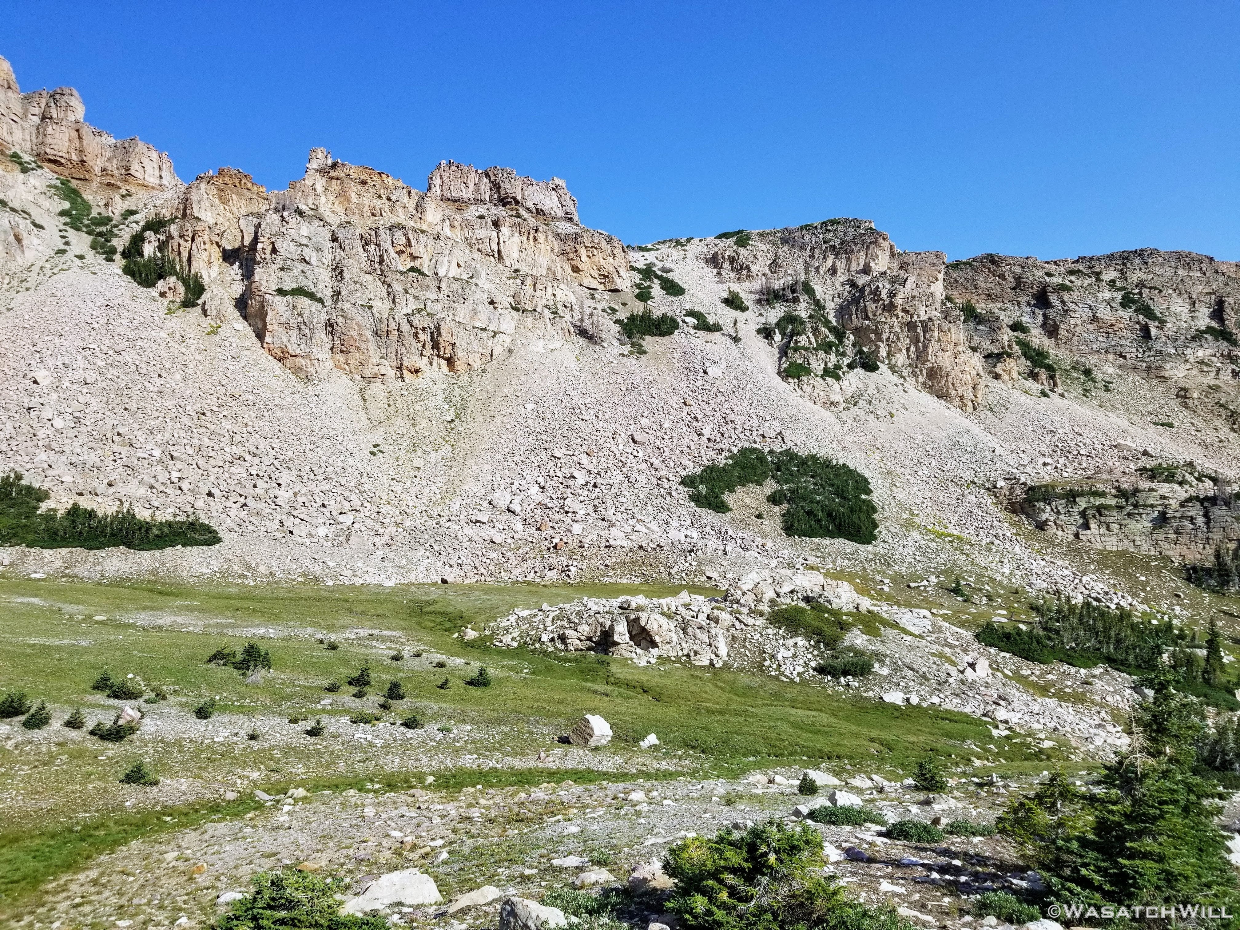
After a nice little grind up, I arrived on the selected saddle. Once again, I was treated to some fantastic views in virtually every direction. For whatever reason, I did not take many photos up on top this time around, only some video. But more photos of these views can be enjoyed in my prior trip report of Allsop.
The Cathedral as seen from 'Yard Pass'
Now it was time to do some major route finding as I picked myself down the other way basin #2, 'Priord Basin' or Right Hand Fork Basin.
From here on through the rest of the day, it would be all new territory for me. Next up: Norice Lake.

Looking out across 'Priord Basin' and Lamotte Peak beyond
Of course, to get to Norice Lake required a lot more route finding. I was trying to follow what was supposed to be a little-known old shepherd trail in the area that would meet up with the main trail at the lake itself around the corner from where I had come. There wasn't much left of it but I did manage to find some remnants of it that would keep disappearing before I'd pick it up again as the route made its way through some dense pockets of trees. Even so, I was loving it! I get a high from such seclusion.
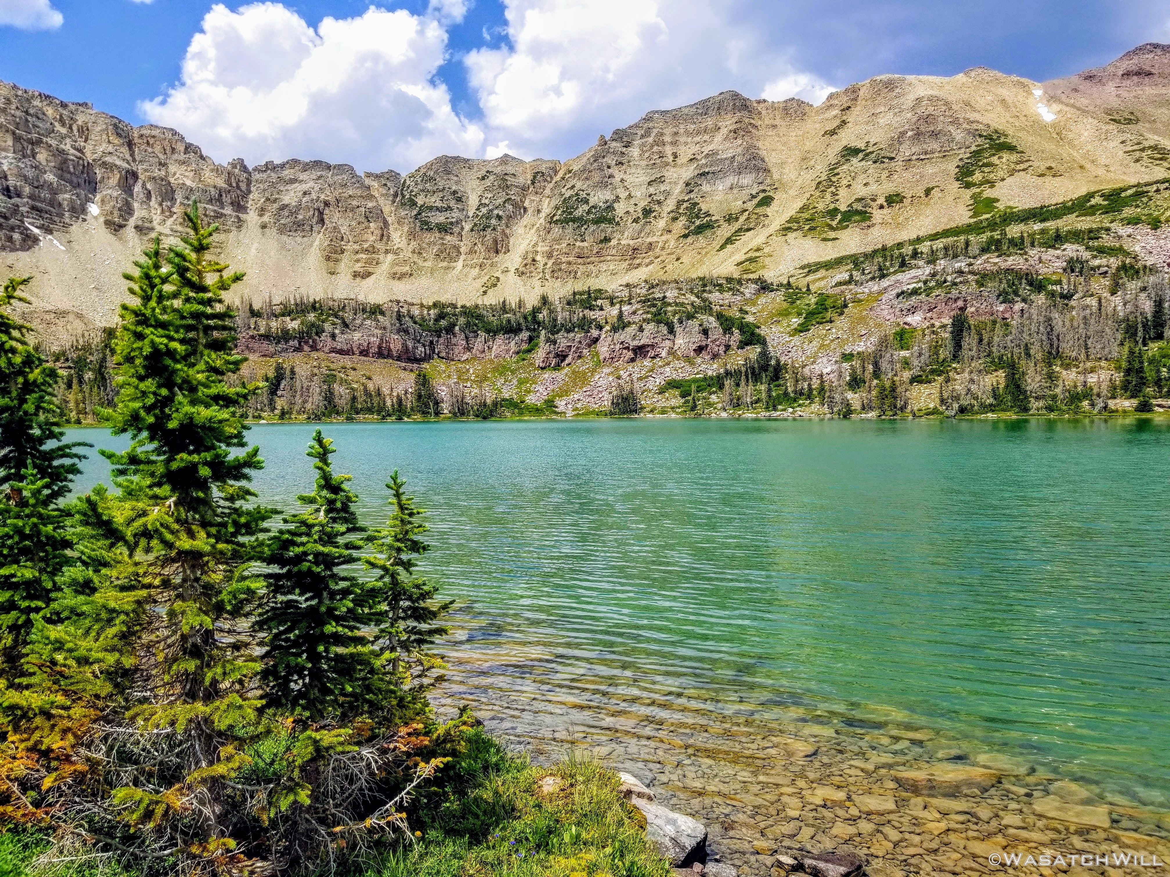
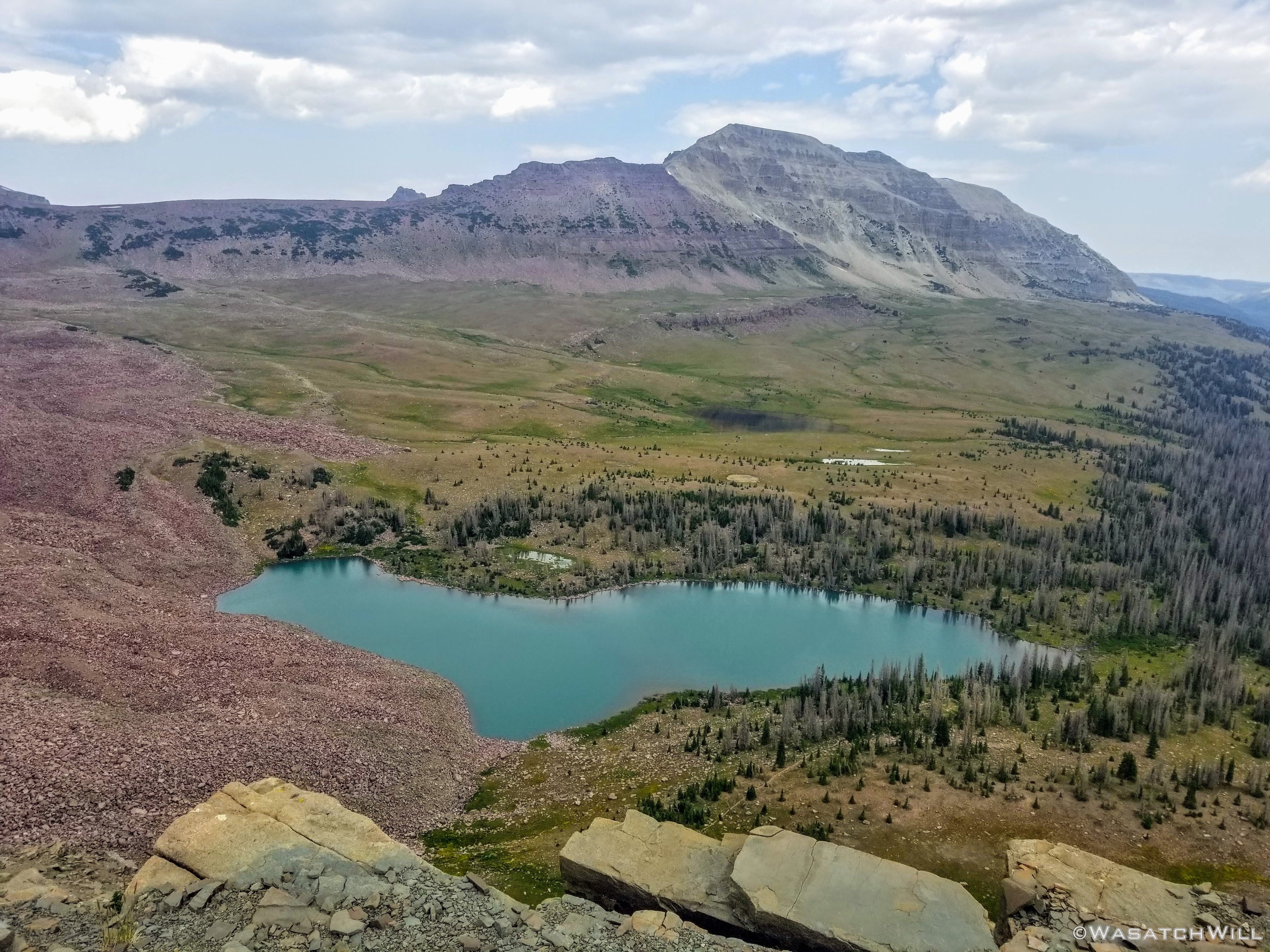
Then almost immediately upon popping out from the trees, there it was Norice Lake with South Yard Peak up on the left and Priord Peak up to the right. Norice was not the prime lake for this basin, however. That was still to come with Priord Lake.

Norice Lake with South Yard Peak (left) and Priord Peak (right)
Did I say the old trail I had tracked down was supposed to meet up with the main trail at Norice? Well...the main trail at Norice that comes up from the fork I had passed the day before more or less disappears there as well. So again, it was back to more route finding to get to Priord Lake. It was pretty straight forward though. Just had to lock onto Priord Peak up on the ridge and aim true for that, following and traversing the contour of the hillside leading up and following a path of least resistance. There may have been an occasional cairn here and there, but I don't remember as much seeing as a good course was pretty simple to track out without any.
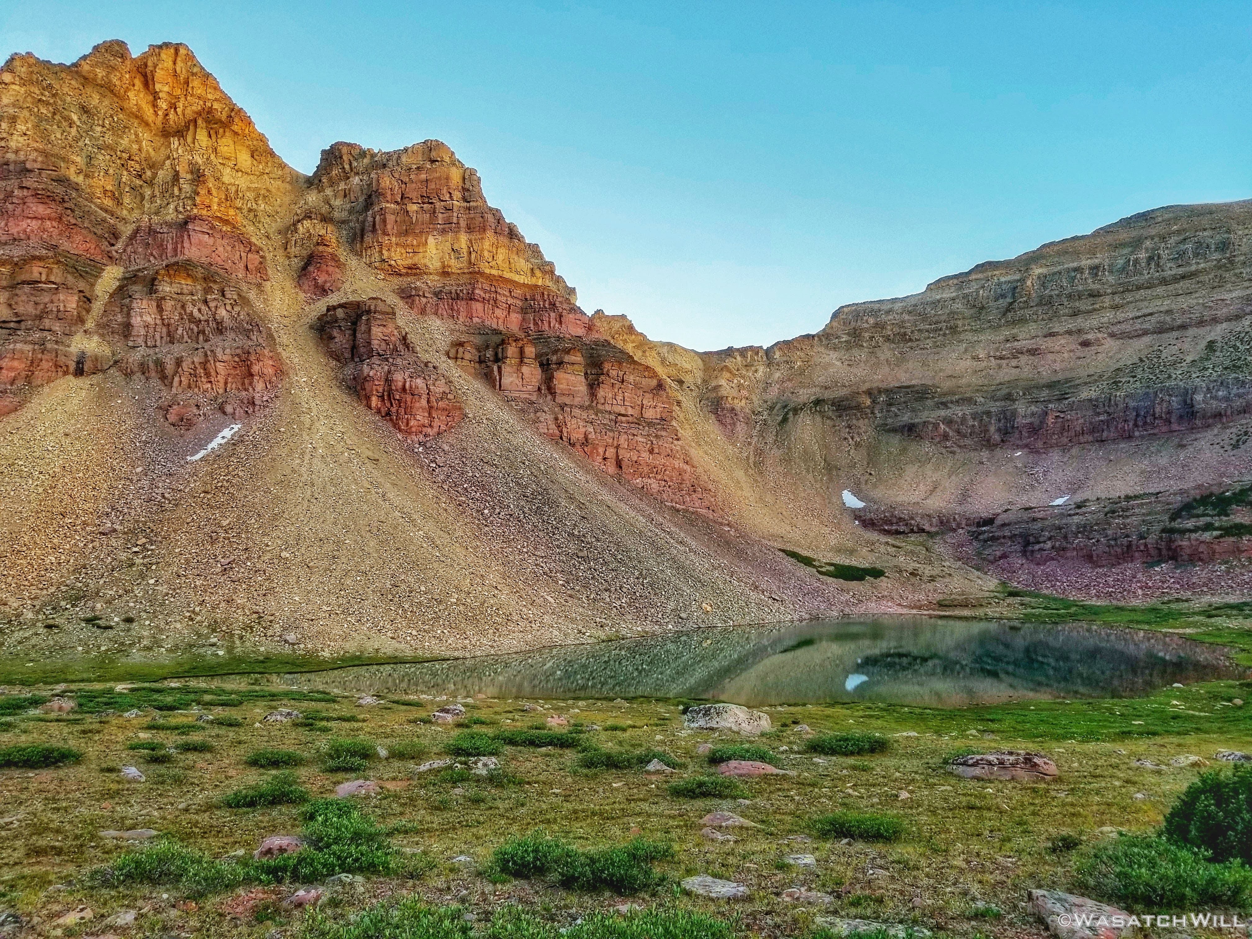
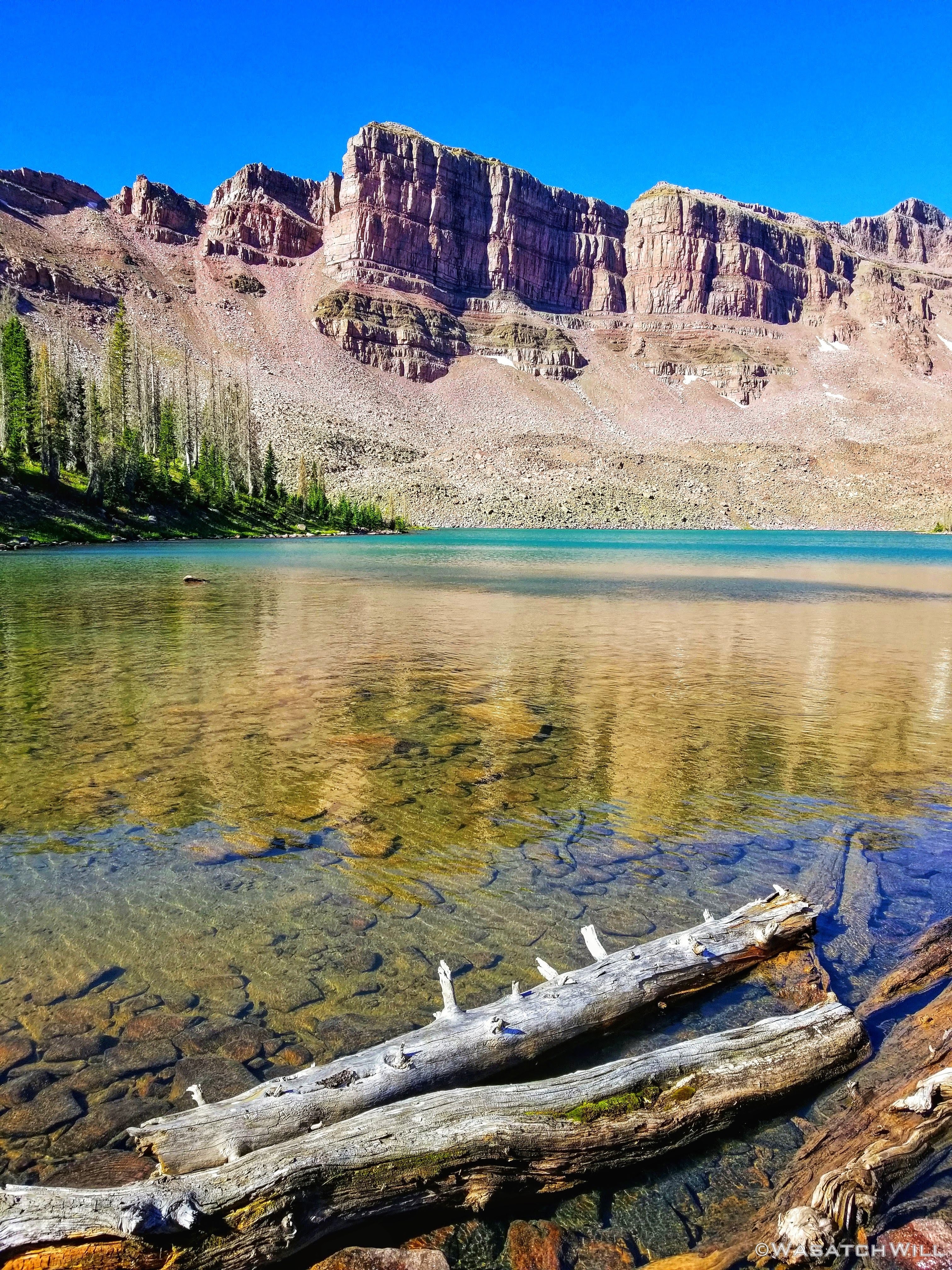
Priord was very high on the list of features I was very much looking forward to seeing on this particular trip. I knew it was known to hold a bright turquoise hue and once I got glimpses of it, it did not disappoint. It was brilliant!!! Suddenly I felt like I was standing on an alpine version of some Caribbean or South Pacific island beachside.
It was so tempting to just stop and stay the night here and fish the afternoon away. Taking a quick swim would have been tempting too. However, it was only just past noon and doing so would set me back from my desired schedule by quite a lot. So I compromised and pulled over for a nice and relaxing lunch break.
Pretty Priord

Priord Pano
While eating, I kept gazing up at the sky and clouds along the ridge line. There were some darkening clouds more to the west straight across the lake but steering more northerly and away. The clouds on the ridge to the south that I would be aiming for were showing a pattern of consistently breaking up in chunks and giving way to more blue sky.
Concluding it was good to go, I said my farewells to Priord and pursued a course for what can be called 'Priord Pass'. Apparently here too, there was to be remnants of an old path that went over the ridge and crossed over into the Rock Creek basin immediately to the south. However I could not find any photos or any other beta of it online or even any other trip reports out there that feature this pass as part of any given route used. So.. I did not know what to expect from it or if it would even go safely enough for me. Needless to say, I was filled with all sorts of nervous excitement. This is what would make or break my trip...

'Priod Pass'
But go it did! I was indeed able to find the remnants of the old path and was able to follow for the lower half before the path faded. At that point I just picked a line that looked the most doable and tried to keep to the more stable looking rocks as best I could. Right below the top of the ridge it got a little sketchy for a moment, but I was able to pull through and successfully mount the saddle there.
Once standing on the saddle I exploded with emotions of excitement and enthusiasm and just pure unbridled joy. I know that for others with much more experience in off-trail scrambles, especially those who've done some of the well known high routes out there in other ranges like the Sierras and Wind Rivers, this pass would pale in comparison and such an accomplishment wouldn't rank so high for them, but for me, this was big time.
I don't yet have a lot of experience with these kinds of routes and with this particular pass, being the most mysterious to me of all the passes on my chosen route given the lack of beta I had on it, and being solo, it was very much a big deal for me so I felt like a million bucks. I had just made it up what I believed was to be the hardest pass for me to cross over and felt certain my planned route would now go forward as planned. I had anticipated it to be the crux with the final two passes of my route to both have designated trails going over them, one of which I was very familiar and experienced with already.
While such emotions were rewarding enough, what's a high mountain pass or peak without some big views back down to see where you came from and/or where you're going next? And big views there were!
In fact, looking back down over to Priord, I could no longer see the full line I had taken to get up the pass. The angle of the slope was just steep enough to hide a section of it away from my field of view. This reminded me of how it looked down into Middle Basin from a pass I had tried to scout out for a route I was hoping to use to link up with Naturalist Basin just a few weeks prior.
Priord Lake as seen from 'Priord Pass'
Priord Peak

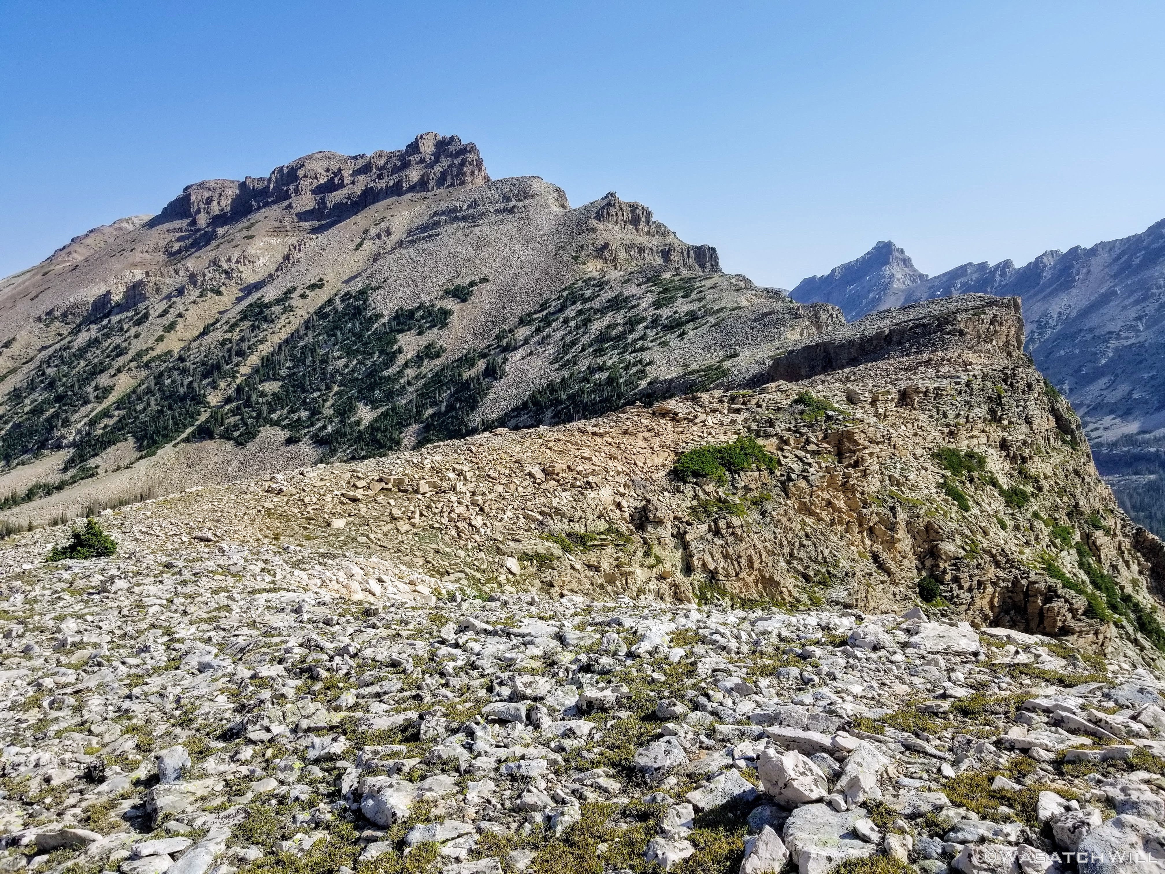
'Priord Pass' pano looking north
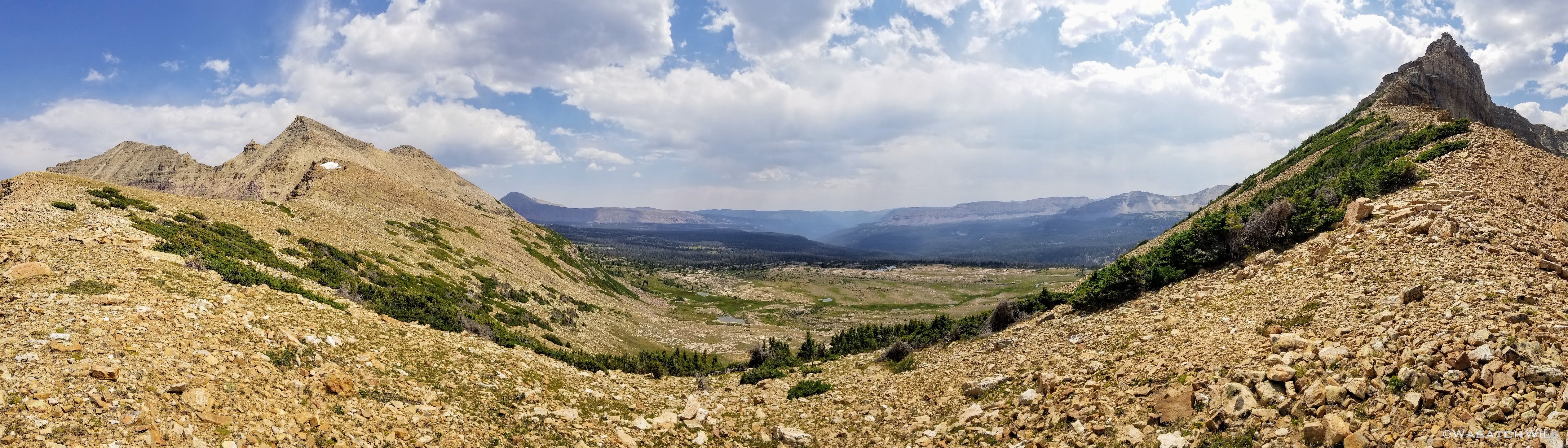
'Priord Pass' pano looking south
There's summit selfies. Now I'm putting out saddle selfies.
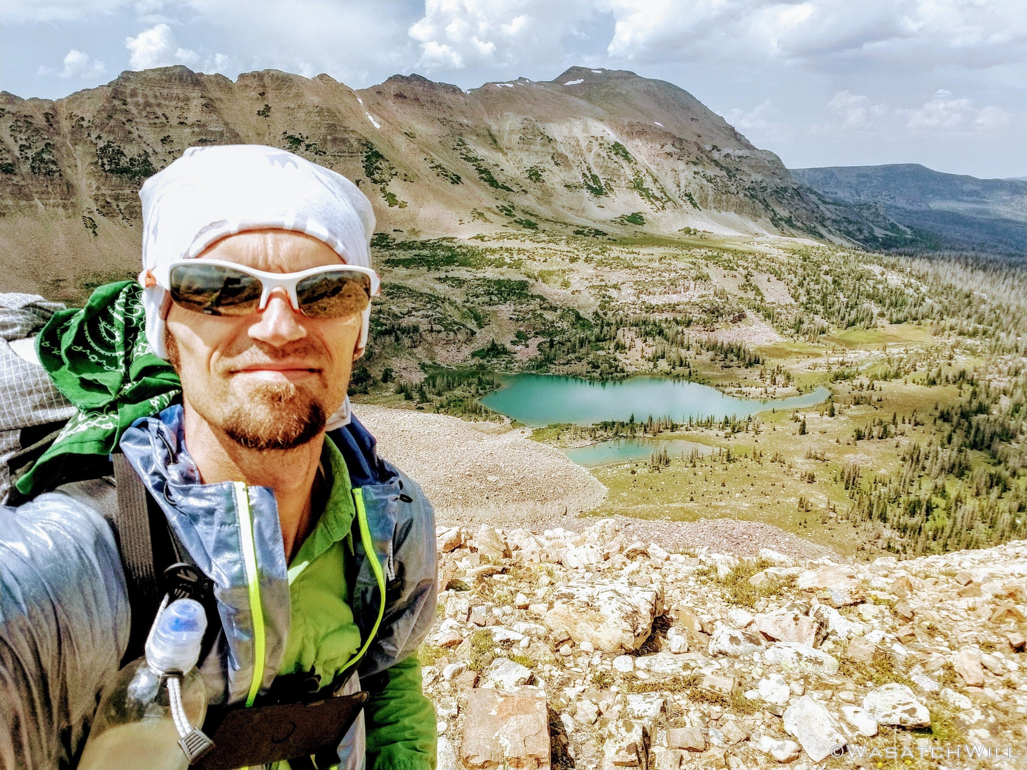
Saddle Selfie
The Rock Creek side of the pass was much tamer, making for a rather mild descent. Right below me now sat the head waters for Rock Creek. Little did I know that straight ahead of me, throughout the following month, a wildfire would start from lightning far out in the distance, lead to a closure of the whole basin, and then go on to grow and consume nearly everything within tree line that was then within the sight before me. Lucky was I to get one more experience backpacking through the Rock Creek basin before much of it would become so changed for a long, long time to come.
Headwaters of Rock Creek
Once off the second and final pass of the day and back down into the flats, I set my course eastward and followed the base of the ridge in search of yet another elusive lake I had been longing to lay my eyes on. In my prior two trips through this basin, each with a group (one including a complete circumnavigation of much of the upper basin), we stayed on trail, which is always for the better when with any large group anyhow. A larger group can have much more of an impact when off trail in some areas than being solo or when part of small group consisting of just two or three persons can. But now that I was solo, and had specifically targeted this lake I had in mind, I was now free to finally pursue it as one my priority objectives with this trip.
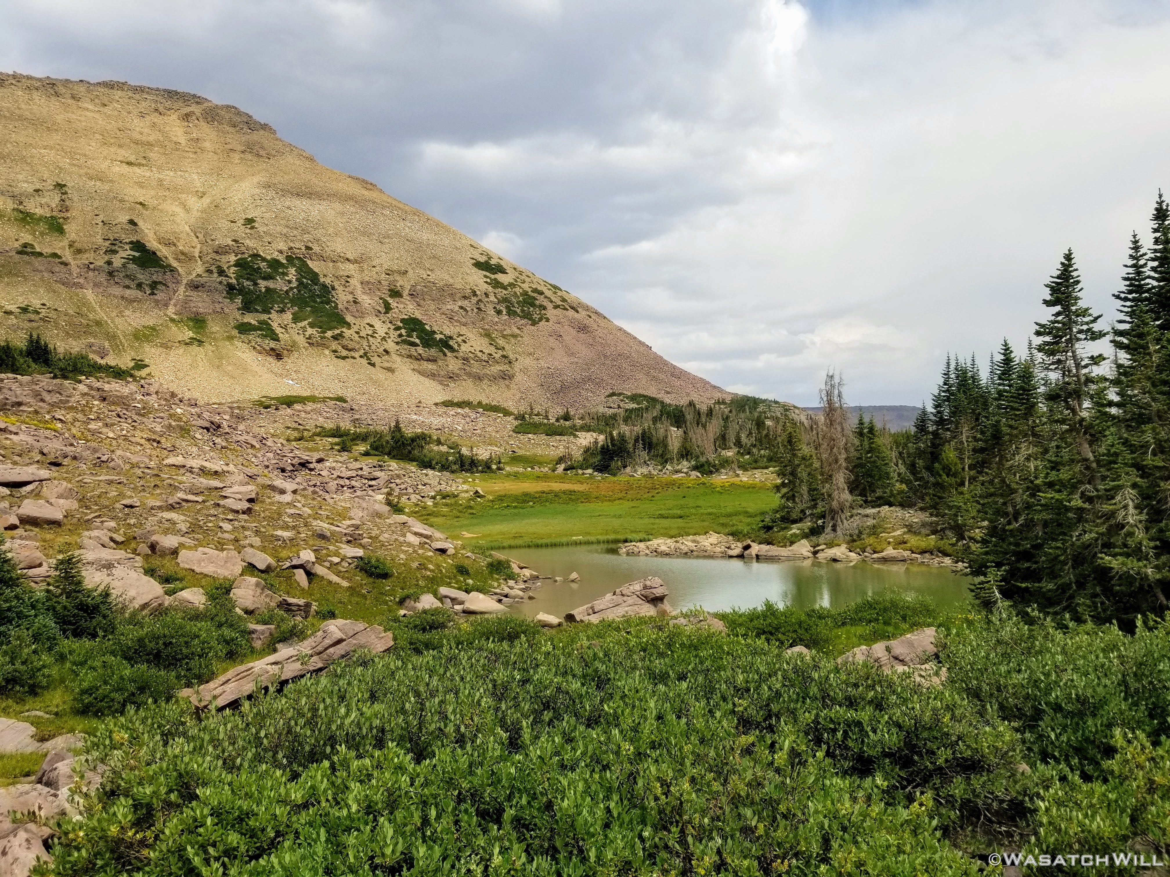
A tarn beneath the willows
Down a series of benches I went, skirting numerous tarns with an occasional willow whack as I roughly paralleled the ridge line I had just come over ,all mixed in with a bit or two of some short scrambles here and there, just to keep things more entertaining.
Back into some talus
And then the anticipation had built up to a fever pitch as I rose up a little higher and approached a cozy, albeit very-exposed-to-the-elements, corner of the upper edge of the basin.

The anticipation approach
Then...wait for it...there it was!!!
_________ Lake
That's right. For now, I'm going to leave this one a mystery. I'm confident that a good handful of those who may read this report will know exactly what lake it is. And with a little bit of time spent reviewing maps of this area, many more will be able to connect some dots and feel confident in identifying it.
And for those who do, may you too keep it a secret. Please. Not to be elitist about it. Not to privilege yourself above others. But to help preserve the pristine, wild, and remote nature of this lake and the whole area surrounding it. To preserve the tranquility and serenity and the quiet solitude to be found. in such places can only be experienced with a lack of crowds that can so regularly be attracted to a place such as this in this day and age. Beyond that reason, I also think it's good to let others savor the thrill of being rewarded with the self satisfaction that can come from doing one's own homework, one's own detective work using other resources freely available on the Internet rather than having the identities of these kinds of locations handed to them on a silver platter. Let it be a place that resides humbly on a map, there in waiting for others to put in the time to seek after, stumble upon and pursue.

Mystery Lake
Right upon arriving at this secluded lake and settling onto a little flat a couple hundred yards up hill from it, the weather would hold off no longer. I had gotten my tent up just in time to jump inside and lay out while a customary high mountain afternoon thundershower passed over.

Camp, Day Two
After a nice siesta, the storm began to break and I emerged to have dinner. Following dinner, I went out for what I like to call a 'wee little wander' to explore more of my surroundings. One of my favorite times to enjoy the mountains is in the early evening after a storm has just cleared out giving way to blue skies and sunshine that lights up the landscape as freshly fallen raindrops glisten and sparkle while clinging on to whatever they have fallen on before evaporating away. There is also a subtle calmness that always presents itself in such conditions and this time was no exception. It was another heavenly sight to behold and experience. Just amazing!

Post rain pano
Upon returning from my post dinner wander, I used up the last hour of good light left in the day to go back down to the lake and see how the fishing was. Well...it was good! Even with the choppy, windy water, I was able to hook a few different fish with a variety of lures I had brought with me. They were all brook trout though, so nothing special to go out of the way for that can't be caught in a majority of other Uinta waters.
Note: This year I switched out most all the treble hooks on my lures to single hooks and pinched down the barbs in order to help keep the trout I was releasing happier and healthier. It also makes is much easier for me to slide the hook out. Win-Win!
One of a half dozen fish netted
Finally, it was time to conclude day two.

Sunset
Once more I would be awaken by a bright moon overhead in the middle of the night and this time nature called me out of my tent, so I took the liberty to set up my camera and get another shot of the mountain lit aglow, this time with my tent in it.

Moonlit Mountain (and tent)
Wednesday - August 5, 2020
Day 3: Rock Creek to Dead Horse
Miles hiked: 6, Elevation gained: 1100 ft
Day Three.
Wake up to calm, blue bird skies and soak up mirrored reflections upon smooth-as-glass lake.
Wash. Rinse. Repeat.

Morning, Day Three
Blue Hour begins to transition to Golden Hour

Glass reflection

The upside down

A paintbrush trio
Moon on its way to setting down
Paintbrush now under full sun

Full sun reflection
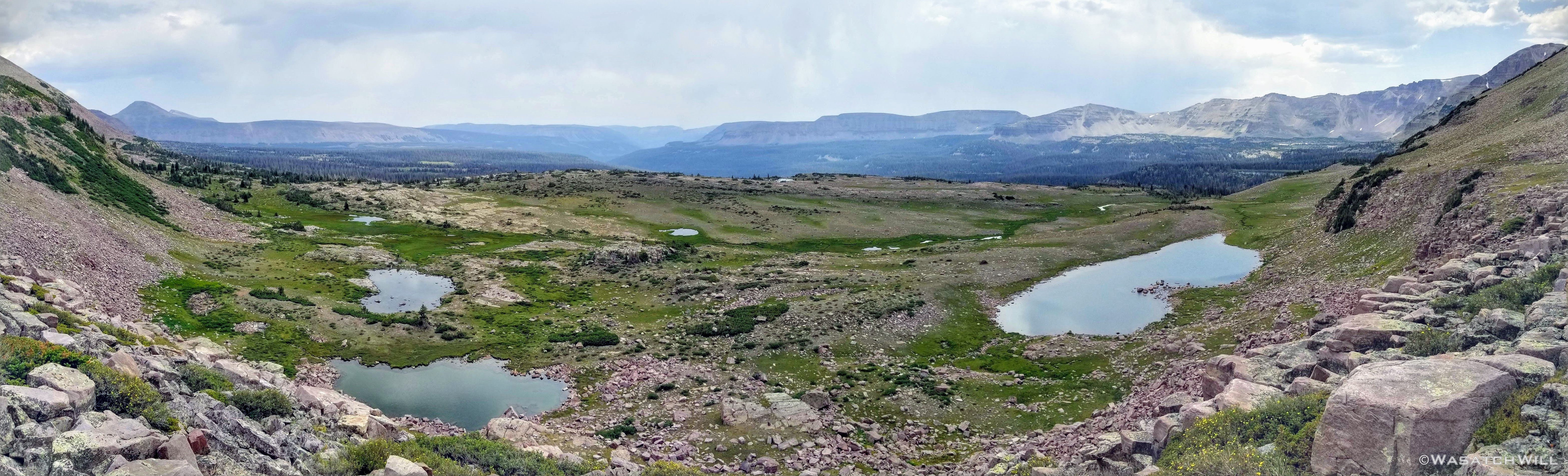
Upon breaking camp and packing up I set sail for my destination for day three: Dead Horse Lake. With only one pass to do and another relatively low number of miles to hike this day, I took things a bit more leisurely on my approach to Dead Horse Pass.
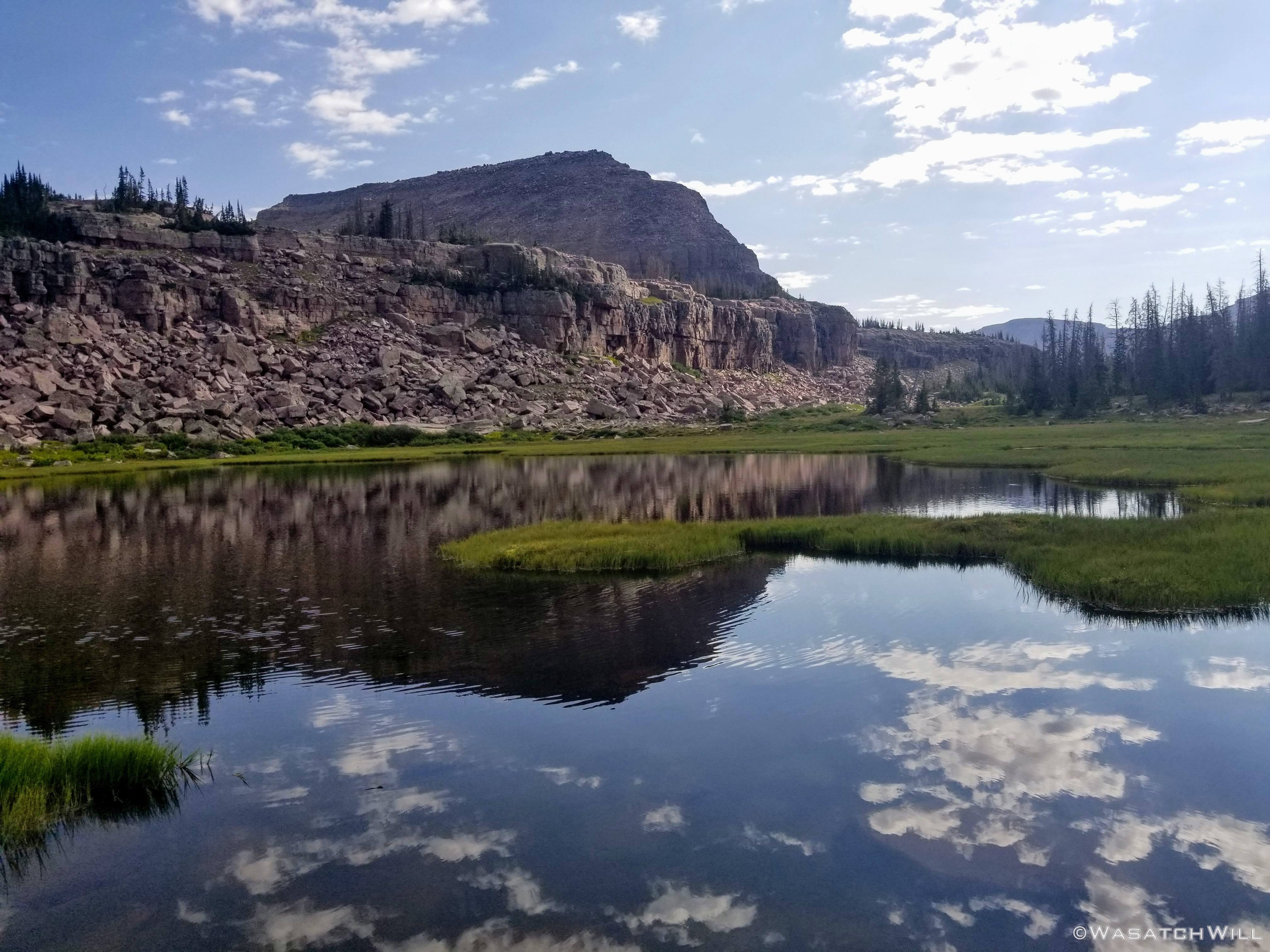
On my way out I stumbled by a lake that was not at all marked out on any of the maps I had. Cool! In fact it was much more of a lake than others nearby that were marked out on maps and even had names.

Unnamed and unmapped lake
One of those other lakes was this one below. It was a lot smaller than it looks in the picture. In fact, it was very underwhelming compared to how this picture makes it look.

A tiny lake (name withheld)
In due time, I found myself back on a designated trail which would lead me out to join up with the official Highline Trail very soon thereafter. Up until this morning, I had not seen or heard another human since I had left the trailhead. That had now just changed. Right before jumping back on trail, I had passed by another couple's camp and went on to see a few other people at various points along the trail.
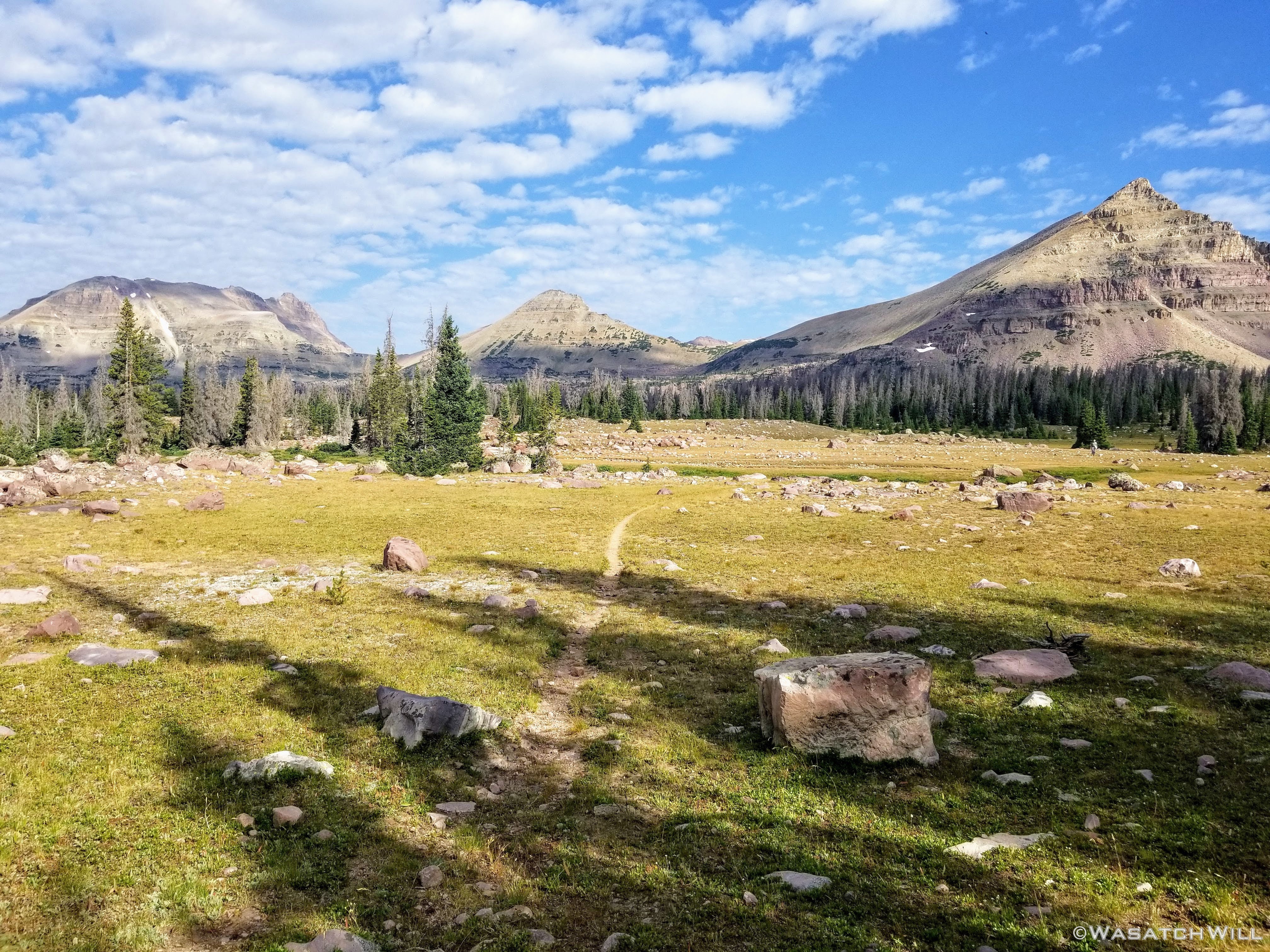
Upper Rock Creek Basin
Small no name lake near Highline junction

Highline Junction
Once on the Highline Trail, I turned eastward again and followed the Highline up to Bench Lake for a mid-morning break. There, I had a snack and took some time to try some more fishing. Unlike the night before, I could not get anything to take an interest. Oh well, there'd be more fishing to do later on in the day.

Bench Lake
Once up and above Bench Lake, Dead Horse Pass came into view. I had strongly considered wandering off to get a quick glance of Continent Lake but ultimately opted out of it. It would be too tempting to get my pole out and do some fishing and then risk weather presenting a problem. I directed myself back toward the pass.

Approaching Dead Horse Pass
On the approach to the pass I was spooked by a couple of ptarmigans lying low down among some rocks. At least I think they were ptarmigans.

White-tailed Ptarmigan?

Getting closer to the pass
The ascent up the south face of Dead Horse Pass was very mild. It didn't feel like much of a pass at all, not unlike Tungsten Pass further along on the Highline. But of course, it's a whole different ball game on the other side though. More the come on that below...
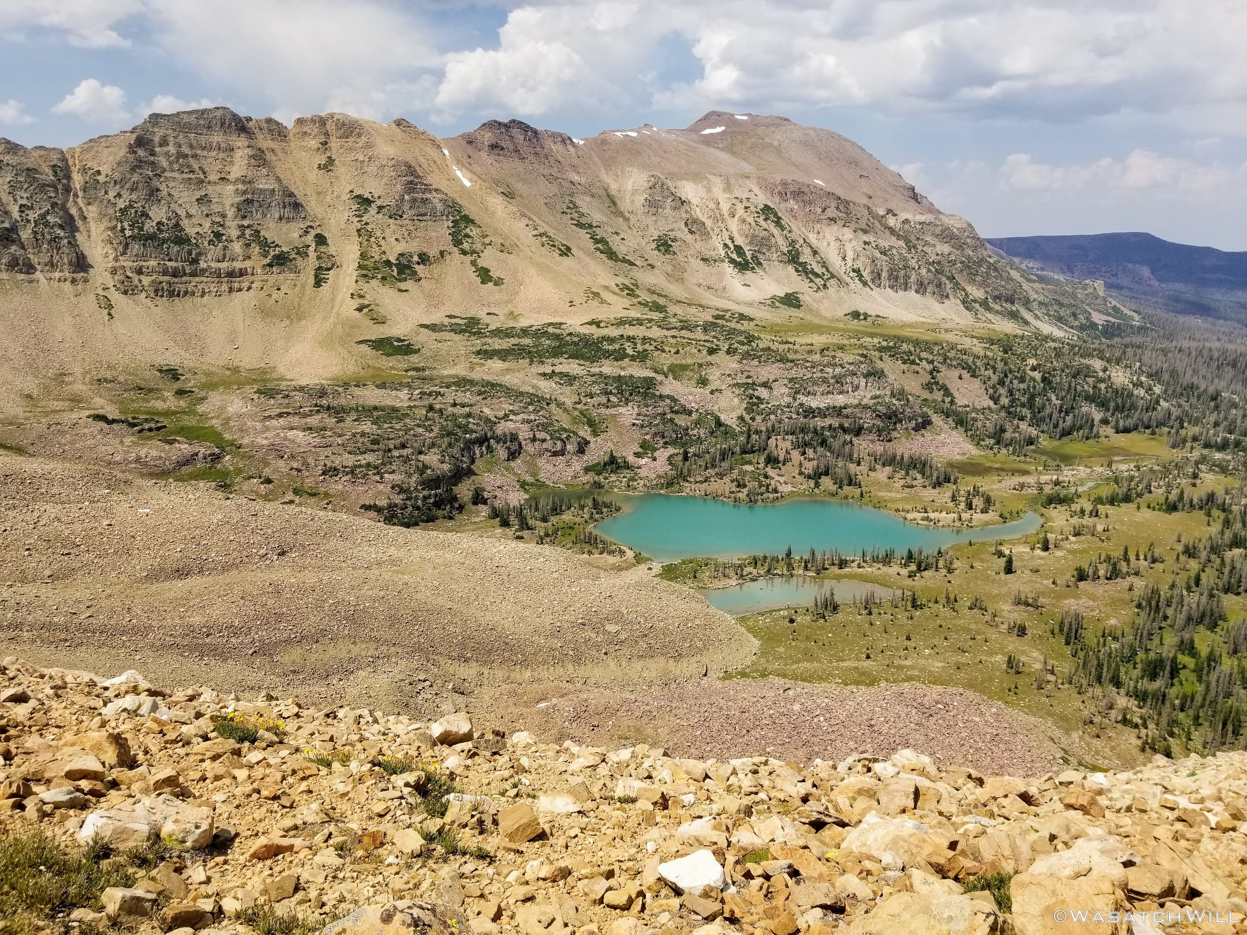
The view down to Dead Horse Lake from the pass might well be one of my favorite views in all of the Uintas having first experienced the pass when I hiked a majority of the Highline Trail with a friend and his brother in 2016, only we were of course going the opposite direction.
When I arrived on top of Dead Horse Pass, some nearby and approaching clouds were starting to gather, thicken and darken so I didn't spend too long soaking up the view this time over. I was anxious to get down the other side anyway and seek out an optimal campsite down near the lake.
Dead Horse Lake and South Allsop Peak as viewed from the pass
After toeing a few false leads off the pass and having to re-orient myself with my GPS to find and follow the correct lead over the north side of the pass, I began the descent down what I was now sure was the true trail.
This descent, however, presented me with something I was not anticipating...AT ALL. The first switchback down the north side of Dead Horse Pass was very-very narrow, and very-very exposed to what would certainly be a deadly fall with any significant slippage or stumble off my right side. Or at least the illusion of such was there. I'm not sure if the trail had actually eroded away a good bit since I had last been up it, thus becoming narrower, or if it was just the fact that descents put a different kind of stress on different sets of muscles to stabilize yourself than ascents do. In other words, all other things being equal, it can be much easier to slip and fall on a descent than an ascent of the same line if not extra cautious. Of course, having a full field of view off over over what appeared to be cliff band right below me to the right and nothing secure to grab hold of or to use for sturdy support to my left did not help my sudden burst of anxiety either.
Needless to say, my knees were now beginning to shake and I paused once again to ensure I was descending the right trail since it looked and felt nothing like how I remembered it when I had come up from the opposite way four years prior. I paused to check my GPS once more wondering if I must have missed yet another lead off the top of the pass and that perhaps this was some bad, hairy little use trail formed as some sort of risky shortcut to cutoff the switch back I was supposed to be on. Nope, this was indeed it.
With only about 14-18 inches of width to work with, I lowered myself down on to my back side and began to butt-crawl, er, scoot my way down the somewhat steep decline so as to keep my center of gravity as low and close to the trail as physically possible and to keep myself from slipping on some loose dust and scree that riddled the trail. I continued this technique until I hit a point where the trail narrowed up even more into an evermore butt-puckering spot. Here, the trail choked up against a large boulder or part of the mountain itself firmly planted into the mountain side whereby the trail against it decreased to no more than 6 to 8 inches wide with the steep long slide and cliff band still immediately below. The trail was certainly not wide enough for me to remain comfortable and safe staying on my bum and I could not bring myself to edge around the boulder with my feet.
What to do? What to do? I briefly contemplated turning back and finishing off the trip back through Priord. Yes, I was that nervous.
Instead, I opted to dig toes into the scree along the side of the boulder, using the boulder for support, and negotiated my way around the top edge of it. I then carefully inched my way back down on my backside along the other side of the boulder until my feet made contact with the trail again. Here it widened back out and thankfully, the angle of the trail also mellowed out a bit. I could now feel more sure and secure remaining on my feet the rest of the way down, especially through the switchbacks away from the cliffy ends . There was one other tight switch back within the cliff bands where I think I did a side-stepping shuffle around it to make the turn but other than that, all was well and my heart rate gradually began to come down again.
Whew!!! Once again, I thought to myself, That was not how I remembered it.
Ascending rather than descending the north side is definitely the more advisable way to take that pass on as the great majority of Highline Trail hikers do. I was so sure I had conquered the crux of my route the day before, and was disappointed to have it replaced by the tedious descent down Dead Horse.
At last, I finally arrived at the bottom of the pass where I could gracefully finish out the rest of the day's hike down to Dead Horse Lake.

All down, safe and sound

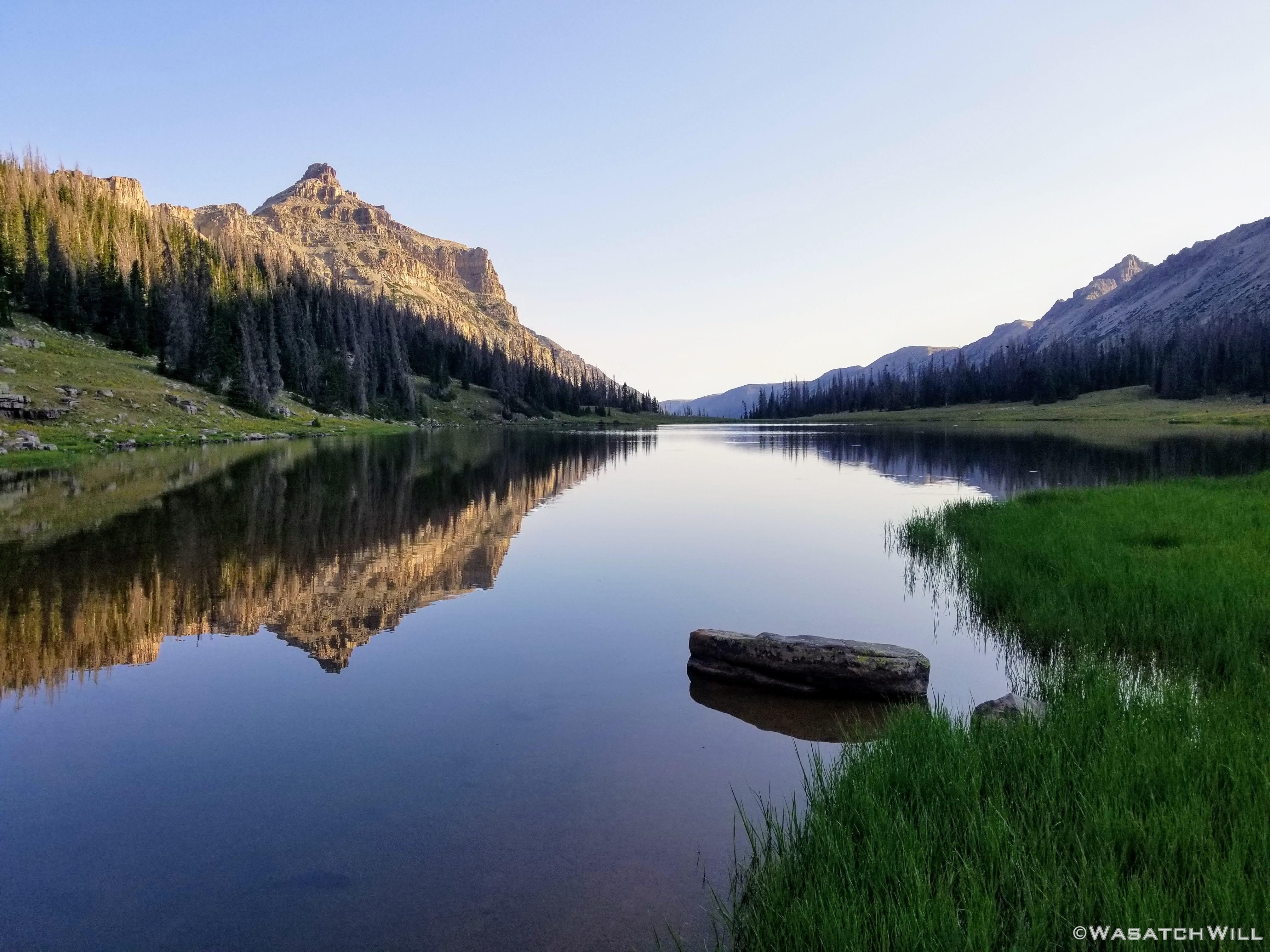
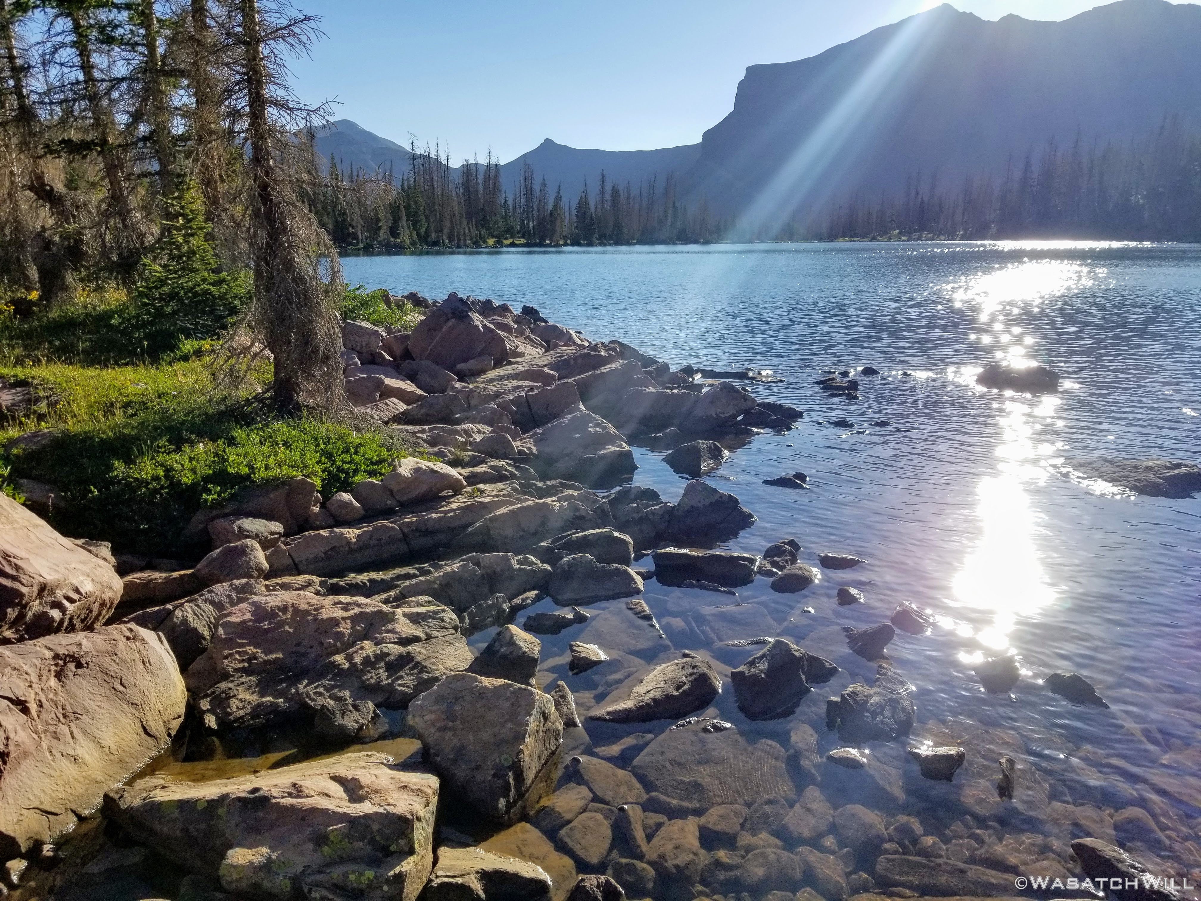
Dead Horse Lake from the Highline Trail
Just after arriving on the shoreline and getting more level with the lake I sat my pack down and began to scout out all the many places to camp. By now the weather was looking good again.

Pack takes a rest while I scavenge for a campsite
I was able to find a nice little grassy flat between beyond some trees about 250 feet away. Most of the already established campsites in the vicinity were well within 200 feet of the shoreline, which is frowned upon according to Leave No Trace principles and ethics.
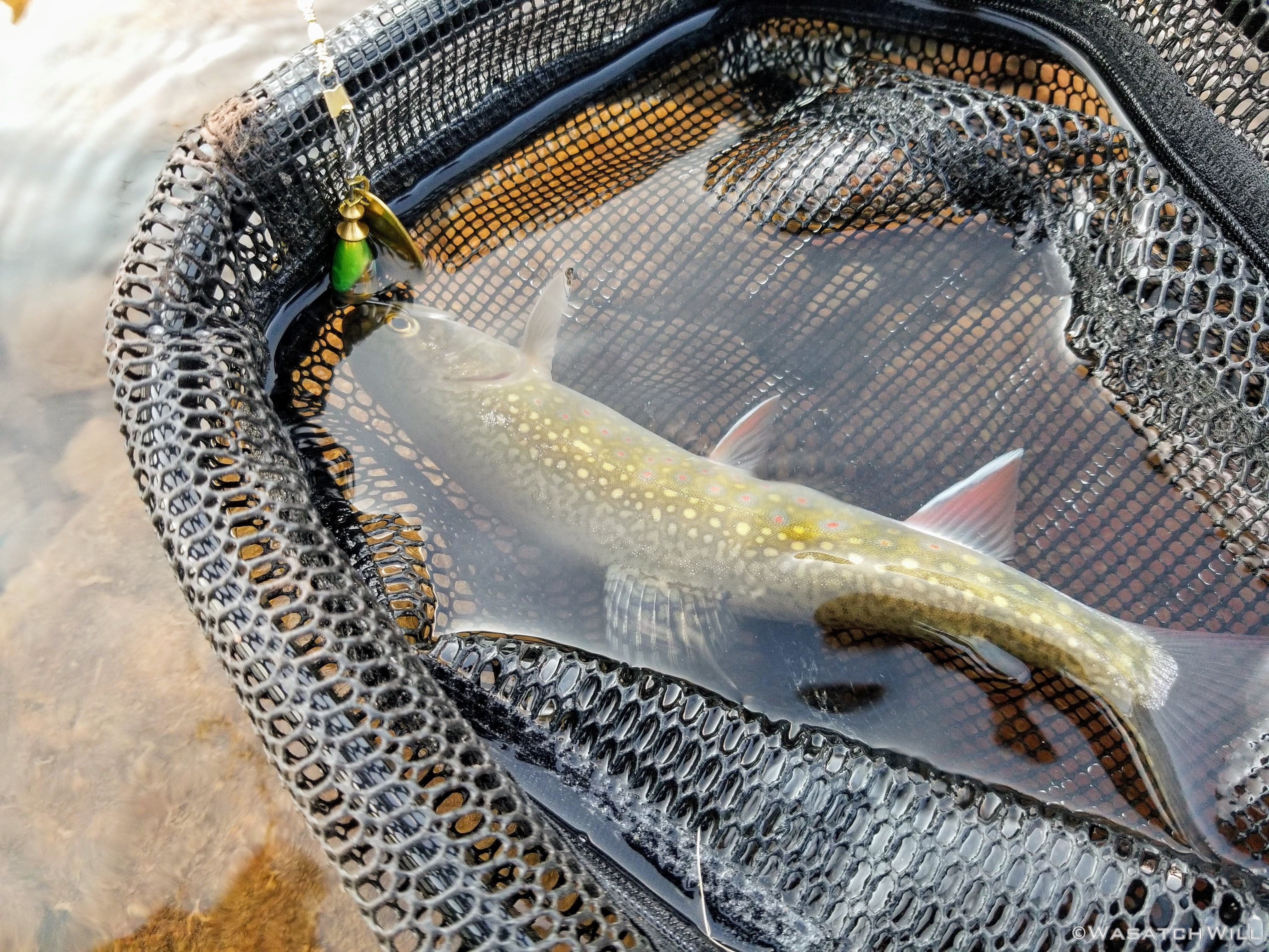
Once I had my camp up, I sat down for some lunch, then pulled out my fishing gear and went back out to the lake. The day was still young and I was intent on enjoying it in a relaxing manner. I was able reel in a few fish to my net over the course of the rest of the afternoon. This time, all had been tiger trout. But for all the fish activity there was at the surface of the lake I did not hook very many at all. Lots of fish would follow my lures or my flies in before they'd spook right as they came within sight closer to shore. I'd guess that was due in part to the popularity of the lake being a premiere Uinta destination for many weekend backpackers.
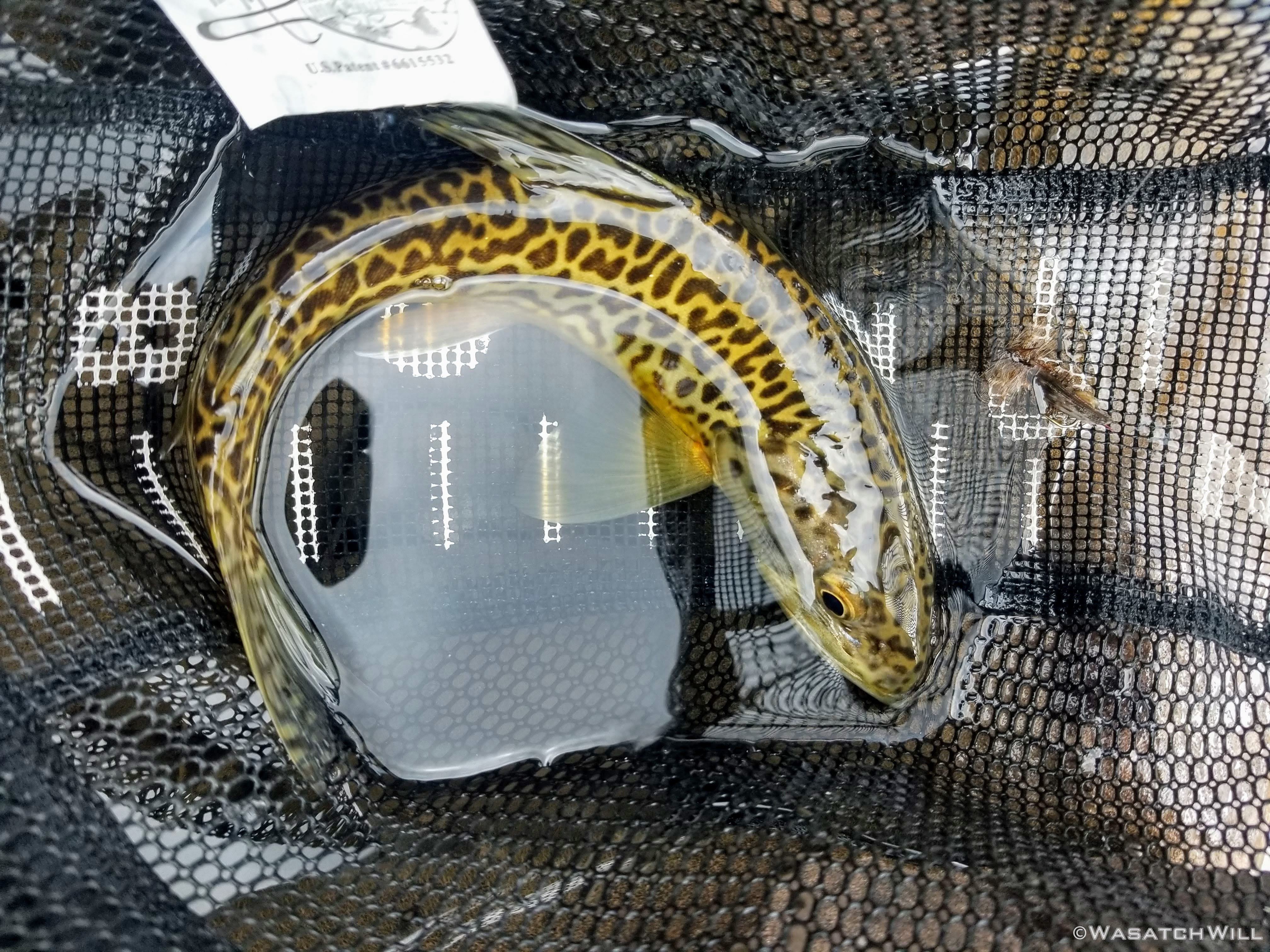
Tiger
While fishing, a couple different groups of Highline hikers, or Highliners, as I like to call them pulled over at the lake for some short photoshoots and a recharge before they'd continue their trek up and over Dead Horse Pass...the nicer way.
In fact, I had fully expected to see more westbound hikers out backpacking the Highline in my approach to Dead Horse, but as I recall, I only saw one person along the whole stretch of Highline I hiked to get up to the south side of Dead Horse Pass. I also expected to be sharing Dead Horse Lake with at least one, if not two or three other camps. There was no sign of anybody there when I had arrived, but I was still certain there'd be some Highliners that would arrive later and set up their camp for the night right there at Dead Horse as well.
But nope....aside from those who had passed on by that afternoon, there would remain no sign of any one else out camping at or around the lake through the rest of the evening. For the third night in a row, I would indeed have a whole picturesque lake to myself and this time it was one of the more popular and sought after destinations in the Uintas. It's no wonder I've become so spoiled for solitude and seclusion. The quiet calm that comes with not having anyone else around in such a setting is such a luxury once it has been experienced.

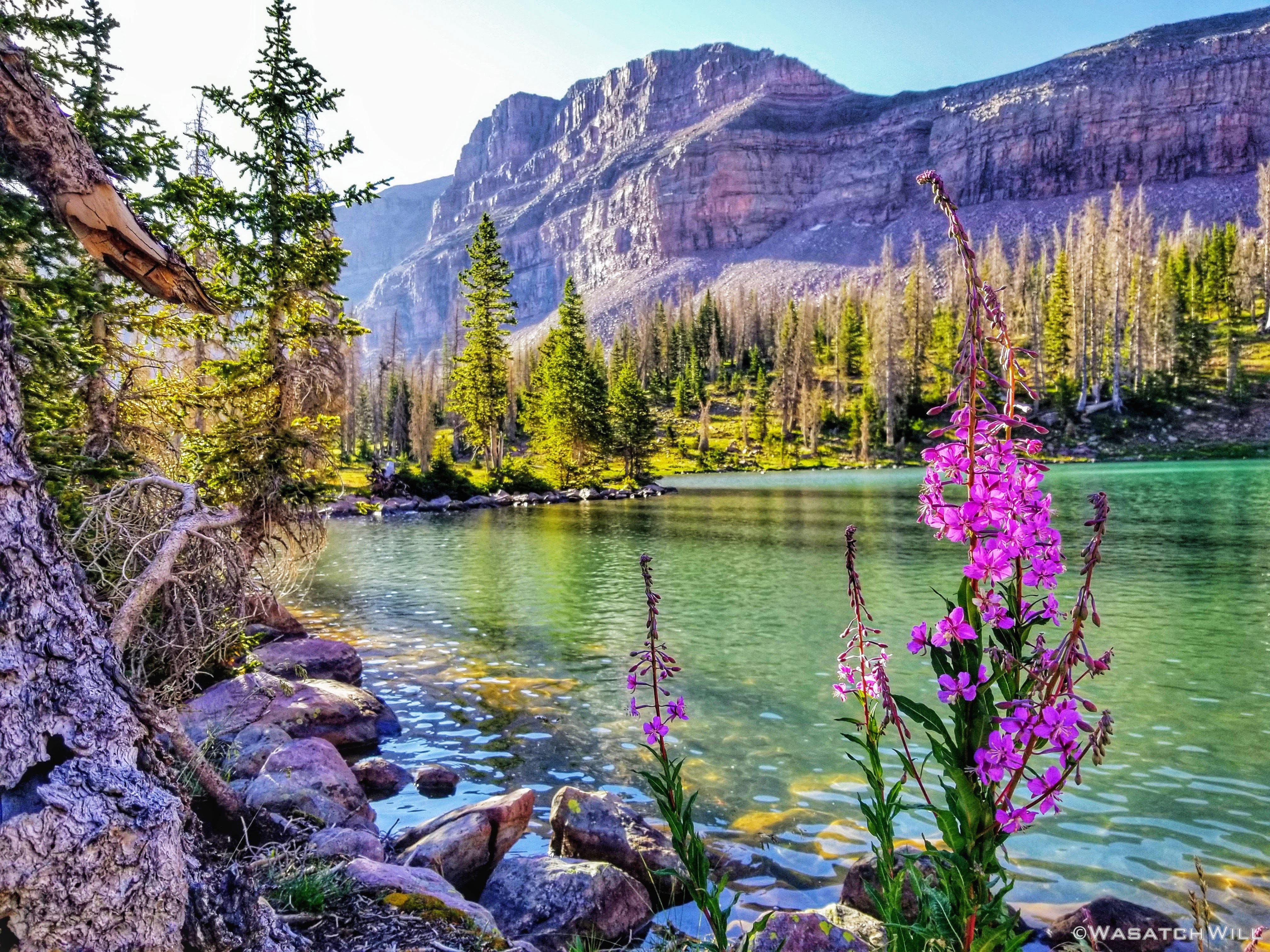
Fireweed on the shores of Dead Horse

Aqua blue hues in the waters of Dead Horse
As the afternoon transitioned into the evening, clouds had started gathering again and threatened to unleash some rain. In fact, the weather couldn't make up its mind through the rest of the night.
I returned to camp ready to take shelter but only ended up with some occasional sprinkles of rain.
Now good and hungry, I prepared some dinner before going out yet on another wander, specifically to go get a peek of Lake Ejod up and over the hill near my camp. In fact, I had thought I would actually go all the way out to it to do some fishing too that afternoon, but the fish at Dead Horse were just enough to keep me interested in persisting with them.

'Italian Night' was the theme for dinner

Lake Ejod
Back at Dead Horse Lake, the sun would muscle through some more clouds to throw down some great light across the lake, making for a gorgeous golden hour.
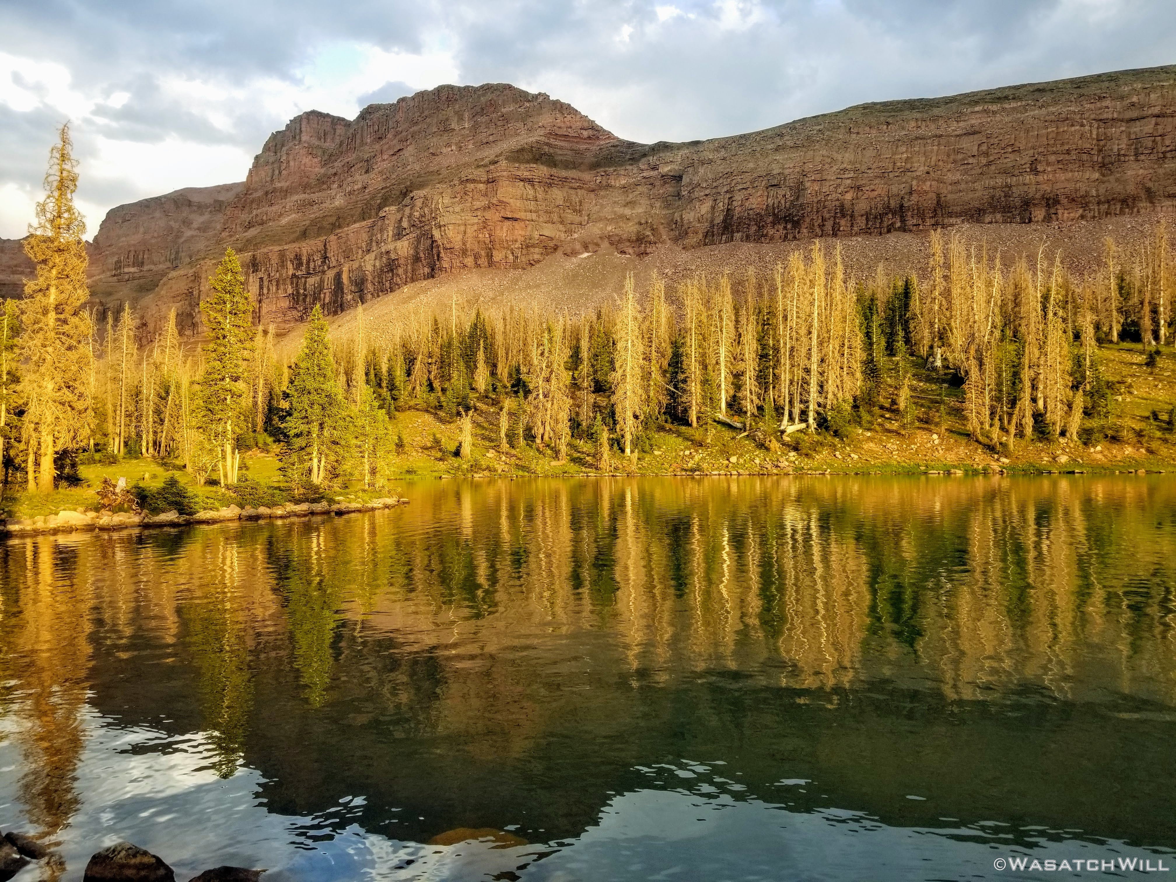
Golden Hour at Dead Horse Lake with East Dead Horse Peak above
Dead Horse Pass above Dead Horse Lake
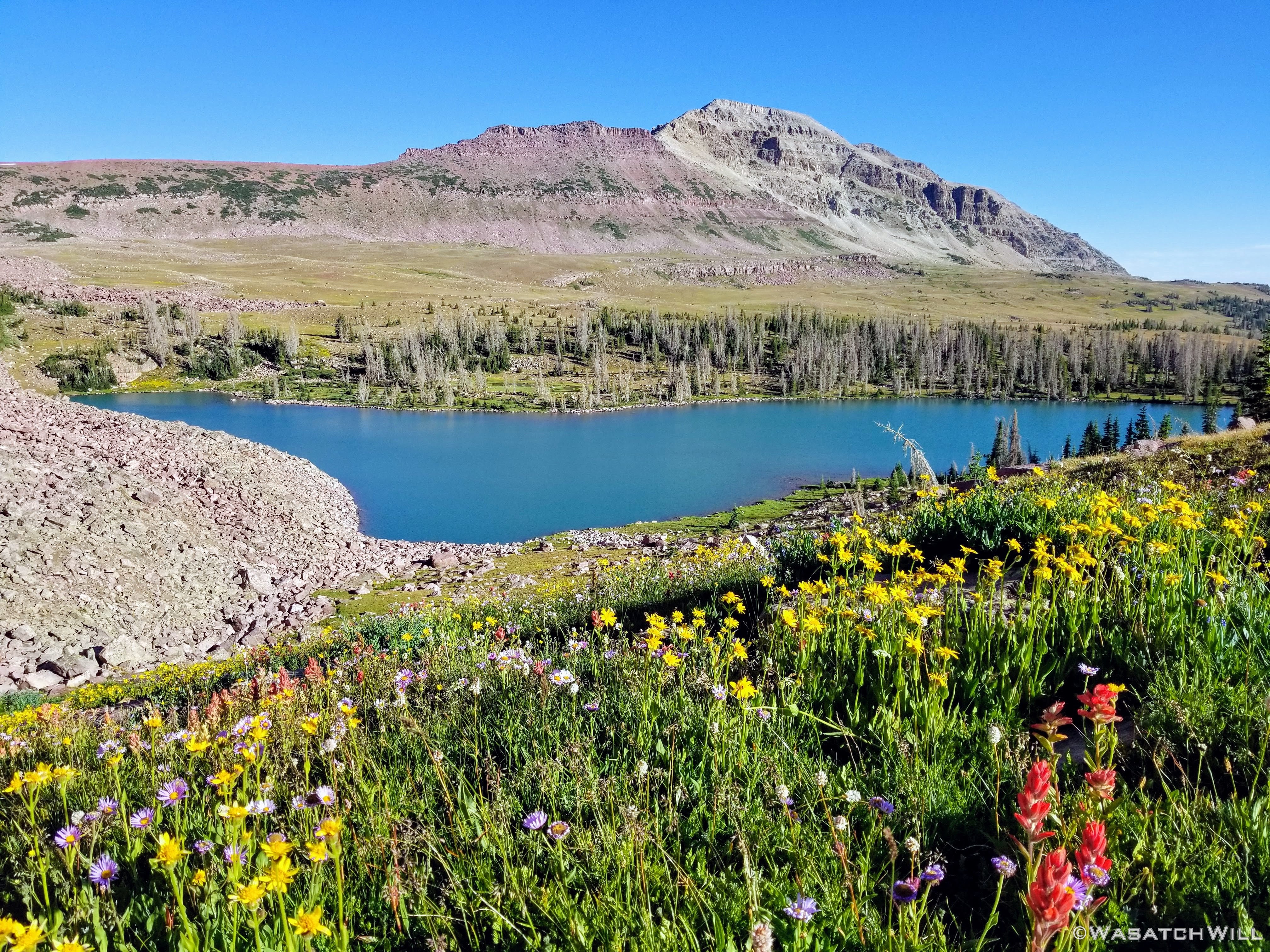
Out the other way from near my camp, Red Knob and Red Knob Pass, being the next pass out along the Highline to the east, stood up out in the distance above a field full of wildflowers.

Red Knob Pass beyond a field of flowers
Golden flower shining in golden hour
All in all, it had been another terrific day on the trail, but it was now time to wrap it up and call it in for the night. The final day was on the morrow.

Evening alpenglow above camp
Thursday - August 6, 2020
Day 4: Dead Horse to Trailhead
Miles hiked: 15.5 (+2.5), Elevation gained: 1800 ft (+800ft)
Day four set up to be the longest day, by a large margin, for amount of miles to be hiked. And that was just from camp back to the trailhead. To add to that, I wanted to go check out the views from yet another pass that rose above this same basin. One that's been unofficially named 'Allsop Pass'. In order to make that happen, I woke myself up good and early.
Rise and no shine...yet
It didn't take long for the physical activity of hiking cross country over the vast alpine tundra fields to get my blood going and warm me up before the sun had a chance to burst forth over the mountains to the east.

Lake Ejod beneath South Allsop Peak

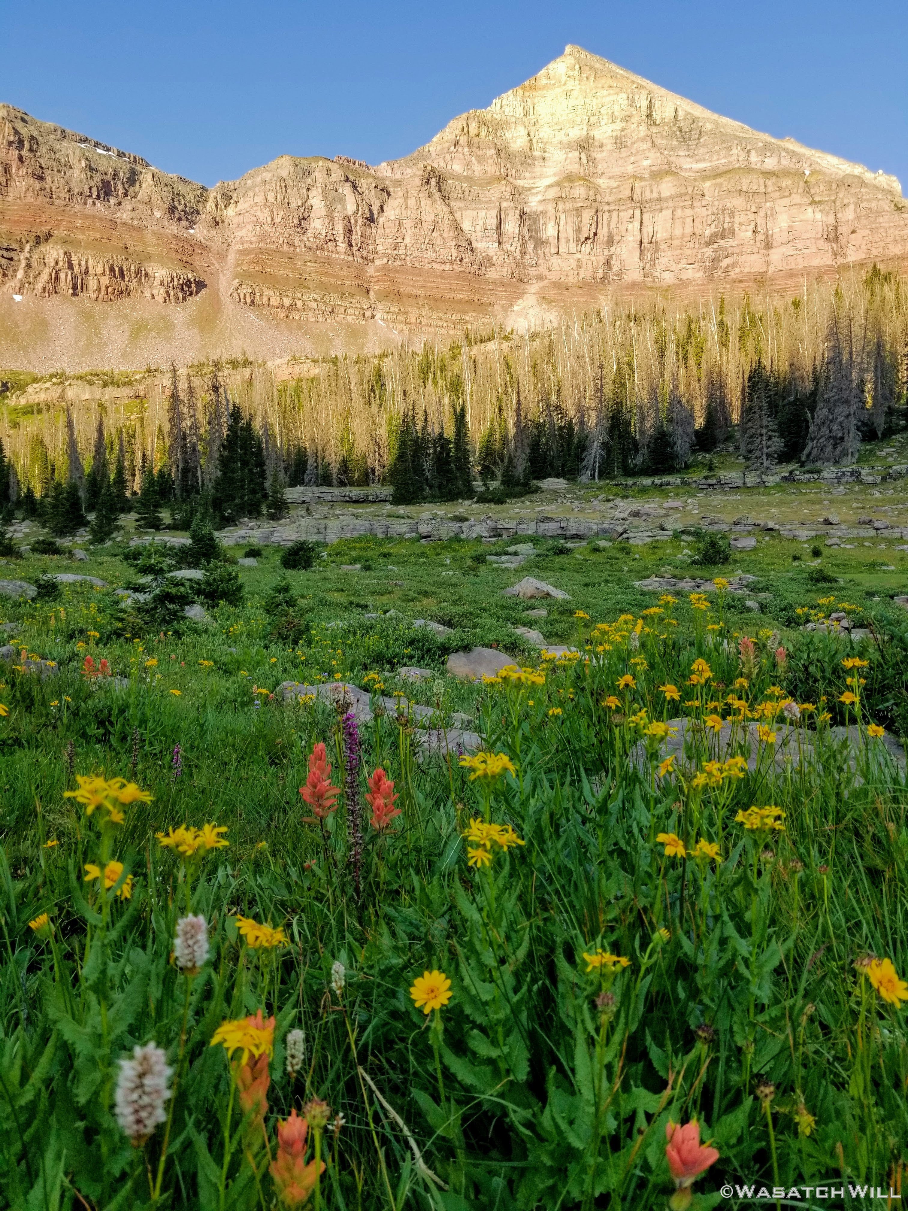
First sunlight fills out Dead Horse Peak
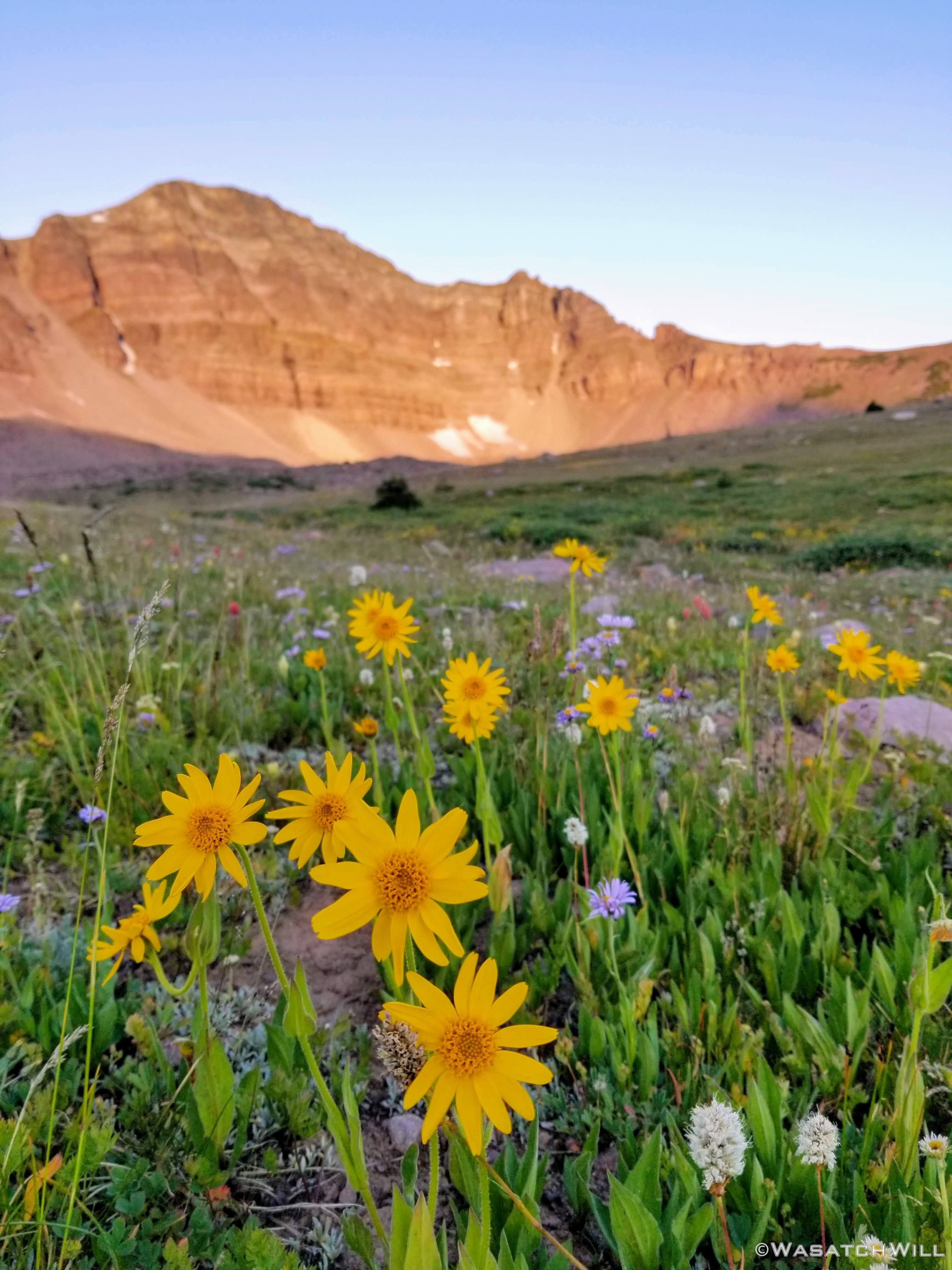
Wildflowers and Dead Horse Peak
I had previously been informed of yet another old use trail that would lead the way up to the top of the pass. Sure enough, I found it and began ascending the switchbacks.
Nearing the crest of 'Allsop Pass'
Once on top of the pass, I had the view I was after. A look down to none other than, Allsop Lake of course! The very place I had spent my first night of the trip.
Allsop Lake and the Cathedral above as seen from 'Allsop Pass'

Pano from 'Allsop Pass'
Now, I know of a few others who have actually reached Allsop Lake from Dead Horse using this very pass by traversing along the ridge for nearly a mile to the north before descending down a very long and steep scree slide. There is also a super steep couloir on the south end of the pass right where I was standing that, in theory, could also get one down off the pass and save the extra mile of ridge-walking. Of course, in gazing down the couloir, I really don't think I could get myself comfortable enough to attempt that and risk setting off a big slide of rocks and boulders with me amongst them.
When I had strung together the route for this trip, it had actually been very tempting to make plans to pack up my camp and attempt the former option to save myself two miles of hiking, including an additional pass to go over to get back to my car at the trailhead. And I think I would have certainly been more willing to do so with a capable partner.
Alas, I had never hiked up or down the West Fork Black Fork drainage before (having only skirted the upper edge of it when I last passed through via the Highline Trail) and wanted to maximize the amount of new territory I could see with this trip. So in exchange for some more new scenery, I was willing to pay the price of the extra distance and the extra pass to come. To do so, I now had to descend Allsop Pass the way I had come and return to camp to pack up before resuming my chosen course back to the trailhead.
If you count my morning jaunt up Allsop Pass and back, that would technically make for a total of 5 passes...eh...maybe even 6! More on that to come later on down this report. I'm not counting Allsop though because it was more of a little morning spur trip with a mostly empty pack and was not a necessary requirement to keep to my planned route. Besides, 5 would mess up my whole "4-4-4" title I was giving this trip. And even if I had made it a part of the primary route, that would have still left me with 4 total passes for the trip.
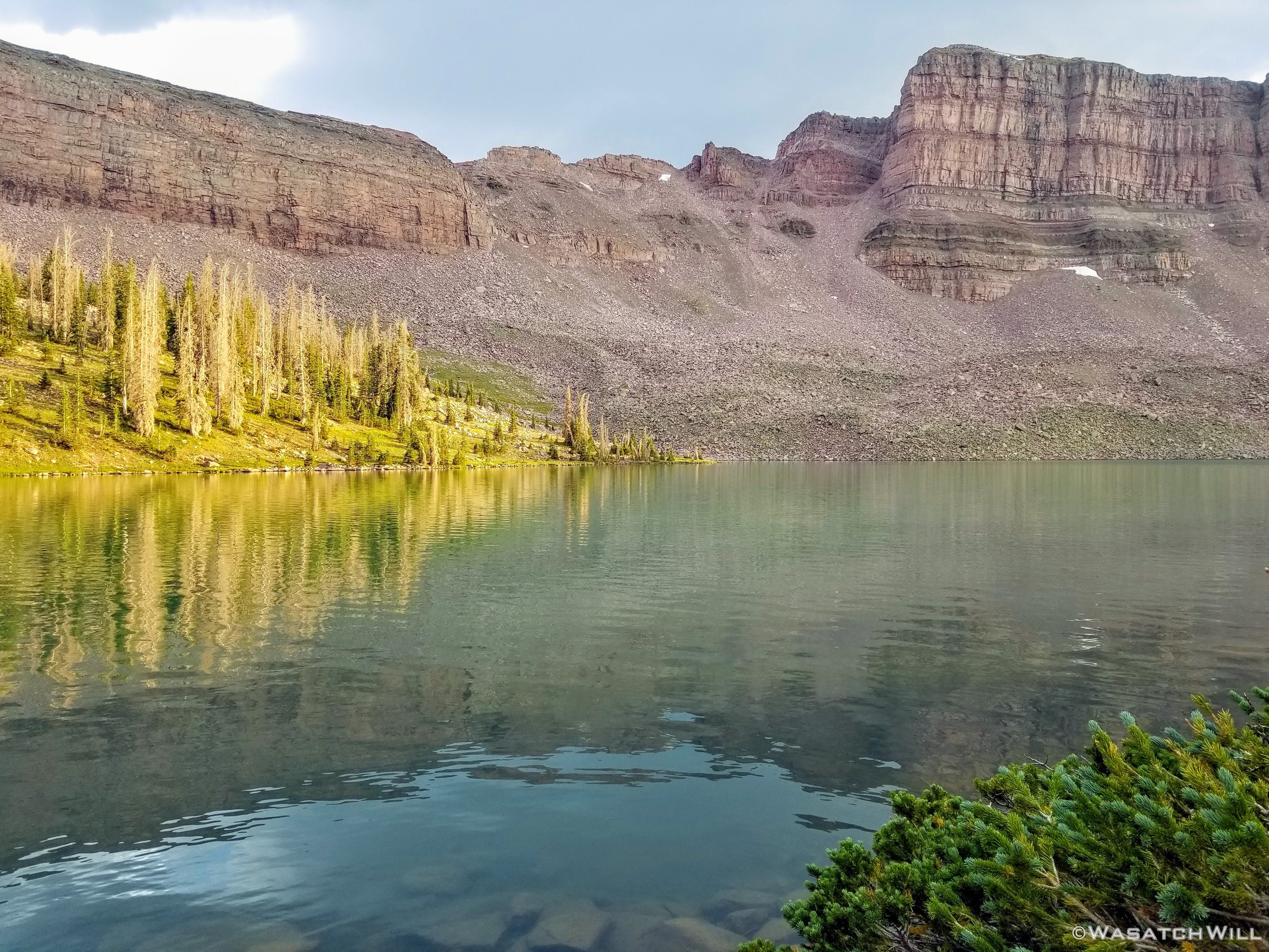
Before arriving back at camp, I wandered around the shores of Dead Horse Lake to again admire the flowers to be found all around the shoreline and the water all aglow from from the eastern sun. Ultimately I ended up back around the other side at the base of Dead Horse Pass before returning to pack up my camp.
Sunlight glistens on Dead Horse Lake
Fireweed with East Dead Horse Peak beyond
Wildflowers, Dead Horse Lake, and South Allsop Peak

Dead Horse Ridge
Dead Horse Lake with Dead Horse Pass (upper right) above
Once I had camp all packed up it was time to officially make my way down trail and down the drainage.

Falls along upper West Fork Blacks Fork
Close up of the falls
As typical with the mid to lower sections of each Uinta drainage, the trail would cut through various stands of forest with large open meadows in between giving way to nice views of the mountainous ridges to either side above.

Large clearing along West Fork Blacks Fork Trail
One particular clearing carries the name of Buck Pasture. While flowers were still blooming up on the higher edges of the head of the basin, most all that would have been down along the lower stretches of the trail had now been spent, perhaps 2 to 4 weeks earlier. At this point of what had been a very dry summer following a less than stellar snow year, the grasses too were already starting to dry up and go yellow and brown in various patches. Still, the views remained beautiful. I am also happy to report that given the dry conditions of things, the mosquitos were at a minimum throughout the trip.

Entering Buck Pasture

Looking back south across Buck Pasture to Mt Beulah beyond
One last look back while exiting Buck Pasture
Just below the big pasture I was greeted by the local sheep herd and their shepherd.

Baaa. Baaa. Baaa.
And shortly after that, I would be step back outside the wilderness boundary.
Exiting the wilderness area
By now the heat of mid-summer was making its presence known on account of being at the lowest elevation I had been in 3 days. I pulled over for a rest alongside the creek just past the wilderness boundary to have lunch, top of my water bottle, and to give my feet a much deserved breather. Giving them a quick dip into the ice cold creek was incredibly refreshing. I also removed the bottoms of my pants to convert them into shorts, something I don't often do.
Picking back up and continuing down trail until it had been nine miles from where I left camp, I arrived at the West Fork Blacks Fork Trailhead. The trailhead served as not just a terminus for the trail up to Dead Horse Lake and/or the Highline Trail, but also a junction with another trail, namely, the Bear River - Smith Fork Trail. This trail goes on to become the Highline - North Slope Trail if one were to take it eastward and out past East Fork Blacks Fork. I would be taking it westward however. It would serve as a link up back over to the East Fork Bear River and the trailhead where my car resided, five and a half miles more miles away.
At this point I had popped into my water bottle my first ever Nuun electrolyte tablet to try. My, what a game changer that turned out to be. Having paired it with a caloric lunch I had just eaten, I never felt any kind of bonk in my energy level as I pushed myself onward for the final pass.
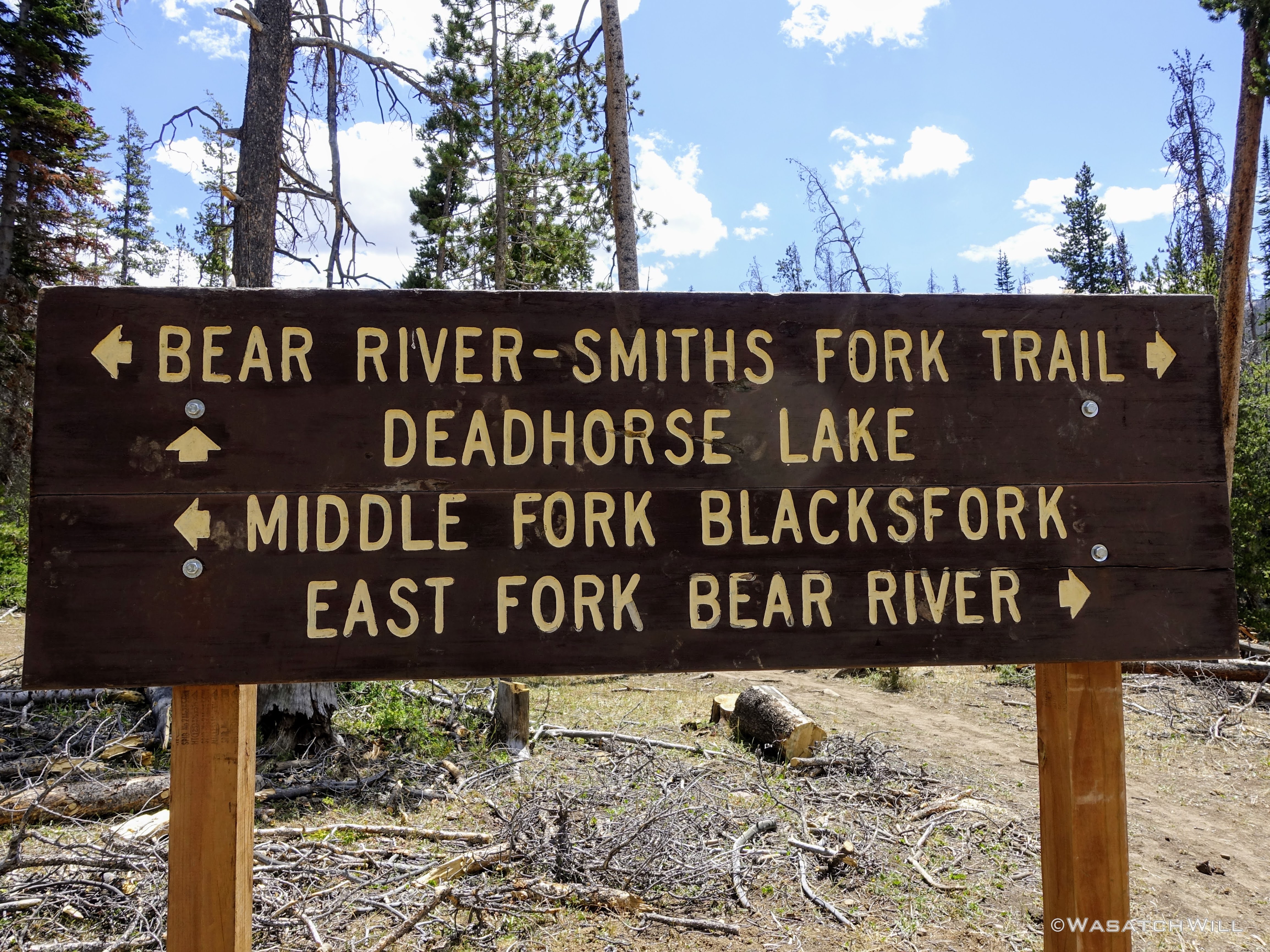
Trail sign at West Fork Blacks Fork Trailhead
To pick up the westward trail, however, would require fording the West Fork Blacks Fork. I could not see anything obvious on the other side to signal where the trail would be other than a small indentation amongst some high grass. Consulting my GPS showed that was probably it. If it wasn't, I figured it was as good of a spot to cross over as anywhere and I could just search out the trail on the other side.
Fortunately the water level was running low on account of virtually no snow left up high in the basin to melt down into any more runoff, so it would be a rather simple ford. I changed my shoes for the crossing and made it happen. Again, the cold water was so refreshing on my feet and sure enough, once on the other side, there was a path that became more evident and beyond that, a series of a few cairns through some trees and grassy meadows. This must be it!
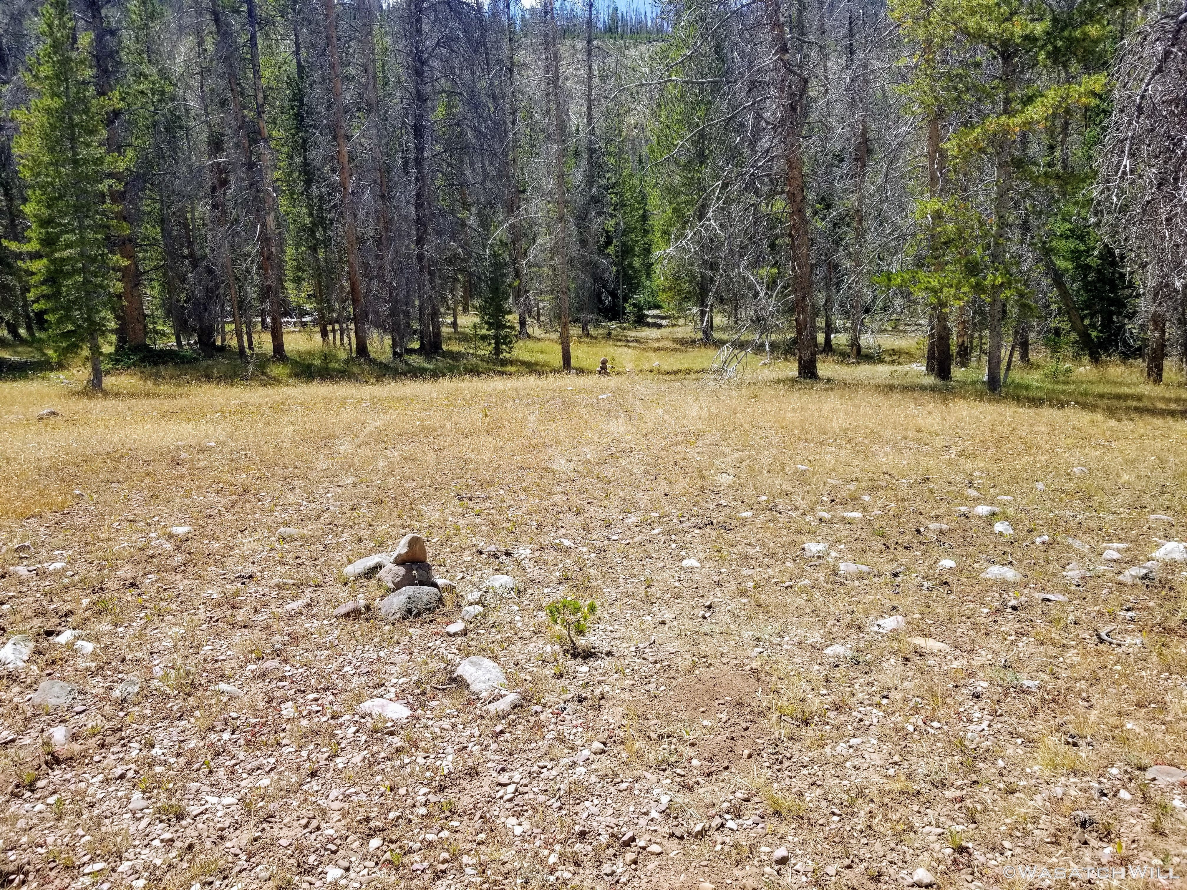
Cairns along Bear River - Smith Fork Trail
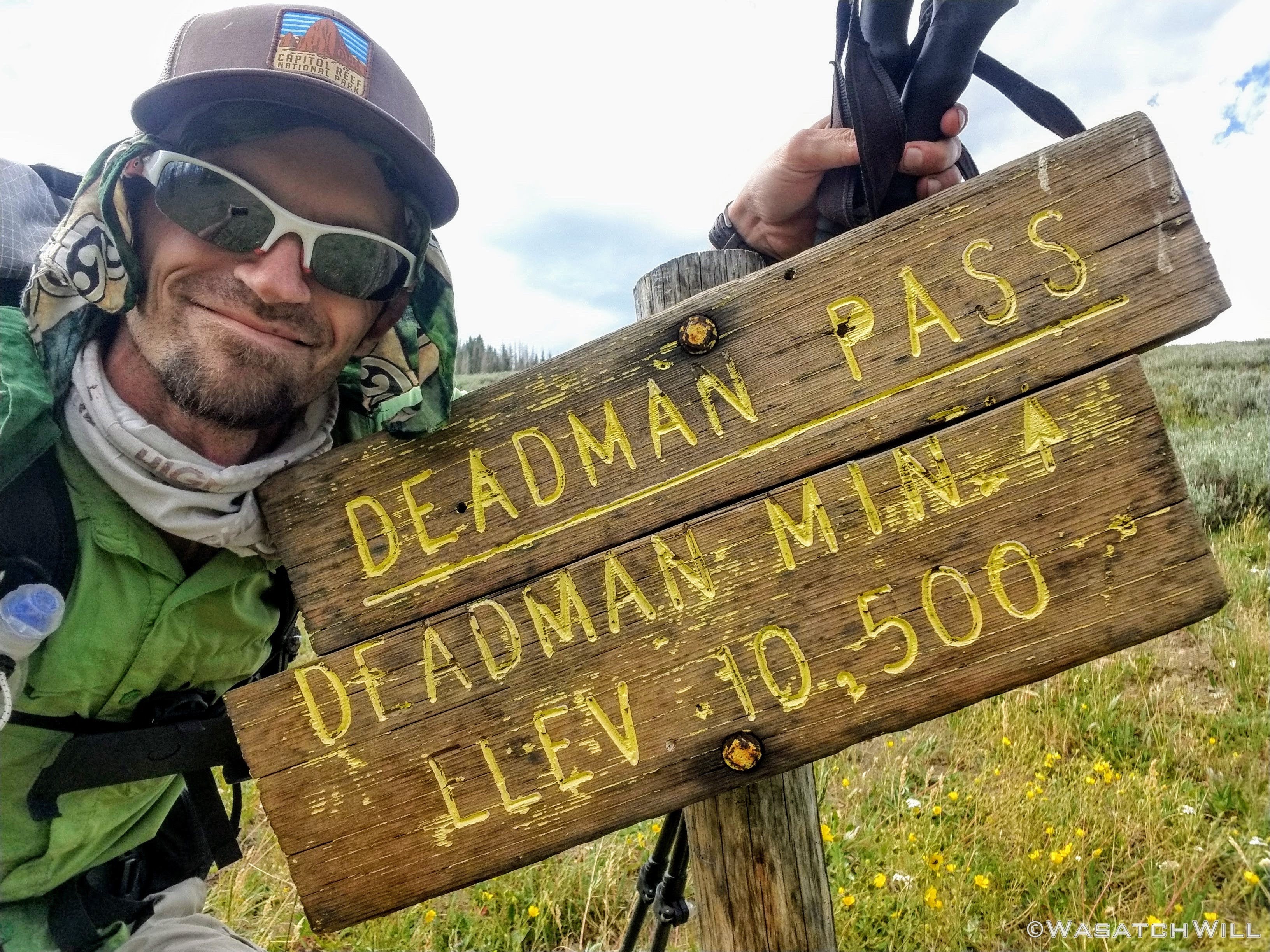
After the cairns, the trail become much more prominent and thus began the ascent up toward the final pass of the trip. That pass in target: Deadman Pass.

Onward and upward

Looking north across lower West Fork Blacks Fork drainage
After a lengthy affair through some very dense forest (which in turn provided some much appreciated shade), I crested over what I thought was Dead Man Pass. As it turns out, it ended up being a pass with no name, but it was the high point of the day at about 10,800 feet since leaving my last camp which sat closer to 10,900 feet above sea level.
What?! How was that not a pass?! No, technically it was a pass. Just because it didn't have a name on the map doesn't mean it wasn't a pass. How did this pass with a distinct trail not have a name? Arrghh!! Whatever. Because it doesn't have a name, I won't count it. If I did, it would mess up my catchy 4-4-4 title for the route.
Moving on, the trail continued on down a little ways until it seemingly disappeared and I was back to relying on my GPS to route me over to a little lake I'll call 10,412, after the manner of naming other lakes with given elevations on the map but no formal name. It might as well be called Dead Lake though or even Dead Fish Lake because it looked pretty dead with no sign of any fish living in it and looked pretty murky.

Lake 10,412...or 'Dead Lake'
From there I was able to pick up a well trodden trail which was actually now more of a road for ATV's and other high clearance vehicles. From the lake, this dirt road continued to lead me east toward Dead Man Pass.
It was hard not to laugh when sizing up Dead Mass Pass as I approached it. After all that I had been over to that point, it looked, well...rather cute and adorable.

Approaching Dead Man Pass (upper left)
Right where the road I was on swung north was my exit point. The turn-off was marked by a trail marker and then a post with a yellow diamond mounted on it.

Trail marker post
If indeed there was a path all the way up to the pass, I almost immediately lost it after the post. Instead, I strolled up the hill climbing over and negotiating a bunch of downed trees and deadfall with no apparent trail in sight until arriving at the top of the pass where indeed, there was a sign and a path emerged just below it.
Another 'saddle selfie'
Dead was apparently a common theme to the greater area, from Dead Horse Pass (and lake and peak), to now Deadman Pass. I'm not sure if the inspiration for the name of this pass came from Dead Horse Pass and someone thought it not fair to not have a Dead MAN Pass to go with it, or if indeed there was a man who died or was found dead in the vicinity some time in the past just as Dead Horse Pass likely received its name from a horse that must have died there. Whatever the origins of the name, there was nothing deadly at all about Deadman Pass save all the dead trees across it. Widow-makers, perhaps?. If anything, a more fitting name for it now might be Dead Tree Pass after the 2002 fire previously mentioned burned out all the life of said trees.
No matter. It was only a mile and a half to go now and it was all down hill coasting.

Dead trees galore

Overlooking the lower East Fork Bear River
A little over a mile later I rejoined the East Fork Bear River trail and from there, it was an easy stroll back over the boardwalks and through the aspens I had started the route with. In other words, my big loop had now been closed.

Final stretch
Back at the trail register, I couldn't help but brag a little in the comments. I DID IT!
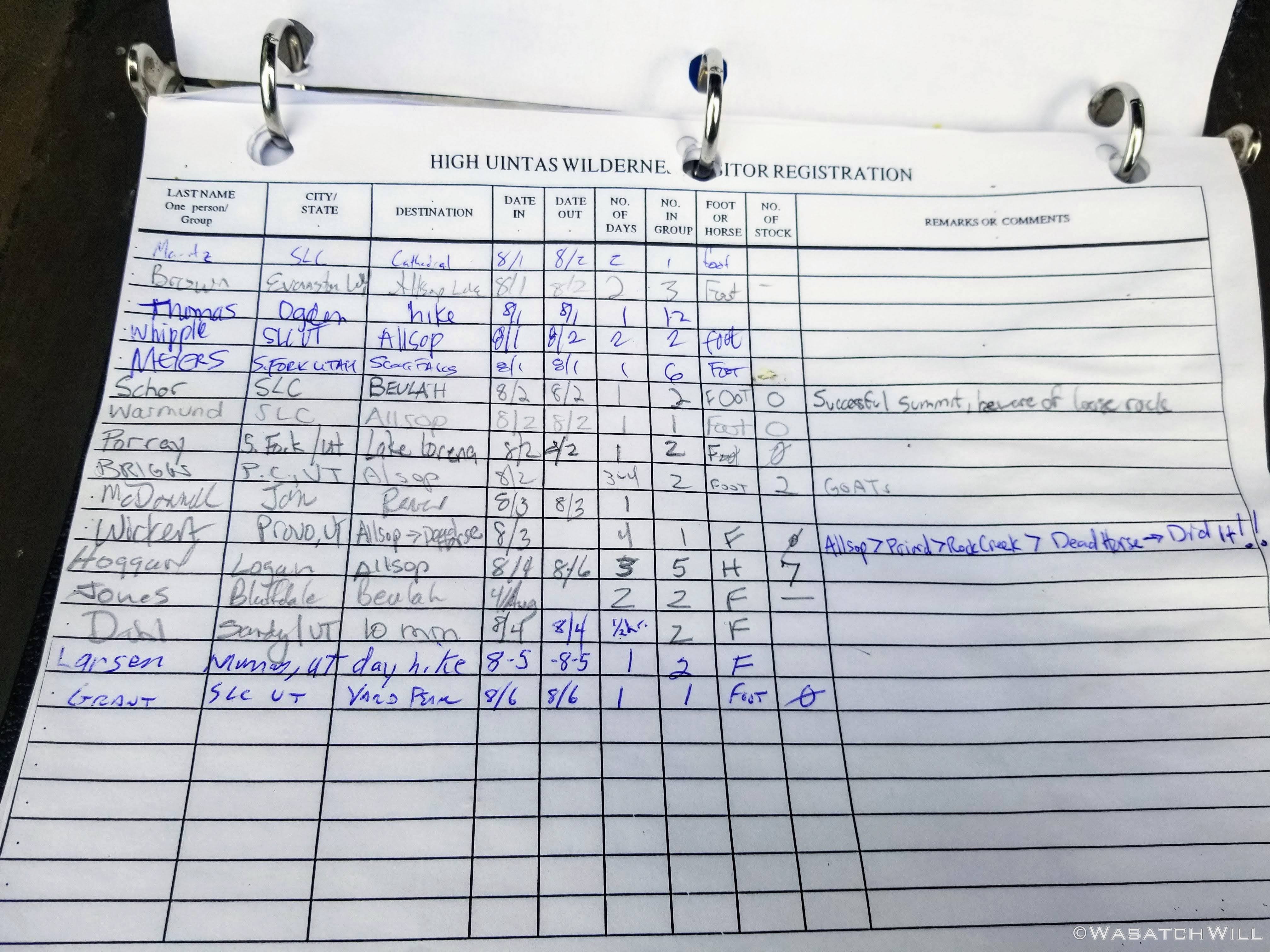
DID IT!!!
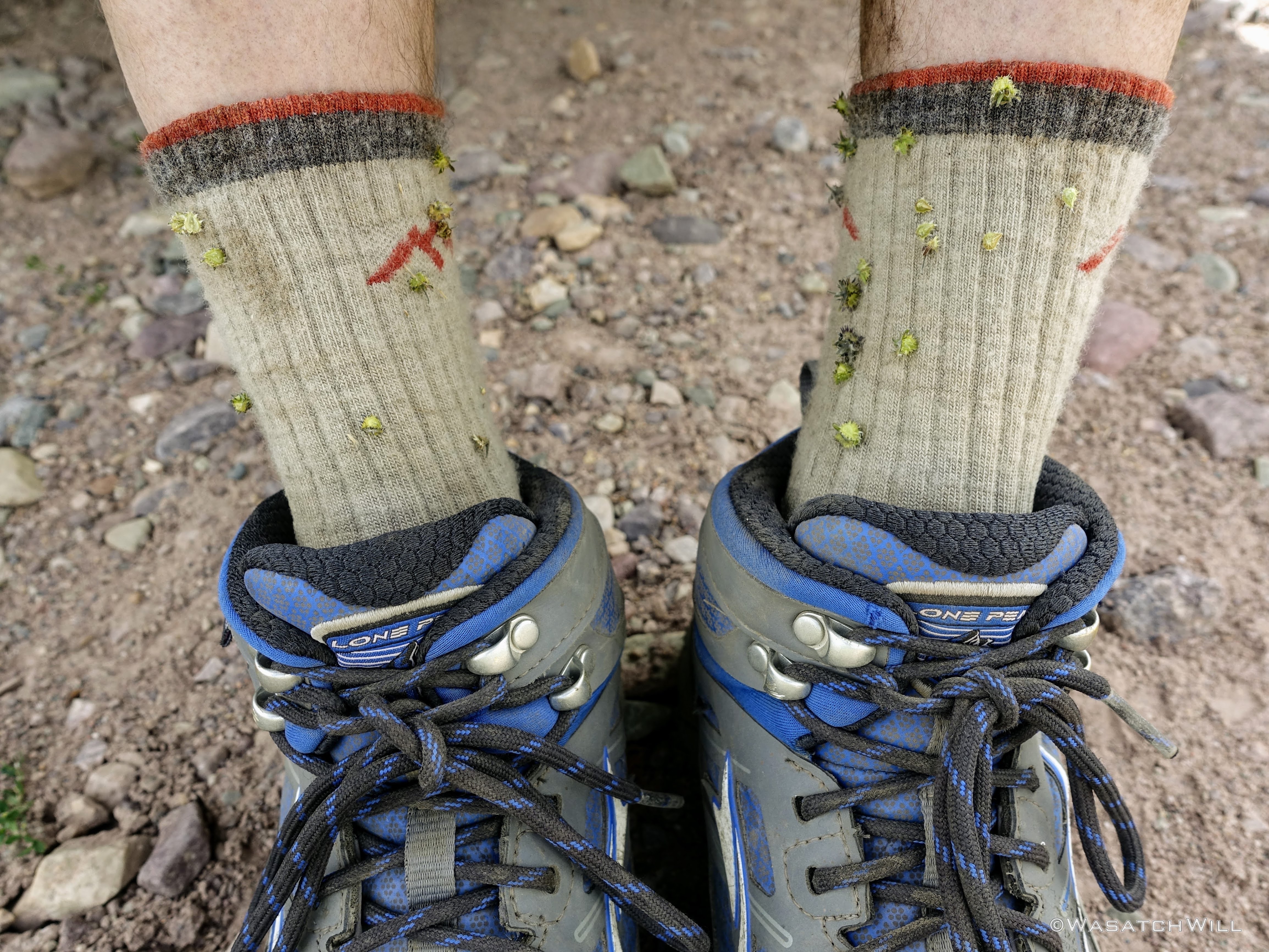
Sitting down at my car, I was reminded of one of the reasons why I typically stick to wearing pants when I go hiking and backpacking, especially when it involves off trail routes or even lesser traveled trails. My socks had become infested with a bunch of little sticky seeds I picked up from some plants somewhere along the way.
At last the route was complete. For all the themes of death on the day, I had survived and stayed alive. I had successfully completed my route incorporating 4 different basins via 4 different passes (plus some change) over the course of 4 days, gaining approximately 7,300 feet in the process.
YES!!!
It had been a fantastic route and boy did it feel so good to have it all go as I had planned...well, except for the missing tent stakes. Indeed, those had in fact been left behind in the back of my car. Now, I was eager to return back to my family at the cabin to finish out the week with them.
And so I did...
") . I was at Deadhorse Lake a few weeks after this and it was a zoo, like a big frat party, we took in the sights and then camped far, far away from the lake!
. I was at Deadhorse Lake a few weeks after this and it was a zoo, like a big frat party, we took in the sights and then camped far, far away from the lake!

")