- Joined
- Aug 21, 2018
- Messages
- 735
Excellent trip reports of our Hidden Creek/Teton Wilderness trip have been posted by @b.stark , @Georgia Yankee , @scatman , and @Bob . I know @wsp_scott takes a little longer to post his reports and I think @futurafree took about five pictures the entire trip, so I might as well take my turn and throw on another log to keep this campfire of a story going.
My reports tend to be wordy and picture heavy, so I am breaking my story up into three parts: The Approach, Hidden Creek, and the Return -- which could also be called wrapping things up (which Hugh should have done with his wrist ). You may have had your fill of Hidden Creek by now and you may not like wordy, picture heavy trip reports. I can appreciate that, but I'm going to post this one anyway.
Part One: The Approach.
We stepped into the wilderness on August 1st, but I should probably step back a day to July 31st. I took a flight from Ohio to Cody, Wyoming and @b.stark was kind enough to pick me up at the airport. He shuttled me into town and we wandered downtown Cody until we found ourselves eating ice cream at the "Big Chill" ice cream shop. Some time later a scraggly looking dude from Utah strolled in and ordered some Oreo ice cream -- @scatman had arrived. The three of us would be staying at the Irma for the night -- which I would recommend as the building felt historical and had character that did not feel gimmicky.
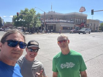
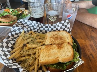
Later that afternoon @wsp_scott and @Bob joined us for dinner at the WyOld West Taproom. I really liked the truffle fries. My reports tend to be wordy and picture heavy, so I am breaking my story up into three parts: The Approach, Hidden Creek, and the Return -- which could also be called wrapping things up (which Hugh should have done with his wrist
Part One: The Approach.
We stepped into the wilderness on August 1st, but I should probably step back a day to July 31st. I took a flight from Ohio to Cody, Wyoming and @b.stark was kind enough to pick me up at the airport. He shuttled me into town and we wandered downtown Cody until we found ourselves eating ice cream at the "Big Chill" ice cream shop. Some time later a scraggly looking dude from Utah strolled in and ordered some Oreo ice cream -- @scatman had arrived. The three of us would be staying at the Irma for the night -- which I would recommend as the building felt historical and had character that did not feel gimmicky.


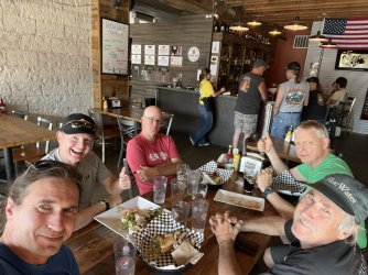
After dinner we waddled back to the hotel and watched the shootout performance that happens in front of the Irma most nights. Your time might be better spent in one of the local museums or even just eating dinner if it was something you were considering seeing. 
Day One: August 1, 2024
Today's itinerary involved hiking a distance up the Deer Creek trail in the Washakie Wilderness. Hugh shuttled me down to the trailhead where we waited for @wsp_scott and @futurafree to arrive. @Bob and @b.stark were riding horseback up the trail and we would be meeting up with them tomorrow.
It was known going in that the Deer Creek trail had a lot of elevation gain and was somewhat exposed. Having only yesterday as an acclimation day I probably should have elected to ride the horse too, but part of me wanted to see if I was up for the challenge of hiking up. I was about to find out if my training hikes with Mrs.TractorDoc over the summer had conditioned my legs well enough to carry my 50+ pack -- 10lbs. of which was unessential cameras, batteries, etc.
Beautiful morning at the Deer Creek Trailhead in the Shoshone National Forest.
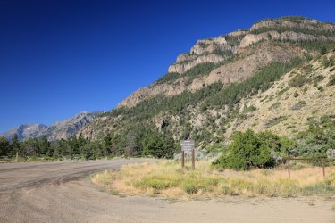

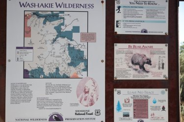
Postings at the trailhead.
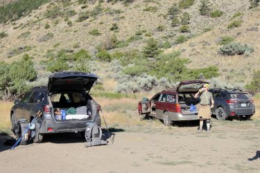
It must have been bring your Subaru to the trailhead day.
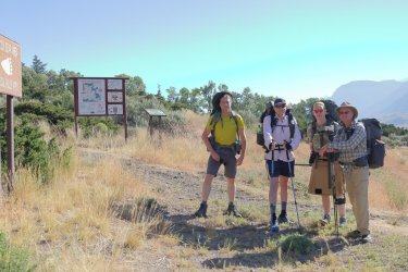
An ambitious group of hikers. I just made it into the picture after hitting the auto timer on the camera, so I look a little disheveled.
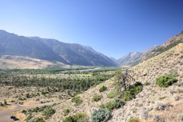
The Deer Creek trail quickly ascends a series of switchbacks providing nice views of the South Fork of the Shoshone River (and some Subarus).
I would be at the back of the group most of the day. Hugh was moving swiftly on this part of the trail, he blends right in.
I mentioned the Deer Creek trail had some areas of (moderate?) exposure. I really do not like heights, but I managed to make my way up. At least there was a little slope that you would have to roll down (and maybe catch yourself on) before you flew off the cliff to an impending doom.
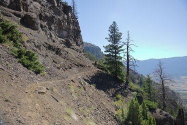
After the first main set of switchbacks and rounding a couple corners you are greeted by the sight of this lovely double drop falls. I was too chicken to get close enough to the edge to capture the bottom of the second drop in the picture.
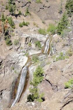
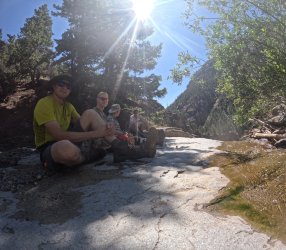
Taking a rest at the falls. Morale is still high.
Looking back towards the falls and the path we had taken.
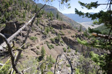
After the initial switchbacks there is a stretch of trail that ascends gradually. Portions of it bring you close to Deer Creek.
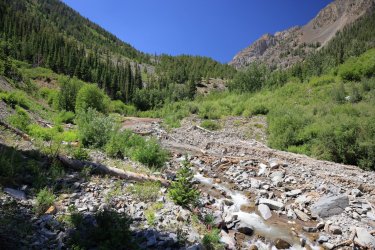
The trail begins to climb again not long after this water crossing.
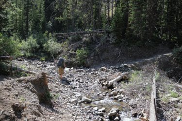
As the trail climbed and gained elevation my pace slowed. I would still see Hugh ahead of me from time to time. I think he stopped now and again to see if I was still coming. . . or if I had turned around! I felt bad that instead of the sounds of the wilderness all he could hear was the sound of me sucking air as I tried to stay oxygenated.
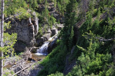
Deer Creek was not always visible from the trail as we continued up the trail, but sometimes it was. This little waterfall looked like it would be worth the scramble down to see it up close.
Deer Creek was not always visible from the trail as we continued up the trail, but sometimes it was. This little waterfall looked like it would be worth the scramble down to see it up close.
It was bound to happen -- we crossed paths with the outfitter that hauled Bob and Brent to the top. I think he is telling Hugh that the trail climbs switchbacks here, then goes up a hill there, then eventually climbs more switchbacks. . .
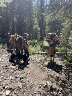
Day one was originally going to cover about seven miles, but a lack of suitable campsites had us continuing up the trail. It was a hot day, but mercifully a good portion of the trail is shaded. I tucked the camera away around this time and focused on getting up the trail. Pictures of a shady trail are not that exciting anyway.
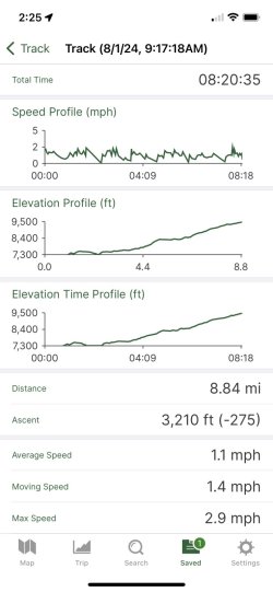
As my tracking app was ticking just over 8.8 miles I saw Scott ahead on the trail saying something about finding a campsite. He did not use favorable adjectives to describe the site, but seeing as how I had contemplated sleeping leaning up against a tree I thought any flat spot would look fantastic. The campsite was rather nice in my opinion -- a pleasant stretch of Deer Creek was even nearby.
Dinner for night one. The BBQ Mac and Cheese was not as Barbequey as I would have liked. Also, Mrs.TractorDoc has been partial to using my official BCP water bottle. . . so I tried making my own for this trip. I wrote "Backcountry Post" on it with a marker, but it had worn off by day three.
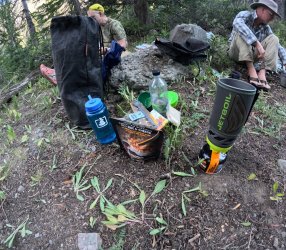
Camp for night one. This was the first level spot we found suitable for a campsite for a group of our size. I did not notice the dead pine trees surrounding us at the time -- something Bob pointed out later.

Maybe the most interesting picture of day one for some. Eight hours, three thousand feet of elevation gain, 8.8 miles, heavy pack.
Another fun day one story unfolded as I used the satellite communicator to check in back home. I received a message from Brent after he and Bob took an off trail route via North Fork Butte Creek earlier that day -- the same route our group planned to take tomorrow. Brent advised (and I quote) "DO NOT try to go down N Fk Butte Creek, very sketchy." He went on to say where he and Bob would try to meet us the next day. I showed Chris and Scott the message and they were convinced to take the South Fork Butte Creek trail without too much trouble. The "DO NOT" was in capital letters after all.
I knew Hugh would not be as easily convinced -- he had already climbed into his tent for the night so I approached telling him with the same caution I might use in rounding a blind, willow covered bend near a roaring creek deep in Grizzly country. Hugh had not yet drifted off to sleep, so I relayed Brent's message. Hugh wanted more details on what "sketchy" meant -- details I could not provide due to lack of immediate communications via satellite device.
Not long after that I crawled into my tent for the night. I did not get the best nights sleep, not because of the uncertainty of what route to take in the morning but because I had pitched my tent on a subtle rise in the ground and I was trying to sleep in the shape of an upside down 'U."
Day Two: August 2, 2024
After a breakfast discussion and more satellite communication with Brent it was decided that our group would take the South Fork Butte Creek trail today and try to meet up with Bob/Brent where the North and South Forks join. I know Hugh really wanted to try the route down the North Fork of Butte Creek. . . there is a rumor out there that he wants to explore that area in the future. . .
From camp it was about a mile and a half to Deer Creek Pass -- up more switchbacks and (moderately?) exposed trail. We would climb above tree line though and the effort walking up the switchbacks was offset by the visual treat of Kingfisher Peak looming to the South.
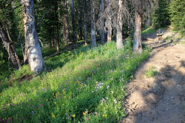
Wildflowers lining the trail as we left camp.
Nice view of Kingfisher Peak.
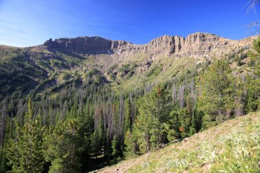
I fell to the back of the group for the second day in a row -- partly because I was still trying to adjust to the mountain air and partly because I was taking a lot of pictures. My dislike of heights was present, but it did not stop me from moving on up. I'm not sure I'd want to ride a horse on this part!
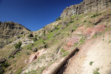
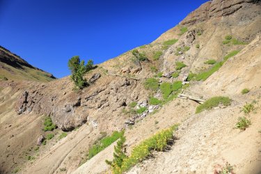
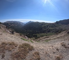
Deer Creek Pass, looking down the South Fork of Butte Creek. This marks the boundary of the Washakie and Teton Wilderness.
This year I brought along a fixed 16mm wide angle lens that came in handy for times like these.
This year I brought along a fixed 16mm wide angle lens that came in handy for times like these.
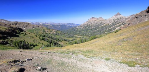
Looking back down Deer Creek Valley.
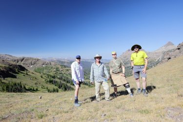
Group shot at the Pass. I should mention that Chris is quite the speedy hiker and group/camp shots were about the only time I was able to get his picture.

Group shot at the Pass. I should mention that Chris is quite the speedy hiker and group/camp shots were about the only time I was able to get his picture.
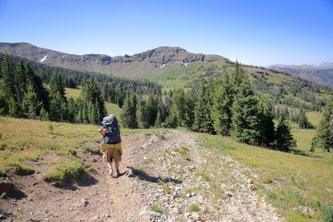
Hugh. . . reluctantly heading down the South Fork Trail. 
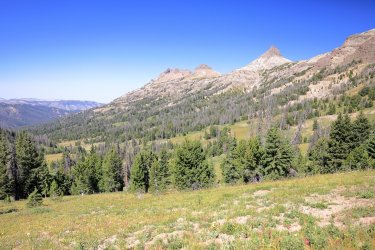
Thorofare Buttes dominate the view to our right.
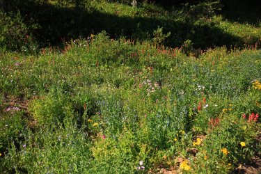
Wildflowers displaying a riot of colors.
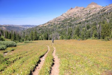
A look back up to Deer Creek Pass. I thought this was the last time I would get to see it.
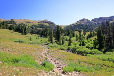
The hillside to our left was covered in fireweed (I think). The Woody Creek Trail covers ground in that region. . . rumor has it someone wants to check it out on a future hike. . .
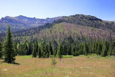
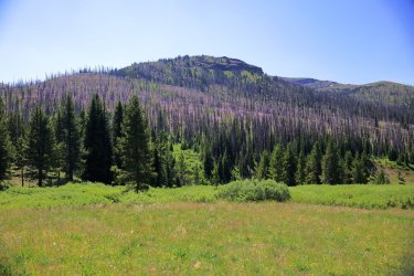
It was another hot day and I progressed down the trail by darting thru the sunny spots and catching my breath in the shady spots. The majority of today's hike was downhill so I was able to stick with the group today.
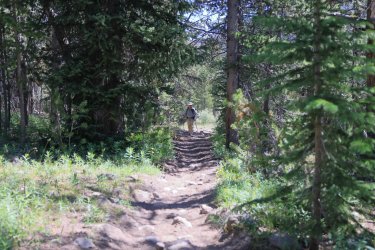
Sunny stretch of trail.
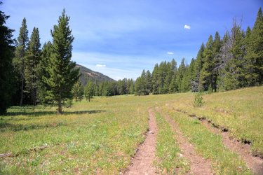
Some nice views of Butte Creek's South Fork could be had as we approached the junction of the North Fork.
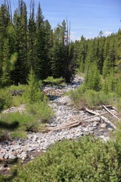
After some searching our group of four grew to six when we met up with Bob and Brent. Even when I can catch up with Chris he is hard to get a picture of (as he hides behind Scott here).
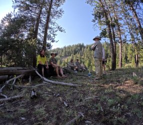
There is an outfitter camp near the Butte Creek Junction but we found our own little slice of home down the trail and not far from the creek.
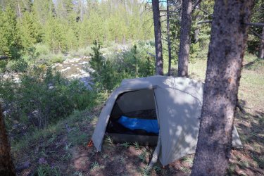
Dinner time on our second night out, first night in the Teton Wilderness.
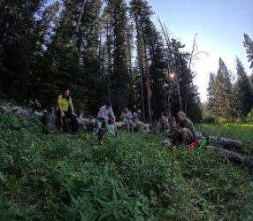
I remember the biting flies becoming a nuisance in the afternoon. Before turning in the group discussed the plan for tomorrow. We were running ahead of schedule by moving our second night camp ahead on the trail. Tomorrow's original goal was to hike to the junction of Thorofare and Hidden Creeks, but we decided to try and cover more ground up the Hidden Creek Trail too. There was also a chance of meeting @Georgia Yankee tomorrow. For some reason I thought he had posted on the forum a change of plans and that we might not cross paths. . . but it turns out I was wrong. It happens.
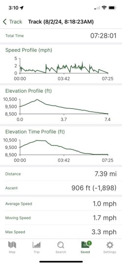
Day Two Data Track.
Day Three: August 3, 2024
Day three began with a walk down still unfamiliar terrain as we followed the main channel of Butte Creek. This would change when the Butte Creek Trail merged with the Thorofare Creek Trail that Scott, Hugh, Bob, and I travelled last year. If many months ago you had bet me I would be back on this trail in 2024 I would have lost the wager.
Main channel of Butte Creek.
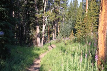
Some of the woodsy sections of trail were adorned with attractive patches of fireweed.
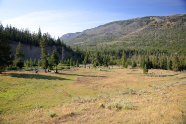
Getting close to familiar territory. Somewhere behind those trees Butte Creek flows into Thorofare Creek.
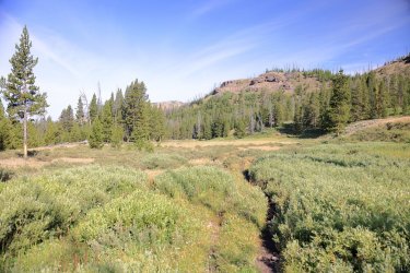
Officially on the Thorofare Creek Trail. Hello Old Friend.
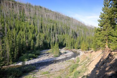
This part of the trail took us right up to Thorofare Creek. Farther down the trail we would be walking thru a burned out area with dense lodgepole regrowth -- a tree prison of sorts.
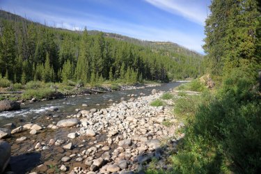
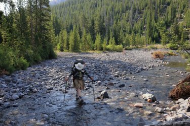
Brent taking some big steps as he approaches Pass Creek.
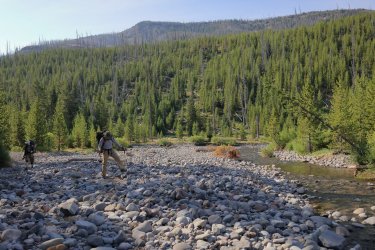
Scatman in the act of crossing Pass Creek.
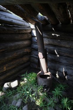
Between Pass Creek and Hidden Creek one can find this old cabin on a bench above Thorofare Creek.


Sunny stretch of trail.

Some nice views of Butte Creek's South Fork could be had as we approached the junction of the North Fork.

After some searching our group of four grew to six when we met up with Bob and Brent. Even when I can catch up with Chris he is hard to get a picture of (as he hides behind Scott here).

There is an outfitter camp near the Butte Creek Junction but we found our own little slice of home down the trail and not far from the creek.

Dinner time on our second night out, first night in the Teton Wilderness.

I remember the biting flies becoming a nuisance in the afternoon. Before turning in the group discussed the plan for tomorrow. We were running ahead of schedule by moving our second night camp ahead on the trail. Tomorrow's original goal was to hike to the junction of Thorofare and Hidden Creeks, but we decided to try and cover more ground up the Hidden Creek Trail too. There was also a chance of meeting @Georgia Yankee tomorrow. For some reason I thought he had posted on the forum a change of plans and that we might not cross paths. . . but it turns out I was wrong. It happens.
Day Two Data Track.

Day Three: August 3, 2024
Day three began with a walk down still unfamiliar terrain as we followed the main channel of Butte Creek. This would change when the Butte Creek Trail merged with the Thorofare Creek Trail that Scott, Hugh, Bob, and I travelled last year. If many months ago you had bet me I would be back on this trail in 2024 I would have lost the wager.
Main channel of Butte Creek.

Some of the woodsy sections of trail were adorned with attractive patches of fireweed.

Getting close to familiar territory. Somewhere behind those trees Butte Creek flows into Thorofare Creek.

Officially on the Thorofare Creek Trail. Hello Old Friend.

This part of the trail took us right up to Thorofare Creek. Farther down the trail we would be walking thru a burned out area with dense lodgepole regrowth -- a tree prison of sorts.

Brent taking some big steps as he approaches Pass Creek.

Scatman in the act of crossing Pass Creek.

Between Pass Creek and Hidden Creek one can find this old cabin on a bench above Thorofare Creek.


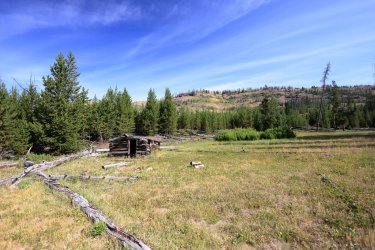
Perfect spot for a group shot I say. One, two three. . . hmmm, do I see seven BCPers in the next picture?
You betcha! When we saw a determined looking hiker booking it down the Thorofare Trail Scott bravely called out and invited him up to our cabin rest spot. It turned out to be none other than @Georgia Yankee !
You betcha! When we saw a determined looking hiker booking it down the Thorofare Trail Scott bravely called out and invited him up to our cabin rest spot. It turned out to be none other than @Georgia Yankee !
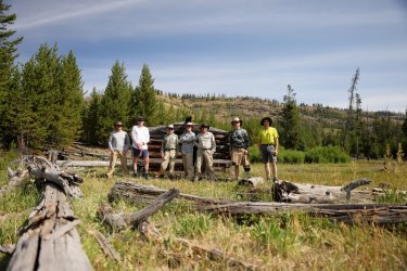
Jim would be joining us on the journey up Hidden Creek. After introductions/pleasantries he returned to pack up his camp while the rest of the "Hidden Creek Seven" (Magnificent Seven was already taken  ) moved down the trail.
Does Bob make Thorofare Creek look good, or does Thorofare Creek make Bob look good? I say Yes!
Does Bob make Thorofare Creek look good, or does Thorofare Creek make Bob look good? I say Yes!
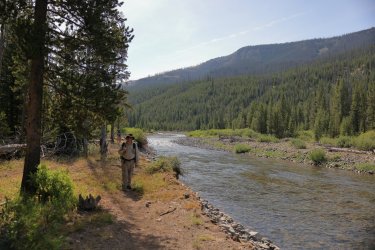
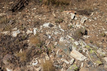
A spur trail leads away from the official Thorofare Creek Trail and leads down to Thorofare Creek/a junction with the trail to Hidden Creek. This interesting display of petrified wood was near the trail.
Hidden Creek is hiding somewhere between those two hills.

Hidden Creek is hiding somewhere between those two hills.
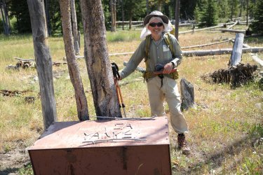
A better look at @Georgia Yankee . He made the mistake of telling me he was a retired geologist. I may have asked him a question or two about rocks during his time with us.
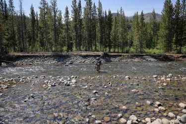
Crossing of Thorofare Creek -- no more than knee deep on this day.
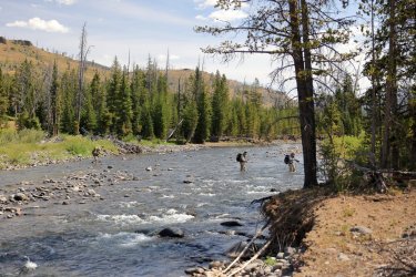
Some bendy clouds compliment winding Thorofare Creek nicely.

Crossing of Thorofare Creek -- no more than knee deep on this day.


Some bendy clouds compliment winding Thorofare Creek nicely.
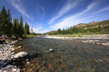
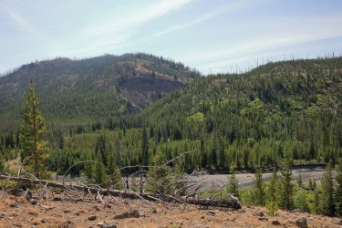
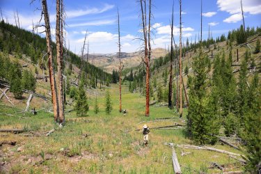
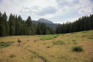
After crossing Thorofare Creek (and resting a bit) we located and hiked up the Hidden Creek trail to an outfitters camp near the junction of East/West branches of Hidden Creek. The trail climbed up an interesting little valley that had burned and provided nice views back toward Petrified Ridge. Some of my favorite pictures capture the group members scattered along the trail.
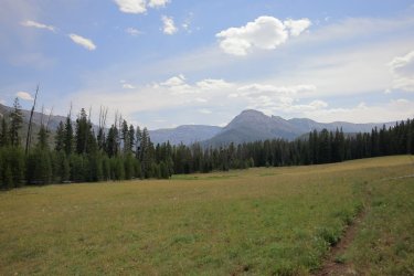
Camp for the night was somewhere near the base of the hill (mountain?) at center right. This same picture might be found in most of the other trip reports, but I think we were all here at different times.
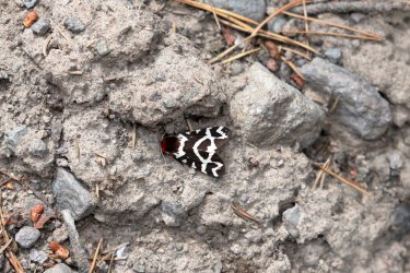
A cool moth I noticed on the trail. Not sure if this is what Hugh calls a Police Car Moth -- I do not remember seeing the red heads on those.
Jim was on the move. I was able to chat with him a bit on this section of the trail -- when I was able to keep up with him.
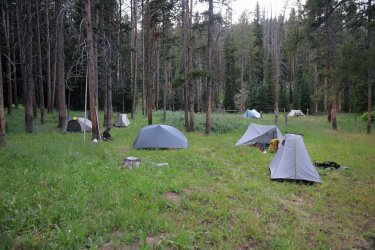
We found the outfitter camp without much trouble and set up our tent city on the outskirts. This was my least favorite campsite of the trip as there was not much of a view and a modest swarm of biting flies in the area.
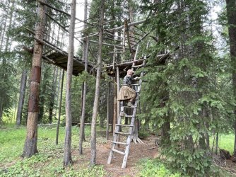
I think Hugh was scoping out potential tent sites here. He might actually be smiling -- could be conjuring memories of the tree house he had that time when he was young.
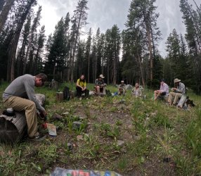
At least the outfitter camp had some seating for dinner. GoPro take a picture!
I'll tell you it is an elk skull, but does the background bony structure between the guy in the yellow shirt and Brent's head look like a skeleton?
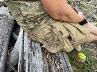
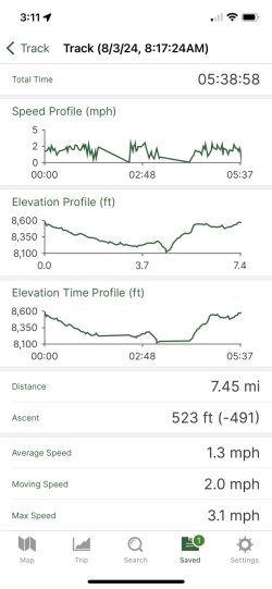
Words of wisdom and the data track to end Day Three.
The end of Day Three brings us to the end of Part One of my story.
Around the dinner circle this evening we had discussions about what we might see tomorrow. To complete the initial route planned for our trip we would have to find a path up the canyon walls at the head of the main Hidden Creek Canyon. We did not yet know if this was possible (advice from outfitters/guides/locals seemed to suggest it was not), but we were determined to find out. I'll be sure to post what we saw and what happened in my next installment (even though everyone already knows!). If you do not already know and cannot wait that long you can just read one of the other trip reports.

A cool moth I noticed on the trail. Not sure if this is what Hugh calls a Police Car Moth -- I do not remember seeing the red heads on those.

Jim was on the move. I was able to chat with him a bit on this section of the trail -- when I was able to keep up with him.

We found the outfitter camp without much trouble and set up our tent city on the outskirts. This was my least favorite campsite of the trip as there was not much of a view and a modest swarm of biting flies in the area.

I think Hugh was scoping out potential tent sites here. He might actually be smiling -- could be conjuring memories of the tree house he had that time when he was young.

At least the outfitter camp had some seating for dinner. GoPro take a picture!
I'll tell you it is an elk skull, but does the background bony structure between the guy in the yellow shirt and Brent's head look like a skeleton?

Words of wisdom and the data track to end Day Three.


The end of Day Three brings us to the end of Part One of my story.
Around the dinner circle this evening we had discussions about what we might see tomorrow. To complete the initial route planned for our trip we would have to find a path up the canyon walls at the head of the main Hidden Creek Canyon. We did not yet know if this was possible (advice from outfitters/guides/locals seemed to suggest it was not), but we were determined to find out. I'll be sure to post what we saw and what happened in my next installment (even though everyone already knows!). If you do not already know and cannot wait that long you can just read one of the other trip reports.
Last edited:

