IntrepidXJ
ADVENTR
- Joined
- Jan 17, 2012
- Messages
- 3,488
Tuesday & Wednesday, July 29-30, 2014
The Decalibron is a name given to a route in the Mosquito Range that allows you to summit four of Colorado's 58 named 14ers in one 7-mile loop; Mount Democrat (14,148 feet), Mount Cameron (14,238 feet), Mount Lincoln (14,286 feet) and Mount Bross (14,172 feet). Some people do not count Mount Cameron as an official 14er because it is not ranked (the saddle between Cameron and Lincoln does not drop below the 300 feet required), but I have decided that I am going to try and complete the list of named 14ers and am going to count it (why short myself some Colorado high points?). Since my goal for the year is to summit five 14ers, I figured that this hike would be a good way to reach that goal after hiking Huron Peak a few weeks ago. Since this route is very popular and closer to the Front Range (Denver area), it can be very busy on the weekends. I decided to avoid the crowds by taking a day off from work in the middle of the week to attempt this hike.
I left work before lunch on Tuesday morning with weather forecasts of heavy rain and thunderstorms for the rest of the day and the following day, including flash flood warnings throughout the state. I wasn't sure if I'd even be able to make the climb in this weather, but I thought I'd still drive down there and hope for the best the following morning since the forecasts have certainly been wrong in the past.
After lunch in Breckenridge I drove over Hoosier Pass to Alma and then followed Buckskin Creek up to Kite Lake where I would setup camp for the night just above 12,000 feet.
Mount Bross on the left and Mount Lincoln on the right from just below Hoosier Pass on this cloudy afternoon.
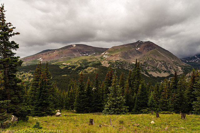
Bross & Lincoln by IntrepidXJ, on Flickr
A different view of Mount Bross.
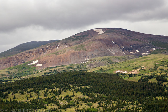
Mount Bross by IntrepidXJ, on Flickr
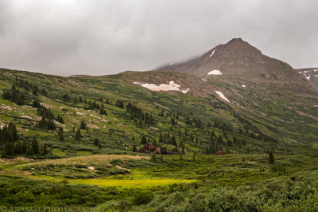
My tentcot setup near Kite Lake below Mount Democrat in the clouds.
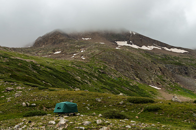
Kite Lake Camp by IntrepidXJ, on Flickr
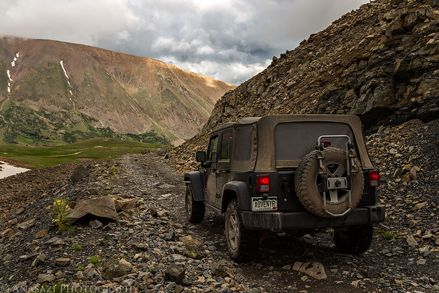
My Jeep at the trailhead below Mount Democrat. I never would get a good look at the summit of this mountain on this trip as it would be in the clouds the whole time.
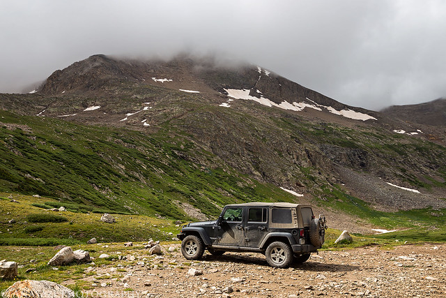
Below Mount Democrat by IntrepidXJ, on Flickr
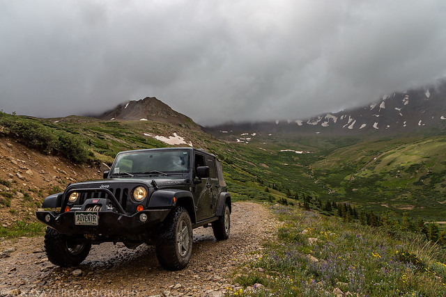
After setting up camp I still had a few hours to kill before sunset, so I decided to drive over to nearby Mosquito Pass and see if I could get any views that weren't in the clouds.
A small insignificant peak in the spotlight along the Mosquito Pass Road.
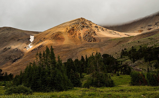
In the Light by IntrepidXJ, on Flickr
Mosquito Peak (13,781 feet) in the clouds.
Mosquito Peak by IntrepidXJ, on Flickr
Clouds cover the peaks above the basin behind me.
Under Low Clouds by IntrepidXJ, on Flickr
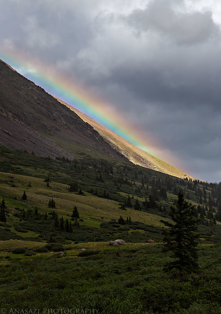
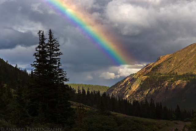
A rainbow appears next to London Mountain (13,194 feet).
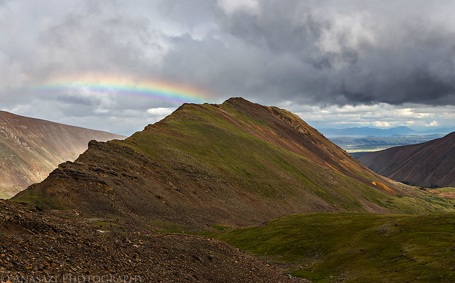
London Mountain by IntrepidXJ, on Flickr
My Jeep below the rainbow on my drive up to Mosquito Pass.
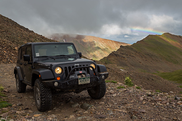
Mosquito Pass Rainbow by IntrepidXJ, on Flickr
Nice light over American Flats with another faint rainbow to the right of London Mountain.
Gulch Light by IntrepidXJ, on Flickr
Light on the ridge above the Mosquito Pass Road I was driving up.
Mount Buckskin Ridge by IntrepidXJ, on Flickr
Low clouds over American Flats below.
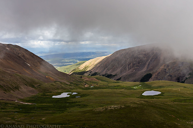
Moving Clouds by IntrepidXJ, on Flickr
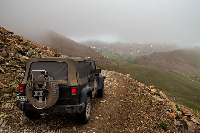
Almost to the pass, which means I'd be driving through the clouds the rest of the way.
In the Clouds by IntrepidXJ, on Flickr
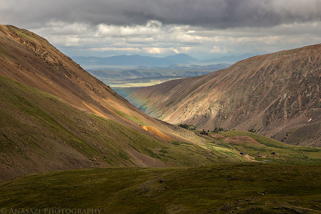
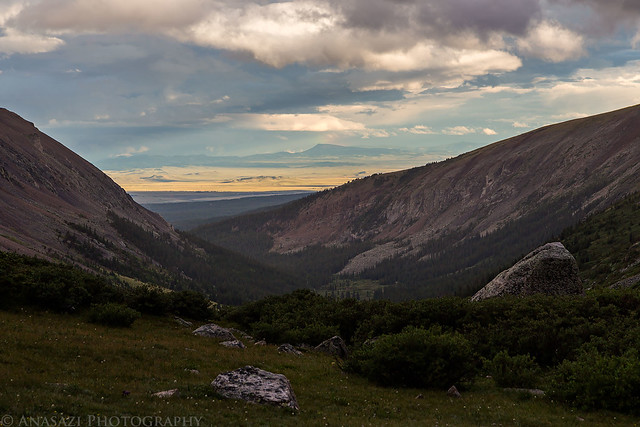
Nice view through a gap under the clouds and nice light on the distant landscape.
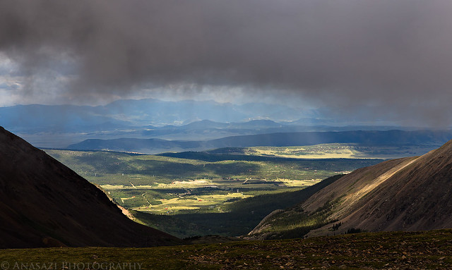
Below the Clouds by IntrepidXJ, on Flickr
Finally at Mosquito Pass, the highest drivable pass in Colorado at 13,185 feet. It was pretty windy up here.
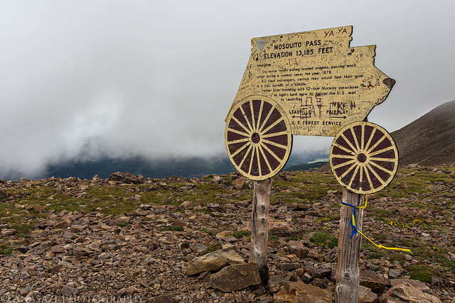
Mosquito Pass by IntrepidXJ, on Flickr
After watching the clouds blow over the pass for a little while it was time to start driving back down the way I had come.
Back Down by IntrepidXJ, on Flickr
Bumpy Road by IntrepidXJ, on Flickr
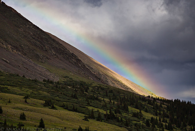
Another rainbow, this time outlining the edge of the mountain.
Edge Rainbow by IntrepidXJ, on Flickr
A closer look.
On the Edge by IntrepidXJ, on Flickr
Pennsylvania Mountain (13,006 feet) lit up in the distance as I make my way back towards Alma.
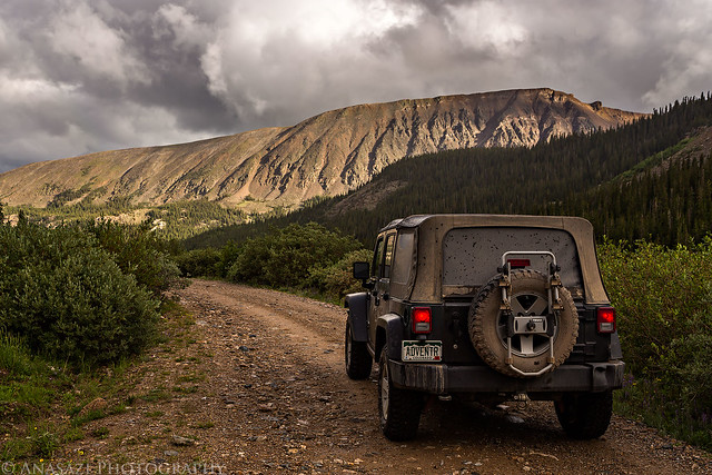
Leaving by IntrepidXJ, on Flickr
I saw one more nice rainbow on my way back.
Mosquito Rainbow by IntrepidXJ, on Flickr
When I was back in Alma, I checked the latest weather forecast on my phone while I still had signal. It was still calling for heavy rain and thunderstorms most of Wednesday, but there was a small window with little chances of storms between 4:00am and 7:00am. I typically start my summit hikes around 4:00am, so it looked like I would have a small window of time to try and avoid the weather.
View from near my camp at sunset before getting into my sleeping bag for the night.
Light in the Distance by IntrepidXJ, on Flickr
After getting into my sleeping bag shortly after sunset (there wasn't really a sunset with all the clouds) it started to rain pretty good. It would rain on and off for much of the night with some gusty winds on occasion.
The alarm on my phone went off at 3:30 and I was surprisingly wide awake. I looked outside of my tent see see what the weather was doing and saw some stars, but I also saw some large patches of black, which mean there were still some clouds around. It was pretty calm out at this point and I decided to start my climb to up Mount Democrat and see how the weather played out. I figured that I could always retreat after doing Democrat if the weather turned. It would have been nice to get updated weather conditions on my phone, but I was unable to get signal anywhere along the entire hike.
Before I continue with the trip report, I'd like to apologize in advance for the rest of the photos. I am almost too embarrassed to post them. Not only was it too dark out early in the morning which required very high ISO settings (a lot of noise), I was also in the clouds for most of the hike which limited my views. To top it off, I ended up with some ice and water drops on my lens which caused some focusing issues and blurry spots on some of the photos. These are certainly not my finest photos. That said, I am still posting them anyway so that I can document the trip here on my site (the whole purpose of this trip was to hike The Decalibron, so it would be disappointing if I didn't have any photos from that portion of the trip!). I will definitely have to return another day for better views and photos in the future!
I left camp around 3:50am and started my hike up the trail under the the stars above with some help from my headlamp. I was feeling pretty good and made it to the top of Mount Democrat before 6:30am. It was still a half hour before sunrise and in the clouds, so I couldn't see very much.
My view from the top of Mount Democrat at least thirty minutes before sunrise.
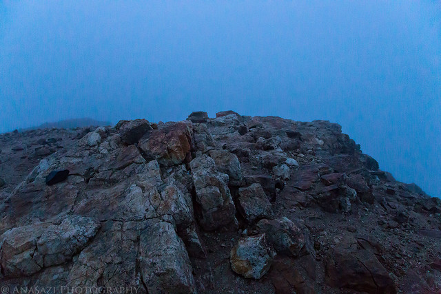
Mount Democrat Summit by IntrepidXJ, on Flickr
From the top of Mount Democrat I descended back to it's saddle with Mount Cameron and had to make the decision of whether or not I wanted to try and complete the loop or head back down to camp. If I continued on the loop I would not really have another opportunity to bail out and would have to complete it. It was just about sunrise when I reached the saddle so I could see that plenty of new clouds had moved into the area. I could not see much of the sky around me, but what I could see didn't look threatening. I decided to take my chances and climbing up to the summit of Mount Cameron to complete the loop. I planned to keep moving pretty quickly, though.
Hiking back down to the saddle between Mount Democrat and Mount Cameron.
Back to the Saddle by IntrepidXJ, on Flickr
The view towards Mount Cameron.
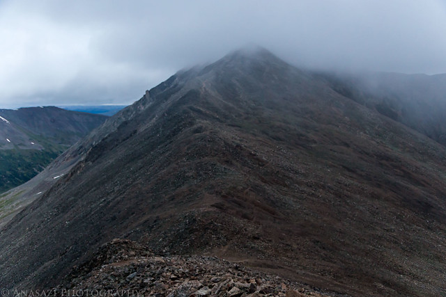
To Cameron by IntrepidXJ, on Flickr
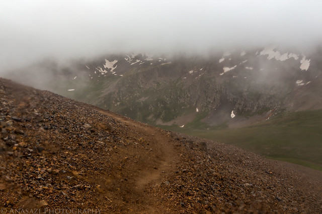
View back towards the trailhead while out of the clouds for a moment.
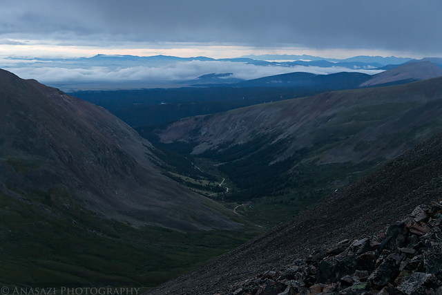
View Down by IntrepidXJ, on Flickr
Climbing up Mount Cameron in the clouds.
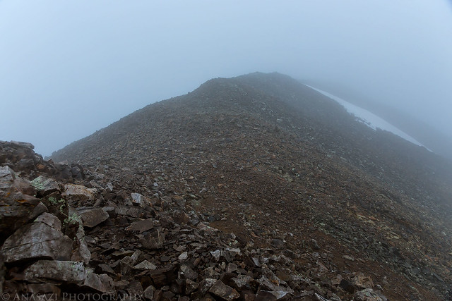
Cloud by IntrepidXJ, on Flickr
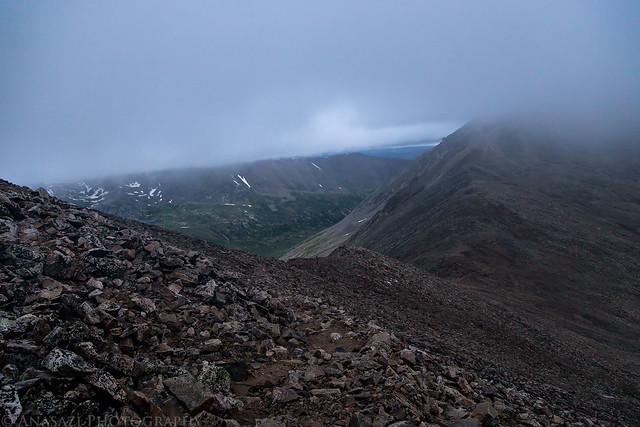
As I got closer to the summit of Mount Cameron the clouds really thickened up and I couldn't see very far around me. It also started to rain and snow on me at this point, so I had to put my camera away for a little while and didn't get any photos from this area. From the big wide summit of Cameron I quickly made my way out to Mount Lincoln in the same thick cloud-cover and returned back to the ridge so I could follow it to Mount Bross.
I could just barely make out Kite Lake below under this small gap in the clouds between Mount Lincoln and Mount Bross.
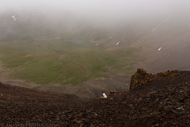
Kite Lake by IntrepidXJ, on Flickr
Descending the trail back to the trailhead from Mount Bross. Getting down below the clouds.
Descending Bross by IntrepidXJ, on Flickr
Hey look! Mount Democrat is almost out of the clouds for the first time since I've been here.
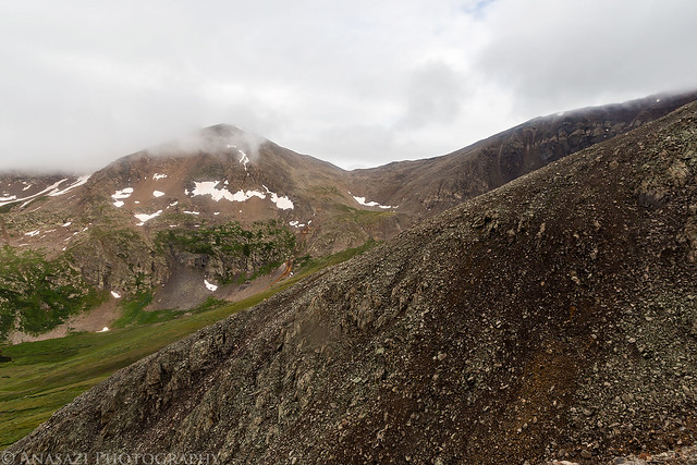
A Little Clearer by IntrepidXJ, on Flickr
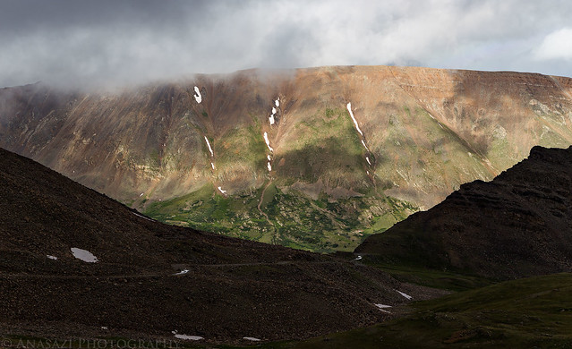
Clouds over a ridge of Mount Buckskin across the gulch.

Ridge Clouds by IntrepidXJ, on Flickr
A quick shot of a nice waterfall along the trail shortly before reaching the end of the loop.
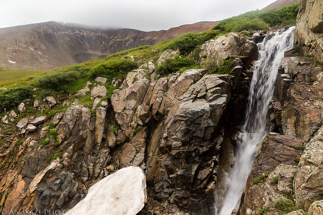
Trail Waterfall by IntrepidXJ, on Flickr
I must be getting in pretty good shape with all the high-altitude mountain hiking I've been doing lately, because this hike seemed a lot easier to me than many of the other 14ers I've done over the years. I made it back down to Kite Lake trailhead around 8:00am and I didn't run into a single other person on the trail the whole time. I guess it's not surprising with the weather conditions and it being the middle of the week, though. While I am glad that I was able to complete the loop and summit all four of these 14ers to reach my goal for the year, it was still a little bittersweet since I was unable to truly enjoy the views from the top of these mountains. I will definitely have to come back another time to complete the loop again when the weather is more favorable.
>> The Decalibron Photo Gallery
>> The Original Trip Report on ADVENTR.CO
Featured image for home page:

The Decalibron is a name given to a route in the Mosquito Range that allows you to summit four of Colorado's 58 named 14ers in one 7-mile loop; Mount Democrat (14,148 feet), Mount Cameron (14,238 feet), Mount Lincoln (14,286 feet) and Mount Bross (14,172 feet). Some people do not count Mount Cameron as an official 14er because it is not ranked (the saddle between Cameron and Lincoln does not drop below the 300 feet required), but I have decided that I am going to try and complete the list of named 14ers and am going to count it (why short myself some Colorado high points?). Since my goal for the year is to summit five 14ers, I figured that this hike would be a good way to reach that goal after hiking Huron Peak a few weeks ago. Since this route is very popular and closer to the Front Range (Denver area), it can be very busy on the weekends. I decided to avoid the crowds by taking a day off from work in the middle of the week to attempt this hike.
I left work before lunch on Tuesday morning with weather forecasts of heavy rain and thunderstorms for the rest of the day and the following day, including flash flood warnings throughout the state. I wasn't sure if I'd even be able to make the climb in this weather, but I thought I'd still drive down there and hope for the best the following morning since the forecasts have certainly been wrong in the past.
After lunch in Breckenridge I drove over Hoosier Pass to Alma and then followed Buckskin Creek up to Kite Lake where I would setup camp for the night just above 12,000 feet.
Mount Bross on the left and Mount Lincoln on the right from just below Hoosier Pass on this cloudy afternoon.
Bross & Lincoln by IntrepidXJ, on Flickr
A different view of Mount Bross.
Mount Bross by IntrepidXJ, on Flickr
My tentcot setup near Kite Lake below Mount Democrat in the clouds.
Kite Lake Camp by IntrepidXJ, on Flickr
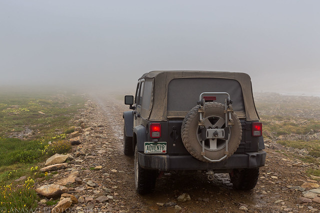
My Jeep at the trailhead below Mount Democrat. I never would get a good look at the summit of this mountain on this trip as it would be in the clouds the whole time.
Below Mount Democrat by IntrepidXJ, on Flickr
After setting up camp I still had a few hours to kill before sunset, so I decided to drive over to nearby Mosquito Pass and see if I could get any views that weren't in the clouds.
A small insignificant peak in the spotlight along the Mosquito Pass Road.
In the Light by IntrepidXJ, on Flickr
Mosquito Peak (13,781 feet) in the clouds.
Mosquito Peak by IntrepidXJ, on Flickr
Clouds cover the peaks above the basin behind me.
Under Low Clouds by IntrepidXJ, on Flickr
A rainbow appears next to London Mountain (13,194 feet).
London Mountain by IntrepidXJ, on Flickr
My Jeep below the rainbow on my drive up to Mosquito Pass.
Mosquito Pass Rainbow by IntrepidXJ, on Flickr
Nice light over American Flats with another faint rainbow to the right of London Mountain.
Gulch Light by IntrepidXJ, on Flickr
Light on the ridge above the Mosquito Pass Road I was driving up.
Mount Buckskin Ridge by IntrepidXJ, on Flickr
Low clouds over American Flats below.
Moving Clouds by IntrepidXJ, on Flickr
Almost to the pass, which means I'd be driving through the clouds the rest of the way.
In the Clouds by IntrepidXJ, on Flickr
Nice view through a gap under the clouds and nice light on the distant landscape.
Below the Clouds by IntrepidXJ, on Flickr
Finally at Mosquito Pass, the highest drivable pass in Colorado at 13,185 feet. It was pretty windy up here.
Mosquito Pass by IntrepidXJ, on Flickr
After watching the clouds blow over the pass for a little while it was time to start driving back down the way I had come.
Back Down by IntrepidXJ, on Flickr
Bumpy Road by IntrepidXJ, on Flickr
Another rainbow, this time outlining the edge of the mountain.
Edge Rainbow by IntrepidXJ, on Flickr
A closer look.
On the Edge by IntrepidXJ, on Flickr
Pennsylvania Mountain (13,006 feet) lit up in the distance as I make my way back towards Alma.
Leaving by IntrepidXJ, on Flickr
I saw one more nice rainbow on my way back.
Mosquito Rainbow by IntrepidXJ, on Flickr
When I was back in Alma, I checked the latest weather forecast on my phone while I still had signal. It was still calling for heavy rain and thunderstorms most of Wednesday, but there was a small window with little chances of storms between 4:00am and 7:00am. I typically start my summit hikes around 4:00am, so it looked like I would have a small window of time to try and avoid the weather.
View from near my camp at sunset before getting into my sleeping bag for the night.
Light in the Distance by IntrepidXJ, on Flickr
After getting into my sleeping bag shortly after sunset (there wasn't really a sunset with all the clouds) it started to rain pretty good. It would rain on and off for much of the night with some gusty winds on occasion.
The alarm on my phone went off at 3:30 and I was surprisingly wide awake. I looked outside of my tent see see what the weather was doing and saw some stars, but I also saw some large patches of black, which mean there were still some clouds around. It was pretty calm out at this point and I decided to start my climb to up Mount Democrat and see how the weather played out. I figured that I could always retreat after doing Democrat if the weather turned. It would have been nice to get updated weather conditions on my phone, but I was unable to get signal anywhere along the entire hike.
Before I continue with the trip report, I'd like to apologize in advance for the rest of the photos. I am almost too embarrassed to post them. Not only was it too dark out early in the morning which required very high ISO settings (a lot of noise), I was also in the clouds for most of the hike which limited my views. To top it off, I ended up with some ice and water drops on my lens which caused some focusing issues and blurry spots on some of the photos. These are certainly not my finest photos. That said, I am still posting them anyway so that I can document the trip here on my site (the whole purpose of this trip was to hike The Decalibron, so it would be disappointing if I didn't have any photos from that portion of the trip!). I will definitely have to return another day for better views and photos in the future!
I left camp around 3:50am and started my hike up the trail under the the stars above with some help from my headlamp. I was feeling pretty good and made it to the top of Mount Democrat before 6:30am. It was still a half hour before sunrise and in the clouds, so I couldn't see very much.
My view from the top of Mount Democrat at least thirty minutes before sunrise.
Mount Democrat Summit by IntrepidXJ, on Flickr
From the top of Mount Democrat I descended back to it's saddle with Mount Cameron and had to make the decision of whether or not I wanted to try and complete the loop or head back down to camp. If I continued on the loop I would not really have another opportunity to bail out and would have to complete it. It was just about sunrise when I reached the saddle so I could see that plenty of new clouds had moved into the area. I could not see much of the sky around me, but what I could see didn't look threatening. I decided to take my chances and climbing up to the summit of Mount Cameron to complete the loop. I planned to keep moving pretty quickly, though.
Hiking back down to the saddle between Mount Democrat and Mount Cameron.
Back to the Saddle by IntrepidXJ, on Flickr
The view towards Mount Cameron.
To Cameron by IntrepidXJ, on Flickr
View back towards the trailhead while out of the clouds for a moment.
View Down by IntrepidXJ, on Flickr
Climbing up Mount Cameron in the clouds.
Cloud by IntrepidXJ, on Flickr
As I got closer to the summit of Mount Cameron the clouds really thickened up and I couldn't see very far around me. It also started to rain and snow on me at this point, so I had to put my camera away for a little while and didn't get any photos from this area. From the big wide summit of Cameron I quickly made my way out to Mount Lincoln in the same thick cloud-cover and returned back to the ridge so I could follow it to Mount Bross.
I could just barely make out Kite Lake below under this small gap in the clouds between Mount Lincoln and Mount Bross.
Kite Lake by IntrepidXJ, on Flickr
Descending the trail back to the trailhead from Mount Bross. Getting down below the clouds.
Descending Bross by IntrepidXJ, on Flickr
Hey look! Mount Democrat is almost out of the clouds for the first time since I've been here.
A Little Clearer by IntrepidXJ, on Flickr
Clouds over a ridge of Mount Buckskin across the gulch.
Ridge Clouds by IntrepidXJ, on Flickr
A quick shot of a nice waterfall along the trail shortly before reaching the end of the loop.
Trail Waterfall by IntrepidXJ, on Flickr
I must be getting in pretty good shape with all the high-altitude mountain hiking I've been doing lately, because this hike seemed a lot easier to me than many of the other 14ers I've done over the years. I made it back down to Kite Lake trailhead around 8:00am and I didn't run into a single other person on the trail the whole time. I guess it's not surprising with the weather conditions and it being the middle of the week, though. While I am glad that I was able to complete the loop and summit all four of these 14ers to reach my goal for the year, it was still a little bittersweet since I was unable to truly enjoy the views from the top of these mountains. I will definitely have to come back another time to complete the loop again when the weather is more favorable.
>> The Decalibron Photo Gallery
>> The Original Trip Report on ADVENTR.CO
Featured image for home page:
")