randakag
Member
- Joined
- Jun 8, 2013
- Messages
- 36
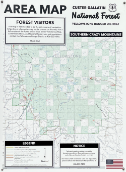
Peter, Chris and I spent the second week of September in the Crazy Mountains, an “island” range in central Montana. It was an incredible week of stunning high-peak scenery that is super accessible. But the 30ish mile out-and-back (with approximately 17,000' of elevation) wasn't a cake walk, as you will see below. The range is about a hundred miles northeast of Bozeman, surrounded by high plains. “The Crazies” are an odd amalgamation of US Forest Service land (green squares in the map below) and private parcels (white), laid out in an arbitrary checkerboard. One minute the trail is on public land and the next it’s an easement that you’re not allowed to leave until you reenter public land, which eventually the trails do.
Their topography promised big mountain scenery on day one, but wasn’t conducive to loops or traverses. Which may explain the relative dearth of information on the web about its backcountry. I also had the sense that this non-Wilderness wilderness was less known because locals prefer it that way. We met up in Bozeman (Chris from London, Peter from New Paltz and me from Old Lyme), got fuel at REI, ate at Ted’s downtown, and went to bed early. By seven the next day we were on I80 towards Big Timber. At the Grand Hotel we had our traditional eggs-bacon-potatoes last supper (tasty!). We then drove Highway 191 North along the eastern front of the Crazies, before turning west, first on Wooster and then on Big Timber Canyon Road. The rolling high plains roll more and more and then shoot straight up. But all we see is smoke.
Six fires raged in western Montana that week and the smoke came unhindered across the high plains to The Crazies. Where it got caught in the abrupt prominence of the range. There weren’t any fires in the Crazies - I called the Ranger Station a week earlier to confirm that. But I didn't think to ask them about the air quality. We’ve backpacked into smoke before, but this stuff was thicker and more persistent. From the highway just south of The Crazies, you'd hardly have known there mountains there.
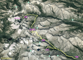
Day 1, Sunday: Halfmoon CG (6470) to Blue Lake (8240), 3.6 miles via Big Timber Creek.
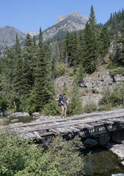
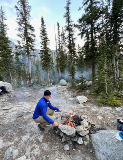
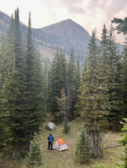
Only when we were a good way into Big Timber Creek Valley did the peaks emerge, as did lush, forested slopes and a rushing rocky creek. Once in the range - at least at first - the smoke was manageable. The change in elevation and full packs made more of an impact on us as we headed up the rather gentle forest trail alongside the creek. We crossed a few bridges and 2.3 miles in we left the main trail and began a 1150 foot climb up and 150 down to Blue Lake. After hopscotching a wide flat creek to a split of land, we made camp by the western shores of Blue Lake. There were plenty of tent sites and a few fire rings. In all directions we had big views of the lake and the surrounding peaks, including Crazy Peak.
After making camp Chris and I scrambled our way over to Granite Lake and tried to find a high open point from which to shoot the peaks and upper valleys around us. While we were able to get some decent shots, none were the hoped-for panorama. We also began to see the limits of our “big” cameras relative to our iPhones. Though the skies were meteorologically clear (the weather was great), the smoke diffused the light so much that our big lenses had trouble focusing and metering.
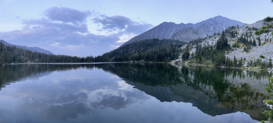
The iPhones, on the other hand, took multiple exposures using multiple lenses and then fused them together with its processor to create far more representative images. Later in the trip, under different conditions, the iPhone over processed images that didn’t need it, creating “ultra” realism which was not representative. As you’ll see, the smoke played a big part in our trip, as did what supplanted it.
Day 2, Monday: Blue Lake (8240) to Glacier Lake (8550), 5.4 miles via Big Timber Cr (7750) and Conical Pass (10,020)
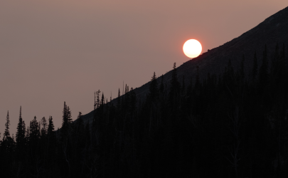
Lots of elevation on this one. First, we had one of the craziest sunrises ever. The smoke and cloudless skies and sun coming up over the lower ridge line of Big Timber Peak made a spectacle. It was also a harbinger of the air quality to come.
The trail back down to Big Timber Creek was simple. As was the one up to Twin Lakes. Without the smoke, the views of Upper Twin and the surrounding cirque would have been unparalleled. Upper Twin sits on private land, which will be of interest later in our trek.
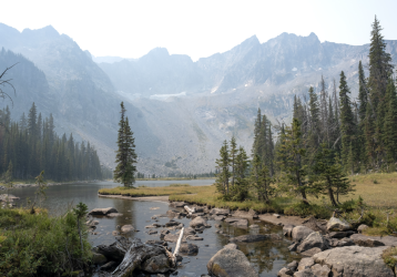
From there we began the relentless yet enjoyable march up to Conical Pass. The trail seems to go much higher than is necessary. The lower forest gives way to krummholz. And the vistas up and out of the valley are wonderful. We pass a high alpine camp site nestled in boulders and trees. Remember that, we tell each other, knowing we’ll come back this way in a few days.
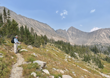
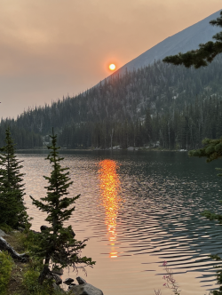
Above tree line, giant dark peaks appear, and the wind picks up. We stow our big cameras and must lean into the wind as we get near the pass. Once or twice, I lose my footing but get it back quickly. The wind is ripping at the pass. The weather station a little higher up seems pointless, its sensors spinning wildly. We spend almost no time there and soon stared down into Glacier Lake through a smokey haze. And we wonder: how can there be this much smoke and wind at the same time? But there is. Glacier Lake reflects the sun back. Photos are meaningless. Down we go, fifteen hundred feet.
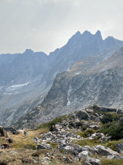
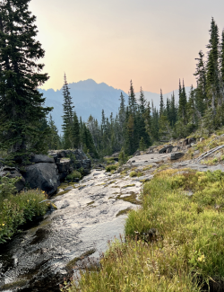
On the way we hear the echo of hollering down by the Glacier Lake. Are there people on the island? Impossible. Our goal was a half mile or so past the lake. We even skip the lake, knowing we can go back whenever. Near the bottom of the descent we meet two young women, probably in their twenties. They were camping by the lake, but the wind nearly shredded their tent. So, they went to Sunlight Lake and had a great time. Now they’re off to Twin Lakes. They go up, we go down. Looking for camp, which we find on a rocky rise in the valley just before it gets steeper and narrower. There are high jagged peaks in all directions. It reminds us of the Sawtooth’s in Idaho, where we spent a glorious week in 2014. The smoke plays tricks on us, turning the light auburn and peach. The creek rushes nearby. Chris makes another top-notch fire, and we enjoy nightfall before heading to bed.
Day 3, Tuesday: Glacier Lake (8550) to Moose Lake (7750), 5.8 miles via Sweetgrass Creek (7250)
Our original plan was to go to Campfire Lake and spend 2 nights there before returning to Conical Pass and heading out. That changed around lunchtime. After breakfast we leisurely headed down the South Fork of Sweetgrass Creek, the trail was steep at first and passed a few waterfalls. A mile or so in it leveled out into a stunning valley of broad meadows and lazy bends in the creek. One could easily camp tucked in behind one of the stands of trees, and not leave for a week (but we’re on private land, so….).
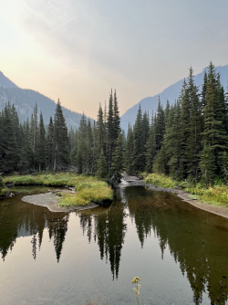
Farther down the valley we had open views of the eastern flank of Sunlight Peak. As we neared the trail junction, we saw what looked like a semi-permanent hunting camp on the far side of a small meadow. Are we back on private land? At the junction by the creek we found some shade, dropped packs and made lunch. The weather was perfect, and down in the forest it was easier to forget the smoke.
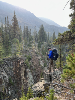
We hear voices. A few minutes later we meet a surgeon from Billings and his two twentysomething sons. It’s the beginning of bow hunting season and they’re after elk. From the camp you can see straight across to the upper slopes of the long ridge. Open slopes where elk like to hang out and bugle. Today there aren’t any elk, so they’re fishing. We tell them our destination for today (Campfire Lake) and the dad asks, “Are you sure you want to go that far? Some bad weather is coming in. We’re packing up tomorrow. Probably going to snow.”
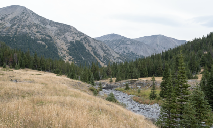
We didn’t want to cross Conical Pass in the snow, so we altered our plan. They showed us small meadows on the map that were on public land but still a short walk from Moose Lake. The goal was to camp a night in the forest and make our way back up to Glacier Lake in the morning. As the hike down was stunning and mellow, we had no problem retracing our steps a day early. On Thursday we’d cross back over Conical Pass, hopefully before it snowed. That way - should things get nasty - we’d only be a few forested miles from the trailhead.
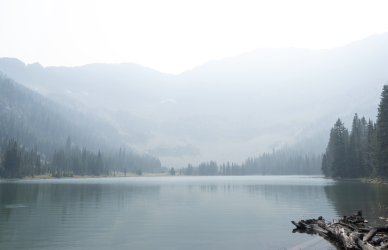
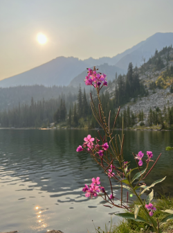
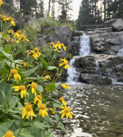
The trail to Moose was a gentle 2ish miles through lovely forest. A half mile from the lake we turned left, crossed a small meadow, passed under a severely bowed tree down to the creek, took five steps across and stood in a larger meadow that someone at some point used for camping. We tucked our tents by some tall trees, made camp and then - with lots of day light left - started exploring. First stop was Moose Lake, which is iconic. Steep cliff peaks dropping to a shimmering lake bordered by pine forests. It didn’t matter that it was private land and we couldn’t camp there. The light from the high sun diffused brightly across the lake and everywhere and gave me a headache. Maybe the smoke and elevation were finally getting to me. After only a few minutes I headed back to camp and took a welcome nap. Well rested, I meandered up the creek a bit and hung out by a small waterfall circled in yellow flowers.
Day 4, Wednesday: (near) Moose Lake (7750) to (near) Glacier Lake (8550), about 5.8 miles.
Lots of elk bugling in the night. Other than that, all was calm and restful. The morning hike was a gentle down through the forest by the Middle Fork of Sweetgrass. At the junction by the hunting camp, we turned up the South Fork of the Sweetgrass and enjoyed one of the best hikes anywhere. The smoke was maybe half as bad as the previous day. I could use my big camera again, and we had a completely different perspective of the valley. The lower meadows glowed. The creek fell down steep, red-rocked canyons at times. It was sunny, but not hot. About halfway along the trail, by a lazy bend in the creek that has an honest-to-goodness beach, Chris and I stripped and threw ourselves into the still current. The chill water electrified, and our hollering echoed off nearby peaks. After drying and dressing we headed up the steepest part of the trail, which didn’t take long, and soon we were back to our (near) Glacier Lake camp.
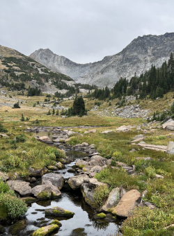
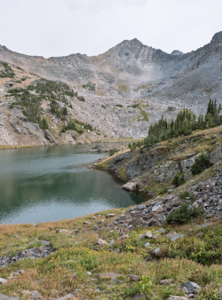
After making camp, Chris and I meandered up to Glacier Lake, exploring the nooks and crannies of the upper valley. The lake itself isn’t inviting. There’s no belt of cuddly pine trees at its shore. Only rock. Lots of it, and it is magnificent. To get to the “island” in the middle - which is really a string of boulders - we had to go up and around some cliffs, off trail, but super obvious. We took our time walking back to camp. This is where the iPhone photos went into hyper-realism. The clouds never looked like that, at least to us humans they didn’t.
As we made dinner and prepared to go to bed early - to get up early and over the pass - the clouds came in. Thick dark ones. The wind picked up and swirled. It didn’t look bad yet, but I was still glad we were getting out the next morning. We probably got in our tents - Chris and I on one side of the creek and Peter on the other - around 8pm. I’m guessing I was asleep at 8:30. I didn’t sleep long because a stiff wind rattled the side of my tent by my head. Then it started bending my tentpole in a way I didn’t like. After that the wind began gusting in circles around the upper valley. It would come down hard on us for a few minutes, and then go off elsewhere in the canyon. Like a crazed beast, I could hear it a few hundred yards off making a mess of someplace else.
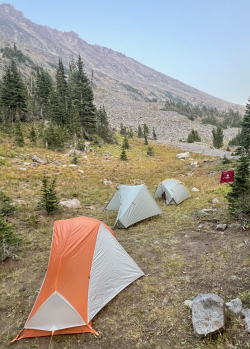
Then it came back, whooshing down towards us. It also brought rain. Not the worst rain ever, but still rain. For the next hour the intensity of the winds and the gusts and the whipping around the mountain walls grew and grew. Half-way through I was dressed in full rain gear and had all my stuff in dry sacks around me. I was in my sleeping bag and my shoes were ready by my side. The wind found a way to get underneath my tent fly, so I sat up and had my arms out both sides of the fly to hold the tent pole to the ground. I’m pretty sure that if I hadn’t, the whole thing would have come apart and been ripped to shreds. I mentally prepared myself to lose my shelter at any moment.
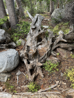
My plan was to wrap my sleeping pad and bag with myself inside like a giant burrito and shove the whole thing alongside a row of squarish rocks nearby that might provide cover from the wind. Of course, it was dark and raining and my headlamp was old and dull. So the probability of pulling that off and avoiding hypothermia (or worse) was unknown. I’ve had some bad nights in tents in the wilderness, but this one topped them all. For an hour I fought the wind and expected to lose. Then the intensity dipped, and I had a break from holding the tentpole down. The wind came back, but not as mad. And it went away again. Half an hour later it was just “breezy”, and we emerged from our tents. All the lines were loosened to the max, but the stakes held. We tightened out lines, grounded our stakes and went back in. The wind and rain came back a few more times that night, but never again with the same ferocity. I was on guard the entire night and didn’t sleep well at all.
Day 5, Thursday: (near) Glacier Lake (8550) to Twin Lakes (8000), about 4 miles via Conical Pass (10,020).
Up early. Pack quick. Get up and over the pass. Camp at Twin Lakes. That was the plan. And we executed it. It was drizzling and windy on the way up, but it was early, and we were motivated, so getting to the pass was easy. We were just below the cloud cover and the views of the range were stupendous.
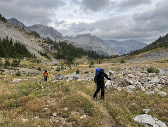
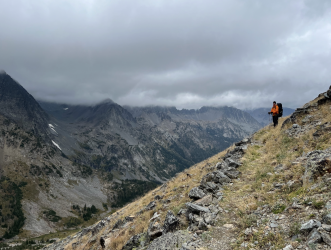
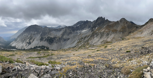
The way down started ok, but the drizzle turned to light hail and then lots of small hail. Nothing harmful. As we descended it turned to slush and sleet. And down by the lakes it was just rain. The first and by far best campsite was right beside upper Twin Lake, but several signs remind you that you’re on private land. We’re only allowed to walk through. Now the rain is steady, and I wait for Chris and Peter. After they arrive, we head 1/4 mile to lower Twin and make a quick camp there. Most of the decent tent sites are below the trail level and starting to pool. I made camp on an awkward slant and ducked into my tent for what would have been 15 solid hours if Peter and Chris hadn’t coaxed me out with a hot meal (usually my job). Top shelf tent meditation bookended a bowl of ramen. The slant forced me to undertake some creative leveling under my sleeping pad. At one point the rain turned to sleet and almost snow. Then it went back to sleet. By morning, it was rain again.
Day 6, Friday: Twin Lakes (8000) to Halfmoon CG (6470), about 4 miles via Big Timber Creek.
The skies weren’t clearing, and we were soaked. It didn’t make sense to hang out at Twin Lakes another day and night if we were going to spend most of that time in our tents. Hence Plan C: hike out a day early and stay in the town of Big Timber. The out was a walk in the park through forest and meadows, crossing rivers. It rained half the time, but we didn’t care. The Crazies were just as beautiful in the rain. We also knew that our car was within reach. After the Blue Lake turnoff, we started seeing people again. The rain stopped, and before we knew it, the trip was over. At least the backpacking portion was.
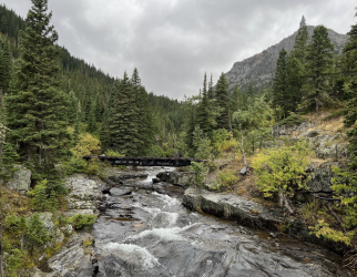
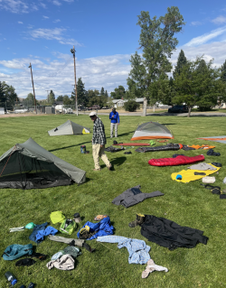
We drove to Big Timber and got rooms at The Grand. The skies here were clear and sunny. The rooms weren’t ready, so we went to Timber Bar across the street for burgers and beers. Lots of friendly people there. And good food. We then drove to the town park, opened our vehicle and dumped all our gear out onto a large lawn beside a basketball court. We put up our tents and spread all our stuff around the lawn to dry it out. Pretty much everything we had was wet or damp. For two hours we allowed a steady breeze and a welcome sun to dry it all out. Something we would have had to do at home. Several locals did slow drive-by’s to see what the hell was up. We then packed it all up and returned to The Grand for our first hot shower in a week.
Final Thoughts
The Crazies earned their name many times over. We saw almost no wildlife, and fewer backpackers. The conditions varied more than probably any placed we'd been. Hot and smokey one moment, ripping wind the next. We swam in Sweetgrass Creek! And carried way too much mustard, gorp and jelly. This was the first and last time I do a week-long trek in trail runners. Lastly, don't touch the trees around Blue Lake, unless you like sticky sap that doesn't come off with soap & water. In the end, our week in The Crazies was a smashing success. They were also a puzzle. The public-private checkerboard is non-sensical given the topography. And even though they were shrouded in smoke when I saw them, Moose Lake and upper Twin Lake are sublimely beautiful. It's almost ridiculous that they are not part of our national patrimony.

Their topography promised big mountain scenery on day one, but wasn’t conducive to loops or traverses. Which may explain the relative dearth of information on the web about its backcountry. I also had the sense that this non-Wilderness wilderness was less known because locals prefer it that way. We met up in Bozeman (Chris from London, Peter from New Paltz and me from Old Lyme), got fuel at REI, ate at Ted’s downtown, and went to bed early. By seven the next day we were on I80 towards Big Timber. At the Grand Hotel we had our traditional eggs-bacon-potatoes last supper (tasty!). We then drove Highway 191 North along the eastern front of the Crazies, before turning west, first on Wooster and then on Big Timber Canyon Road. The rolling high plains roll more and more and then shoot straight up. But all we see is smoke.
Six fires raged in western Montana that week and the smoke came unhindered across the high plains to The Crazies. Where it got caught in the abrupt prominence of the range. There weren’t any fires in the Crazies - I called the Ranger Station a week earlier to confirm that. But I didn't think to ask them about the air quality. We’ve backpacked into smoke before, but this stuff was thicker and more persistent. From the highway just south of The Crazies, you'd hardly have known there mountains there.

Day 1, Sunday: Halfmoon CG (6470) to Blue Lake (8240), 3.6 miles via Big Timber Creek.
Only when we were a good way into Big Timber Creek Valley did the peaks emerge, as did lush, forested slopes and a rushing rocky creek. Once in the range - at least at first - the smoke was manageable. The change in elevation and full packs made more of an impact on us as we headed up the rather gentle forest trail alongside the creek. We crossed a few bridges and 2.3 miles in we left the main trail and began a 1150 foot climb up and 150 down to Blue Lake. After hopscotching a wide flat creek to a split of land, we made camp by the western shores of Blue Lake. There were plenty of tent sites and a few fire rings. In all directions we had big views of the lake and the surrounding peaks, including Crazy Peak.

After making camp Chris and I scrambled our way over to Granite Lake and tried to find a high open point from which to shoot the peaks and upper valleys around us. While we were able to get some decent shots, none were the hoped-for panorama. We also began to see the limits of our “big” cameras relative to our iPhones. Though the skies were meteorologically clear (the weather was great), the smoke diffused the light so much that our big lenses had trouble focusing and metering.

The iPhones, on the other hand, took multiple exposures using multiple lenses and then fused them together with its processor to create far more representative images. Later in the trip, under different conditions, the iPhone over processed images that didn’t need it, creating “ultra” realism which was not representative. As you’ll see, the smoke played a big part in our trip, as did what supplanted it.

Day 2, Monday: Blue Lake (8240) to Glacier Lake (8550), 5.4 miles via Big Timber Cr (7750) and Conical Pass (10,020)
Lots of elevation on this one. First, we had one of the craziest sunrises ever. The smoke and cloudless skies and sun coming up over the lower ridge line of Big Timber Peak made a spectacle. It was also a harbinger of the air quality to come.


The trail back down to Big Timber Creek was simple. As was the one up to Twin Lakes. Without the smoke, the views of Upper Twin and the surrounding cirque would have been unparalleled. Upper Twin sits on private land, which will be of interest later in our trek.

From there we began the relentless yet enjoyable march up to Conical Pass. The trail seems to go much higher than is necessary. The lower forest gives way to krummholz. And the vistas up and out of the valley are wonderful. We pass a high alpine camp site nestled in boulders and trees. Remember that, we tell each other, knowing we’ll come back this way in a few days.

Above tree line, giant dark peaks appear, and the wind picks up. We stow our big cameras and must lean into the wind as we get near the pass. Once or twice, I lose my footing but get it back quickly. The wind is ripping at the pass. The weather station a little higher up seems pointless, its sensors spinning wildly. We spend almost no time there and soon stared down into Glacier Lake through a smokey haze. And we wonder: how can there be this much smoke and wind at the same time? But there is. Glacier Lake reflects the sun back. Photos are meaningless. Down we go, fifteen hundred feet.

On the way we hear the echo of hollering down by the Glacier Lake. Are there people on the island? Impossible. Our goal was a half mile or so past the lake. We even skip the lake, knowing we can go back whenever. Near the bottom of the descent we meet two young women, probably in their twenties. They were camping by the lake, but the wind nearly shredded their tent. So, they went to Sunlight Lake and had a great time. Now they’re off to Twin Lakes. They go up, we go down. Looking for camp, which we find on a rocky rise in the valley just before it gets steeper and narrower. There are high jagged peaks in all directions. It reminds us of the Sawtooth’s in Idaho, where we spent a glorious week in 2014. The smoke plays tricks on us, turning the light auburn and peach. The creek rushes nearby. Chris makes another top-notch fire, and we enjoy nightfall before heading to bed.

Day 3, Tuesday: Glacier Lake (8550) to Moose Lake (7750), 5.8 miles via Sweetgrass Creek (7250)
Our original plan was to go to Campfire Lake and spend 2 nights there before returning to Conical Pass and heading out. That changed around lunchtime. After breakfast we leisurely headed down the South Fork of Sweetgrass Creek, the trail was steep at first and passed a few waterfalls. A mile or so in it leveled out into a stunning valley of broad meadows and lazy bends in the creek. One could easily camp tucked in behind one of the stands of trees, and not leave for a week (but we’re on private land, so….).

Farther down the valley we had open views of the eastern flank of Sunlight Peak. As we neared the trail junction, we saw what looked like a semi-permanent hunting camp on the far side of a small meadow. Are we back on private land? At the junction by the creek we found some shade, dropped packs and made lunch. The weather was perfect, and down in the forest it was easier to forget the smoke.

We hear voices. A few minutes later we meet a surgeon from Billings and his two twentysomething sons. It’s the beginning of bow hunting season and they’re after elk. From the camp you can see straight across to the upper slopes of the long ridge. Open slopes where elk like to hang out and bugle. Today there aren’t any elk, so they’re fishing. We tell them our destination for today (Campfire Lake) and the dad asks, “Are you sure you want to go that far? Some bad weather is coming in. We’re packing up tomorrow. Probably going to snow.”

We didn’t want to cross Conical Pass in the snow, so we altered our plan. They showed us small meadows on the map that were on public land but still a short walk from Moose Lake. The goal was to camp a night in the forest and make our way back up to Glacier Lake in the morning. As the hike down was stunning and mellow, we had no problem retracing our steps a day early. On Thursday we’d cross back over Conical Pass, hopefully before it snowed. That way - should things get nasty - we’d only be a few forested miles from the trailhead.

The trail to Moose was a gentle 2ish miles through lovely forest. A half mile from the lake we turned left, crossed a small meadow, passed under a severely bowed tree down to the creek, took five steps across and stood in a larger meadow that someone at some point used for camping. We tucked our tents by some tall trees, made camp and then - with lots of day light left - started exploring. First stop was Moose Lake, which is iconic. Steep cliff peaks dropping to a shimmering lake bordered by pine forests. It didn’t matter that it was private land and we couldn’t camp there. The light from the high sun diffused brightly across the lake and everywhere and gave me a headache. Maybe the smoke and elevation were finally getting to me. After only a few minutes I headed back to camp and took a welcome nap. Well rested, I meandered up the creek a bit and hung out by a small waterfall circled in yellow flowers.


Day 4, Wednesday: (near) Moose Lake (7750) to (near) Glacier Lake (8550), about 5.8 miles.
Lots of elk bugling in the night. Other than that, all was calm and restful. The morning hike was a gentle down through the forest by the Middle Fork of Sweetgrass. At the junction by the hunting camp, we turned up the South Fork of the Sweetgrass and enjoyed one of the best hikes anywhere. The smoke was maybe half as bad as the previous day. I could use my big camera again, and we had a completely different perspective of the valley. The lower meadows glowed. The creek fell down steep, red-rocked canyons at times. It was sunny, but not hot. About halfway along the trail, by a lazy bend in the creek that has an honest-to-goodness beach, Chris and I stripped and threw ourselves into the still current. The chill water electrified, and our hollering echoed off nearby peaks. After drying and dressing we headed up the steepest part of the trail, which didn’t take long, and soon we were back to our (near) Glacier Lake camp.

After making camp, Chris and I meandered up to Glacier Lake, exploring the nooks and crannies of the upper valley. The lake itself isn’t inviting. There’s no belt of cuddly pine trees at its shore. Only rock. Lots of it, and it is magnificent. To get to the “island” in the middle - which is really a string of boulders - we had to go up and around some cliffs, off trail, but super obvious. We took our time walking back to camp. This is where the iPhone photos went into hyper-realism. The clouds never looked like that, at least to us humans they didn’t.

As we made dinner and prepared to go to bed early - to get up early and over the pass - the clouds came in. Thick dark ones. The wind picked up and swirled. It didn’t look bad yet, but I was still glad we were getting out the next morning. We probably got in our tents - Chris and I on one side of the creek and Peter on the other - around 8pm. I’m guessing I was asleep at 8:30. I didn’t sleep long because a stiff wind rattled the side of my tent by my head. Then it started bending my tentpole in a way I didn’t like. After that the wind began gusting in circles around the upper valley. It would come down hard on us for a few minutes, and then go off elsewhere in the canyon. Like a crazed beast, I could hear it a few hundred yards off making a mess of someplace else.

Then it came back, whooshing down towards us. It also brought rain. Not the worst rain ever, but still rain. For the next hour the intensity of the winds and the gusts and the whipping around the mountain walls grew and grew. Half-way through I was dressed in full rain gear and had all my stuff in dry sacks around me. I was in my sleeping bag and my shoes were ready by my side. The wind found a way to get underneath my tent fly, so I sat up and had my arms out both sides of the fly to hold the tent pole to the ground. I’m pretty sure that if I hadn’t, the whole thing would have come apart and been ripped to shreds. I mentally prepared myself to lose my shelter at any moment.

My plan was to wrap my sleeping pad and bag with myself inside like a giant burrito and shove the whole thing alongside a row of squarish rocks nearby that might provide cover from the wind. Of course, it was dark and raining and my headlamp was old and dull. So the probability of pulling that off and avoiding hypothermia (or worse) was unknown. I’ve had some bad nights in tents in the wilderness, but this one topped them all. For an hour I fought the wind and expected to lose. Then the intensity dipped, and I had a break from holding the tentpole down. The wind came back, but not as mad. And it went away again. Half an hour later it was just “breezy”, and we emerged from our tents. All the lines were loosened to the max, but the stakes held. We tightened out lines, grounded our stakes and went back in. The wind and rain came back a few more times that night, but never again with the same ferocity. I was on guard the entire night and didn’t sleep well at all.
Day 5, Thursday: (near) Glacier Lake (8550) to Twin Lakes (8000), about 4 miles via Conical Pass (10,020).
Up early. Pack quick. Get up and over the pass. Camp at Twin Lakes. That was the plan. And we executed it. It was drizzling and windy on the way up, but it was early, and we were motivated, so getting to the pass was easy. We were just below the cloud cover and the views of the range were stupendous.


The way down started ok, but the drizzle turned to light hail and then lots of small hail. Nothing harmful. As we descended it turned to slush and sleet. And down by the lakes it was just rain. The first and by far best campsite was right beside upper Twin Lake, but several signs remind you that you’re on private land. We’re only allowed to walk through. Now the rain is steady, and I wait for Chris and Peter. After they arrive, we head 1/4 mile to lower Twin and make a quick camp there. Most of the decent tent sites are below the trail level and starting to pool. I made camp on an awkward slant and ducked into my tent for what would have been 15 solid hours if Peter and Chris hadn’t coaxed me out with a hot meal (usually my job). Top shelf tent meditation bookended a bowl of ramen. The slant forced me to undertake some creative leveling under my sleeping pad. At one point the rain turned to sleet and almost snow. Then it went back to sleet. By morning, it was rain again.
Day 6, Friday: Twin Lakes (8000) to Halfmoon CG (6470), about 4 miles via Big Timber Creek.
The skies weren’t clearing, and we were soaked. It didn’t make sense to hang out at Twin Lakes another day and night if we were going to spend most of that time in our tents. Hence Plan C: hike out a day early and stay in the town of Big Timber. The out was a walk in the park through forest and meadows, crossing rivers. It rained half the time, but we didn’t care. The Crazies were just as beautiful in the rain. We also knew that our car was within reach. After the Blue Lake turnoff, we started seeing people again. The rain stopped, and before we knew it, the trip was over. At least the backpacking portion was.

We drove to Big Timber and got rooms at The Grand. The skies here were clear and sunny. The rooms weren’t ready, so we went to Timber Bar across the street for burgers and beers. Lots of friendly people there. And good food. We then drove to the town park, opened our vehicle and dumped all our gear out onto a large lawn beside a basketball court. We put up our tents and spread all our stuff around the lawn to dry it out. Pretty much everything we had was wet or damp. For two hours we allowed a steady breeze and a welcome sun to dry it all out. Something we would have had to do at home. Several locals did slow drive-by’s to see what the hell was up. We then packed it all up and returned to The Grand for our first hot shower in a week.

Final Thoughts
The Crazies earned their name many times over. We saw almost no wildlife, and fewer backpackers. The conditions varied more than probably any placed we'd been. Hot and smokey one moment, ripping wind the next. We swam in Sweetgrass Creek! And carried way too much mustard, gorp and jelly. This was the first and last time I do a week-long trek in trail runners. Lastly, don't touch the trees around Blue Lake, unless you like sticky sap that doesn't come off with soap & water. In the end, our week in The Crazies was a smashing success. They were also a puzzle. The public-private checkerboard is non-sensical given the topography. And even though they were shrouded in smoke when I saw them, Moose Lake and upper Twin Lake are sublimely beautiful. It's almost ridiculous that they are not part of our national patrimony.
