uintahiker
Adventure Guru
- Joined
- Jan 20, 2012
- Messages
- 719
I haven't done a Utah post for a while, so since I've been out a time or two recently, here's another one.
Posted from my blog at www.livevicariouslythroughus.blogspot.com
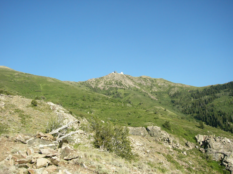
Last Monday my wife and kids were up at Bear Lake, so I had a free evening to go hiking. It didn't take me long to decide to head up to the airplane crash site above Kaysville. United Flight 2860 crashed on a sub peak below Francis Peak in 1977. I had not been up there because it's essentially a 3,000 foot climb and I didn't want to do it carrying 30-40 pounds of gear and kids.
I started out at 5 PM at the Baer Canyon Trailhead, my plan being to hike up Baer Canyon to about the 7,800 foot level, then to cut over to the ridge on the north side of the canyon, hit the lower peak (Ed's Peak) and head back down. I made good time to the second stream crossing, getting there in about half an hour. The creek was really low and I hopped across with no dagner of getting wet. Then I made it to the 3rd crossing in another 15 minutes. I'd made great time up to this point. The 3rd crossing was the highest I'd ever made it up Baer and the last time I'd been up was earlier this year. On that trip, I had found a dead horse just below the trail between the 2nd and 3rd crossing. The Forest Service had come up and removed it since then.
From the 3rd onward, the hike was a lot slower. There's a whole lot of switchbacks and elevation gain once the trail crosses back to the north side and stops following the creek. I sure was sucking air on the climb! I crossed a small tributary, went through the fern forest, and finally made it out to the flatter spot before the final climb up to Francis Peak. I rested for a few minutes, ate a Probar, then continued on. This was essentially level with Ed's Peak and where I planned to cut over to the ridge. I checked the time: 6:50.
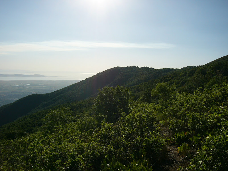
From here on, I left the trail and picked my way through heavy brush across the slope to the ridge. It wasn't the fastest way to go, that's for sure! Twice as I struggled through the brush an explosion of sound and feathers made my adrenaline levels spike. Grouse have a way of doing that when you're not expecting them to! I finally made it to the ridge, then followed a patchwork of trails over to the peak.
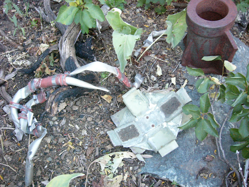
A hundred yards or so before the top, I found my first wreckage. It was some aluminum and tubing about the size of a dinner plate. The rusted steel piece nearby may also have been some wreckage. I looked around for more, but didn't see any as I nailed the peak. By this time sundown was rapidly approaching, so I took a short break, then dropped down the southwest side to find the crash site.

There's a trail from the peak, but the actual crash site is a hundred or so yards off of the trail. Even so, numerous smaller pieces of the plane litter the hillside and trail. These pieces are about the size of quarters.
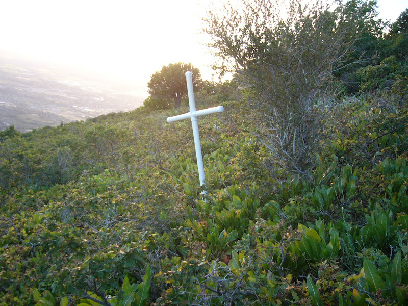
I picked my way down to the crash site, which is marked with a plastic cross. Three people died when the plane, a cargo plane, crashed. The plane had a few mechanical failures, then when it went into a holding pattern, crashed into the side of the mountain. An excellent writeup detailing the history of the plane crash is at http://coord.info/GC2H8YB
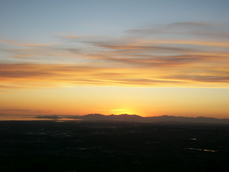
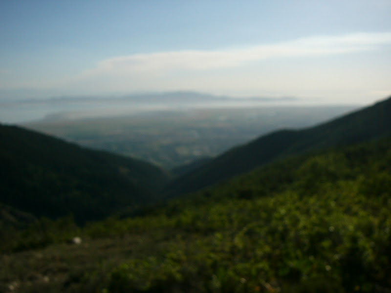
From the crash site, I hiked back to the trail, then down the mountain. I ended up at the rifle range trailhead, and hitched a ride back over to Baer Canyon and my car. I made it down about 9:45, having hiked 6 1/2 miles with approximately 6,000 feet of elevation change (3,000 up and 3,000 down) in 4 hours and 45 minutes. It wiped me out, but it sure was a good hike!
Posted from my blog at www.livevicariouslythroughus.blogspot.com
Last Monday my wife and kids were up at Bear Lake, so I had a free evening to go hiking. It didn't take me long to decide to head up to the airplane crash site above Kaysville. United Flight 2860 crashed on a sub peak below Francis Peak in 1977. I had not been up there because it's essentially a 3,000 foot climb and I didn't want to do it carrying 30-40 pounds of gear and kids.

I started out at 5 PM at the Baer Canyon Trailhead, my plan being to hike up Baer Canyon to about the 7,800 foot level, then to cut over to the ridge on the north side of the canyon, hit the lower peak (Ed's Peak) and head back down. I made good time to the second stream crossing, getting there in about half an hour. The creek was really low and I hopped across with no dagner of getting wet. Then I made it to the 3rd crossing in another 15 minutes. I'd made great time up to this point. The 3rd crossing was the highest I'd ever made it up Baer and the last time I'd been up was earlier this year. On that trip, I had found a dead horse just below the trail between the 2nd and 3rd crossing. The Forest Service had come up and removed it since then.

From the 3rd onward, the hike was a lot slower. There's a whole lot of switchbacks and elevation gain once the trail crosses back to the north side and stops following the creek. I sure was sucking air on the climb! I crossed a small tributary, went through the fern forest, and finally made it out to the flatter spot before the final climb up to Francis Peak. I rested for a few minutes, ate a Probar, then continued on. This was essentially level with Ed's Peak and where I planned to cut over to the ridge. I checked the time: 6:50.

From here on, I left the trail and picked my way through heavy brush across the slope to the ridge. It wasn't the fastest way to go, that's for sure! Twice as I struggled through the brush an explosion of sound and feathers made my adrenaline levels spike. Grouse have a way of doing that when you're not expecting them to! I finally made it to the ridge, then followed a patchwork of trails over to the peak.

A hundred yards or so before the top, I found my first wreckage. It was some aluminum and tubing about the size of a dinner plate. The rusted steel piece nearby may also have been some wreckage. I looked around for more, but didn't see any as I nailed the peak. By this time sundown was rapidly approaching, so I took a short break, then dropped down the southwest side to find the crash site.
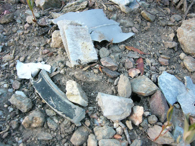
There's a trail from the peak, but the actual crash site is a hundred or so yards off of the trail. Even so, numerous smaller pieces of the plane litter the hillside and trail. These pieces are about the size of quarters.

I picked my way down to the crash site, which is marked with a plastic cross. Three people died when the plane, a cargo plane, crashed. The plane had a few mechanical failures, then when it went into a holding pattern, crashed into the side of the mountain. An excellent writeup detailing the history of the plane crash is at http://coord.info/GC2H8YB

From the crash site, I hiked back to the trail, then down the mountain. I ended up at the rifle range trailhead, and hitched a ride back over to Baer Canyon and my car. I made it down about 9:45, having hiked 6 1/2 miles with approximately 6,000 feet of elevation change (3,000 up and 3,000 down) in 4 hours and 45 minutes. It wiped me out, but it sure was a good hike!