hatchcanyon
Member
- Joined
- May 29, 2013
- Messages
- 136
In May 2013 we visited the Caineville area, but had no concept what to see. We left UT 24 for Caineville Wash Road and suddenly there was a spur going away from the road. After a short distance there was some pavement in the middle of the Caineville Wash Valley. A Road? I doubt!
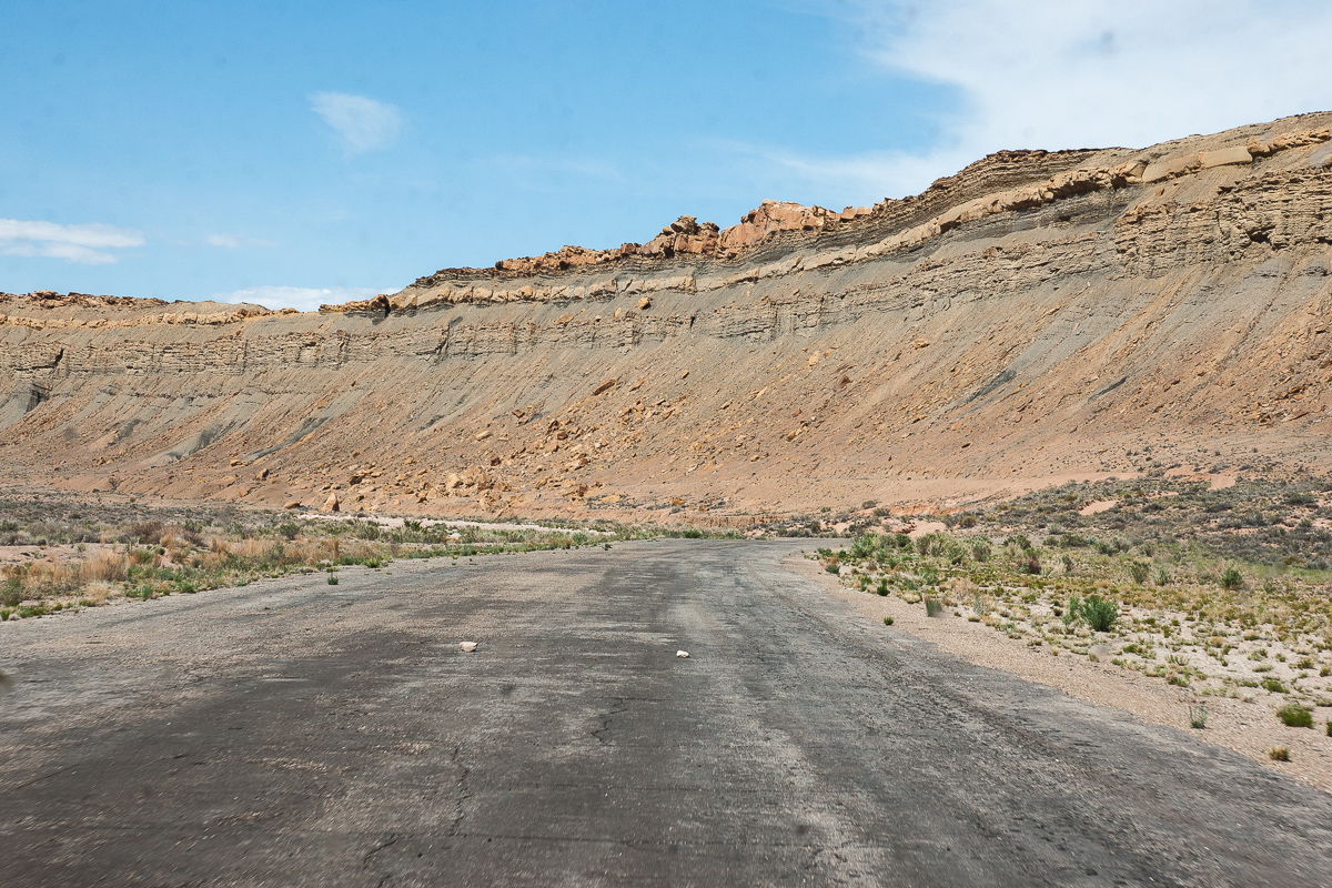
Length of pavement might be some 1,100 to 1,200 feet and it is not completely straight. Might this be an airstrip?
One end of the assumed airstrip
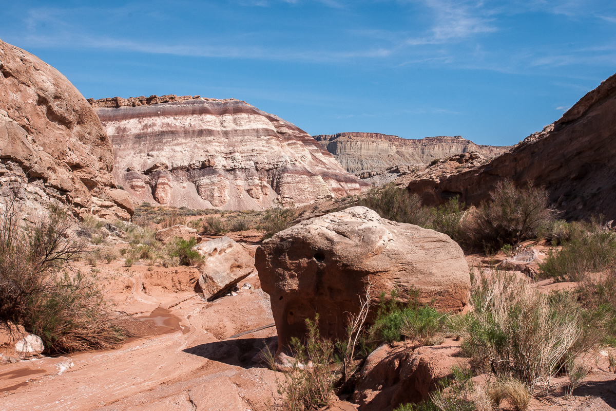
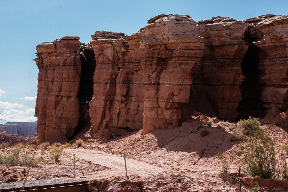
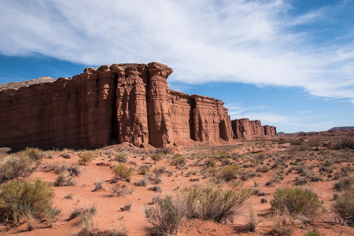
Nevertheless this was the wrong way. On the other end of pavement a spur let us across Caineville Wash and into a smaller colorful canyon with another wash. (We named it Red Desert Wash) It must have flown not that long ago. The bed was still moist. This canyon is short, the length of the pretty good road measures approximately 1,2 miles.
Entering the small canyon
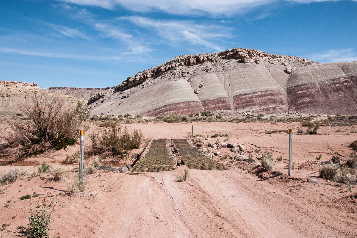
Improvement by pioneer bridges
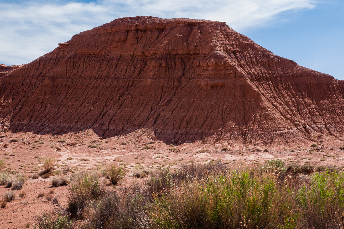
Wild and colored
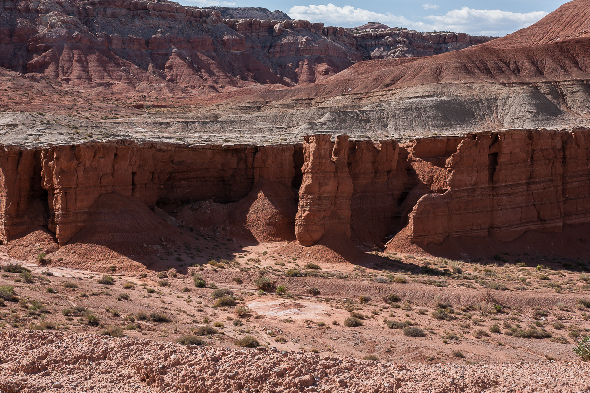
Within the canyon
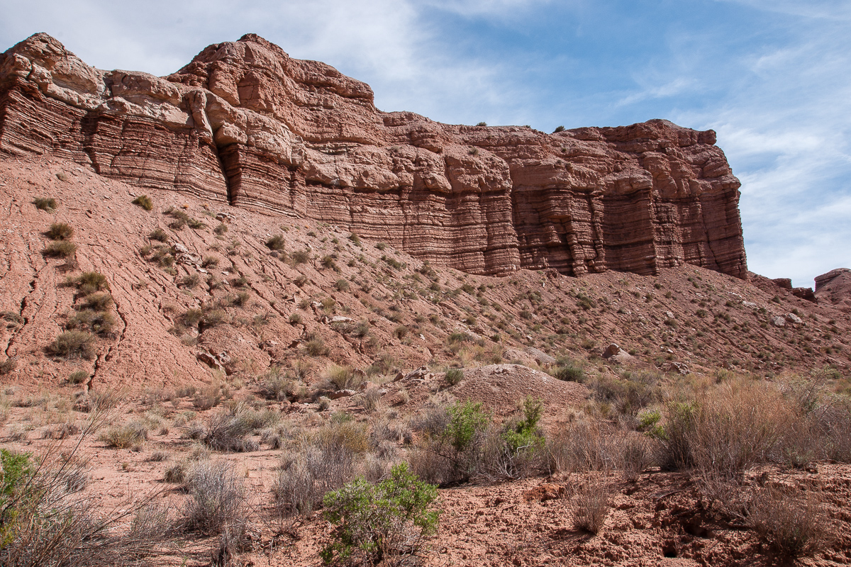
Angled strata ascending to the West
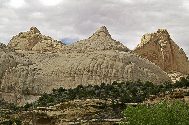
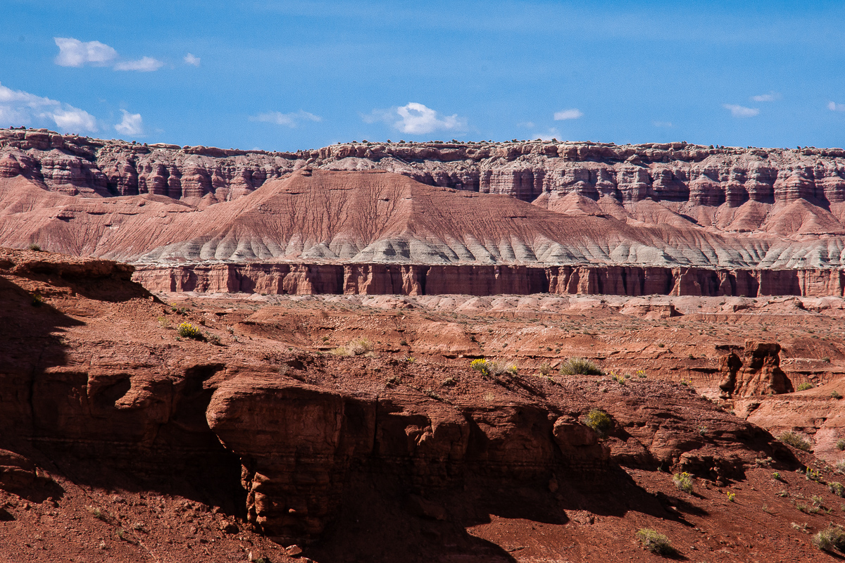
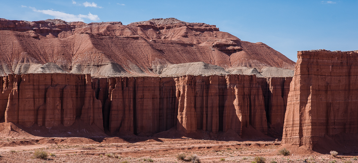
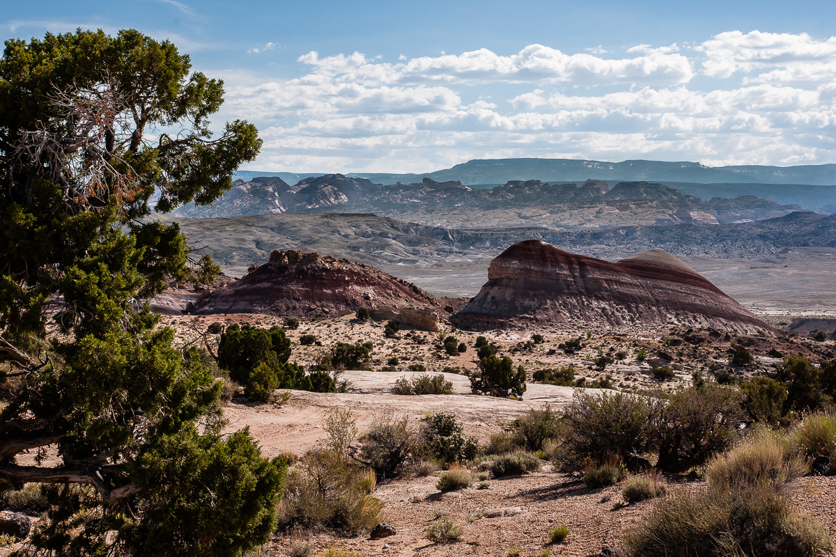
Looking back (east): banded Morrison Formation and Caineville Mesa in background
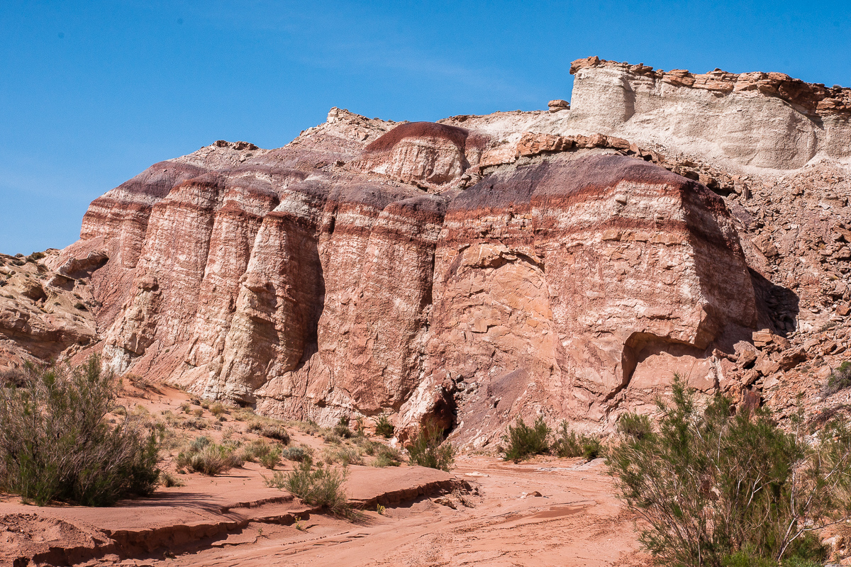
Next layer is Summerville Formation
Topomap tells us we are entering Red Desert. Seems to be!
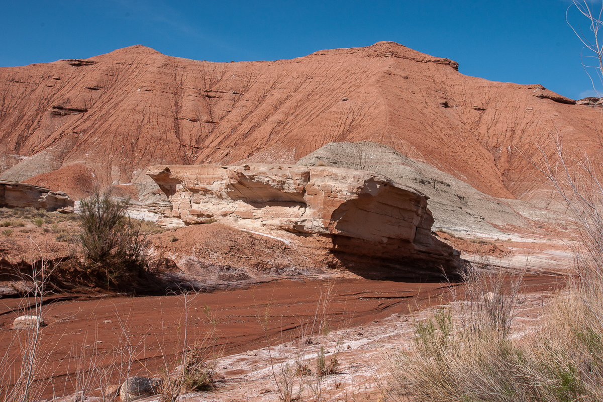
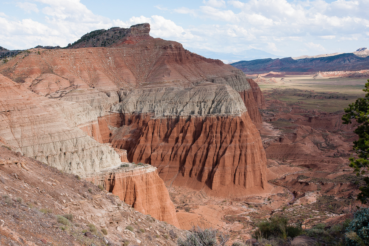
Red Summerville remnants on greyish Curtis Formation. Nice contrast!
Entrada cliffs with Curtis caps
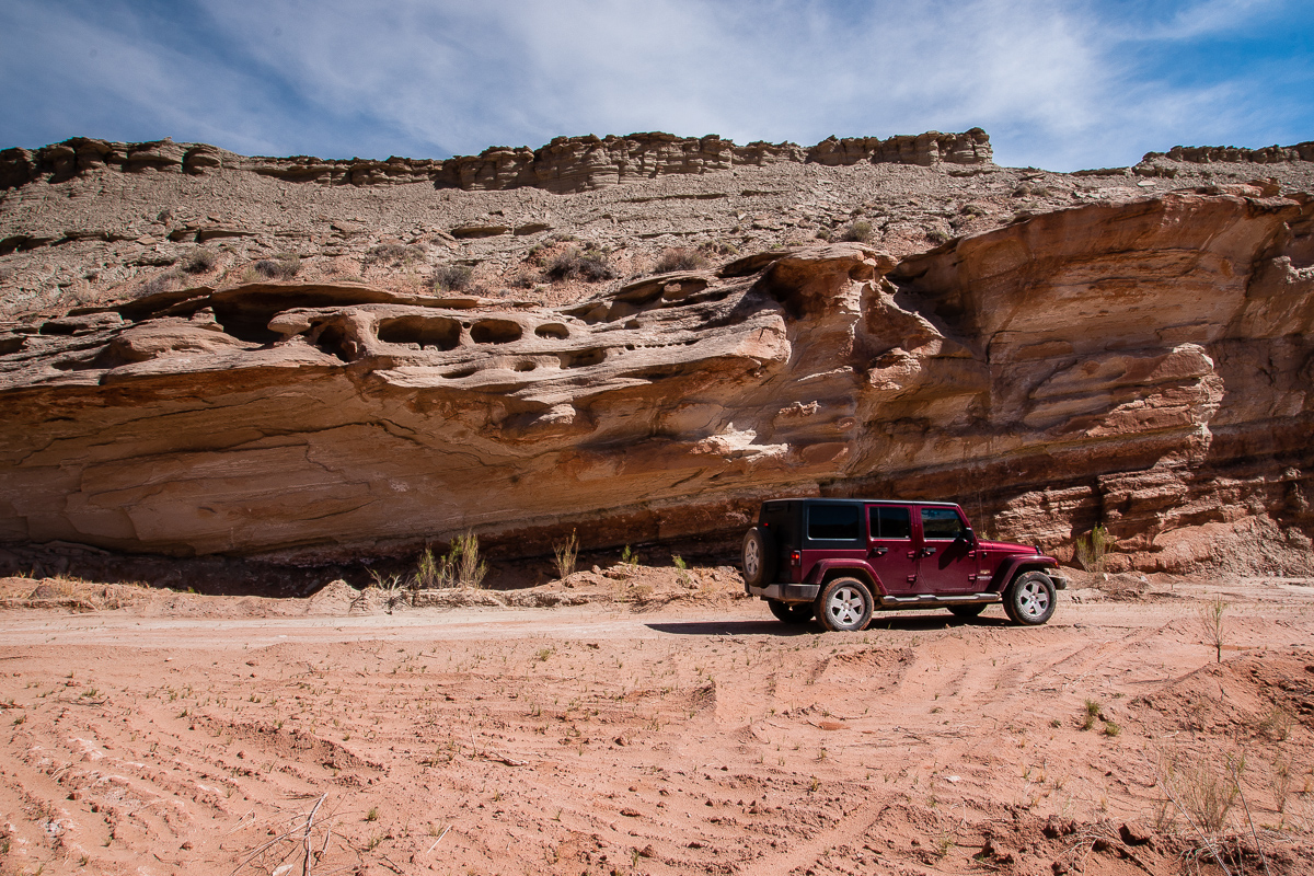
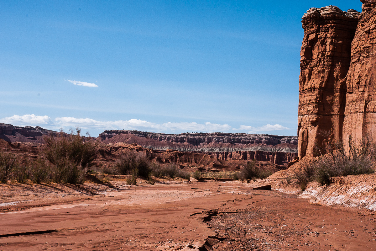
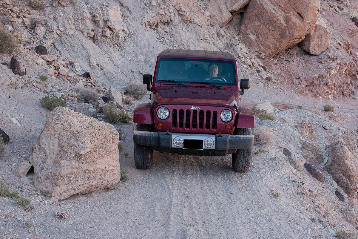
At this point there is no need for a Jeep Wrangler. Even a sedan might work.
Looking west out of the little canyon
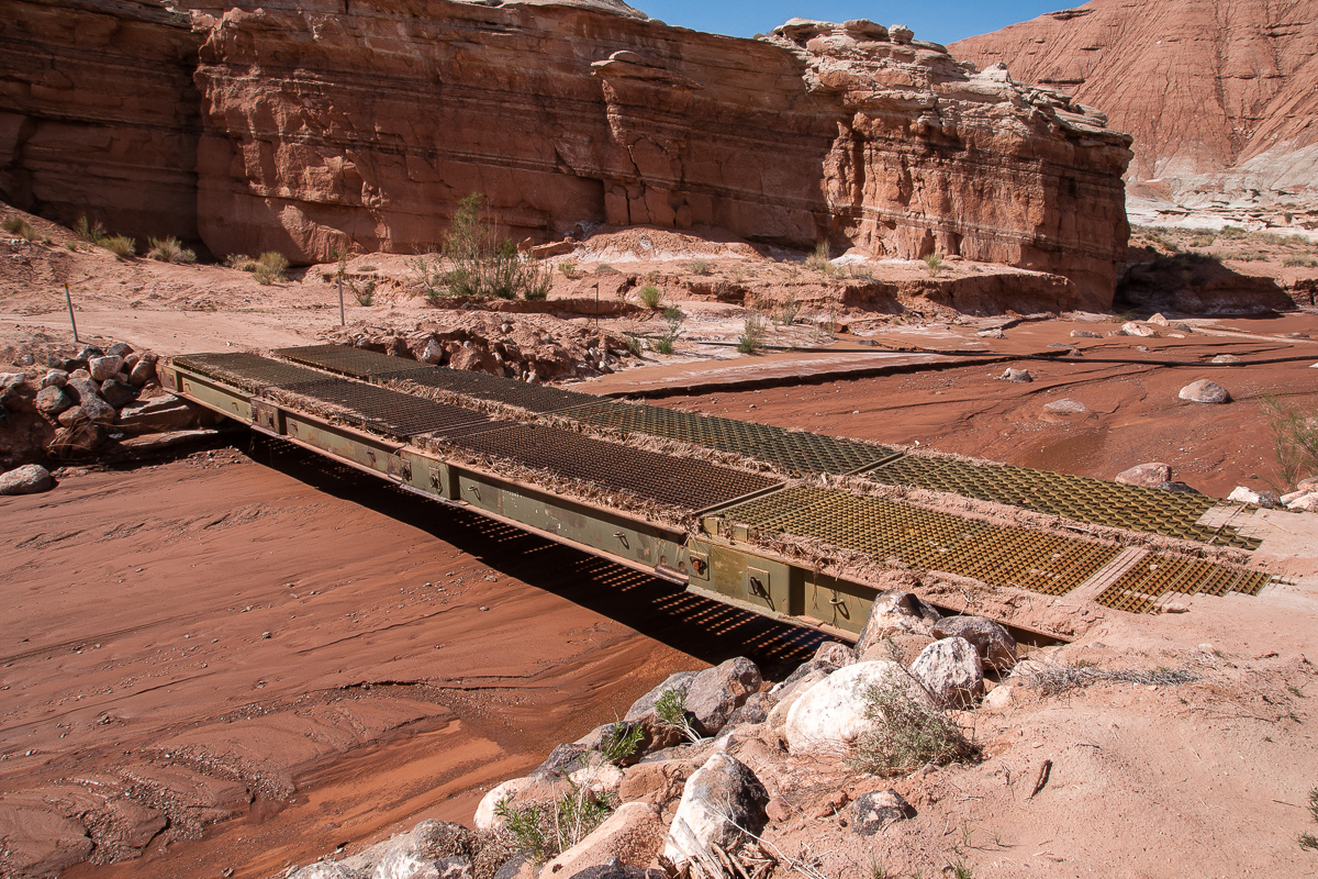
The last of at least three pioneer bridges
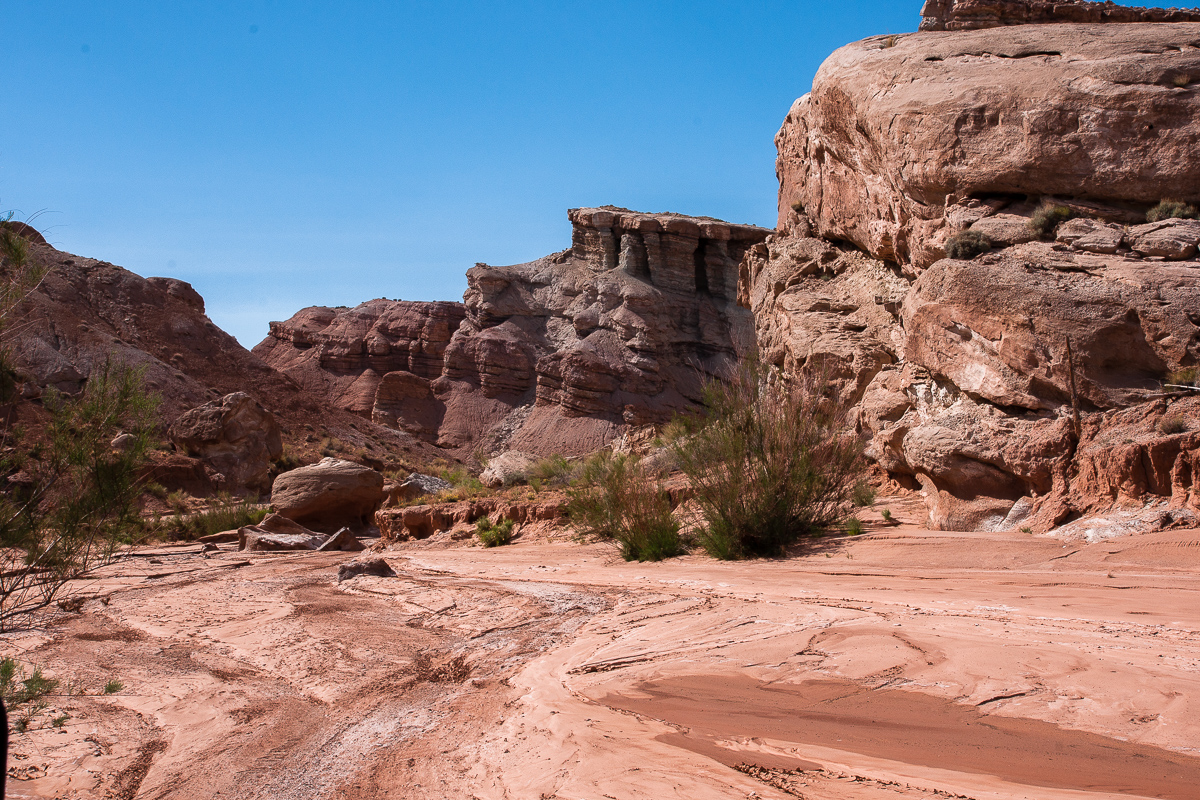
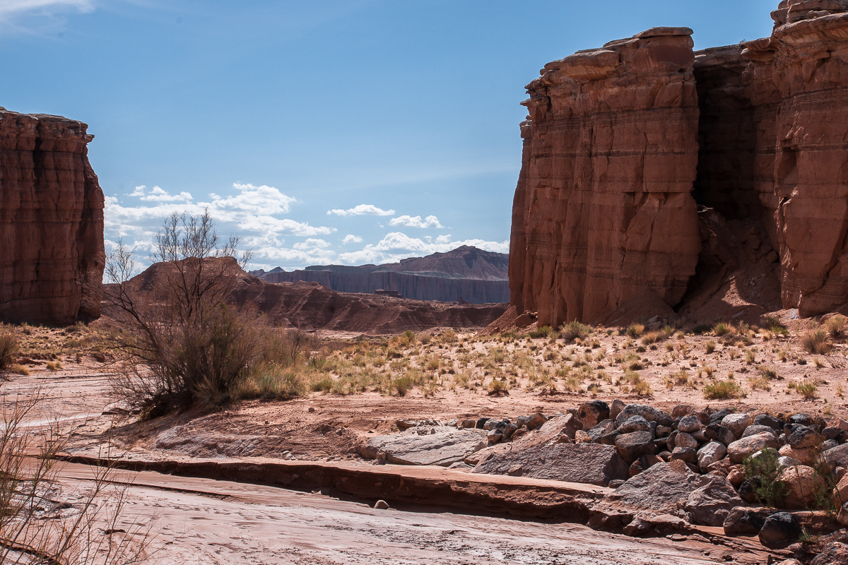
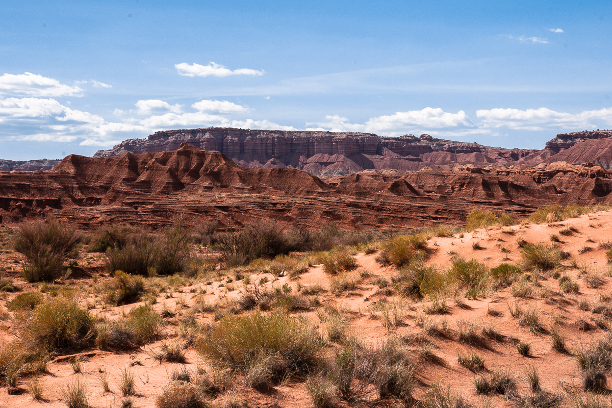
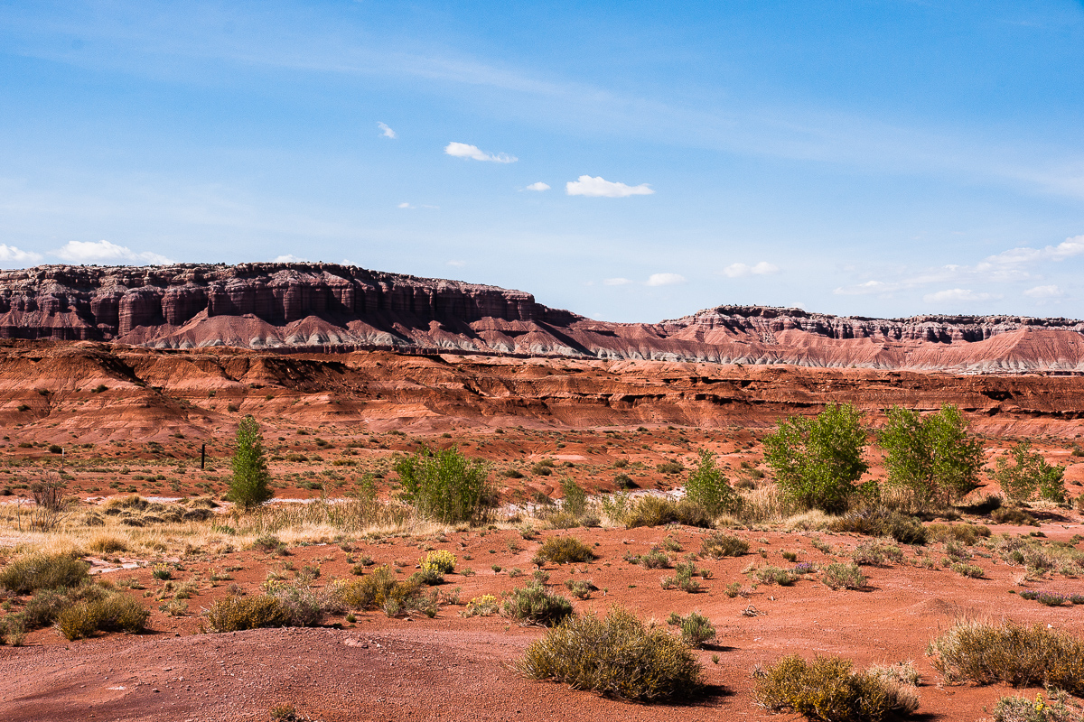
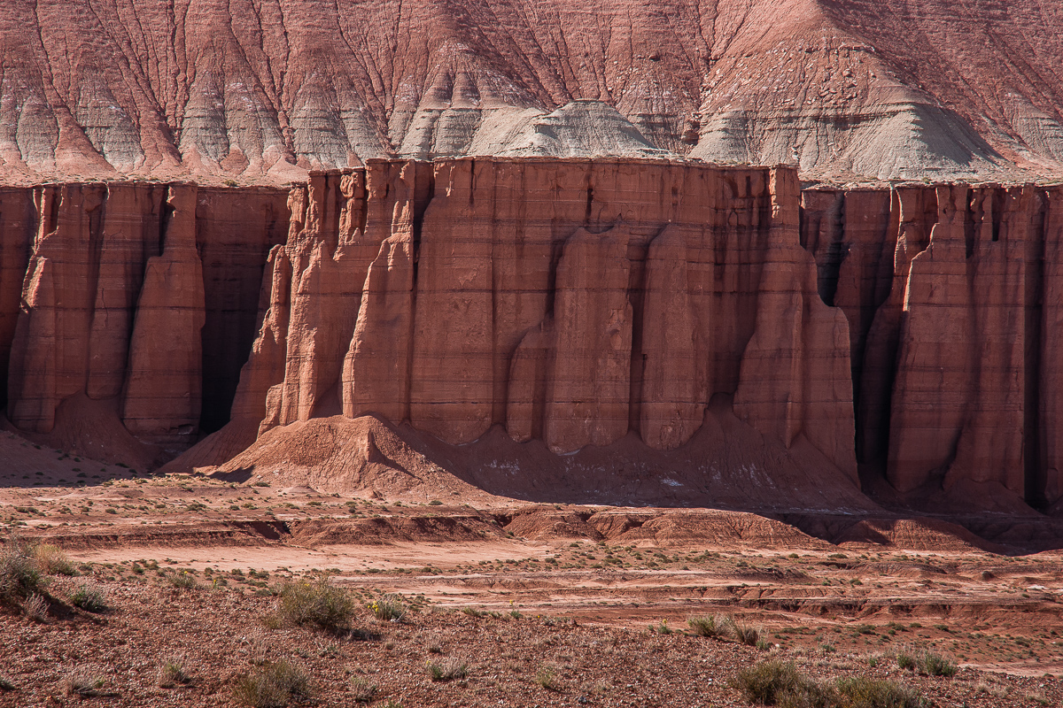
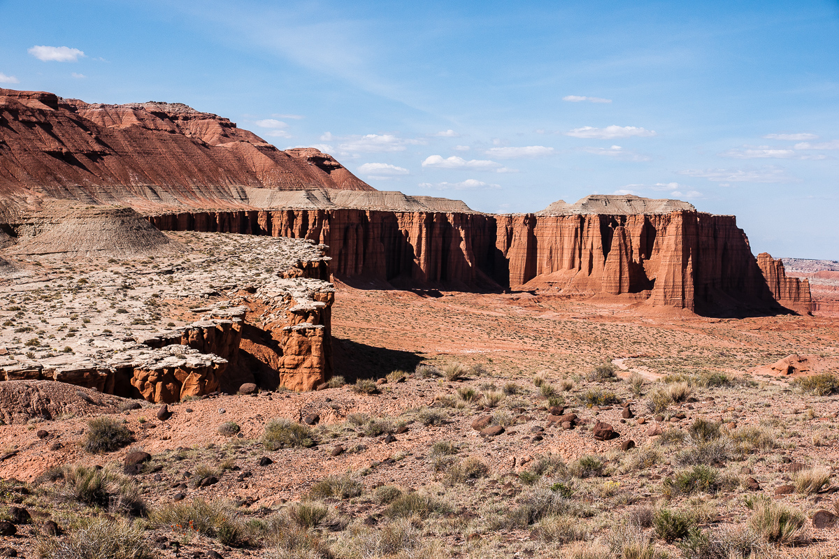
The wash in the little canyon drains a basin surrounded by Entrada sandstone cliffs. Seems to me that this was once an upwarp. The inclining strata from the east side starts to decline on the west side (we saw that later).
The eastern Cliffs of the basin
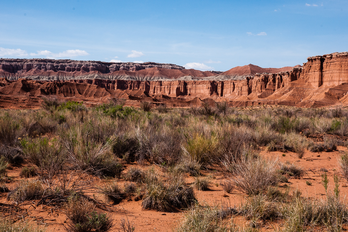
A view across the northern half of the basin
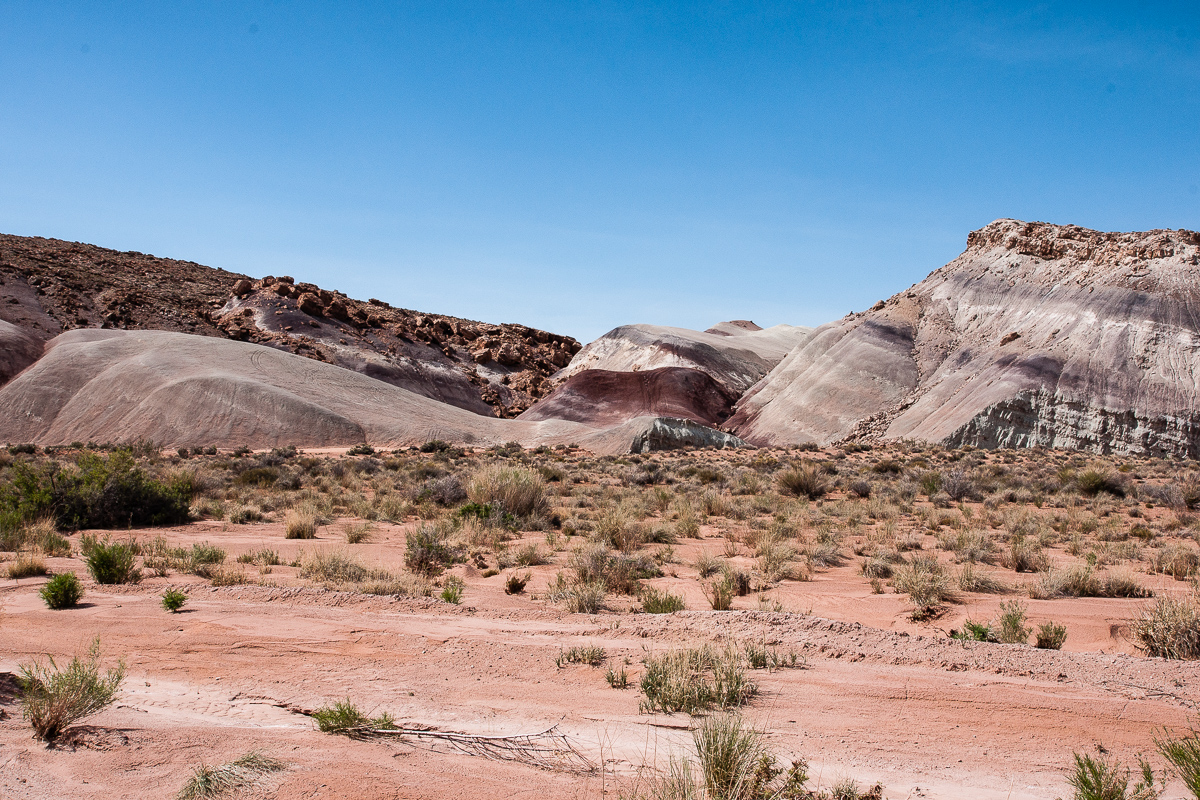
This is what the Topo Maps call Red Desert.
Branch of the wash
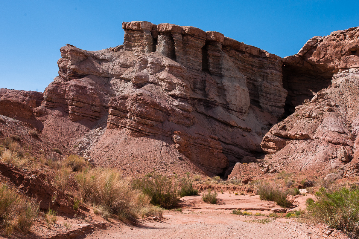
Cliff on the north end of the basin
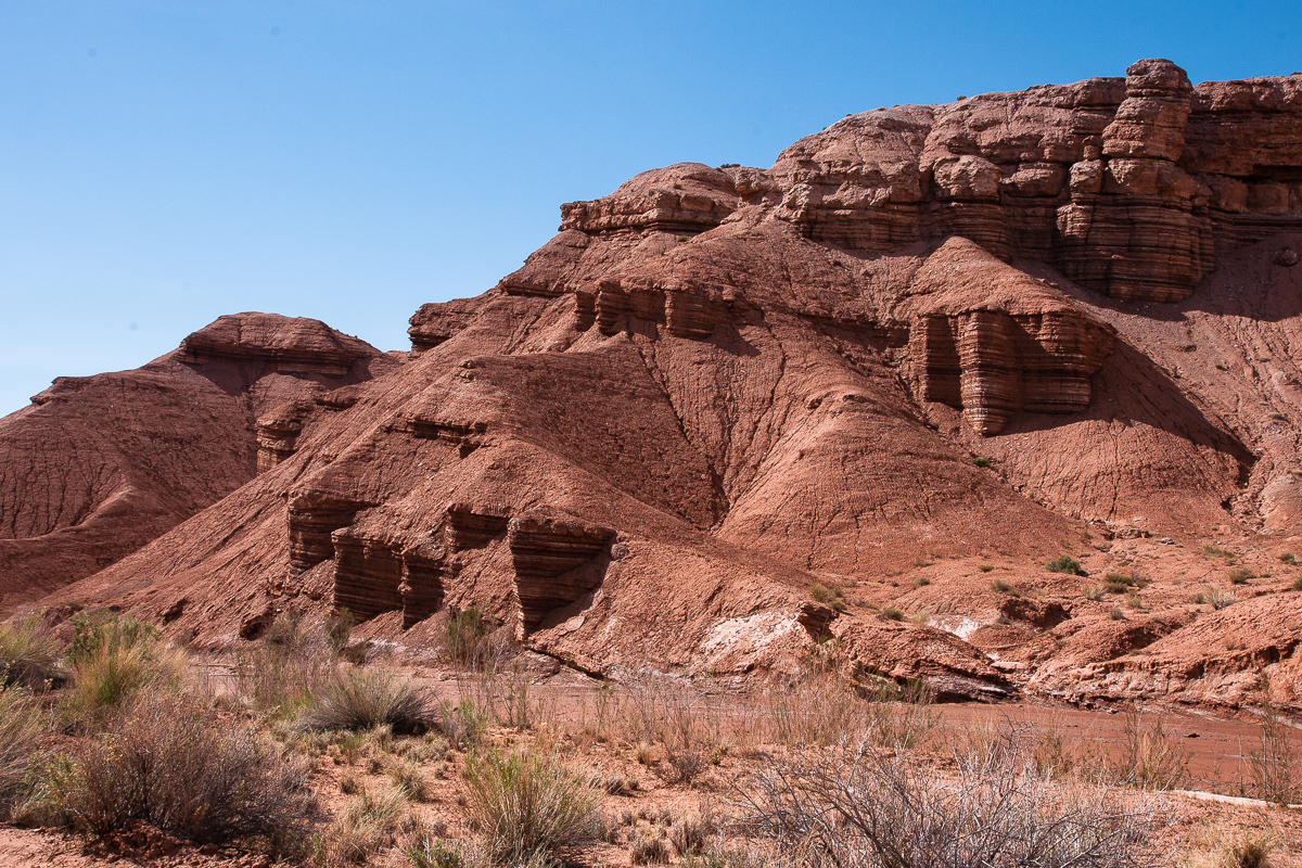
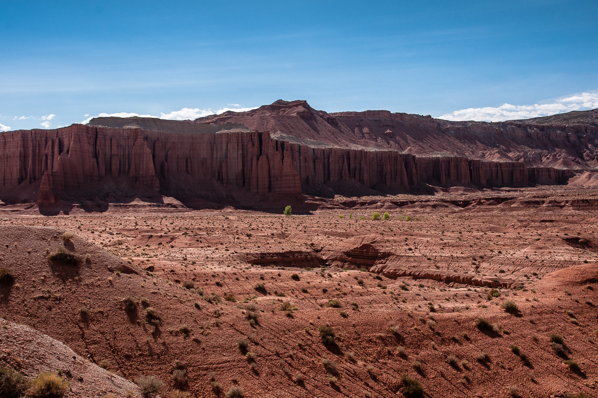
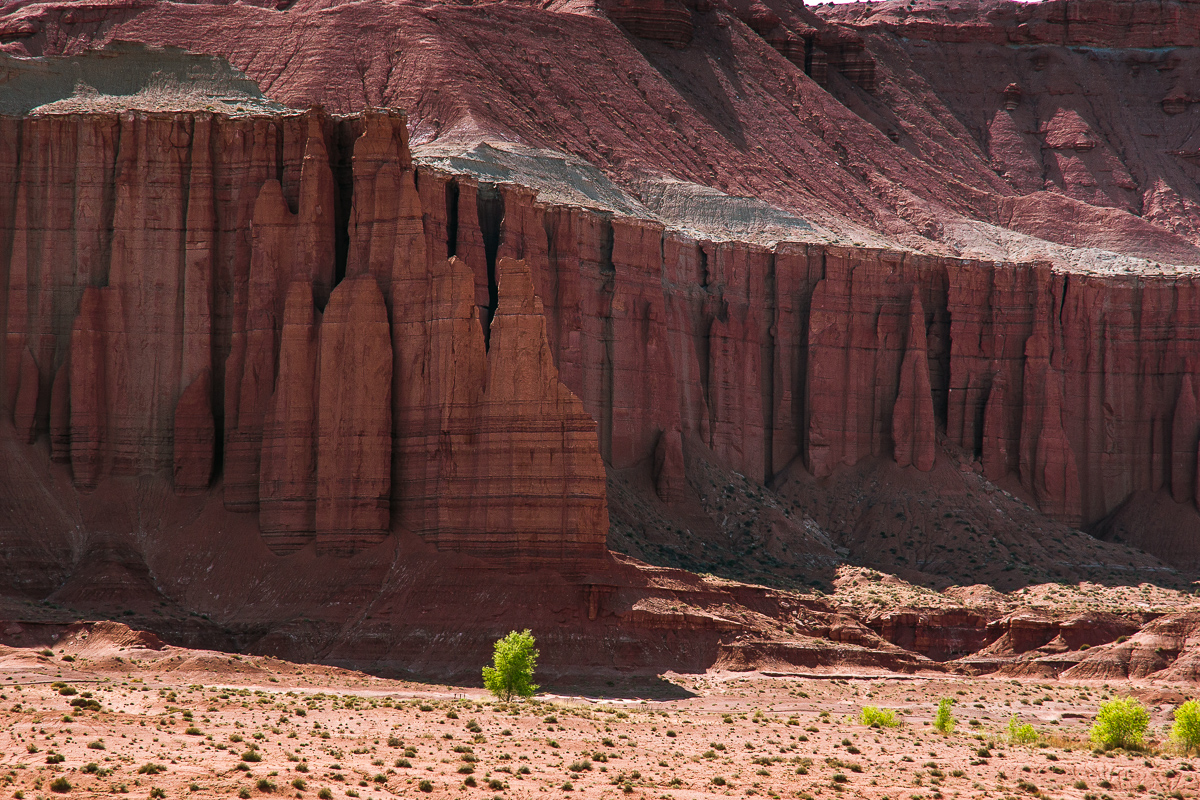
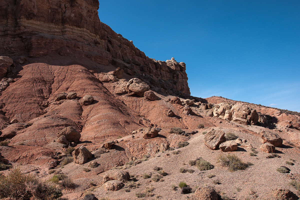
This is what is left from eroded Entrada sandstone
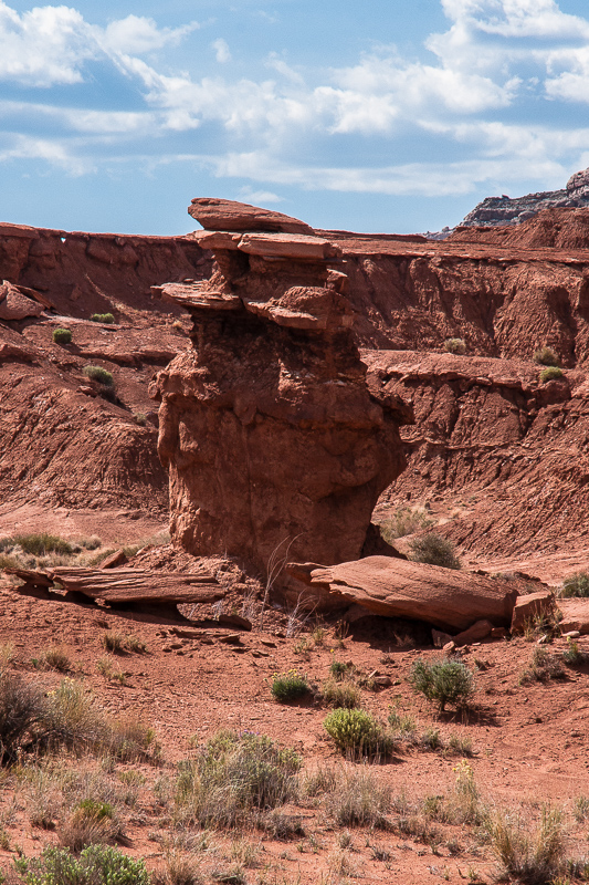
Hoodoo and a small arch in the distance
Still inclining strata
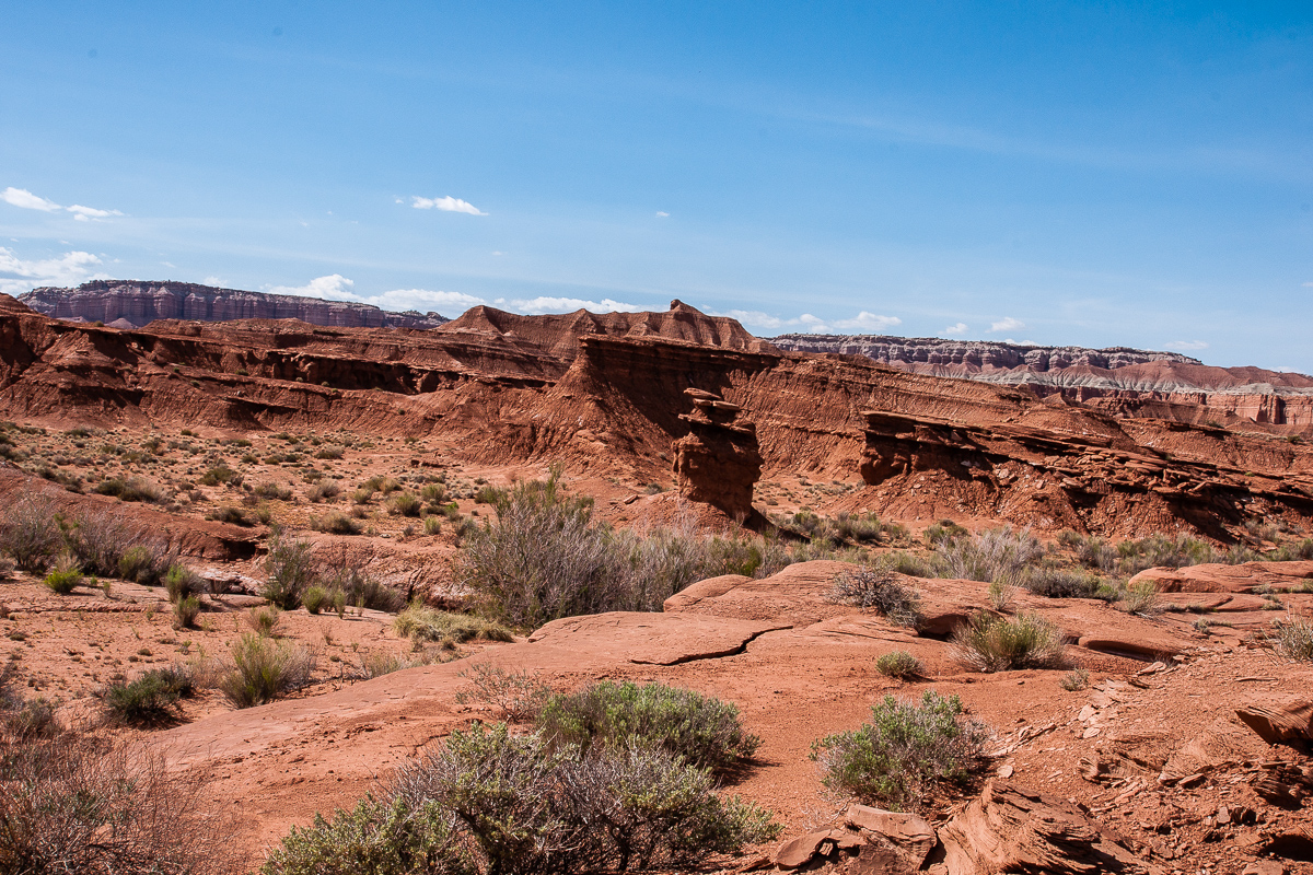
Looks like a labyrinth
Colorful cliffs
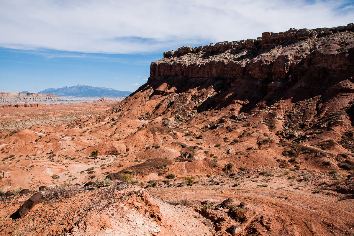
The road climbs up some 250 feet and we got acompletely different view backwards.
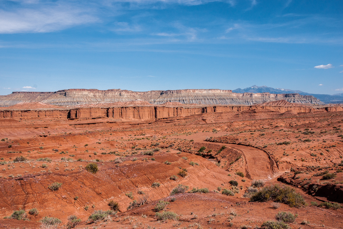
Red Desert and blue shale on the Caineville Mesas
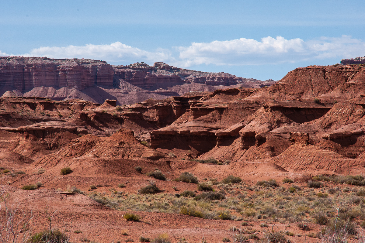
Cliff line to the west
Resembling Cathedral Valley - its the same geological setting
The maps show a flowing well
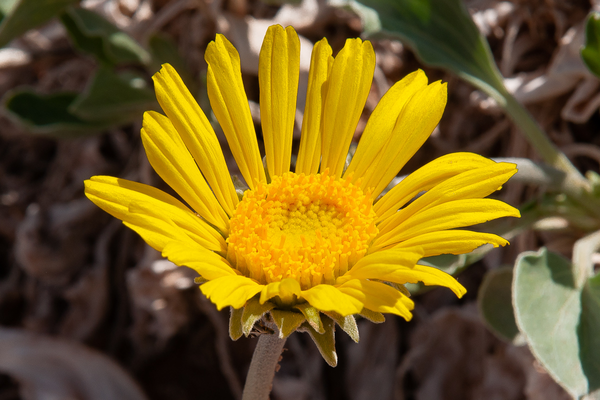
Moisture = flowers
We haven`t seen the well but we saw the trees
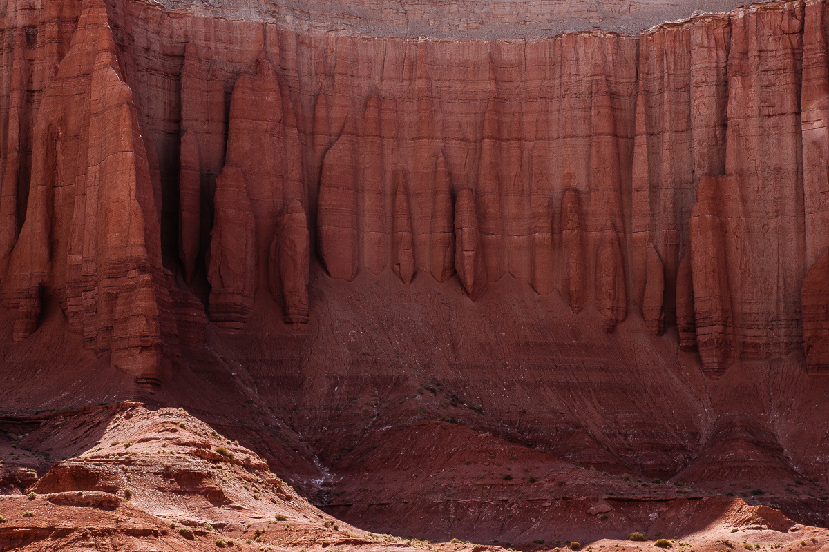
"Cathedral" walls - unfortunately in the shadow
A bit better
Egyptian temples?
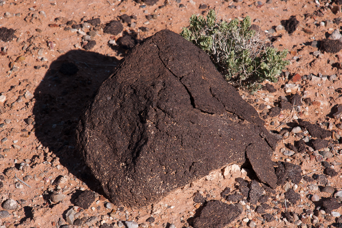
Remnants from volcanism
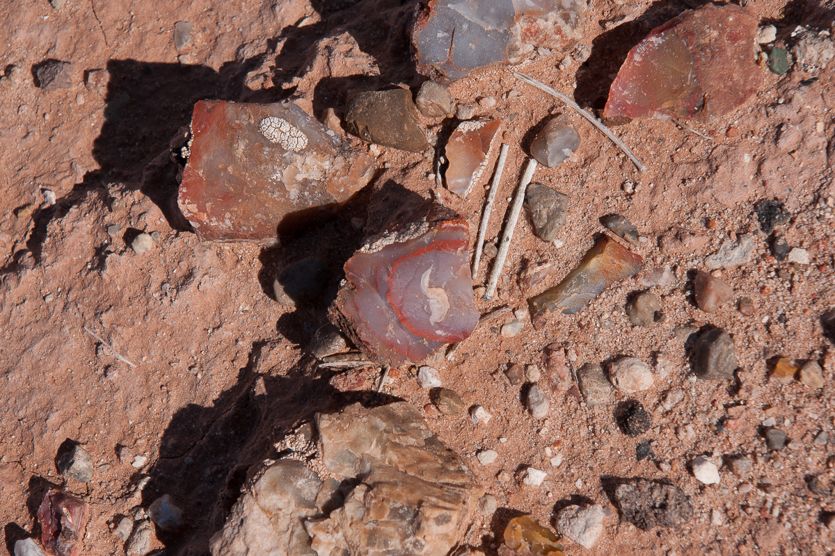
Agate
More cliffs
Cliff height declines
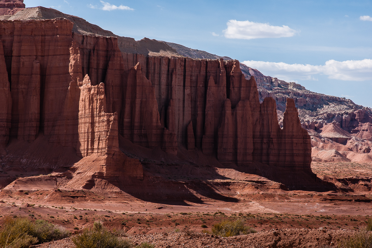
Looking back with better "cathedral" light
There is something like a gap on the west side of the basin. Topo maps show a prospect and a trail running up to it. We wanted to see whats there? The prospect must be in that gap.
Western cliffs
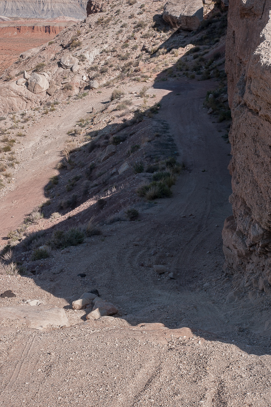
The former road is now a trail
No name on the maps - we call it Red Desert Pass

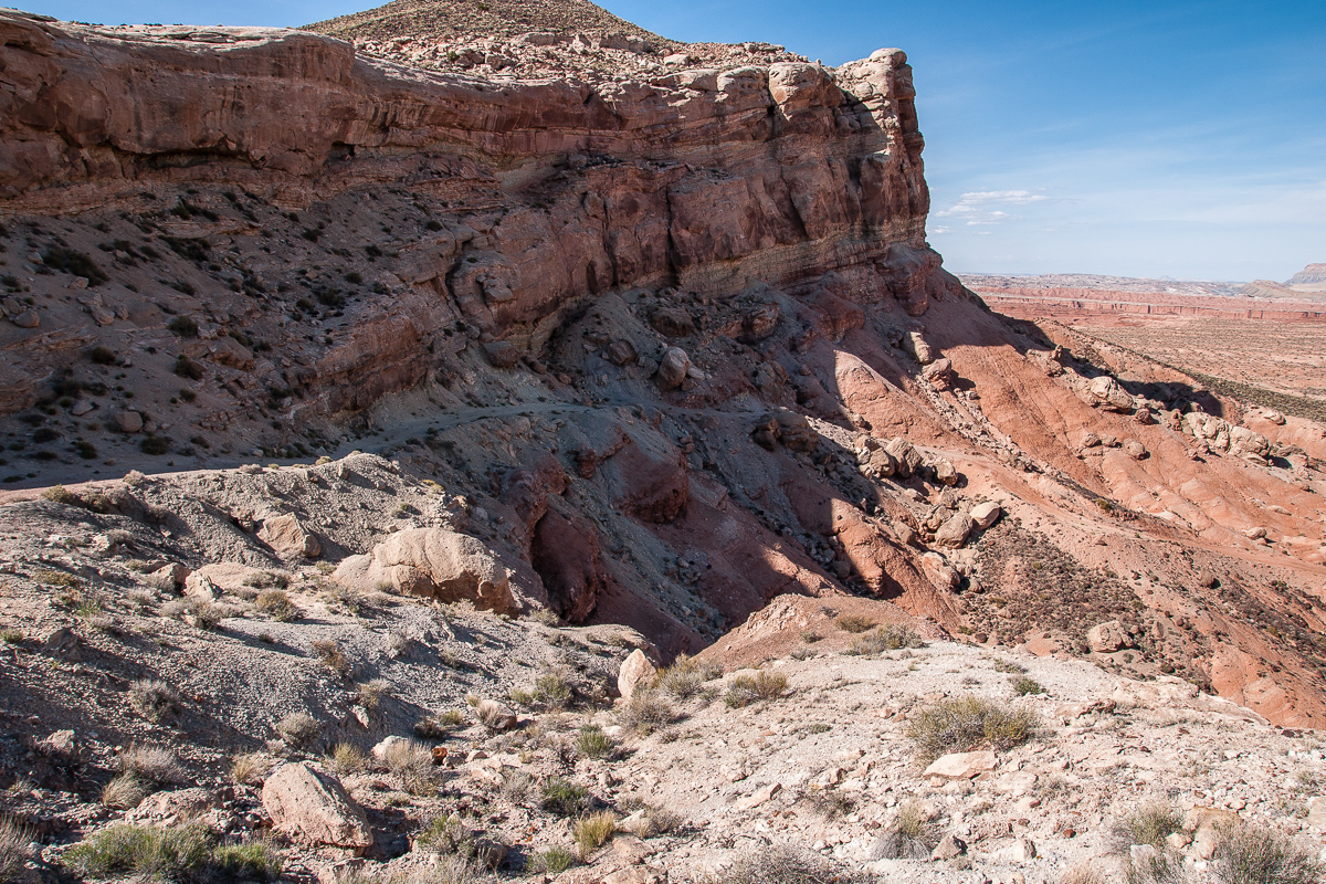
The Red Desert Basin from Red Desret Pass
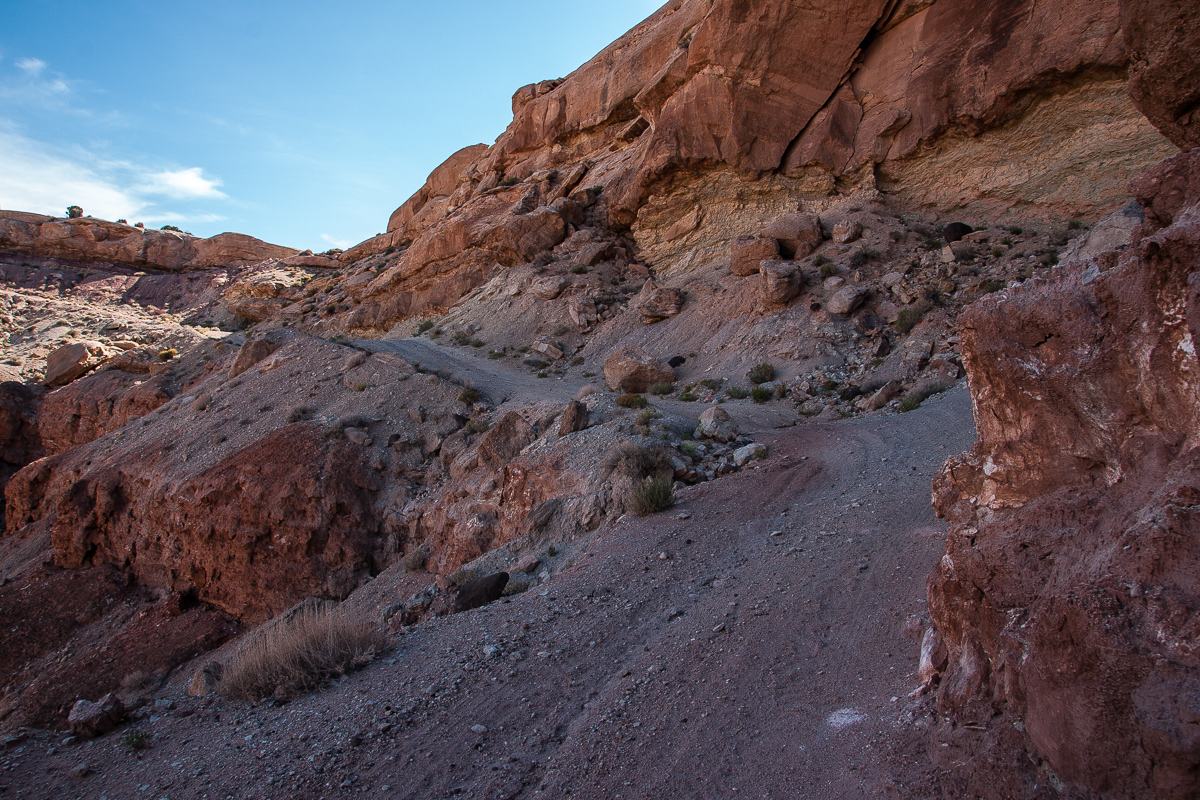
A tighter spot
Red Desert Pass
Last stretch to the summit
From the summit to the west
Down in the valley runs Hartnet Road. It is only a mile away. (Junction at 12S 0491175 4241257) Strata is pointing down now to the west.
Red Desert Pass and Red Desert might be a solution for these coming from Cathedral Valley finding Freemont River running to high to ford. Driving back to Cathedral Valley to change onto Caineville Wash Road to reach UT 24 means 56 miles or so, the pass is only 12 miles. A big saver!
More details at "Red Desert"
Featured image for home page:

Length of pavement might be some 1,100 to 1,200 feet and it is not completely straight. Might this be an airstrip?
One end of the assumed airstrip
Nevertheless this was the wrong way. On the other end of pavement a spur let us across Caineville Wash and into a smaller colorful canyon with another wash. (We named it Red Desert Wash) It must have flown not that long ago. The bed was still moist. This canyon is short, the length of the pretty good road measures approximately 1,2 miles.
Entering the small canyon
Improvement by pioneer bridges
Wild and colored
Within the canyon
Angled strata ascending to the West
Looking back (east): banded Morrison Formation and Caineville Mesa in background
Next layer is Summerville Formation
Topomap tells us we are entering Red Desert. Seems to be!
Red Summerville remnants on greyish Curtis Formation. Nice contrast!
Entrada cliffs with Curtis caps
At this point there is no need for a Jeep Wrangler. Even a sedan might work.
Looking west out of the little canyon
The last of at least three pioneer bridges
The wash in the little canyon drains a basin surrounded by Entrada sandstone cliffs. Seems to me that this was once an upwarp. The inclining strata from the east side starts to decline on the west side (we saw that later).
The eastern Cliffs of the basin
A view across the northern half of the basin
This is what the Topo Maps call Red Desert.
Branch of the wash
Cliff on the north end of the basin
This is what is left from eroded Entrada sandstone
Hoodoo and a small arch in the distance
Still inclining strata
Looks like a labyrinth
Colorful cliffs
The road climbs up some 250 feet and we got acompletely different view backwards.
Red Desert and blue shale on the Caineville Mesas
Cliff line to the west
Resembling Cathedral Valley - its the same geological setting
The maps show a flowing well
Moisture = flowers
We haven`t seen the well but we saw the trees
"Cathedral" walls - unfortunately in the shadow
A bit better
Egyptian temples?
Remnants from volcanism
Agate
More cliffs
Cliff height declines
Looking back with better "cathedral" light
There is something like a gap on the west side of the basin. Topo maps show a prospect and a trail running up to it. We wanted to see whats there? The prospect must be in that gap.
Western cliffs
The former road is now a trail
No name on the maps - we call it Red Desert Pass
The Red Desert Basin from Red Desret Pass
A tighter spot
Red Desert Pass
Last stretch to the summit
From the summit to the west
Down in the valley runs Hartnet Road. It is only a mile away. (Junction at 12S 0491175 4241257) Strata is pointing down now to the west.
Red Desert Pass and Red Desert might be a solution for these coming from Cathedral Valley finding Freemont River running to high to ford. Driving back to Cathedral Valley to change onto Caineville Wash Road to reach UT 24 means 56 miles or so, the pass is only 12 miles. A big saver!
More details at "Red Desert"
Featured image for home page:
Last edited:
") But it is indeed a fantastic way to see parts of that desert the vast majority of visitors don't. For one of my jobs we used to travel (on foot & with handcarts) over some of the two-tracks hatchcanyon refers to. Beautiful pics, btw! After you've driven/hiked through that area, get to the east side of the top of Thousand Lake Mountain for bird's-eye views of the country. You can drive up there from the desert, the road goes west up to it from above the Hartnet switchbacks, south of the campground. That road will then go over the mountain and drop you onto Highway 72 above Fremont. It's a maintained logging road, so just about any car can make it depending on weather.
But it is indeed a fantastic way to see parts of that desert the vast majority of visitors don't. For one of my jobs we used to travel (on foot & with handcarts) over some of the two-tracks hatchcanyon refers to. Beautiful pics, btw! After you've driven/hiked through that area, get to the east side of the top of Thousand Lake Mountain for bird's-eye views of the country. You can drive up there from the desert, the road goes west up to it from above the Hartnet switchbacks, south of the campground. That road will then go over the mountain and drop you onto Highway 72 above Fremont. It's a maintained logging road, so just about any car can make it depending on weather.