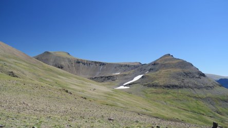
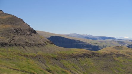
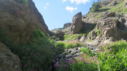
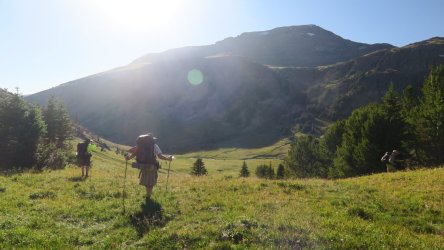
I'm planning a 13 day solo backpacking trip in the Teton & Washakie Wilderness Areas in late July. I'd like to include the Silvertip Creek Trail and the North Fork of Butte Creek Trails in my route. However, it is difficult to find any current information on them. The Silvertip Creek Trail connects upper Open Creek with upper Pass Creek. The North Fork of Butte Creek Trail connects upper Pass Creek with the upper end of the Thorofare Creek Trail. Does anyone have first-hand, or even second-hand, information on the current state of those trails? They are described in the Ralph Maughan guidebook, but that was written in 1981. I assume that they aren't maintained, except possibly by outfitters. I'm reluctant to commit to including them in my route because I'm afraid that I'll find out that they no longer really exist, or are no longer passable.
Navigation
Install the app
How to install the app on iOS
Follow along with the video below to see how to install our site as a web app on your home screen.
Note: This feature may not be available in some browsers.
More options
Style variation
You are using an out of date browser. It may not display this or other websites correctly.
You should upgrade or use an alternative browser.
You should upgrade or use an alternative browser.
Teton Wilderness (WY) trail questions
- Thread starter Fungi
- Start date
Bob
Trailmaster
- Joined
- Mar 3, 2013
- Messages
- 4,911
They are there. You can see most parts of them on Google Earth. Joey went up the open creek trail and over to Rampart a few years back. Outfitters maintain most of them. Pass creek is main trail. The cutoff to NF butte is there. The trail down from deer creek pass is there. I wouldn't worry about them. Google Earth is your friend.
That's encouraging, thanks!They are there. You can see most parts of them on Google Earth. Joey went up the open creek trail and over to Rampart a few years back. Outfitters maintain most of them. Pass creek is main trail. The cutoff to NF butte is there. The trail down from deer creek pass is there. I wouldn't worry about them. Google Earth is your friend.
I'm planning to start at the Boulder Basin Trailhead and head up the South Fork Shoshone River to Shoshone Pass. From there I'll head cross country to the Continental Divide and follow it over towards Marston Pass. I'm going to head over to the headwaters of the South Fork of the Yellowstone, then the headwaters of the North Fork of the Yellowstone, and finally the headwaters of Thorofare Creek. I'll head down Thorofare Creek until I hit trail, and follow it down to Open Creek. From there I'm going up Open Creek to the headwaters, with a layover day to check out Rampart Pass. For my exit, I'm planning to follow the Silvertip Creek Trail to the North Fork Butte Creek Trail, then up to Deer Creek Pass, and then finally down to Deer Creek Campground.Post your route we can tell you better .. or dm me
- Joined
- May 16, 2016
- Messages
- 1,538
That sounds like an awesome trip, I hope the weather cooperates for you.I'm planning to start at the Boulder Basin Trailhead and head up the South Fork Shoshone River to Shoshone Pass. From there I'll head cross country to the Continental Divide and follow it over towards Marston Pass. I'm going to head over to the headwaters of the South Fork of the Yellowstone, then the headwaters of the North Fork of the Yellowstone, and finally the headwaters of Thorofare Creek. I'll head down Thorofare Creek until I hit trail, and follow it down to Open Creek. From there I'm going up Open Creek to the headwaters, with a layover day to check out Rampart Pass. For my exit, I'm planning to follow the Silvertip Creek Trail to the North Fork Butte Creek Trail, then up to Deer Creek Pass, and then finally down to Deer Creek Campground.
Please post a trip report
Bob
Trailmaster
- Joined
- Mar 3, 2013
- Messages
- 4,911
Deer Creek campground is about 3 road miles from the Trailhead. I believe there are only 8 spots there. Rampart Pass is not where the trail goes up out of Open Creek into Rampart Creek..... I doubt you can climb up to where the map says "rampart pass". There is an old trail out of Silvertip, into Pass Creek, another old trail crosses from Pass Creek into NF Butte Creek. I've seen a partial of a trail going out of NF Butte Creek to Deer Creek Pass. (we will be over that part Aug 2, our trip starts Aug 1 at Deer Creek TH). From Shoshone Pass to headwters of NF Yellowstone is good tundra walking...Tstorms could be a problem). Not sure you can get around Thorofare Mtn without dropping into the NF Yellowstone, then climbing back over ..... Thorofare Mtn (as others) are strange tuff / dirt composite and terrible to hike on.... Dont know where Boulder Basin TH is? At the USFS South Fork Work Center? Or are you talking down by the campground at the end of the road. There is a large parking area there at the end of the road, where the SF trail starts. Its a long hike up the SF Shoshone to Shoshone Pass, about half was burned in 2013.
You realize you are talking about 110 mile? ...... about 9 miles/day average. Thats not too bad of mileage days, more than I like to plan though.
A lot of food to pack. Is prime Griz country. From Shoshone Pass to Thorofare, not much to hang food on...you'll need a Ursack. Younts Peak area should have Griz looking for moths then too.
Good trip though..........
Yeah, the Boulder Basin Trailhead & S Fork Work Center are the same place. The trailhead on the west side of the river near Cabin Creek would be shorter, but that would require a major river ford. I don't want to attempt that this early in the season (7/20). The Boulder Basin / S Fork Work Center Trailhead is actually 11 miles from Deer Creek Campground by road. I have a friend that will probably be able to shuttle me, but he isn't certain yet. If that falls through I would seriously consider breaking this into two trips. The first would start the same as my original plan but then I would descend the Marston Creek Trail and backtrack 19 miles along the S Fork Shoshone River. The second would be up from Deer Creek Campground and back the same way, with 5 days to check out Thorofare Creek, Open Creek, etc. I'm actually considering this anyway since it would be easier, but I'd have to leave a lot of stuff out.Deer Creek campground is about 3 road miles from the Trailhead. I believe there are only 8 spots there. Rampart Pass is not where the trail goes up out of Open Creek into Rampart Creek..... I doubt you can climb up to where the map says "rampart pass". There is an old trail out of Silvertip, into Pass Creek, another old trail crosses from Pass Creek into NF Butte Creek. I've seen a partial of a trail going out of NF Butte Creek to Deer Creek Pass. (we will be over that part Aug 2, our trip starts Aug 1 at Deer Creek TH). From Shoshone Pass to headwters of NF Yellowstone is good tundra walking...Tstorms could be a problem). Not sure you can get around Thorofare Mtn without dropping into the NF Yellowstone, then climbing back over ..... Thorofare Mtn (as others) are strange tuff / dirt composite and terrible to hike on.... Dont know where Boulder Basin TH is? At the USFS South Fork Work Center? Or are you talking down by the campground at the end of the road. There is a large parking area there at the end of the road, where the SF trail starts. Its a long hike up the SF Shoshone to Shoshone Pass, about half was burned in 2013.
You realize you are talking about 110 mile? ...... about 9 miles/day average. Thats not too bad of mileage days, more than I like to plan though.
A lot of food to pack. Is prime Griz country. From Shoshone Pass to Thorofare, not much to hang food on...you'll need a Ursack. Younts Peak area should have Griz looking for moths then too.
Good trip though..........
I walked the Continental Divide from near Marston Pass (Lost Creek) to Bonneville Pass in July of 2022. It was fantastic - part of the inspiration for this trip is simply to do that again. Thunderstorms are my biggest concern with that. Last time we got lucky with the weather, although we did alter our route to come out a day early ahead of some approaching storms. Most of that area you can get off the very top pretty quickly, but not below treeline. I'll check the weather forecast each day before and during the trip.
For food I will carry a bear canister and hang the excess. One flaw is that I won't be able to fit all of it in the canister before I get above treeline, so I'll need to get creative with the extra.
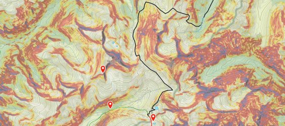
Getting from the headwaters of the S Fork Yellowstone to Thorofare Creek will be the crux of the route. Yes, I'm planning to drop into the North Fork Yellowstone River first, then up and over the ridge to the east, and then down into the upper part of Thorofare Creek. Joey did that on one of his trips - I need to watch that video again. I see one route that looks reasonable on the map. I'll post maps of my planned route for that section below.
If everything goes according to plan I will be coming out at Deer Creek Campground on 8/1, so I may pass you going the other way. I'll probably be the only human that you see that isn't on a horse. I'll probably be looking pretty feral by then, so don't be alarmed.
- Joined
- Aug 21, 2018
- Messages
- 738
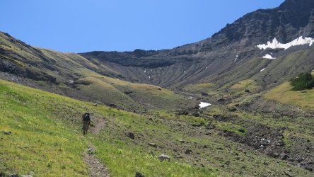
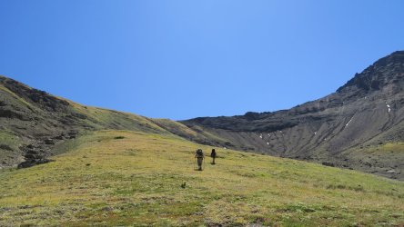
That sounds similar to the route we took last year. . . only we moved in the opposite direction and crawled out of the Thorofare headwaters at a slightly different spot. Our campsite near a tributary leading into the North Fork (where the blue and purple lines meet) was one of my favorite places of the trip.I'm planning to drop into the North Fork Yellowstone River first, then up and over the ridge to the east, and then down into the upper part of Thorofare Creek.
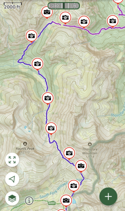
Part of our group may be taking a horse ride to the top, if you don't get trampled by them you may pass us suckers for punishment hiking up. We will probably be looking pretty hot, tired, and winded by then, so don't be alarmed.If everything goes according to plan I will be coming out at Deer Creek Campground on 8/1, so I may pass you going the other way. I'll probably be the only human that you see that isn't on a horse. I'll probably be looking pretty feral by then, so don't be alarmed.
Bob
Trailmaster
- Joined
- Mar 3, 2013
- Messages
- 4,911
Go a little farther north of where you cut across to Thorofare...... There is a pass there .... Majo Pass. From the NF Yellowstone side stay on the north side of the drainage, some use trails. Going down into the Thorofare drainage ...... there is supposed to be a trail all the way down on the north side of the drainage...we never found it till the top, and we just climbed up in the bottom of the drainage.. I've talked to Joey about that climb, he went over a little closer to thorofare mtn. You've plotted about the same path we are looking at for our trip, except we willo be contouring around the head to finish out along the ridge to Falls Creek
Last edited:
Bob
Trailmaster
- Joined
- Mar 3, 2013
- Messages
- 4,911
Really dont think youd have much of a problem crossing the Shoshone there just south of the campground. Snow is coming off fast around here now.... 80 to 85 degrees at 6400ft. Mt Jefferson (10K) by me is bare except for the chutes. The Shoshone there is pretty braided as well. I'd swim before an extra 11 miles in a hot canyon.....
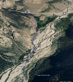

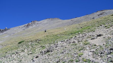
Thanks, that is great info! I wondered about that possible route. It looks great on the west side, but really steep on the east. Was it as steep as it looks on the map? The route I came up with is just my best guess based on the topography, but of course you never really know for sure until you are there.That sounds similar to the route we took last year. . . only we moved in the opposite direction and crawled out of the Thorofare headwaters at a slightly different spot. Our campsite near a tributary leading into the North Fork (where the blue and purple lines meet) was one of my favorite places of the trip.
View attachment 132219
Part of our group may be taking a horse ride to the top, if you don't get trampled by them you may pass us suckers for punishment hiking up. We will probably be looking pretty hot, tired, and winded by then, so don't be alarmed.
Thanks, that is good to know. Yeah, most years it seems like the snow melts off a good 2 weeks earlier than it did even 20 years ago. If my friend can shuttle me it won't matter much which side I start on, but if that falls through starting from Cabin Creek will be a lot better than an 11 mile road walk.Really dont think youd have much of a problem crossing the Shoshone there just south of the campground. Snow is coming off fast around here now.... 80 to 85 degrees at 6400ft. Mt Jefferson (10K) by me is bare except for the chutes. The Shoshone there is pretty braided as well. I'd swim before an extra 11 miles in a hot canyon.....
View attachment 132220
I'm also considering spending the second half of my backpacking trip exploring around Ferry Lake and north towards Tri County Lake, Yellowstone Point, etc. That would mean saving the Thorofare area for a future trip. That would be an easier trip overall, and maybe a better choice since I will be solo. If I do that I would exit by the Marston Creek Trail and then backtrack along the South Fork Shoshone to the original trailhead.
- Joined
- Aug 21, 2018
- Messages
- 738
Not the best video, but a quick one from the hike/climb up.Was it as steep as it looks on the map?
Don't like ads? Become a BCP Supporting Member and kiss them all goodbye. Click here for more info.

