AKay09
Member
- Joined
- Mar 10, 2015
- Messages
- 96
A warning going forward, this is basically a novel! ") Scroll to the second group of text for the actual backpacking trip.
Scroll to the second group of text for the actual backpacking trip.
A few years ago after my first backpacking adventure in the Great Smoky Mountains National Park I set a goal for myself; to backpack in five different national parks before I turned 30, so one a year. In 2014 it was GSMNP, last year it was Glacier National Park and this year it was Grand Teton National Park. It would seem I have set the bar pretty high in terms of beauty for my next few adventures!
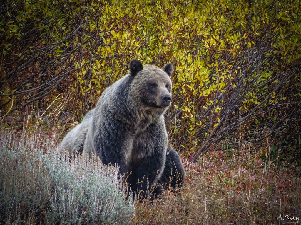
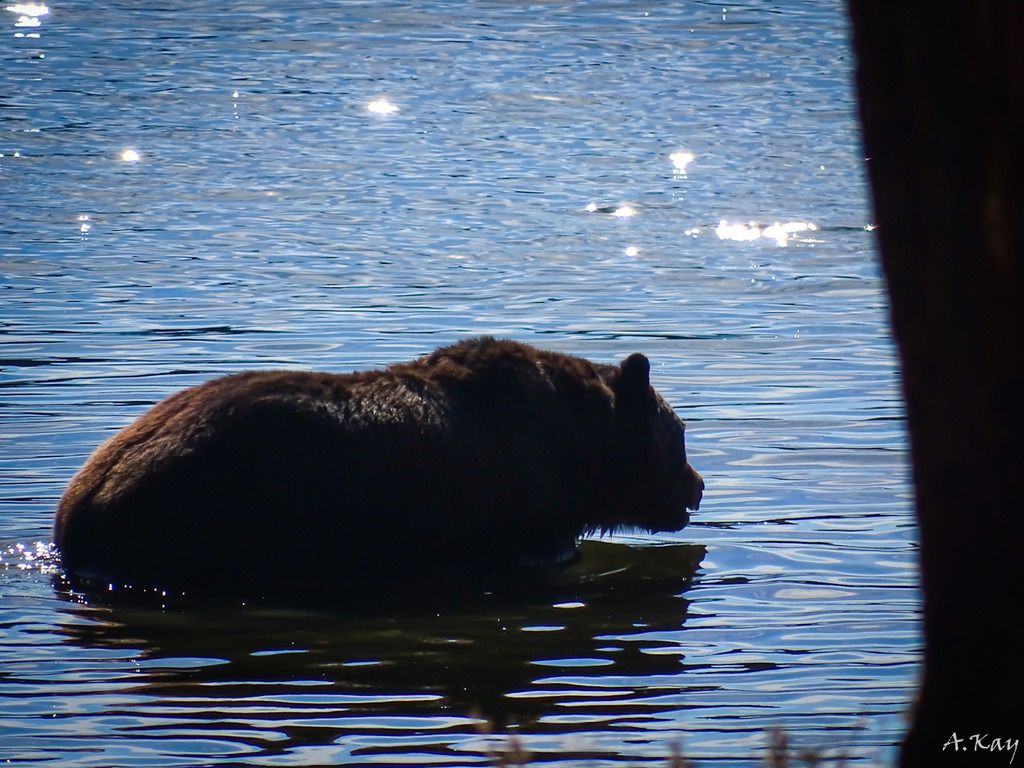
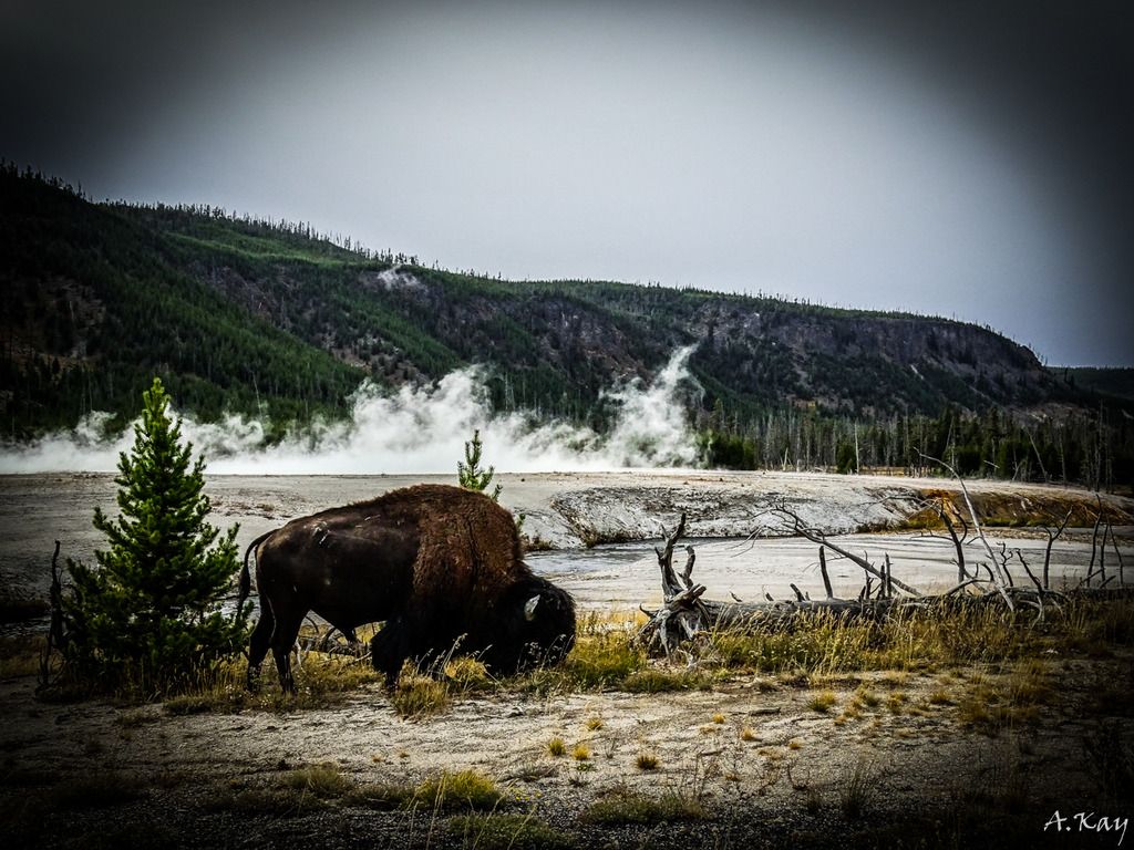
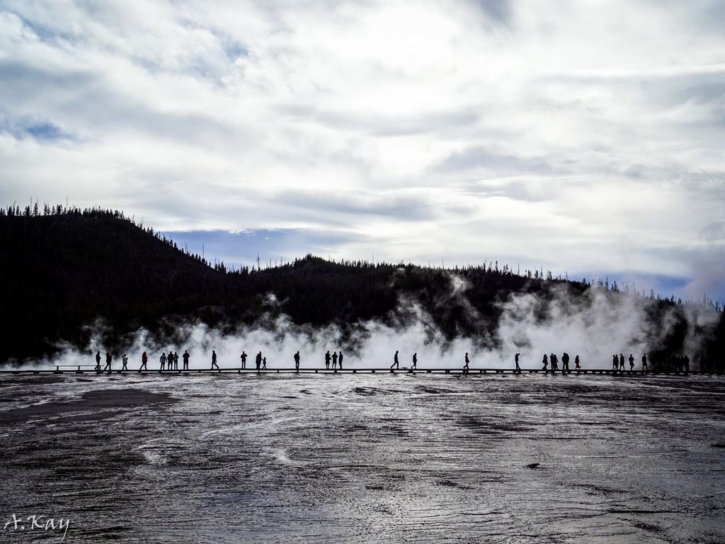
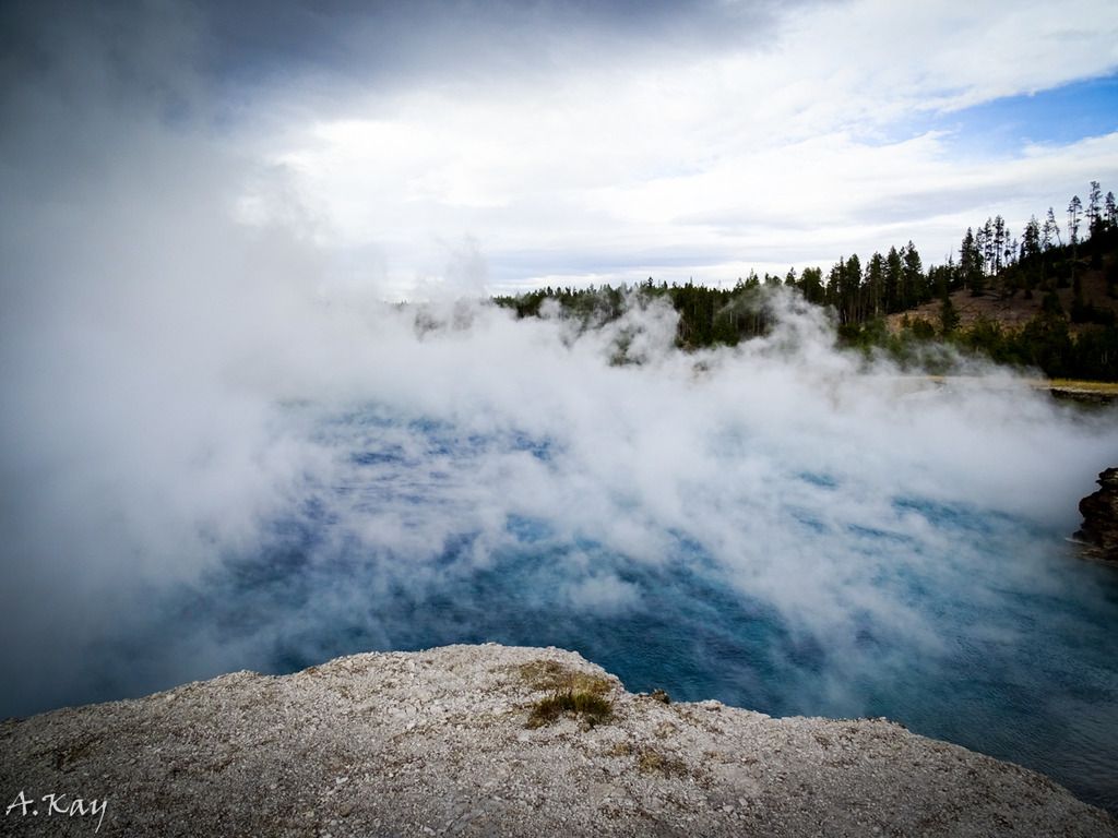
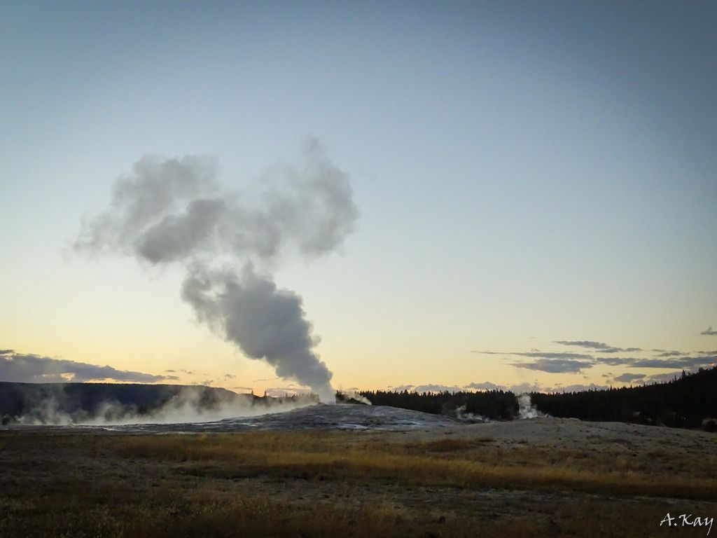
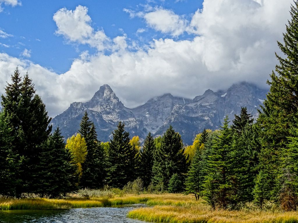
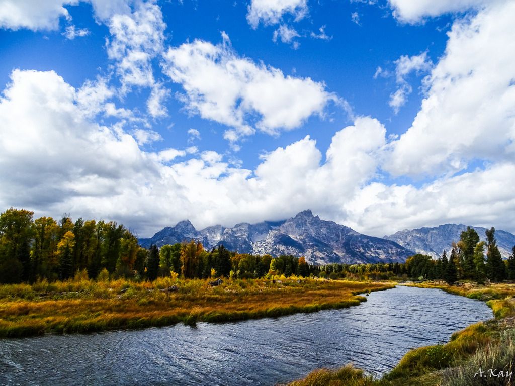
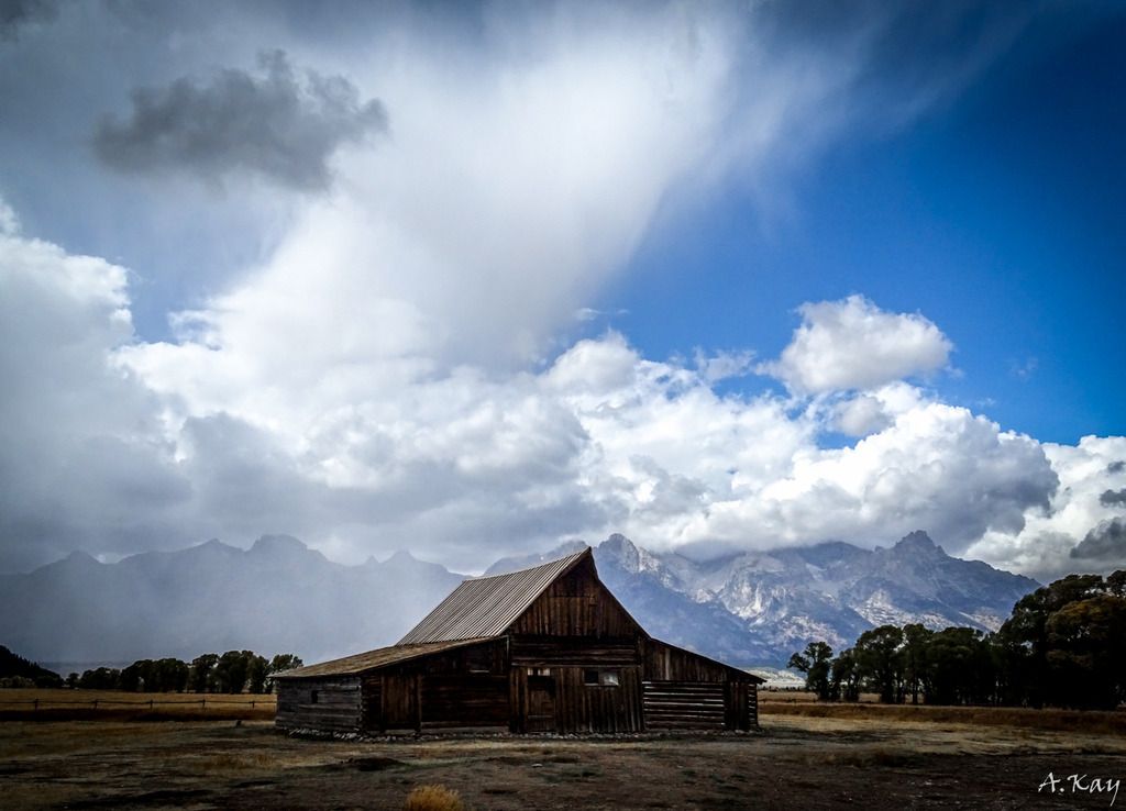
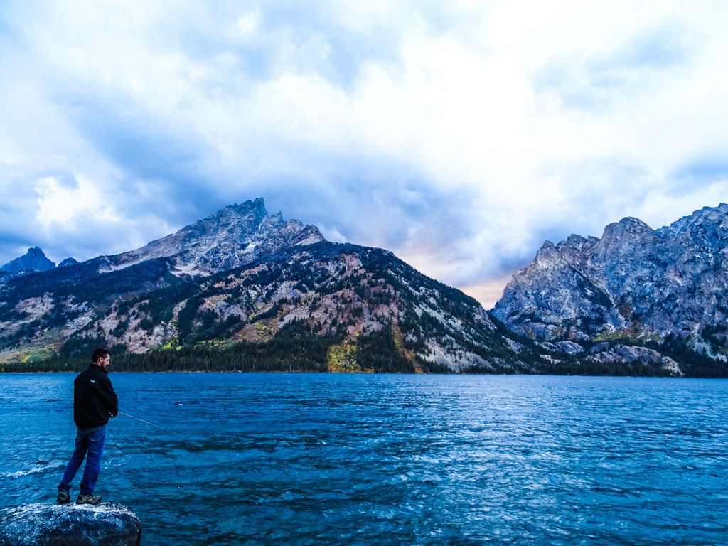
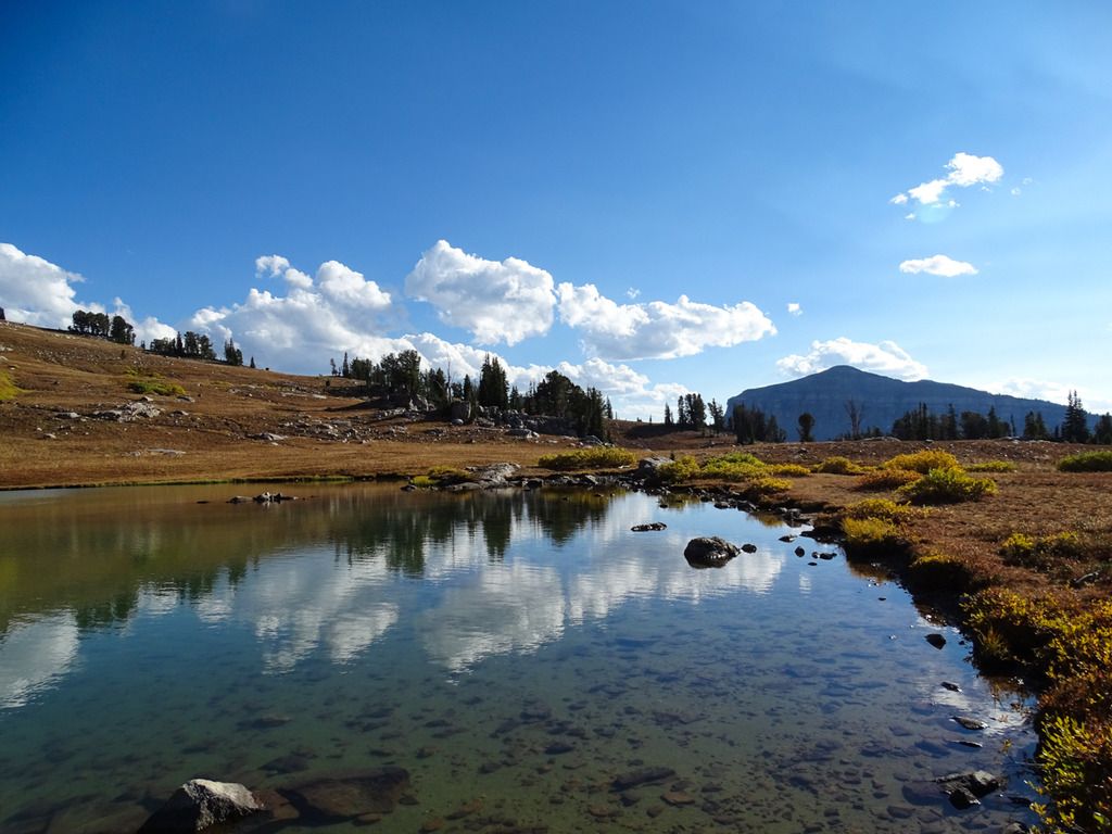
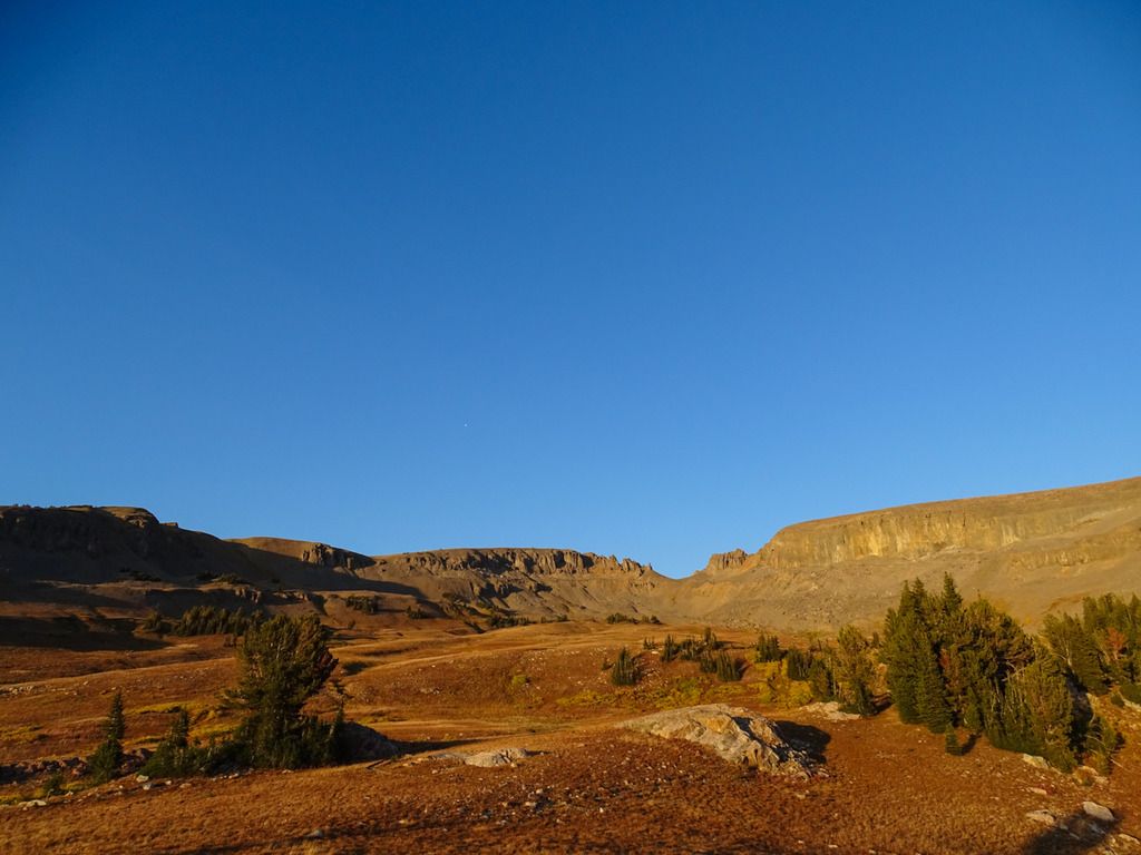
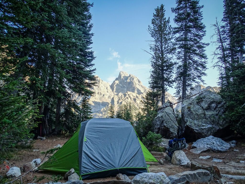
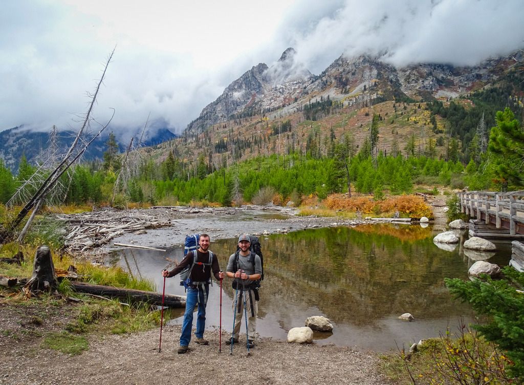
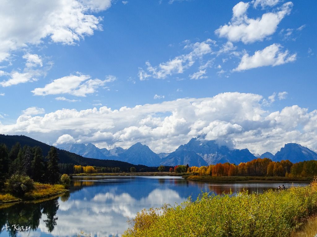
On September 15th my buddy Kyle and I began our trip out west, fittingly from the Gateway to the West, St. Louis. Seeing as I had never been to this area of the country before we decided to spend two days in Yellowstone and one day in the Tetons before we began our hike. After 10 hours in the car on our second day we made it to Yellowstone and somehow managed to snag the very last campsite in the entire park, so that was nice! The campsite was nothing special and a little too close to others for my liking but hearing the elk bugle at night and in the morning made it OKAY in my book. We spent that first evening driving around looking for wildlife and the second day checking out as many geysers and tourist spots as we could, it was pretty hectic but worth it. The next morning we drove down to the Tetons, managed to get the permit I was hoping for and then set up camp at Jenny Lake for the last night they would be open for the season. After that we drove around again looking for wildlife and did some fishing before getting to bed pretty early in preparation for the hike. Here are a few pictures from the three days prior to the hike.
Yellowstone:
Tetons:
Day 1:
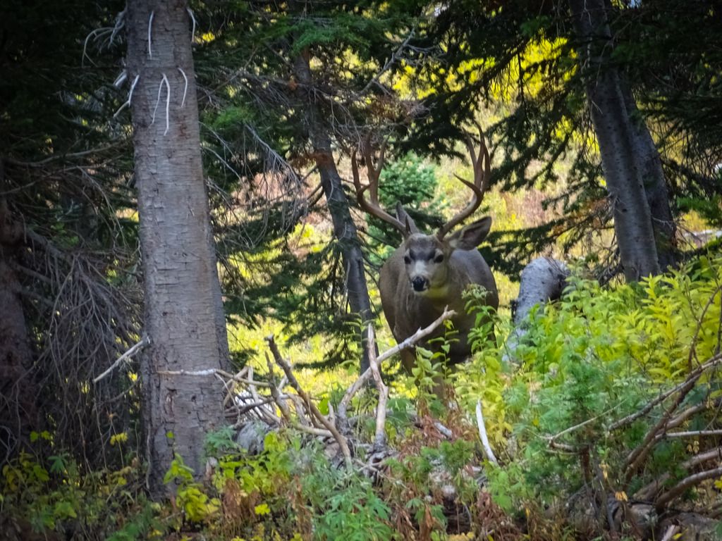
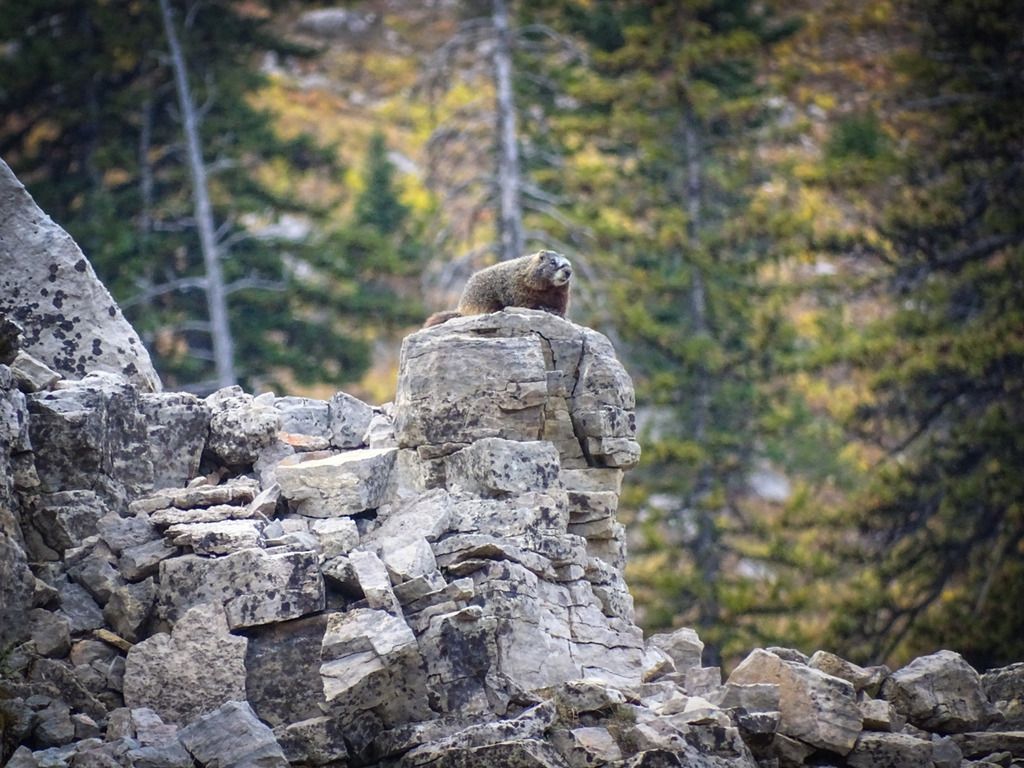
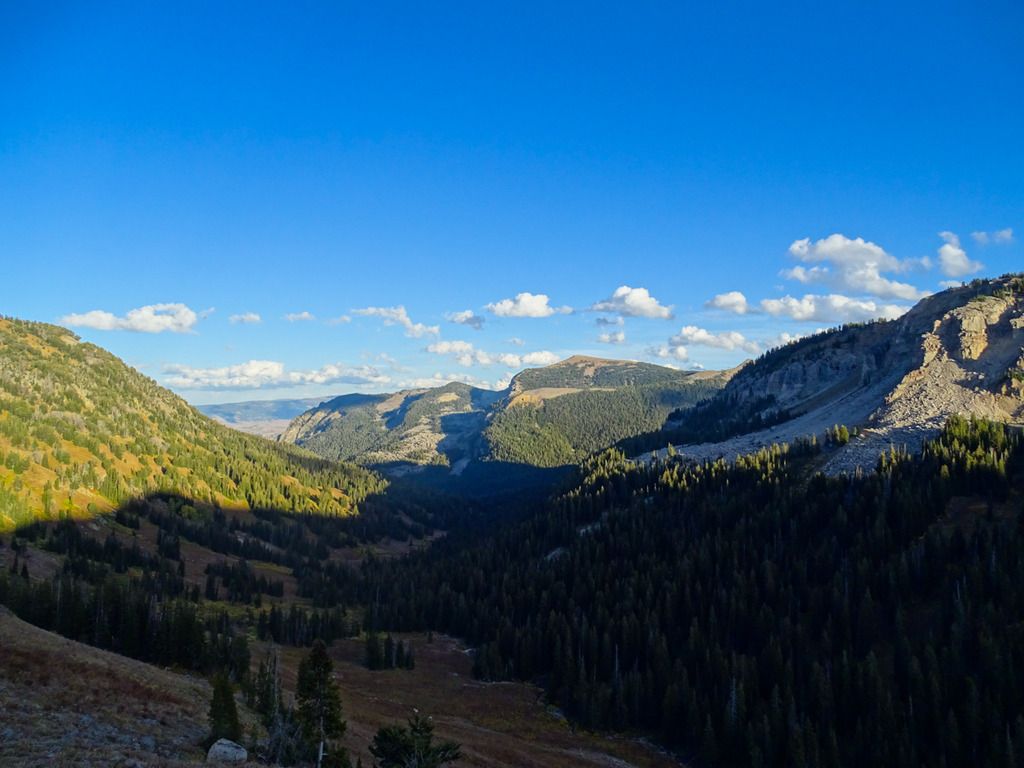
The morning of September 19th we began our hike. The plan would be for us to go from the tram to String Lake via Paintbrush Divide over 5 days. We took a pretty pricey ride from String Lake Trailhead down to the tram in Teton Village. When we arrived it was beautiful and sunny but within about 5 minutes of making it to the top the wind picked up and it started pouring and sleeting. We hid next to a little shop at the top and got on our rain gear and pack covers and waited it out for about 15 minutes. We knew weather was going to be an issue on the trip, that morning we checked the forecast and it was calling for 1 to 3inches of snow on our third night and rain all day after that so we were sort of mentally prepared for it. After the rain stopped we began our decent to Marion Lake for night one. Sadly the wind had not died down and almost immediately my pack cover managed to blow off the mountain...so that sucked ha. The hike to Marion Lake was a nice way to start the trip, it was mostly down hill and offered some nice views and some wildlife. We heard and saw lots of pikas, one marmot and one nice mule deer buck. The campsite at Marion Lake has some really nice views but I wish it was a bit closer to the lake. Weather wise the day was great after the first rough patch, temps did drop probably into the low 30s or high 20s at night so it was a bit chilly but not awful.
Ride up the tram
Mule Deer
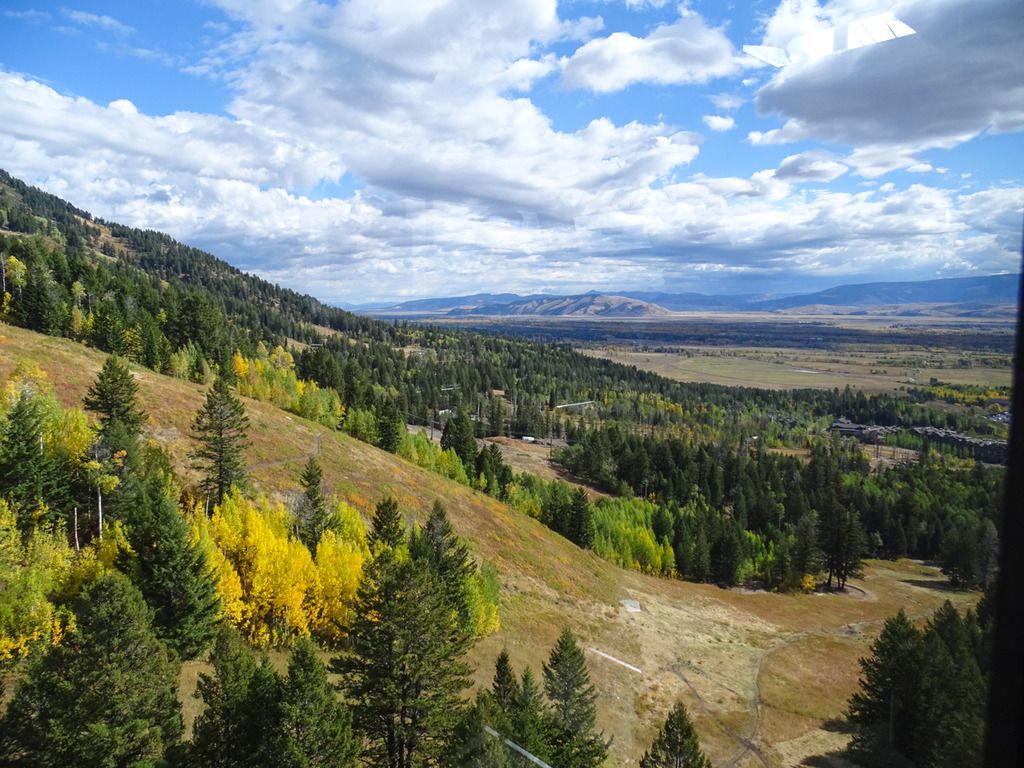
View from behind our tent looking down upper Granite Canyon I believe. The high point in the middle right of the frame was where the tram dropped us off, a little over 6miles away.
Marion Lake
Day 2:
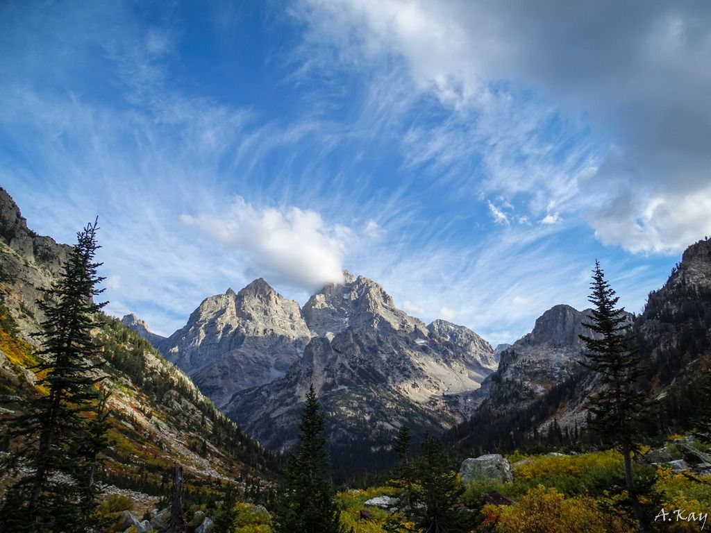
On day two we hiked from Marion Lake into the Alaska Basin and down into Sunset Lake for our second night. The weather was perfect all day, sunny and mid 60s. It was a very cool hike, we finally were able to see the Tetons free of clouds and it was the first time I had ever been basically above treeline for an extended period of time. The hike along Death Canyon Shelf was beautiful and unlike anything else I have ever experienced. The elevation seemed to be getting to both of us on this day so we stopped pretty often and enjoyed the views. The last few miles in the Alaska Basin seemed to drag on forever and at this point we were ready to relax. We camd across a sign that said we had 1.3 miles to go to Sunset Lake but after talking with some people at camp that evening, it turns out the distance was actually closer to 3 miles. I forgot to mention that about a month before this hike I sprained my right knee and wasn't able to really do any training the last month. I remember the last few miles that day being a killer on my legs and knee but the lake was definitely worth the discomfort. On a side note, my knee is still not right about 4 months later, so that's annoying.
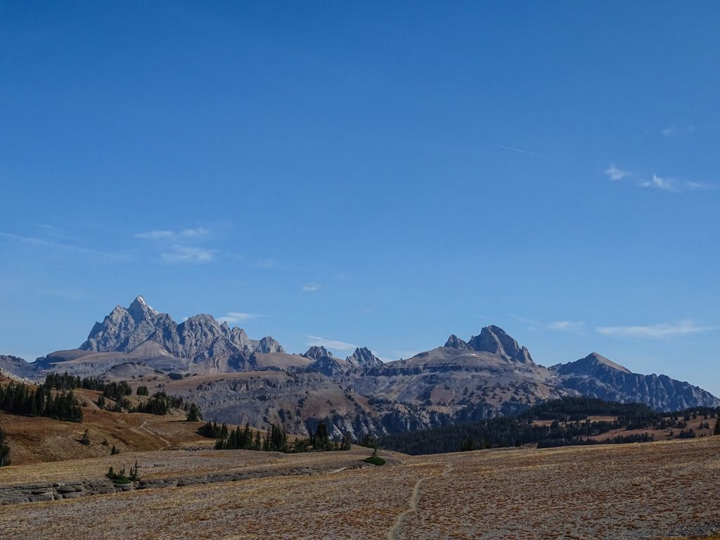
First view of the Tetons
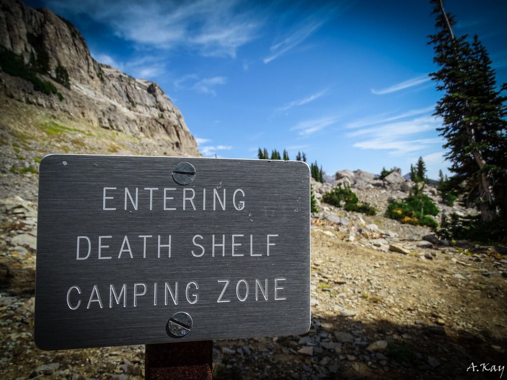
Tetons a little before Death Shelf
Such a lovely name...
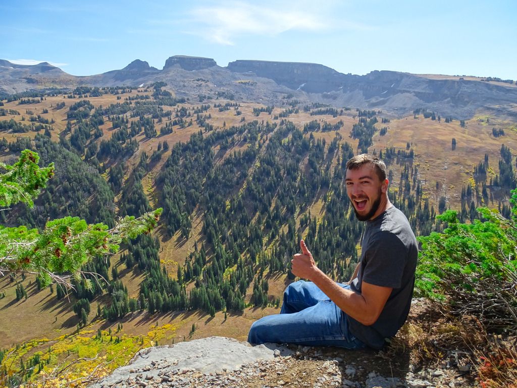
Kyle
Looking down Death Canyon
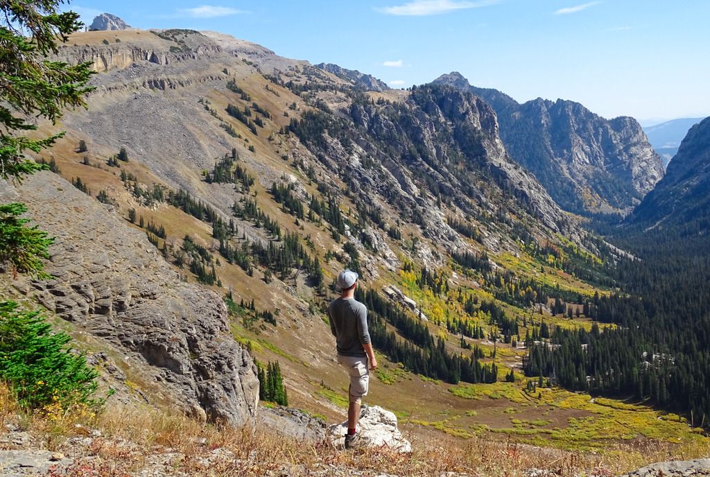
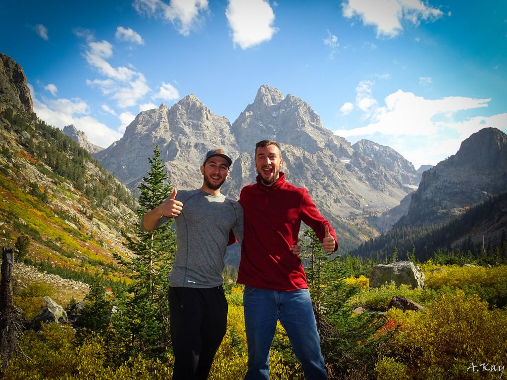
I'm in the hat on the left.
Making that high quality H2O!
Camp at sunset lake
Sunset Lake - Was full of big amphipods
Day 3:
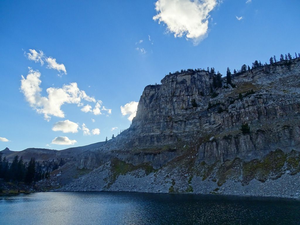
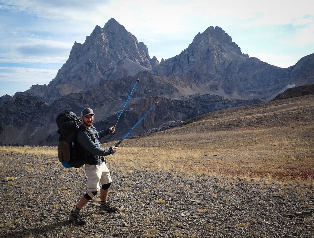
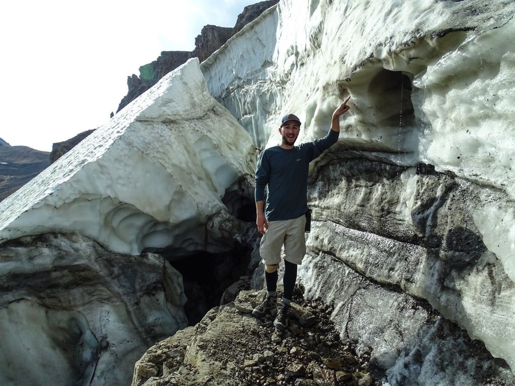
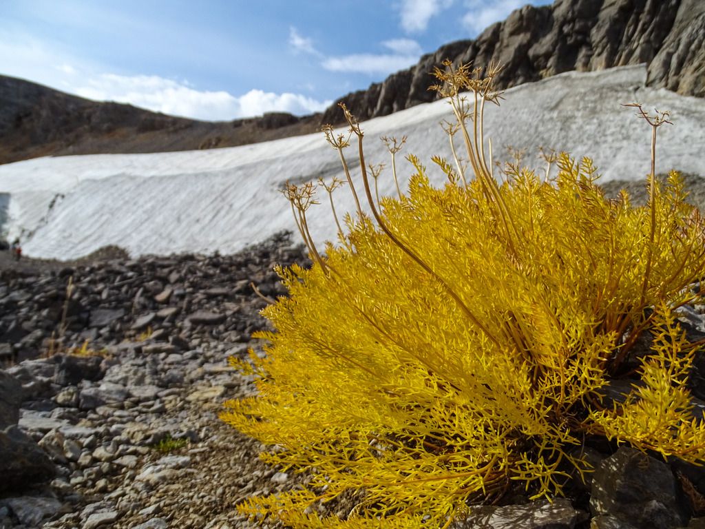
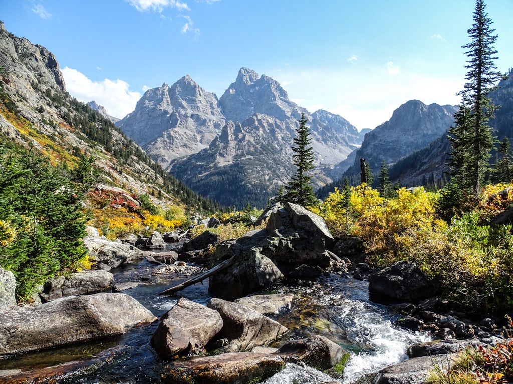
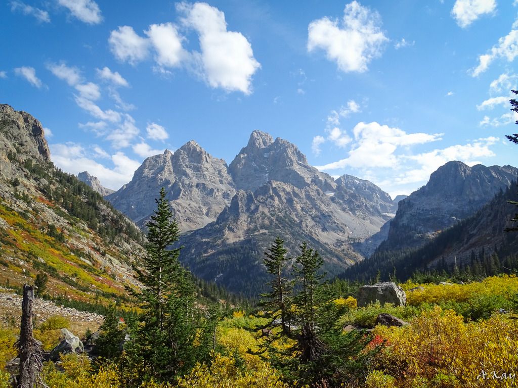
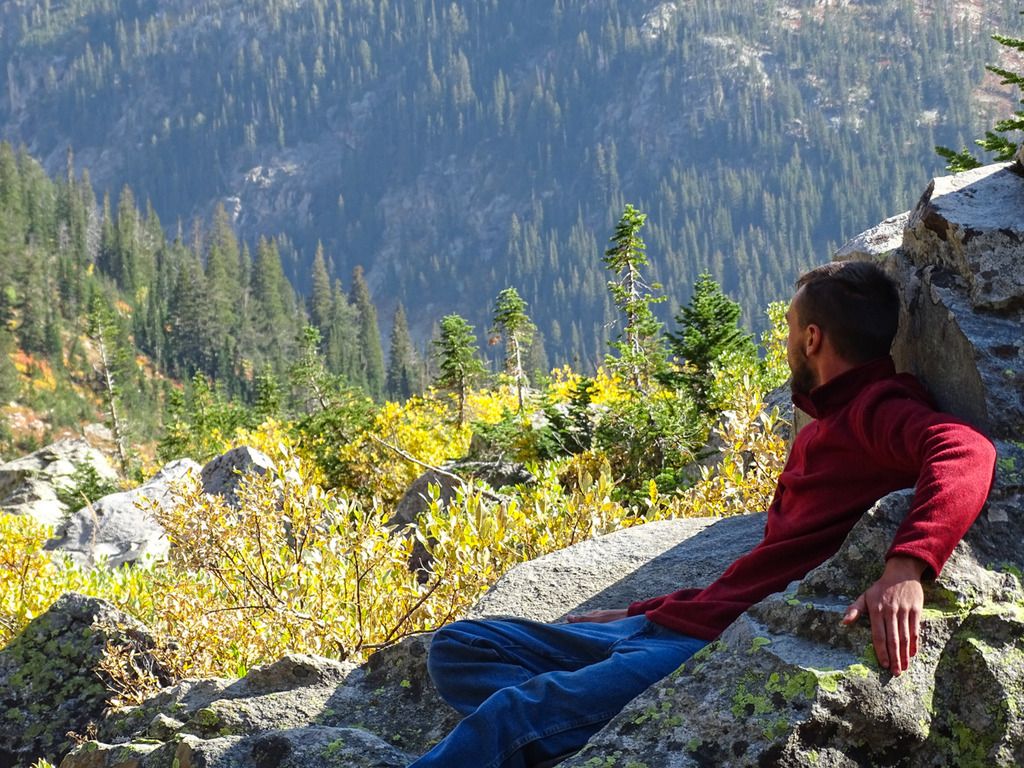
At sunset lake there were two other groups of hikers that were planning on doing the same trip we were, that is hiking up over Paintbrush Divide and down to String Lake. Sadly none of us were able to find anyone with a more up to date weather forecast so we were all expecting the weather to turn ugly towards evening. Both of those groups decided to call their trips two days early in fear of the snow and rain that we thought was coming. They would both hike out Cascade Canyon that day. Kyle and I decided we would keep going to our North Fork Cascade camping zone as we didn't want to call a quits before the weather even turned bad. After we left Sunset Lake the trail went straight up for a few miles up over Hurricane Pass. It ended up being a lot easier than we were expecting it to be and after that we had a few easy miles heading down hill. Just over Hurricane Pass was Schoolhouse Glacier which was very cool and gave us the opportunity to touch our first glacier. The hike down through South Fork Cascade was beautiful once again and the colors all around us were amazing. After about a 2 mile hike up into the North Fork Cascade we settled on a campsite that was right on the river and had probably one of the most amazing views you can have from any campsite in the park. We spent a few hours just lounging on the big flat rocks staring at the Tetons before clouds rolled in around dark.
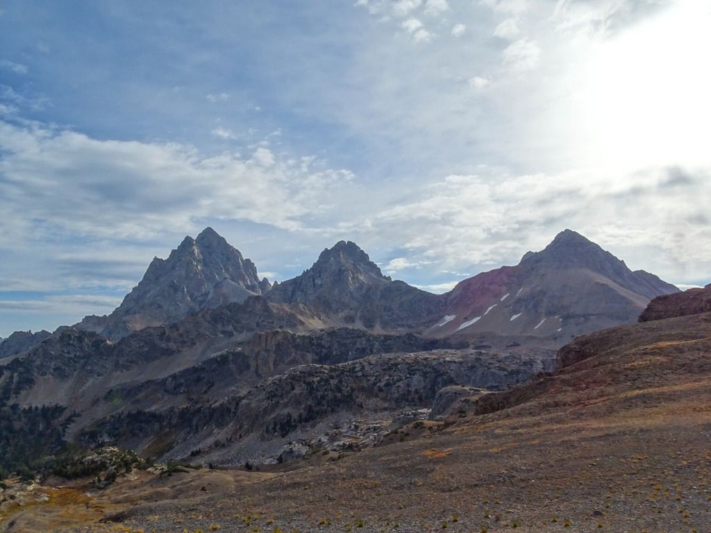
Top of Hurricane Pass
Schoolhouse Glacier
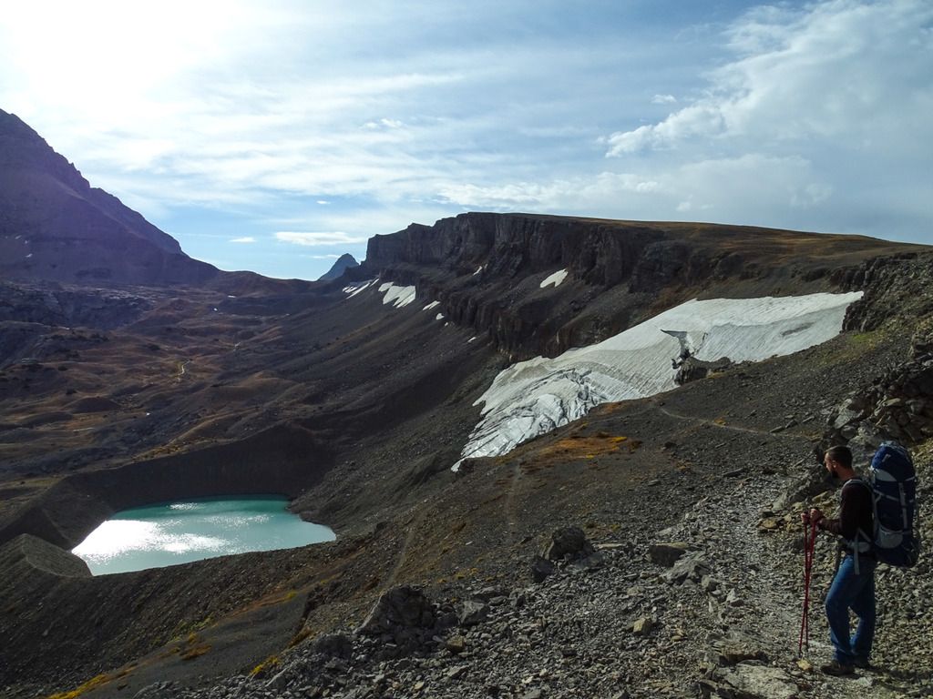
Camp night #3
Few pics of the view, it was like looking up at a screen saver, simply amazing!
There were moose tracks all over along the river and around camp but sadly we had no company besides a distant pika. Around sunset some clouds started to roll in so we headed for the tent and an early night. At some point in the night it started pouring so we decided that if it was still raining and crappy when we woke up we would head back down to Cascade Canyon and end the trip a day early. We had heard that day that the next few days were going to be very cold and wet so we didn't feel it would be worth the extra night. I had already lost my pack cover and Kyle for some crazy reason only brought a 50cent poncho to keep him dry, trying to get him to buy gear is like pulling someones finger nails out.
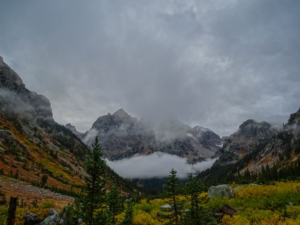
Day 4:
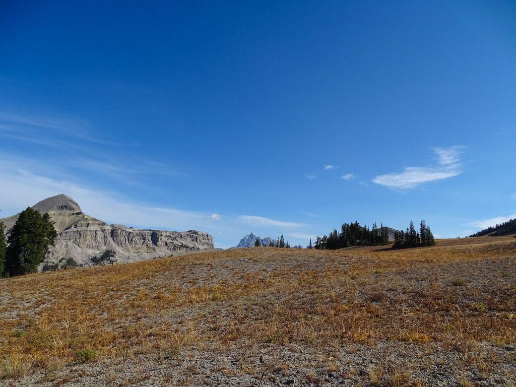
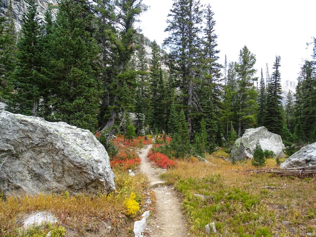
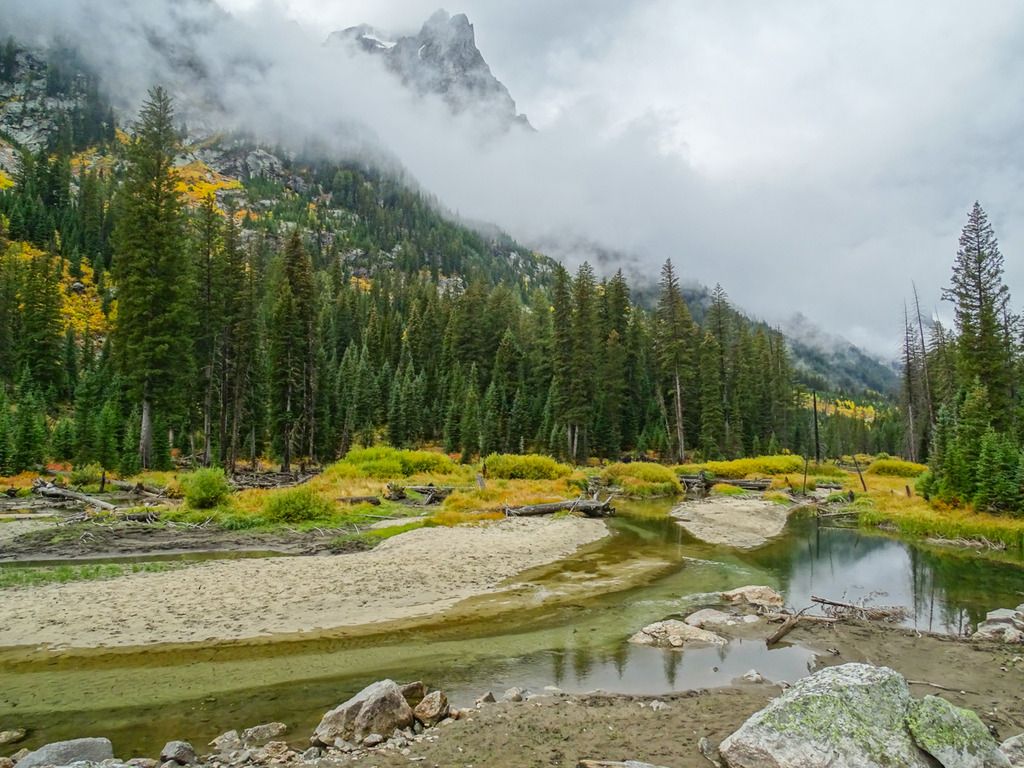
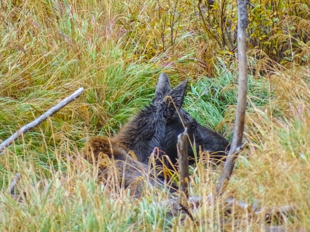
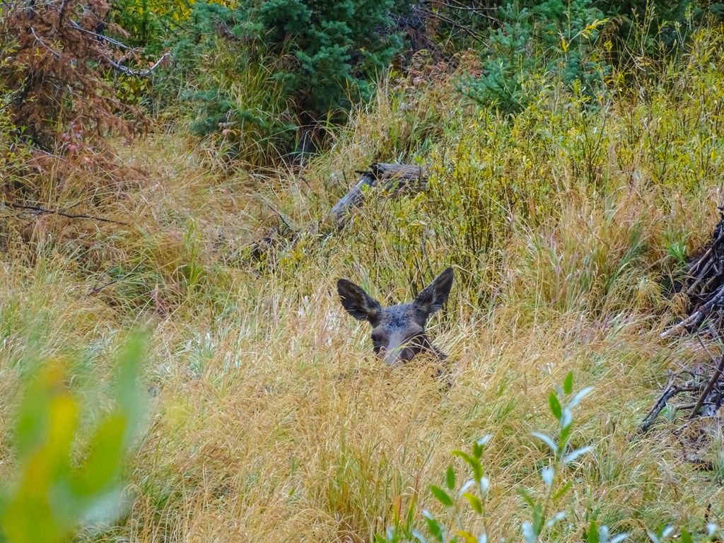
When we woke up the rain had stopped but it was still very overcast and foggy. It would drizzle on us off and on while we ate breakfast and packed up camp so we decided to call it early and head for the car. It wasn't a decision I was exactly happy with but felt it was the right one to make, especially with Kyle's lack of rain gear and wearing jeans haha. It was a pretty scenic hike out, it was rather foggy the whole hike which made for some cool views. It would drizzle here and there but never got that bad. We again saw lots of moose tracks along the river all the way out and eventually we came across a moose and her calf laying in a meadow. Other than that and some day hikers it was a pretty uneventful hike out, minus the great scenery of course. Of course after we got out of the mountains the weather was pretty clear which was a bummer but I'm pretty sure it rained that evening and all the next day so all is well.
Next morning's view
Looking up Cascade Canyon

Moose tracks all over
All done.
Looking back at the mountains on the way out of the park.
Welp, I hope you enjoyed my novel! All in all the trip was amazing and more than I could have hoped for. By not finishing the trail completely, I just have a good excuse to go back and do it over again!
Scroll to the second group of text for the actual backpacking trip.A few years ago after my first backpacking adventure in the Great Smoky Mountains National Park I set a goal for myself; to backpack in five different national parks before I turned 30, so one a year. In 2014 it was GSMNP, last year it was Glacier National Park and this year it was Grand Teton National Park. It would seem I have set the bar pretty high in terms of beauty for my next few adventures!
On September 15th my buddy Kyle and I began our trip out west, fittingly from the Gateway to the West, St. Louis. Seeing as I had never been to this area of the country before we decided to spend two days in Yellowstone and one day in the Tetons before we began our hike. After 10 hours in the car on our second day we made it to Yellowstone and somehow managed to snag the very last campsite in the entire park, so that was nice! The campsite was nothing special and a little too close to others for my liking but hearing the elk bugle at night and in the morning made it OKAY in my book. We spent that first evening driving around looking for wildlife and the second day checking out as many geysers and tourist spots as we could, it was pretty hectic but worth it. The next morning we drove down to the Tetons, managed to get the permit I was hoping for and then set up camp at Jenny Lake for the last night they would be open for the season. After that we drove around again looking for wildlife and did some fishing before getting to bed pretty early in preparation for the hike. Here are a few pictures from the three days prior to the hike.
Yellowstone:


Tetons:


Day 1:
The morning of September 19th we began our hike. The plan would be for us to go from the tram to String Lake via Paintbrush Divide over 5 days. We took a pretty pricey ride from String Lake Trailhead down to the tram in Teton Village. When we arrived it was beautiful and sunny but within about 5 minutes of making it to the top the wind picked up and it started pouring and sleeting. We hid next to a little shop at the top and got on our rain gear and pack covers and waited it out for about 15 minutes. We knew weather was going to be an issue on the trip, that morning we checked the forecast and it was calling for 1 to 3inches of snow on our third night and rain all day after that so we were sort of mentally prepared for it. After the rain stopped we began our decent to Marion Lake for night one. Sadly the wind had not died down and almost immediately my pack cover managed to blow off the mountain...so that sucked ha. The hike to Marion Lake was a nice way to start the trip, it was mostly down hill and offered some nice views and some wildlife. We heard and saw lots of pikas, one marmot and one nice mule deer buck. The campsite at Marion Lake has some really nice views but I wish it was a bit closer to the lake. Weather wise the day was great after the first rough patch, temps did drop probably into the low 30s or high 20s at night so it was a bit chilly but not awful.
Ride up the tram

Mule Deer


View from behind our tent looking down upper Granite Canyon I believe. The high point in the middle right of the frame was where the tram dropped us off, a little over 6miles away.

Marion Lake

Day 2:
On day two we hiked from Marion Lake into the Alaska Basin and down into Sunset Lake for our second night. The weather was perfect all day, sunny and mid 60s. It was a very cool hike, we finally were able to see the Tetons free of clouds and it was the first time I had ever been basically above treeline for an extended period of time. The hike along Death Canyon Shelf was beautiful and unlike anything else I have ever experienced. The elevation seemed to be getting to both of us on this day so we stopped pretty often and enjoyed the views. The last few miles in the Alaska Basin seemed to drag on forever and at this point we were ready to relax. We camd across a sign that said we had 1.3 miles to go to Sunset Lake but after talking with some people at camp that evening, it turns out the distance was actually closer to 3 miles. I forgot to mention that about a month before this hike I sprained my right knee and wasn't able to really do any training the last month. I remember the last few miles that day being a killer on my legs and knee but the lake was definitely worth the discomfort. On a side note, my knee is still not right about 4 months later, so that's annoying.
First view of the Tetons

Tetons a little before Death Shelf

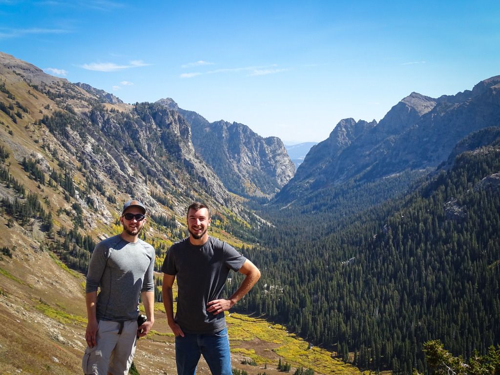
Such a lovely name...

Kyle

Looking down Death Canyon

I'm in the hat on the left.

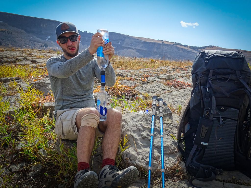
Making that high quality H2O!


Camp at sunset lake

Sunset Lake - Was full of big amphipods


Day 3:
At sunset lake there were two other groups of hikers that were planning on doing the same trip we were, that is hiking up over Paintbrush Divide and down to String Lake. Sadly none of us were able to find anyone with a more up to date weather forecast so we were all expecting the weather to turn ugly towards evening. Both of those groups decided to call their trips two days early in fear of the snow and rain that we thought was coming. They would both hike out Cascade Canyon that day. Kyle and I decided we would keep going to our North Fork Cascade camping zone as we didn't want to call a quits before the weather even turned bad. After we left Sunset Lake the trail went straight up for a few miles up over Hurricane Pass. It ended up being a lot easier than we were expecting it to be and after that we had a few easy miles heading down hill. Just over Hurricane Pass was Schoolhouse Glacier which was very cool and gave us the opportunity to touch our first glacier. The hike down through South Fork Cascade was beautiful once again and the colors all around us were amazing. After about a 2 mile hike up into the North Fork Cascade we settled on a campsite that was right on the river and had probably one of the most amazing views you can have from any campsite in the park. We spent a few hours just lounging on the big flat rocks staring at the Tetons before clouds rolled in around dark.

Top of Hurricane Pass

Schoolhouse Glacier


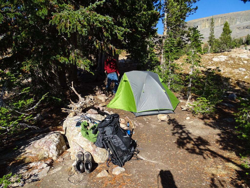
Camp night #3

Few pics of the view, it was like looking up at a screen saver, simply amazing!


There were moose tracks all over along the river and around camp but sadly we had no company besides a distant pika. Around sunset some clouds started to roll in so we headed for the tent and an early night. At some point in the night it started pouring so we decided that if it was still raining and crappy when we woke up we would head back down to Cascade Canyon and end the trip a day early. We had heard that day that the next few days were going to be very cold and wet so we didn't feel it would be worth the extra night. I had already lost my pack cover and Kyle for some crazy reason only brought a 50cent poncho to keep him dry, trying to get him to buy gear is like pulling someones finger nails out.
Day 4:
When we woke up the rain had stopped but it was still very overcast and foggy. It would drizzle on us off and on while we ate breakfast and packed up camp so we decided to call it early and head for the car. It wasn't a decision I was exactly happy with but felt it was the right one to make, especially with Kyle's lack of rain gear and wearing jeans haha. It was a pretty scenic hike out, it was rather foggy the whole hike which made for some cool views. It would drizzle here and there but never got that bad. We again saw lots of moose tracks along the river all the way out and eventually we came across a moose and her calf laying in a meadow. Other than that and some day hikers it was a pretty uneventful hike out, minus the great scenery of course. Of course after we got out of the mountains the weather was pretty clear which was a bummer but I'm pretty sure it rained that evening and all the next day so all is well.
Next morning's view

Looking up Cascade Canyon

Moose tracks all over


All done.

Looking back at the mountains on the way out of the park.

Welp, I hope you enjoyed my novel! All in all the trip was amazing and more than I could have hoped for. By not finishing the trail completely, I just have a good excuse to go back and do it over again!
Last edited:


.jpg")

")


